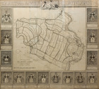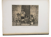

Voyage to the Strait of Le Maire and first detailed exploration of the region,
with an engraved folding map, and types made famous by Ibarra in Madrid
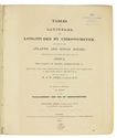
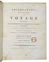
NODAL, Bartholome Garcia de & Gonzalo.
Relacion del viage, que por orden de su magestad, y acuerdo de el real consejo de Indias ...
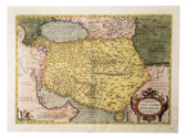
Including: ECHELEVAR, D. Manuel de, J.M. y J. Instruccion exacta, y util de las derrotas, y navegaciones ...
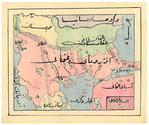
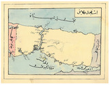
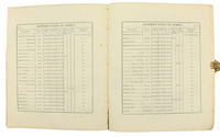
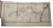
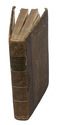
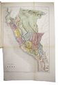
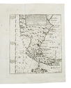
Cadiz, Don Manuel Espinosa de los Monteros, Impressor de la Real Marina, [1766?-1769]. 4to. With a folding map of the Strait of Magellan drawn and engraved by D.M. de Rueda, dated 1769. 2 parts in 1 volume. 4to. Contemporary limp sheepskin parchment by the Cadiz printing office's own bindery. [18], [2 blank], "162" [= 164], [2], [2 blank]; 41, [2], [1 blank] pp. Full description
€ 18,000
Including: ECHELEVAR, D. Manuel de, J.M. y J. Instruccion exacta, y util de las derrotas, y navegaciones ...
Cadiz, Don Manuel Espinosa de los Monteros, Impressor de la Real Marina, [1766?-1769]. 4to. With a folding map of the Strait of Magellan drawn and engraved by D.M. de Rueda, dated 1769. 2 parts in 1 volume. 4to. Contemporary limp sheepskin parchment by the Cadiz printing office's own bindery. [18], [2 blank], "162" [= 164], [2], [2 blank]; 41, [2], [1 blank] pp. Full description