
The book that opened America
ACOSTA, José de.
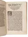
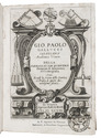
Historie naturael ende morael van de Westersche Indien.
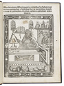
Enkhuizen, Jacob Lenaertsz. Meyn (colophon: Haarlem, printed by Gillis Rooman), 1598. 8vo. With a woodcut decoration on the title page. Vellum (ca. 1700?). [7], 398, [8] ll. Full description
€ 7,500
Enkhuizen, Jacob Lenaertsz. Meyn (colophon: Haarlem, printed by Gillis Rooman), 1598. 8vo. With a woodcut decoration on the title page. Vellum (ca. 1700?). [7], 398, [8] ll. Full description