OTTENS, Reinier and Josua OTTENS.
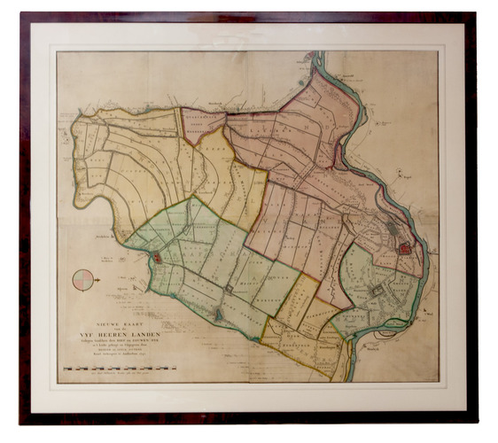
Nieuwe kaart van de Vyf Heeren landen gelegen tusschen den Dief en Zouwen dyk.
Amsterdam, Reinier and Josua Ottens, 1741. Engraved map on 4 sheets (85 x 98 cm as assembled), coloured by a contemporary hand. With the title and publisher at the foot left, together with a scale (ca. 1:19,000) and the name of the engraver at the right (Jan van Jagen). Framed.
€ 6,000
First state of a topographical wall map of the Vijfheerenlanden, a Dutch (polder) district south of Utrecht and the river Lek, coloured by a contemporary hand. The area is bordered by the Lek at the right (the north), the river Linge at the left, the Diefdijk at the foot and the Zouwendijk at the head, and includes the cities Vianen and Leerdam, and the towns and villages Ameide, Oosterwijk, Leerbroek, Lexmond, Nieuwland and Everdingen.
A very good copy. Donkersloot-De Vrij (1981) 809; Fockema Andrae, Geschiedenis der kartografie van Nederland, p.72; Koeman, handleiding 184.
Related Subjects: