
Much acclaimed work on the Indonesian Archipelago
CRAWFURD, John.
De Indische Archipel, in het bijzonder het eiland Java.
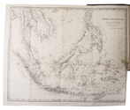
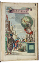
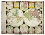
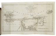
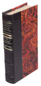
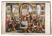
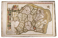
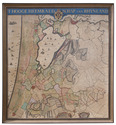
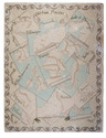
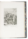
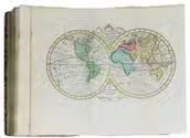
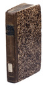
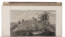
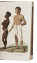
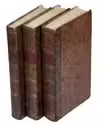
Haarlem, widow A. Loosjes (colophon: Amsterdam, printed by H. Bakels), 1823-1825. 3 volumes. 8vo. With 3 line-etched frontispieces, 3 full-page plates (2 line-etched, 1 hand-coloured aquatint with line etching), and a folding map (44 x 55.5 cm), hand-coloured in outline. Contemporary mottled half calf, gold-tooled spine. XXII, 332, [2]; LXXII [= LXXIV], 434, [1], [1 blank]; LX, 538, [2] pp. Full description
€ 2,500
Haarlem, widow A. Loosjes (colophon: Amsterdam, printed by H. Bakels), 1823-1825. 3 volumes. 8vo. With 3 line-etched frontispieces, 3 full-page plates (2 line-etched, 1 hand-coloured aquatint with line etching), and a folding map (44 x 55.5 cm), hand-coloured in outline. Contemporary mottled half calf, gold-tooled spine. XXII, 332, [2]; LXXII [= LXXIV], 434, [1], [1 blank]; LX, 538, [2] pp. Full description