Categories
Shopping cart (0 items € 0)
Advanced search

Cartography & Exploration

Letter by famous Scottish explorer of the Korean coasts and parts of China

[AUTOGRAPH]. HALL, Basil. [Autograph letter, signed, to Aaron Louis Frédéric Regnault, Baron de la Susse].
Smyrna (Izmir, Turkey), 27 June 1842. 8vo (18 x 11 cm). Manuscript letter in English, in brown ink on one side of an 8vo double leaf. Signed at the foot by Basil Hall. [1], [3 blank] pp. Full description
€ 850
Order Inquire Terms of sale

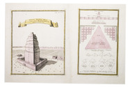
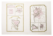
Exceptionally rare first edition of an unrivalled plate collection containing plans of antique cities

[HASE, Johann Matthias]. Plans des villes que passent pour les plus grandes de l'antiquité, et de nos jours ...
Nuremberg, Homann heirs, 1745. Folio. With 15 hand coloured, numbered, engraved plates. Modern folder, marbled paper over boards. Each leaf (ca. 56 x 66 cm) is separately mounted in a passe-partout (ca. 60 x 78 cm). [8] ll. Full description
€ 2,500
Order Inquire Terms of sale

Beautiful album of 12 tinted lithographic views of Argentina and Uruguay

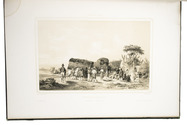
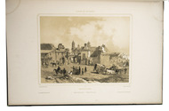
HASTREL, Adolphe d'. Album de la plata.
Paris, Gihau(l)t frères (printed by Auguste Bry, Lemercier and Thierry), [1846]. 1mo (55 x 38 cm). 12 tinted lithographs (22 x 35 cm), depicting views in and around Montevideo, Buenos Aires, etc. Mid-19th-century binding, rebacked in green morocco. 12 lithographed plates. Full description
€ 30,000
Order Inquire Terms of sale

Hearne's expedition to the Arctic in a rare Dutch edition

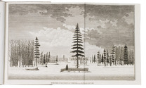
HEARNE, Samuel and Johann Reinhold FORSTER (editor). Landreis van 't Prins van Wallis Fort aan Hudson Baai, naar den Noorder-Oceaan.
The Hague, J.C. Leeuwenstijn, 1798. 2 volumes. 8vo. With folding map, hand-coloured in outline (41.5×50.5 cm), a folding map of the Coppermine River, and 2 folding views, all engraved and etched. Contemporary half sheepskin, gold-tooled spine. 16, 247, [1 blank]; [4], 289, [1] pp. Full description
€ 2,500
Order Inquire Terms of sale

Charming lithographed topographic and architectural views of northern France

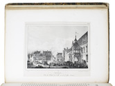
HÉDOUIN, Pierre. Souvenirs historiques et pittoresques du nord de la France, ou Collection des plus belles vues et des plus beaux monumens, de cette partie de la France.
Paris, Dondey-Dupré, père et fils, 1830. Super Royal 4to (34.5 x 27 cm). With a letterpress half-title, title-page, 4-page letterpress introductory letter from Hédouin (dated 14 August) and 25 somewhat irregularly numbered, finely lithographed plates (mostly in landscape orientation with image size ca. 14.5 x 20 cm but the largest in portrait orientation 23.5 x 18 cm), printed on thin so-called "China" paper and mounted on blank leaves, each with a view of a site in northern France, by Pierre Langlumé after various artists, each followed by a letterpress account of the site. Modern half calf over contemporary boards with shell on shell marbled sides. [56] pp. Full description
€ 1,950
Order Inquire Terms of sale

Including the first illustration of Niagara Falls and first engraving of an American bison

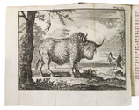
HENNEPIN, Louis. Nouvelle decouverte d'un tres grand pays situé dans l'Amerique, entre le Nouveau Mexique, et la mer glaciale.
Amsterdam, Abraham van Someren, 1698. 12mo. With engraved frontispiece by Caspar Luyken, 2 folding engraved maps and 2 folding engraved plates. Contemporary mottled calf, gold-tooled spine. [72], 1-312, [10], 313-506 pp. Full description
€ 8,000
Order Inquire Terms of sale

Large chart of European countries and their royal or noble families

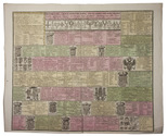
[HERALDIC CHART - EUROPE]. SPECHT, Caspar. Historische en geographische tafel om te leren een kort begrip vande landen en staaten in Europa haar grootheyd, besitting en alles dat tot onderricht der liefhebbers van de landbeschryvinge dienen kan.
Amsterdam, Reinier and Joshua Ottens, [before 1750]. Engraved chart (47.5 x 57 cm) printed on a single sheet of paper (51.5 x 64 cm), coloured by hand, including several coats of arms. Full description
€ 250
Order Inquire Terms of sale

The Desert of Paran and the 42 stations of the Exodus, with a map

HERMANN, Amand. Desertum Pharan mystice explicatum, cum quadraginta duabus in eo mansionibus filiorum Isràél ad Palaestinam pergentium: . . .
Kalisz, printed by the college of the Society of Jesus, 1685. 4to. With an engraved frontispiece, showing a map of the Holy Land and the route of the Exodus with the 42 stations numbered. Contemporary overlapping vellum. [32], 505, [1 blank], [16] pp. Full description
€ 1,950
Order Inquire Terms of sale

The first complete account of the Le Maire-Schouten expedition

HERRERA Y TORDESILLAS, Antonio de. Novis orbis, sive descriptio Indiae Occidentalis ... Methaphraste C. Barlaeo. Accesserunt & aliorum Indiae Occidentalis descriptiones, & navigationis nuperae Australis Jacobi le Maire Historia, uti & navigationum omnium per Fretum Magellanicum succincta narratio.
Amsterdam, Michiel Colijn, 1622. Folio. With an engraved title, 17 engraved maps (1 folding, 16 double-page), a full-page portrait, and 4 half-page illustrations in the text. Later three-quarter vellum, with the manuscript title on the spine, sprinkled paper sides, red edges. [4], "81" [=84], [2], "9" [=10], 11, [1 blank] ll. Full description
€ 40,000
Order Inquire Terms of sale
678 books found / Show all