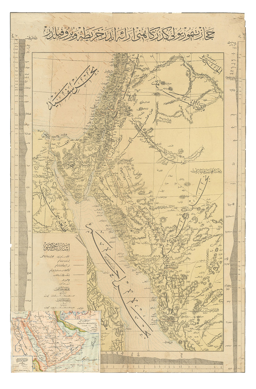
[HEJAZ RAILWAY].
[Map and profile of the Hijaz Railway route].
Constantinople, Matba a-i Bahriye, 1320 Rumi [= 1904 CE]. Colour-lithographed map (76.5 x 49.5 cm), trimmed to neat line.
€ 22,000
A rare separately issued official railway map, with the entire text in Ottoman Turkish, depicting the route of the Hejaz Railway. Following a route proposed by the eminent Turkish engineer Mukhtar Bey and surveyed by the cavalry officers Umar Zaki and Hasan Mu'ayyin, the epic project, funded by subscriptions from the global Islamic faithful, completed a rail link from Damascus to Medina by 1908. The present map shows the intended continuation to Mecca, never completed. Although it went no further south than Medina, the railway nevertheless briefly allowed many thousands of pilgrims to make the Hajj in relative comfort, bringing them to Medina and within about 300 km of Mecca. It shows the northern half of the Red Sea, the Sinai peninsula, the southeast corner of the Mediterranean Sea and what were to become Palestine, most of Jordan and parts of Lebanon and Syria.
A contemporary Ottoman colour-lithographed map of the Arabian Peninsula has been pasted over the lower left corner (below the key), like an inset map, hiding only a tiny bit of the main maps topographic image. Old folds and creases, some small tears repaired, tiny chips to neat line, some light stains. Some remnants of tape and old private collector's stamps on the back. Still in good condition.
Related Subjects: