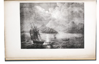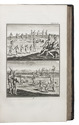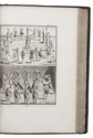

Captain's journal of the voyage of the steam ship "Cornelis Dirks" to Africa and South America

KOOPMAN, J.F.
Verslag van eene reize naar de westkust van Afrika, Rio de Janeiro en Rio de la Plata, door Z.M. schroef-stoomschip Cornelis Dirks, ...1859-1860.
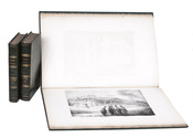
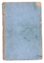
[Amsterdam, widow of G. Hulst van Keulen, 1863]. 8vo. Contemporary blue paper wrappers. [2 blank], [2], 127, [1 blank] pp. Full description
€ 1,500
[Amsterdam, widow of G. Hulst van Keulen, 1863]. 8vo. Contemporary blue paper wrappers. [2 blank], [2], 127, [1 blank] pp. Full description