Categories
Shopping cart (0 items € 0)
Advanced search

Middle East & Islamic World / Cartography & Exploration

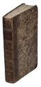
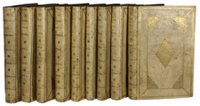
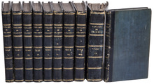
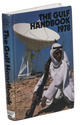
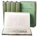
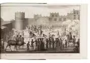
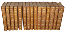
8 large illustrated volumes of the most important voyages from the 15th to the end of the 17th century

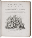
AA, Pieter van der (editor) and Johann Ludwig GOTTFRIED. 
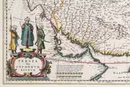
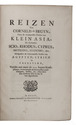
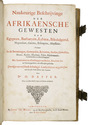
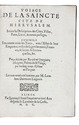
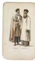
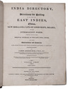
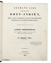
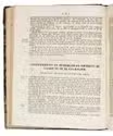
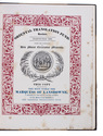
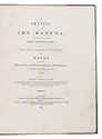
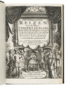
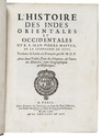
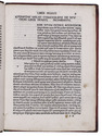
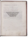
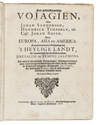
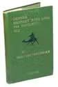
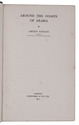
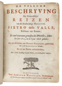
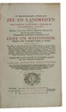
De aanmerkenswaardigste en alomberoemde zee- en landreizen der Portugeezen, Spanjaarden, Engelsen en allerhande natiën: zoo van Fransen, Italiaanen, Deenen, Hoogh- en Nederduitsen als van veele andere volkeren. Voornaamenlyk ondernomen tot ontdekking van de Oost- en Westindiën, midsgaders andere verafgelegene gewesten des aardryks.
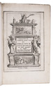
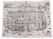
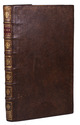
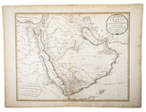
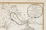
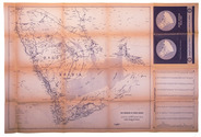
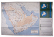
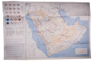
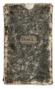
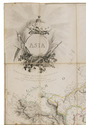
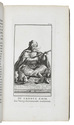
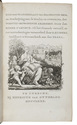
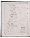
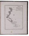
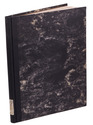
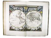
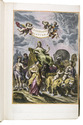
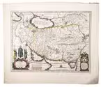
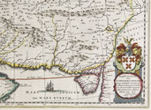
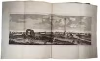
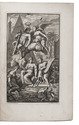
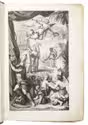
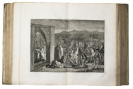
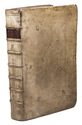
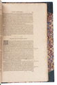
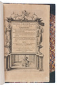
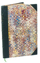
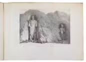
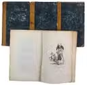
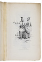
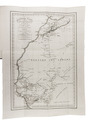
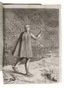
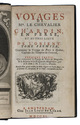
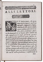
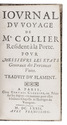
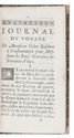
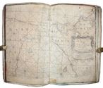
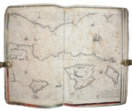
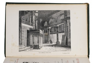
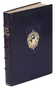
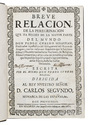
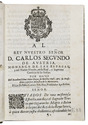
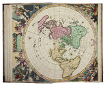
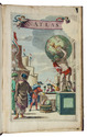
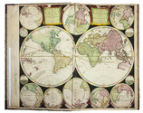
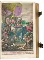
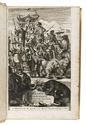
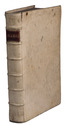
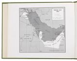
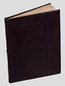
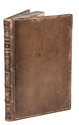
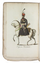
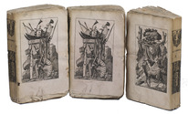
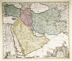
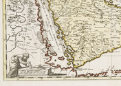
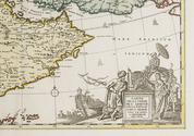
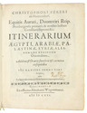
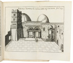
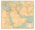
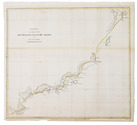
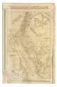
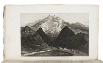
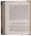
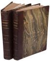
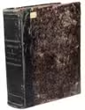
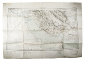
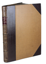
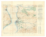
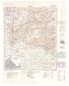
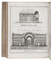
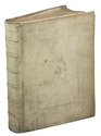
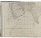
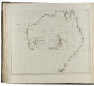
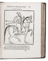
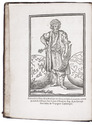
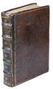
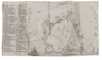
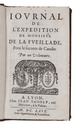
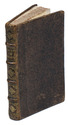
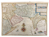
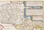
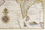
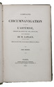
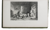
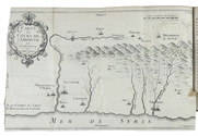
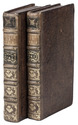
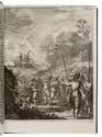
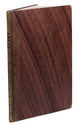
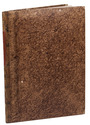
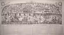
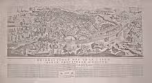
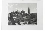
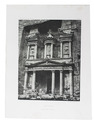
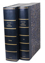
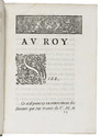
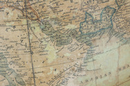
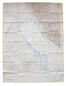
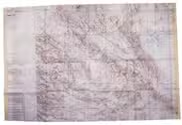
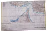
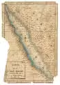
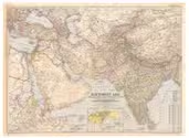
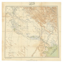
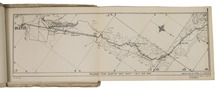
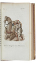
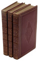
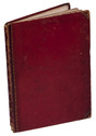
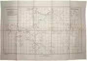
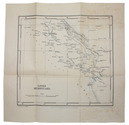
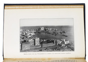
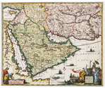
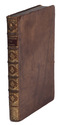
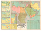
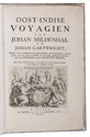
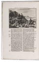
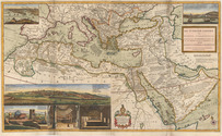
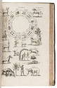
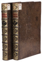
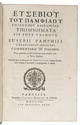
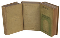
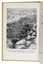
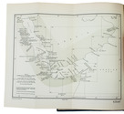
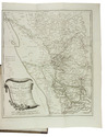
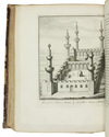
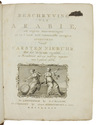
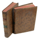
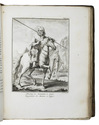
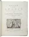
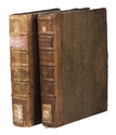
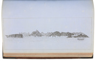
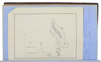
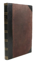
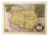
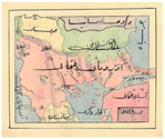
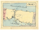
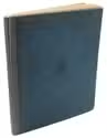
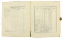
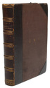
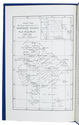
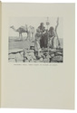
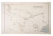
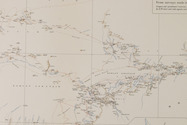
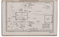
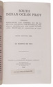
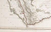
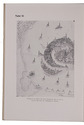
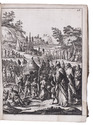
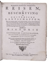
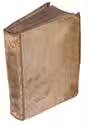
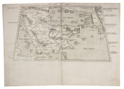
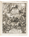
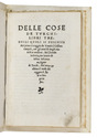
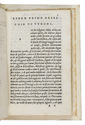
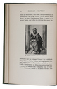
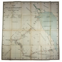
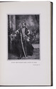
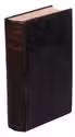
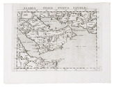
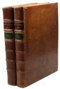
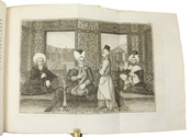
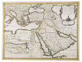
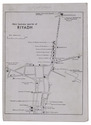
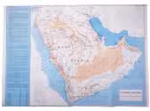
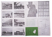
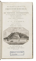
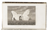
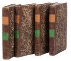
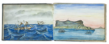
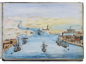
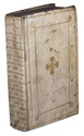
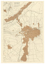
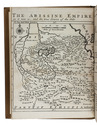
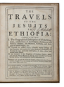
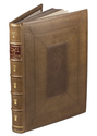
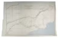
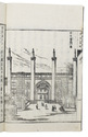
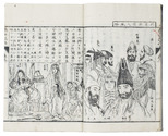
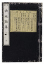
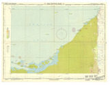
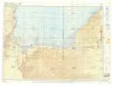
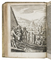
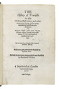
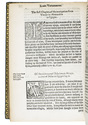
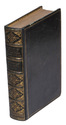
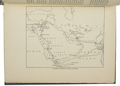
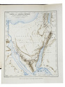
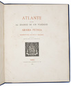
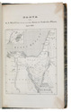
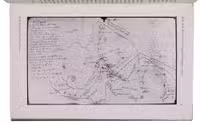
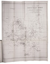
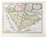
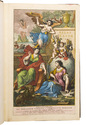
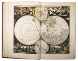
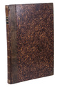
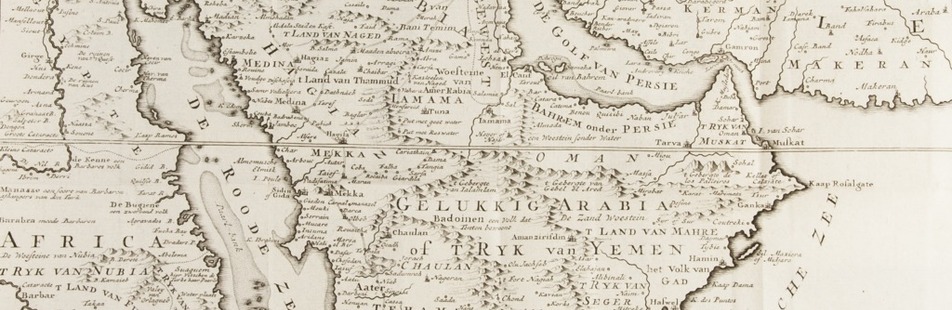
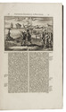
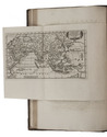
The Hague, widow of Engelbrecht Boucquet and sons; Leiden, Jan van der Deyster, and Boudewijn and Pieter van der Aa, 1727. 8 volumes. 1mo and folio. With 7 (of 8) engraved frontispieces (lacking that of volume 4), 4 engraved dedications, 117 engraved maps on 61 leaves, 7 engraved plates and 502 engravings in text. Further with 127 (of 128) title-pages (including a general title-page, a title-page to 7 (of 8) volumes, lacking that of volume 4, and 118 for the separate works). Volume 1-3 & 5-8: contemporary mottled calf, gold-tooled spine and board edges; volume 4: modern calf. Full description
€ 65,000
Order Inquire Terms of sale

With attractive maps of the Holy Land

ADRICHEM, Christiaan van. Theatrum Terrae Sanctae et biblicarum historiarum cum tabulis geographicis aere expressis.
[Cologne, Officina Birckmannica, for Hermann Mylius, 1628]. Folio. With engraved allegorical title-page, numerous decorated woodcut initial letters and tailpieces, 11 maps of Israel and 1 map of Jerusalem (8 folding and 4 double-page). Contemporary calf, gold-tooled spine with red morocco title-label, blind-tooled sides, gilt binding edges. [12], 286, [30] pp. Full description
€ 10,000
Order Inquire Terms of sale

Rare travelogue of Yemen, with the original Arabic text

AL-GARADI, Ahmed Ibn Muhammad [and Eugen MITTWOCH]. Aus dem Jemen. Hermann Burchardts letzte Reise durch Südarabien. bearbeitet von Eugen Mittwoch...
Leipzig, Deutsche Morgenländische Gesellschaft in kommission bei F.A. Brockhaus, [1926]. 4to. 28 plates with 55 photos, 1 map on page 9. Text is partially in Arabic. Original paper covers. [4], 74 pp. Full description
€ 200
Order Inquire Terms of sale

USAF pilot's map of the Arabian Gulf

[MAP - ARABIAN GULF]. Aeronautical chart and information center. Persian Gulf | ONC-H-6/7. Operational navigation chart.
St Louis, Aeronautical chart and information center, United States Air Force, 1969. Two copies of two folding maps colour printed on both sides of a sheet of silk (103 x 78.5 cm) on a scale of ca. 1:1,000,000. The two maps (ONC-H-6 & ONC-H-7) show one continuous area. Full description
€ 2,800
Order Inquire Terms of sale

Large folding road map of Saudi Arabia

[ARAMCO]. Saudi Arabian road map.
Dammam, Al-Mutawa press company, 1973. Large folding map (60 × 90.5 cm), printed in light orange with darker purple, depicting the Kingdom of Saudi Arabia and its main roads. With on the right the title in both Arabic and English and a table with the distances from one city to another. Full description
€ 1,800
Order Inquire Terms of sale

Surviving traffic in Saudi Arabia, a large folding map

ARAMCO. Saudi Arabian road map.
Dammam, printed by the Al-Mutawa Press for the Arabian American Oil Company, 1973. Large folding map (60 x 90.5 cm), printed in colour, depicting the Kingdom of Saudi Arabia and its main roads. With on the right the title in both Arabic and English and a table with the distances from one city to another. Printed on two sides, one side with the map in English and the other in Arabic. Full description
€ 1,800
Order Inquire Terms of sale

Surviving traffic in Saudi Arabia, a large folding map

ARAMCO. Saudi Arabian road map.
Dammam, printed by the Al-Mutawa Press for the Arabian American Oil Company, 1975. Large folding map (60 x 90.5 cm), printed in colour, depicting the Kingdom of Saudi Arabia and its main roads. With on the right the title in both Arabic and English and a table with the distances from one city to another. Printed on two sides, one side with the map in English and the other in Arabic. Full description
€ 1,500
Order Inquire Terms of sale

Highly detailed wall map of Asia and the Arabian peninsula, from the collection of the Governor of Ceylon

ARROWSMITH, Aaron. Asia.
London, Aaron Arrowsmith, 1 January 1801. Engraved wall map, hand coloured in outline, on 4 sheets joined as 2 (measuring 124 x 147 cm in total) on a scale of ca. 1:6,490,880, with an elaborately decorated cartouche at the head left, a dedication below ("To major James Rennell, Esqr. F.R.S. &c. &c.") and the name of the engraver at the foot right (George Allen). Mounted on cloth and divided into 32 sections. Contemporary slipcase, covered with marbled paper and a manuscript title-label on front. Full description
€ 7,500
Order Inquire Terms of sale

French mission to Mount Carmel, with a portrait of the Emir

ARVIEUX, Laurent d'; Gerard KUIPERS (transl.). Reis naar de legerplaats van den grooten Emir, en beschrijving, van de zeeden en gewoonten, der woestyn-bewoonende Arabieren ... Uit het Fransch vertaald en met aanteekeningen vermeerderd door G. Kuipers ...
Utrecht, Henricus van Otterloo, 1780. 8vo. With engraved title-page with a vignette by De Vries (a female figure reading from "H[eilige] Schriftuur" (Holy Scripture) with 4 putti and in the background a desert scene with tents, camels and dozens of mostly dark-skinned people, apparently representing nomads), 3 full-page engraved plates by Izaak de Wit Jansz., an engraved half-page illustration (unsigned), headpieces built up from rococo typographic ornaments and woodcut tailpieces. Contemporary half tree calf, gold-tooled spine with red morocco label, shell-marbled sides. [6], XL, 384, [16] pp. Full description
€ 2,500
Order Inquire Terms of sale

A French view on the Arabs in a Dutch translation

ARVIEUX, Laurent d'. Reis naar de legerplaats van den Grooten Emir, en beschrijving van de zeeden en gewoonten der woestijn-bewoonende Arabieren ... Tweede druk.
Dordrecht, A. Blussé & Zoon, 1802. 8vo. With 3 full-page engraved plates and 1 engraved illustration in text. Contemporary gold-tooled half calf, shell-marbled sides. [4], XL, 384, [16] pp. Full description
€ 1,350
Order Inquire Terms of sale

The geographical details of two outstanding maps of Arabia

BERGHAUS, Heinrich. Geographisches memoir zur erklärung und erlaüterung der Karte von Syrien. (no. 5. von Berghaus' Atlas von Asia).
Gotha, Justus Perthes, 1835. With an engraved map of Syria.
With: (2) BERGHAUS, Heinrich. Geo-hydrographisches memoir zur erklärung und erlaüterung der General-Karte von Arabia und dem Nil-Lande. (no. 6. von Berghaus' Atlas von Asia).
Gotha, Justus Perthes, 1835. 2 works in 1 volume. 4to. With a supplement to another article by Berghaus bound at the end: Supplement zur historisch-geographischen Beschreibung von Assam etc., with an engraved map. Modern half cloth. [4], 48; [4], 128; 179-182 pp. Full description
€ 2,500
Order Inquire Terms of sale

First edition of the first printed ethnographic comparison of the world's people, typographically stunning

BOEMUS (BÖHM), Johannes. Omnium gentium mores leges et ritus ex multis clarrissimis rerum scriptoribus ... nuper collecti: & in libros tris distinctos Aphricam, Asiam, Europam, optime lector lege. [Half-title:] Repertorium librorum trium Ioannis Boemi de omnium gentium ritibus. Item index rerum scitu digniorum in eosdem. Cum privilegio Papali ac Imperiali M.D.XX.
[Colophon: Augsburg, Sigismund Grimm & Marcus Wirsung, July 1520]. Folio. With the letterpress half-title in an elaborate woodcut border with a trophy of arms, putti and mermen. 17th century vellum with 3 raised spine-bands. [6], LXXXI, [1] ll. Full description
€ 5,750
Order Inquire Terms of sale

3 little-known works by Italian scientist on astronomy, hydrostatics and navigation

BRUNETTI, Francesco Saverio. Trattenimenti scientifici su la sfera, geografia istorica, meteore, ed astronomia.
Rome, Bernabò and Lazzarini, 1754. With several woodcut illustrations in the text (including an armillary sphere), and an extra added folding engraved frontispiece.
With:
(2) BRUNETTI, Francesco Saverio. Trattenimenti scientifici su lindrografia, nautica, blasone, statica, meccanica, architectura, pirotecnia, e suono.
Roma, Bernabò and Lazzarini, 1755. With several woodcut illustrations in the text, and an extra added frontispiece (facsimile of an engraving?).
(3) BRUNETTI, Francesco Saverio. Macchina semplicissima per cui lacqua da se stessa salice ad una data altezza.
Rome, Bernabò and Lazzarini, 1747. With folding engraved plate as frontispiece. 3 works (the first in 2 parts) in 1 volume. 4to. Contemporary sheepskin parchment. [24], 180, 112; [8], 173, [3 blank]; 12 pp. Full description
€ 4,500
Order Inquire Terms of sale

Large paper copy of the beautifully illustrated first edition of De Bruyn’s travels to the Levant

BRUYN (LE BRUN), Cornelis de. Reizen van Cornelis de Bruyn, door de vermaardste deelen van Klein Asia, de eylanden Scio, Rhodus, Cyprus, Metelino, Stanchio, &c. Mitsgaders de voornaamste steden van Aegypten, Syrien en Palestina.
Delft, printed by Hendrik van Kroonevelt [engravings printed by Petrus Schenk and Gerard Valck?], 1698. Large folio (39.5x26 cm). With engraved frontispiece, engraved author's portrait, large engraved folding map of the Mediterranean Sea, 103 engraved plates (many double-page and folding) and 18 engravings in text. 18th-century, gold-tooled, tanned goatskin; rebacked, with original backstrip laid down and modern endpapers. [20], 398, [8] pp. Full description
€ 25,000
Order Inquire Terms of sale

First edition of a sumptuous account of a voyage to Russia, Persia and the East Indies,
with large folding views of Moscow and Isfahan (194x42 cm)

BRUYN (LE BRUN), Cornelis de. Reizen over Moskovie, door Persie en Indie: verrykt met driehondert konstplaten, vertoonende de beroemste lantschappen en steden, ook de byzondere dragten, beesten, gewassen en platen, die daer gevonden worden ...
Amsterdam, Willem and David Goeree for the author, 1711. Folio (40x25.5 cm). With engraved frontispiece by Bernard Picart, engraved author's portrait, 2 folding engraved maps, 109 engraved plates (13 folding, 55 double-page, 41 full-page) and 36 engraved illustrations in text. Contemporary blind-tooled vellum. [8], 472, [12] pp. Full description
€ 9,000
Order Inquire Terms of sale

First printed record of Abu Dhabi and Dubai: the first Latin edition

DE BRY, Theodor; Johann Israel DE BRY and Joris VAN SPILBERGEN. Indiae Orientalis pars septima [...].Including: Icones, hoc est verae variorum populorum et regum, ceremoniarum item, superstitiosorum rituum et rerum aliarum, ...
Frankfurt, Wolfgang Richter, 1606. Folio (32.5 x 20 cm). With the letterpress title in an engraved architectural border, a separate letterpress title-page for the Icones, an engraved coat of arms on the dedication leaf, 20 engravings in text and 2 double-page engraved plates. 20th-century green half morocco. [4], 126, [2 blank] pp.; 26 ll. Full description
€ 28,000
Order Inquire Terms of sale

Stunning lithographic illustrations and a detailed route map of a voyage
through Persia, Afghanistan, Uzbekistan and India

BURNES, Alexander. Voyages de l'embouchure de l'Indus a Lahor, Caboul, Balkh et a Boukhara; et retour par la Perse, pendant les années 1831, 1832 et 1833 ... Atlas.
Paris, Arthus Bertrand (colophon on back wrapper: Imprimerie et Fonderie de Fain), [1835]. 3 text volumes and 1 atlas volume. 8vo. With 11 numbered lithographed plates (1 folding) showing costumes of the regions, medals and engraved stones, topographic views, archaeological sites, etc., and a large folding engraved map with the routes hand-coloured in red and orange. Contemporary gold-tooled half sheepskin (text volumes), original publisher's letterpress-printed brown paper wrappers (atlas volume). [3], [1 blank] pp. plus plates. Full description
€ 3,500
Order Inquire Terms of sale

The first European to visit Timbuktu

CAILLIÉ, René-Auguste. Dagverhaal eener reize naar Temboektoe, van de westkust af van Afrika, door de binnenlanden, over Jenné, Kabra, Arawan en vele andere opmerkelijke plaatsen, de groote woestijn door, op Tanger... Uit het Fransch overgebragt door Herman van Lil.
Haarlem, widow A. Loosjes, 1831. 2 volumes. 8vo. With engraved frontispiece and an engraved author's portrait by D. and A. Veelvaard, and a large folding map (41.5 x 28.5 cm) after E.F. Jomard. Contemporary half cloth. XVI, 496; [4], 622 [= 582] pp. Full description
€ 1,950
Order Inquire Terms of sale

On Bedouin tribes, with a map and pictures

CARRUTHERS, Alexander Douglas Mitchell. A journey in North-Western Arabia.
[London, W. Clowes], March 1910. 4to. With 12 black and white photographs made during the journey and a folding chromolithographed map of North-West Arabia (27x30.5 cm). Modern blue wrappers. [32] (numbered 225-248) pp. Full description
€ 750
Order Inquire Terms of sale

French merchant travels through Persia and becomes personal jeweller to the Shah

CHARDIN, Jean. Voyages de mr. le chevalier Chardin, en Perse, et autres lieux de l'Orient.
Amsterdam, J. L. de Lorme, 1711. 10 volumes. 12mo. With an engraved frontispiece portrait of Johannes Chardin, 1 engraved map, 79 engraved folding plates and 6 letterpress folding tables. Contemporary half morocco, gold-tooled spine. [24], 254; 334; 285, [1 blank]; 280; 312; 328; 448; 255, [1 blank]; 308; 220, [82] pp. Full description
€ 4,000
Order Inquire Terms of sale

Very rare and little known collection of Italian Renaissance merchant voyages to India

CIGNANO, Ludovico. Quieta solitudine di varii ragionamenti, discorsi, et concetti, ove si narra quattro navigationi ...
Bologna, Alessandro Benacci, 1587. Small 4to. With the woodcut coat of arms of the dedicatee Giovanni Luigi Scappi, elaborately helmed, crested and mantled, on the title-page, a woodcut tailpiece (plus 1 repeat), woodcut decorated initials (at least 4 series), decorations built up from cast typographic ornaments.
Goatskin morocco (ca. 1870/80?), richly gold-tooled spine and turn-ins, signed in foot of front turn-in by the Paris bookbinders "DARLAUD FRÈRES", gold fillets on sides and board edges, combed curl-marbled endpapers, edges gilt over marbling, headbands worked in white and beige, and a yellow, red and green ribbon marker. 166 pp. Full description
€ 45,000
Order Inquire Terms of sale

Journey around the world with a long stay in India

CUBERO SEBASTIAN, Pedro. Breve relacion, de la peregrinacion que ha hecho de la mayor parte del mundo.
Madrid, Juan Garcia Infançon, 1680. Small 4to (20 x 14.5 cm). With the title-page in a border built up from cast fleurons, woodcut coat of arms of the dedicatee Charles II of Spain, and some woodcut initials and tailpieces.Gold-tooled morocco, by the leading Barcelona binder Emilio Brugalla (1901-1987), with the arms of the Spanish bibliophile Isidoro Fernandez (1878-1963) stamped in gold on front and back, gilt edges. [20], 360 pp. Full description
€ 18,000
Order Inquire Terms of sale

Beautifully coloured composite atlas

[DANCKERTS, ALLARD, VISSCHER, DE WIT, MORTIER and others]. Atlas.
[Amsterdam, Theodorus and Cornelis III Danckerts?, ca. 1706 (dated maps 1694-1706)]. Imperial folio (53.5 x 33.5 cm). Composite atlas, with an engraved title-page, 43 double-page engraved maps and 4 double-page engraved tables, all beautifully coloured in a consistent and balanced manner by a contemporary hand, probably in the workshop of the publisher. With maps by Johannes, Justus, Theodorus and Cornelis III Danckerts, Carel and Abraham Allard, Nicolaas Visscher I & II, Frederik de Wit, Pieter Mortier, Caspar Specht and even Alexis-Hubert Jaillot in Paris. Modern maroon sheepskin. Full description
€ 48,500
Order Inquire Terms of sale

Unique hand-coloured copy of Dapper's famous description of Africa

DAPPER, Olfert. Naukeurige beschrijvinge der Afrikaensche gewesten van Egypten, Barbaryen, Lybien, Biledulgerid, Negroslant, Guinea, Ethiopiën, Abyssinie: vertoont in de benamingen, grenspalen, revieren, steden, gewassen, dieren, zeeden, drachten, talen, rijkdommen, godsdiensten en heerschappyen. ...
Including: Naukeurige beschrijvinge der Afrikaensche eylanden ...
Amsterdam, Jacob van Meurs, 1676. 3 works in 1 volume. Folio (33 x 22 cm). With a richly engraved allegorical frontispiece, a large folding engraved map of Africa (44.5 x 56 cm), 14 double-page engraved maps of parts of Africa and the adjacent islands, 27 double-page and 1 larger folding engraved plates and views, and 55 half-page engraved views, plans, illustrations of costumes, animals, plants, etc. in the text. All illustrations coloured by a contemporary hand. Contemporary vellum at a later date with elaborate blind-tooled decorations, including oriental portraits. With 2 decorated brass clasps, signed B-I. [6], 428, 349, [16]; [1], 121, [4] pp. Full description
€ 85,000
Order Inquire Terms of sale

Classic description of Asia, Persia and Georgia

DAPPER, Olfert. Asia, of naukeurige beschryving van het Rijk des Grooten Mogols, En een groot gedeelte van Indiën ... Beneffens een volkome beschryving van geheel Persie, Georgie, Mengrelie en andere gebuur-gewesten.
Amsterdam, Jacob van Meurs, 1672. 3 parts in 1 volume. Folio. With richly engraved frontispiece, first title printed in red and black, double-page engraved map, 20 engraved plates and views, 4 double-page, and 22 engravings in text in the first part, and 3 double-page engraved maps, 8 double-page engraved views, and 11 engravings in text in the second part. Including: DAPPER, Olfert. Beschrijving des koningryks van Persie ... Contemporary calf with richly gilt spine. "379" [= 401], [3]; [1], [1 blank], "184" [= 192]; 43, [5] pp. Full description
€ 6,850
Order Inquire Terms of sale

Major source of information on the Muslim world in the 17th century

DAPPER, Olfert. Naukeurige beschryving van Asie: behelsende de gewesten van Mesopotamie, Babylonie, Assyrie, Anatolie, of Klein Asie: beneffens eene volkome beschrijving van gantsch gelukkigh, woest, en petreesch of steenigh Arabie. Vertoont in een bondigh ontwerp van 's lands benamingen, bepalingen, . . . inzonderheit die van d'oude Arabieren, Mahomet en Mahometanen.
Amsterdam, Jacob van Meurs, 1680. Folio. With engraved frontispiece, 3 double-page maps (of Basra and surroundings, Anatolia and the Arabian Peninsula), 12 double-page or folding views (partly drawn by Charles Vasteau). Near contemporary blind-stamped vellum. [8], 357, [3], 324, [4] pp. Full description
€ 9,500
Order Inquire Terms of sale

Incunable edition of an influential second century description of the antique world,
including early mentions of China and Arabia

DIONYSIUS Periegetes. [incipit :] ... de situ orbis habitabilis ...
[Colophon:] Venice, Franz Renner, 1478. Small 4to (19 x 14 cm). With the first four lines printed in red and 9 white on black decorated woodcut initials (1 series), plus 1 repeat. Set in roman type, 26 lines to a page, with two words in Greek. Modern blind-tooled calf. [36] ll. Full description
€ 35,000
Order Inquire Terms of sale

Life and customs in the Ottoman Empire, described by a Christian former slave

DJURDJEVIC, Bartol (Bartholomeus GEORGIEVITZ) Voiage de la saincte cite de Hierusalem. Jointe la description des citez, villes, ports, lieux, & autres passages. Ensemble les ceremonies des Turcs ...
Liège, printed by Leonard Streel for Lambert de la Coste, 1600. 2 parts in 1 volume. 4to. 18th-century calf, gold-tooled spine. [32], [32] lvs. Full description
€ 17,500
Order Inquire Terms of sale

Afghanistan and its dependencies in Persia, Tartary and India, with 14 hand-coloured plates, in original wrappers

ELPHINSTONE, Mountstuart. Tableau du royaume de Caboul, et de ses dépendances, dans la Perse, la Tartarie et l'Inde, offrant les moeurs, usages et costumes de cet empire, ... traduit et abrégé de l'anglais, par M. Breton.
Paris, Nepveu, 1817. 3 volumes. 18mo. With 14 engraved plates depicting various costumes, lords on horseback, etc., all beautifully coloured by hand. Original publisher's printed wrappers, each volume with wood engraved illustrations on front, back and spine. Preserved in a modern gold-tooled green morocco box. XLIV, 189 [3]; [4], 222, [2]; [4], 223 [1] pp. Full description
€ 4,950
Order Inquire Terms of sale

A French adventurer in the Middle East

FERRIER, Jean-Paul. Voyages en Perse dans l'Afghanistan le Béloutchistan et le Turkestan.
Paris, E. Dentu, 1860. 2 parts in 1 volume. 8vo. With portrait for frontispiece, printer's device on both titles, and one large folding map. Contemporary dark purple half morocco. [6], XIV, [2], 463; [4], 463 pp. Full description
€ 1,250
Order Inquire Terms of sale

1565/66 pilgrimage to the Middle East, with author's portrait, coat of arms and 6 illustration plates

FÜRER VON HAIMENDORF, Christoph. Itinerarium Aegypti, Arabiae, Palaestinae, Syriae, aliarumque regionum orientalium.
Nuremberg, Abraham Wagenmann, 1621 (colophon: Nuremberg, printed by Abraham Wagenmann, 1620). Small 4to. With finely engraved full-page portrait of the author by Peter Isselberg, full-page engraved Fürer von Haimendorf coat of arms, 6 folding engraved plates. Contemporary limp sheepskin parchment. [16], 118, [114] pp. Full description
€ 12,500
Order Inquire Terms of sale

Five treatises in French concerning the Arabs and Turks, including a translation of an account of a pilgrimage to Mecca

GALLAND, Julien-Claude. Recueil des rits et cérémonies du pelerinage de la Mecque, auquel on a joint divers ecrits relatifs à la religion, aux sciences & aux mœurs des Turcs.
Amsterdam; Paris, Jean Desaint and Charles Saillant, 1754. 8vo. Contemporary mottled, tanned sheepskin, gold-tooled spine. VIII, 215, [1 blank] pp. Full description
€ 3,950
Order Inquire Terms of sale

The most accurate map of India and the Gulf region to its time

[GASTALDI, Giacomo]. Seconda tavola.
[Venice], Ferrando Bertelli, 1565 [printed ca. 1570]. Engraved map of the Indian Ocean, Indian subcontinent and most of the Gulf region (28 x 39 cm; margins extended to 50 x 66.5 cm), at a scale of about 1:13,500,000 with north at the foot, with 3 sea monsters, a spouting whale and 3 ships in the ocean; and on the land elephants, lions and 2 people on horseback carrying spears. Although printed from a single copper plate, the present map image is divided into two parts, with a 7 mm gap between the right and left halves, so that nothing would be lost if the map were bound as a double-page plate. Full description
€ 18,000
Order Inquire Terms of sale

Important work on the natural history of Palastine

HASSELQUIST, Friedrich and Carl LINNAEUS. Reise nach Palästina in den Jahren von 1749 bis 1752. auf Befehl ihro Majestät der Königinn von Schweden herausgegeben vond Carl Linnäus aus em Schwedischen.
Rostock, Johann Christian Koppe, 1762 (colophon: Leipzig, Johann Gottlob Immanuel Breitkopf, 1761). 8vo. With woodcut tailpieces. Contemporary half vellum. [18], 606 pp. Full description
€ 1,800
Order Inquire Terms of sale

Massive navigational directory for the East

HORSBURGH, James. The India directory, or, directions for sailing to and from the East Indies, China, New Holland, Cape of Good Hope, Brazil, and the interjacent ports ... third edition.
London, printed for the author and sold by Kingsbury, Parbury and Allen, booksellers to the East India Company (back of title-page: printed by Plummer & Brewis), 1826-1827. 2 volumes. 4to. Contemporary half calf, rebacked with the original backstrips laid down. [8], XXVI, 503, [1], 16; [8], 642, [1], [1 blank] pp. Full description
€ 15,000
Order Inquire Terms of sale

Massive navigational directory, with sections on the Arabian Sea, the Red Sea and the Gulf

HORSBURGH, James, Gerrit KUIJPER and D. BOES LUTJENS. Zeemans-gids, naar, in en uit Oost-Indiën, China, Japan, Australiën, de Kaap de Goede Hoop, Braziliën en tusschenliggende havens, volgens de vierde Engelsche uitgave van James Horsburgh, ...
Amsterdam, C.F. Stemler, (back of half-title: printed in Haarlem by H. Bakels), 1841. 4to. Contemporary half calf, spine lettered in gold, marbled sides. I-XII, [2], XIII-XXIV, XXVIII, 1376 pp. Full description
€ 3,750
Order Inquire Terms of sale

Massive navigational directory, this edition updated with information on the northeast coasts of Africa and Arabia

HORSBURGH, James. The India directory, or, directions for sailing to and from the East Indies, China, Australia, and the interjacent ports of Africa and South America ... Seventh edition.
London, Wm. H. Allen & Co. (back of title-pages: printed by Cox and Wyman), 1855. 2 volumes. Large 4to (28 x 23 cm). Contemporary half calf; rebacked with the original backstrips laid down. XII, XXXIV, [2], “681”[=683], [1 blank]; VIII, 978 pp. Full description
€ 18,000
Order Inquire Terms of sale

British military terrain map of the Persian Gulf, published in Calcutta

HUNTER, Frederic Fraser (editor); Sir Sidney Gerald BURRARD (director). Southern Asia series - Southern Persia sheet - Persia, Arabia and Turkey in Asia
[Dehradun, Survey of India Office], sold at the Map Record and Issue Office, Calcutta, 1912. 61.5 x 88 cm. Large photozincographed (heliozincographed) folding map on a scale of 1:2,000,000 in black, blue and red, with relief shown by contours, hachures and gradient tints. Folded. Full description
€ 15,000
Order Inquire Terms of sale

First substantial English translation of Ibn Batuta's travels through the Islamic world and beyond

IBN BATUTA and Samuel LEE (editor). The travels of Ibn Batuta; translated from the abridged Arabic manuscript copies, preserved in the public library of Cambridge. With notes, illustrative of the history, geography, botany, antiquities, &c. occurring throughout the work.
London, printed for the Oriental Translation Committee (colophon: by J.L. Cox). Large 4to (32 x 26). With various passages including the original Arabic text. Later half calf. "XVIII" [=XX], [2], 243, [1] pp. Full description
€ 17,500
Order Inquire Terms of sale

Historical narrative of a voyage to India and Persia written by a surgeon of the British Royal Navy

IVES, Edward. Reize naar Oost-Indië en Persië, en de daar omliggende landen. Ondernomen langs een' ongewoonen weg.
Amsterdam, De Compagnie, 1779. 2 parts in 1 volume. 4to. With 2 engraved title-pages, 2 folding engraved maps, one of India, the other tracking Ives's journey from Basra to Latakia, and 9 engraved plates (including 1 large folding). Contemporary blind-tooled vellum. [16], 324; [1], [1 blank], [1], [1 blank], 379, [1] pp. Full description
€ 3,950
Order Inquire Terms of sale

World atlas including one 6-sheet and eleven 4-sheet wall maps

KITCHIN, Thomas and others. Kitchin's general atlas, describing the whole universe.
London, Robert Laurie, James Whittle, 1808. Imperial folio (53 x 39.5 cm). With 28 engraved maps (numbered in 41 parts) assembled from 67 sheets. Most include elaborate cartouches with pictorial decoration. With the maps coloured in outline. Contemporary half calf. 1 leaf plus maps. Full description
€ 18,000
Order Inquire Terms of sale

Explorations in Arabia and vicinity, with 69 spectacular plates

LABORDE, Léon Emmanuel Simon Joseph de. Voyage de l'Arabie Pétrée.
Paris, Giard (colophon: printed by the Imprimerie Normale/Jules Didot l'ainé), 1830[-1834]. Royal 1mo (42 x 59.5 cm). With lithographic title-page (with a large lithographed title vignette separately printed on "India" paper and mounted on the title-page) and lithographed coat of arms of the dedicatee Wilhelm II of Hesse printed directly on dedication leaf, 69 lithographed plates (3 double-page and 1 larger folding) showing views, maps and plans after Laborde and Linant de Bellefonds, most separately printed on "India" paper and mounted on the leaves. With 1 zoological plate (of a marmot and young: "El Oueber") subtly coloured as published. Period-style half calf with gilt title to spine. Full description
€ 45,000
Order Inquire Terms of sale

Travels through the Middle East, India and Europe, with 34 woodcut illustrations, including several trees

LA BOULLAYE LE GOUZ, Francois de. Les voyages et observations du sieur de la Boullaye-le-Gouz gentil-homme Angevin...
Paris, Francois Clousier, 1653. 4to. With a woodcut and an engraved author's portrait, 34 woodcut illustrations in text, including several full-page, and some woodcut initals, head- and tailpieces. Contemporary calf, gold-tooled spine. [16], 540, [10], [2 blank] pp. Full description
€ 18,000
Order Inquire Terms of sale

French account of the Siege of Candia (Heraklion) in first edition with engraved fortification plan

[LA FEUILLADE, François Aubusson de]. Journal de l'expedition de Monsieur de la Feuillade, pour le secours de Candie. Par un volontaire.
Lyon, Jean Thioly, 1669. 12mo. With woodcut printer's device on title-page, some woodcut initials and head-and tailpieces and 1 engraved folding plan of the fortification of Candia (20 x 28.5 cm). Contemporary calf, gold-tooled spine and sprinkled edges. [8], 198, [2] pp. Full description
€ 4,750
Order Inquire Terms of sale

Around the world in 1180 days, with 2 folding maps and 31 steel-engraved views

LAPLACE, Cyrille Pierre Théodore. Campagne de circumnavigation de la frégate l'Artémise, pendant les annéees 1837, 1838, 1839 et 1840, ... Tome premier[-sixième].
Paris, Arthus Bertrand, 1841-1854. 6 volumes. 8vo. With 2 large folding engraved maps and 31 steel-engraved views. With the maps coloured in outline or partly coloured, and with the routes indicated and coloured. Contemporary boards, covered with the publisher's original green printed paper. XXXIX, [1 blank], 343, [1 blank], [3], [1 blank]; [3], [1 blank], 467, [1 blank], [3], [1 blank]; [3], [1 blank], 548, [1], [1 blank]; [3], [1 blank], 464, [3], [1 blank]; [3], [1 blank], III, [1 blank], 542, [2]; [3], [1 blank], 400 pp. Full description
€ 22,500
Order Inquire Terms of sale

A French voyage to the Levant

LA ROQUE, Jean de. Voyage de Syrie et du Mont-Liban.
Paris, André Cailleau, 1722. 2 volumes. 12mo. With 9 engraved plates (5 folding), including a folding map showing the course of the Orontes river; dedication with woodcut coat of arms of De Fleury. Contemporary sprinkled calf, gold-tooled spines with gilt-stamped crest of Henry Edward Bunbury. [12], 347, [1 blank]; [2], 321, [3] pp. Full description
€ 4,950
Order Inquire Terms of sale

Illustrated eye-witness accounts and tall tales: sixty years of a sailor's world travels

LE BLANC, Vincent. De vermaarde reizen van de heer Vincent Le Blanc van Marsilien, die hy sedert d'ouderdom van veertien jaren, tot aan die van zestig, in de vier delen des werrelts gedaan heeft ...
Amsterdam, Jan Hendricksz. Boom, Jan Rieuwertsz., 1654. 2 parts in 1 volume. 4to. With engraved title-page and 7 engraved plates. 19th-century boards. [1], [1 blank], 152, 116 pp. Full description
€ 4,500
Order Inquire Terms of sale

Journal of a 1674/75 overland voyage through India, Iran, Iraq and Syria to Amsterdam

LEEUWENSON, Joannes (Pieter Arend LEUPE, ed. & intro.). Eene overlandreis uit Indië naar Nederland, in 1674-1675.
[Amsterdam, Frederik Muller, 1863]. 8vo. Offprint, retaining the original pagination and collation, of an article in Bijdragen tot de Taal-, Land- en Volkenkunde van Nederlandsch-Indië, 6 (1863). 20th-century stiff paper wrappers, with a printed label on the front. pp. [89], 90-142. Full description
€ 1,250
Order Inquire Terms of sale

Famous work on the Middle East, illustrated with very early photogravures of the Holy Land

LUYNES, Honoré d'Albert de. Voyage d'exploration à la mer Morte, à Petra et sur la rive gauche du Jourdain. ... Oeuvre posthume publiée par ses petit-fils sous la direction de M. le Comte de Vogüé.
Paris, Arthus Bertrand (on back of half-title: printed by E. Martinet (vols. 1-2) and Arnous de Rivière (vol. 3)), [1874]. 3 volumes of text and 1 atlas of plates. Imperial 4to (35.2 x 26.5 cm). With 14 numbered lithographed plates in volume 3 (4 double-page chromolithographed maps, views and geological sections; 2 further geological plates and 8 plates showing archaeological specimens), 85 plates in the atlas volume (including 65 photogravures and double-page chromolithographed maps) and numerous wood-engravings in the text. Set in roman and italic types with occasional passages in Greek and especially Arabic. Text volumes in original publisher's letterpress-printed light blue wrappers, atlas in half cloth portfolio with the original publisher's letterpress-printed paper sides, matching the text volumes; the 4 volumes preserved in 2 modern black half calf clamshell boxes. [8], 388; [6], 226; [4], VI, 326; [4] pp. Full description
€ 35,000
Order Inquire Terms of sale

Extremely rare example of the largest globe engraved by Malby (45.5 cm diameter), with lines of magnetic variation, London 1848, showing “Debai” (Dubai)

[GLOBE - TERRESTRIAL]. MALBY & CO. Malby's terrestrial globe.
[London], Malby & Co. (engraved by Chas. Malby), 1 January 1848. Diameter: 45.5 cm (18 inch), height in stand: 64.5 cm. An engraved terrestrial globe with 12 gores and 2 polar caps over a plaster-covered core, and the engraved horizon ring on the wooden stand, all coloured by a contemporary hand. In a contemporary wooden stand with 3 turned legs supporting the horizon ring, and 3 turned stretchers with a cylindrical centrepiece with a knob on the underside. Further with a contemporary brass hour circle and a slightly later iron meridian ring (and probably the axis pivots). Full description
€ 35,000
Order Inquire Terms of sale

Bedouins in Egypt and Syria, with 25 steel-engraved plates
beautifully coloured by a contemporary hand

MAYEUX, F. J. Les Bédouins, ou Arabes du désert. Ouvrage publié d'après les notes inédites de Dom Raphaël, sur les mœurs, usages, lois, coutumes civiles et religieuses de ces peuples.
Paris, Ferra jeune, 1816. 3 volumes. 12mo. With 24 steel engraved plates, coloured by a contemporary hand. Contemporary long-grained gold-tooled red morocco, each board with fillets and decorative frames, decorations on the raised bands, gilt edges. X, 238; [4], 166; [4], 279 pp. Full description
€ 9,500
Order Inquire Terms of sale

The first Roman geography of the world, including the Arabian peninsula and the Gulf,
in the rare 1502 edition of its first accurate printed text

MELA, Pomponius. De situ orbis Hermolai Barbari fideliter emendatus.
[Venice], (colophon: printed by Albertino da Vercelli, 14 May 1502). Small 4to (20.5 x 15.5 cm). With printed guide letters left for manuscript initials (not filled in). Gold-tooled red half sheepskin (ca. 1820?). XXIIII ll. Full description
€ 6,500
Order Inquire Terms of sale

The climate of the East African coast

[ARABIAN GULF]. Weather in the Indian Ocean to Latitude 30° S. and Longitude 95° E. Including the Red Sea and Persian Gulf. Volume II. Local information. Part 9 Coast of East Africa from the equator to Cape Delgado [...].
London, Meteorological Office, Air Ministry, 1940. 8vo. With map frontispiece and several illustrations and tables in the text. Original publisher's printed red wrappers. 63 pp., final blank page. Full description
€ 1,500
Order Inquire Terms of sale

Instructions for Carsten Niebuhr's expedition to Arabia

MICHAELIS, Johann David. Recueil de questions, proposées à une société de savants, qui par ordre de Sa Majesté Danoise font le voyage de l'Arabie.
Amsterdam, S.J. Baalde; Utrecht, J. van Schoonhoven & comp., 1774. 4to. Set in roman type with incidental Greek, Hebrew, Arabic, Syriac and 1 word in Coptic. Near-contemporary tanned sheepskin, gold-tooled spine. [4], XLIV, 256, [16], 38, [2 blank] pp. Full description
€ 3,500
Order Inquire Terms of sale

Two British voyages to the Middle East and the Moghul Empire

MILDENHALL, John, John CARTWRIGHT and [Samuel PURCHAS (editor)]. Oost-Indise voyagien van Johan Mildenhal en Johan Cartwright; onder veel avontuuren en opmerkelyke waarnemingen, (in de jaren 1599 en 1606) te water en te lande, gedaan na de landen van Persien en den Grooten Mogol.
Leiden, Pieter van der Aa, 1706. Folio. With an engraving on the title-page by Jan Goeree, 2 engraved illustrations in text and a woodcut tailpiece. Modern decorated cloth, dark blue title-labels. 10 ll. Full description
€ 750
Order Inquire Terms of sale

Excellent, attractively coloured large map of the Ottoman Empire at its height

MOLL, Herman. The Turkish empire in Europe, Asia and Africa, divided into all its governments, together with the other territories that are tributary to it, as also the dominions of the Emperor of Marocco.
London, Herman Moll, John Bowles, Thomas Bowles & John King, ca. 1730. A large engraved map in two sheets (61 x 101 cm as assembled) at a scale of about 1:7,100,000, with 3 insets containing 6 topographic and architectural views. Coloured. Full description
€ 8,500
Order Inquire Terms of sale

First complete edition of Cosmas's Christiana topographia describing his travels
in the Red Sea and the Arabian Gulf

MONTFAUCON, Bernard de (editor). Collectio nova patrum et scriptorum Graecorum, Eusebii Caesariensis, Athanasii, & Cosmae Aegyptii.
Paris, Claudius Rigaud, 1707. 2 volumes. Folio. With 4 engraved plates, and 3 woodcut illustrations in the text. Each volume with an engraved headpiece, the first incorporating the coat of arms of Pope Clement XI, and the second that of Jean-Paul Bignon. Contemporary calf, richly gold-tooled spine and binding edges. [14], XL, [1], [1 blank], 732, [26], [2 blank]; [16], LXVIII, 112, [2], I-XXIV, 113-593, [26], [1 blank] pp. Full description
€ 25,000
Order Inquire Terms of sale

Navigating the Red Sea and Gulf of Aden

[NAVIGATION - RED SEA]. Red Sea and Gulf of Aden pilot comprising the Suez canal, the gulfs of Suez and 'Aqaba, the Red Sea, the Gulf of Aden, ...
Including: Supplement no. 1-1957 relating to the Red Sea and Gulf of Aden pilot, tenth edition ...
London, published by the Hydrographic Department, Admiralty, 1955-1957. 8vo. With a folding map (printed on both sides), 2 coloured plates with diagrams (printed on both sides), 28 plates showing coastlines and occasionally a map (many printed on both sides), and many some illustrations in text. Original blue cloth; supplement with original printed paper wrappers. LI, [1 blank], 518, [1], [1 blank] pp. Full description
€ 1,750
Order Inquire Terms of sale

Niebuhr's description of Arabia: an important contribution to the study of the Middle East

NIEBUHR, Carsten. Beschrijving van Arabie, uit eigene waarnemingen en in 't land zelf verzamelde narigten opgesteld door Carsten Neibuhr. Uit het Hoogduits vertaald, en vermeerderd met een volledig register van 't geheele werk.
Amsterdam and Utrecht, S.J. BAalde and J. van Schoonhoven & Comp., MDCCLXXIV [= 1774]. 2 works in one volume. 4to. With engraved title-page, 24 (partly folding, a few coloured) maps and views, including a long folding map of the Red Sea, a folding genealogical table of the rulers of Sana, and the large map of Yemen (coloured in outline). With some parts (some sentences) of the text printed in Arabic script.
With: (2) MICHAËLIS, Johann David [transl. Jacob van EKERS]. Vragen aan een gezelschap van geleerde mannen, die op bevel zynder majesteit des konings van Denemarken naar Arabie reizen. Voorgesteld door den hooggeleerden en wydberoemden heer Johann David Michaëlis. Koninglyken Grootbrittanischen en keurvorstlyken Brunswyk- Lunenburgschen hofraad, hoogleeraar in de wysbegeerte te Gottingen, en bestierder van de societeit der wetenschappen aldaar. Waarby gevoegd is, beoordeling van Niebuhrs beschryving van Arabie door den zelfden schryver, getrokken uit deszelfs orientalische en exegetische bibliotheek , IV. deel. In 't Neerduitsch vertaald en uitgegeven door Jacob van Ekers, bedienaar des goddelyken woords te Medenblik.
Amsterdam and Utrecht, S.J. Baalde and J. van Schoonhoven and Comp., MDCCLXXIV [=1774].
Contemporary half calf marbled sides, gold-tooled spine, red and black spine labels with the two titles lettered in gold. [6], XXXXI, [1], 408, [14]; [2 blank] XLVI, 270, [2] pp. Full description
€ 2,800
Order Inquire Terms of sale

A superb set of two lavishly illustrated descriptions of Arabia and the Middle East

NIEBUHR, Carsten. Beschryving van Arabie.
Amsterdam, Steven Jacobus Baalde; Utrecht, Johannes van Schoonhoven & comp. (colophon: printed by Johan Joseph Besseling, Utrecht), 1774. With engraved title-page and 25 engraved plates, including 7 folding showing 1 view of military exercises, 2 Kufic inscriptions (coloured by hand) and 4 maps. The unnumbered map of Yemen (plate size 58.5 x 39 cm) is coloured by hand in outline.
With: (2) NIEBUHR, Carsten. Reize naar Arabië en andere omliggende landen.
Amsterdam, Steven Jacobus Baalde; Utrecht, Johannes van Schoonhoven & comp. (colophons: printed by Johan Joseph Besseling, Utrecht), 1776-1780. With 2 engraved title-pages and 125 engraved plates (38 folding). 2 works in 3 volumes. Large 4to (28.5 x 22.5 cm). Contemporary sprinkled and polished half calf. Untrimmed. [6], XXXXI, [1], 408, [14]; [2], VIII, [6], 484, [2]; [16], 455, [1] pp. Full description
€ 10,000
Order Inquire Terms of sale

Important contribution to the study of the Middle East

NIEBUHR, Carsten. Voyage en Arabie & en d'autres pays circonvoisins. Tome premier[- second]. Traduit de l'Allemand.
Amsterdam, Steven Jacobus Baalde; Utrecht, Barthelemy Wild (colophon: printed by Joh. Jos. Besseling, Utrecht, 1775), 1775-1780. 2 volumes. 4to. With 2 engraved integral title-pages, 124 engraved plates (many folding) and a folding map of Yemen (in partial colour). Contemporary gold-tooled calf. VIII, [6], 409, [1], [1 blank]; VI, [10], 389, [1] pp. Full description
€ 6,000
Order Inquire Terms of sale

First Dutch edition of Niebuhr's detailed and extensively illustrated description of his travels
in Arabia and surrounding regions

NIEBUHR, Carsten. Reize naar Arabië en andere omliggende landen.
Amsterdam, S.J. Baalde; Utrecht, J. van Schoonhoven & Comp. (vol. 1) and Bartholomeus Wild (vol. 2) (colophons: printed in Utrecht by Johan Joseph Besseling), 1776-1780. 2 volumes. 4to (27.5 x 22 cm). With 2 engraved title-pages, each with the same vignette, 35 maps and plans (9 folding and the large map of Yemen coloured by hand in red and green outlines), 21 views (12 folding) and 69 other illustrations (19 folding) of people, sculptures and examples of ancient script, engraved by C. Philips, Th. and C.H. Koning, C.J. de Huyser, C.F. Fritsch, C. Brouwer and others. Half calf, sprinkled paper sides, gold-tooled spine with a red title label with gold lettering. VIII (I and III blank), [6], 484, [2]; [1], [1 blank], [1], [1 blank], [12], 455, [1] pp. Full description
€ 5,000
Order Inquire Terms of sale

Rare handbooks of the British naval intelligence division on Arabia, Palestine, and Syria

NAVAL INTELLIGENCE DIVISION. Syria. April 1943.
With:
(2) IDEM. Palestine and Transjordan. December 1943.
(3) IDEM. Western Arabia and the Red Sea. June 1943.
Stationery Office, University Press Oxford, 1943-1946.
3 volumes. Many plates, tables and photographs. Each volume including separate fold-out maps, one in colour. Contemporary green cloth with the title in gold on the front boards and the spines. [2], XVI, 485, [1]; [2], XV, [1], 621, [1]; [2], XIX, [1], 659, [1] pp. Full description
€ 1,750
Order Inquire Terms of sale

Manuscript log of a voyage from Suez through the Red and Arabian Seas to Bombay, Karachi and Colombo, with 8 excellent nautical charts and 5 beautiful sketches, including one of the city of Muscat

[OMAN NAVIGATION LOGBOOK]. MCKINNELL, Thomas, assistant master. Log of the proceedings. HMS "Cyclops". W. J. S. Pullen Esq. Captain. Commencing Monday 7th February 1859, ending Wednesday 22nd of May, 1861. Kept by Thos. McKinnell, Mast. Asst.
HMS Cyclops: Oman, Khuriya Muriya Islands, Yemen, Egypt, Red Sea, Arabian Sea, Pakistan, Sri Lanka and other places, 1857-1861. Folio (20 x 31.5 cm). Over 360 pp. of manuscript entries, written with brown ink in a legible hand on watermarked laid paper with a blue cast. With 8 pen and ink nautical charts and 5 sketches of coastal sites, including the city of Muscat (8 on the logbook pages and 5 on separate thick album leaves). Contemporary brown cloth over boards, rebacked in period-style black calf with the spine lettered in gold: "Log H.M.S. Cyclops". [ca. 360], [32 blank] pp. Full description
€ 45,000
Order Inquire Terms of sale

Ottoman manuscript atlas of the western (mostly European) parts of the Ottoman Empire, with 10 maps

[OTTOMAN ATLAS - MANUSCRIPT]. [Atlas of the western Ottoman Empire].
Ottoman Empire, ca. 1910. Oblong 4to (26.5 x 19.5 cm). 14 leaves with 10 pen-and-ink maps, hand coloured with watercolours. Tissue guards. Gold-stamped cloth with the tughra of Mehmed V (ruled 1908-18) on the front board (when reading right to left) and "Album" on the back board (the front when reading left to right), with an inscription below the tughra and the European numerals "16" and "2" flanking an ornament below the inscription, the whole framed by 4 large floral cornerpieces. Full description
€ 8,500
Order Inquire Terms of sale

Probably the first manual for the use of chronometers at sea

OWEN, William Fitzwilliam (ed.) & Richard OWEN. Tables of latitudes, and longitudes by chronometer, of places in the Atlantic and Indian Oceans; principally of the west and east coast of Africa, the coasts of Arabia, Madagascar. &c. resulting from the observations of H.M.S. Leven and Barracouta, in the years 1820 to 1826 inclusive, ... To which is prefixed an essay on the management and use of chronometers ...
London, George Duckworth and William Ireland, 1827. 4to. Contemporary blue boards for the Danish Navy Library, later backed with cloth. [2], 33, [3], 16, [36], 8 pp Full description
€ 2,500
Order Inquire Terms of sale

Warmly inscribed by the author

PALGRAVE, William Gifford. Personal narrative of a year's journey through Central and Eastern Arabia (1862-63).
London and New York, Macmillan and Co., 1871. 8vo (ca. 13 x 19 cm). With a linen-backed folding map and 3 extending plans. Contemporary half morocco with maroon cloth over boards, gilt, front board stamped with the owner's initials "G.W.T.", marbled endpapers. [2], VI, [4], 421, [1] pp. Full description
€ 2,500
Order Inquire Terms of sale

Traversing Qajar Persia with a manuscript guide

[PERSIA - TRAVEL GUIDE]. [Manuscript travel guide].
[Qajar Iran, ca. 1850s]. 8vo (12.5 x 22 cm). Persian manuscript on polished paper. Black nasta'liq script in 15 lines per page, ruled in green and blue, with rubricated chapter headings and marginal medallions. Contemporary limp leather and woven floral-patterned cloth. 26 ll. Full description
€ 8,500
Order Inquire Terms of sale

Map of Alios Musil's journeys

PEUCKER, Karl. Musils explorations in Northern Arabia, 1908-9.
[London, W. Clowes, May 1910]. With a full-page black and white lithographed map (19x12.5 cm). 4to. With a full-page lithographed black and white map. Modern blue wrappers. 579-581 pp. Full description
€ 300
Order Inquire Terms of sale

The first European crossing the Rub' al-Khali (Empty Quarter) of Arabia from east to the west

PHILBY, Harry St. John Bridger and Alfred Felix Landon BEESTON. Sheba's daughters beign a record of travel in southern Arabia. With an appendix on the rock inscriptions by A.F.L. Beeston.
London, Methuen & Co., [1939]. 4to. With photographic frontispiece, 46 photographic plates (1 of which double-page), 1 folding map of southern Arabia, and several photographic illustrations in the text. Contemporary light yellow cloth with giltstamped title and ornament to the spine. XIX, [1 blank], 485, [1] pp. Full description
€ 350
Order Inquire Terms of sale

The British admiralty’s pilot guide for the South Indian Ocean

[PILOT GUIDE]. South Indian Ocean pilot. Comprising Madagascar, Iles Comores, Ile de la Réunion, Mauritius, the Seychelles, the Chagos Archipelago, and other islands lying westward of longitude 80° East. Sixth edition.
London, hydrographic department, admiralty (colophon: printed by Butler & Tanner), 1946. 8vo. With two maps, to be used as an index, 10 plates and a few illustrations in text. Publisher's beige cloth.
With: Supplement no. 5-1956 relating to the South Indian Ocean pilot sixth edition, 1946 corrected to 23 April, 1956.
London, hydrographic department, admiralty (colophon: printed by Tinlling & Co., Liverpool), 1946. 8vo. With a loosely inserted folding plate illustrating the system of buoyage. Publisher's wrappers. XXX, 403, [1]; 46 pp. Full description
€ 750
Order Inquire Terms of sale

Only published edition of the original 1521 text of the navigation book of the great Ottoman admiral

PIRI REIS (Paul KAHLE, ed.). Bahrije. Das türkische Segelhandbuch für das Mittelländische Meer vom Jahre 1521.
Berlin and Leipzig, Walter de Gruyter & Co., 1926-1927. 3 volumes. Large 8vo (26 x 18 cm). Volume 1 with 137 reproductions of manuscript pages of Ottoman Turkish text and maps and volume 2 with 4 plates. Publisher's original printed wrappers. [1], [1 blank], [2] pp. + 64 ll. + [4], [1 blank], [1] pp.; ll. 65-137; [1], [1 blank], XLVIII, 88 pp. Full description
€ 2,500
Order Inquire Terms of sale

First Dutch editions of 8 accounts of the Middle & Far East, from Marco Polo’s voyages to the capture of Formosa by the pirate Zheng Chenggong

POLO, Marco. Reisen, en beschryving der Oostersche lantschappen; ...
Including:
-HETOUM of Corycus. Historie der Oostersche lantschappen; ...
-[BRACCIOLINI, Poggio, and Girolamo di SANTO STEFANO]. Reysen naar Indien, en d'oostersche landen; gedaan by Nicolaus Venetus, en Jeronymus van St. Steven.
-[Anonymous VOC officer in Formosa]. Verhaal van de verövering van 't eylant Formosa door de Sinesen.
Amsterdam, Abraham Wolfgang, 1664. With 4 engraved plates.
With:
(2) BOURGES, Jacques de. Naaukeurig verhaal van de reis des Bisschops van Beryte uit Frankryk te lant en ter zee naar China.
Amsterdam, Abraham Wolfgang, 1669. With 8 half-page engraved illustrations in text.
(3) Verhaal van drie voorname reizen naar Oostindien, te weten van Johan Jacobsz Saar, Volkert Evertsz, en Albrecht Herport.
Comprising:
-SAAR, Johann Jacob. De reisbeschryving ... naar Oostindien, sedert ... 1644. tot ... 1659. ...
-OLEARIUS, Adam. De beschryving der reizen van Volkert Evertsz. [= Volquard Iversen] naar Oostindien. ... uitgevaren in ... 1655. en in ... 1668 ... gekeert.
-HERPORT, Albrecht. De beschryving der Oostindische reizen ... sedert ... 1659. tot ... 1668. ...
Amsterdam, Jan Rieuwertsz & Pieter Arentsz, 1671 (works 2 and 3 dated 1670 on their title-pages). With 8 engraved plates, the last 4 sometimes attributed to Romeyn de Hooghe or his school.
3 editions (the 1st containing 4 works and the 3rd containing 3 works) in 1 volume. 4to.Contemporary vellum. [12], 99, [8], [1 blank], 70, [2], 25, [1 blank], 12; [2], 126; [6], 198 pp. Full description
€ 28,000
Order Inquire Terms of sale

Second map of the Arabian peninsula ever published

[MAP - ARABIAN PENINSULA]. PTOLEMAEUS, Claudius. Sexta Asiae tabula.
[Rome, Petrus de Turre, 1490 (engraved Rome, ca. 1478)]. Engraved map of the Arabian peninsula (topographic image 25.5 x 46 cm) printed, as usual, on two joined folio leaves (together 39.5 x 56 cm). Mounted on paper board, in a modern gilt frame (50.5 x 67 cm). Full description
€ 50,000
Order Inquire Terms of sale

A kind Muslim, an English mummy snatcher and John Smith before Pocahontas

[PURCHAS, Samuel], John SANDERSON, Henry TIMBERLAKE and others. Seer gedenckwaerdige vojagien, van Johan Sanderson, Hendrick Timberly, en Capt. Johan Smith, door Europa, Asia en America. ...
Amsterdam, Joachim van Dyck, 1678. 4to. With engraved title-page, letterpress title-page with a woodcut floral ornament, 4 folding engraved illustration plates (including 1 with 4 small views). 18th-century half vellum. [12], 158 pp. including integral frontispiece. Full description
€ 4,500
Order Inquire Terms of sale

A Danish traveller in Kuwait, Saudi-Arabia and Bahrain, meets Mubarak al-Sabah and Ibn Saud, presentation copy

RAUNKIAER, Barclay. Gennem Wahhabiternes land paa kamelryg. Beretning om den af det Kongelige Danske Geografiske Selskab planlagte og bekosterde forskningsrejse i Ost- og Centralarabien 1912.
Copenhagen, Gyldendalske boghandel, Nordisk forlag, 1913. 8vo. With a frontispiece showing the author in Arab garb, 88 illustrations in text, most of them reproductions of drawings and photographs by the author, and a folding map loosely inserted in a pocket at the end. Publisher's green cloth. [1], [1 blank], [2], 304 pp. Full description
€ 5,000
Order Inquire Terms of sale

Road map of Saudi Arabia, with plans of Jeddah, Riyadh and Dammam

[SAUDI ARABIA – MAP]. Road map of Saudi Arabia: accurate and most up to date road map.
[Saudi Arabia, 1960s]. Colour-printed folding map (48 x 69.5 cm) of the Arabian peninsula (scale: ca. 1: 5,000,000), with on the back a city map of Jeddah, a plan of the main business quarter of Riyadh, a city plan of Dammam(?), a distance table and 8 photographic city views. Full description
€ 1,800
Order Inquire Terms of sale

Road map of Saudi Arabia, with plans of Jeddah, Riyadh and Dammam

[SAUDI ARABIA – MAP]. Road map of Saudi Arabia: accurate and most up to date road map.
Karachi, Pakistan, printed at Golden block works, [1970s]. Colour-printed folding map (48 x 69.5 cm) of the Arabian peninsula (scale: ca. 1:5,000,000), with on the back a city map of Jeddah, a plan of the main business quarter of Riyadh, a city plan of Dammam(?), a distance table and 8 photographic city views. Full description
€ 1,750
Order Inquire Terms of sale

Correspondence of the "lord of the naval and commercial conquest of Arabia, Persia and India"

SILVA, Luiz Augusto Rebello da (et al.). Corpo diplomatico Portuguez contendo os actos e relações politicas e diplomaticas de Portugal.
Lisbon, Typographia da Academia Real das Sciencias / Imprensa Nacional, 1862-1959. 15 volumes (final volume in 2 parts). Small folio (22.5 x 28.5 cm). Uniformly bound in half tan sheepskin, decorated paper sides, gold-tooled spines, decorated endpapers, sprinkled edges. Some original publishers printed wrappers bound in. Full description
€ 18,500
Order Inquire Terms of sale

Rare collection of travel accounts, with 12 aquatint views

SOMMER, Johann Gottfried. Merkwaardige bijzonderheden, inhoudende de nieuwste ontdekkingen in de natuurkunde, natuurlijke historie, land- en volkenkunde, op alle gedeelten van den aardbol.
Amsterdam, Ten Brink and De Vries, 1825-1827. 4 volumes. 8vo. With 4 engraved title-pages, each with one of two aquatint views, plus 10 aquatint views on 8 plates, all by H.W. Hoogkamp. Contemporary half calf, gold-tooled spine. VIII, 331, [1 blank]; IV, 316; [IV], 316; [IV], 312 pp. Full description
€ 1,500
Order Inquire Terms of sale

Best edition of Strabo's "Geographika" including Casaubon's notes, with descriptions of the Arabian Peninsula

STRABO. Rerum geographicarum libri XVII.
Paris, typis Regiis [Fédéric Morel], 1620. 2 parts in 1 volume. Folio. With title-page printed in red and black with the engraved coat of arms of Louis XIII, and several woodcut initials, head- and tailpieces. Contemporary gold-tooled parchment, gilt edges. [12], 843, [112]; [4], 282, [8] pp. Full description
€ 8,500
Order Inquire Terms of sale

Authoritative history of the Portuguese missions in Ethiopia and Arabia, with a folding map

TELLEZ (TELLES), Balthasar. The travels of the Jesuits in Ethiopia: containing ... travels in Arabia Felix, wherein many things of that country ... are treated of, as a particular description of Aden, Moca, and several other places ...
London, J. Knapton [and 3 others, and sold by 5 more], 1710. 4to. With engraved map of Ethiopia, including part of the Red Sea and the source of the Blue Nile. Modern calf. [4], 264, [16] pp. Full description
€ 25,000
Order Inquire Terms of sale

Important anthropological study on the original inhabitants of the southern Arabic Peninsula

THOMAS, Bertram. Anthropological observations in South Arabia.
[offprint from:] Journal of the Royal Anthropological Institute 42 (1932). Large 8vo. With 2 plates (XI-XII) from photographs: (1) two views on the landscapes of the Sands of Dakara and the Qara Mountains, Arabia; (2) 12 portraits of members of the various tribes of Southern Arabia/Jemen. Blue wrappers with printed title label on the front cover. 83-108 pp. Full description
€ 750
Order Inquire Terms of sale

Japanese woodblock geography of the Middle and Near East and Indonesia, with 5 maps and 35 views

UCHIDA Masao. Yochi shiryaku [Compendium of world geography].
[Tokyo], Meiji 4 [= 1871]. (25.5 x 17 cm). With the title and all text in Japanese, printed from woodblocks on rice paper, with 1 double-page, 2 full-page and 2 half-page maps and 12 full-page and 23 half-page illustrations of architecture, people and costumes, topography, plants and animals. Original publisher's heavy paper wrapper. [1 blank], 59, [1] ll. Full description
€ 4,500
Order Inquire Terms of sale

U.S. Air Force aeronautical chart of the future UAE

[UNITED ARAB EMIRATES]. USAF Pilotage Chart. Ash Sharigah (548 D). Trucial Oman.
Washington, DC, Aeronautical Chart Service, U.S. Air Force, 1948-1950. Colour-printed map, 554 x 733 mm. Constant ratio linear horizontal scale 1:500,000., Lambert Conformal Conic Projection. Relief shown by contours, shading, gradient tints, and spot heights. Key printed on verso. Full description
€ 3,500
Order Inquire Terms of sale

Della Valle's travels in Persia and the Near East, "one of the finest works of travel literature" (Howgego)

VALLE, Pietro della. De volkome beschryving der voortreffelijke reizen van de deurluchtige reisiger Pietro della Valle, edelman van Romen, in veel voorname gewesten des werrelts, sedert het jaer 1615, tot in 't jaar 1626 gedaan ...
Amsterdam, Abraham Wolfgang, 1666 (each volume title: Abraham Wolfgang, widow of Jan Hendriks Boom, Jan Rieuwertsz., 1664-1665). 6 volumes bound as 1. 4to. With 25 engraved plates. 19th-century vellum. Full description
€ 12,500
Order Inquire Terms of sale

Very early European eyewitness description of India, confirming Marco Polo’s statements

VARTHEMA, Ludivico di. The Navigation and v[o]yages of Lewes Vertomannus, Gentelman of the citie of Rome, to the regions of Arabia, Egypte, Persia, Syria, Ethiopia, and East India, both within and without the ryver of Ganges, etc. In the yeere of our Lorde 1503. Conteynyng many notable and straunge thinges, both hystoricall and naturall. Translated out of Latine into Engylshe, by Richarde Eden.
London, Richard Jugge, 1577. 4to. With historiated woodcut initials. Splendid modern full navy blue morocco, bands on spine with title showing faded gilt, covers double-ruled gilt. [10], 466, [6] ll. Full description
€ 265,000
Order Inquire Terms of sale

An English edition of the first account of a European travelling through the Middle East,
visiting Mecca and Medina, to Persia, India, and the East Indies

VARTHEMA, Ludovico di. [transl. John Winter JONES, ed. Norman Mosley PENZER] The itinerary of Ludovico di Varthema of Bologna from 1502 to 1508 as translated from the original Italian edition of 1510, by John Winter Jones, F.S.A. in 1863 for the Hakluyt Society with a discourse on Varthema and his travels in Southern Asia by Sir Richard Carnac Temple [...].
London, The Argonaut Press, 1928. 4to. With 5 maps, the facsimile text of the title-page and colophon of the original 1510 book of Di Varthema, 1 plate, and a small blue illustration (similar to the blind-tooled image on the front board) on the title-page. Half white and half blue cloth with gold lettering on spine. LXXXV, [1 blank], 121, [3] pp. Full description
€ 500
Order Inquire Terms of sale

"Arabia Petra" explored: account of an expedition (1865) through the Sinai, Petra in Jordan, and surrounding regions, with 48 plates and albumen prints

VISCONTI, Giammartino Arconati. Diario di un viaggio in Arabia Petrea (1865).Including: Atlante per servire al Diario di un viaggio in Arabia Petrea.
Torino, Vincenzo Bona, 1872. 2 volumes. Royal 4to (31 x 27 cm). With 2 title-pages printed in red and black, each with the author's wood-engraved decorated GAV-monogram and motto; vol. 1 with 2 folding lithographed maps (1 printed in black, brown and blue, with the route coloured by hand in red, of the Sinai Peninsula; the other in black and white, of the city of Petra); 40 mounted albumen prints after paintings by Emile Pierre Metzmacher (mainly 11.5 x 16 cm), individually mounted with letterpress captions on the mount; and 2 engraved plates; vol. 2 with 6 numbered engraved plates of molluscs and insects. The Diario in the original publisher's maroon cloth with the author's crowned monogram gold--blocked on the front board and spine. The Atlante in the original publisher's blue cloth, with the author's crowned monogram and the title gold-blocked on the front board. Both volumes with gilt edges, orange endpapers and with tissue guard leaves tipped in, protecting the albumen prints and engraved plates. 439; 46, [2 blank] pp. (vol. II, pp. 1-2 blank). Full description
€ 25,000
Order Inquire Terms of sale

Swedish account of a journey through Arabia

WALLIN, Georg August (Yrjö Aukusti). Första Resa fran Cairo till Arabiska Öknen i April 1845. Fragment. ... Med en karta.
Helsinki, (S. Baranovskij for) J. Simelius, 1853. 8vo. With lithographed map at the end; printed music for a Bedouin melody in the text. Green half calf, contemporary marbled boards, title in gold on rebacked spine. VII, [1], 126, [2 blank] pp. Full description
€ 8,500
Order Inquire Terms of sale

With two large maps of Yemen

WERDECKER, Josef. A contribution to the geography and cartography of north-west Yemen (based on the results of the exploration by Eduard Glaser, undertaken in the years 1882-1884).
Cairo, lInstitut Français dArchéologie Orientale du Caire, 1939. 8vo. With a portrait of Eduard Glaser, 8 numbered plates and 2 large folding maps. Later half cloth, with the original front wrapper mounted on the front board. [2], 160 pp. Full description
€ 2,800
Order Inquire Terms of sale
119 books books found / Show pages