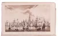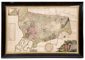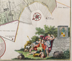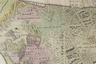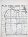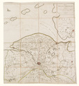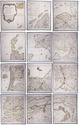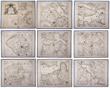

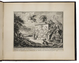
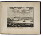
Rare print series with beautiful views and vistas of the Middachten estate and its surroundings, located between the Veluwe nature reserve and the river IJssel
LAEN, Adolf van der & Hendrik de LETH.
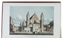
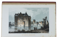
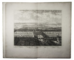
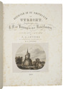
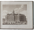
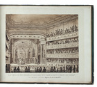
Afbeeldinge van het out adelyk huis Middachten, op de Veluwe, in Gelderlant. Zoo in een generael, als veele particuliere gezichten der gebouwen, tuinen, plantadien enz. toebehorende den hoogwelgeboren heere, den heere Reinhart, baron van Reede, heere Van Ginkel, Middachten, Zuilenburg, Rouwenberg, Burghman tot den Niënburg enz. ... [title-print:] Verscheyde schoon en vermaakelyke gesichte[n] van 't adelyk huis van Middagten ...
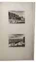
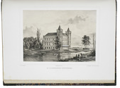
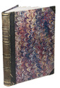
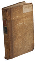
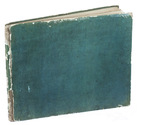
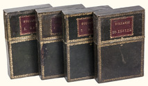
Amsterdam, Andries & Hendrik de Leth, [ca. 1725/31]. Oblong folio (ca. 29 x 23 cm). With the title-print and 19 (of 21) numbered engraved views (ca. 16 x 20 cm), printed on laid paper without watermarks and mounted on wove paper. All prints captioned in Dutch and French below the image, except for the title-print, which is captioned in Dutch only. 20th-century half maroon cloth and maroon paper. [4] ll. plus title-print & 19 of 21 numbered views. Full description
€ 2,500
Amsterdam, Andries & Hendrik de Leth, [ca. 1725/31]. Oblong folio (ca. 29 x 23 cm). With the title-print and 19 (of 21) numbered engraved views (ca. 16 x 20 cm), printed on laid paper without watermarks and mounted on wove paper. All prints captioned in Dutch and French below the image, except for the title-print, which is captioned in Dutch only. 20th-century half maroon cloth and maroon paper. [4] ll. plus title-print & 19 of 21 numbered views. Full description