
A modest career on vast seas: an anonymous French naval memoir

[FRENCH - COLONIAL - MARITIME].
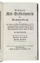
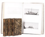
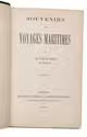
Souvenirs de voyages martimes par un officier de marine en retraite
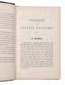
Algiers, Adolphe Jourdan Libraire-editieur Jourdan, 1884. 8vo. 19th-century half morocco. VIII, 516, [2] pp. Full description
€ 3,500
Algiers, Adolphe Jourdan Libraire-editieur Jourdan, 1884. 8vo. 19th-century half morocco. VIII, 516, [2] pp. Full description