Categories
Shopping cart (0 items € 0)
Advanced search

Australia, New Zealand & Pacific

The first complete account of the Le Maire-Schouten expedition

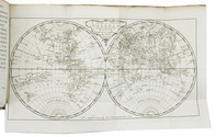
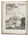
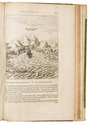
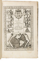
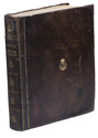
HERRERA Y TORDESILLAS, Antonio de. Novis orbis, sive descriptio Indiae Occidentalis ... Methaphraste C. Barlaeo. Accesserunt & aliorum Indiae Occidentalis descriptiones, & navigationis nuperae Australis Jacobi le Maire Historia, uti & navigationum omnium per Fretum Magellanicum succincta narratio.
Amsterdam, Michiel Colijn, 1622. Folio. With an engraved title, 17 engraved maps (1 folding, 16 double-page), a full-page portrait, and 4 half-page illustrations in the text. Later three-quarter vellum, with the manuscript title on the spine, sprinkled paper sides, red edges. [4], "81" [=84], [2], "9" [=10], 11, [1 blank] ll. Full description
€ 20,000
Order Inquire Terms of sale

From the library of the Dutch explorer and diplomat Pieter Nuyts, discoverer of the southern coast of Australia in 1627

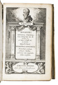
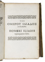
HOMER [and Henri ESTIENNE (editor)]. Opera omnia, cum interpretat[ione]. lat[ina]. ad. verbum ... et breves notae marginales. Editio novissima.
Amsterdam, Johannes van Ravesteyn, 1650. Small 8vo (ca. 15.5 x 10 cm). With the engraved title (within collation) and a few woodcut tail-pieces and decorated initials. Contemporary overlapping vellum, manuscript title in black ink on the spine, red painted edges. [16], 895, [1 blank], [14] pp. Full description
€ 6,000
Order Inquire Terms of sale

Massive navigational directory, with sections on the Arabian Sea, the Red Sea and the Gulf

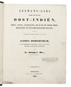
HORSBURGH, James, Gerrit KUIJPER and D. BOES LUTJENS. Zeemans-gids, naar, in en uit Oost-Indiën, China, Japan, Australiën, de Kaap de Goede Hoop, Braziliën en tusschenliggende havens, volgens de vierde Engelsche uitgave van James Horsburgh, ...
Amsterdam, C.F. Stemler, (back of half-title: printed in Haarlem by H. Bakels), 1841. 4to. Contemporary half calf, spine lettered in gold, marbled sides. I-XII, [2], XIII-XXIV, XXVIII, 1376 pp. Full description
€ 3,750
Order Inquire Terms of sale

Updated edition of a massive directory providing essential information
for navigating in the Southern and Eastern hemispheres

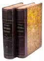
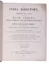
HORSBURGH, James. The India directory, or, directions for sailing to and from the East Indies, China, Australia, and the interjacent ports of Africa and South America ... Seventh edition.
London, Wm. H. Allen & Co. (back of the title pages: printed by Cox and Wyman), 1855. 2 volumes. Large 4to (28 x 23 cm). Contemporary half calf, re-backed with the original backstrips laid down. XII, XXXIV, [2], “681” [= 683], [1 blank]; VIII, 978 pp. Full description
€ 18,000
Order Inquire Terms of sale

Important guide to navigating the seas to the far reaches of Asia

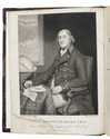
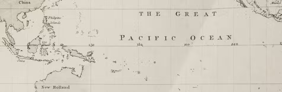
HUDDART, Joseph. The oriental navigator; or, new directions for sailing to and from the East Indies, China, New Holland, &c. &c. &c. Also for the use of the country ships, trading in the Indian and China seas, Pacific Ocean, &c. &c. &c...
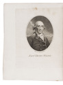
London, printed and published by Robert Laurie and James Whittle, map, chart, and printsellers, 1801. 4to. With an engraved frontispiece portrait of Huddart by James Stow after John Hoppner and small woodcut coastal views in the text. Contemporary tree calf. [2], XII, 656 pp. Full description
€ 7,500
Order Inquire Terms of sale

First and only edition of a radical political pamphlet built around an imaginary voyage.
A spin-off from Neville's 1668 "Isle of Pines"

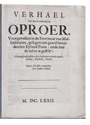
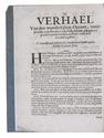
[IMAGINARY VOYAGE]. Verhael van den wonderlijken oproer, voorgevallen in de provincie van Mallanbruino, gelegen een graed bezuiden het eyland Pines: ende hoe de zelve is gestilt. t'Samenspraek tusschen drie persoonen te wacht zijnde, Arent, Gijsbert, Dirck.
[Holland?], 1672. 4to. Later blue/grey paper wrappers. 8 pp. Full description
€ 6,850
Order Inquire Terms of sale

The main source of early knowledge of the Pelew or Palau Islands in Micronesia, in Dutch translation

KEATE, George. Beschryving van de Pelew Eilanden ...
Rotterdam, Gerard Abraham Arrenberg, 1789. 4to. With 8 plates: 4 mixed technique (partly stipple-engraved) portraits, 1 large folding engraved map of the Palau Islands and western equatorial Pacific, and 3 folding engraved views. Contemporary boards. XXXII, 365, [1] pp. Full description
€ 2,500
Order Inquire Terms of sale

World atlas including one 6-sheet and eleven 4-sheet wall maps

KITCHIN, Thomas and others. Kitchin's general atlas, describing the whole universe.
London, Robert Laurie, James Whittle, 1808. Imperial folio (53 x 39.5 cm). With 28 engraved maps (numbered in 41 parts) assembled from 67 sheets. Most include elaborate cartouches with pictorial decoration. With the maps coloured in outline. Contemporary half calf. 1 leaf plus maps. Full description
€ 18,000
Order Inquire Terms of sale

The original and best edition of an important circumnavigation and Russian expedition
to the Bering Strait during the years 1815-1818

KOTZEBUE, Otto von. Entdeckungs-Reise in die Süd-See und nach der Berings-Strasse zur Erforschung einer nordöstlichen Durchfahrt. Unternommen in den Jahren 1815, 1816, 1817 und 1818, auf Kosten Sr. Erlaucht des Herren Reichs-Kanzlers Grafen Rumanzoff auf dem Schiffe Rurick unter dem Befehle des Lieutenants der Russisch-Kaiserlichen Marine Otto von Kotzebue.
Weimar, Hoffmann Brothers, 1821. 3 parts in 1 volume. Large 4to. With 6 engraved maps, 4 folding double-page etched aquatints by Paul Anton Skerl and Carl Ermer after Ludwig Choris, 4 hand coloured full-page engraved portraits of indigenous men and women (of which 3 facing the title-pages of the 3 parts), 11 hand coloured full-page engraved plates (numbered I-XI in the plate) of butterflies by Carl Ermer after Johann Friedrich Gustav von Eschscholtz, 1 full-page engraved plate of skulls, 2 folding printed tables, and several tables and schemes in the text. With a divisional title page for parts 2 and 3. Contemporary half marbled leather. [1], [1 blank], [1], [1 blank], 91, [1 blank], [1], [1 blank], [93]-168 pp.; 176 pp.; [1], [1 blank], "240" [= 241], [4], [1 blank], [1], [1 blank], XVIII pp. Full description
€ 12,500
Order Inquire Terms of sale

Very rare first and only Dutch edition of Kotzebue's account of his first major expedition in search of a northwest passage

KOTZEBUE, Otto von (Pieter Gerardus WITSEN GEYSBEEK, translator). Ontdekkingsreis in de Zuid-zee en naar de Bering-straat in de jaren 1815, 1816, 1817 en 1818, onder het bevel van Otto von Kotzebue, luitenant der Russisch-keizerlijke marine.
Amsterdam, Johannes van der Hey, 1822. 3 volumes. 8vo. Volume 1 with an engraved title page, a hand-coloured engraved plate and an engraved folding map; volume 2 with an engraved title page, 3 hand-coloured engraved portraits, 2 engraved folding plates and 4 engraved folding maps, including one large map; volume 3 with an engraved title page, an engraved folding map, and an engraved folding plate showing skulls. Half brown calf and brown decorated paper sides, with gold- and blind-tooled spines. VIII, 428, [2 blank], [1], [1 blank]; IV, 413, [1 blank], [1], [1 blank]; VIII, 492, [1], [1 blank], [1], [1 blank] pp. Full description
€ 2,950
Order Inquire Terms of sale
120 books found / Show all