
"Confidential"
[INDIA – ARMY, GENERAL STAFF BRANCH].
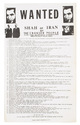
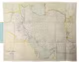
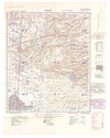
Operations in Waziristan 1919-1920. Confidential. Compiled by the General Staff, Army Headquarters, India, 1921.
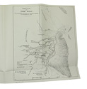
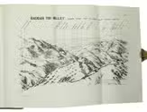
Calcutta, Superintendent of Government Printing, 1921. 8vo. With frontispiece, 31 plates, 7 maps (3 in pocket on inside of back board), and 8 panoramas, mostly folding.Contemporary half calf, green cloth sides, gold-stamped red spine labels. X, 187, [1] pp. Full description
€ 2,800
Calcutta, Superintendent of Government Printing, 1921. 8vo. With frontispiece, 31 plates, 7 maps (3 in pocket on inside of back board), and 8 panoramas, mostly folding.Contemporary half calf, green cloth sides, gold-stamped red spine labels. X, 187, [1] pp. Full description