
Extensive article on the Middle East oil industry around 1948
[OIL - MIDDLE EAST].
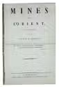
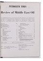
The Petroleum Times. [drop-title]: Review of Middle East oil. A comprehensive illustrated review of all aspects of current developments based on a recent extended tour by Dr. C.T. Barber, ...
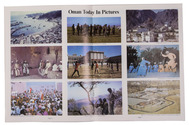
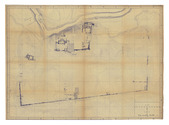
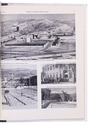
London, Brettenhem house, June 1948. 30 x 23.5 cm. With many reproductions of photographs, ground plans, maps, and cross-sections. Later cardboard binder. V-XXX, 115, XXXA-XLVI pp. Full description
€ 1,750
London, Brettenhem house, June 1948. 30 x 23.5 cm. With many reproductions of photographs, ground plans, maps, and cross-sections. Later cardboard binder. V-XXX, 115, XXXA-XLVI pp. Full description