Categories
Shopping cart (0 items € 0)
Advanced search

Middle East & Islamic World

The defeat of the Ottoman corsair fleet, one of two known copies

[MURILLAS Y FEXADA, Juan Lopez de]. Relacion verdadera de las Gloriosas proezas, y Vitorias, que han hecho las invencibles Galeras de Malta en los mares de Levante, en este ano de mil y seiscientos y cincuenta y dos.
Madrid, Gregorio Rodriguez, [1652]. Folio (29 x 20.8 cm). With the Spanish Royal coat of arms on the recto of the first leaf [4] pp. Full description
€ 1,500
Order Inquire Terms of sale

From the Rothschild library: 102 extraordinary plates of the Mosque at Córdoba and the Alhambra complex

MURPHY, James Cavanah. The Arabian antiquities of Spain.
London, Cadell & Davies, 1815. Double elephant folio (500 x 675 mm). With an engraved frontispiece, an engraved part title and 103 plates (numbered 1 to 97, plates 8, 79 and 80 in 2 parts, plate 86 in 3 parts) including a folding plate (pl. 12), engraved by Porter, Turel, Roffe, Keux and others after Murphy. Contemporary red half morocco and marbled boards, raised spine bands, titled in gilt on spine. All edges gilt. [4], 21, [1] pp. Full description
€ 25,000
Order Inquire Terms of sale

Handbook to western Arabia, intended for British naval officers only

NAVAL INTELLIGENCE DIVISION, [SCOTT, Hugh, a.o.]. Western Arabia and the Red Sea, B.R. 527 (restricted) geographical handbook series for official use only.
(Colophon: Oxford, University press), Naval Intelligence division, 1946. 8vo. With 357 reproductions of photographs on 90 plates, numerous (folding) maps and illustrations in text and 1 separate folding map. Original publisher's green cloth. XIX, [1 blank], 659, [1 blank] pp. Full description
€ 600
Order Inquire Terms of sale

One of the limited official copies of the British Allied War Effort
of a geographical handbook on Palestine and Jordan

NAVAL INTELLIGENCE DIVISION. Palestine and Transjordan. Geographical handbook series.
(colophon:) Oxford, University Press, December 1943. 2 parts in 1 volume. Large 8vo. With 1 large folding map stored in a pocket on the back board of the communications of Palestine (air fields and landing grounds, railways, roads and sea plane moorings), 2 other folding maps (geological map of Palestine; map of Haifa Harbour), 1 double-page plan of the church of Holy Sepulchre and 58 other figures in the text. Also with 154 half-tone photographs, inserted on separate leaves and all numbered and captioned. Original publisher's green cloth, gilt-lettering on front board and spine. XV, 621, [1 blank] pp. Full description
€ 1,000
Order Inquire Terms of sale

Rare handbooks of the British naval intelligence division on Arabia, Palestine, and Syria

NAVAL INTELLIGENCE DIVISION. Syria. April 1943.
With:
(2) IDEM. Palestine and Transjordan. December 1943.
(3) IDEM. Western Arabia and the Red Sea. June 1943.
Stationery Office, University Press Oxford, 1943-1946.
3 volumes. Many plates, tables and photographs. Each volume including separate fold-out maps, one in colour. Contemporary green cloth with the title in gold on the front boards and the spines. [2], XVI, 485, [1]; [2], XV, [1], 621, [1]; [2], XIX, [1], 659, [1] pp. Full description
€ 1,750
Order Inquire Terms of sale

For official use only: Royal Navy wartime handbook on Iraq and the Persian Gulf

NAVAL INTELLIGENCE DIVISION. [MASON, Kenneth, a.o.]. Iraq and the Persian Gulf. September 1944. B.R. 524 (restricted) geographical handbook series for official use only.
[Oxford,] Naval Intelligence division, 1944. 8vo. With numerous diagrams, reproductions of photographs and (folding) maps, including a loose map in the pocket at the back. Publisher's green cloth. 682 pp. Full description
€ 3,500
Order Inquire Terms of sale

One of the limited official copies of a geographical handbook on Persia and Arabia

NAVAL INTELLIGENCE DIVISION. 
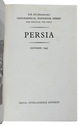
Persia. Geographical handbook series for official use only.
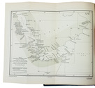
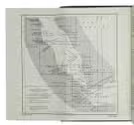
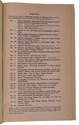
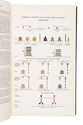
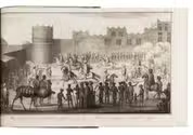
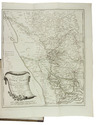
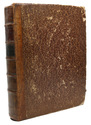
(colophon:) Oxford, University Press, September 1945. Large 8vo. With 1 large folding map of Iraq, Arabia and Persia bound at the end of the book, 11 smaller folding maps and 50 illustration figures in the text (smaller maps, current and wind charts, sections, diagrams on the rainfall, etc.). Also with 337 half-tone photographs, inserted on separate leaves and all numbered and captioned. Original publisher's green cloth, gilt-lettering on front board and spine. XIX, [1 blank], 638 pp. Full description
€ 1,250
Order Inquire Terms of sale

Navigating the Red Sea and Gulf of Aden

[NAVIGATION - RED SEA]. Red Sea and Gulf of Aden pilot comprising the Suez canal, the gulfs of Suez and 'Aqaba, the Red Sea, the Gulf of Aden, ...
Including: Supplement no. 1-1957 relating to the Red Sea and Gulf of Aden pilot, tenth edition ...
London, published by the Hydrographic Department, Admiralty, 1955-1957. 8vo. With a folding map (printed on both sides), 2 coloured plates with diagrams (printed on both sides), 28 plates showing coastlines and occasionally a map (many printed on both sides), and many some illustrations in text. Original blue cloth; supplement with original printed paper wrappers. LI, [1 blank], 518, [1], [1 blank] pp. Full description
€ 1,750
Order Inquire Terms of sale

Sailing directions for the Red Sea and Gulf of Aden,
intended for practical use by naval and merchant ships

[NAVIGATION - RED SEA - PILOT GUIDE]. Red Sea and Gulf of Aden pilot comprising the Suez Canal, the Gulfs of Suez and Aqaba, the Red Sea, the Gulf of Aden, the South-East coast of Arabia from Ras Baghashwa to Ras Al Hadd, the coast of Africa from Ras Asir to Ras Hafun, Socotra and its adjacent islands.
London, United Kingdom Hydrographic Office, 1967. Large 8vo. The main work with 3 maps (including 2 folding) and 82 views of coastal profiles on 52 plates. The supplement with 2 folding maps (on the two sides of a single folding leaf) and 4 views of coastal profiles on 3 pages.
With: [NAVIGATION - RED SEA - PILOT GUIDE]. Supplement No. 7 - 1977 to Red Sea and Gulf of Aden pilot (eleventh edition, 1967) corrected to 4th March, 1977 Whenever reference is made to the pilot this supplement must be consulted.
London, United Kingdom Hydrographic Office, 1977.
Grey-blue back wrapper; the two quires, map and back wrapper held together by two metal staples. Blue cloth with title information in yellow on front cover and spine, the supplement loosely inserted at the end of the volume. [4], XV, [1 blank], 599, [1]; [2], 60, [2 blank] pp. Full description
€ 1,250
Order Inquire Terms of sale

Navigating the Red Sea and Gulf of Aden, intended for practical use by naval and merchant ships

[NAVIGATION - RED SEA - PILOT GUIDE]. Red Sea and Gulf of Aden pilot comprising the Suez canal, the Gulfs of Suez and 'aqaba, the Red Sea, the Gulf of Aden, the South-east coast of Arabia from Ras Baghashwa to Ras al Hadd, the coast of Africa from Ras Asir to Ras Hafun, Socotra and its adjacent islands. Tenth edition.
London, Published for the Hydrographic Department, Admiralty, 1955.
With: [NAVIGATION - RED SEA - PILOT GUIDE]. Supplement no. 1-1957 relating to the Red Sea and Gulf of Aden pilot, tenth edition, 1955, corrected to 17th July, 1957, whenever reference is made to the pilot, this supplement must be consulted.
London, published for the Hydrographic Department, 1957. 8vo. With a folding map (printed on both sides), 2 coloured plates with diagrams (printed on both sides), 28 plates showing coastlines and occasionally a map (many printed on both sides), and many some illustrations in text. Original blue cloth with yellow lettering on the spine and the front board, the supplement is loosely inserted at the end of the volume: original printed paper wrappers, stapled. [2], LI (= LIII: II plus [1], [1 blank]), [1 blank], 518, [1], [1 blank] pp; Supplement: 20 pp. Full description
€ 1,750
Order Inquire Terms of sale
679 books found / Show all