Categories
Shopping cart (0 items € 0)
Advanced search

Middle East & Islamic World

A collection of Venetian voyages to the Near and Middle East, printed at the Aldine press

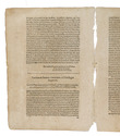
[MANUZIO, Antonio (ed.)]. Viaggi fatti da Vinetia, alla Tana, in Persia, in India, et in Costantinopoli: con la descrittione particolare di città, luoghi, siti, costumi, & della porta del Gran Turco: & di tutte le intrate, spese, & modo di governo suo, & della ultima impresa contra Portoghesi.
Venice, sons of Aldus Manutius, 1545. 8vo. With Alduss woodcut anchor device on the title-page. 18th-century English polished calf. 163 ll. Full description
€ 7,500
Order Inquire Terms of sale

One of the fullest descriptions of life in Sana'a and Turkish-occupied North Yemen

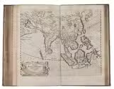
MANZONI, Renzo. El Yèmen. Tre anni nell'Arabia felice. Escursioni fatte dal Settembre 1877 al Marzo 1880.
Rome, Botta heirs, 1884. 8vo. With a frontispiece portrait, 21 plates (including 7 double-page sized; the last single-page plate included in pagination), 2 folding colour-printed maps of Yemen, folding plate of the game "abdùr", folding coloured plan of Sana'a, folding view of Sana'a, folding view of Aden, as well as numerous woodcut illustrations in the text. Contemporary half calf over marbled boards with blind-stamped spine and gold-stamped spine-title. Marbled endpapers. [8], VI, [2], 446 pp. Full description
€ 2,500
Order Inquire Terms of sale

USAF pilot's map of the Arabian Gulf

[MAP - ARABIAN GULF]. Aeronautical chart and information center. Persian Gulf | ONC-H-6/7. Operational navigation chart.
St Louis, Aeronautical chart and information center, United States Air Force, 1969. Two copies of two folding maps colour printed on both sides of a sheet of silk (103 x 78.5 cm) on a scale of ca. 1:1,000,000. The two maps (ONC-H-6 & ONC-H-7) show one continuous area. Full description
€ 2,800
Order Inquire Terms of sale

Cross-cultural mapping of the Red Sea: Bruce's chart in an early Egyptian manuscript copy

[MAP - ARABIAN PENINSULA]. BRUCE, James. Carte de la mer Rouge, relevée sur celle de James Bruce.
[Egypt, probably Cairo], 1827. Folio leaf (46 x 31.5 cm). Manuscript map in pen and ink with watercolour, with a French text on Middle Eastern hand-made paper. Full description
€ 15,000
Order Inquire Terms of sale

Abu Dhabi's Oil industry: the Israeli perspective

[MAP - ARABIAN PENINSULA OIL RESOURCES]. Neft ba-mizrah ha-tikhon. Zikaynot, shadot, tzinorot, batei zikuk. [= Oil in the Middle East. Concessions, oilfields, pipelines, refineries].
Tel Aviv, Israel Defence Forces, General Staff, [1957]. 56 x 82.5 cm. Chromolithographic map of the Arabian Peninsula, from Turkey in the north to the Indian Ocean in the south, and covering Saudi Arabia, Egypt, Israel, Palestine, Jordan, Syria, Lebanon, Iraq, Iran, Kuwait, Bahrain, Qatar, United Arab Emirates, Oman, North and South Yemen. Scale 1:5,000,000. Scale and key in Hebrew inset to top-right, inset explanatory panels in Hebrew and English, compass rose in Saudi Arabia. Folded. Full description
€ 7,500
Order Inquire Terms of sale

Asia and the Middle East in 1952, with many borders on the Arabian Peninsula still undefined

[MAP – ASIA – MIDDLE EAST]. NATIONAL GEOGRAPHIC SOCIETY. Southwest Asia, India, Pakistan, and Northeast Africa.
Washington, DC, National Geographic Society, 1952. Colour printed map, 68.5 x 95 cm. Scale 1:7,5000,000. With an inset map of "the Moslem World; percentage of Moslems in total population". Full description
€ 850
Order Inquire Terms of sale

Ottoman map of Iraq, Kuwait and southwestern Iran, used by its army in World War I

[MAP - OTTOMAN ARMY]. [Iraq, Kuwait and Iran].
Istanbul, [Erkan-i Harbiye-i Umumiye], 1331 Rumi [= 1915 CE]. Colour-lithographed map of Iraq, Kuwait and southwestern Iran (65.5 x 66 cm) in black, brown, blue and green at a scale of 1:1,000,000, dissected into 12 sections and mounted on contemporary cloth. Full description
€ 3,500
Order Inquire Terms of sale

Unpublished French study of Islamic coins and medals,
with about 157 drawings and engravings, many in colour

[MARCEL, Jean-Joseph?]. [Islamic coins and medals].
[Paris?], [ca. 1791-ca. 1817?]. Mostly folio (31.5 x 21 cm). A manuscript compilation of loose leaves and bifolia, with about 104 drawings (some in ink; some in coloured gouaches, many including gold, silver and other metallic colours) and about 53 engravings (some black on white; some white on black) each drawing and engraving showing the obverse and reverse of an Islamic coin or medal (except for about 3 that show only one side). Most of the drawings and engravings are on slips attached to leaves with notes in Arabic and French.Loose leaves and bifolia. [ca. 150] ll. Full description
€ 28,000
Order Inquire Terms of sale
648 books found / Show all