
Quixotic adventures in Corsica
BOSWELL, James.
An account of Corsica, the journal of a tour to that island; and memoirs of Pascal Paoli.
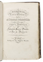
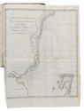
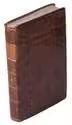
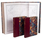
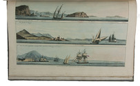
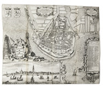
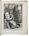
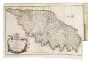
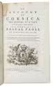
Glasgow, printed by Robert & Andrew Foulis for Edward & Charles Dilly London, 1768. 8vo (ca. 21 x 13 cm). With an engraved vignette on the title page incorporating the crowned coat of arms of the Republic of Corsica, and a large folding map (plate size 27.5 x 45 cm) of Corsica engraved in Edinburgh by Thomas Phinn in 1768. Contemporary calf, rebacked with the original backstrip, with the red morocco title label lettered in gold, laid down. XXI, [1 blank], [1], [1 blank], 382 pp. Full description
€ 2,000
Glasgow, printed by Robert & Andrew Foulis for Edward & Charles Dilly London, 1768. 8vo (ca. 21 x 13 cm). With an engraved vignette on the title page incorporating the crowned coat of arms of the Republic of Corsica, and a large folding map (plate size 27.5 x 45 cm) of Corsica engraved in Edinburgh by Thomas Phinn in 1768. Contemporary calf, rebacked with the original backstrip, with the red morocco title label lettered in gold, laid down. XXI, [1 blank], [1], [1 blank], 382 pp. Full description