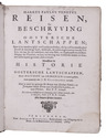
POLO, Marco.
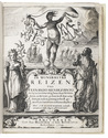
Reisen, en beschryving der Oostersche lantschappen; ...
Including:-HETOUM of Corycus. Historie der Oostersche lantschappen; ...
-[BRACCIOLINI, Poggio, and Girolamo di SANTO STEFANO]. Reysen naar Indien, en d'oostersche landen; gedaan by Nicolaus Venetus, en Jeronymus van St. Steven.
-[Anonymous VOC officer in Formosa]. Verhaal van de verövering van 't eylant Formosa door de Sinesen.
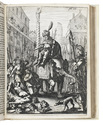
Amsterdam, Abraham Wolfgang, 1664. With 4 engraved plates.
With:(2) BOURGES, Jacques de. Naaukeurig verhaal van de reis des Bisschops van Beryte uit Frankryk te lant en ter zee naar China.
Amsterdam, Abraham Wolfgang, 1669. With 8 half-page engraved illustrations in text.
(3) Verhaal van drie voorname reizen naar Oostindien, te weten van Johan Jacobsz Saar, Volkert Evertsz, en Albrecht Herport.
Comprising:-SAAR, Johann Jacob. De reisbeschryving ... naar Oostindien, sedert ... 1644. tot ... 1659. ...
-OLEARIUS, Adam. De beschryving der reizen van Volkert Evertsz. [= Volquard Iversen] naar Oostindien. ... uitgevaren in ... 1655. en in ... 1668 ... gekeert.
-HERPORT, Albrecht. De beschryving der Oostindische reizen ... sedert ... 1659. tot ... 1668. ...
Amsterdam, Jan Rieuwertsz & Pieter Arentsz, 1671 (works 2 and 3 dated 1670 on their title-pages). With 8 engraved plates, the last 4 sometimes attributed to Romeyn de Hooghe or his school.
3 editions (the 1st containing 4 works and the 3rd containing 3 works) in 1 volume. 4to.Contemporary vellum. [12], 99, [8], [1 blank], 70, [2], 25, [1 blank], 12; [2], 126; [6], 198 pp.
Full description