
A famous topography of Switzerland enlarged with 68 extra engravings
MERIAN, Matthäus.
Topographia Helvetiae Rhaetiae et Valesiae. Das ist, Beschreibung und eigentliche Abbildung der vornembsten Stätte und Plätz, in der hochlöblichen Eydgnoßschafft, Grawbündten, Walliß, und etlicher zugewanten Orten.
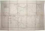
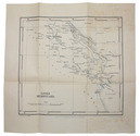
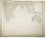
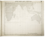
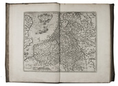
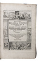
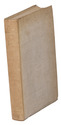
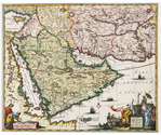
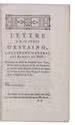
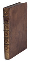
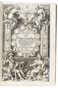
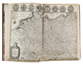
[Frankfurt am Main], Matthäus Merian, 1642. Folio. With richly engraved title-page, 74 (of 76) engraved maps, plans and views on 54 (of 56) plates normally included the 1642 first edition (nearly all double-page) plus 1 large folding plate from the 1653 Anhang, and 67 additional engravings from the 17th and 18th century, including at least 16 by or after Merian. Altogether there are 3 general maps (1 of Germany and surroundings and 2 of Switzerland), 4 detail maps, and numerous city plans and views. Lacking the bird's eye view of Herisau and the second of two views of Neuchâtel. Tanned sheepskin (ca. 1700?), gold-tooled spine. 72, [8] pp. plus engraved plates. Full description
€ 29,500
[Frankfurt am Main], Matthäus Merian, 1642. Folio. With richly engraved title-page, 74 (of 76) engraved maps, plans and views on 54 (of 56) plates normally included the 1642 first edition (nearly all double-page) plus 1 large folding plate from the 1653 Anhang, and 67 additional engravings from the 17th and 18th century, including at least 16 by or after Merian. Altogether there are 3 general maps (1 of Germany and surroundings and 2 of Switzerland), 4 detail maps, and numerous city plans and views. Lacking the bird's eye view of Herisau and the second of two views of Neuchâtel. Tanned sheepskin (ca. 1700?), gold-tooled spine. 72, [8] pp. plus engraved plates. Full description