Categories
Shopping cart (0 items € 0)
Advanced search ▾

Military History / Battle Plans & Siegecraft

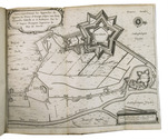
Eyewitness account of the siege of Breda (1637), with the rare folding plan
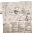
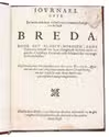
HEXHAM, Henry. Journael ofte een ware ende kort verhael van 't veermaerde belegh van de Stadt Breda, door het kloeck-moedich, ende victorieus beleydt van Syne Hoogheydt de Prins van Orangien &c.
Delft, printed for and sold by Henricus Hondius, The Hague, 1638. 4to. With a large folding map of the city of Breda and surroundings during the siege in 1637, with an explanatory text pasted to the bottom margin. Interleaved copy. Early 19th-century gold-tooled red straight-grained morocco. [8], 55, [1 blank], "14" [= 20] pp. Full description
€ 1,950
Order Inquire Terms of sale

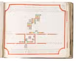
Drilling the Austrian Imperial infantry, with 49 manuscript formation plans in colour

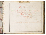
LEEUWEN, Engelhard August Baron van. Plans des neu herrauss gegebene Exercittii nach den dermahligen Kayserl: Königl: kriegs Fuss Volck eingerichtet. Herausgegeben im Jahr 1765. Zugehörig Titl. Herrn Obrist Wacht M[ei]st[er] Baron v[on]: Engelhard.
Austria, 1769[?]. Oblong 4to (18.5 x 23 cm). With title and the explanation of the key letters used in the plans written in red, the key to the colour coding in the troop formations in 8 colours, and 49 (of 55) numbered colour-coded plans of infantry exercises. Each text leaf and each plan (except no. 26) in a frame of rules, nos. 2-35 in red, the rest in black. Plans 1, 24, 32, 33, 42, and 46 have been torn out, in 2 cases leaving a small piece of the drawing. Contemporary mottled tanned sheepskin, gold-tooled spine. [3], 16 ll. plus 49 (of 55) numbered plans. Full description
€ 5,000
Order Inquire Terms of sale

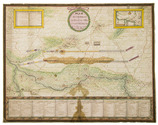
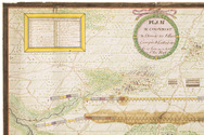
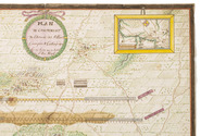
Brightly handcoloured contemporary manuscript plan showing a military camp
near Korbeek/Corbais, Belgium, during the Nine Years' War

[MAP - MILITARY - LOW COUNTRIES - KORBEEK]. Plan du campement de l'armée des alliees campée a Corbay depuis le 19 Juin au 7 Juliet l'an 1696.
[Belgium?, ca. 1696]. Manuscript plan on paper (38 x 48 cm) in ink and bright watercolour. With the title in a wreath at the head, a large panel at the foot with keys identifying the camps of the various troops, and two smaller panels at the head, with keys to the villages and other locations, and a general overview map. Full description
€ 2,000
Order Inquire Terms of sale

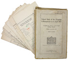
"For offical use only": mapping the Mesopotamian battlefields of WWI

[MESOPOTAMIAN CAMPAIGN]. Critical study of the campaign in Mesopotamia up to April 1917. Part II - Maps.
Calcutta, Government of India Press, 1925. 25 (of 26) folding maps, sketches etc., as always lacking the "Explanation of the Method of giving Map Co-ordinates adopted in Chapters XIII and XX". Original tan cloth map-case with original printed label to cover. 25 (of 26) folding ll. Full description
€ 3,500
Order Inquire Terms of sale

Maps, plans, and descriptions of the military defenses of Holguín, Cuba, shortly before Cuban independence

NAVA Y ORTEGA, Henriques. Campo Atrincherado de Holguin. Documento no. 1. Memoria descriptiva.
Holguín, 1 September 1898.
With: (2) NAVA Y ORTEGA, Henriques. Campo Atrincherado de Holguin. Documento no. 2. Planos.
Holguín, 1 September 1898. 2 documents. Folio. With a double-page manuscript map, 2 full-page manuscript maps, and 4 manuscript plans on tissue paper. Ad 1: Original wrappers, side stiched through 3 holes, with the manuscript title on the front. Ad 2: unbound. [16] pp. Full description
€ 4,950
Order Inquire Terms of sale

Second known copy of a lithographic panorama depicting stages of the Italian War of 1859

[PANORAMA - ITALIAN WAR 1859]. Panorama de la guerre d'Italie. Magnifique album développé formé d'une série de grandes lithographies coloriées représentant les combats et les batailles qui ont immortalisé nos soldats en Italie précédé d'un compte-rendu de cette mémorable campagne.
Pont-à-Mousson (France), Élie Haguenthal (colophon: Paul Toussaint), [1860/65]. (Size of the whole when folded and closed:) 22.5 x 18 cm. Lithographed folding panorama, showing 8 different lithographed scenes, captioned in and beneath the illustrations, of the Italian War of 1859 from the French-Italian perspective. The 8 scenes (5 3-leaf scenes and 3 single leaf scenes) are assembled to make a single long foldout (as assembled with the text: 21.5 x 395 cm; image size 19 x ca. 310 cm), coloured by a contemporary hand. Half red cloth and hand coloured, lithographed paper sides. [5] ll. of letterpress text and the lithographed folding panorama. Full description
€ 3,250
Order Inquire Terms of sale

The siege of 's Hertogenbosch with engravings by Henricus Hondius II,
from the library of Andrew Fletcher of Saltoun

PREMPART, Jacques. Récit, ou brefve description de ce qui s' est passé durant le très-fameux Siège de Bois-le-Duc. ...
Leeuwarden, Claude Fontaine, 1630. Folio. With a woodcut printer's device on the title-page, 2 large folding engraved maps, showing the city of 's Hertogenbosch, its fortifications, and the besieging army under Prince Hendrik of Orange, and 7 folding engraved plans of the "approches" of the besieging army at various quarters. Contemporary vellum. [2], 26, [4] pp. Full description
€ 6,500
Order Inquire Terms of sale

First account of the famous siege of 's-Hertogenbosch by Frederick Henry in 1629,
with 9 folding maps, and bound together with the French translation

PREMPART, Jacques. Verhael oft corte beschryvinghe van 'tghene ghepasseert is inde seer treffelijcke ende vermaerde belegheringhe van 'sHertoghen-bosch. Hier by zijn gedaen, een generale kaerte van 'tgantsche leger, ende voorts verscheyden particuliere van d'approches van yeder quartier in't bysonder ...
Amsterdam, printed by Jan Fredericksz. Stam for Henricus Hondius, 1630.
With: (2) PREMPART, Jacques. Recit, ou brefve description de ce qui s'est passé durant le tres-fameux siege, de Bois-le-Duc, avec une carte generale du camp entier, & plusieurs particulieres des approches de chasque quartier à part ...
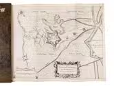
Leeuwarden, printed by Claude Fontaine, 1630. 2 works in 1 volume. Folio. Ad 1: with a woodcut vignette on the title page, 2 large folding engraved maps, 7 folding double-page engraved maps showing the battlefield of the siege of 's-Hertogenbosch in 1629 together with all the fortifications and approaches around the city. Ad 2: with a woodcut printer's device on the title page. Contemporary gold-tooled mottled calf. 28; [2], 26, [4] pp. Full description
€ 4,500
Order Inquire Terms of sale
26 books found / Show all