Categories
Shopping cart (0 items € 0)
Advanced search

Maritime History / Navigation

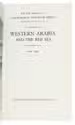
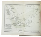
An important surveying voyage to the Pacific
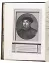
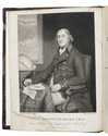
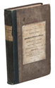
BELCHER, Edward. 
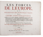
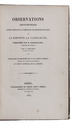
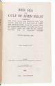
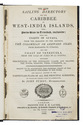
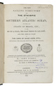
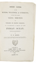
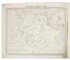
Narrative of a voyage round the world, performed in Her Majesty's ship Sulphur, during the years 1836-1842, including details of the naval operations in China, from Dec. 1840 to Nov. 1841.
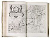
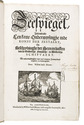
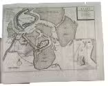
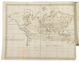
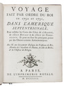
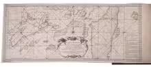
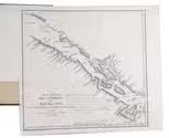
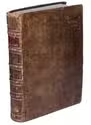
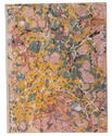
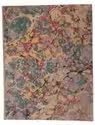
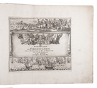
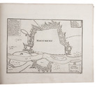
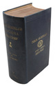
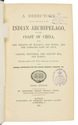
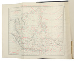
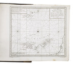
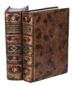
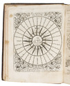
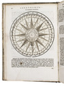
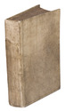
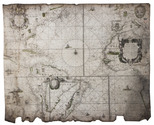
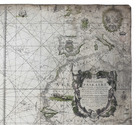
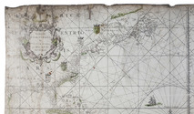
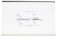
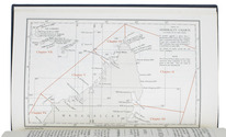
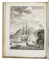
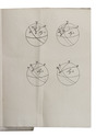
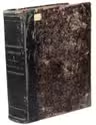
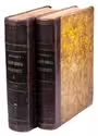
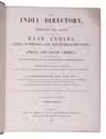
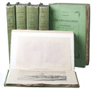
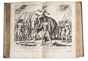
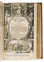
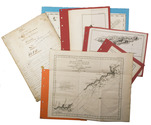
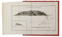
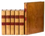
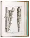
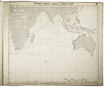
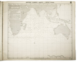
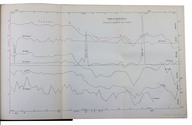
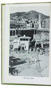
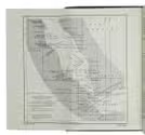
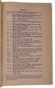
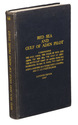
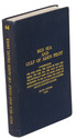
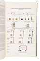
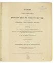
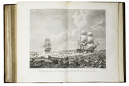
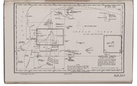
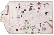
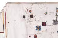
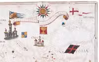
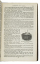
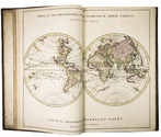
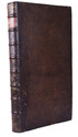
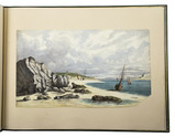
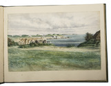
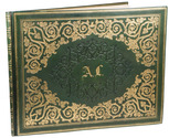
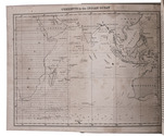
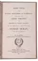
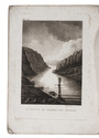
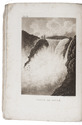
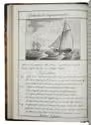
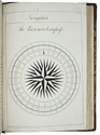
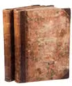
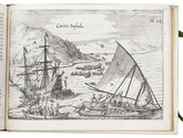
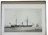
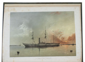
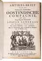
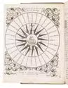
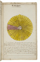
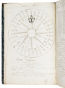
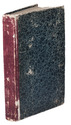
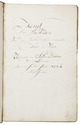
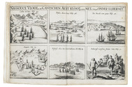
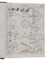
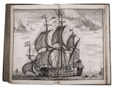
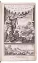
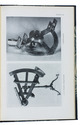
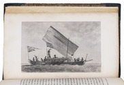
London, Henry Colburn, 1843. 2 volumes. 8vo. With a folding map of the Canton river, folding map with the routes of the H.M.S. Sulphur, large world chart also showing the route of the Sulphur, 19 steel-engraved views and several illustrations in text. Gold-tooled blue sheepskin, shell-marbled sides. Rebacked. In modern slipcase. XXII, 387; VI, 474 pp. Full description
€ 2,950
Order Inquire Terms of sale

Winds and the weather in the coast of India and the Arabian and Persian Gulf:
first edition of a rare meteorological work

CAPPER, James. Observations on the winds and monsoons; illustrated with a chart and accompanied with notes, geographical and meteorological.
London, Charles Whittingham, 1801. 4to. With 1 folding engraved map of the world depicting all the oceans and seas, and several tables in the text. Half calf, marbled sides and edges. Rebacked. XXVIII, 29-234 pp. Full description
€ 2,750
Order Inquire Terms of sale

Catechism of navigation

CLEEFF, Jacob van. Catechismus der zeevaartkunde, of vragen en oefeningen over het beschouwende en werkdadige der stuurmanskunst; ...
Groningen, J. Oomkens, 1840. 8vo. Original publisher's printed paper wrappers, with at the back an advertisement for 6 other works by Van Cleeff. 115, [1 blank] pp. Full description
€ 1,250
Order Inquire Terms of sale

Ocean waves, flooding & hydraulic engineering, well-illustrated

EMY, Amand Rose. Ueber die Bewegung der Wellen und über den Bau am Meere und im Meere. ... Mit 10 Kupfertafeln [sic].
Vienna, Ludwig Förster's artistischer Anstalt (on reverse of title-page: printed by J.P. Sollinger), 1839. 8vo. With 10 folding lithographic plates (23 x 39 to 54 cm) with 75 figures showing diagrams of wave forms and motions, and plans and cross-sections of coasts, man-made barriers, buildings, hydraulic devices, etc. 19-century blue cloth. [2], XIV, 242, [2] pp. Full description
€ 350
Order Inquire Terms of sale

Monograph on rivers, torrents and inland navigation

FABRE, Jean Antoine. Essai sur la théorie des torrens et des rivières, contenant les moyens les plus simples d'en empêcher les ravages, d'en rétrécir le lit & d'en faciliter la navigation, le hallage & la flottaison. Accompagné d'une discussion sur la navigation intérieure de la France; et terminé par le projet de rendre Paris, port maritime en faisant remonter à la voile, par la Seine, les navires qui s'arrêtent à Rouen.
Paris, Bidault, 1797. 4to (29 x 21.5 cm). With 8 folding engraved plates, showing how to determine the drop of a river, the contents of water, how to change currents, how to create different effects with different dyke constructions, etc. Contemporary mottled calf, gold-tooled spine, in the style of Bradel & Derôme. [4], XXXII, 284 pp. Full description
€ 750
Order Inquire Terms of sale

Classic of surveying & instrument-making

FABRI, Ottavio. L'uso della squadra mobile, con la quale per teorica, e pratica si misura geometricamente ogni distanza, altezza, e profondità; ... accresciuta in questa terza edizione di parecchie istruzioni, ..., ec. da Giovanni Vettori.
Trent, Stamparia Vescovile Paroniana [= Giambattista Parone, printer to the Diocese of Trent], 1753. 4to. With engraved architectural title-page, 1 unnumbered folding and 3 numbered illustration plates, 25 engraved illustrations in the text, engraved arms of the dedicatee, 1 engraved pictorial initial letter. Richly gold-tooled contemporary tanned sheepskin, silk ties, gilt edges. XII, 9-144 pp. Full description
€ 3,500
Order Inquire Terms of sale

Europe fortified: the fortifications of Marolois, Stevin and Vauban, beautifully mapped,
together with an atlas of the coasts of France, also with fortifications

FER, Nicolas de. Les forces de l' Europe, ou description des principales villes; avec leurs fortifications. . . .
Paris, "chez l'auteur" [=Nicolas de Fer, a false imprint], 1695-1696 [printed in Amsterdam, for Pieter Mortier, 1695-ca. 1702]. 10 parts in 1 volume. With 234 beautifully engraved plates (a few folding) with 366 maps and views of fortified cities.
With: (2) FER, Nicolas de. Costes de France, sur l' ocean & sur la Mer Mediterranée &c. avec leurs fortifications. . . .
Paris, "Nicolas de Fer" [a false imprint], 1695. [printed in Amsterdam, for Pieter Mortier]. With engraved title-page and 40 engraved plates (including 2 folding). 2 works in 12 parts or volumes, bound as 1 volume. Oblong 1mo (30×37 cm). Contemporary tanned sheepskin, gold-tooled spine. Full description
€ 17,500
Order Inquire Terms of sale

A standard navigational directory for the Indian Archipelago

FINDLAY, Alexander George. A directory for the navigation of the Indian archipelago and the coast of China, from the Straits of Malacca and Sunda, and the passages east of Java, to Canton, Shanghai, the Yellow Sea, and Korea. With the descriptions of the winds, monsoons, and currents, and general instructions for the various channels, harbours, etc. Third edition.
London, Richard Holmes Laurie, 1889. Royal 8vo. With 11 folding maps and charts. Original publishers blindstamped cloth, lettered in gold. XLVIII, IV, 1478; [2], 8 pp. Full description
€ 2,500
Order Inquire Terms of sale

Testing chronometers by Harrison's leading French rival

FLEURIEU, Charles Pierre Claret, Count d'Eveux de. Voyage fait par ordre du Roi en 1768 et 1769, à différentes parties du monde, pour éprouver en mer les horloges marines inventées par M. Ferdinand Berthoud. Première[-seconde] partie, ...
Paris, Imprimerie Royale, 1773. 2 volumes. Large 4to (27 x 20.5 cm). With 5 numbered folding engraved plates in volume 1 (4 maps of the Atlantic Ocean, the Canaries, the Azores, etc., and 1 plate with topographic diagrams), 1 folding engraved plate with geometrical figures illustrating the determination of latitude[!], and 5 folding letterpress tables in volume 2. Contemporary gold-tooled mottled calf. [2], LXXIX, [1 blank], 803, [1 blank]; [2], 622, XL, [2 blank] pp. Full description
€ 9,500
Order Inquire Terms of sale

Rare Swedish scientific dissertation on the making of nautical charts and their use

FRIBERG, Olavus and Olavus HERWECH. Q.B.V. Dissertatio academica, de constructione et usu mapparum hydrographicarum, quam consentiente ampliss. senatu philosoph. in regia academia Upsaliensi, publico eruditorum examini modeste submittunt auctor Olavus Friberg et respondens Olavus Herwech. ad. fil. Vermelandi, In auditorio Carolino Marjori die III. Maji Anno MDCCXLIV.
Uppsala, 1744. 4to. With 4 woodcut geometrical illustrations in the text, a large woodcut headpiece (with the words "constantia coronatur" in it) and one large woodcut decorated initial. Modern stiff (marbled?) paper boards with the title in gold on the spine. 16 pp. Full description
€ 750
Order Inquire Terms of sale

Spanish pioneer of the use of the chronometer in navigation and mapping

GALIANO, Dionisio Alcalá. Memoria sobre las observaciones de latitud y longitud en el mar.
[Madrid], widow of Joaquin Ibarra, 1796. Narrow 4to (20.5 x 14 cm). With a woodcut crowned cypher monogram (of a Spanish Duke?) on the title-page and 7 folding leaves containing 13 numbered letterpress tables. Early 19th-century gold-tooled tree calf. [2], 87, [1] pp. Full description
€ 3,950
Order Inquire Terms of sale

Well-illustrated encyclopaedia of astronomical and surveying instruments from the time of Galileo,
with a world map in two hemispheres, and 3 volvelles

GALLUCCI, Giovanni Paolo. Della fabrica et uso di diversi stromenti di astronomia, et cosmografia, ove si vede la somma della teorica, et pratica di queste due nobilissime scienze.
Venice, Roberto Meietti, 1598. 4to (22 x 16.5 cm). With engraved title-page, folding woodcut plate, 3 woodcut volvelles with moving parts, and numerous woodcut illustrations in text. Including a world map in two hemispheres (incl. America and a scattering of islands at the location of Australia) on two facing pages, they reappear with volvelle attachments on both sides of leaf 149 and leaf 153. Contemporary limp sheepskin parchment. [8], 228 ll. Full description
€ 35,000
Order Inquire Terms of sale

Convolute with rare Dutch works on the art of navigation, richly illustrated with many mathematical
and geometrical figures and two circle figures with moving volvelles

GIETERMAKER, Klaas Hendriksz. 't Vergulde licht der zee-vaard, ofte konst der stuurlieden. Zynde een volkomen en klare onderwyzinge der navigatie, bestaande in 't geen een stuurman hoognodig behoorde te weten.
Amsterdam, Joannes van Keulen & sons, [not before 1774]. With an engraved frontispiece, 2 engraved circle figures with moving volvelles, 1 engraved mathematical and geometrical folding plate, many tables (some folding) and many mathematical and geometrical woodcut illustrations and figures in the text.
With:
(2) DOUWES, Bernardus Joannes. Tafelen, bevattende 1°. De sinussen, tangenten en secanten, van minuut tot minuut voor ieder boog van het quadrant, in hunne natuurlyke getallen, op een radius van 10.000.000. 2°. Derzelver logarithmen. 3°. De logarithmen der gewoone getallen, in hunne natuurlyke orde van opvolging, van 1 tot 10.000. 4°. De vergrootende breedten, in tiende-deelen van minuuten. 5°. De streektafelen, naar het plat en het rond, voor ieder geheele compasstreek van een vierde-rond. Nieuwe, naauwkeurige en veel verbeterde uitgaave.
Amsterdam, Gerard Hulst van Keulen, 1779. Completely filled with mathematical tables.
(3) [drop title:] Tafel van de lengte en breedte der meest bekende zee-plaatzen.
[Amsterdam?, Gerard Hulst van Keulen?, ca. 1779?].
3 works in 1 volume, the first in 4 parts. 4to. Contemporary blind-tooled vellum. Ad 1: [8], 106; 152, 8; 97; 98-120 pp. Ad 2: [233], [1 blank] pp. Ad 3: 39, [1 blank] pp. Full description
€ 6,500
Order Inquire Terms of sale

Goos's West-Indische paskaert in its very rare first state: a monumental nautical chart of the Atlantic Ocean on vellum in Mercator projection, used by the Dutch West Indian Company (WIC)

GOOS, Pieter. West-Indische Paskaert waer in de graden der breedde over wederzijden van de middellijn wassende so vergrooten dat die geproportioneert sijn tegen hunne nevenstaende graden de lengde. Vertonende behalve[n] Europaes zuydelijcste alle de zeekusten van Africa en America begrepen in 't Octroy bij de H.M.H. Staten Generael der vereenichde Nederl. verleent aende Generale West Indische Compagnie. Mitsgaders die van Peru en Chili inde groote Zuyd-Zee.
Amsterdam, Pieter Goos, [ca. 1660]. Printed on vellum (ca. 80 x 98 cm) from one large copperplate engraving, partly coloured by a contemporary hand. Full description
€ 185,000
Order Inquire Terms of sale

A rare, very important work on the scientific side of nautical navigation, by a leading 17th-century Dutch mathematician

GRAAF, Abraham de. De seven boecken van de groote zeevaert, zijnde een volkomen klare, en konstige beschrijvinghe der navigatie.
Amsterdam, Pieter Goos, 1658. 7 parts in 1 volume. Folio. With a half-page engraving on the half-title, a woodcut vignette on the title-page, 6 folding engraved tables and numerous woodcut mathematical diagrams, figures, tables and other illustrations in the text. With woodcut tailpieces and woodcut decorated initials. Contemporary vellum with a manuscript title on the spine. [1], [1 blank], [8], 39, [1 blank]; [2], 4, [45], [1 blank], [90], 5-91, [1 blank]; 96; 86, [2 blank]; 39, [1 blank]; 60, 18, [2 blank]; 96, [7], [1 blank] pp. Full description
€ 8,500
Order Inquire Terms of sale

The British navy's pilot guide for crossing the South Indian Ocean

[GREAT BRITAIN - HYDROGRAPHIC DEPARTMENT]. South Indian Ocean Pilot. Madagascar, Îles Comores, Île de la Réunion, Mauritius, Seychelles Group, Chagos Archipelago, and other islands lying westward of Longitude 80° East. Eight edition.
Taunton, published by the hydrographer of the navy, 1971. With supplement no. 6 (1979). 8vo. With 2 small maps, 8 coastal profiles, 9 diagrams and 11 climatic tables in the book and also 1 view of the coast of Marie Louise Islet (1975) in the supplement. Contemporary blue cloth with printed title in yellow. XI, [1 blank], 333, [1]; 47 pp. Full description
€ 600
Order Inquire Terms of sale

The British navy's pilot guide for crossing the South Indian Ocean

[GREAT BRITAIN, HYDROGRAPHIC DEPARTMENT]. South Indian Ocean pilot. Madagascar, Îles Comores, Île de la Réunion, Mauritius, Seychelles Group, Chagos Archipelago, and other islands lying westward of Longitude 80° East. Eighth edition.
Taunton, published by the hydrographer of the navy, 1971. With supplement no. 5 (1977). 8vo. With 2 small maps, 8 coastal profiles, 9 diagrams and 11 climatic tables in the book and also 1 view of the coast of Marie Louise Islet (1975) in the supplement.Contemporary blue cloth with printed title in yellow. XI, [1 blank], 333, [1]; 40 pp. Full description
€ 600
Order Inquire Terms of sale

Early work on navigation and a primary source for seamen’s “barbaric” language

GUEVARA, Antonio de. Libro de los inventores del arte de marear, y de muchos trabajos que se passan enlas galeras. ... Tocanse enel muy excellentes antiguedades, y avisos muy notables para los que navegan en galeras.
Antwerp, Martin Nutius, [ca. 1545/46]. Small 8vo (13.5 x 10 cm). With Nutius's woodcut device on the title-page. Set in rotunda gothic type with a few words in a large roman. Blind-tooled brown goatskin (1920s?) in 16th-century style by Victor Arias (1856-1935) in Madrid, gold-tooled turn-ins. XXIX, [1], [2 blank] ll. Full description
€ 12,000
Order Inquire Terms of sale

Important work on navigation and an early mention of playing cards

GUEVARA, Antonio de. Epistres dorées moralles & familieres.
Including:
GUEVARA, Antonio de and Jean de GUTERRY (translator). Tome second des epistres dorées et discours salutaires.
GUEVARA, Antonio de. Le troisieme livre des epistres illustres.
Lyon, Macé Bonhomme, 1558-1559.
With:
(2) GUEVARA, Antonio de. Traité des travaux et privileges des galeres & des inventeurs de l'art de naviger.
Lyon, Macé Bonhomme, 1560.
2 works (the first in 3 parts) in 1 volume. 4to. With the titles of the first 3 books in woodcut architectural borders; 2 woodcut illustrations in the text and a number of large woodcut historiated initials. 18th-century tree calf, rebacked with the original backstrip laid down, later endpapers. Full description
€ 2,750
Order Inquire Terms of sale

First Dutch edition of 4 English maritime expeditions, including the first official account of Cook's first voyage

HAWKESWORTH, John (editor). Reizen rondom de weereld, ondernomen . . . tot het doen van ontdekkingen in het zuider halfrond . . .
Including:
BYRON, John. [Drop title:] Verkort verhaal der reizen . . . Tocht van den Kommandeur Byron.
WALLIS, Samuel. Verkort verhaal eener reize rondom de weereld, gedaan in de jaaren 1766, 1767 en 1768. . . . voerende des Konings schip Den Dolphyn.
CARTERET, Philip. Verkort verhaal eener reize rondom de weereld, gedaan in de jaaren 1766, 1767, 1768 en 1769. . . . voerende des Konings sloep De Swaluw.
COOK, James. Verkort verhaal eener reize rondom de weereld, gedaan in de jaaren 1769, 1770 en 1771. . . ., voerende 's Konings schip, Den Onderneemer.
Rotterdam, Reinier Arrenberg, 1774. 4to. With an engraved frontispiece. With an extra folding engraved world map in 2 hemispheres incorporating Cook's recent discoveries: Rigobert Bonne, De oude en nieuwe waereld . . . verrykt met de ondekkingen der laatste reizigers, Amsterdam, 1792 (23×41.5 cm). Modern cloth. [4], 351, [1] pp. Full description
€ 1,950
Order Inquire Terms of sale

Introducing the Dutch standard method of calculating latitude in the 19th century

HAZEWINKEL, Abraham Cornelis. Handleiding om op verschillende wijzen de breedte buiten den middag of meridiaan te vinden, door waarnemingen aan de zon of starren.
Groningen, R.J. Schierbeek, 1827. 8vo. With a lithographed folding plate and numerous letterpress tables (numbered I-VI, but some spread over several pages). Contemporary boards, covered with red sprinkled paper, rebacked with brown paper tape. 10, [2], [42], 66 pp., 3, [1] ll. Full description
€ 850
Order Inquire Terms of sale

Guide to the Dutch standard method of calculating latitude in the 19th century

HAZEWINKEL, Abraham Cornelis. Handleiding om op verschillende wijzen de breedte buiten den middag of meridiaan te vinden, door waarnemingen aan de zon of sterren; ... Tweede druk.
Amsterdam, widow of Gerard Hulst van Keulen, 1839. 8vo. With a lithographed plate and several letterpress tables. Contemporary boards. [4], 53, [3 blank], 31, [1 blank] pp. Full description
€ 750
Order Inquire Terms of sale

Massive navigational directory for the East

HORSBURGH, James. The India directory, or, directions for sailing to and from the East Indies, China, New Holland, Cape of Good Hope, Brazil, and the interjacent ports ... third edition.
London, printed for the author and sold by Kingsbury, Parbury and Allen, booksellers to the East India Company (back of title-page: printed by Plummer & Brewis), 1826-1827. 2 volumes. 4to. Contemporary half calf, rebacked with the original backstrips laid down. [8], XXVI, 503, [1], 16; [8], 642, [1], [1 blank] pp. Full description
€ 15,000
Order Inquire Terms of sale

Extensive directory providing essential information for navigating
in the Southern and Eastern Hemispheres

HORSBURGH, James. The India directory, or, directions for sailing to and from the East Indies, China, Australia, and the interjacent ports of Africa and South America ... Sixth edition.
London, Wm. H. Allen & Co. (back of title-pages: printed by Cox and Wyman), 1852. 2 volumes. Large 4to (29.5 x 23 cm). Contemporary green cloth, title in gold on spine. XIV, XXXIV, [2], 650; VIII, "890" [=880] pp. Full description
€ 7,500
Order Inquire Terms of sale

Massive navigational directory, with sections on the Arabian Sea, the Red Sea and the Gulf

HORSBURGH, James, Gerrit KUIJPER and D. BOES LUTJENS. Zeemans-gids, naar, in en uit Oost-Indiën, China, Japan, Australiën, de Kaap de Goede Hoop, Braziliën en tusschenliggende havens, volgens de vierde Engelsche uitgave van James Horsburgh, ...
Amsterdam, C.F. Stemler, (back of half-title: printed in Haarlem by H. Bakels), 1841. 4to. Contemporary half calf, spine lettered in gold, marbled sides. I-XII, [2], XIII-XXIV, XXVIII, 1376 pp. Full description
€ 3,750
Order Inquire Terms of sale

Massive navigational directory, this edition updated with information on the northeast coasts of Africa and Arabia

HORSBURGH, James. The India directory, or, directions for sailing to and from the East Indies, China, Australia, and the interjacent ports of Africa and South America ... Seventh edition.
London, Wm. H. Allen & Co. (back of title-pages: printed by Cox and Wyman), 1855. 2 volumes. Large 4to (28 x 23 cm). Contemporary half calf; rebacked with the original backstrips laid down. XII, XXXIV, [2], “681”[=683], [1 blank]; VIII, 978 pp. Full description
€ 18,000
Order Inquire Terms of sale

Important guide to navigating the seas to the far reaches of Asia

HUDDART, Joseph. The oriental navigator; or, new directions for sailing to and from the East Indies, China, New Holland, &c. &c. &c. Also for the use of the country ships, trading in the Indian and China seas, Pacific Ocean, &c. &c. &c...
London, printed and published by Robert Laurie and James Whittle, map, chart, and printsellers, 1801. 4to. With an engraved frontispiece portrait of Huddart by James Stow after John Hoppner and small woodcut coastal views in the text. Contemporary tree calf. [2], XII, 656 pp. Full description
€ 7,500
Order Inquire Terms of sale

Around the world in 1180 days, with 2 folding maps and 31 steel-engraved views

LAPLACE, Cyrille Pierre Théodore. Campagne de circumnavigation de la frégate l'Artémise, pendant les annéees 1837, 1838, 1839 et 1840, ... Tome premier[-sixième].
Paris, Arthus Bertrand, 1841-1854. 6 volumes. 8vo. With 2 large folding engraved maps and 31 steel-engraved views. With the maps coloured in outline or partly coloured, and with the routes indicated and coloured. Contemporary boards, covered with the publisher's original green printed paper. XXXIX, [1 blank], 343, [1 blank], [3], [1 blank]; [3], [1 blank], 467, [1 blank], [3], [1 blank]; [3], [1 blank], 548, [1], [1 blank]; [3], [1 blank], 464, [3], [1 blank]; [3], [1 blank], III, [1 blank], 542, [2]; [3], [1 blank], 400 pp. Full description
€ 22,500
Order Inquire Terms of sale

First edition of Le Maire’s journal and first Dutch edition of Herrera’s description of the New World, with 19 newly engraved maps, including the first two to show California as an island

LE MAIRE, Jacob. Spieghel der Australische navigatie, ...
Amsterdam, Michiel Colijn, 1622. With an engraved world map on the title-page, engraved portrait of the author on the back of the title-page, 3 double-page engraved maps, 5 nearly full-page numbered engraved views on integral leaves.
With:
(2) HERRERA Y TORDESILLAS, Antonio de. Nieuwe werelt, anders ghenaempt West-Indien. [engraved title-page:] Descriptio Indiae Occidentlis.
Amsterdam, Michiel Colijn, 1622. With engraved Latin title-page and 14 numbered double-page engraved maps.
(3) ORDONEZ DE CEBALLOS, Pedro. Eyghentlijcke beschryvinghe van West-Indien: ...
Amsterdam, Michiel Colijn, 1621. With a woodcut view on the title-page. 3 volumes bound as 1. Small folio (28.5 x 20 cm). 19th-century vellum. [16], 72 pp., 73-85 ll.; 8, 111, [1 blank]; 29, [1 blank] pp. Full description
€ 28,000
Order Inquire Terms of sale

Battle of words over the best practical solution to the determination of longitude before Harrison's chronometer

LEY, Jan Hendrick Jarichs van der. Het gulden zeeghel des grooten zeevaerts, daerinne beschreven wordt de waerachtige grondt vande zeylstreken en platte pas-caerten ...
Leeuwarden, Abraham vanden Rade, 1615. Oblong 4to (16.5 x 22 cm). With an emblematic engraved device/navigational diagram on the title-page and 27 (of 28) woodcut figures: 18 printed on integral leaves and the others on 3 folding plates. 18th-century(?) half vellum, blue-green paper sides, with manuscript author and title on spine. 114, [2] pp. Full description
€ 55,000
Order Inquire Terms of sale

Seminal guide to the East and West Indies, with 42 double-page and folding plates, including 6 maps, all engravings beautifully coloured by a contemporary hand

LINSCHOTEN, Jan Huyghen van. Histoire de la navigation ... aux Indes Orientales ... Avec annotations de B. Paludanus, ... Troixiesme edition augmentee.
Including:
LINSCHOTEN, Jan Huyghen van. Le grand routier de mer, ...
[LINSCHOTEN, Jan Huygen van]. Description de l'Amerique & des parties d'icelle, ...
Amsterdam, Evert Cloppenburg, 1638. Folio (32.5 x 21 cm). With 3 title-pages (2 from the same full-page engraving and 1 letterpress with an engraving of a ship in a cartouche with 4 inset city views), a nearly full-page engraved portrait of the author in a cartouche with 4 inset views, 42 engraved plates including 6 maps (31 double-page & 11 larger folding). All plates coloured by a contemporary hand. Near contemporary mottled calf, gold-tooled spine. [8], 206 pp.; [4], 181, [1 blank]; [1], [1 blank], “86” [= 80], [2 blank] pp. Full description
€ 275,000
Order Inquire Terms of sale

Early 18th-century Dutch student's manuscript on navigation and mathematics

[MANUSCRIPT - NAVIGATION - DUTCH]. De schat kamer ofte de konst der stuurlieden.
[The Netherlands], [ca. 1702/13?]. Folio (33.5 x 21.5 cm). With more than 300 mathematical figures and illustrations, mainly full-, half- and quarter-circle diagrams. The Dutch text is written in a clearly legible, 18th-century cursive hand in brown ink. Contemporary flexible paperboards. [213], [4 blank], [1] pp. Full description
€ 3,850
Order Inquire Terms of sale

Tuscan cosmography in a local binding, with Augsburg gold-brocade cover papers

MARCHETTI, Angelo. Introduzione alla Cosmografia ... edizione seconda si aggiunge in fine un Succinto Trattato di Navigazione dell' istesso Autore.
Pistoia, Atto Bracali, 1738. 2 parts in 1 volume. 4to. With 3 folding half-page plates and 1 folding letterpress table, 2 full-page plates, and 17 additional woodcut diagrams in the text. Contemporary boards, covered with gold-brocade paper. [4], 137, [1 blank]; 33 pp. Full description
€ 4,500
Order Inquire Terms of sale

First edition of a report - with the rare folding map - from Commodore Perrys expedition containing directions for U.S. merchant ships navigating the coasts of China and Japan

MAURY, William Lewis & Silas BENT. Sailing directions and nautical remarks; by officers of the late U.S. naval expedition to Japan, under the command of Commodore M.C. Perry.
Including (with a divisional title): Fac-simile of the original treaty with Japan, with the English version.
Washington, A.O.P. Nicholson, public printer, 1857. Large 4to (ca. 29.5 x 23 cm). With a large folding map of the coast of China and of the Japanese and other islands, including the Marianas and the Philippines; and the facsimile of the 14-page treaty in Japanese printed on both sides of 7 integral leaves, with the English text printed letterpress on both sides of the following leaf. Original publishers half purple cloth, Spanish-marbled paper sides (grey with red, blue, black, yellow and white veins), letterpress paper label with the title in a built-up decorative border on the front board: "Sailing directions for the coasts of Japan and China". 22, [2], 14, [2] pp. Full description
€ 5,000
Order Inquire Terms of sale

Highly detailed maritime atlas

GREAT BRITAIN METEOROLOGICAL OFFICE. Monthly current charts for the Indian Ocean. From information collated & prepared in the Meteorological Office.
London, Admiralty Hydrographic Office, under the superintendence of Rear-Admiral W. J. L. Wharton, 1895-1896. Plano. Oblong Royal 1mo (full-sheet leaves: 51 x 62 cm). An atlas of 12 large black and white nautical charts. Limp cloth with gold-tooled title on front cover. [12] ll. plus the 1-page “Advertisement”. Full description
€ 3,500
Order Inquire Terms of sale

Very rare Dutch edition of “The Mediterranean pilot”

MICHELOT, Henri. De waare wegwyzer voor de stuurlieden en lootzen in de Middelandsche zee.
Leiden, Johan Arnold Langerak (colophon at the end of the main text: printed by Jacques Gueryn, Paris; colophon at the end of the work: printed by Hendrik van Damme, [Leiden]), 1745. 4to. With a large engraved armorial headpiece above the dedication, a folding engraved plate, a letterpress folding table and an engraved volvelle. Contemporary boards, rebacked with calf. [8], 214, [10] pp. Full description
€ 1,500
Order Inquire Terms of sale

Essays on chronometry resulting from Roquemaurel's circumnavigations
to the Pacific, South East Asia and South America (Brazil)

MOUCHEZ, Amédée Ernest Barthélemy. Observations chronométriques faites pendant la campagne de circumnavigation de la corvette La Capricieuse, commandée par M. Roquemaurel, capitaine de vaisseau.
Paris, Firmin Didot frères, 1855. With 4 folding plates. With:
(2) MOUCHEZ, Amédée Ernest Barthélemy. Longitudes chronométriques des principaux points de la cote du Brésil, rapportées au premier méridien de Rio-Janeiro. Paris, Paul Dupont, 1863.
(3) MOUCHEZ, Amédée Ernest Barthélemy. Positions géographiques des principaux points de la cote orientale de l'Amérique du Sud comprise entre la Guyane Française et le Paraguay. Paris, Paul Dupont, 1868.
3 works in 1 volume. 8vo. Contemporary grained red half sheepskin. VIII, 139, [1]; 32; [4], 35, [1] pp. Full description
€ 3,500
Order Inquire Terms of sale

Handbook to western Arabia, intended for British naval officers only

NAVAL INTELLIGENCE DIVISION, [SCOTT, Hugh, a.o.]. Western Arabia and the Red Sea, B.R. 527 (restricted) geographical handbook series for official use only.
(Colophon: Oxford, University press), Naval Intelligence division, 1946. 8vo. With 357 reproductions of photographs on 90 plates, numerous (folding) maps and illustrations in text and 1 separate folding map. Original publisher's green cloth. XIX, [1 blank], 659, [1 blank] pp. Full description
€ 600
Order Inquire Terms of sale

Navigating the Red Sea and Gulf of Aden

[NAVIGATION - RED SEA]. Red Sea and Gulf of Aden pilot comprising the Suez canal, the gulfs of Suez and 'Aqaba, the Red Sea, the Gulf of Aden, ...
Including: Supplement no. 1-1957 relating to the Red Sea and Gulf of Aden pilot, tenth edition ...
London, published by the Hydrographic Department, Admiralty, 1955-1957. 8vo. With a folding map (printed on both sides), 2 coloured plates with diagrams (printed on both sides), 28 plates showing coastlines and occasionally a map (many printed on both sides), and many some illustrations in text. Original blue cloth; supplement with original printed paper wrappers. LI, [1 blank], 518, [1], [1 blank] pp. Full description
€ 1,750
Order Inquire Terms of sale

Sailing directions for the Red Sea and Gulf of Aden,
intended for practical use by naval and merchant ships

[NAVIGATION - RED SEA - PILOT GUIDE]. Red Sea and Gulf of Aden pilot comprising the Suez Canal, the Gulfs of Suez and Aqaba, the Red Sea, the Gulf of Aden, the South-East coast of Arabia from Ras Baghashwa to Ras Al Hadd, the coast of Africa from Ras Asir to Ras Hafun, Socotra and its adjacent islands.
London, United Kingdom Hydrographic Office, 1967. Large 8vo. The main work with 3 maps (including 2 folding) and 82 views of coastal profiles on 52 plates. The supplement with 2 folding maps (on the two sides of a single folding leaf) and 4 views of coastal profiles on 3 pages.
With: [NAVIGATION - RED SEA - PILOT GUIDE]. Supplement No. 7 - 1977 to Red Sea and Gulf of Aden pilot (eleventh edition, 1967) corrected to 4th March, 1977 Whenever reference is made to the pilot this supplement must be consulted.
London, United Kingdom Hydrographic Office, 1977.
Grey-blue back wrapper; the two quires, map and back wrapper held together by two metal staples. Blue cloth with title information in yellow on front cover and spine, the supplement loosely inserted at the end of the volume. [4], XV, [1 blank], 599, [1]; [2], 60, [2 blank] pp. Full description
€ 1,250
Order Inquire Terms of sale

Probably the first manual for the use of chronometers at sea

OWEN, William Fitzwilliam (ed.) & Richard OWEN. Tables of latitudes, and longitudes by chronometer, of places in the Atlantic and Indian Oceans; principally of the west and east coast of Africa, the coasts of Arabia, Madagascar. &c. resulting from the observations of H.M.S. Leven and Barracouta, in the years 1820 to 1826 inclusive, ... To which is prefixed an essay on the management and use of chronometers ...
London, George Duckworth and William Ireland, 1827. 4to. Contemporary blue boards for the Danish Navy Library, later backed with cloth. [2], 33, [3], 16, [36], 8 pp Full description
€ 2,500
Order Inquire Terms of sale

First edition of a well-illustrated account of Phipps's arctic expedition

PHIPPS, Constantine John. A voyage towards the North Pole undertaken by His Majesty's command 1773.
London, William Bowyer and John Nichols for J. Nourse, 1774. Large 4to. With 15 large double-page and larger folding engraved plates, and many letterpress tables in the text. Contemporary tree calf, gold-tooled board edges, rebacked soon after with a richly gold-tooled spine with globes and numerous floral stamps, red morocco spine-label. VIII, 253 pp. Full description
€ 4,000
Order Inquire Terms of sale

The British admiralty’s pilot guide for the South Indian Ocean

[PILOT GUIDE]. South Indian Ocean pilot. Comprising Madagascar, Iles Comores, Ile de la Réunion, Mauritius, the Seychelles, the Chagos Archipelago, and other islands lying westward of longitude 80° East. Sixth edition.
London, hydrographic department, admiralty (colophon: printed by Butler & Tanner), 1946. 8vo. With two maps, to be used as an index, 10 plates and a few illustrations in text. Publisher's beige cloth.
With: Supplement no. 5-1956 relating to the South Indian Ocean pilot sixth edition, 1946 corrected to 23 April, 1956.
London, hydrographic department, admiralty (colophon: printed by Tinlling & Co., Liverpool), 1946. 8vo. With a loosely inserted folding plate illustrating the system of buoyage. Publisher's wrappers. XXX, 403, [1]; 46 pp. Full description
€ 750
Order Inquire Terms of sale

Portuguese classic of practical navigation, with 36 maps and nautical charts

PIMENTEL, Manuel. Arte de navegar, em que se ensinão as regras praticas, e os modos de cartear, e de graduar a Balestilha por via de numeros, e muitos problemas uteis aì navegação, e roteiro das viagens, e costas maritimas de Guineì, Angola, Brazil, Indias, e Ilhas Occidentaes, e Orientaes ...
Lisbon, Miguel Manescal da Costa, 1762. Folio (30 x 20.5 cm). With 21 engraved plates (1 folding), 1 nearly full-page engraving of a compass rose and about 10 woodcut diagrams in the text. Contemporary or near contemporary tanned sheepskin, richly gold-tooled spine, new endpapers. [12], 603, [1] pp. Full description
€ 5,000
Order Inquire Terms of sale

Only published edition of the original 1521 text of the navigation book of the great Ottoman admiral

PIRI REIS (Paul KAHLE, ed.). Bahrije. Das türkische Segelhandbuch für das Mittelländische Meer vom Jahre 1521.
Berlin and Leipzig, Walter de Gruyter & Co., 1926-1927. 3 volumes. Large 8vo (26 x 18 cm). Volume 1 with 137 reproductions of manuscript pages of Ottoman Turkish text and maps and volume 2 with 4 plates. Publisher's original printed wrappers. [1], [1 blank], [2] pp. + 64 ll. + [4], [1 blank], [1] pp.; ll. 65-137; [1], [1 blank], XLVIII, 88 pp. Full description
€ 2,500
Order Inquire Terms of sale

Extremely rare work on the sailing routes in the Caribbean

PURDY, John. The new sailing directory for the Caribbee or West-India Islands, from Porto-Rico to Trinidad, inclusive: with the coasts of Guyana, from the Maranon to the Orinoco, the Colombian or Leeward Isles, from Margarita to Curazao, and the coast of Venezuela, from the Gulf of Paria to La Guayra. Including descriptions of the navigation described in the work, and equally adapted to the particular plans of all the principal harbours, by which the general chart is accompanied.
London, printed [by J. Rider] for R.H. Laurie, chart-seller of the Admiralty, 1839. 8vo. With 12 steel-engraved coastal profiles. Contemporary half black cloth, marbled sides. [6], 184 pp. Full description
€ 1,950
Order Inquire Terms of sale

Essential information for navigating the coasts of Africa, South America and the islands
in the expansive South Atlantic Ocean

PURDY, John (Alexander George FINDLAY ed.). The new sailing directory for the Ethiopic or Southern Atlantic Ocean; including the coasts of Brasil, etc., to the Rio de La Plata, the Coast Thence to Cape Horn, and the African Coast to the Cape of Good Hope, etc.; including the islands between the two coasts.
London, printed for R.H. Laurie by J. Rider, 1844. 8vo. With Lauries RHL device on the title-page, and 32 small images in the text, mostly coastal profiles. The title-page includes some lines in sans-serif capitals. Half cloth. XLIV, 472 pp. Full description
€ 1,950
Order Inquire Terms of sale

22 excellent watercolour views of rocky sea-coasts in New Caledonia & Peru

ROMIEUX, Osmond. [Watercolour views of sea-coasts in New Caledonia and Peru].
[New Caledonia & Peru], [1855/60?]. Album: full-sheet leaves (oblong 1mo) (39.5 × 52.5); drawings: oblong folio and oblong 4to. An album with 21 watercolour drawings on paper with views of sea coasts from the shore (24 × 31 cm to 29.5 × 46.5 cm), one with a 22nd watercolour drawing on the back with a similar view, and one with about 15 human figure drawings in graphite pencil on the back. All bear the artists stamp on the front (Lugt 3703) and 4 are signed or initialled by the artist. Richly gold- and blind-tooled green goatskin morocco, white watered silk endleaves. 21 album ll. with 1 drawing mounted on each recto. Full description
€ 18,000
Order Inquire Terms of sale

A compendium for sailing the Indian Ocean, with three charts, second copy located

ROSSER, William Henry. Short notes on the winds, weather, & currents, together with general sailing directions and remarks on making passages; to accompany a chart of the Indian Ocean. With two[=three] illustrations.
London, James Imray and son, 1866. 8vo. With 3 folding lithographed charts (the first as frontispiece and the third possibly extra added). Modern brown cloth, spine with a long vertical leather title-label. [4], 64 pp. Full description
€ 3,500
Order Inquire Terms of sale

Sailing routes in the Indian Ocean and a general information about its weather, currents, etc. forecast,
with 2 maps showing the Persian Gulf, Red Sea and Gulf of Aden

ROSSER, William Henry. Short notes on the winds, weather, & currents, together with general sailing directions and remarks on making passages; to accompany a chart of the Indian Ocean.
London, James Imray & son, 1878. 8vo. With 2 folding maps. Original publishers blue wrappers. [4], 71 pp. Full description
€ 1,800
Order Inquire Terms of sale

Navigational guide covering the coast and coastal waters of Brazil, by the French Imprimerie Royale

ROUSSIN, Albin-Reine. Le pilote du Brésil, ou description des côtes de l'Amérique Méridionale comprises entre l'ile Santa-Catharina et celle de Maranaõ, avec les instructions nécessaires pour atterrir et naviguer sur ces côtes; ...
Paris, Imprimerie Royale, 1827. 8vo. Modern half calf, marbled sides. [3], [1 blank], 241, [1 blank] pp. Full description
€ 1,950
Order Inquire Terms of sale

Journal of De Ruyter's expedition to West-Africa, the Caribbean and Newfoundland

RUYTER, Michiel de. Journael, gehouden op 's landts-schip de Spiegel, van 't gene gepasseert en verricht is op de vloot van haer ho. mo. de heeren Staten Generael der Vereenighde Nederlanden, soo in de Middellantsche Zee, als op de kusten van Africa en America. Onder 't beleydt van den ed. manhaften heer Michiel de Ruyter, als admirael, en de heer Jan Cornelis van Meppelen, als vice-admirael, in den jare 1664 en 1665.
Amsterdam, Jacob Vinckel, 1665. 4to. With an engraved title page by Pieter van de Voorde. Modern half vellum. "82" [=74], [2] pp. Full description
€ 3,750
Order Inquire Terms of sale

Contemporary illustrations of the Trollhätte Canal

SKJÖLDEBRAND, Anders Frederik. Description des cataractes et du canal de Trollhätta en Suède; avec un précis historique.
Stockholm, Charles Delén, 1804. 4to. With an aquatint title-page and 12 aquatint plates, including 1 map, all drawn and engraved by the author. Contemporary grey-blue wrappers. [1], [1 blank], 47, [2] pp. Full description
€ 850
Order Inquire Terms of sale

Finely executed Royal Naval Academy exercises by the teenage future Admiral,
Charles Sotheby 493 pages including nautical charts, fortification plans,
astronomical diagrams, topographic views, etc.:

SOTHEBY, Charles. [engraved title-page:] A plan of mathematical learning taught in the Royal Academy Portsmouth performed by [in pencil: Charles Sotheby] a student there.
[Portsmouth], "177 " [recté 1795-1798]. 2 volumes. Imperial 4to (37.5 x 27 cm). Manuscript school exercises with a pre-printed engraved title-page with a blank space for the student to add his name, with 4 full-page and 1 larger folding nautical charts (some partly in colour), 7 full-page fortification plans (in black ink with 1 to 3 colours), 4 full-page astronomical diagrams (2 also with yellow), a full-page compass rose, 23 pen and ink wash views in the text (9 x 15 cm to 12.5 x 22 cm, 1 also with blue washes), and numerous other diagrams (including maps in the surveying section) and some illustrations in the text. Near contemporary (ca. 1803) blind- and gold-tooled half calf, blue sprinkled edges. engraved title-page + “229” [= 228]; 230-493, [2 blank] pp., with pp. 229 and 493 blank excepting the page numbers. Full description
€ 25,000
Order Inquire Terms of sale

A bestseller of illustrated 17th-century travel literature, probably printed by Izaak Elzevier

SPILBERGEN, Joris van and Jacob Le MAIRE. Miroir Oost & West-Indical, auquel sont descriptes les deux dernieres navigations, faictes es années 1614. 1615. 1616. 1617. & 1618.
Amsterdam, Johannes Janssonius [printed by Izaak Elzevier?], 1621. Oblong 4to (17.5 x 23 cm). With 24 (of 25) engraved plates, including 5 double-page and 10 larger folding. Modern vellum. [4], 172 pp. Full description
€ 16,500
Order Inquire Terms of sale

17th-century positive reward philosophy of human resource management

ST. LO, George. England's safety: or, a bridle to the French King. Proposing a sure method for encouraging navigation, and raising qualified seamen ...
London, William Miller, 1693. 4to. With a pseudo-heraldic woodcut frontispiece (17 x 12 cm) with letterpress title and motto ("This encouraged, England must flourish."), with as bearing an anchor topped by the royal crown, and other nautical attributes, supported by 2 men, one with a globe and the other with a quadrant, each with a compass at his feet. The British flag flies above it with ships in the background. Set in roman and italic types. 18th-century blue paper wrappers, side stitched through 4 holes, with manuscript title-label on front. 54, [2] pp. Full description
€ 1,500
Order Inquire Terms of sale

A well-illustrated work on the steamships of the United States,
with a spectacular illustration of Perry's flagship "The Powhatan"

STUART, Charles Beebe. The naval and mail steamers of the United States. ... Illustrated with thirty-six[!] fine engravings. Second edition.
New York, Charles B. Norton; London, Sampson Low, son & Co. (back of title-page: printed by Baker, Godwin & Co., New York), 1853. Large 4to (34 x 27 cm). With chromolithographed frontispiece to the first and tinted lithographed frontispiece to the second part, steel-engraved author's portrait and 32 plates (somewhat irregularly numbered 1-31), including 6 double-page engraved plates and 4 tinted lithographs all printed by Sarony & Major, New York. Publisher's richly gold- and blind-blocked textured cloth. 216; [4], 22, [2 blank]; 4; 21, [1] pp. Full description
€ 1,500
Order Inquire Terms of sale

How to calculate longitude at sea

SWINDEN, Jan Hendrik van, Pieter NIEUWLAND and Gerard HULST VAN KEULEN. Almanach ten dienste der zeelieden voor het jaar 1788.
Including:
(2) Over het bepalen der lengte op zee door de afstanden van de maan tot de zon, of vaste sterren, ...(3) Van tafelen, ten dienste der zeelieden, en voor al ter bevordering van het bepaalen der lengte op zee, door de afstanden van de maan tot de zon, of de vaste sterren; ...
Amsterdam, Gerard Hulst van Keulen, 1787-1788. 3 parts in 1 volume. 8vo. With three title-pages with woodcut printer's device, mathematical figures in the text, letterpress tables, and 4 large printed folding tables. Contemporary half vellum. XXX, 108, 87, [1]; XXIII, 136; [4], 30, [2], 60 pp. Full description
€ 1,500
Order Inquire Terms of sale

Description of Gujarat (Northwest India) by the director of the VOC

TWIST, Johan van. Generale beschrijvinghe van Indien. Ende in 't besonder kort verhaal van de regering, ceremonien, handel, vruchten en geleghentheydt van 't Koninckrijck van Gusuratten, staende onder de beheerschinghe van den Groot-Machtighen Koninck Cajahan: anders genaemt den grooten Mogor ... Hier achter is by-gevoeght de aenwijsinge van meest alle kusten, drooghten ende reeden, om door gantsch Indien te zeylen.
Amsterdam, for Joost Hartgers, 1648. 4to. With woodcut printer's device on the title-page. 19th-century marbled wrappers. [1], [1 blank], 94 pp. Full description
€ 2,500
Order Inquire Terms of sale

Famous Dutch voyages of discovery, with 2 maps, 1 plan and 61 plates

[VOC - WIC]. Nederlandsche reizen, tot bevordering van den koophandel, na de meest afgelegene gewesten des aardkloots. ... Met plaaten. Eerste[-veertiende of laatste] deel.
Amsterdam, Peterus Conradi; Harlingen, W. van der Plaats, 1784-1787. 14 volumes bound as 6. 8vo. With 2 engraved folding maps, 1 engraved folding city plan and 61 engraved plates (56 folding) including many topographic views. Uniform half tree calf (ca. 1820?), gold-tooled spines. Full description
€ 9,500
Order Inquire Terms of sale

Very rare first edition of a standard illustrated handbook for ships' pilots

VRIES, Klaas de. Schat-kamer ofte konst der stier-lieden, ...
Amsterdam, Joannes Loots, 1702. With woodcut illustration of a ship's pilot with a plumb line and navigational instruments by Adriaan Le Duc (1693-1729) on title-page, 4 engraved plates (3 folding and 1 full-page). Further with many woodcut illustrations (mostly diagrams), and letterpress tables of tides and solar and lunar positions.
Including: (2) VLACQ, Adriaen. De Tafelen der sinuum, tangentium en secantium, ofte der hoekmaten, raaklynen en snylynen.
Amsterdam, Joannes Loots, 1702. Primarily with letterpress tables of logarithms and trigonometric functions, the present copy lacking those for logarithms. 2 parts in 1 volume. 8vo. Contemporary vellum. [12], 30, [12], [1], 32-272, 271-334, [1], [1 blank]; [3], 44, [1], [12], [90 lacking], [2], [101], [1 blank] pp. Full description
€ 8,500
Order Inquire Terms of sale

Rare second edition of a standard guide for ships' pilots, using the copperplates and woodblocks of the first edition

VRIES, Klaas de. Schat-kamer ofte konst der stuur-lieden; ... tweeden druk verbetert ... en vermeerdert ...
Amsterdam, Joannes Loots, "171 " (changed to "1707" by stamping with printing types). With woodcut illustration of a ship's pilot with a plumb line and navigational instruments by Adriaan Le Duc (1693-1729) on title-page, 4 engraved plates (3 folding and 1 full-page). Further with many woodcut illustrations (mostly diagrams), and letterpress tables of tides and solar and lunar positions.
Including: (2) SCHOOTEN, Frans van, and Adriaen VLACQ. De tafelen der sinuum, tangentium, en secantium, ofte der hoekmaten, raaklynen en snylynen, ... achter de selve de logarithmi ...
Amsterdam, Joannes Loots, 1707. With letterpress tables of logarithms and trigonometric functions. 2 parts in 1 volume. 8vo. Modern brown goatskin morocco. [16], 384, [1], [1 blank]; [256] pp. Full description
€ 4,750
Order Inquire Terms of sale

Manuscript course in the art of navigation, with figures in colour, including 2 volvelles

[NAVIGATION]. [VRIES, Klaas de, and others]. Schatkamer of konst der stuurlieden.
[Holland?], [ca. 1735/40?]. Folio (31.5 x 20.5 cm). A manuscript course in navigation written in brown ink on laid paper in a largely upright cursive hand, with 6 colour figures, including 2 volvelles, about 100 black and white diagrams, and numerous tables of data, highlighted with a yellow wash. Green paper wrappers (made from a discarded prospectus or the wrapper of an instalment of a book, [ca. 1865?]), later green cloth spine. [2 blank], 16, 19-109, [9 blank] pp. Full description
€ 18,000
Order Inquire Terms of sale

Rare tenth edition of a practical and mathematical manual on the art of navigation

VRIES, Klaas de; Evert FLORYN (ed.); S. HOLLANDER (rev.). Schat-kamer of kunst der stuurlieden, inhoudende: een duidelyke onderwysinge in de navigatie, aangaande het gene de stuurlieden noodwendig behooren te weten.Amsterdam, widow of Gerard Hulst van Keulen, 1812. With 4 folding plates (1 of a compass and the other 3 on drawing "flat" maps and maps with an enlarged latitude), many mathematical and geographical woodcuts in the text, some tables in the text.
With: (2) FLORYN, Evert. Tafelen, bevattende de sinussen, tangenten en secanten, van minuut tot minuut voor ieder boog van het quadrant, in hunne natuurlyke getallen, op een' radius van 10.000.000, ... als mede de logarithmen der gewoone getallen, in hunne natuurlyke orde van opvolging, van 1 tot 10.000.
Amsterdam, widow of Gerard Hulst van Keulen, 1815. The whole work consisting of tables and with some woodcut tailpieces.With: (3) Geographische tafel behelzende de graden der breedte op poolshoogte en lengte of middag-cirkel van de meest bekende steden, rivieren, kapen, baayen. ...
Amsterdam, widow of Gerard Hulst van Keulen, 1812.
3 works in 1 volume, the first in 2 parts. Large 8vo. Contemporary goatskin parchment over stiff boards, blue sprinkled edges. [6], XVI, 296; 220; [239], [1 blank]; 41, [3 blank] pp. Full description
€ 2,950
Order Inquire Terms of sale

The famous circumnavigation by Jacques L'Hermite, with a description of Peru and Chile by Madriga and Spilbergen

[WALBEECK, Johan van]. Journael van de Nassausche vloot, ofte beschrijvingh van de voyagie om den gantschen aert-kloot, gedaen met elf schepen.
Amsterdam, Joost Hartgertsz., 1648. 4to. With half-page woodcut with two ships on the title-page and a large double-page engraved plate. 18th-century marbled wrappers. [2], 76 [ i.e 78] pp. Full description
€ 4,750
Order Inquire Terms of sale

First edition of an important Dutch manual for the use of the sector or proportional compass

WARIUS, Pieter. Nieuwe verklaring over de proportionaal passer, waar in aangewesen word, hoe dezelve is te tekenen, en hoe tafeltjes daar toe dienende konnen werden berekent, vervolgens der zelver veelvuldig en nuttig gebruyk, zoo in de tel- als meetkonst; ...
Amsterdam, Joannes Loots, 1708. 4to. With a large folding engraved plate illustrating the scales on the sector and 12 smaller folding engraved plates showcasing several of the calculations. Contemporary calf, gold-tooled spine. [4], 72 pp. Full description
€ 2,950
Order Inquire Terms of sale

First edition of a famous technical manual on ship-building illustrated by Jan and Caspar Luyken

YK, Cornelis van. De Nederlandsche scheepsbouw-konst open gestelt. Vertoonende naar wat regel ... in Nederland meest alle scheepen werden gebouwd.
Delft, Andries Voorstad, for Jan ten Hoorn, Amsterdam, 1697. Folio. With engraved frontispiece, with two views of ship-building yards, and numerous detailed illustrations of ship-building on 22 engraved plates by and after Jan and Caspar Luyken (including 13 double-page and once 2 plates on 1 page). 18th-century half calf. [16], "354"[= 364], [8] pp. Full description
€ 15,000
Order Inquire Terms of sale
76 books books found / Show pages