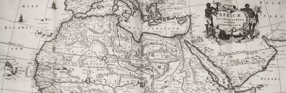

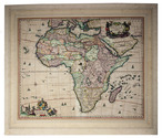
Hand-coloured map of Africa, with an especially accurate southern coastline
[MAP - AFRICA]. VISSCHER, Nicolaas.
Africae accurata tabula.
[Amsterdam], Nicolas Visscher, [ca. 1690?]. Engraved double-page map (image size: 43.5 x 54 cm; leaf size: 51 x 60 cm), coloured by a contemporary hand. With title in a decorated cartouche on the top right flanked by two Africans and two putti and dedication to Gerardus Schaap in a decorated cartouche on the bottom left, with Schaap's coat of arms on top and flanked by mythical figures. Further illustrated with small ships and African animals (including lions, monkeys, rhinoceros and ostriches). In passepartout (56 x 66 cm). Full description
€ 2,500
[Amsterdam], Nicolas Visscher, [ca. 1690?]. Engraved double-page map (image size: 43.5 x 54 cm; leaf size: 51 x 60 cm), coloured by a contemporary hand. With title in a decorated cartouche on the top right flanked by two Africans and two putti and dedication to Gerardus Schaap in a decorated cartouche on the bottom left, with Schaap's coat of arms on top and flanked by mythical figures. Further illustrated with small ships and African animals (including lions, monkeys, rhinoceros and ostriches). In passepartout (56 x 66 cm). Full description