Categories
Shopping cart (0 items € 0)
Advanced search ▾

Cartography, Exploration & Voyages / Atlases, Charts, Maps & Globes

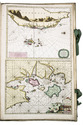
Spectacular 18th-century Dutch composite sea atlas with 3 detailed manuscript charts,
all charts and the engraved title page expertly coloured by a contemporary hand
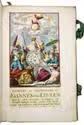
[KEULEN, Gerard and Johannes van, and others]. [Composite sea atlas containing 56 detailed charts including 3 manuscript charts].
Amsterdam, [Johannes van Keulen and others, 1700-1753, engraved title page dated 1734]. Large folio (61.5 x40.5 cm). With an engraved allegorical title page by Aernout Nagtegael after Jan Luyken, and 56 detailed sea charts, the whole expertly coloured by a contemporary hand. The atlas includes 22 large folding charts, including 3 highly interesting manuscript charts, 27 double-page charts, 1 full-page chart, and 6 half-page charts, most of them with beautiful cartouches, depicting views, local people, and merchandise. The maps are engraved and originally edited by the most famous Dutch cartographers and map-publishers of the late 17th- and early 18th centuries. Contemporary blind-tooled vellum, with green cloth closing ties. Title page and 56 charts. Full description
€ 495,000
Order Inquire Terms of sale

World atlas including one 6-sheet and eleven 4-sheet wall maps

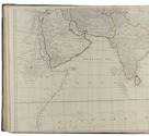
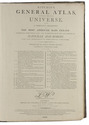
KITCHIN, Thomas and others. Kitchin's general atlas, describing the whole universe.
London, Robert Laurie, James Whittle, 1808. Imperial folio (53 x 39.5 cm). With 28 engraved maps (numbered in 41 parts) assembled from 67 sheets. Most include elaborate cartouches with pictorial decoration. With the maps coloured in outline. Contemporary half calf. 1 leaf plus maps. Full description
€ 18,000
Order Inquire Terms of sale

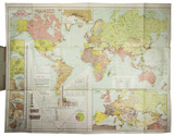
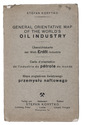
Large map depicting the world's oil industry, including the Middle East and Egypt

KORYTKO, Stefan. General orientative map of the world's oil industry | Übersichtskarte der Welt- Naphtha-Industrie | Carte d'orientation de l'industrie de pétrole du monde | Mapa pogladowa swiatowego przemyslu naftowego.
Lviv, Stefan Korytko, 1925. Large folding chromolithographed map (map size 65.5 x 88 cm). Original publisher's printed paper wrappers. Full description
€ 6,500
Order Inquire Terms of sale

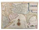
Fine collection of 16th-century Italian cartography from the school of Antonio Lafreri

[LAFRERI - DUCHETTI - FLORINI - MAPS AND ENGRAVINGS - ITALY]. [Large album with 16th-century maps and engravings of Italy].
[Italy, late 16th and early 17th century]. Large oblong folio (ca. 59 x 42.3 cm). With 76 full-page engravings, and 12 full-page etchings. 17th-century gold-tooled brown calf, sewn on 6 supports with the corresponding raised bands on the spine, a red morocco title label on the spine with the title "Novissim[a] urbis Romae descript[io]" lettered in gold, gold-tooled board edges. Full description
€ 150,000
Order Inquire Terms of sale

Dutch edition of a detailed account of an important circumnavigation

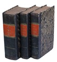
LAPLACE, Cyrille Pière Théodore. Reis rondom de wereld door de zeeën van Indië en China; . . .
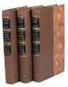
Zaltbommel, Johannes Noman and sons, 1834-1836. 7 volumes bound as 3. 8vo. Each volume with a lithographed title-page, each with a different topographic view, folding engraved map tracking Laplace's journey, 13 lithographed plates (7 folding). Near contemporary uniform blue-black half calf, gold- and blind-tooled spines. XXXVI, 511, [1]; [II], 328; [II], 272; [II], 288; IV, 272; [II], 262, [1], [1 blank]; IV, 323, [1] pp. Full description
€ 2,750
Order Inquire Terms of sale

A rare guide to Moscow, with 8 plates

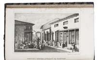
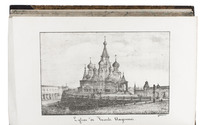
LECOINTE DE LAVEAU, Georges. Guide du voyageur à Moscou, contenant ce que cette capitale offre de curieux et d'intéressant…
Moscow, August Semen, 1824. 8vo. With lithographed frontispiece, 7 lithographed plates, 4 folding tables, and several tables in the text. Contemporary gold-tooled, half purple sheepskin, spine faded to brown, marbled sides and edges. [4], VI, 11-459, [1] pp. Full description
€ 2,250
Order Inquire Terms of sale

Rare first Dutch edition of the famous Lewis and Clarke expedition

LEWIS, Meriwether, William CLARKE and Nicolaas Godfried van KAMPEN (translator). Reize naar de bronnen van den Missouri, en door het vaste land van America naar de Zuidzee. Gedaan op last van de regering der Vereenigde Staten van America, in de jaren 1804, 1805 en 1806.
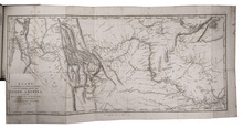
Dordrecht, A. Blussé and son, 1816-1818. 3 volumes. 8vo. With a large folding engraved map of the Missouri River (34.5 x 71 cm) by Cornelis van Baarsel and son, after the map in the first British edition. Modern half calf. XXXII, 398; VIII, 390; "XII" (lacking I-II), 335, [1 blank] pp. Full description
€ 8,500
Order Inquire Terms of sale

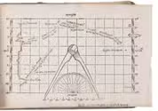
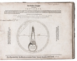
Battle of words over the best practical solution to the determination of longitude before Harrison's chronometer

LEY, Jan Hendrick Jarichs van der. Het gulden zeeghel des grooten zeevaerts, daerinne beschreven wordt de waerachtige grondt vande zeylstreken en platte pas-caerten ...
Leeuwarden, Abraham vanden Rade, 1615. Oblong 4to (16.5 x 22 cm). With an emblematic engraved device/navigational diagram on the title page and 27 (of 28) woodcut figures: 18 printed on integral leaves and the others on 3 folding plates. 18th-century(?) half vellum, blue-green paper sides, with manuscript author and title on spine. 114, [2] pp. Full description
€ 55,000
Order Inquire Terms of sale

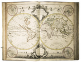
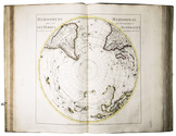
Rare world atlas with 56 large copper-engraved maps.

L'ISLE, Guillaume de. Atlas nouveau, contenant toutes les parties du monde, ou sont exactement remarquées les empires, monarchies, royaumes, etats, republiques &c.
Including: SANSON, Guillaume. Introduction à la Geographie où sont la geographie astronomique qui explique la correspondance du globe terrestre avec la sphere.
Amsterdam, Johannes Covens and Cornelis Mortier, 1730.
Folio. With a large allegorical frontispiece and 56 large copper-engraved maps (most 54 x 65 cm and a few larger, folding ones). Previous owners have added one large copper-engraved map of Normandie by Jean Baptiste Nolin from 1742, and 2 smaller etchings by Israel Silvestre with views of du Havre and Chateau Jametz. The original artwork of these views is from the 1670s, but these prints are from a later date. Contemporary blind-tooled vellum, green closing ties. [1 blank], [6], 32 pp. Full description
€ 45,000
Order Inquire Terms of sale
173 books found / Show all