VALENTIJN, François.
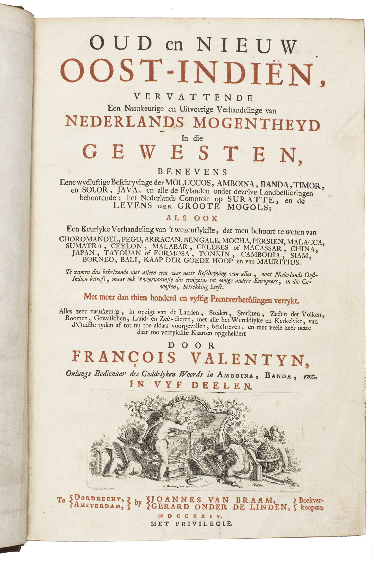
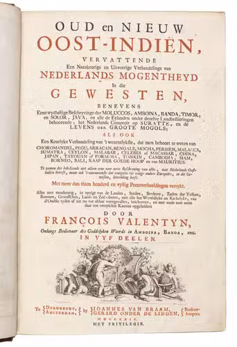
Oud en Nieuw Oost-Indiën.
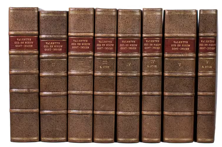
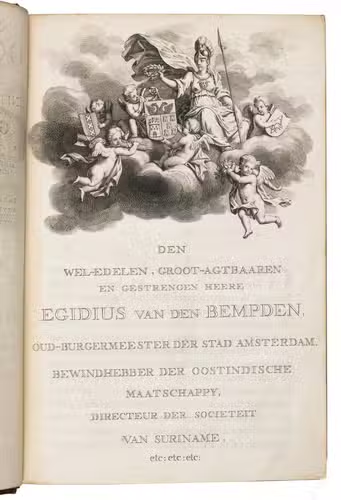
Dordrecht, etc., J. van Braam, etc., 1724-1726. Folio. 5 parts in 8 vols. Engr. frontispiece, folding engr. portrait, engr. dedication, 8 folding tables, 289 engr. plates , 2 extra double-page engr. plates. Modern half calf. Together ca. 3500 pp.
€ 25,000
Rare complete set of the most extensive geographical and historical description of the whole area the Dutch V.O.C. had taken into possession or had gained a foothold in: the East Indies, parts of China, Japan, parts of the Near East, and the Cape of Good Hope. This work still is the main source for the early history of the East Indies, especially for Ambon, where the author lived for years, as well as for the Molucca's, Ceylon, Japan, China, the Cape of Good Hope, etc. The work presents many documents which now are lost, and contains interesting statistics on the products and the trade in the various countries. It also contains the accounts of two early voyages to Australia, with interesting maps. And last but not least, the work also is of great interest today for its rich and beautiful illustrations, its early maps and views, engraved by the best Dutch artists of the time, such as F. Ottens, J.C. Philips, J. Goeree, G. Schoute and J. Lamsvelt etc., mostly after designs by M. Balen.
The work is composed as follows:
Volume I (Introduction and Part I):
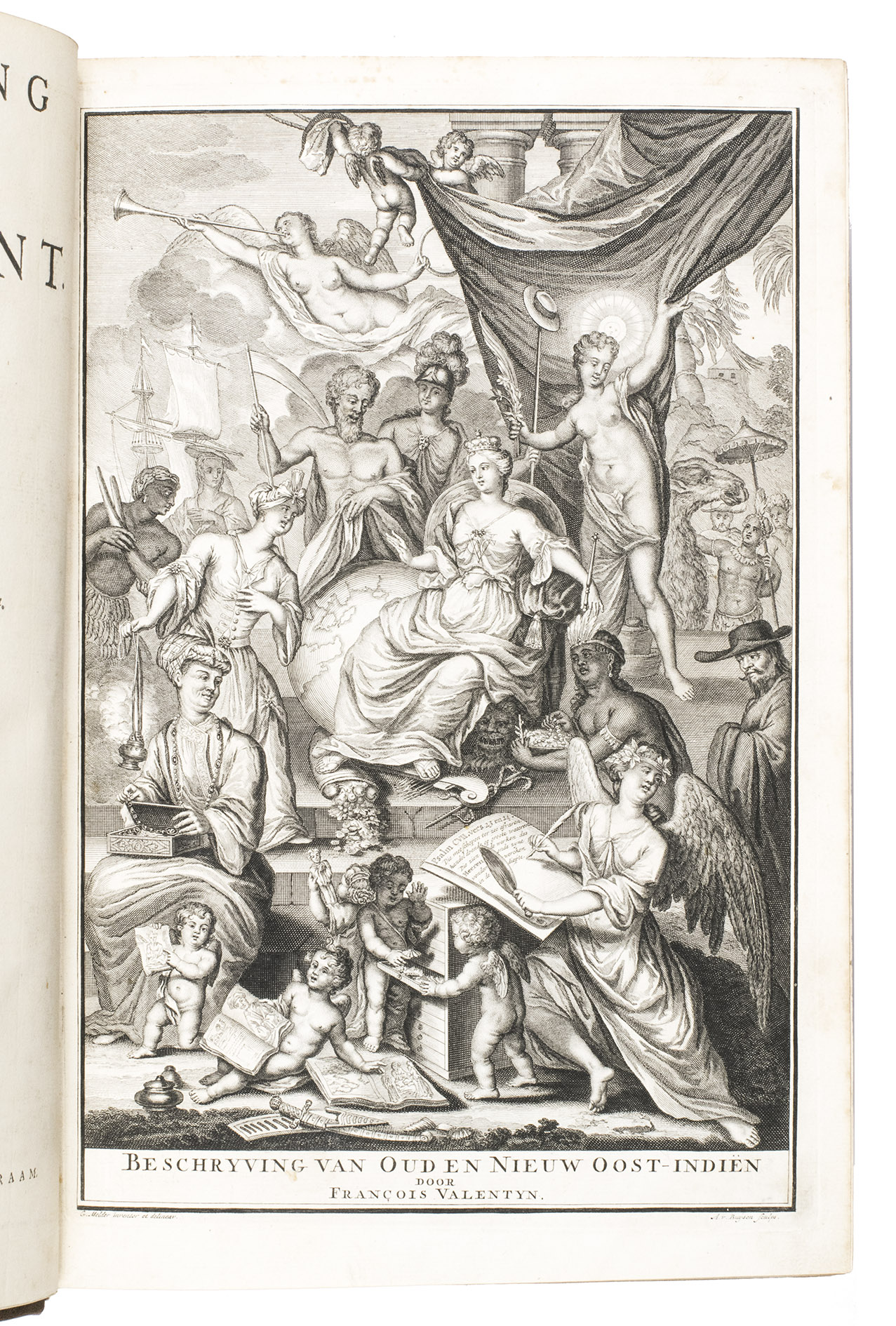
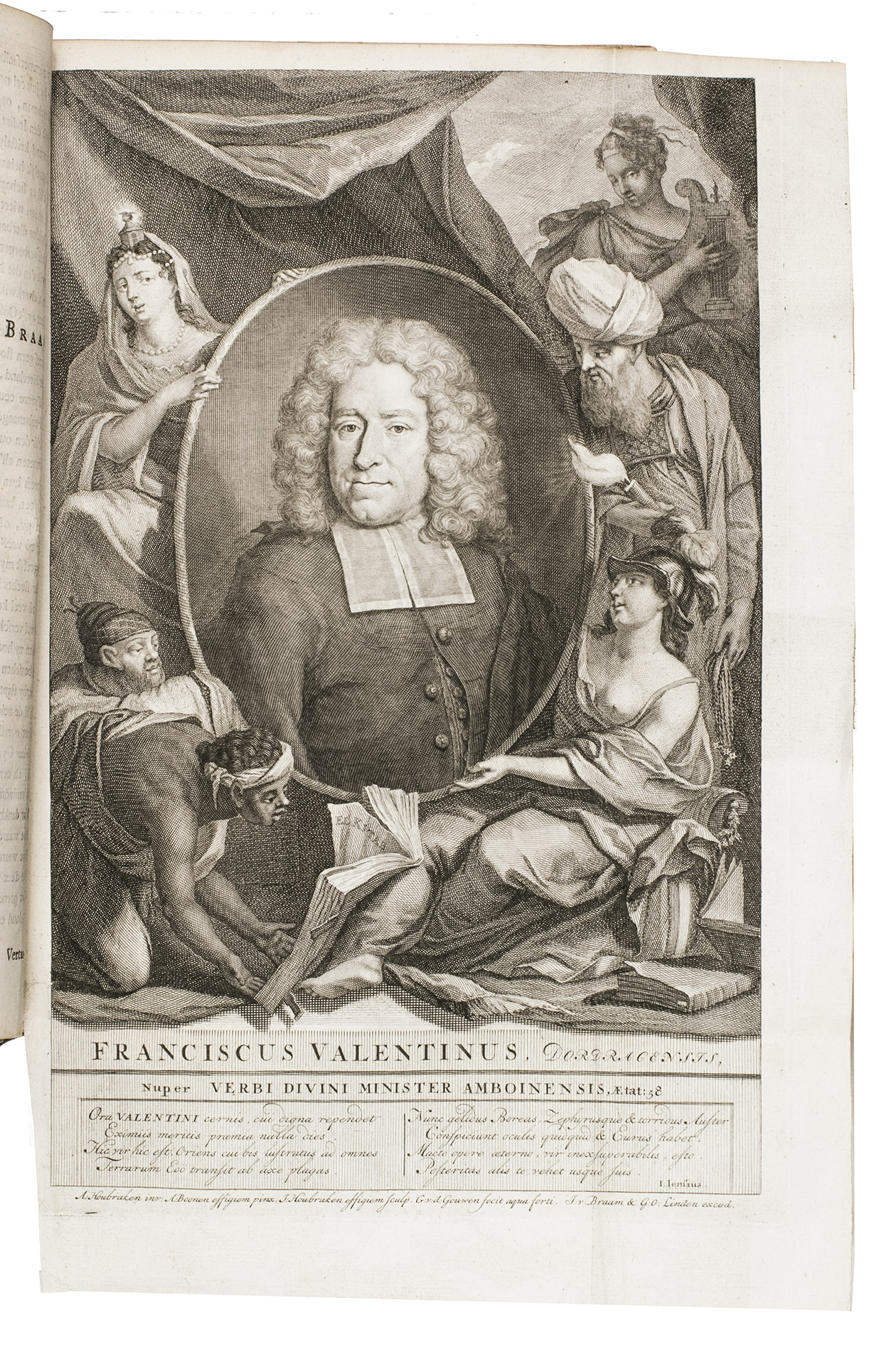
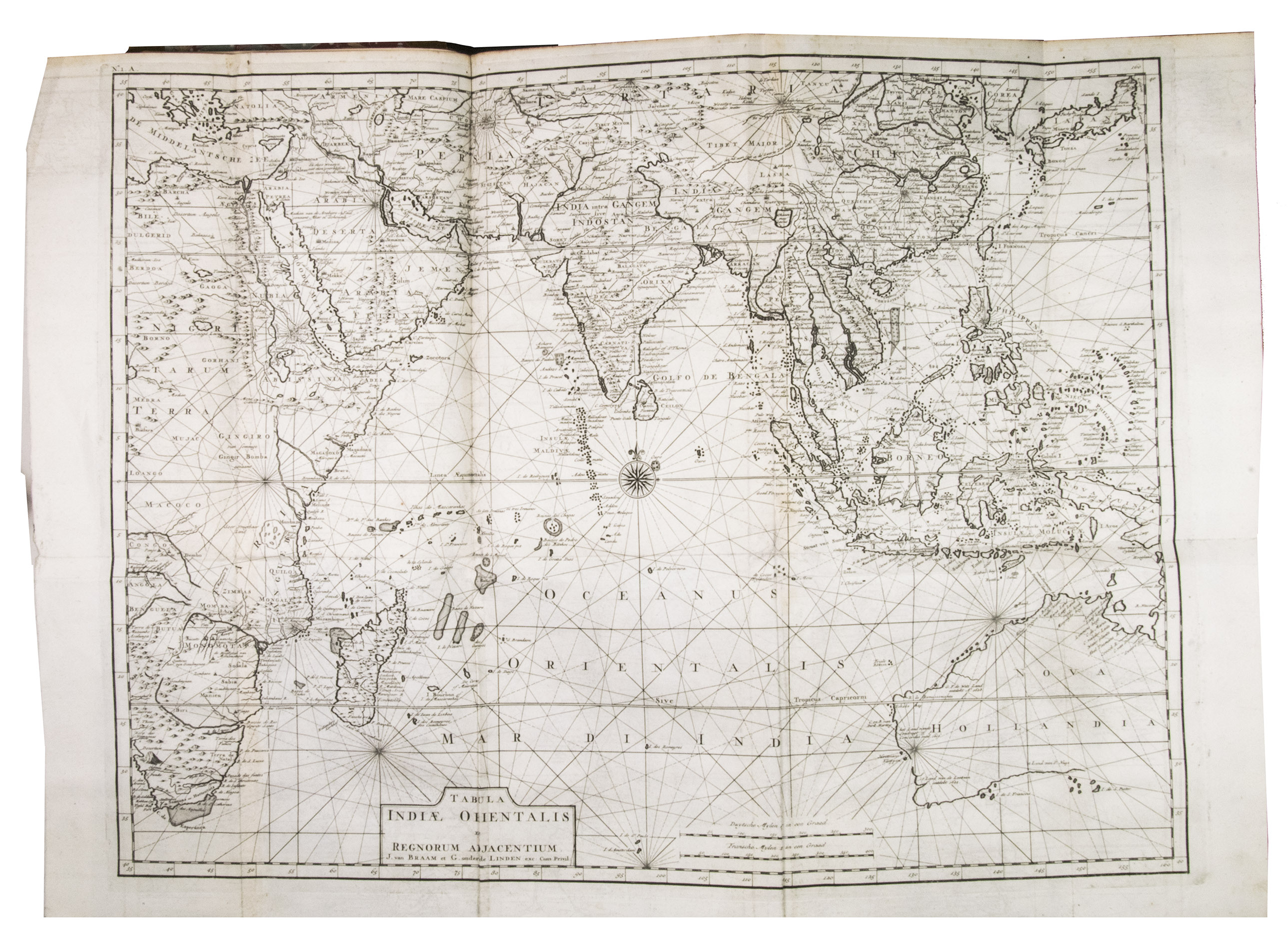
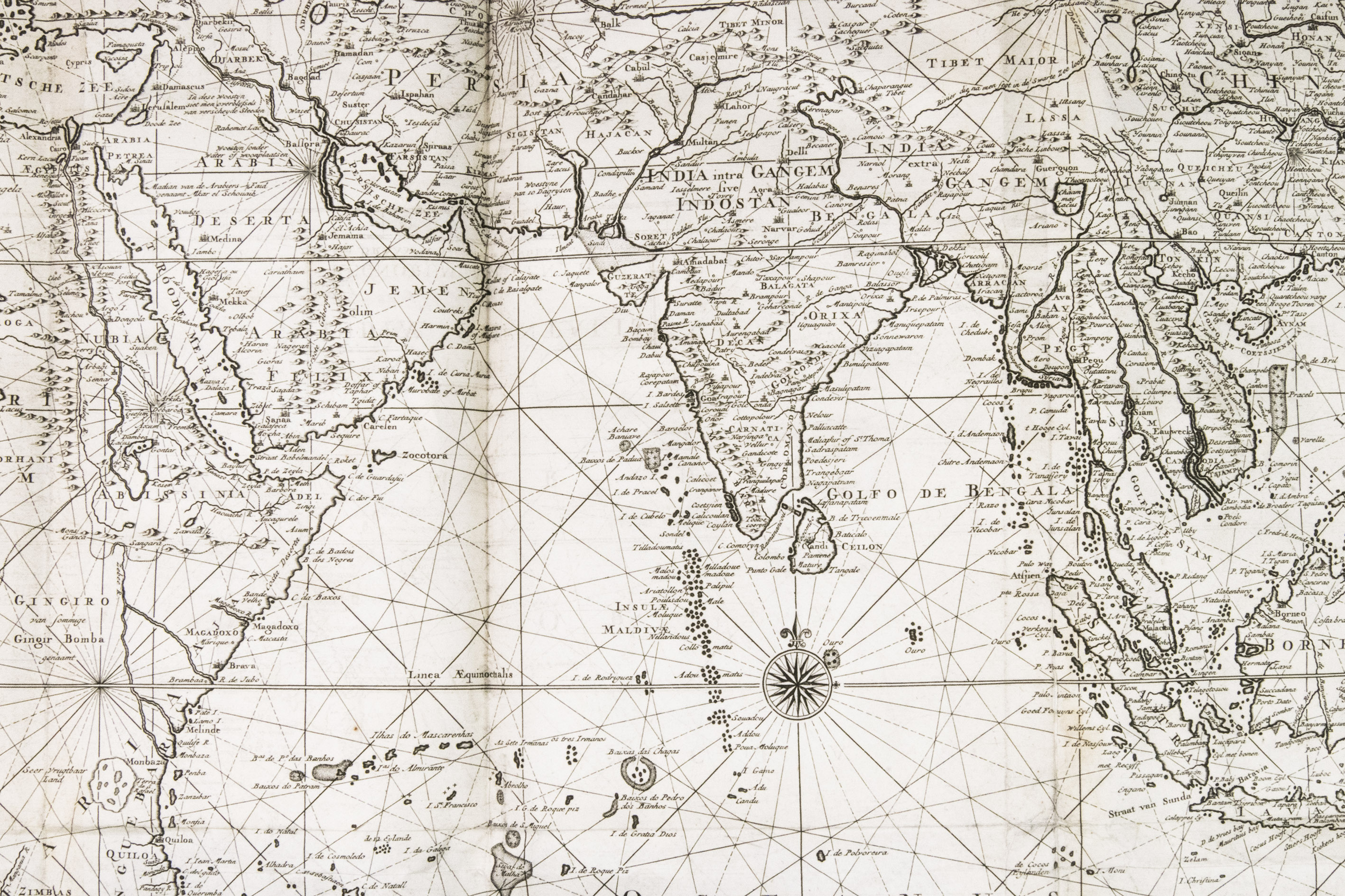
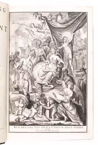
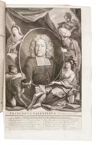
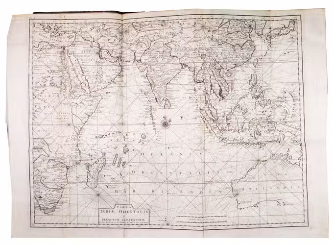
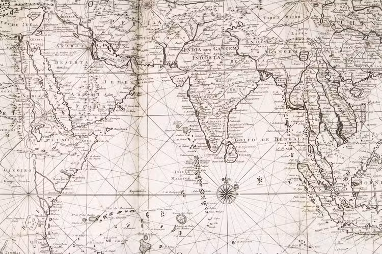
- Preliminaries and introduction with the portrait of the author, a large folding general map of the East Indies, 2 other maps and 2 views.
Geographical and historical descriptions of the Moluccas, with an extensive description of Ternate, Tidore, Batsjan, Makjan and Motir and other isles they consist of. It also tells of the history and other interesting events that occurred. With 7 maps, plans, views and other illustrations and 12 smaller engravings in text.
II (Part II):
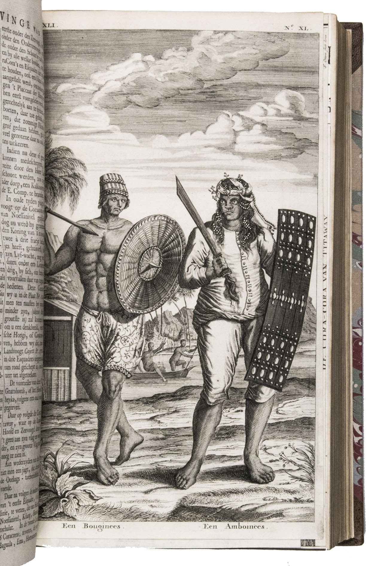
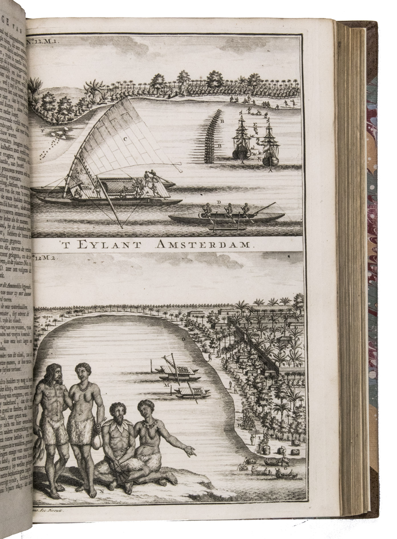
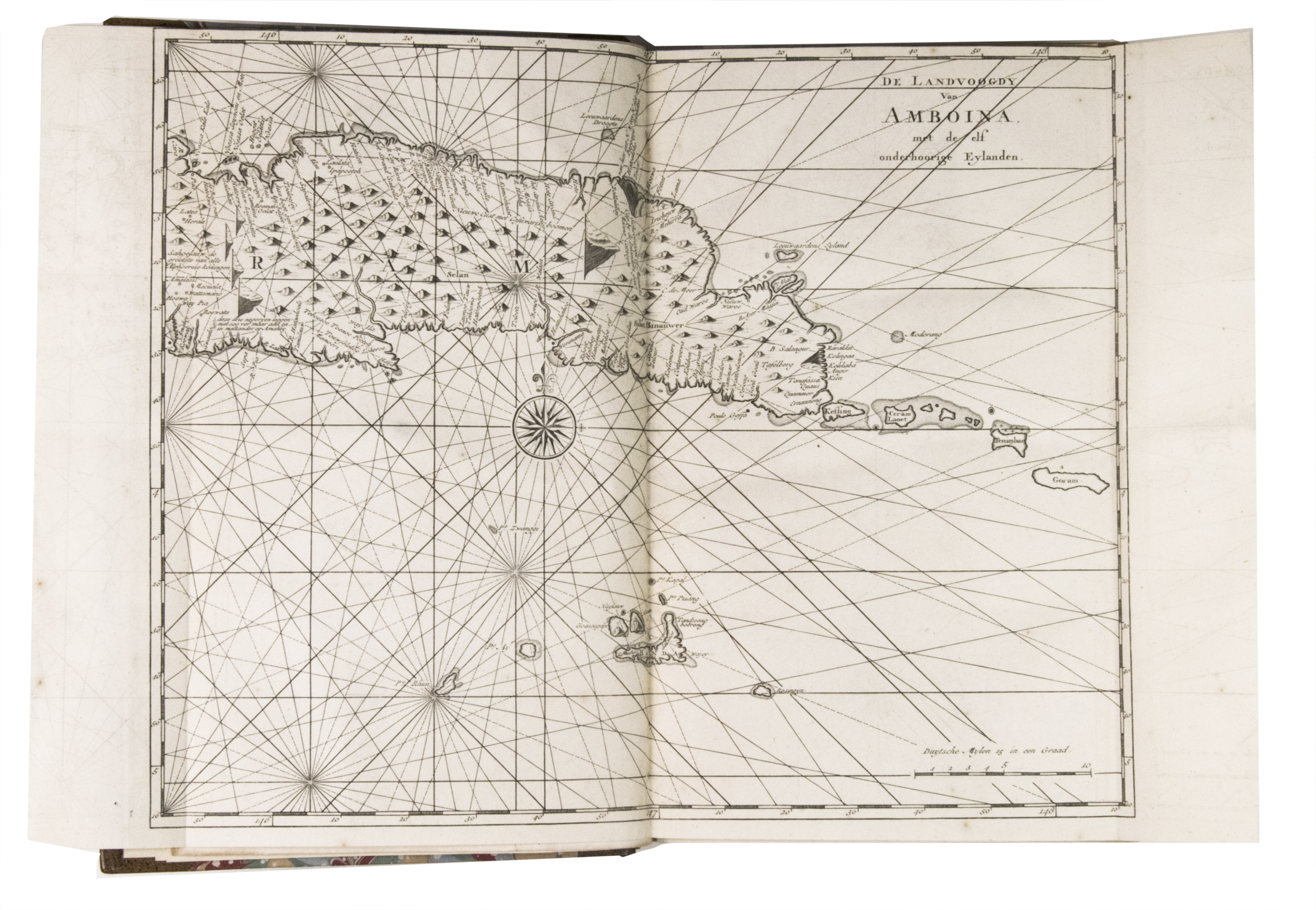
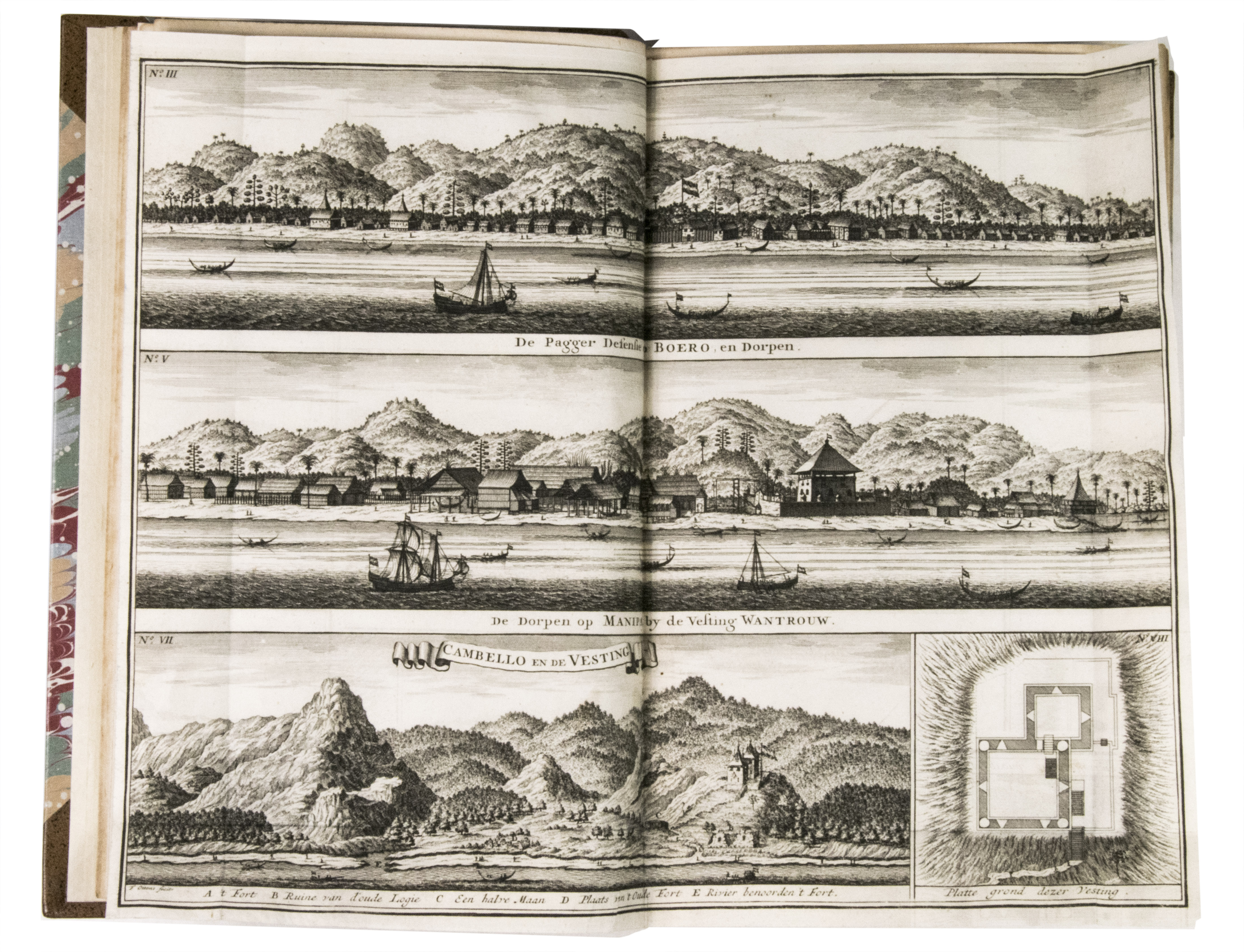
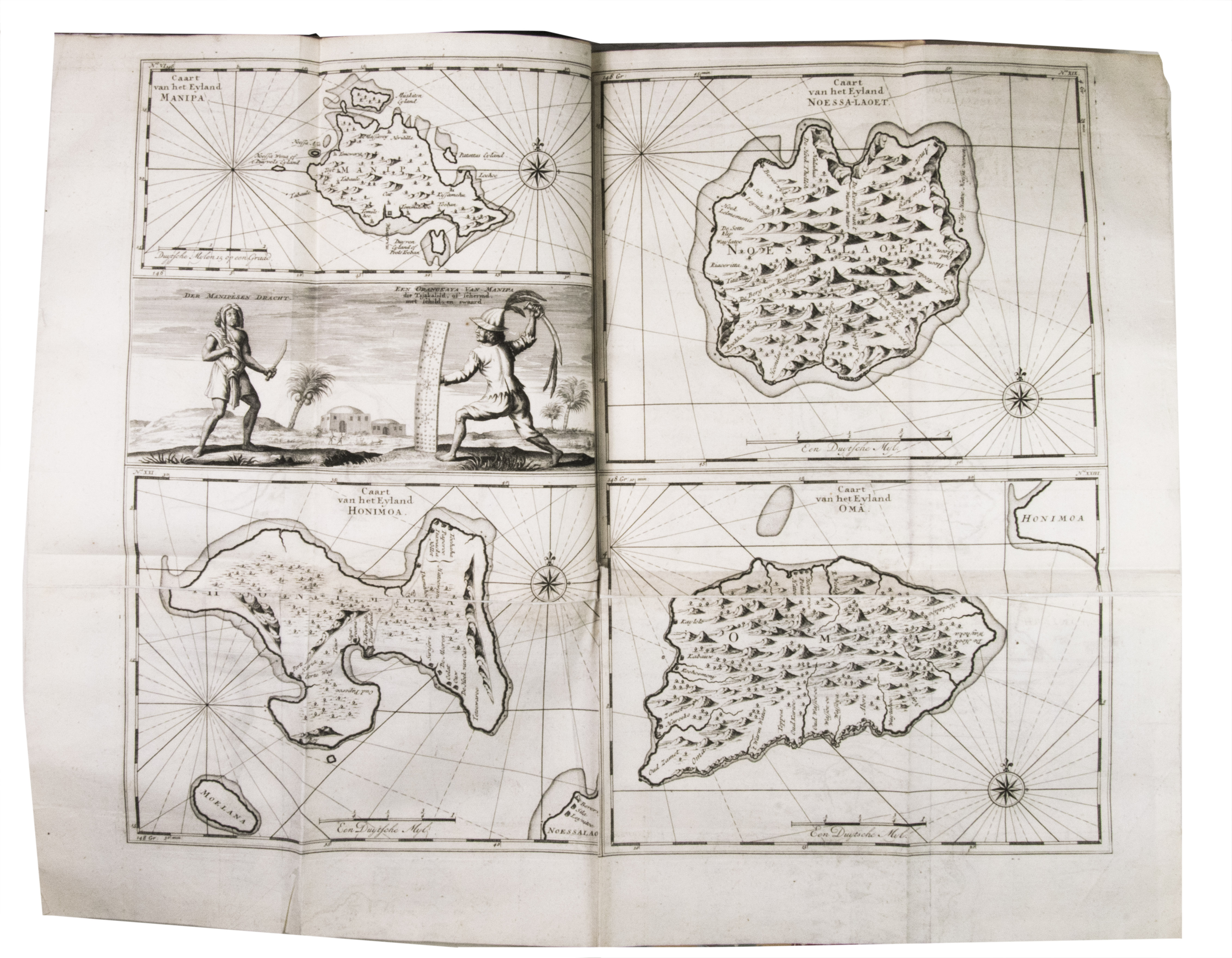
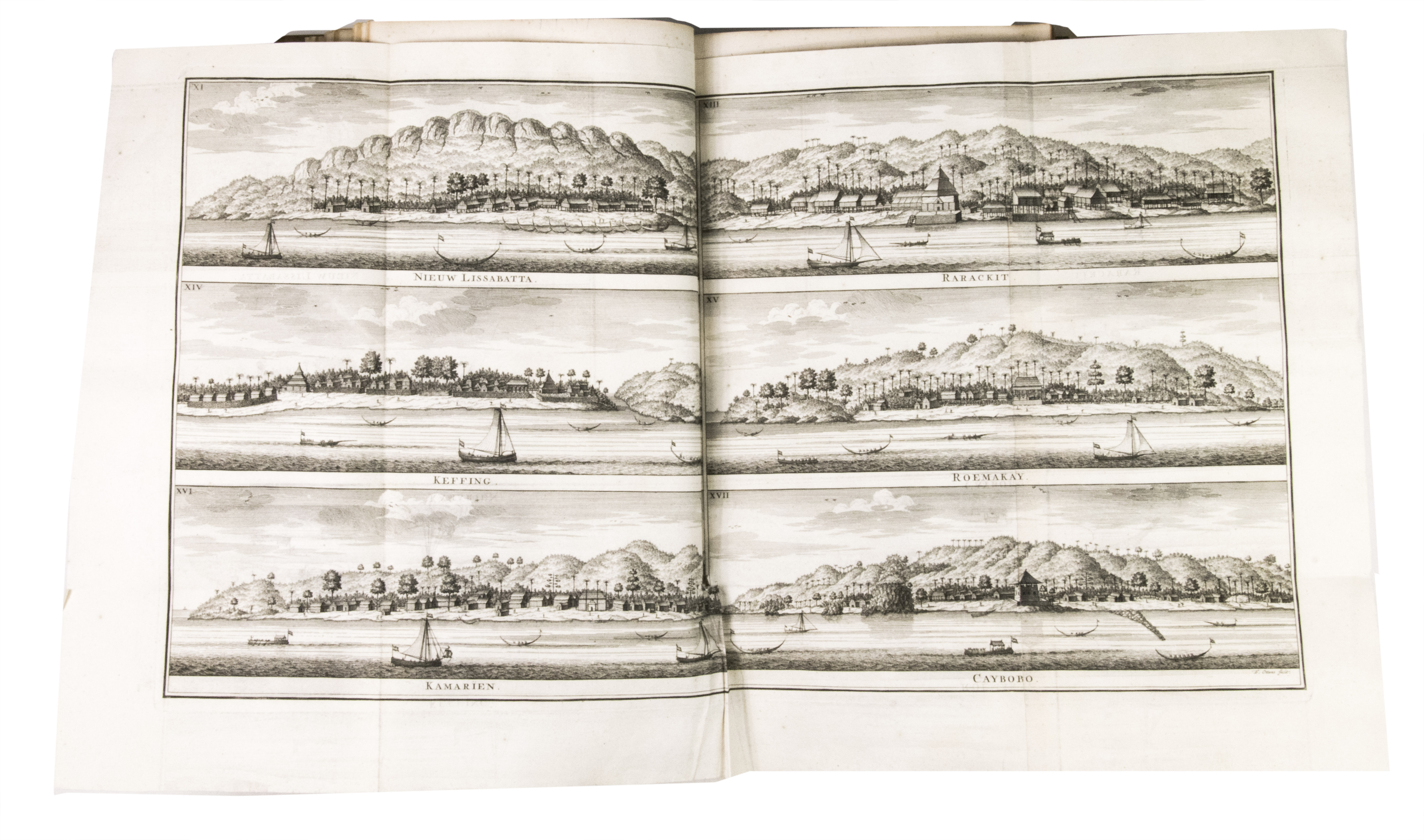
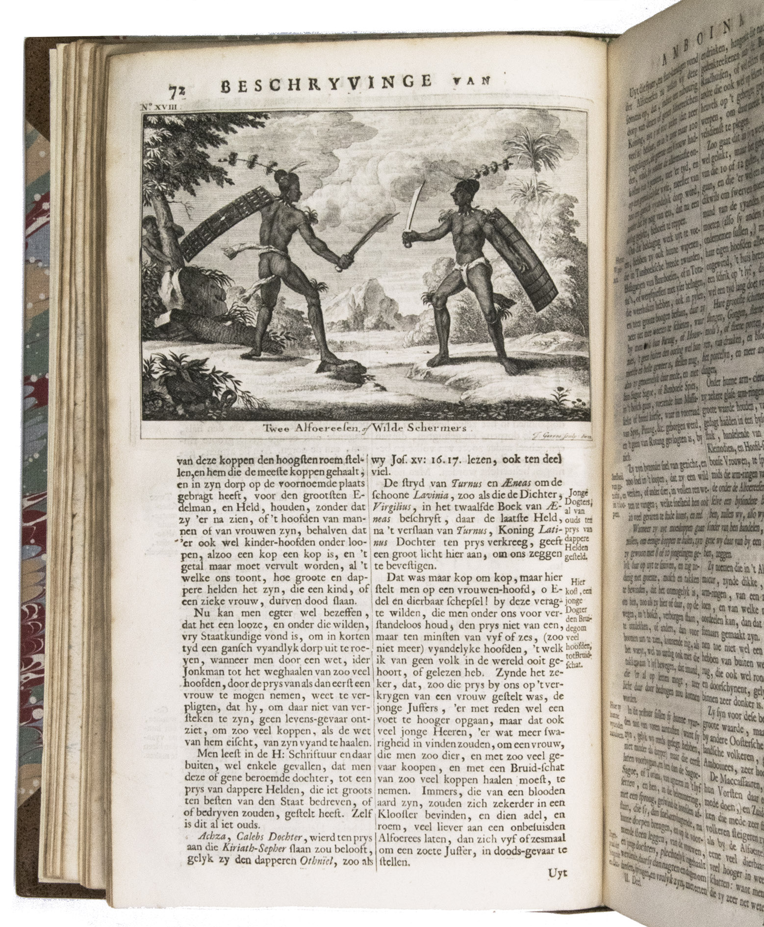
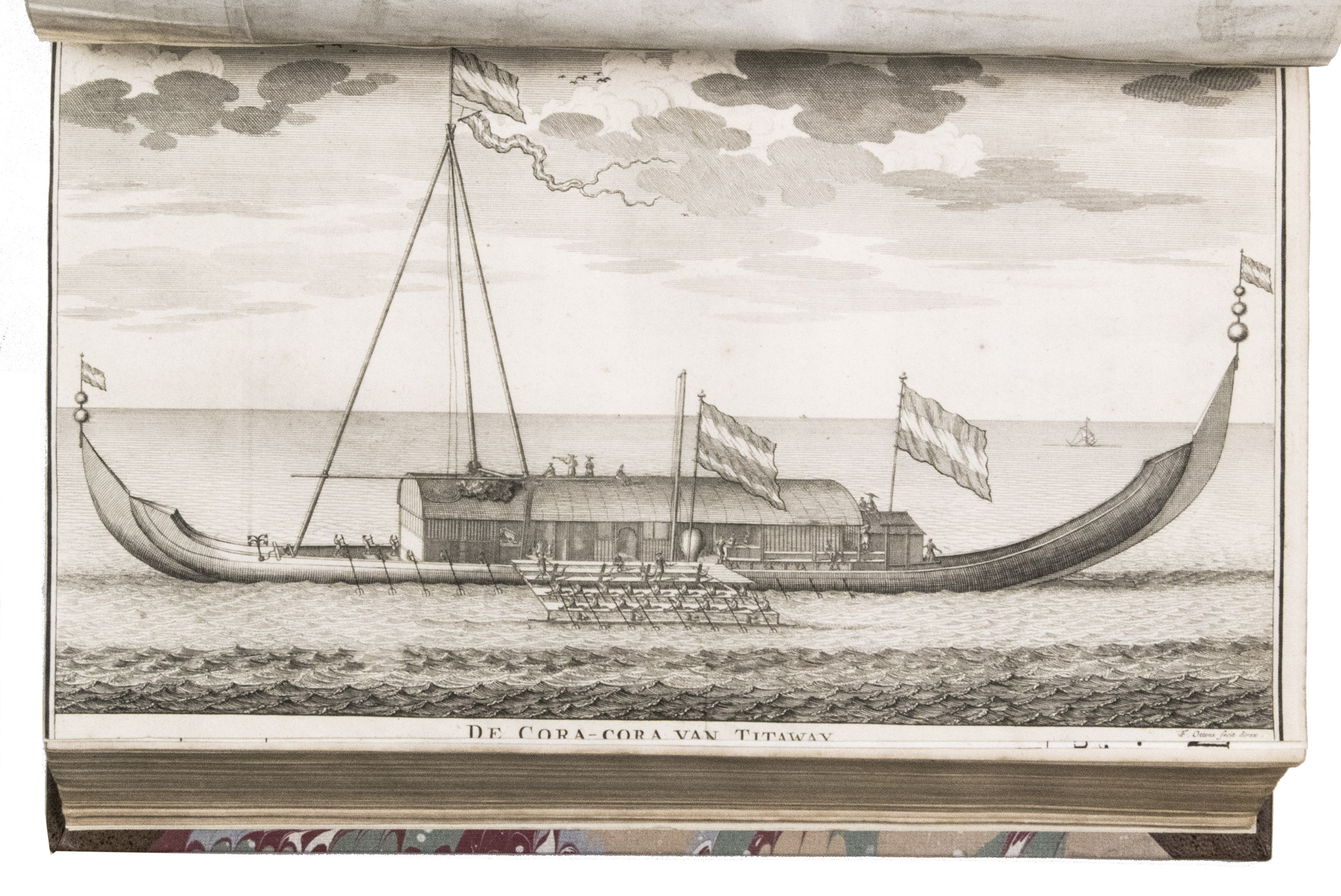
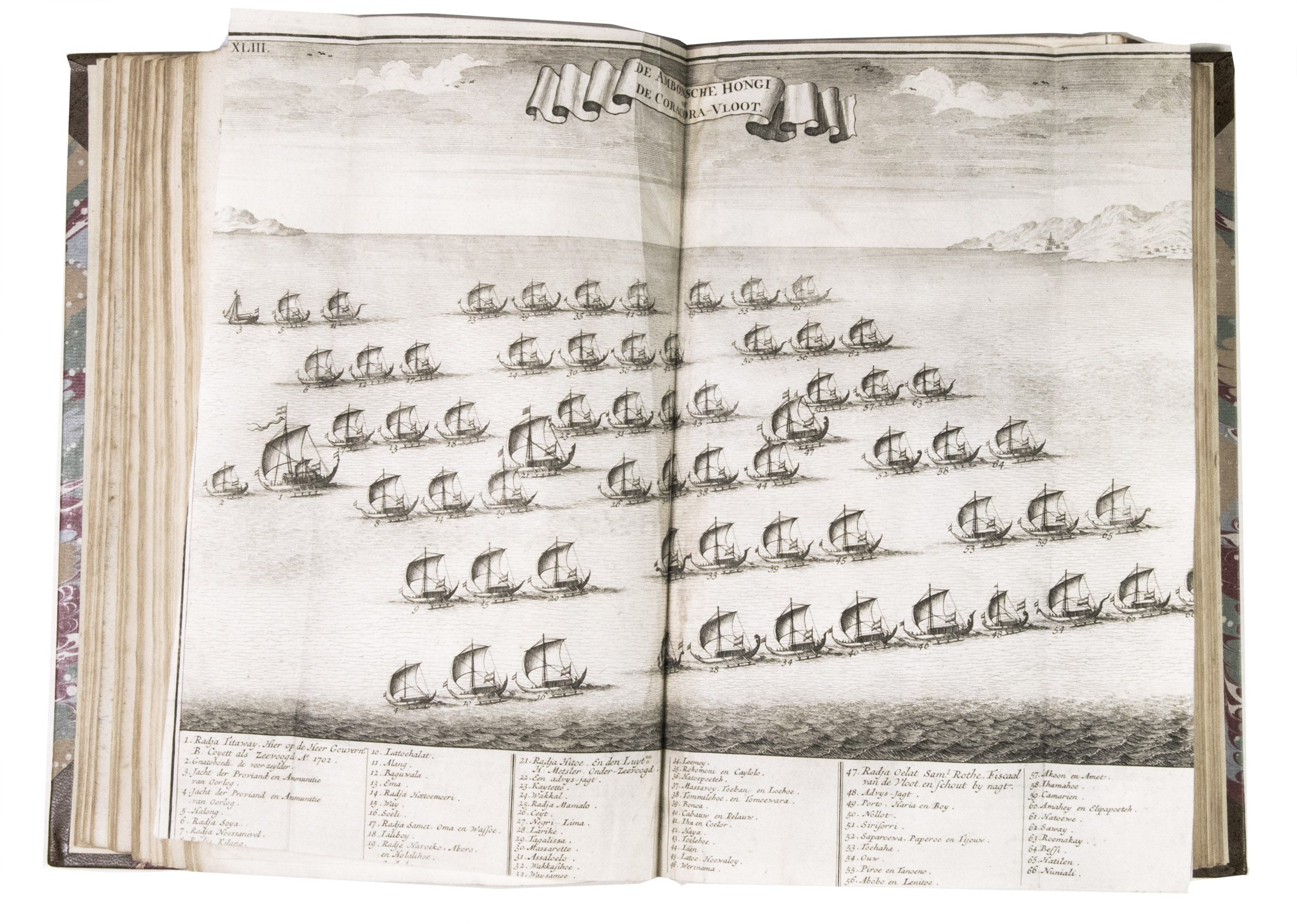
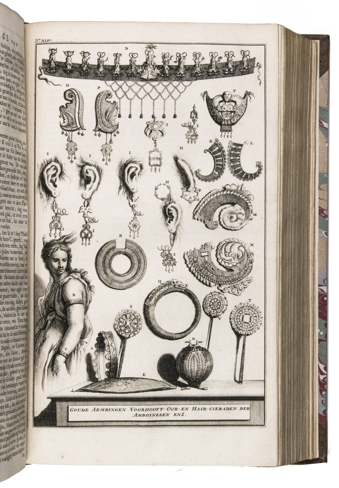
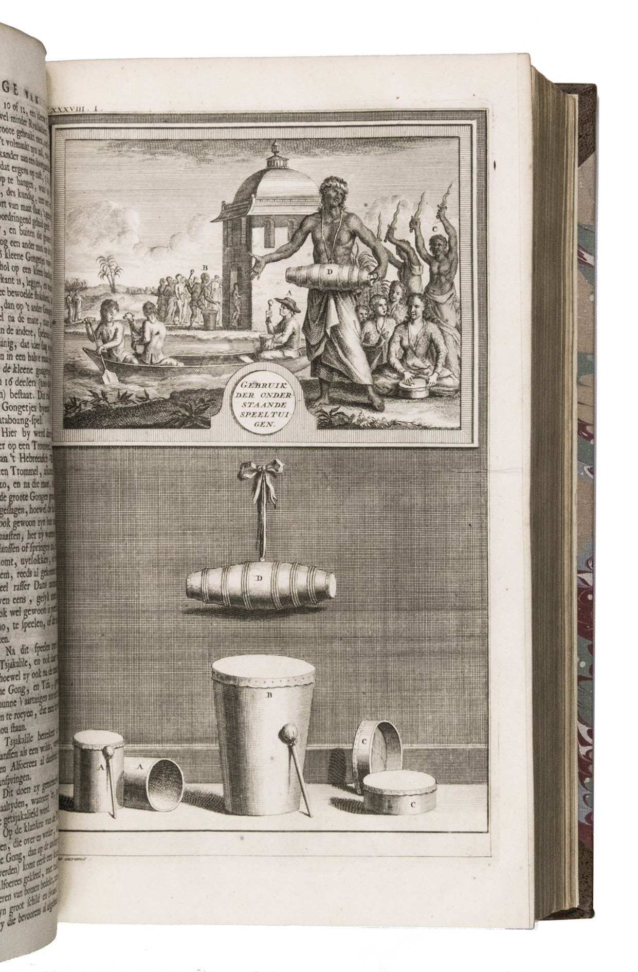
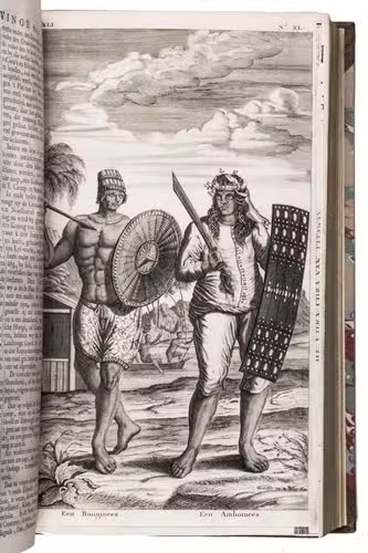
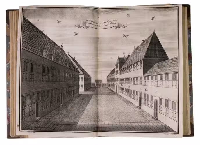
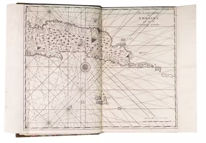
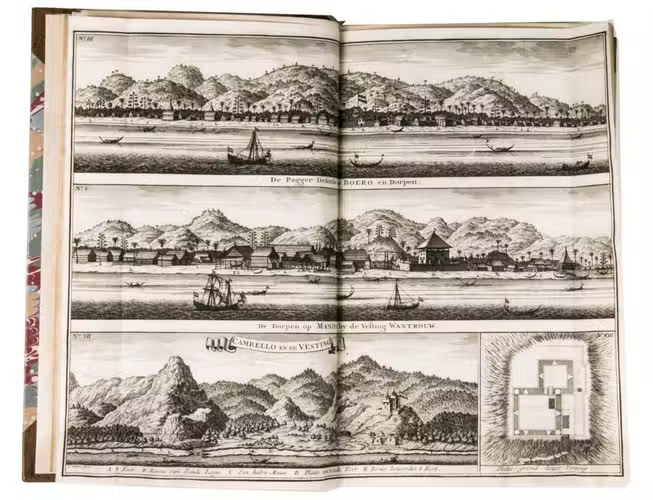
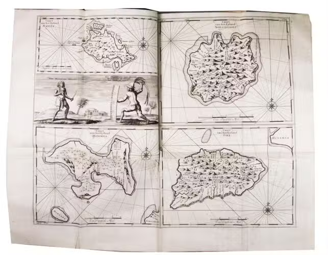
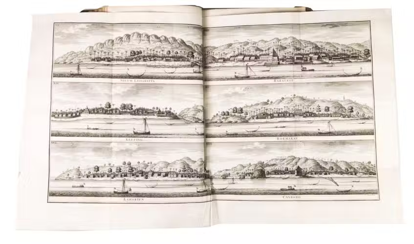
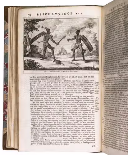
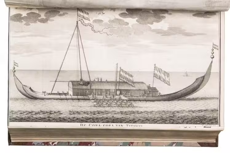
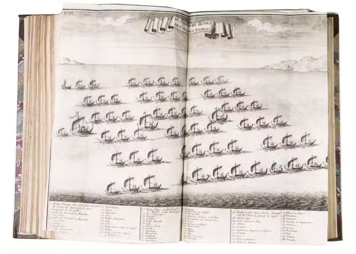
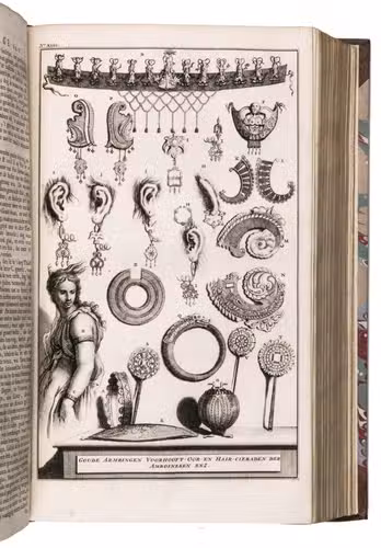
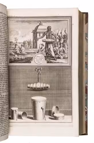
- The geography of Amboina and other isles, like Ceram, Boero, Amboina, Honimoa, Noessa-laoet, Oma, Manipa, Bonoa, Kelang etc., with an account of the habits, costumes and ceremonies of the natives and a summary of the most important historical events. These accounts are illustrated with 20 maps, plans, views and plates illustrating people and other scenes of life etc. on Amboina, as well as 10 smaller engravings in text.
III (Part III, 1):
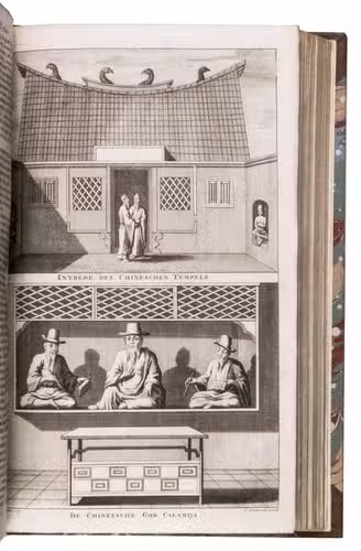
- A religious history of Amboina with a description of all the temples and religious ceremonies in Amboina.
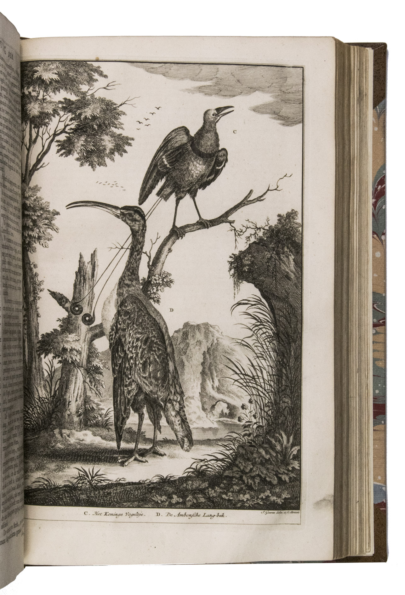
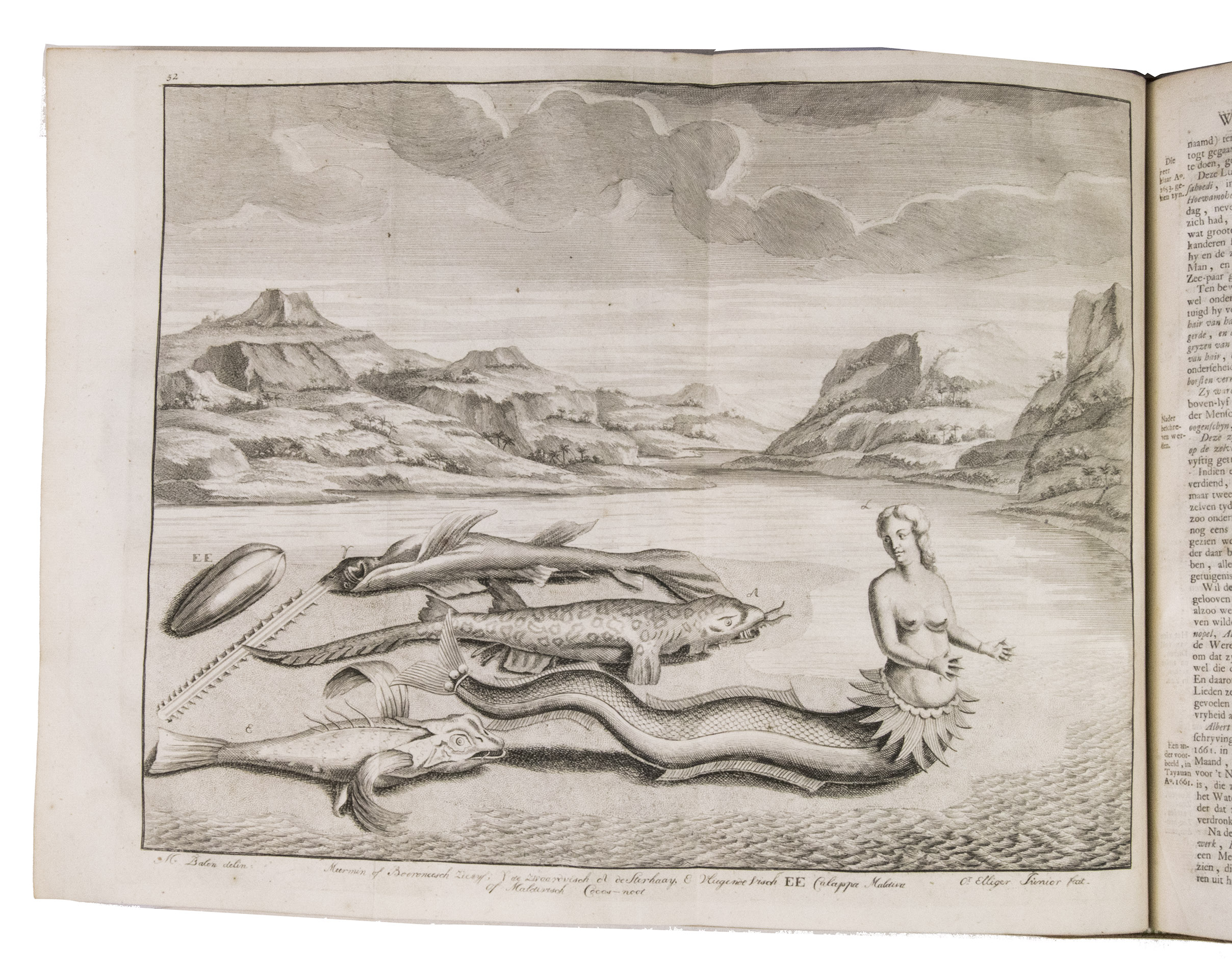
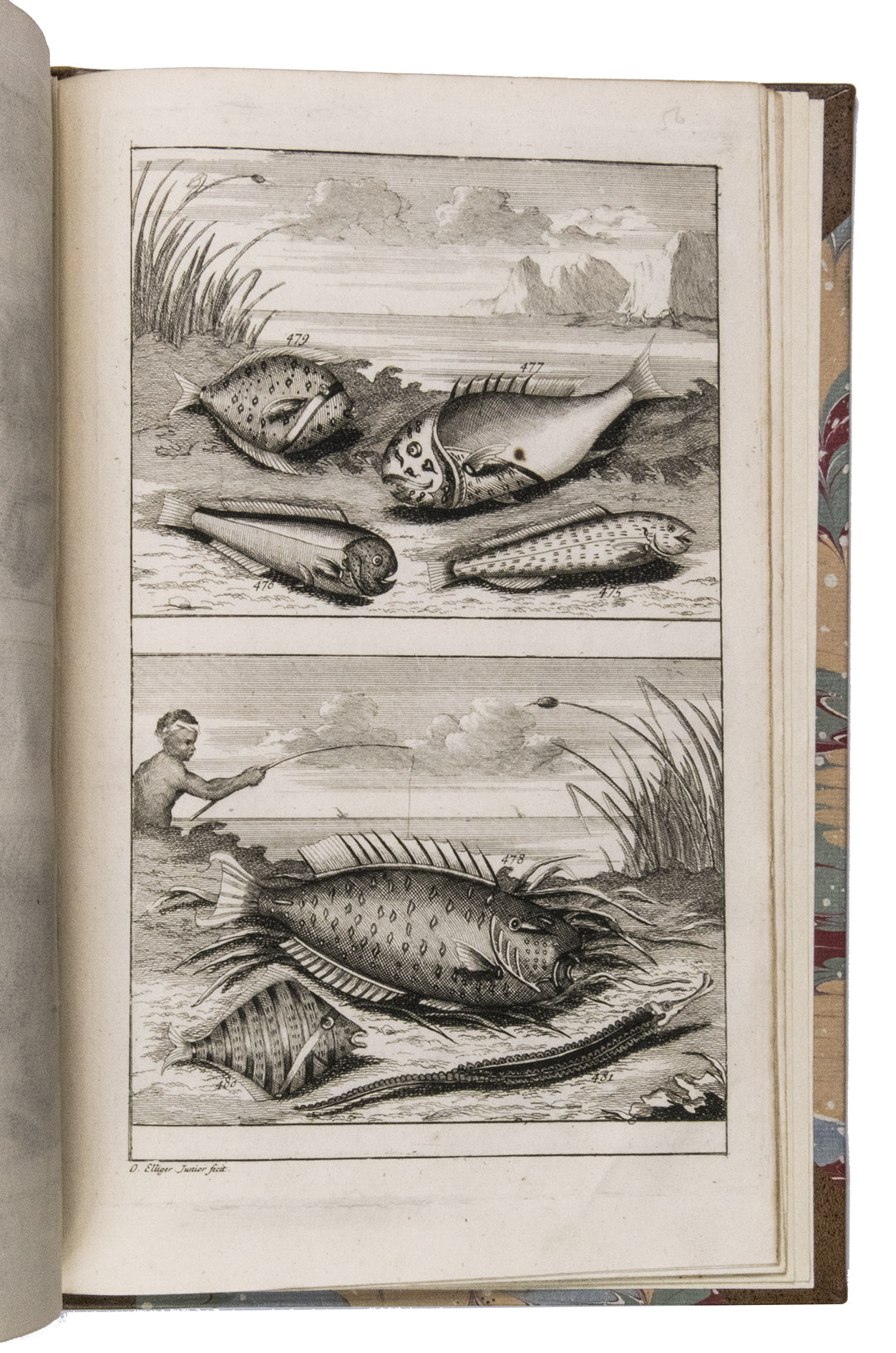
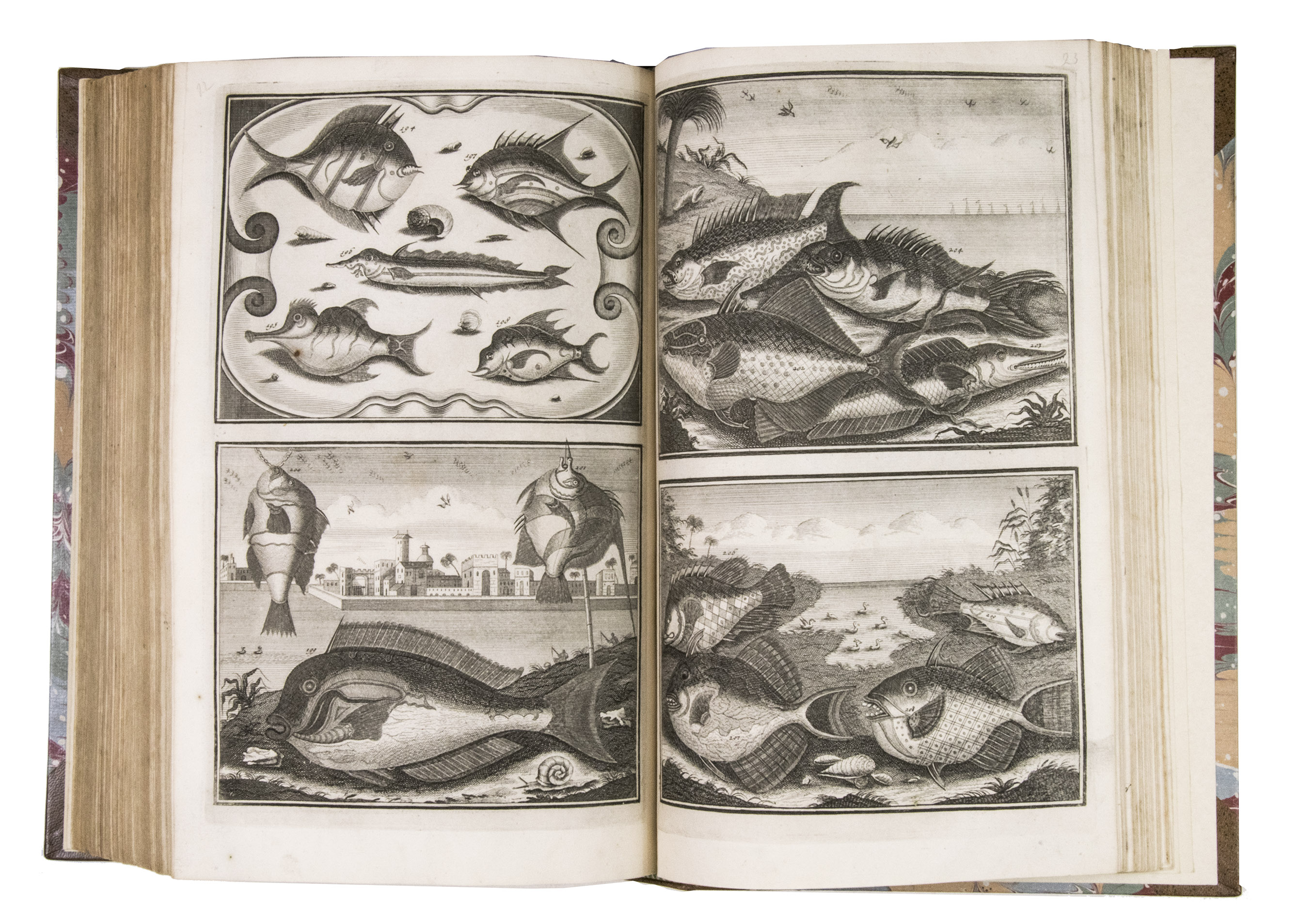
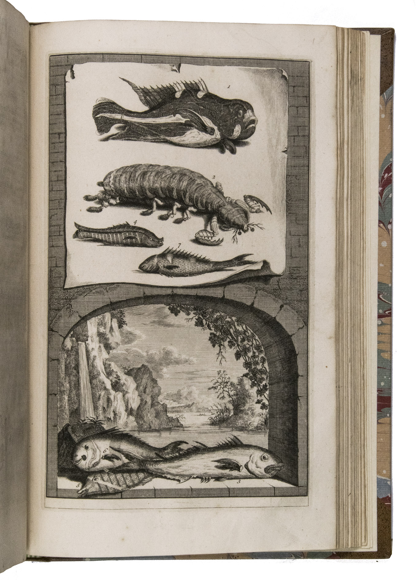
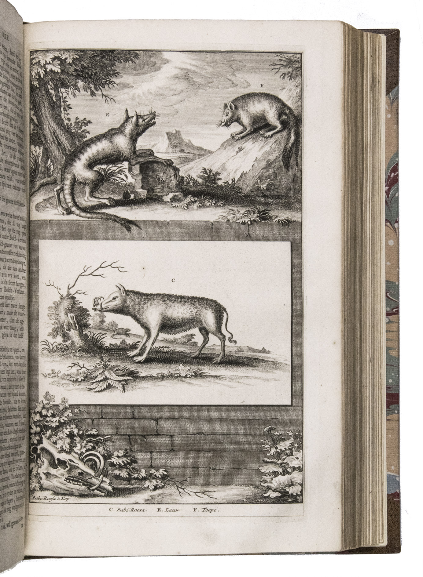
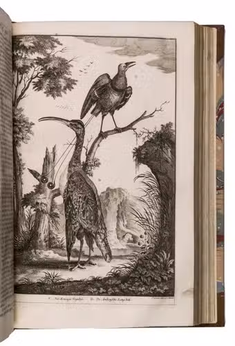
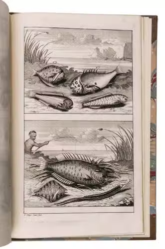
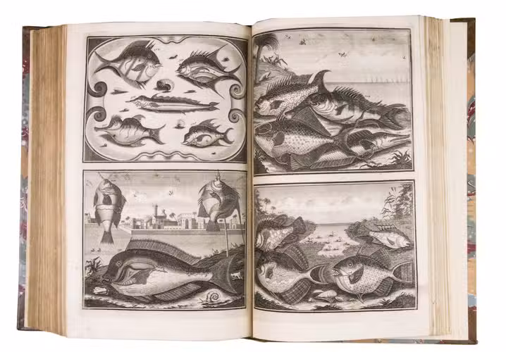
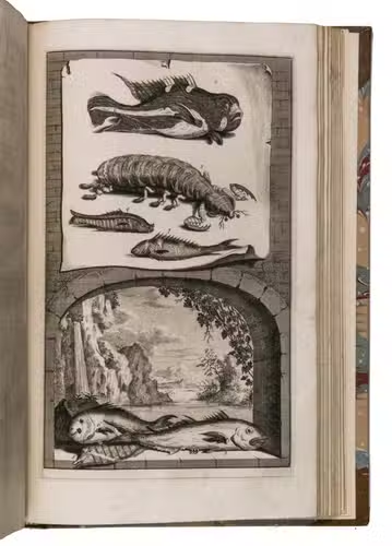
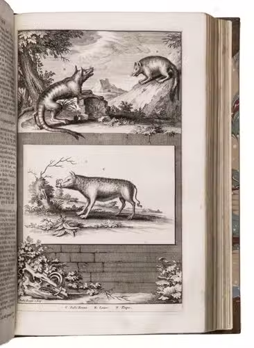
An extensive description of the Flora and Fauna on Amboina such as trees, plants and mammals and the fish and other creatures living in the seas near the isles of Amboina. All very beautifully and in every detail illustrated on 78 plates.
IV (Part III, 2):
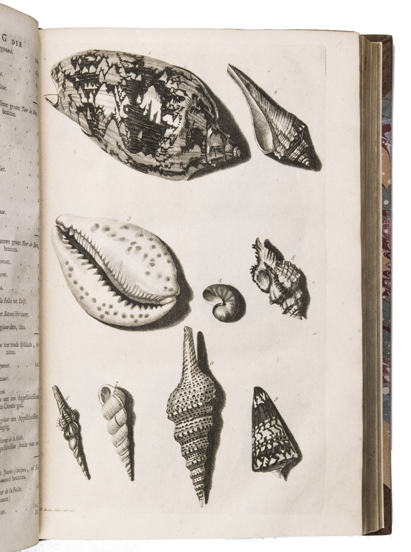
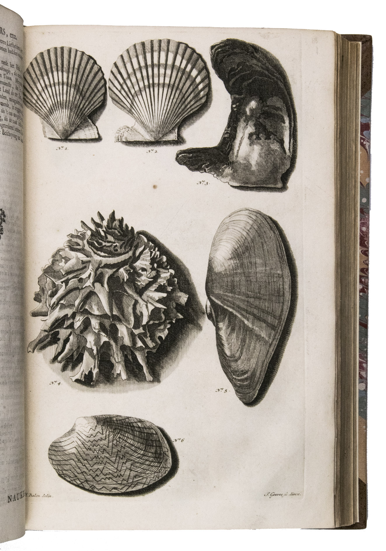
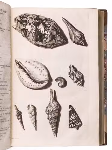
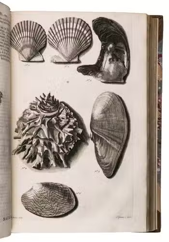
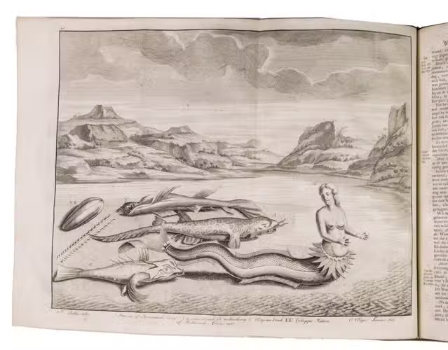
- A treatise on shells and sea-plants existing near Amboina , with full descriptions of all the conchifera found near Amboina based on Rumphius's Ambonsche Rariteit-Kamer. Illustrated with 17 plates.
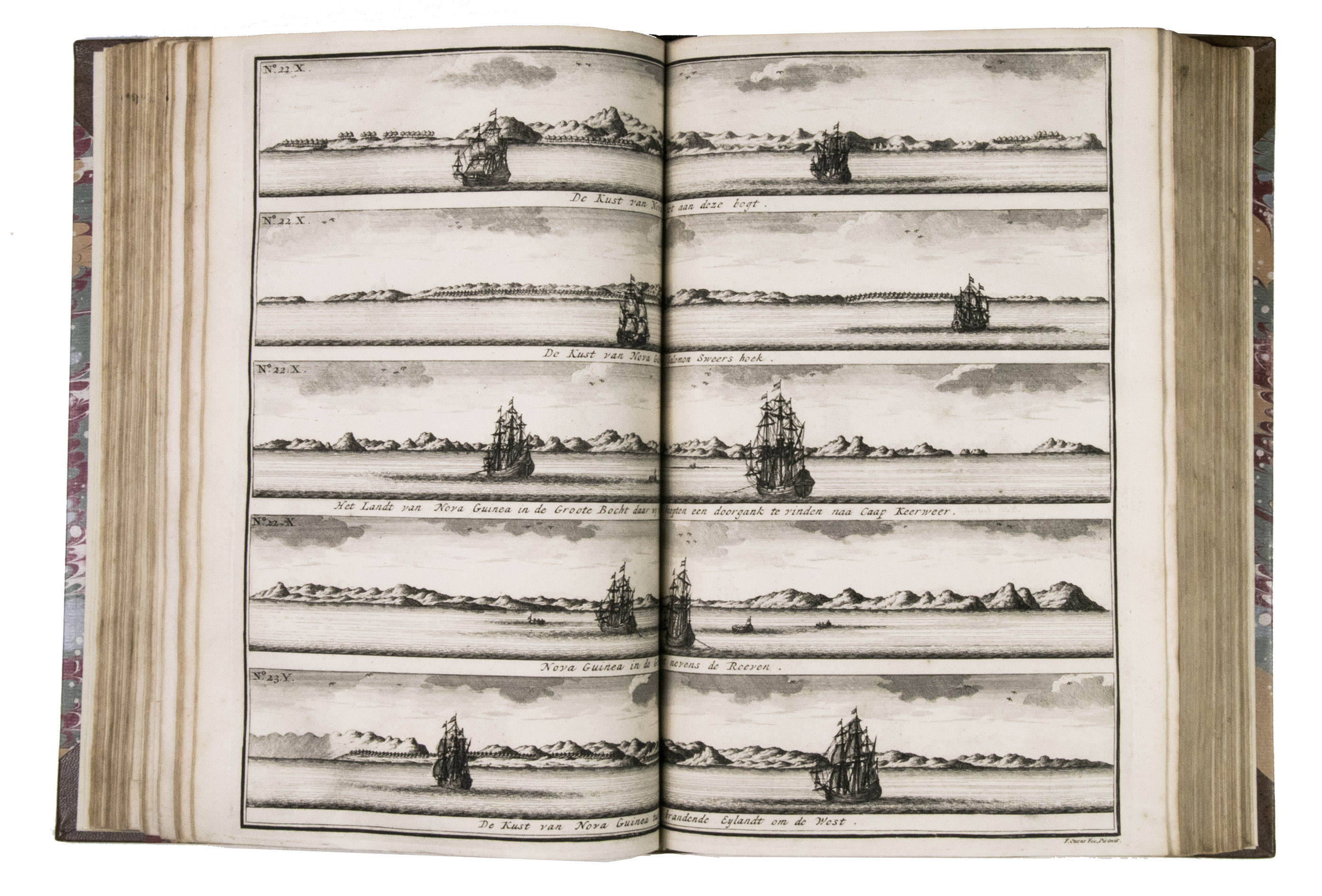
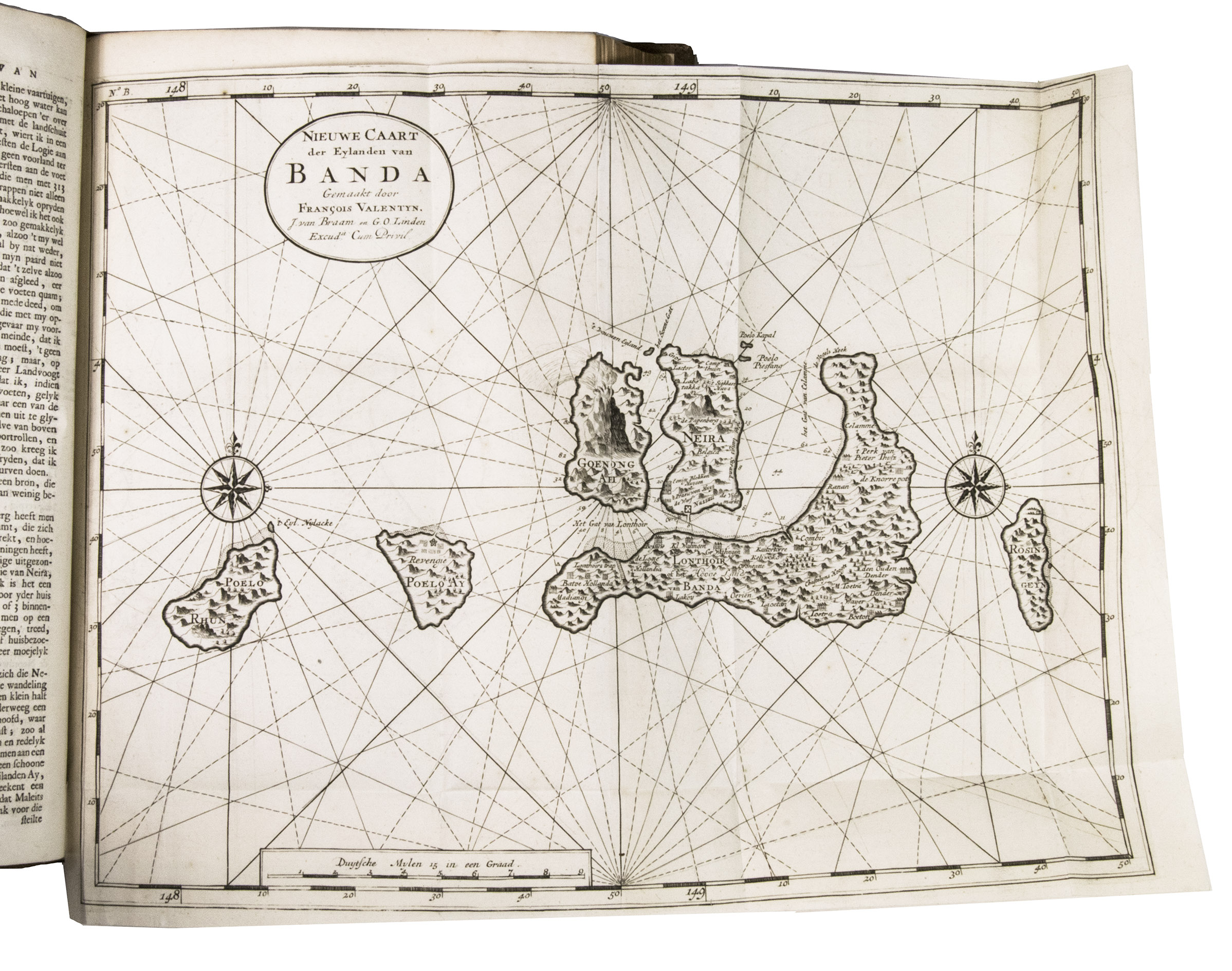
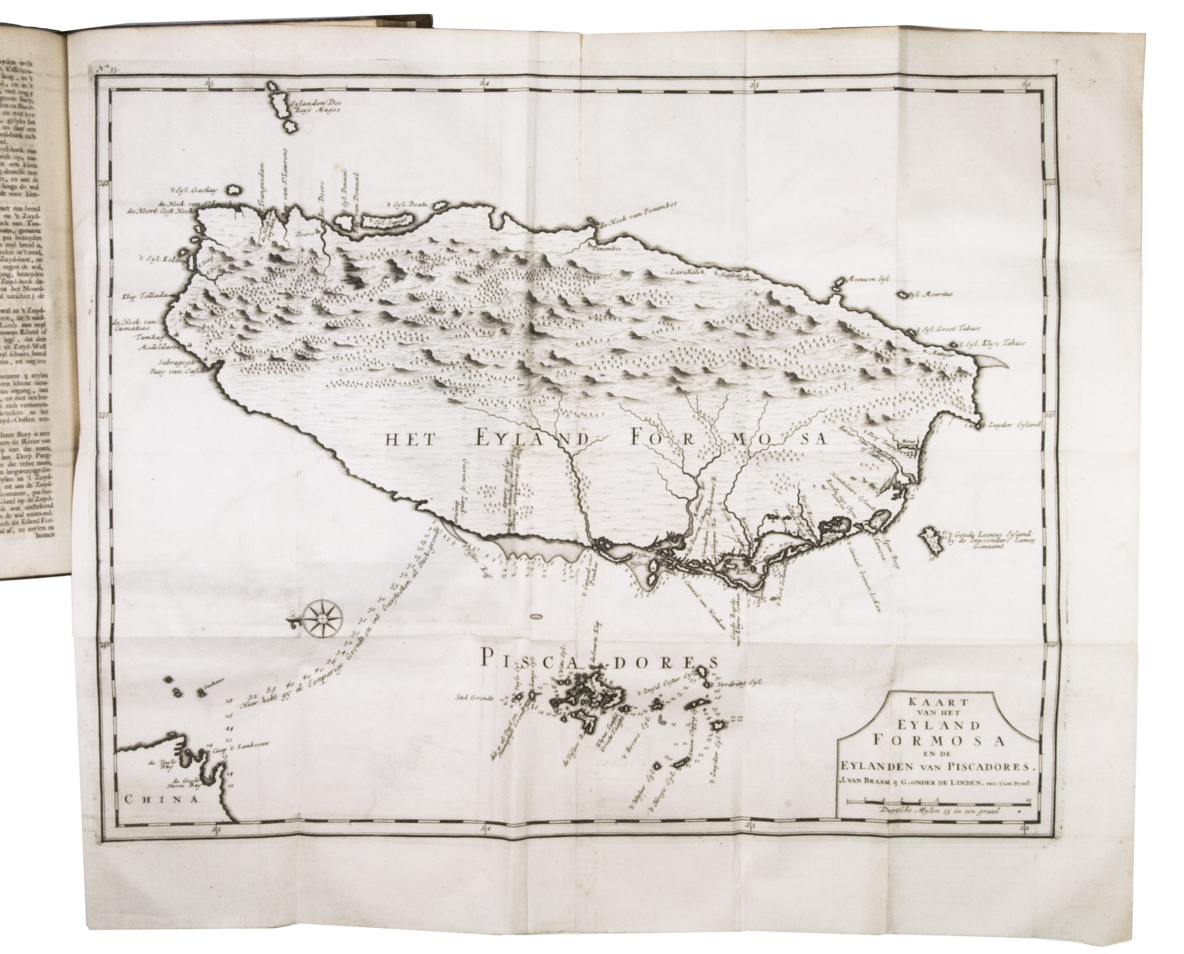
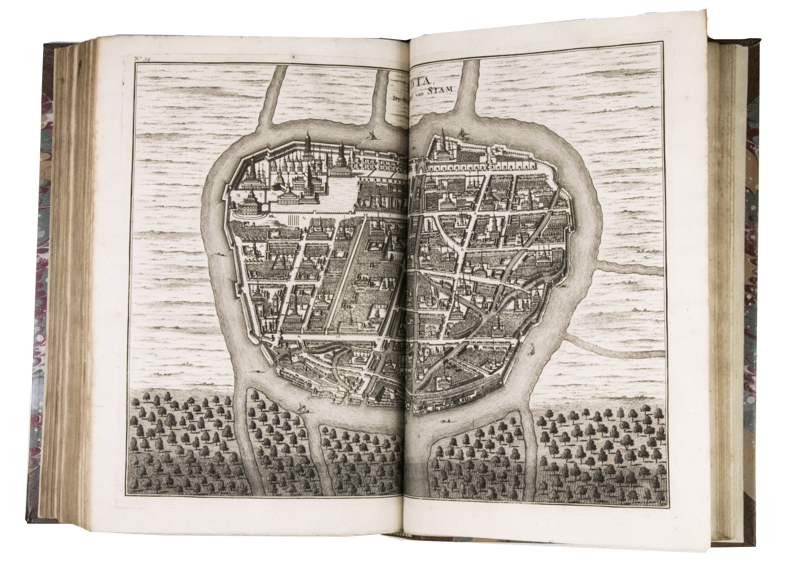
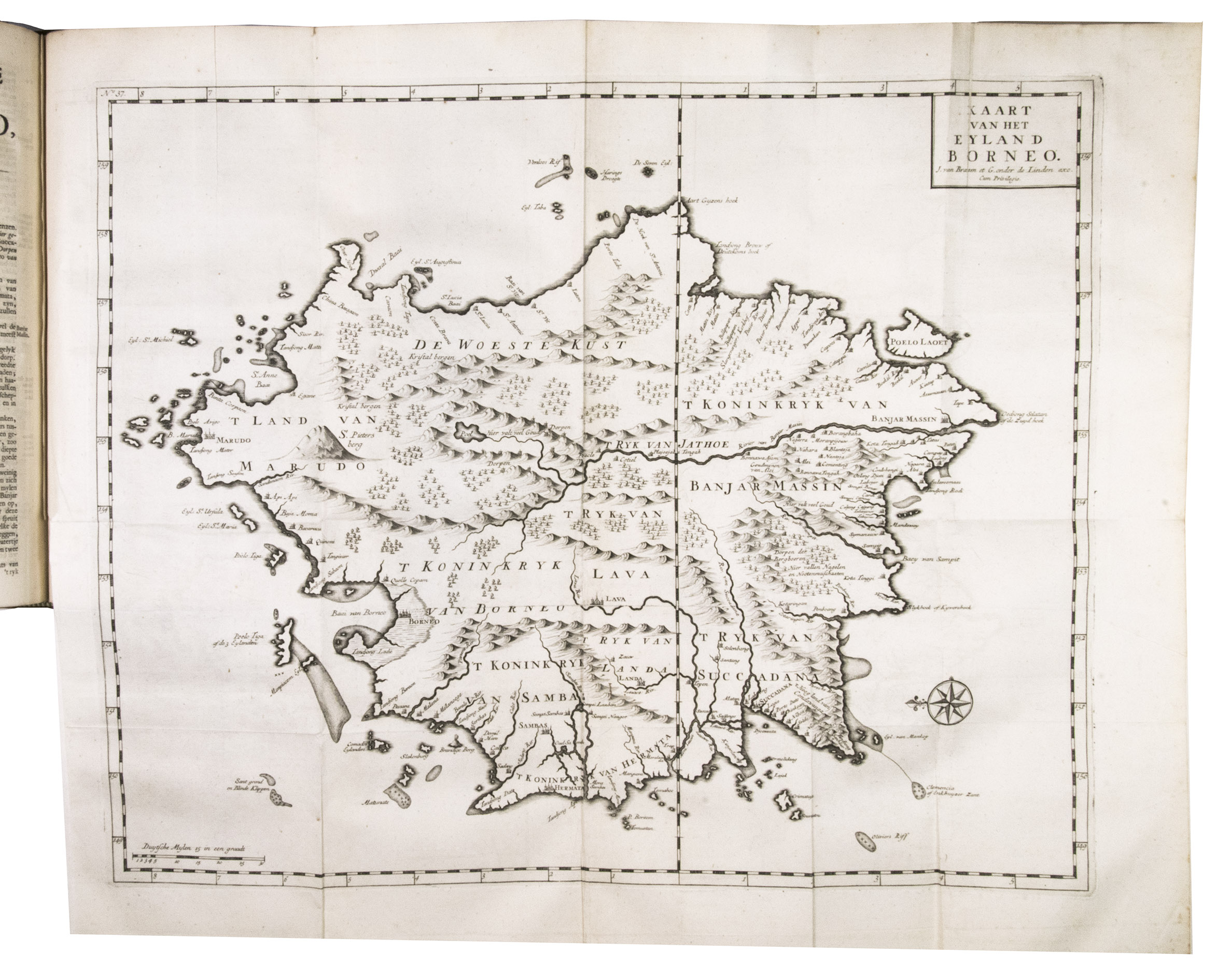
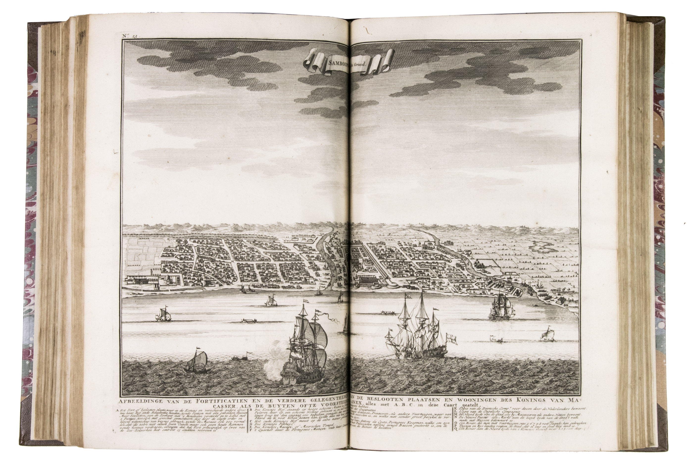
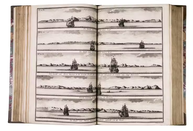
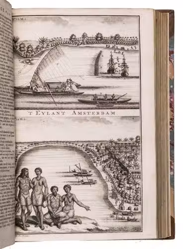
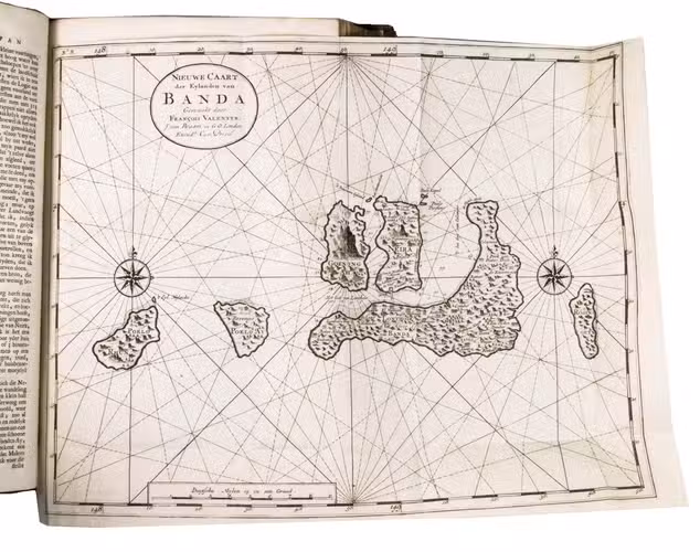
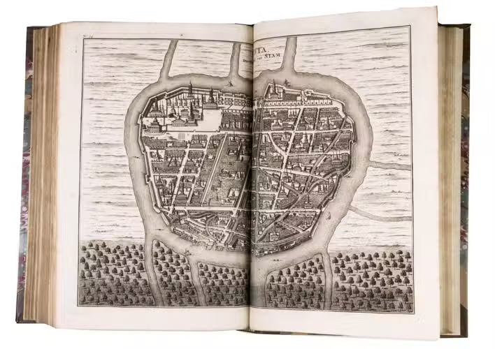
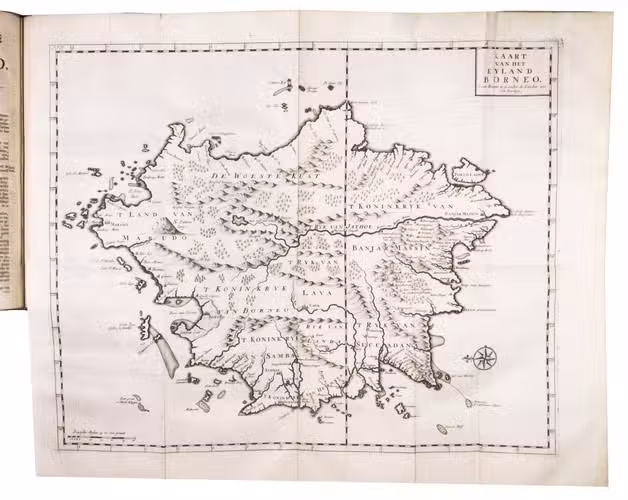
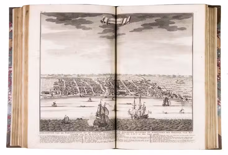
- A detailed geographical and historical description of the isles Banda, Timor and Solor, Celebes (or Macassar), Borneo, Bali, the kingdoms of Tonkin, Cambodia and Siam and the trade of the Dutch with those regions. Accompanied by 25 views, maps, plans and plates and 10 smaller illustrations in the text. The description of Banda includes an account of several expeditions as well as the first complete accounts of Abel Tasman's voyage made in 1642-1643, with a map made after his own notes, and the voyage made by Willem de Vlamingh.
V ( Part IV, 1):
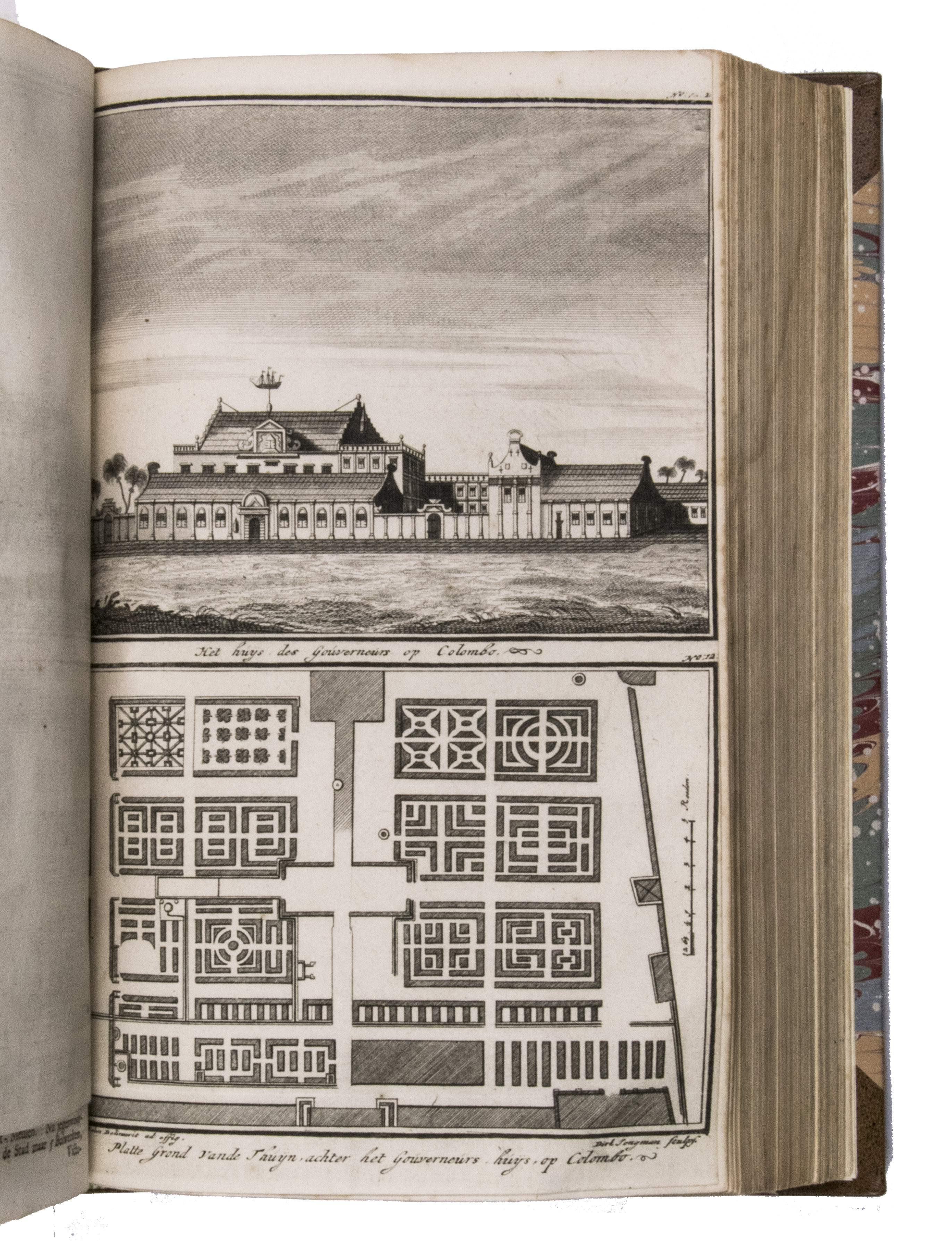
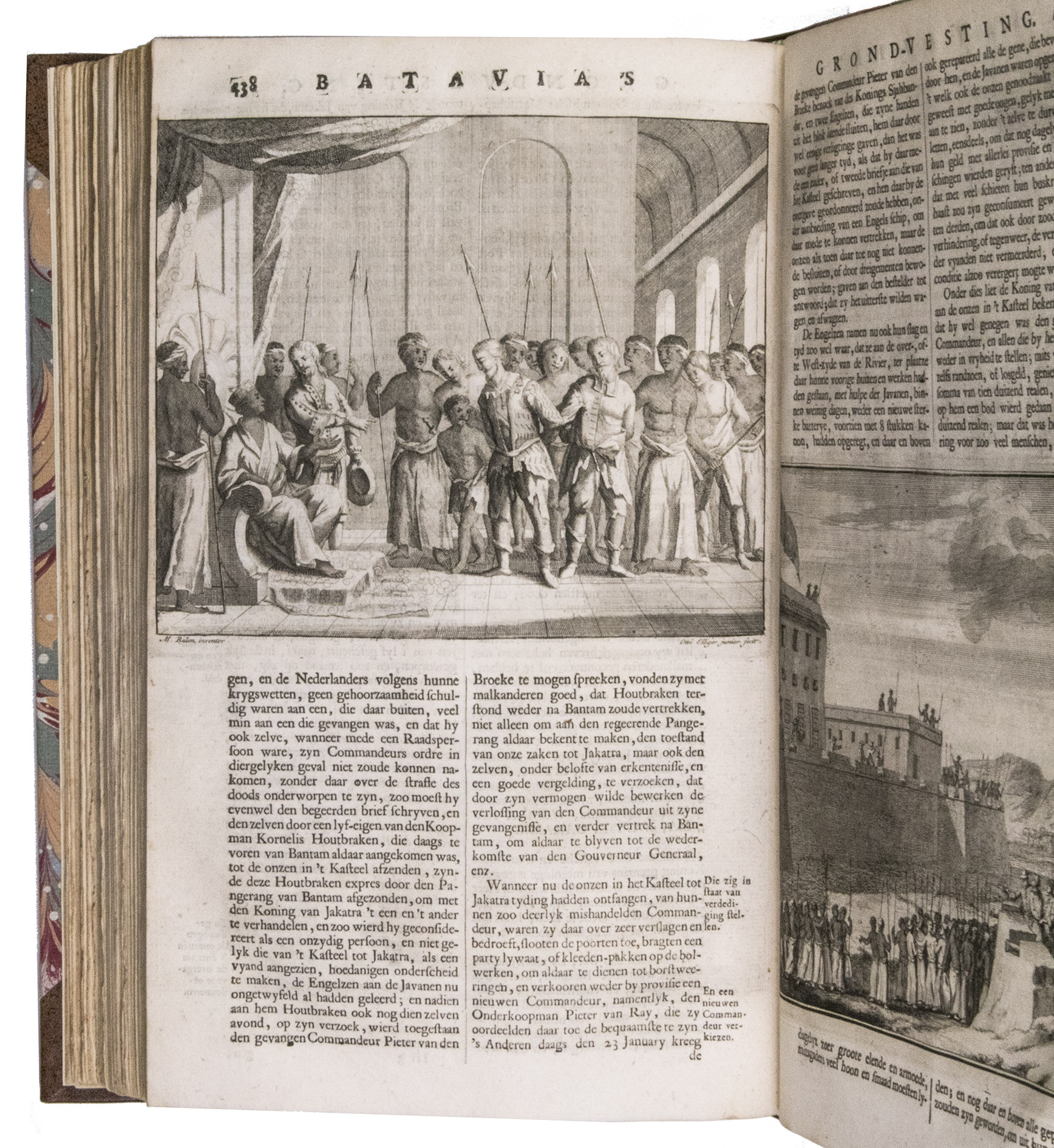
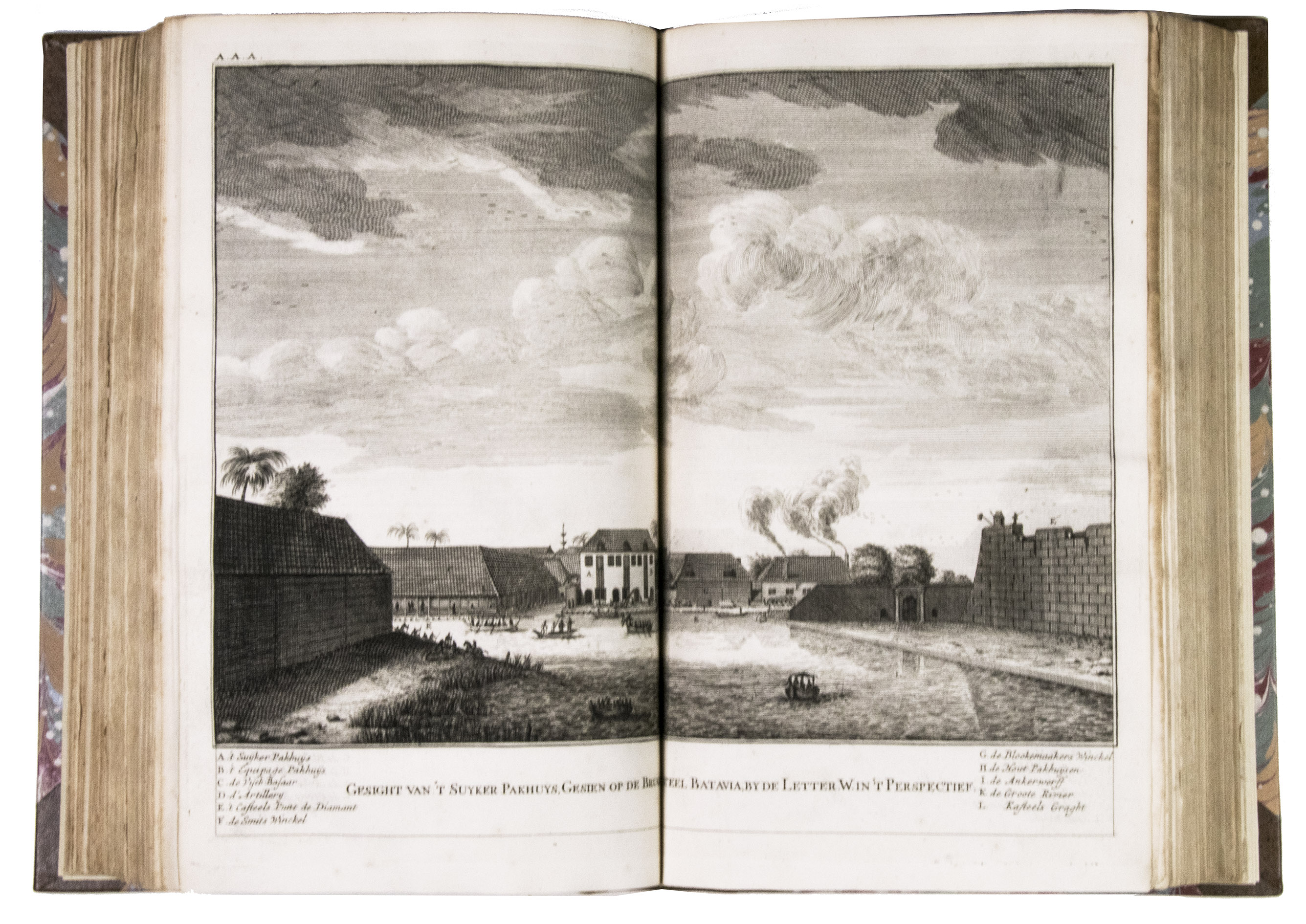
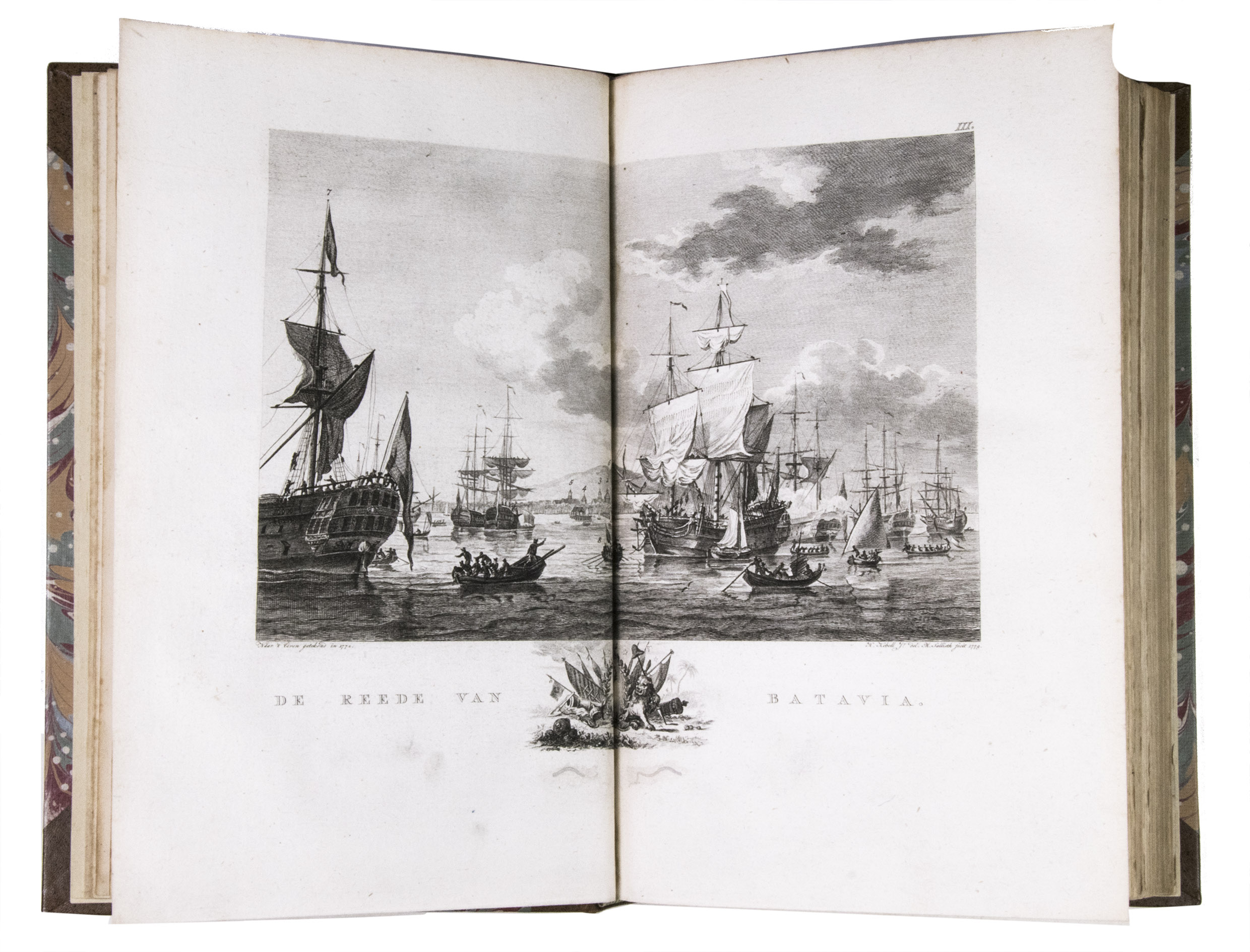
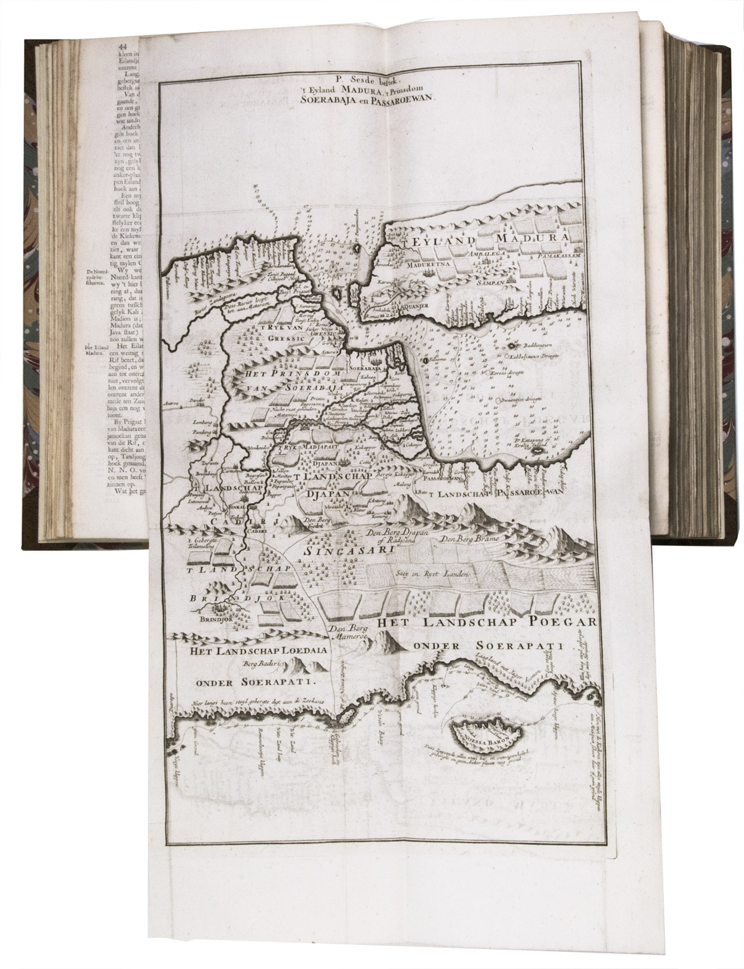
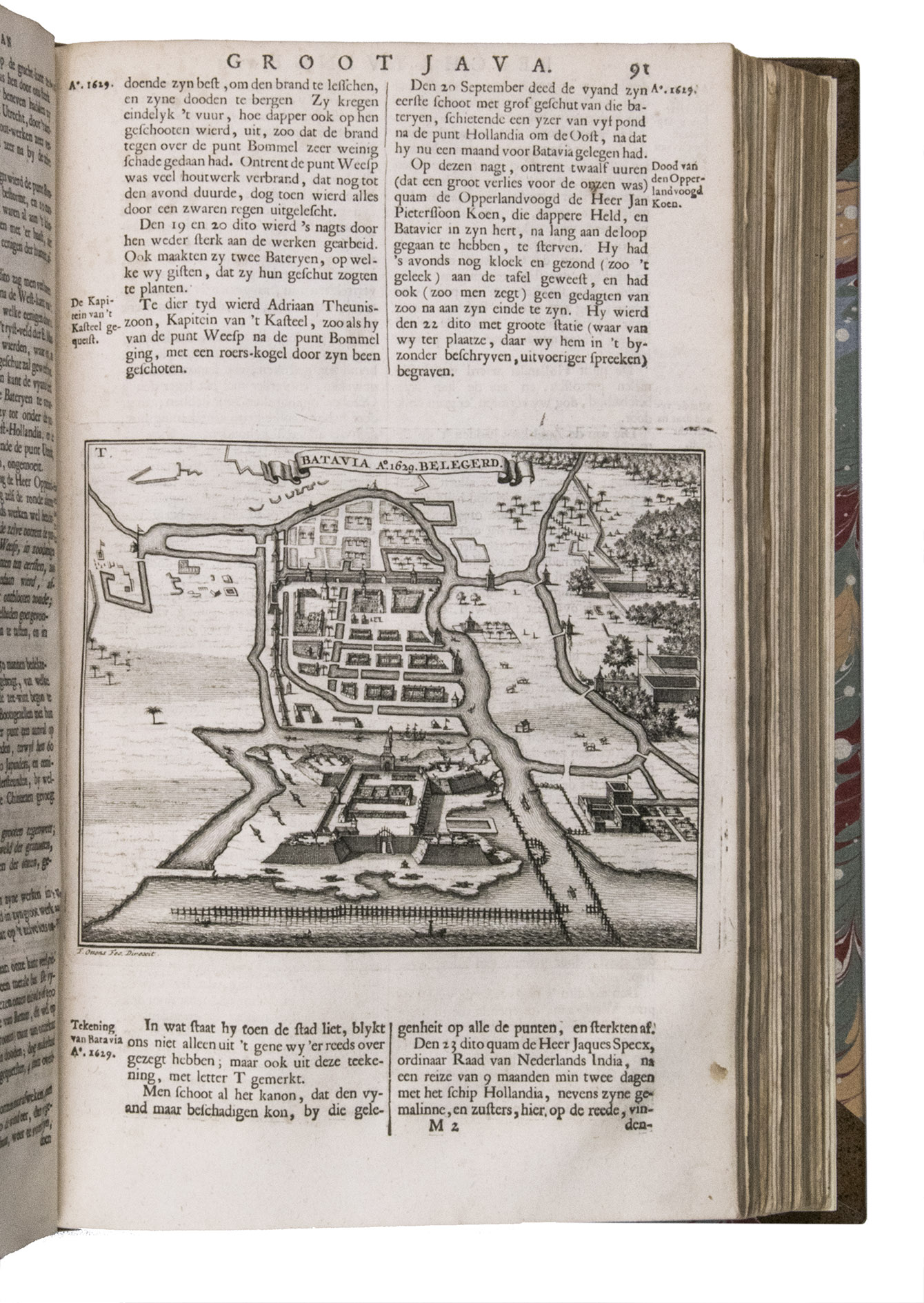
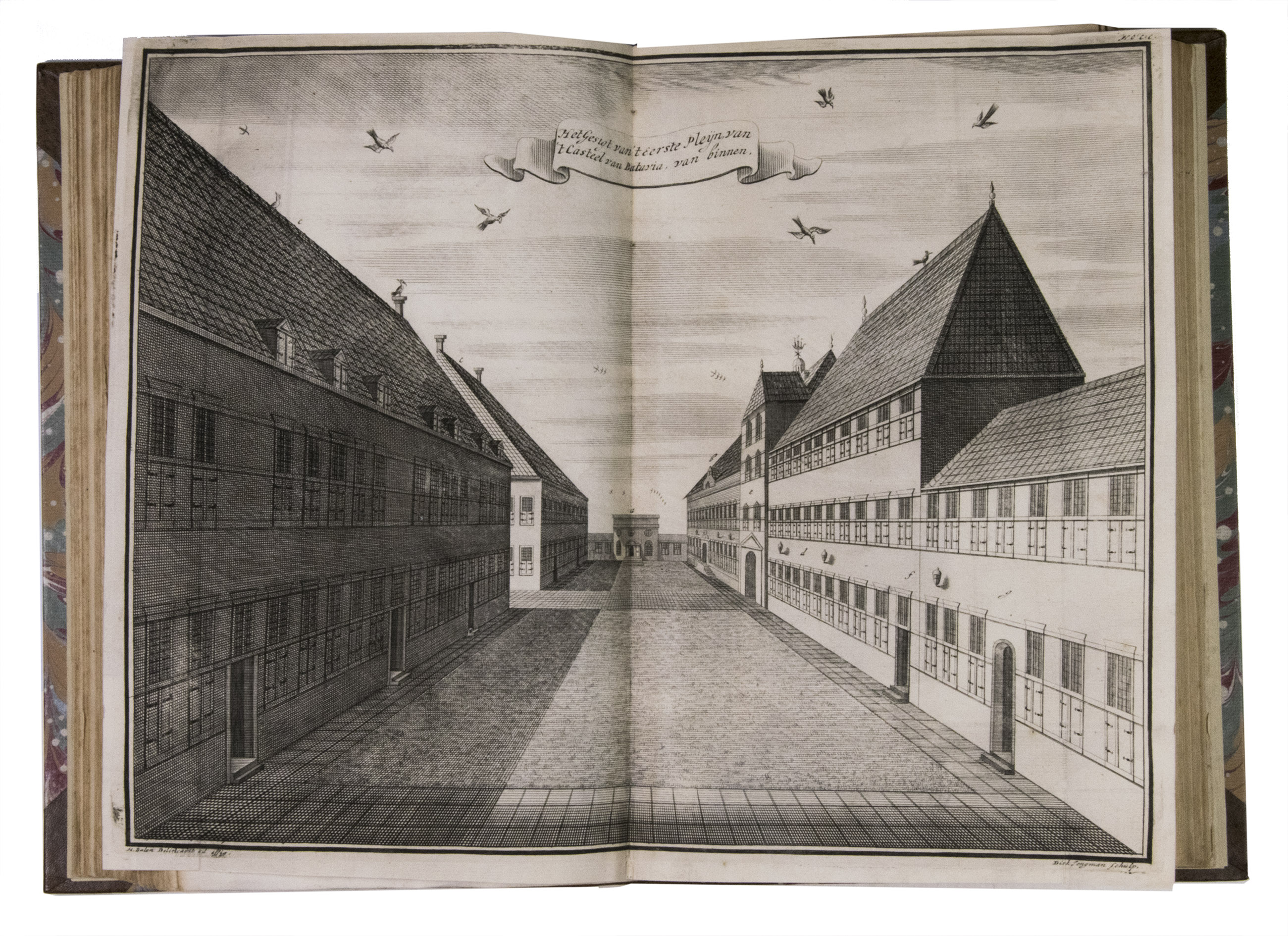
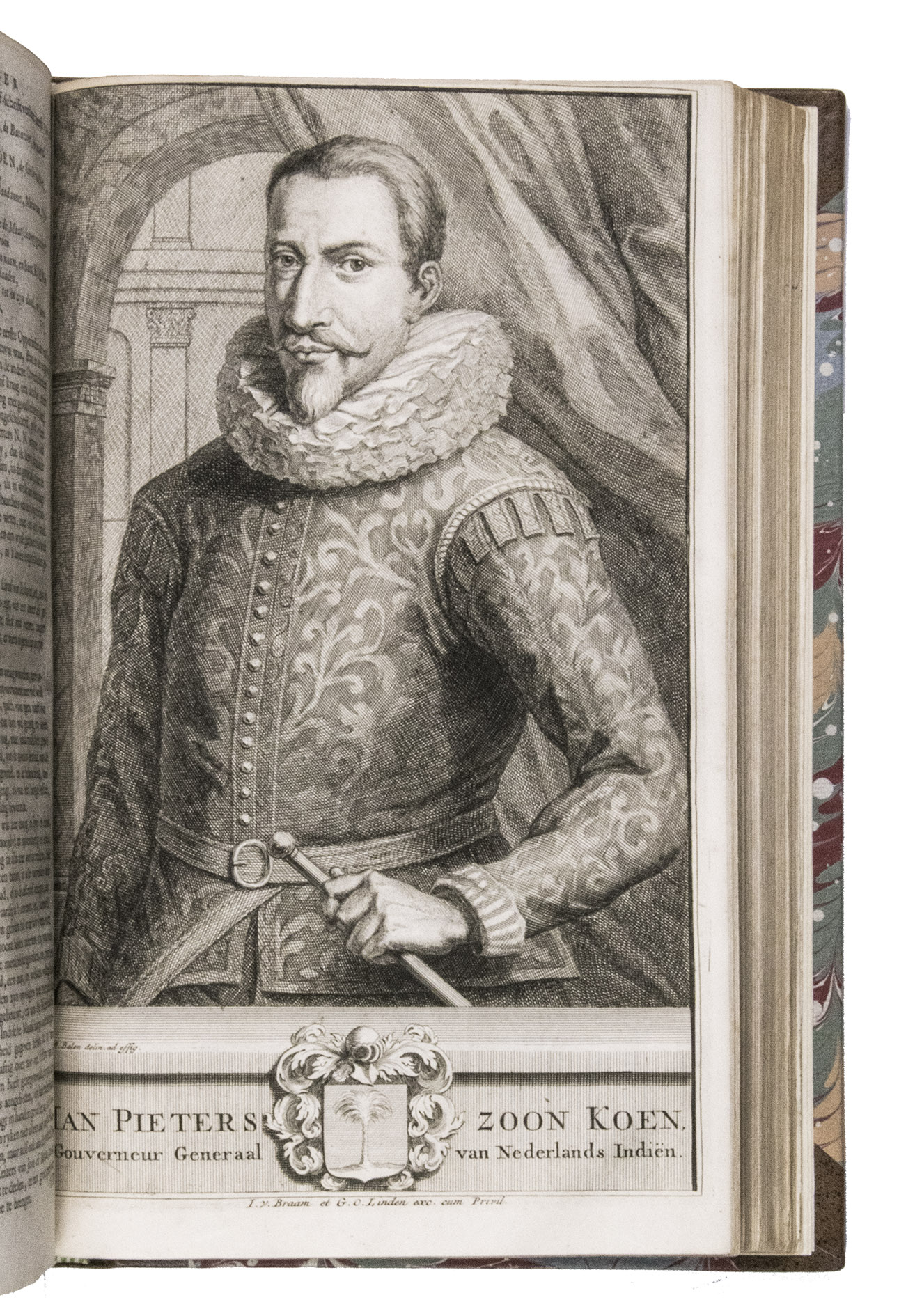
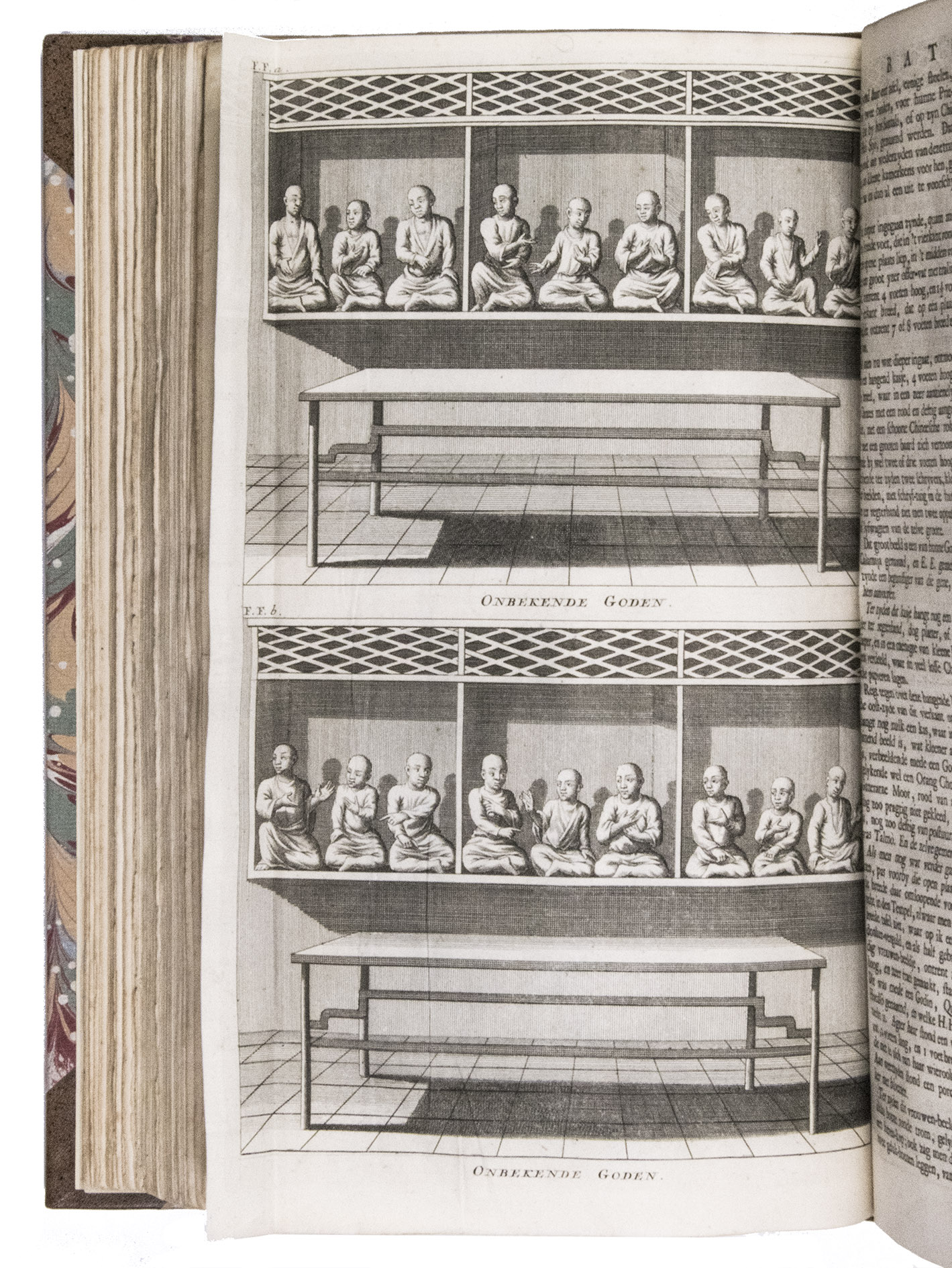
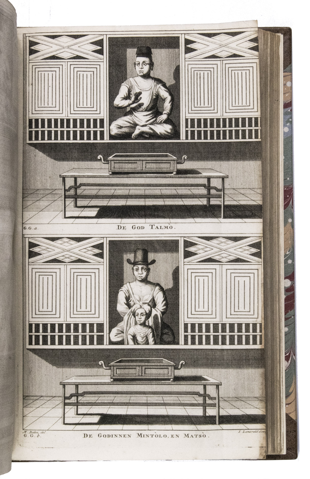
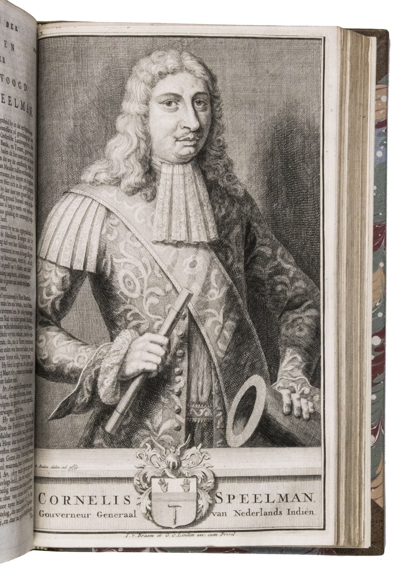
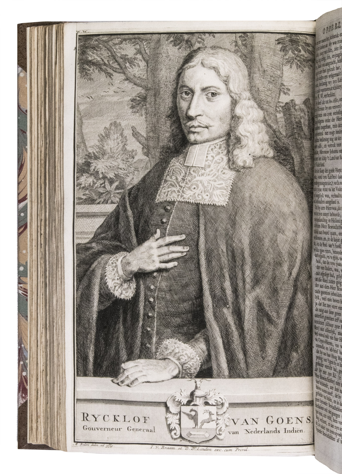
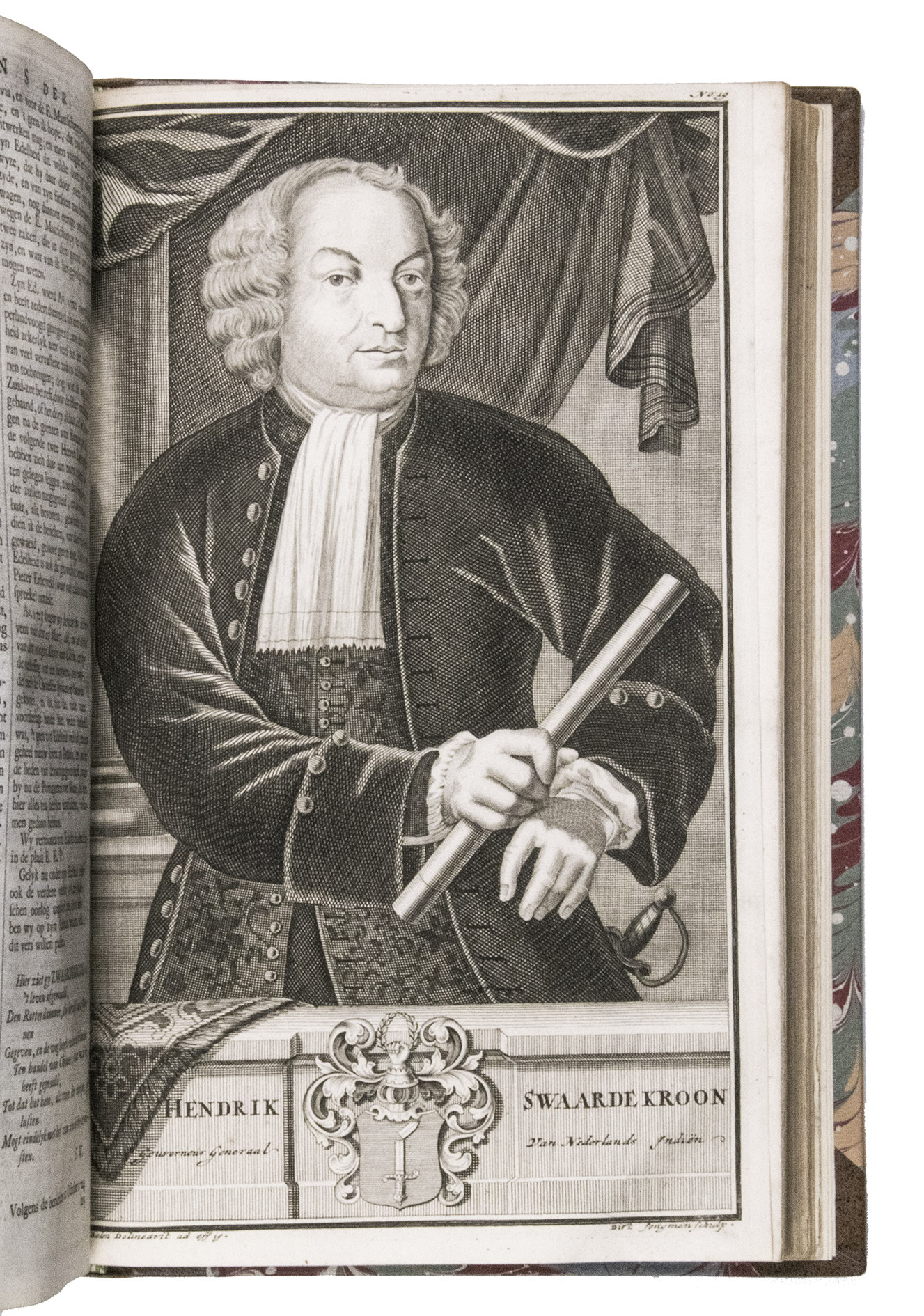
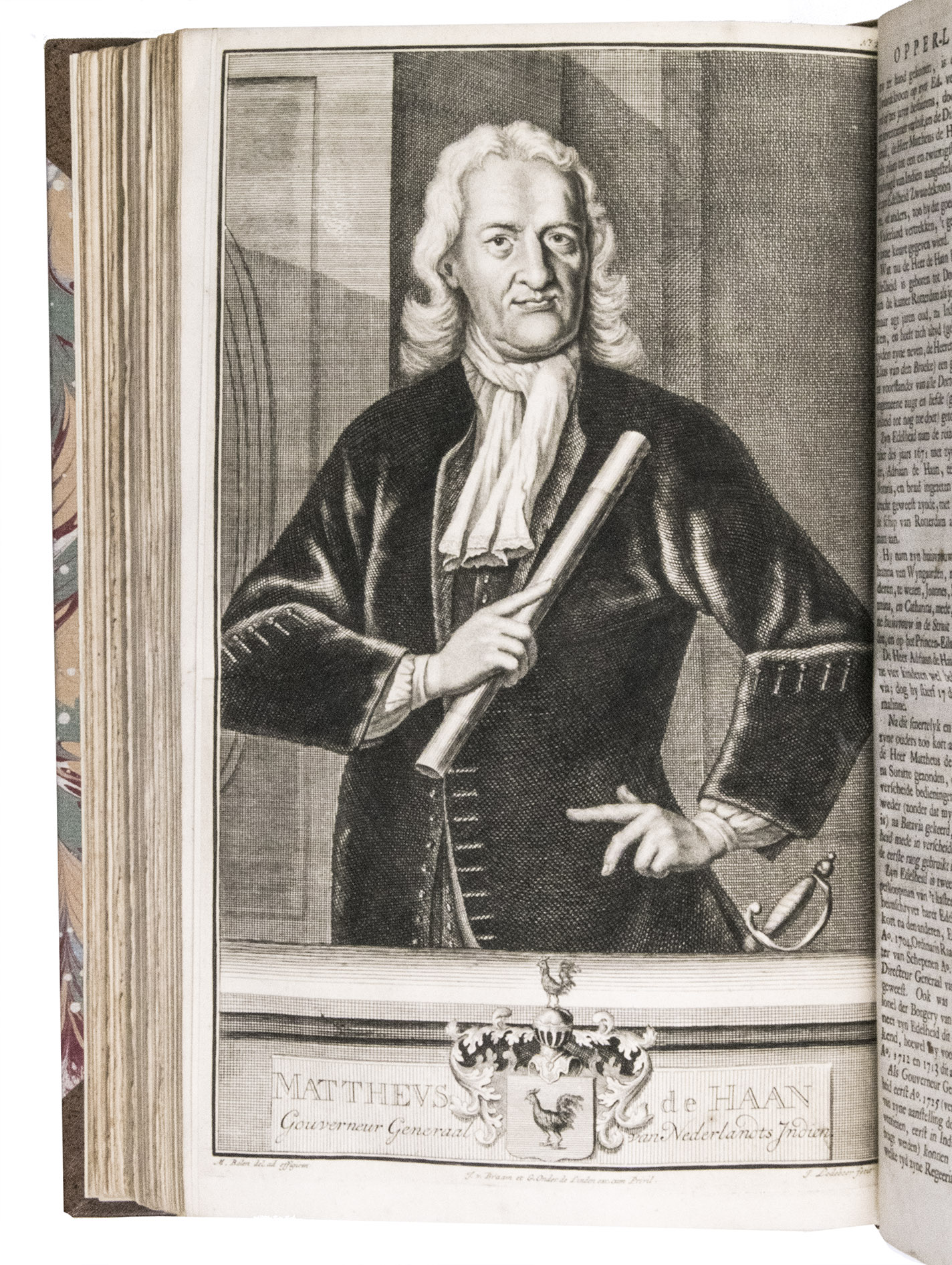
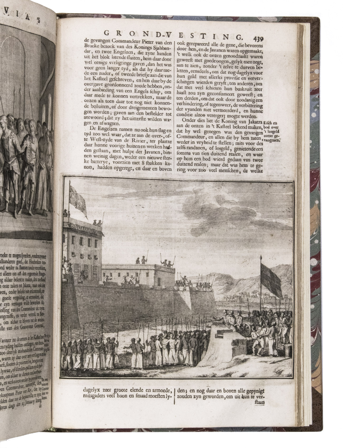
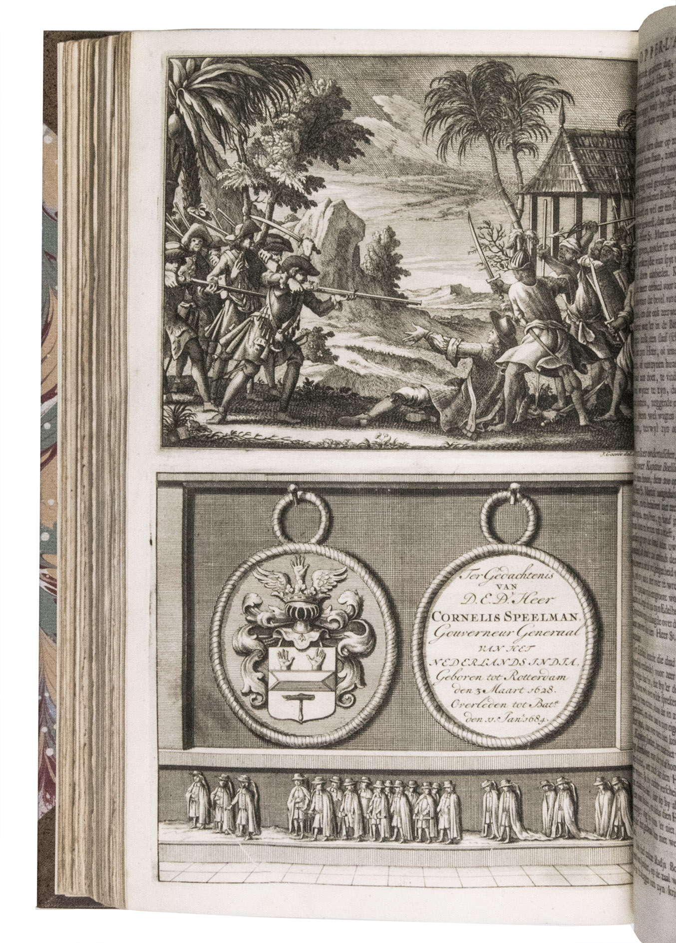
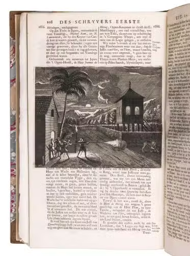
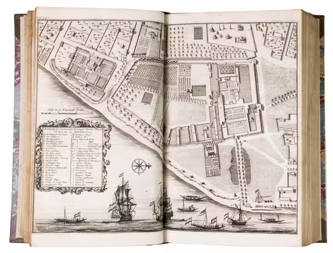
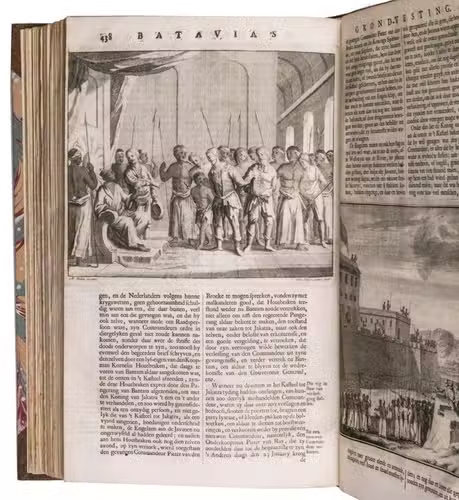
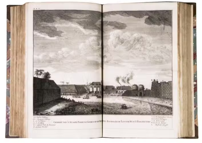
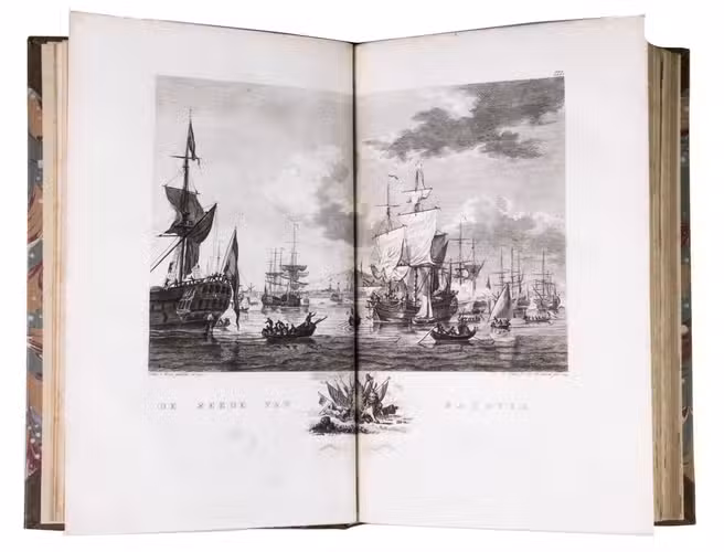
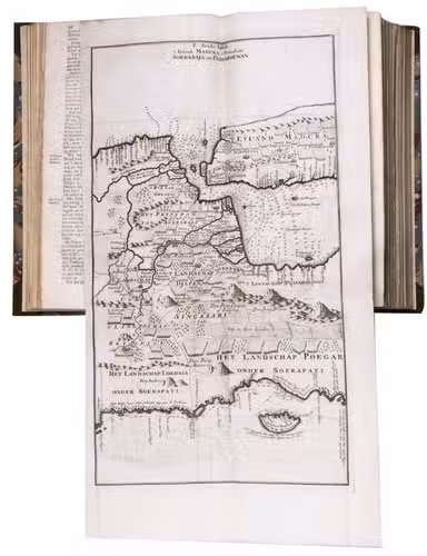
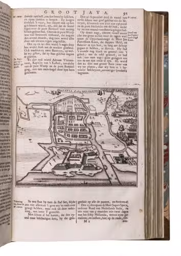
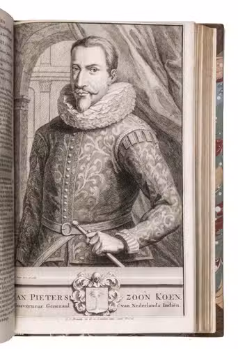
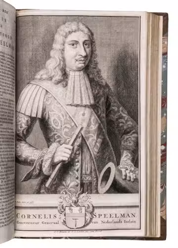
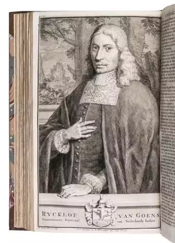
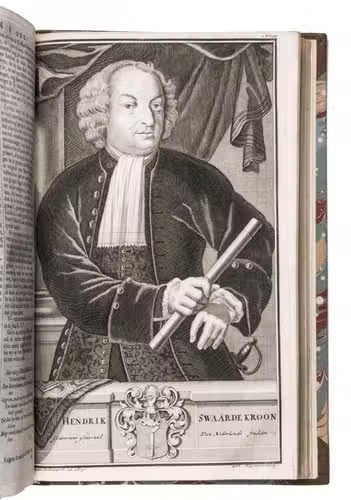
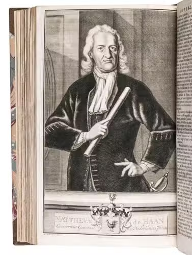
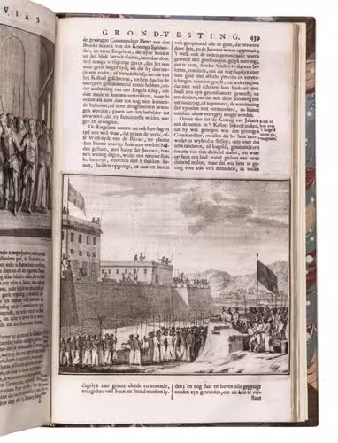
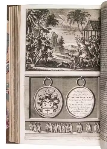
- Description of Java and descriptions of Bantam and Batavia, with biographies of the Governors General, East-Indian coins and a list of VOC employees etc. With 28 maps and plans, views of buildings, illustrations of temples and gods; also with 21 full-page engraved portraits of the Governor General and 6 smaller engravings in text. This volume contains 2 extra plates showing the isle Onrust, near Batavia and the harbour of Batavia, the 2 main ports of the Dutch in Indonesia. Both designed by K. Kobell Jr. and engraved by M. Sallieth. The plates were made for the Atlas van de zeehavens der Bataafsche Republiek by De Jong and Sallieth, 1802, the only and at the same time most luxurious and beautiful large-plate atlas of Dutch sea-ports published in the Netherlands.
VI (Part IV, 2):
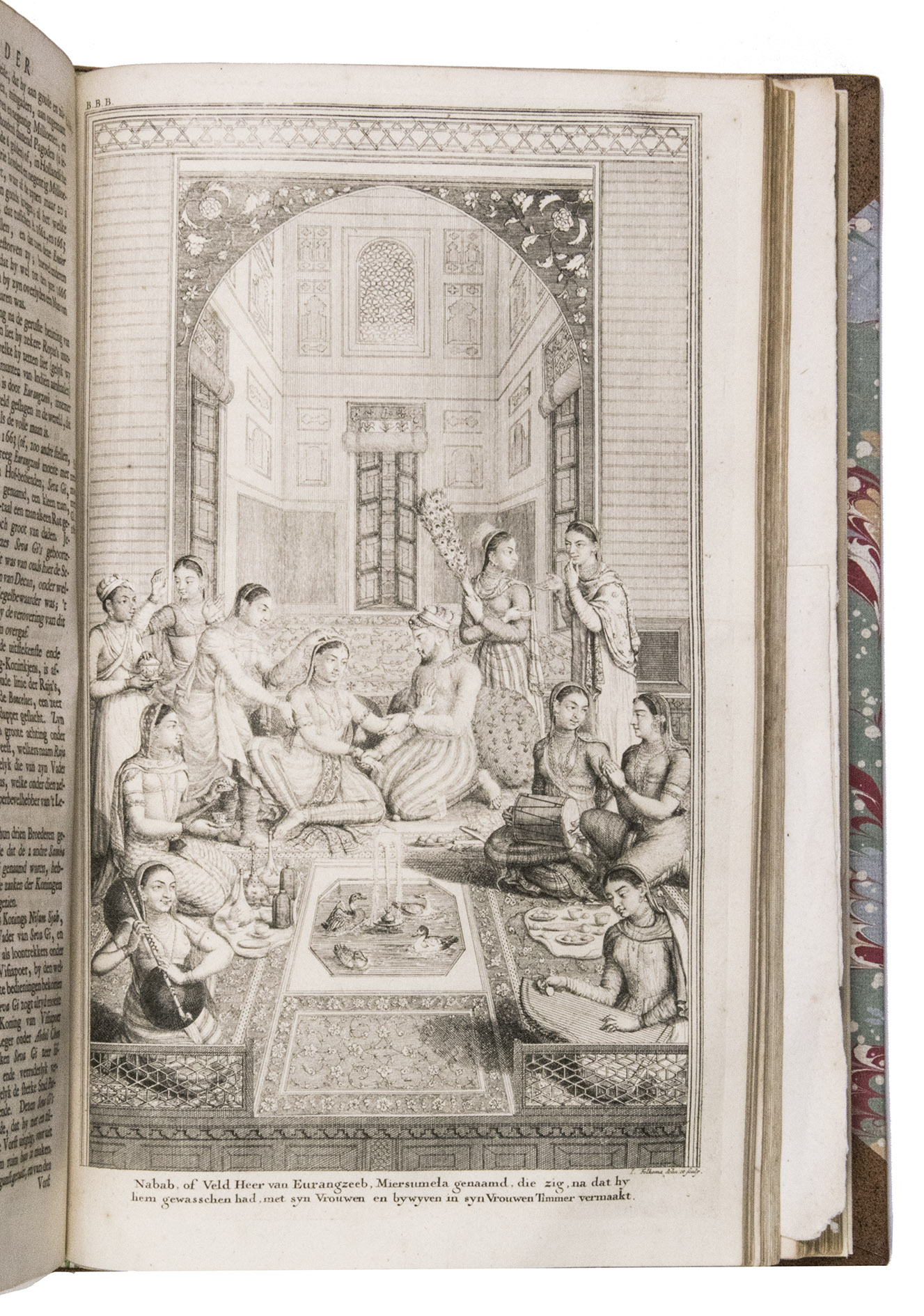
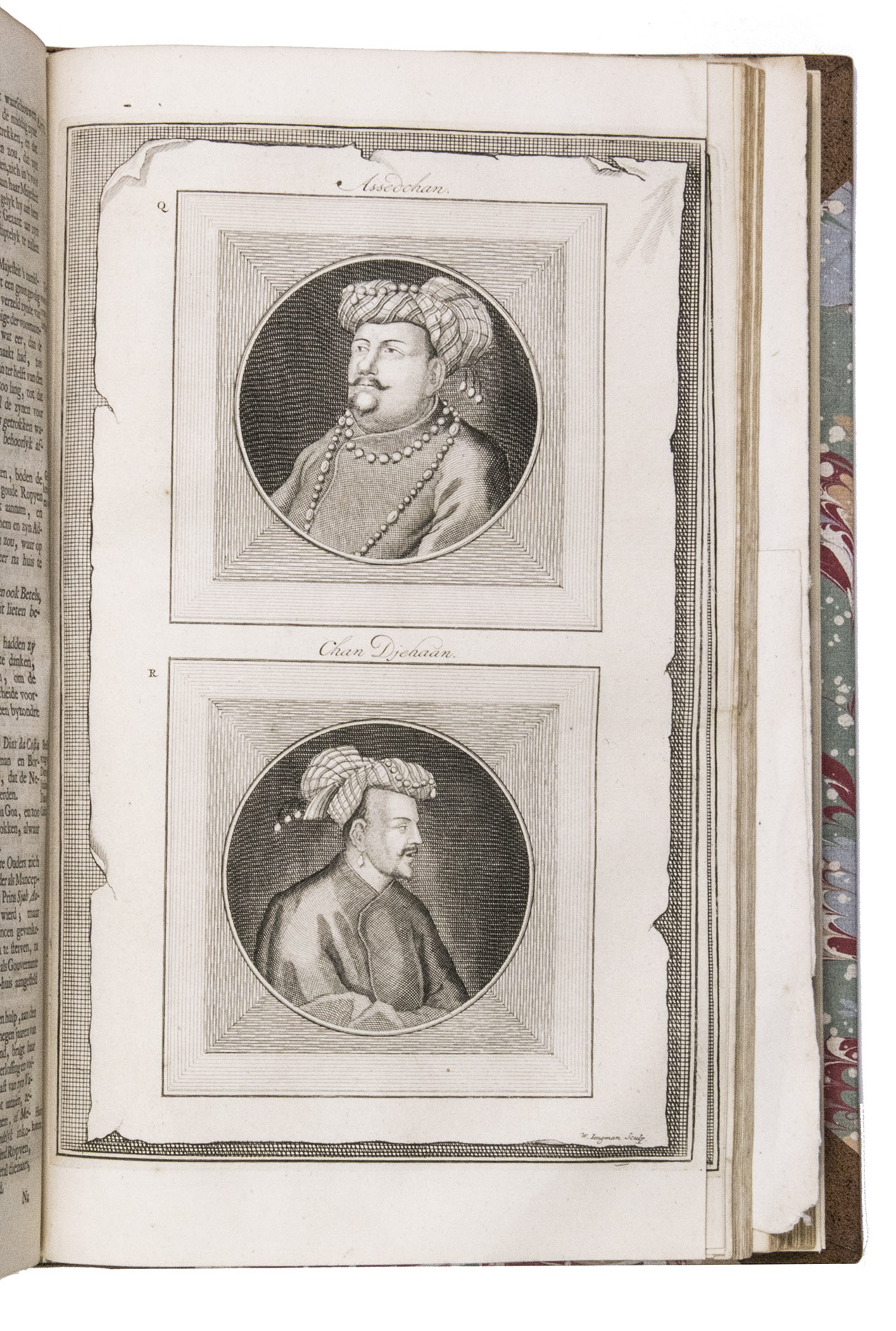
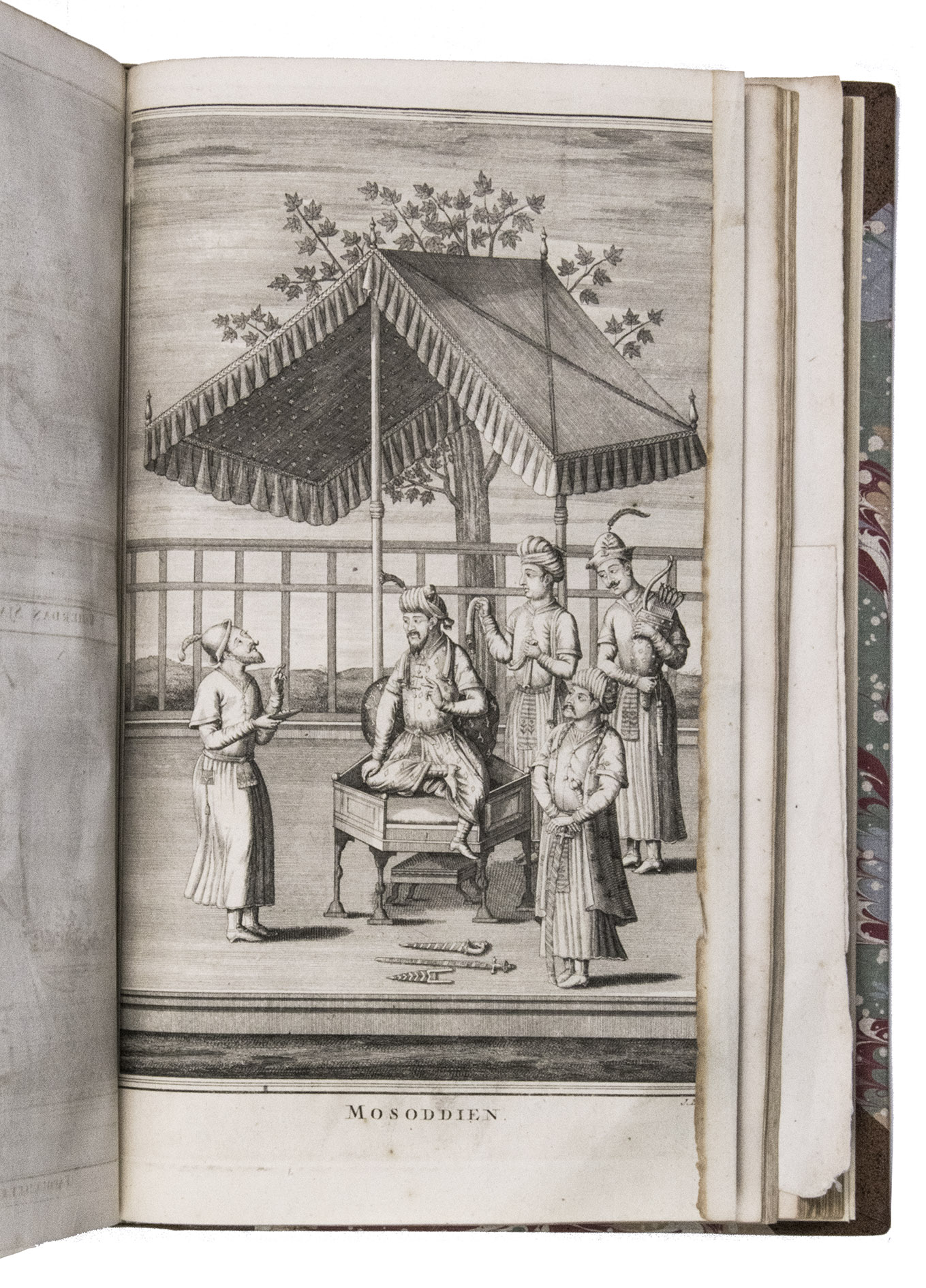
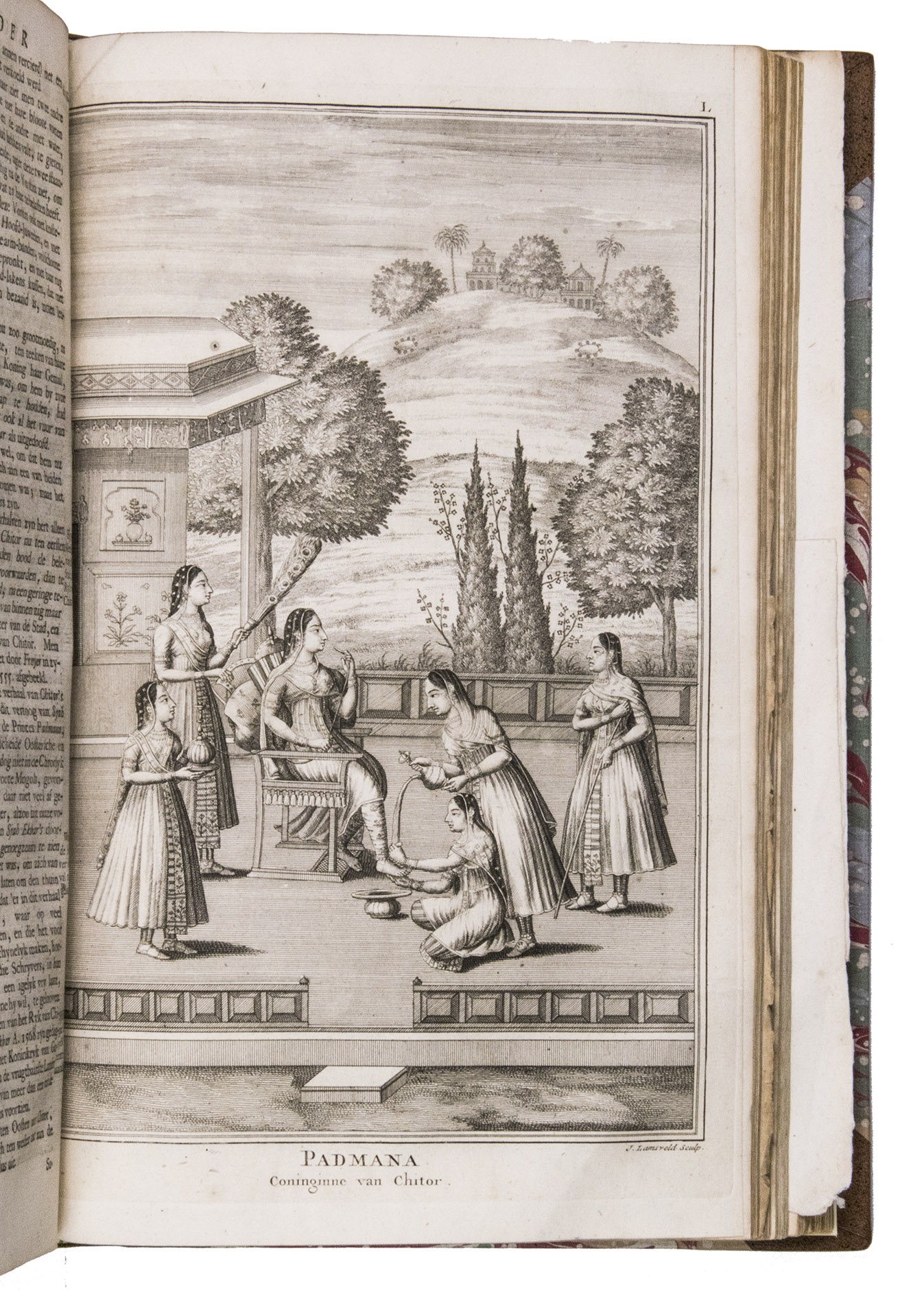
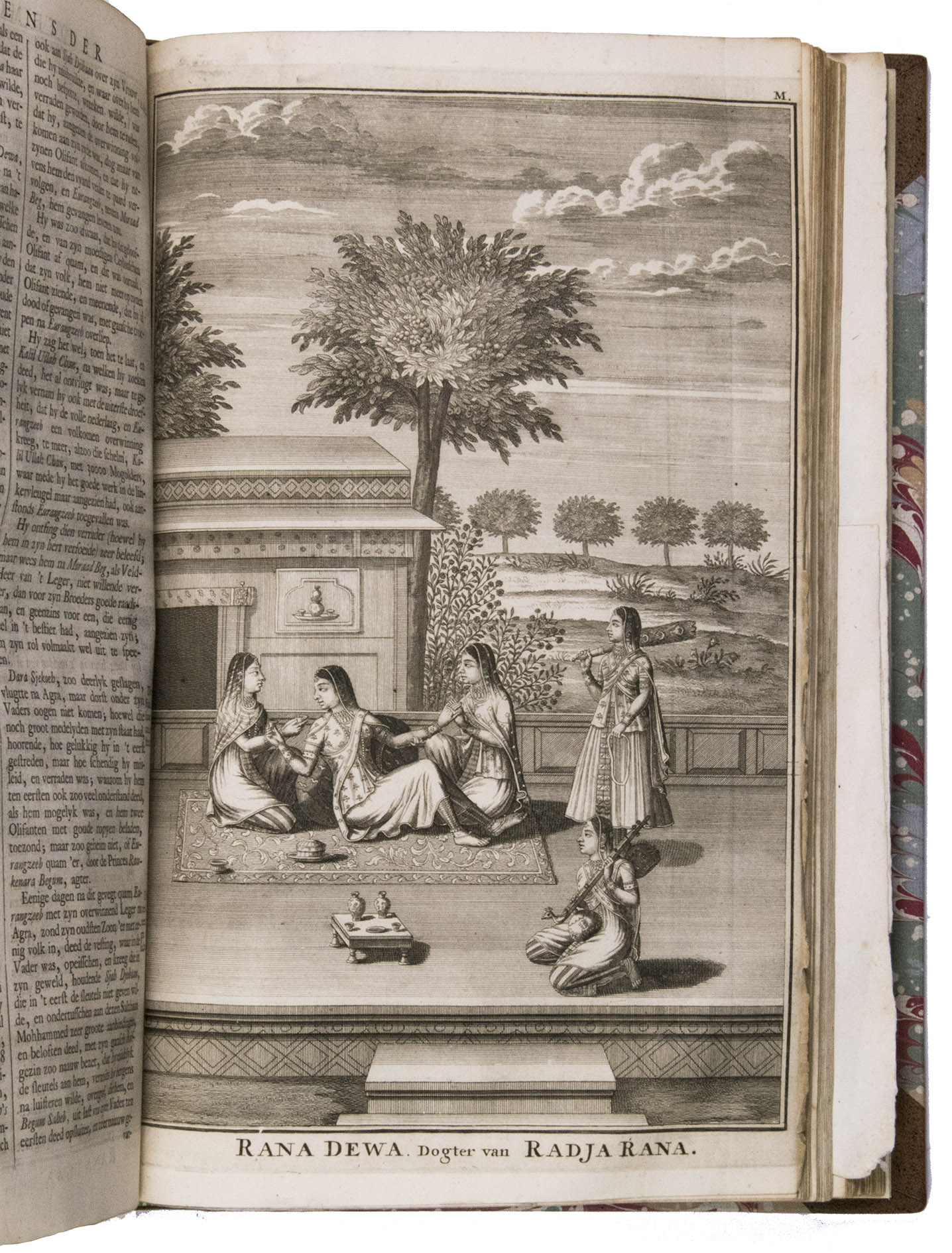
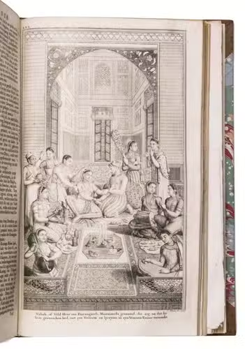
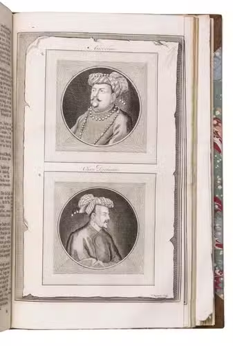
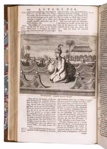
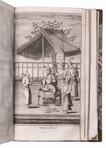
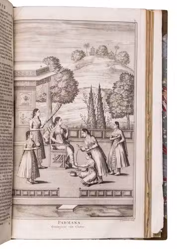
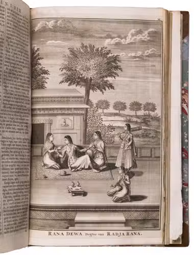
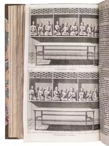
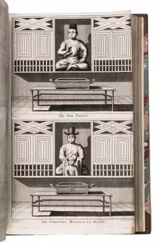
- Account of the religion on Java, description of the Dutch comptoir in Surat and accounts of lives of the great Moguls with 1 map and 19 full-page portraits of Moguls, their wives and their children and 19 smaller text illustrations.
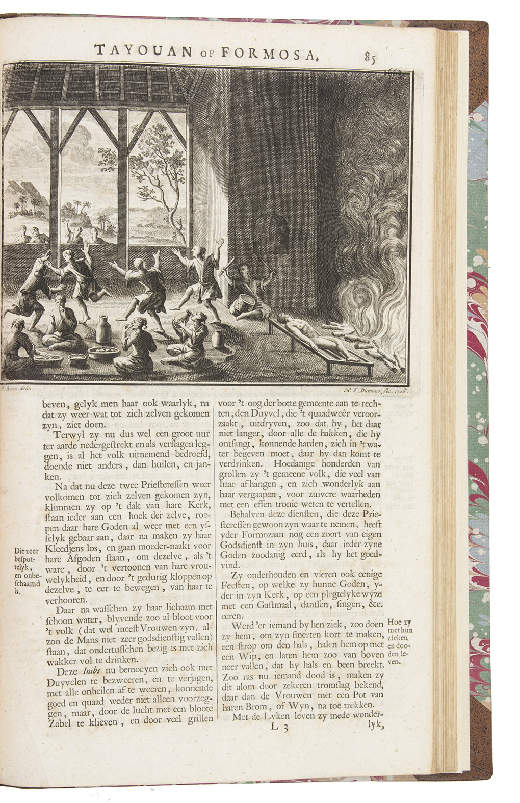
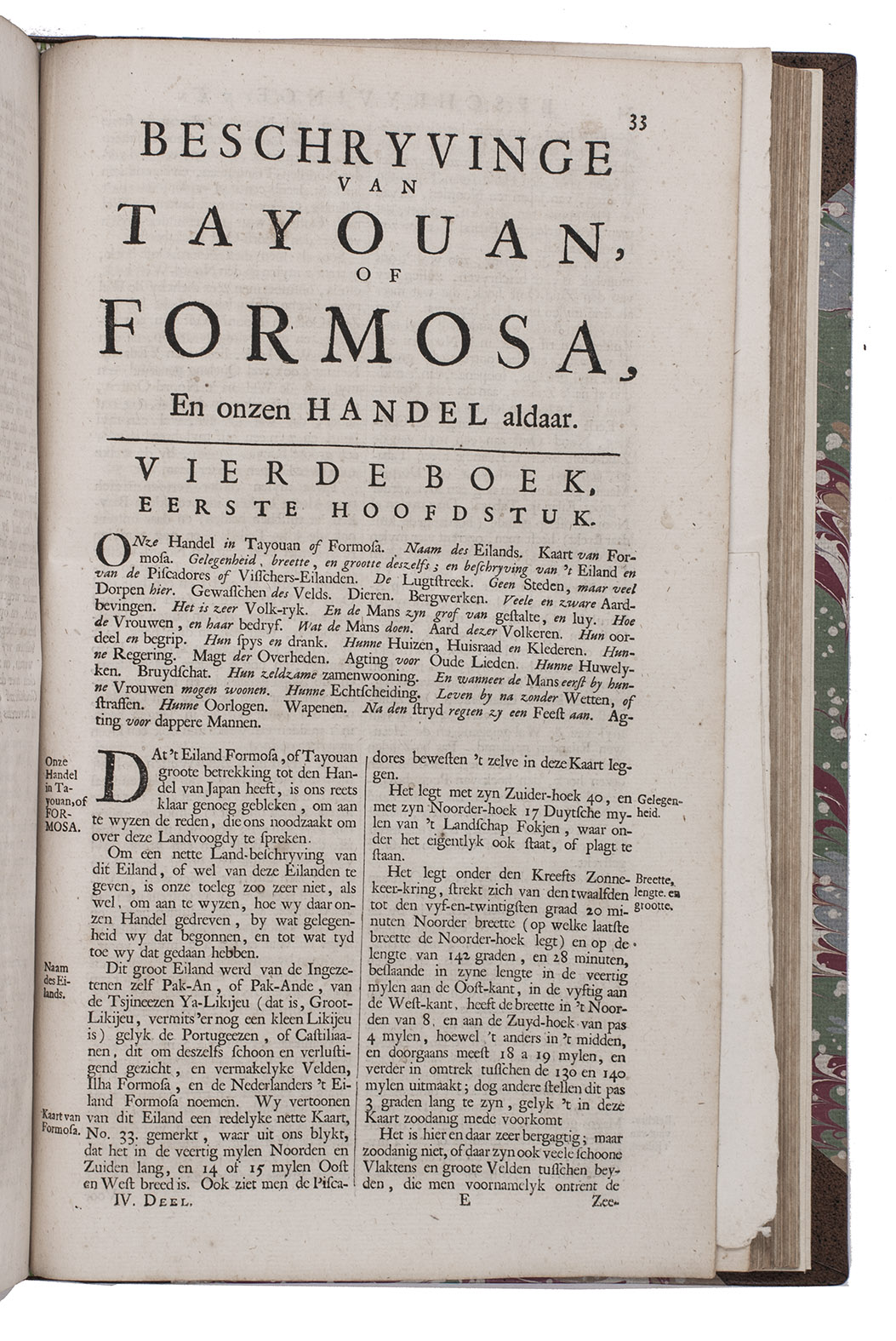
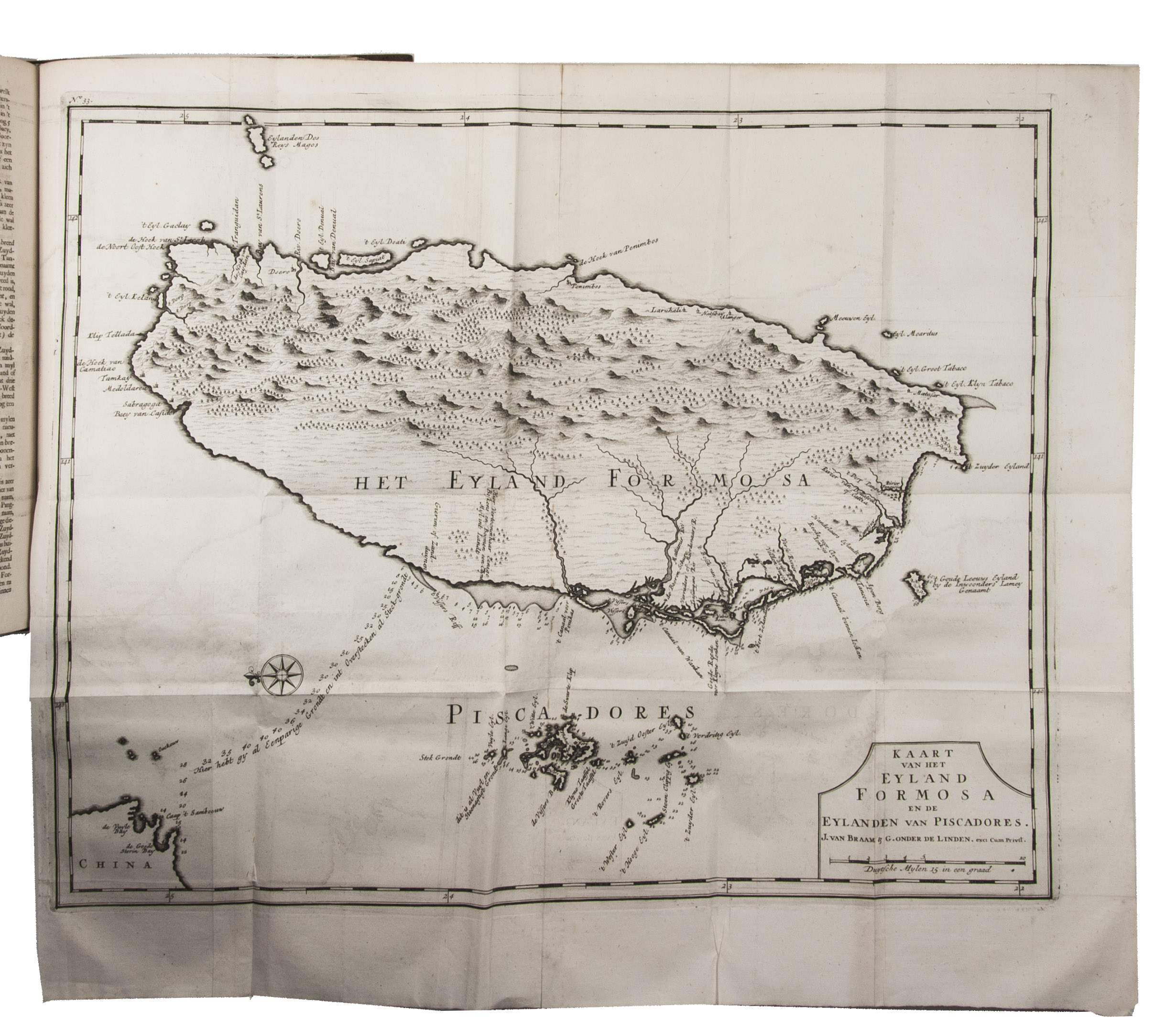
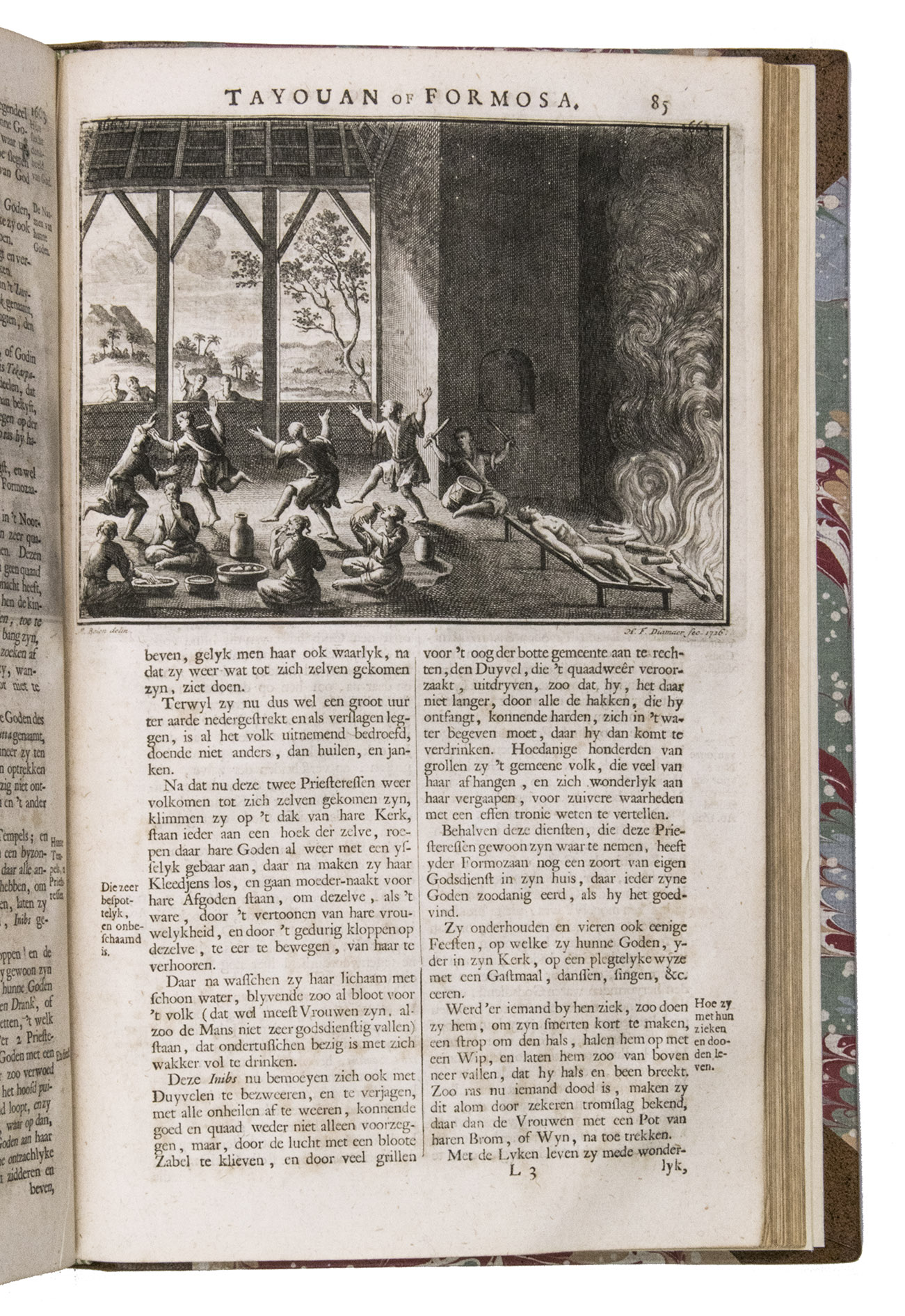
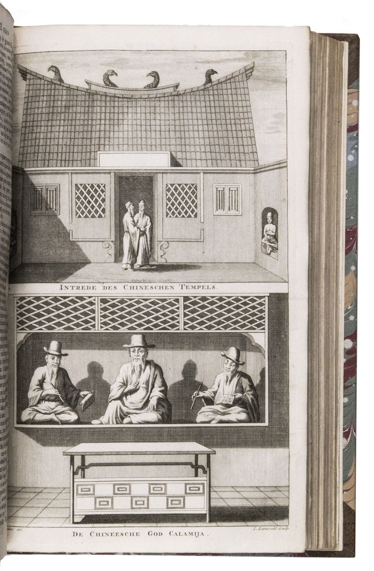
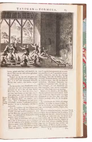
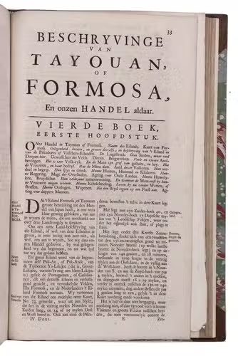
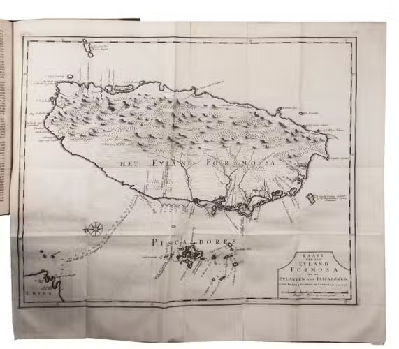
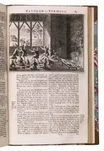
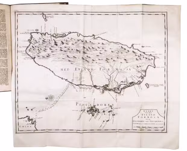
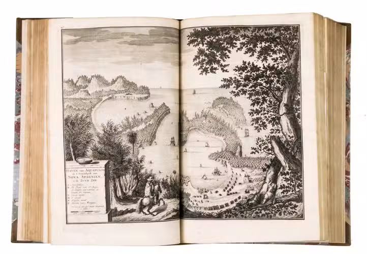
Description of China and Formosa (or Taiwan) illustrated with a map, a plan and a view and 6 smaller engravings in text.
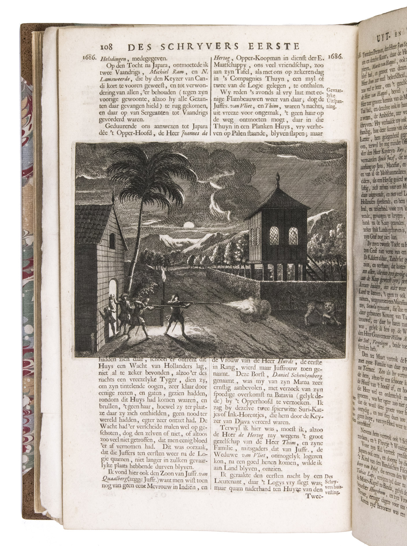
Account of the voyages made by Valentijn himself.
VII (Part V, 1):
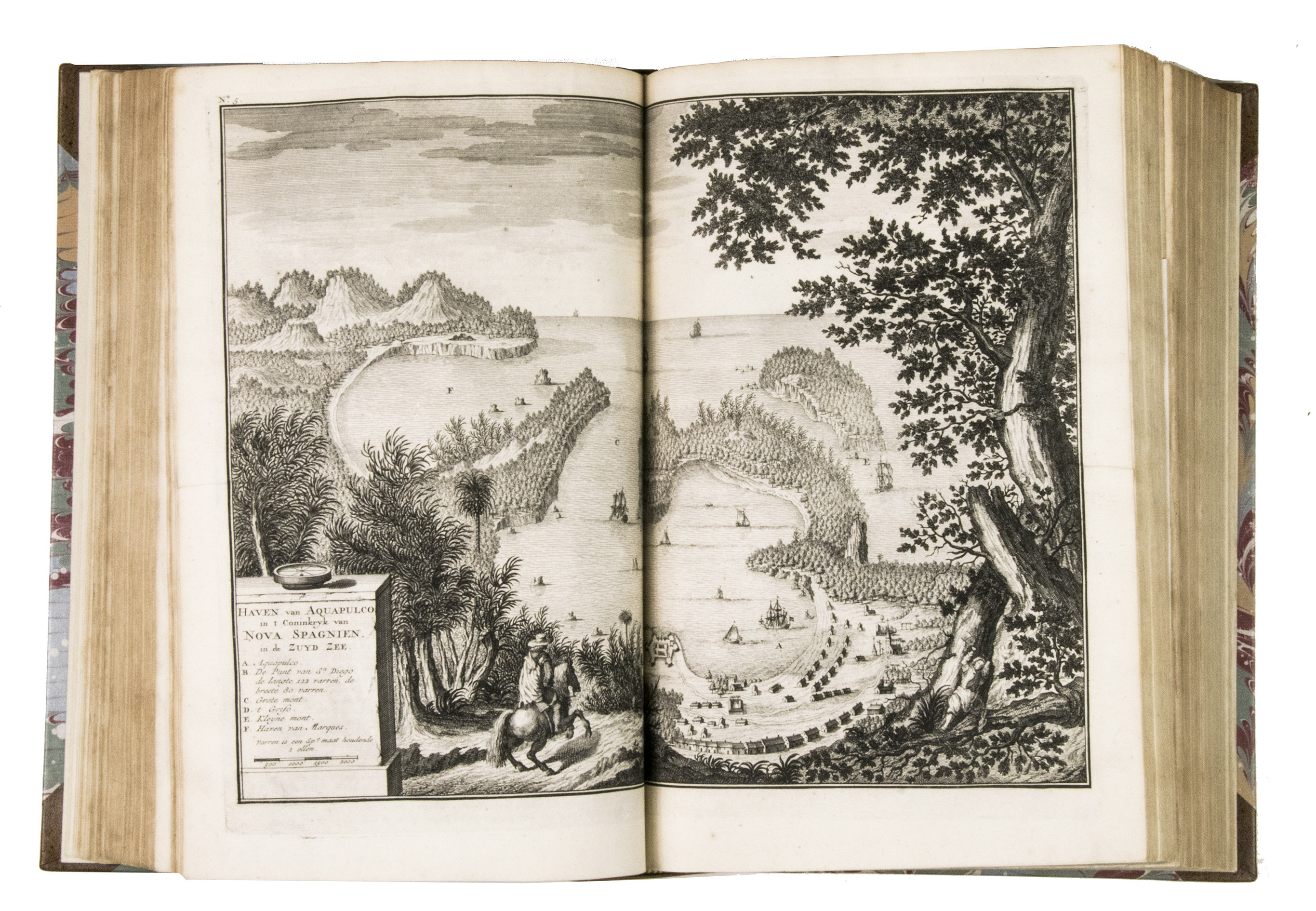
- Descriptions of the coast of Coromandel at the south-east coast of India with information about several main ports like Pegu, Arrakan and Mocha in Yemen.
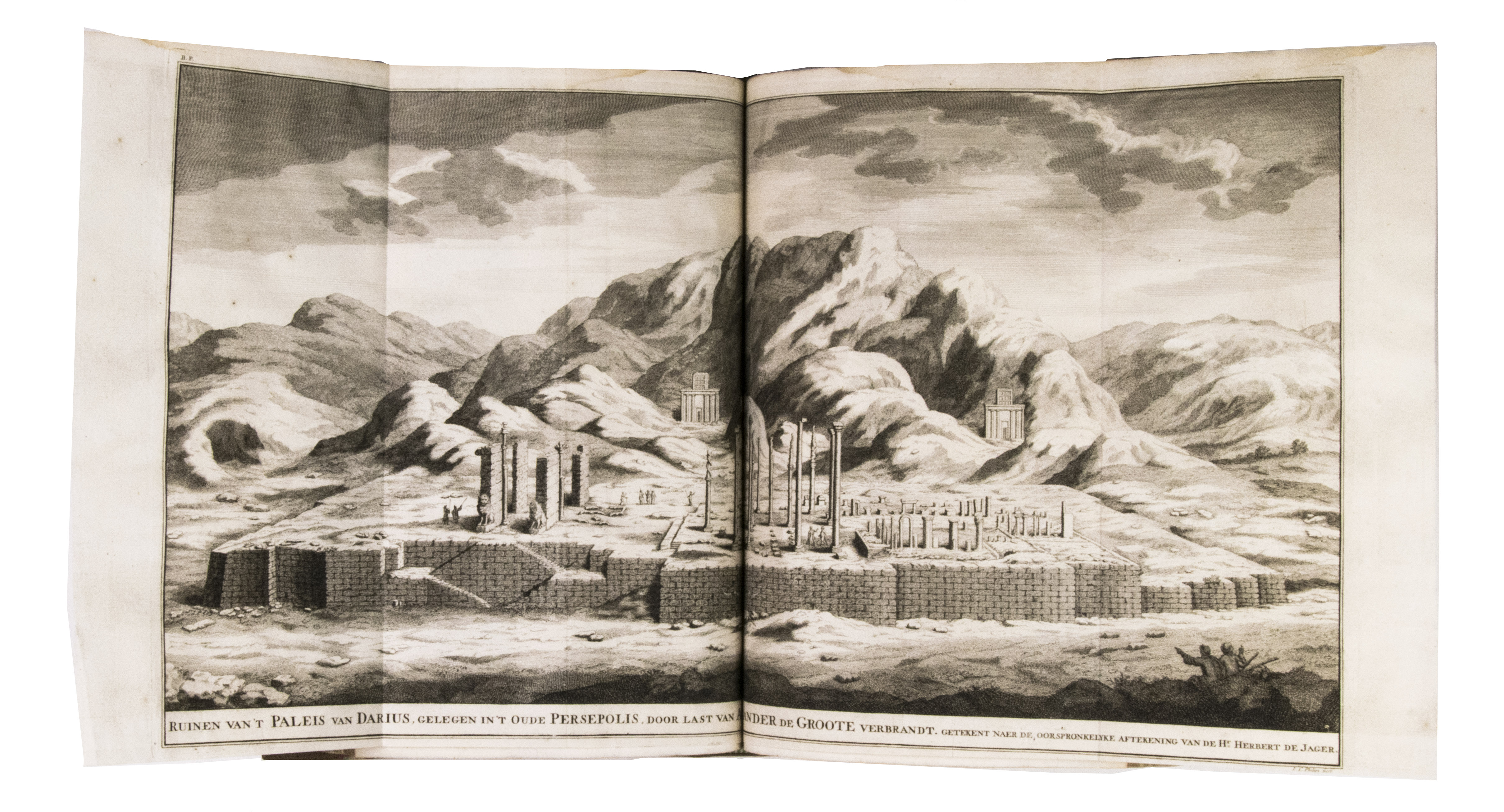
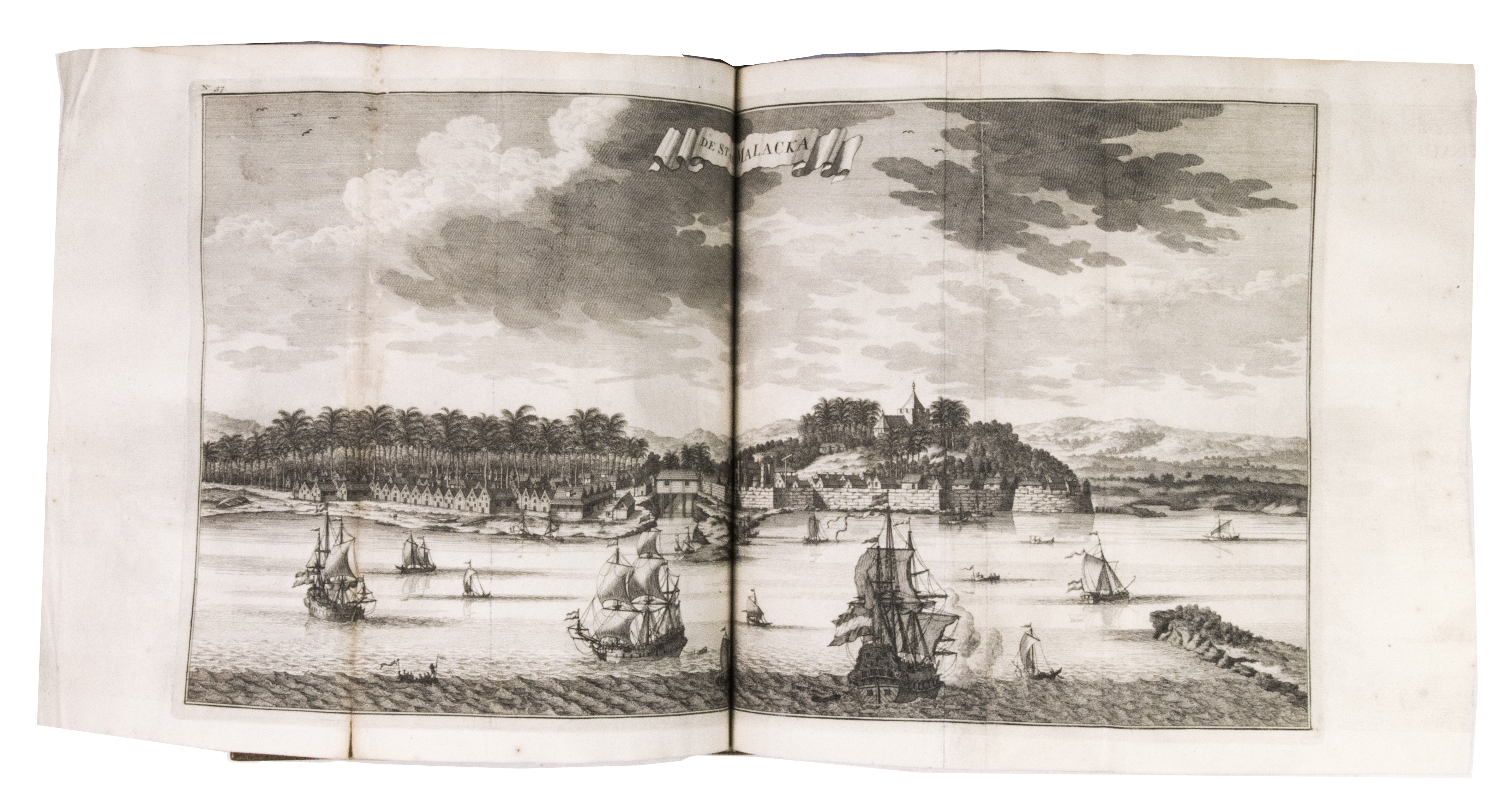
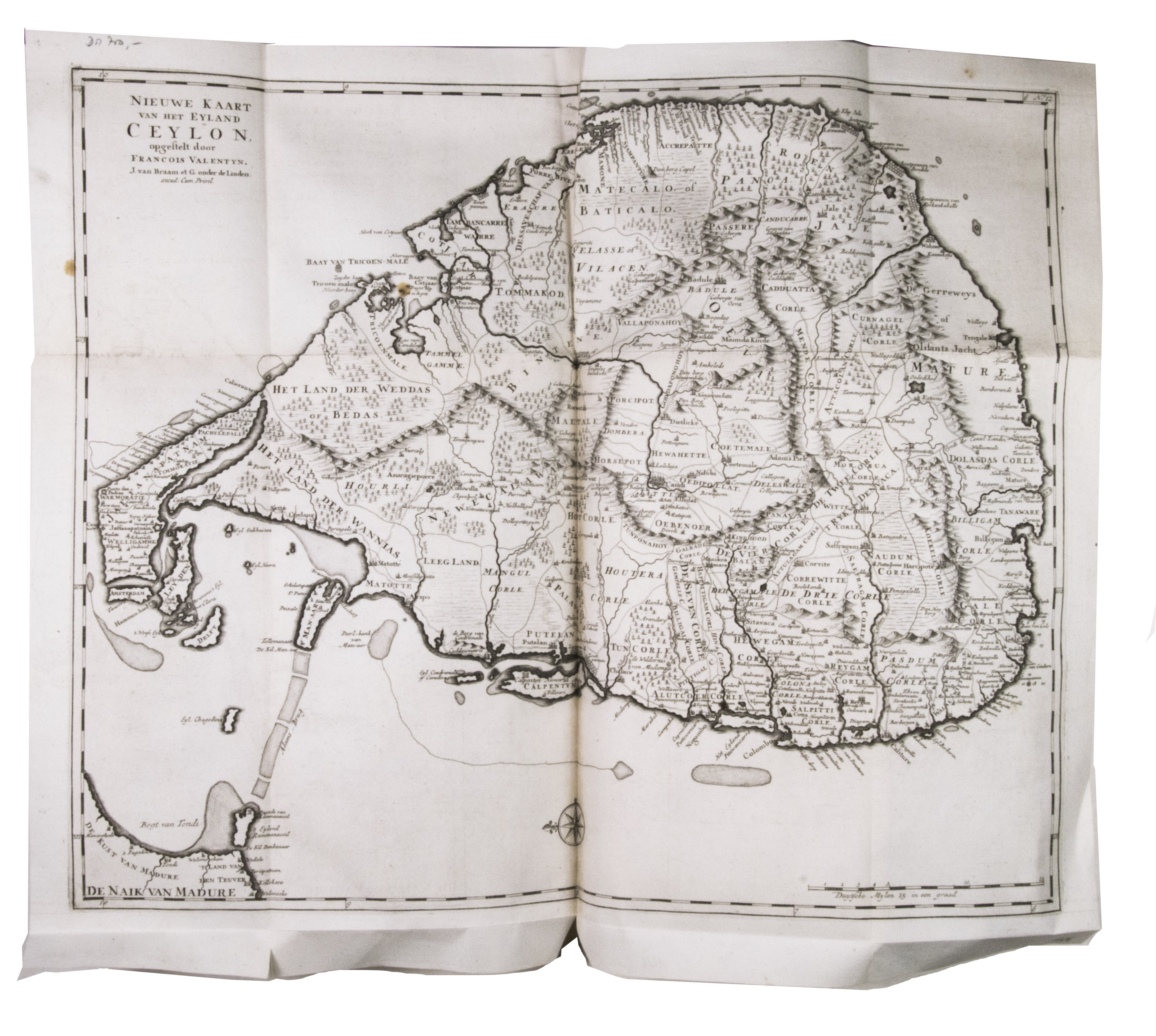
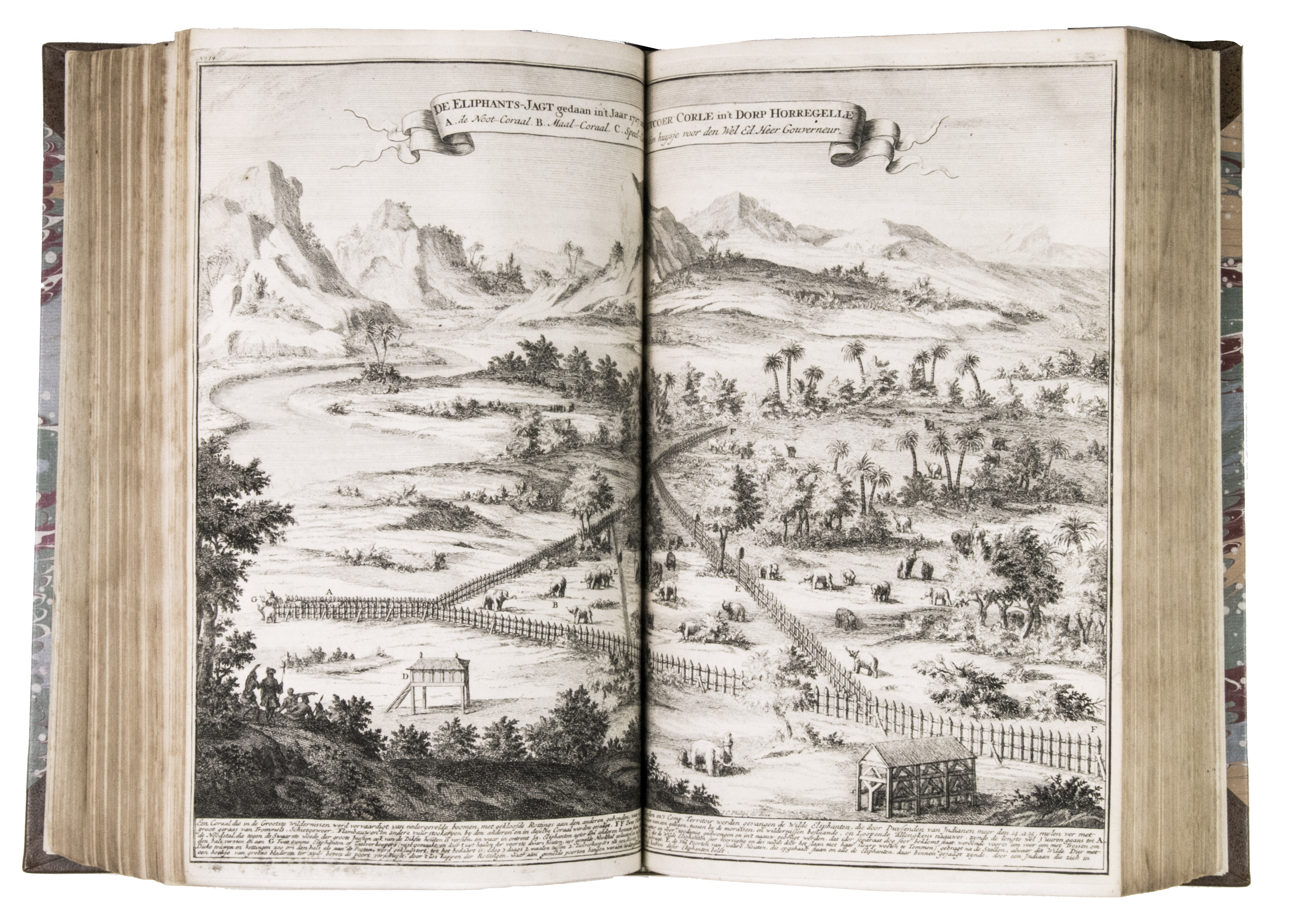
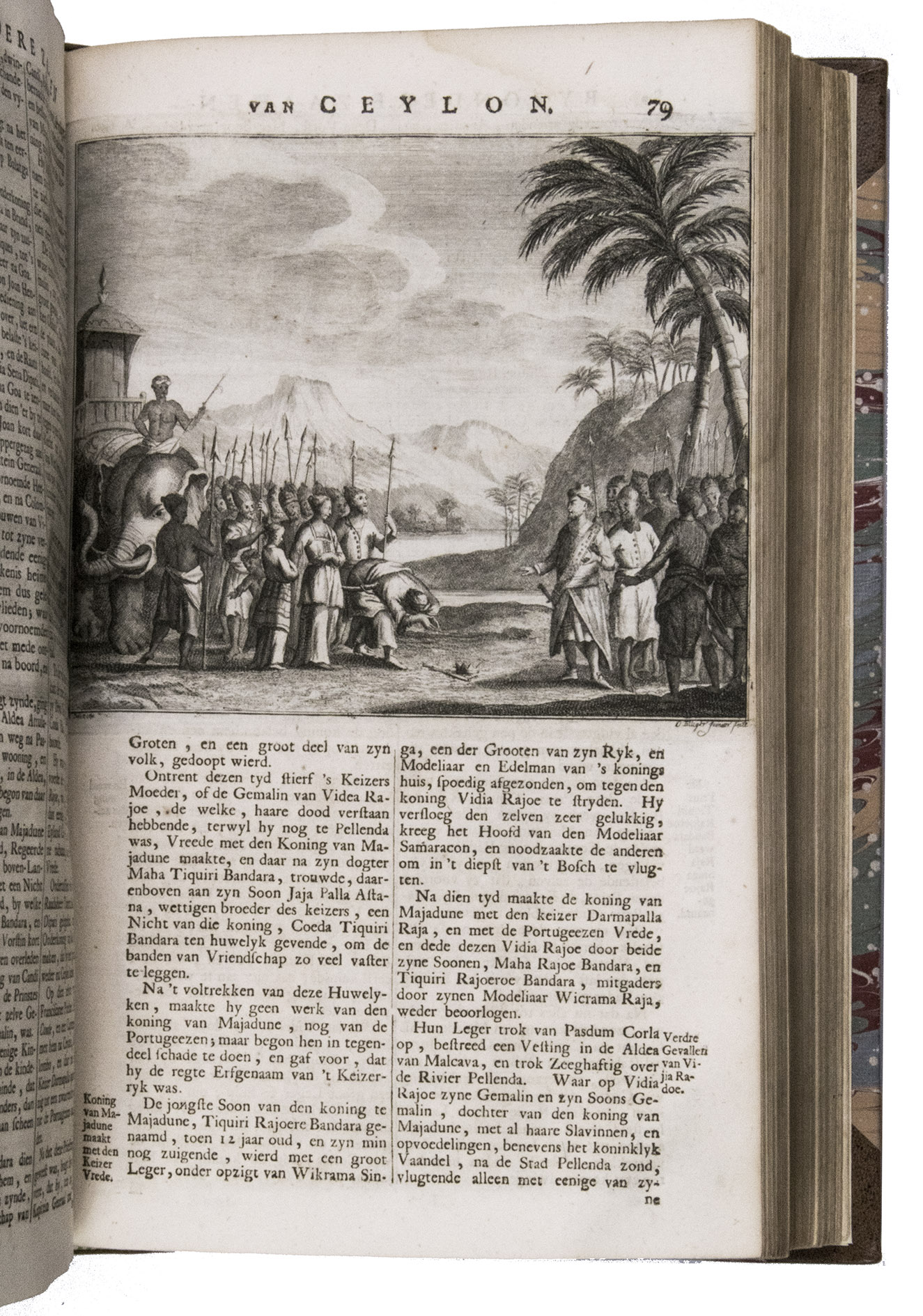
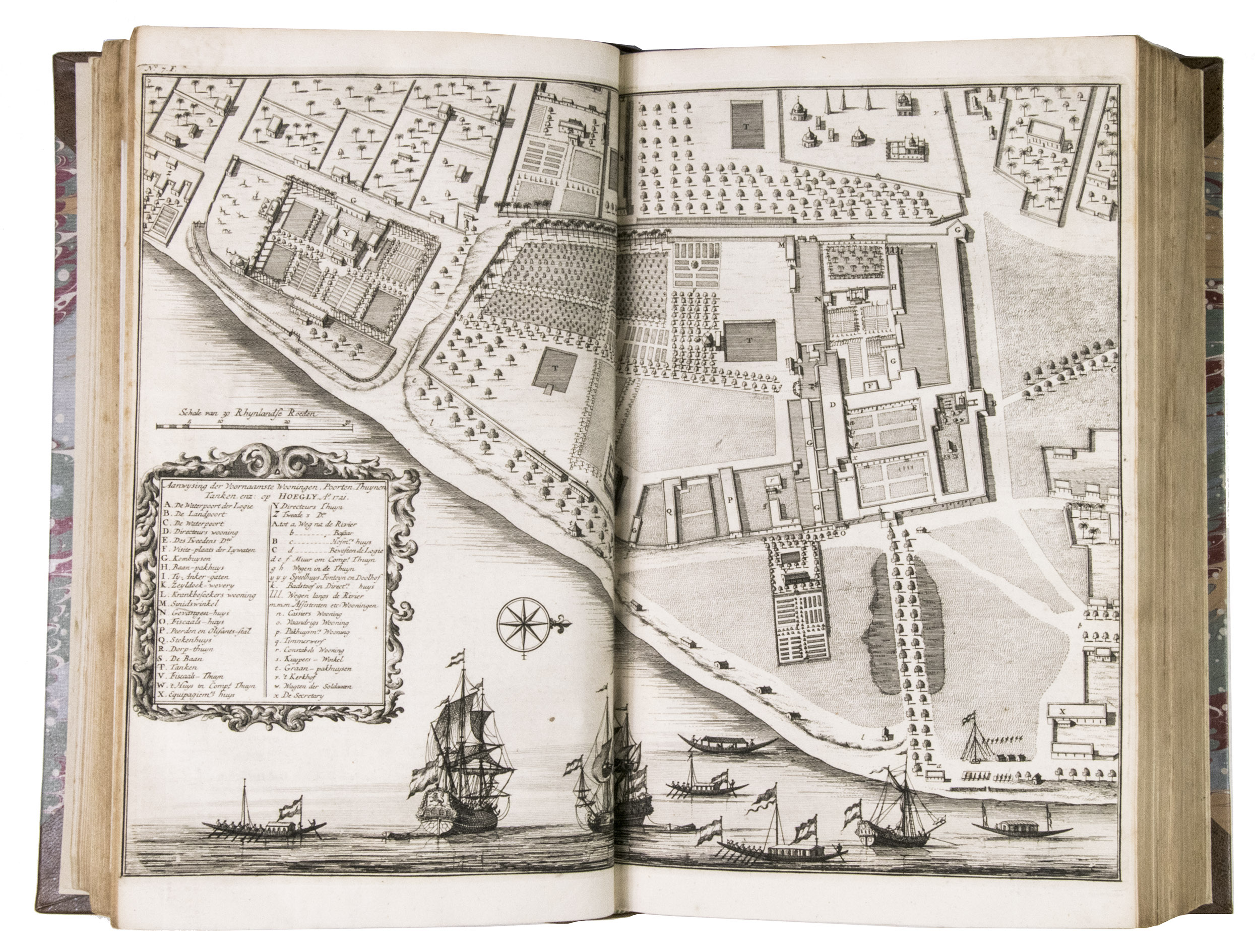
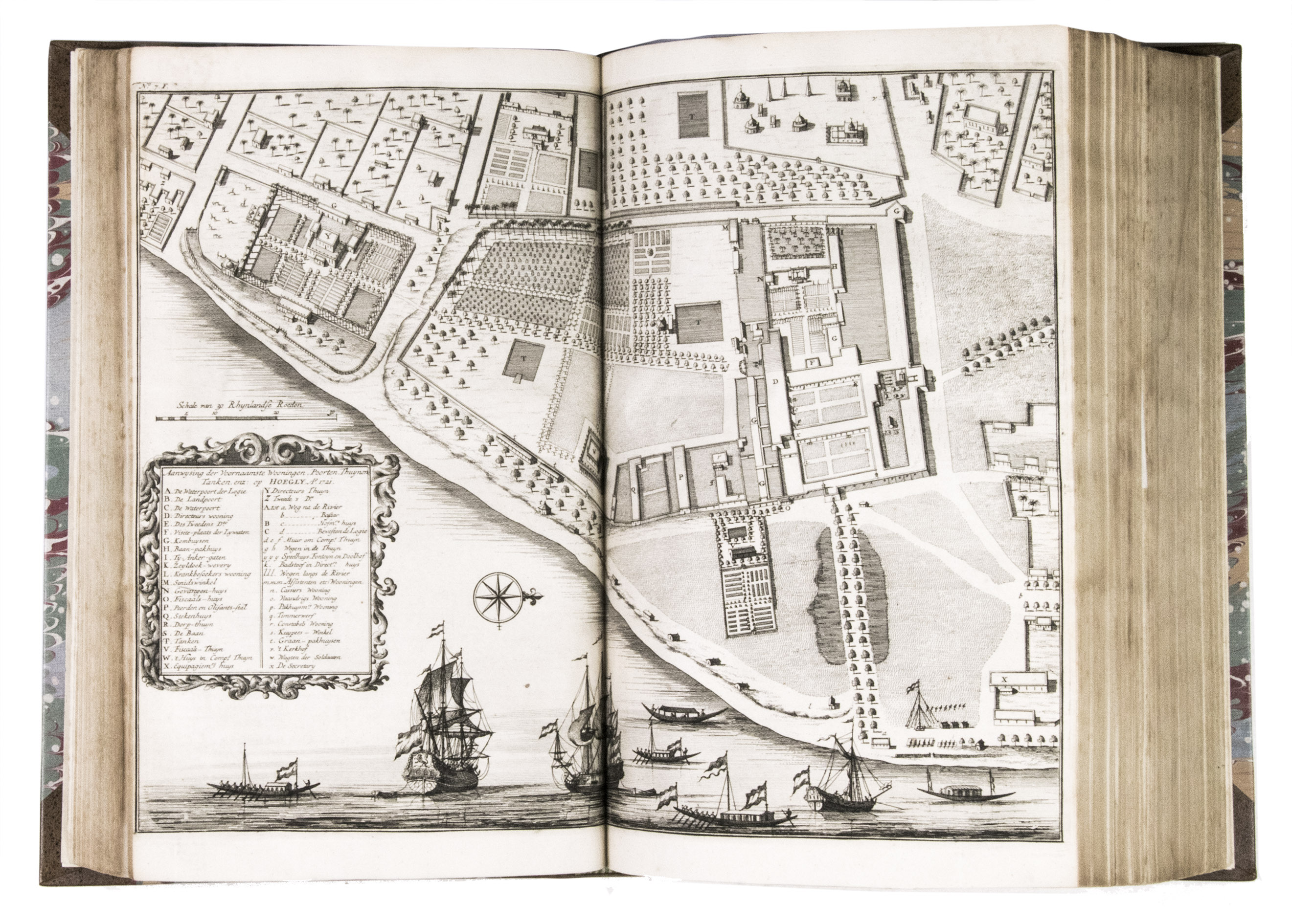
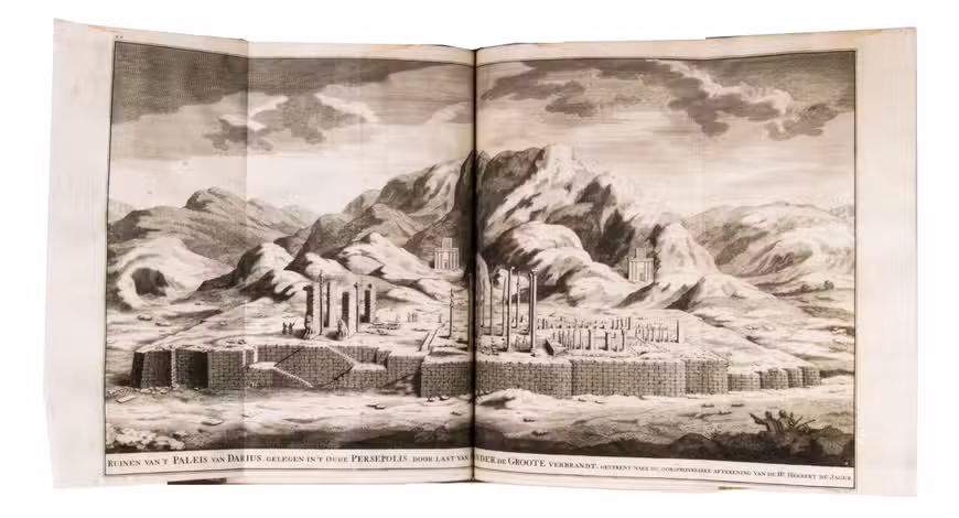
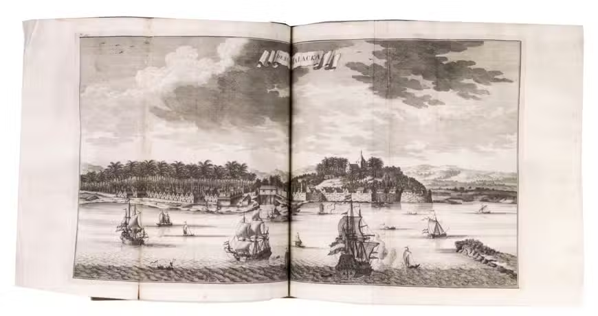
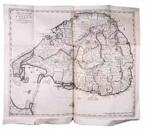
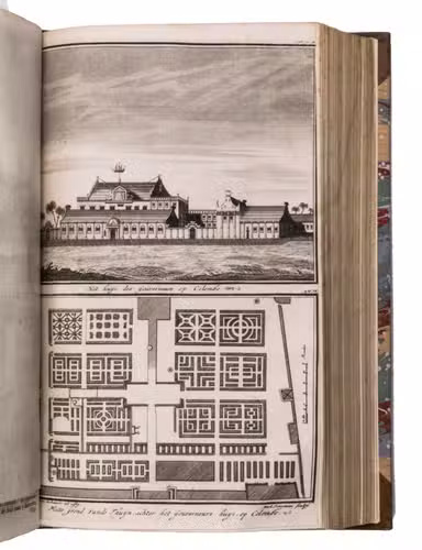
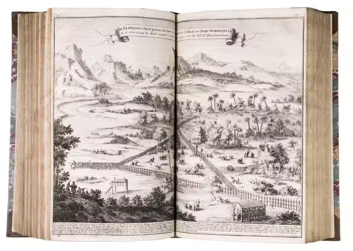
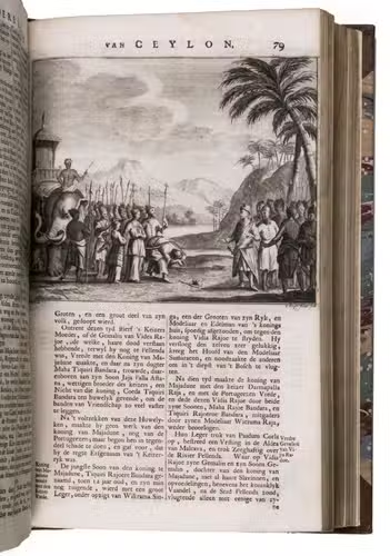
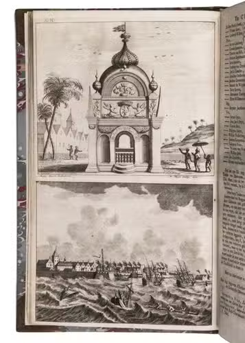
Descriptions of the Dutch settlements in Persia, Malaya and Sumatra. And an extensive geographical report of Ceylon. This last part contains reprints of many original documents. With 24 plates, maps and views and 10 small text illustrations.
VIII (Part V, 2):
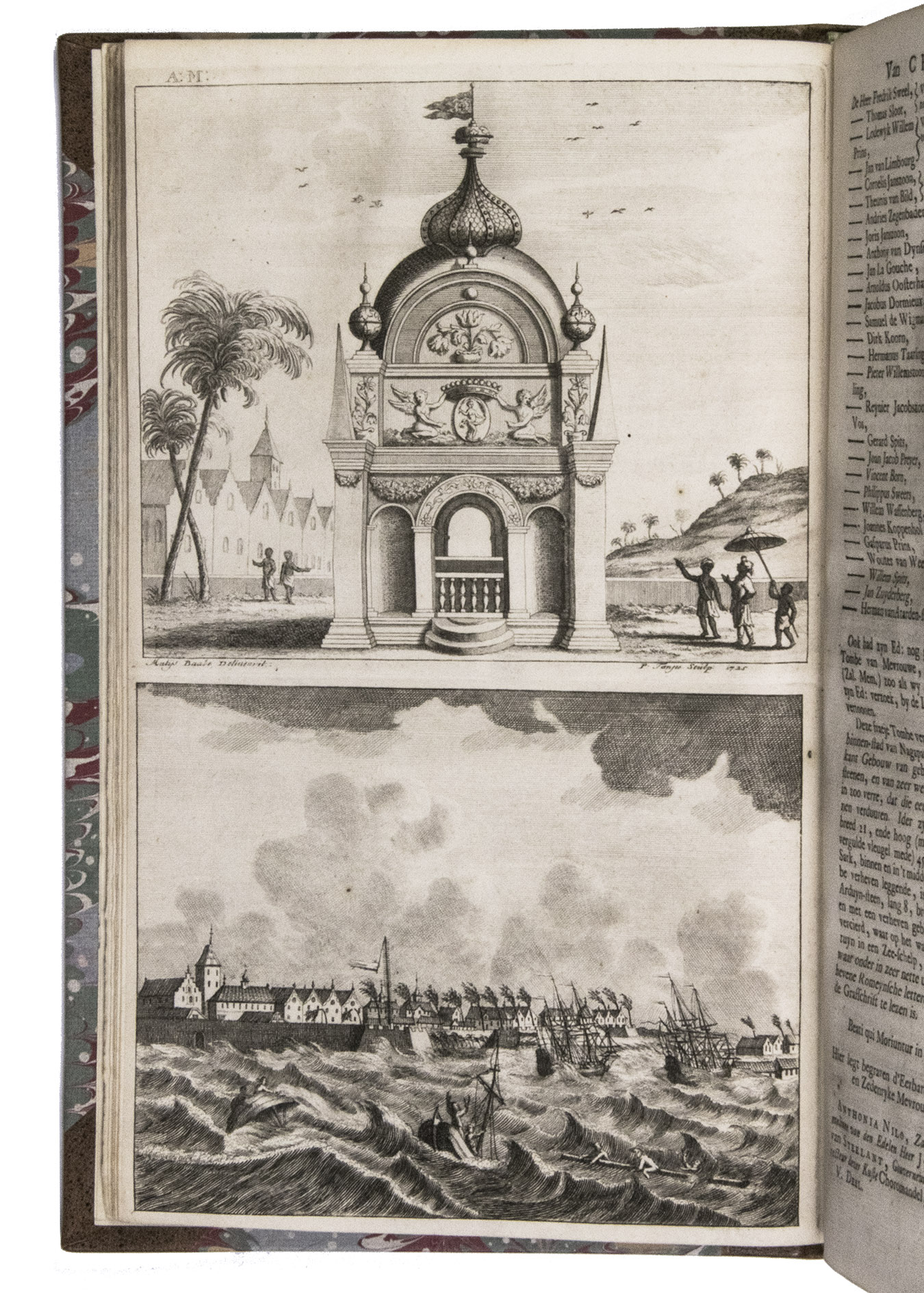
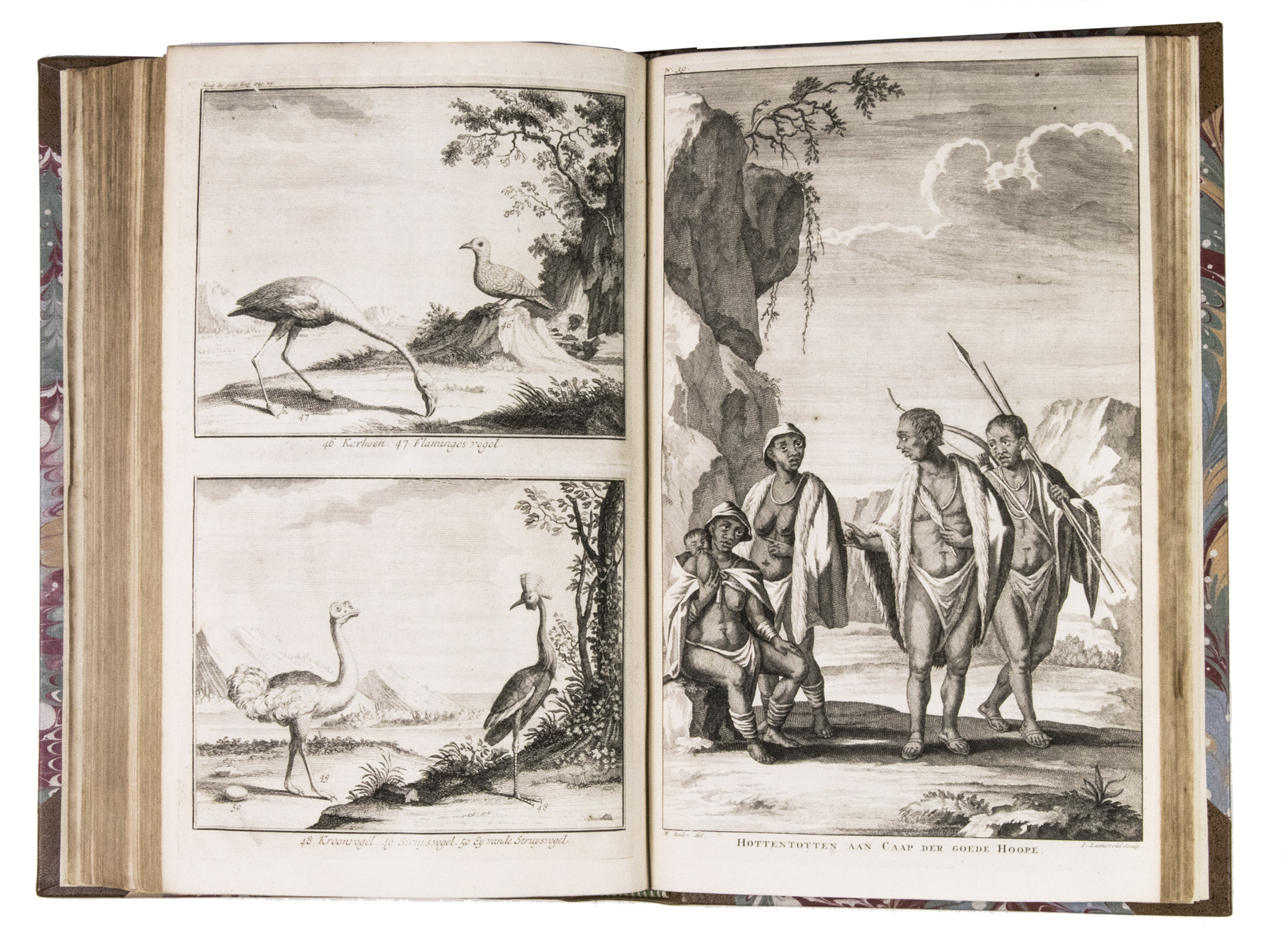
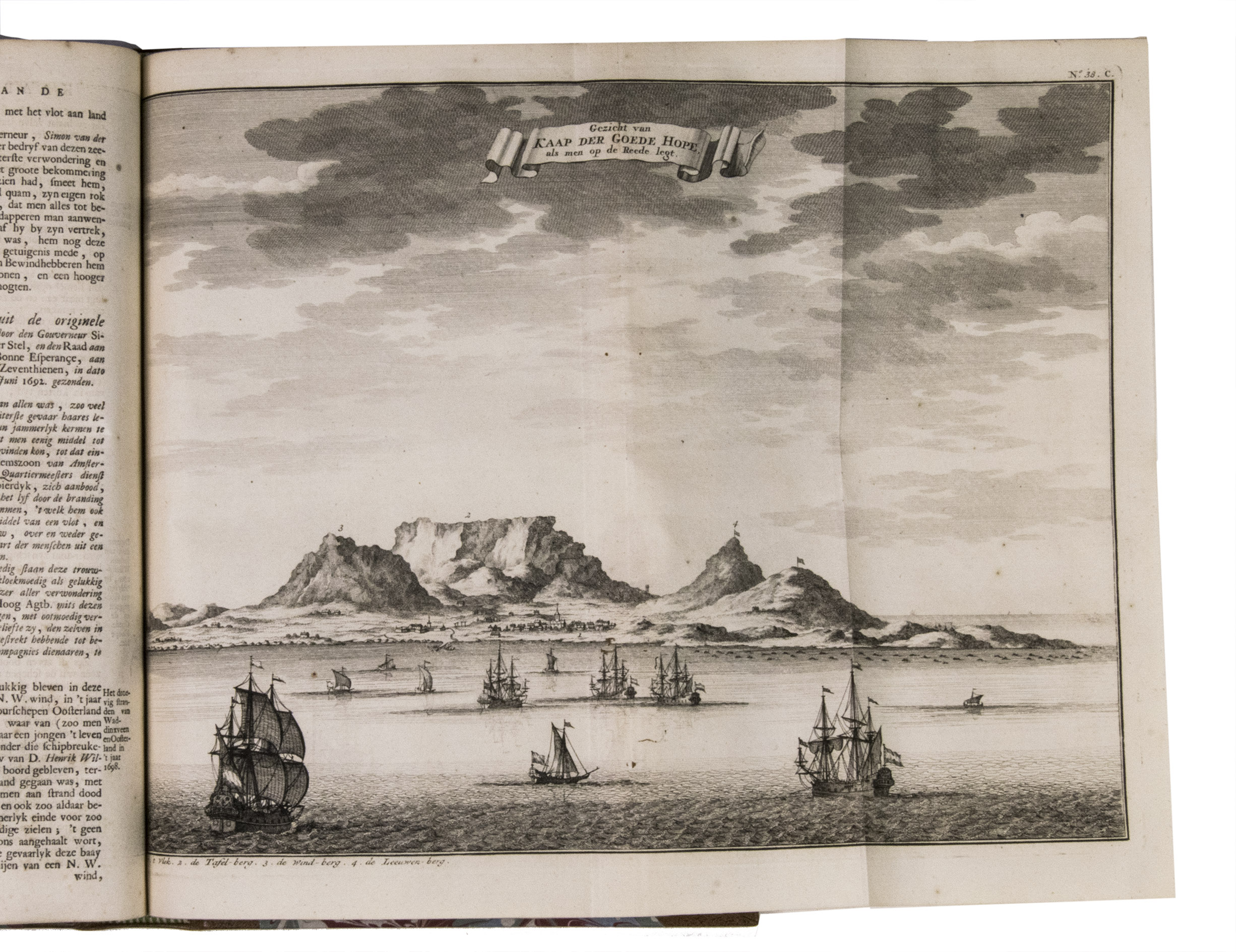
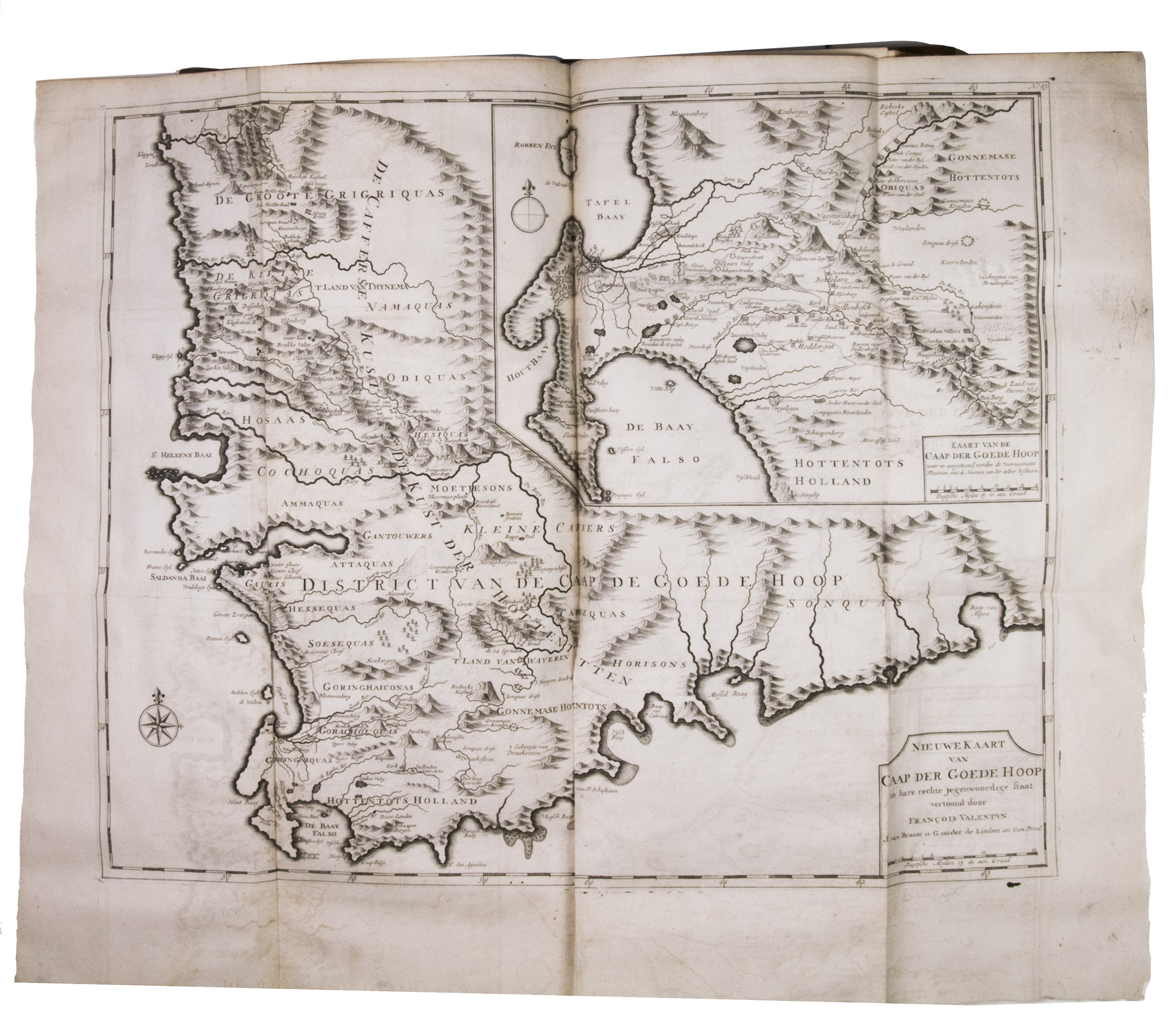
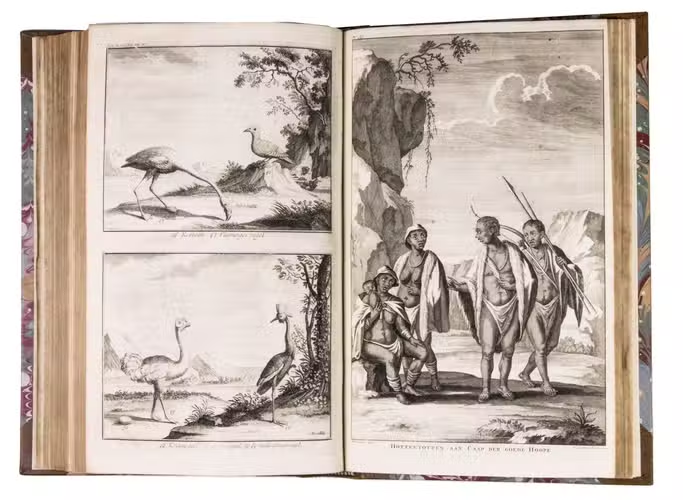
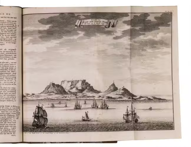
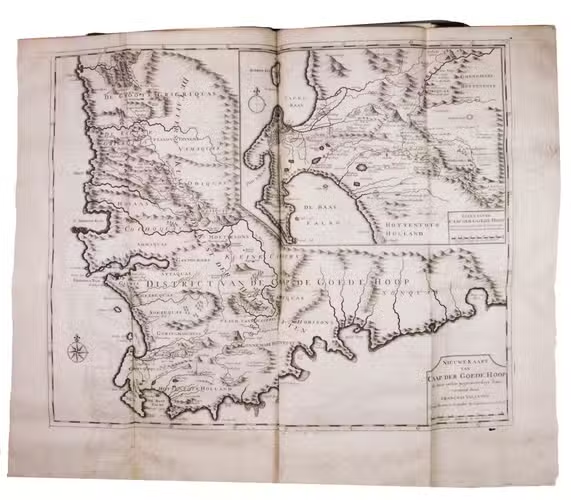
- Descriptions of Malabar, Japan and the Cape of Good Hope, with a list of VOC employees. These accounts give early and very detailed descriptions of the mentioned regions in the far east and southern parts of the Atlantic Ocean around South Africa and Mauritius. With 19 maps, views and other plates and 10 text illustrations.
Amboina is described with special devotion and detail is explained by the fact that the author, Franciscus Valentijn (1666-1727), lived at Amboina during almost his whole period of service in the VOC as a minister of the church. He served 2 periods from 1684 till 1695 and from 1705 till 1714 and resided at Amboina fro 1686 till 1694 and from 1707 till 1712.
Fine copy of a most important work, rarely found complete, with 2 extra plates in part IV, 1. Tiele 1121; Cat. NHSM 502; Cordier, Japonica, 426-428; Cordier, Indosinica, 927-930; Landwehr, VOC, 467.
Related Subjects: