VIANNA, Manoel José.
[Manuscript portolan chart of the Atlantic Ocean, including Western Europe, South America, and West Africa].
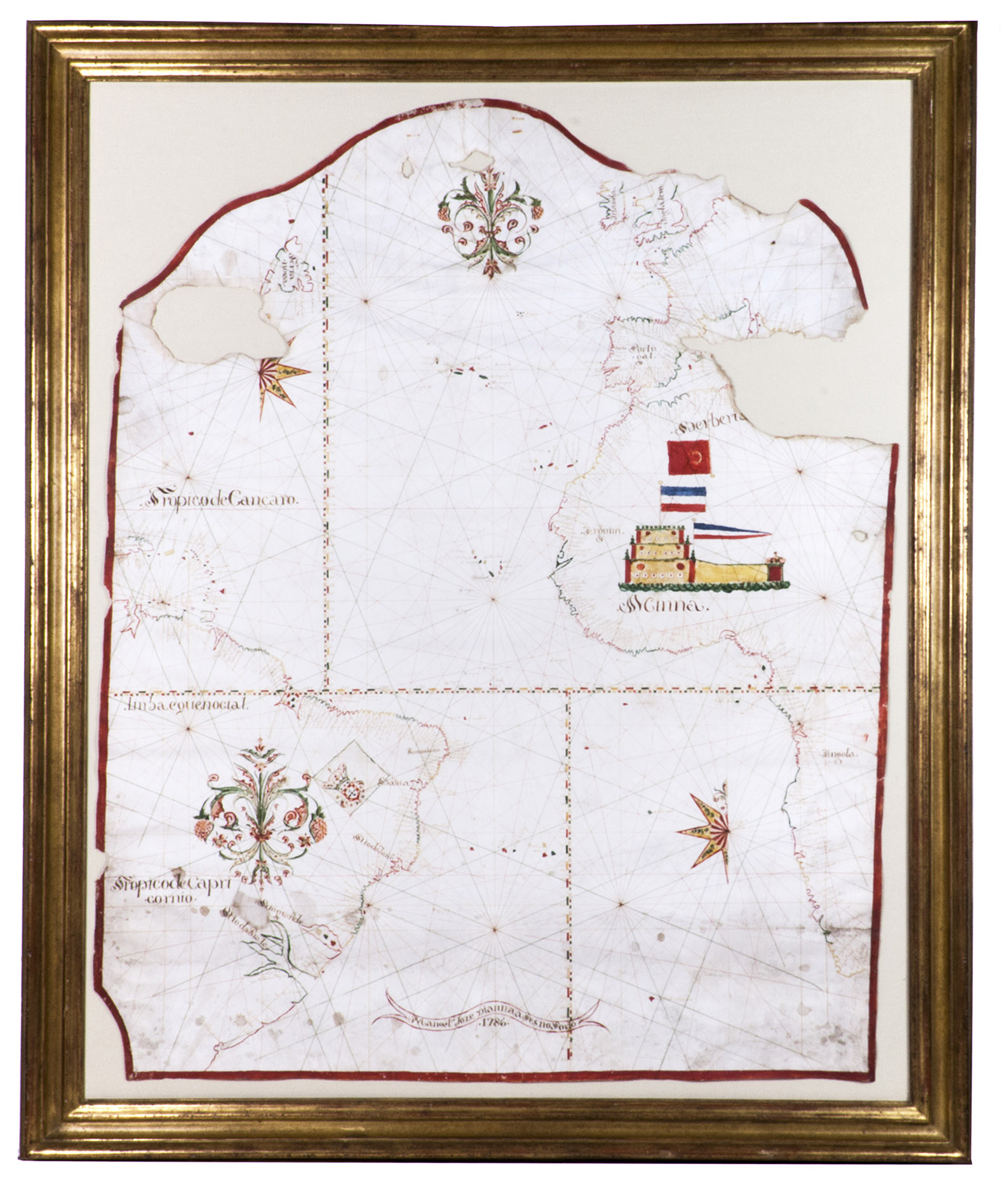
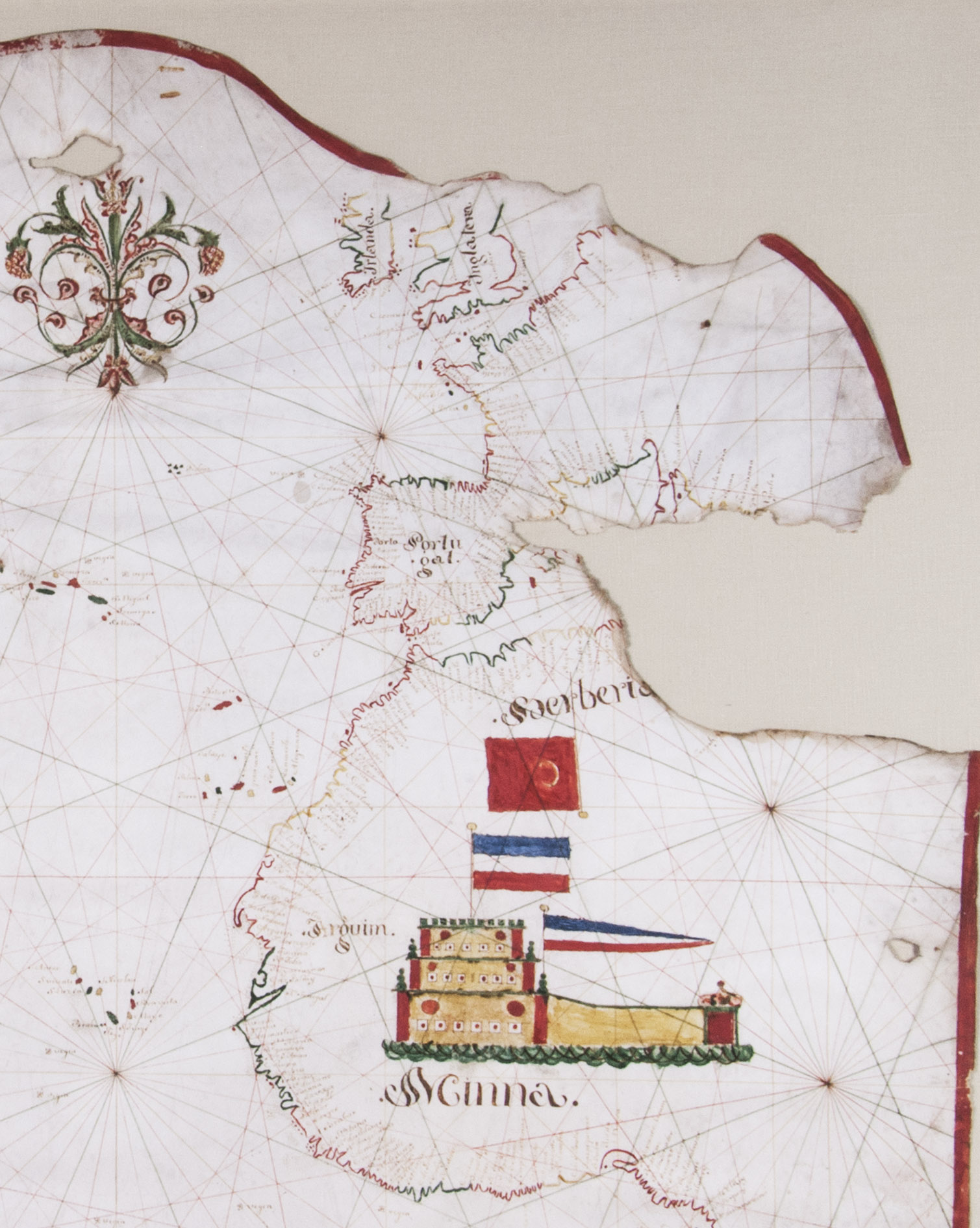
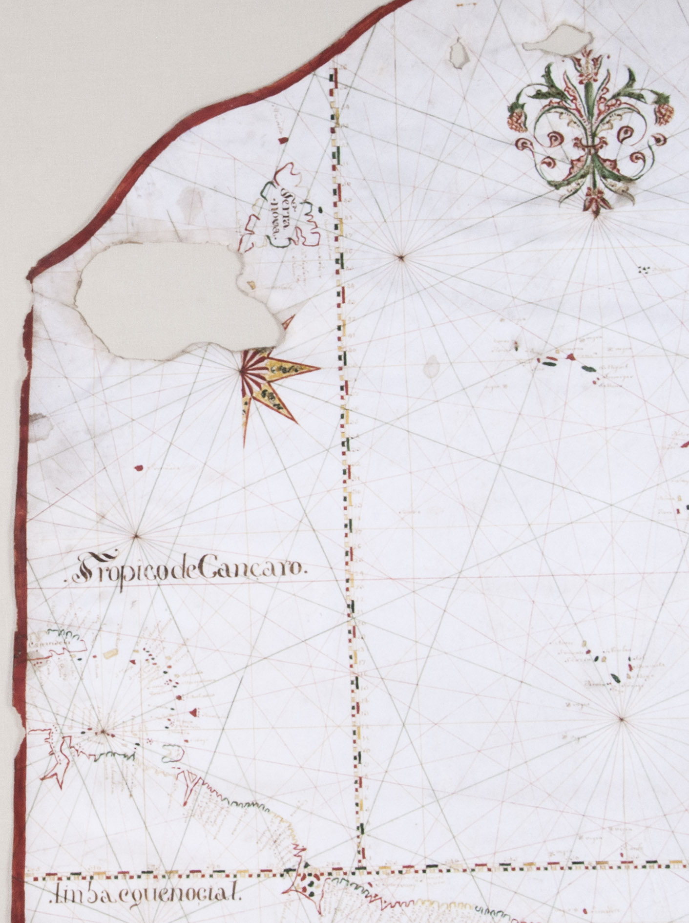
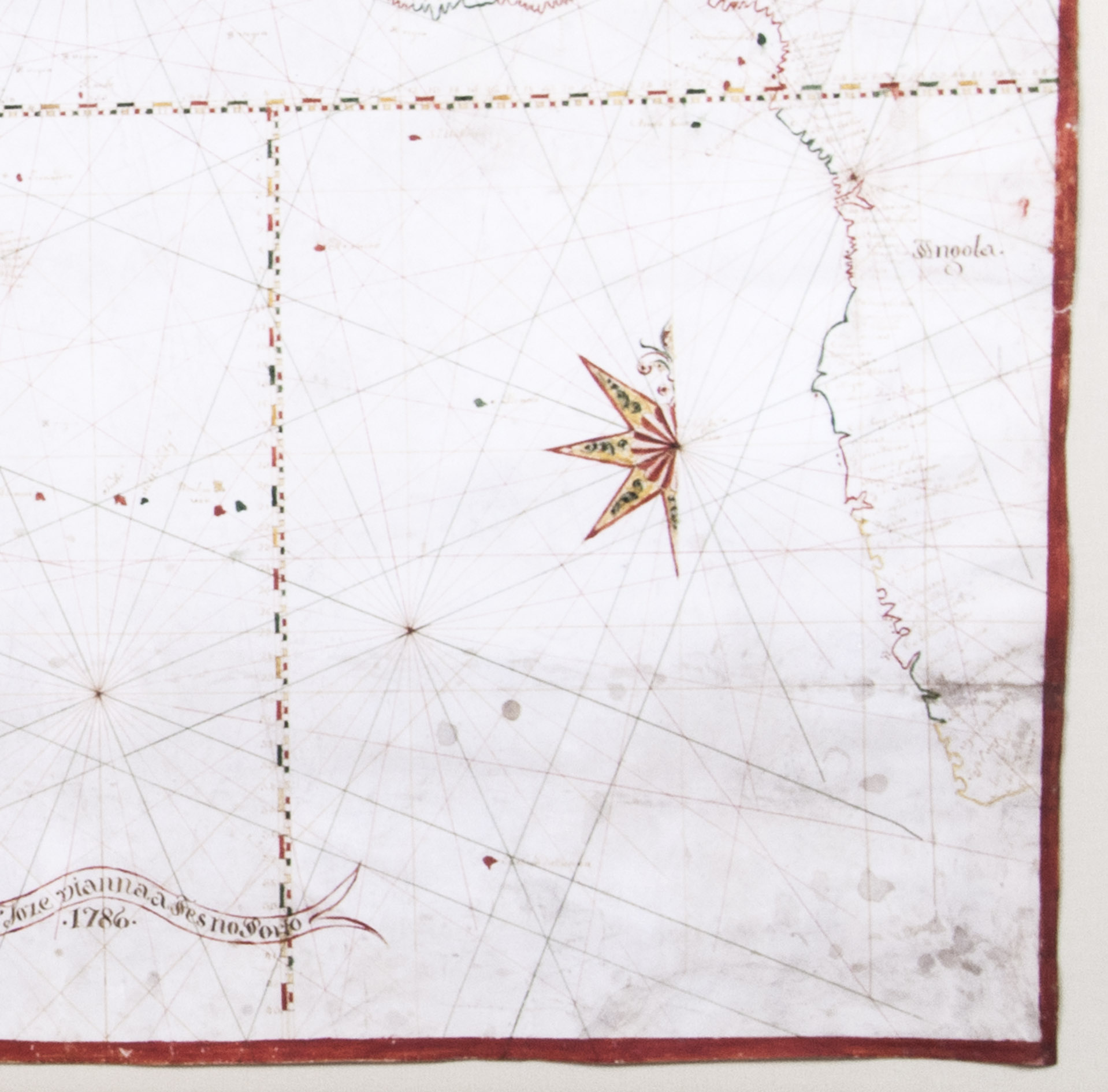
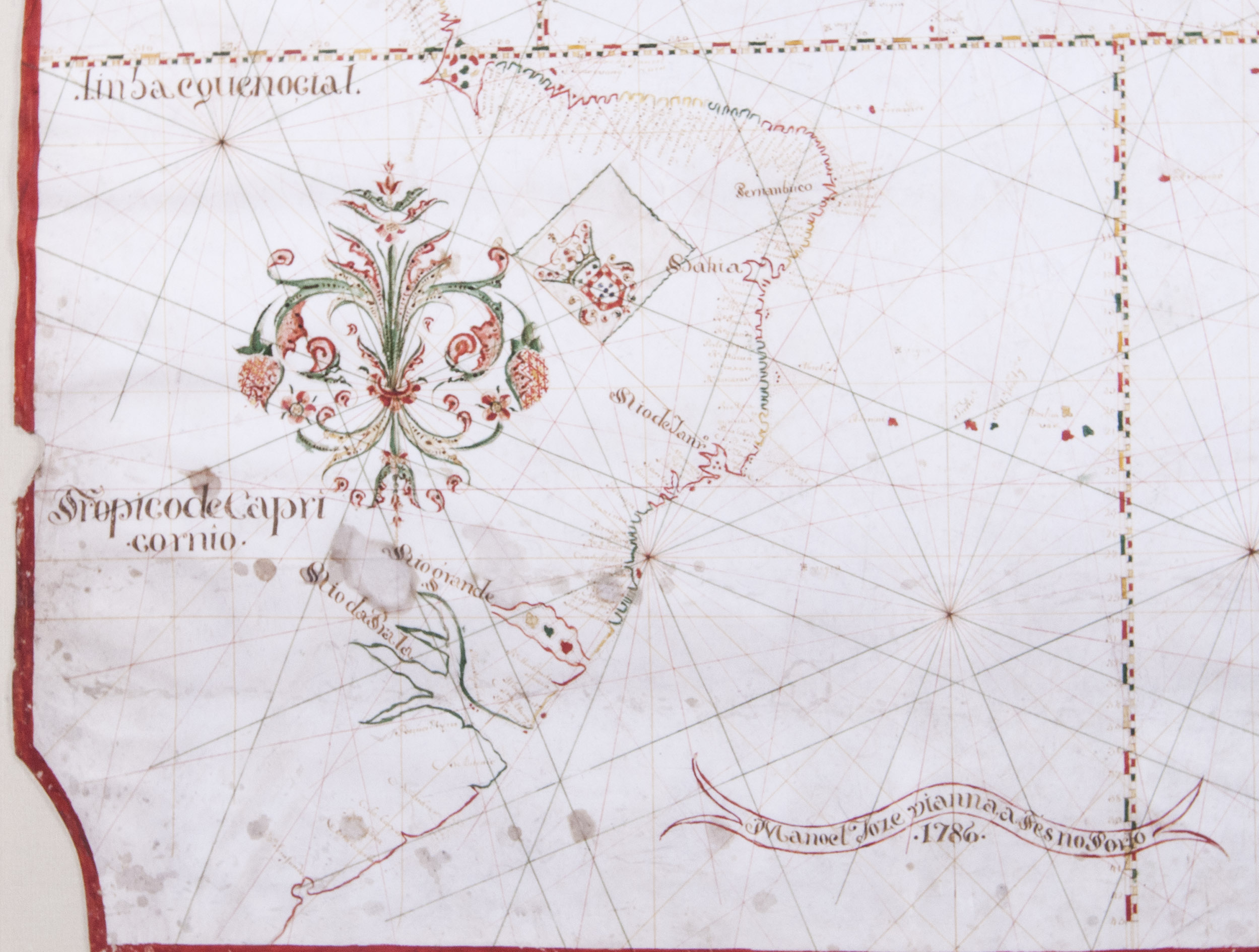
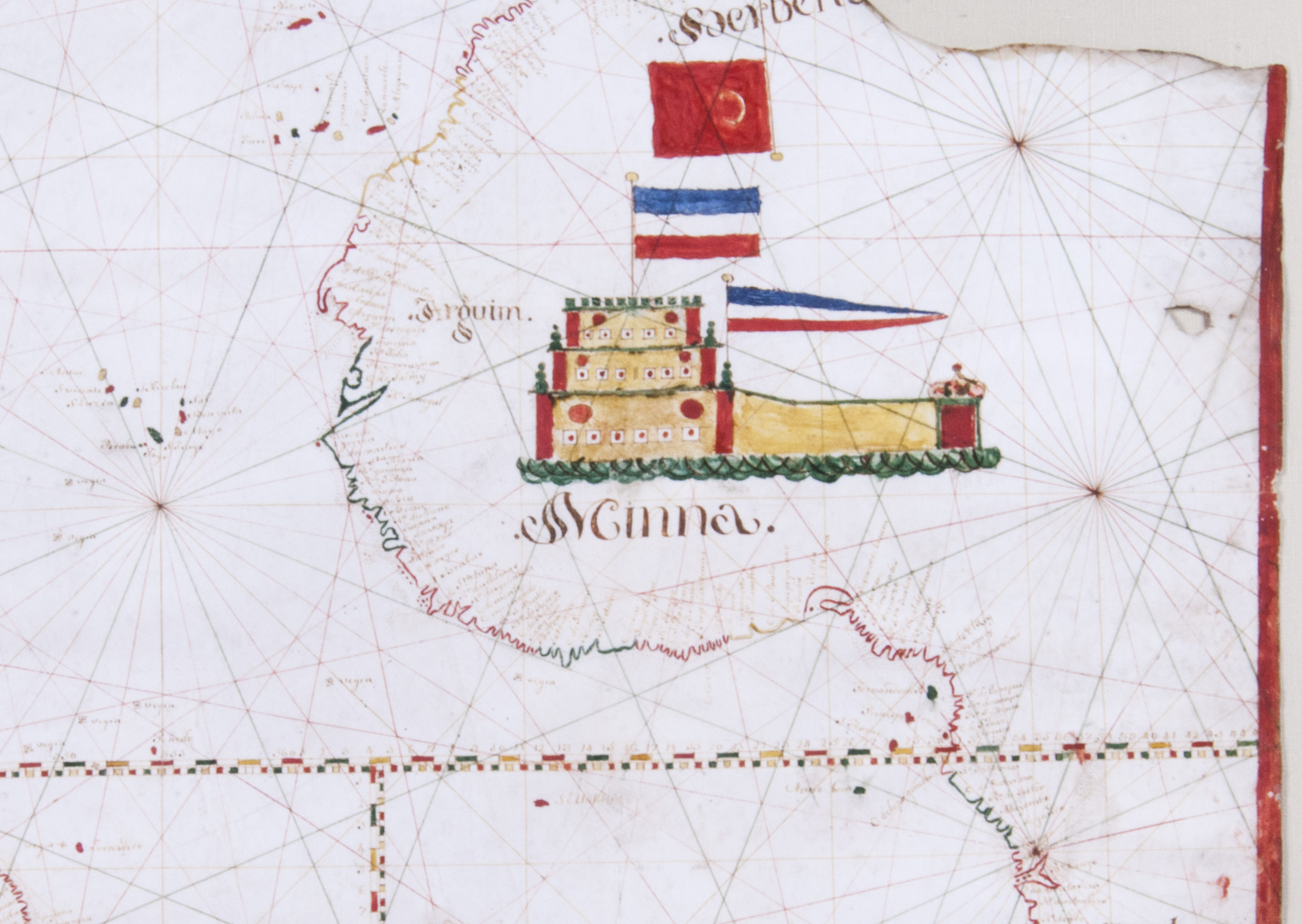
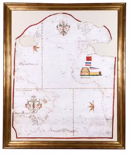
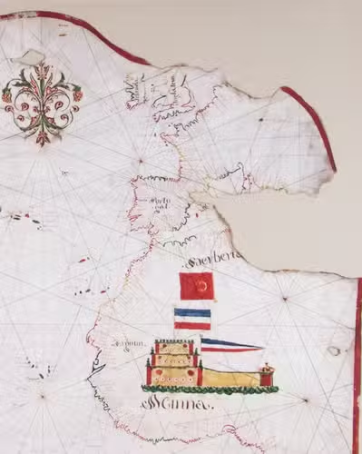
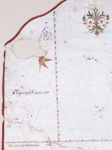
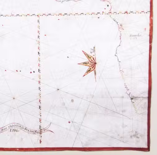
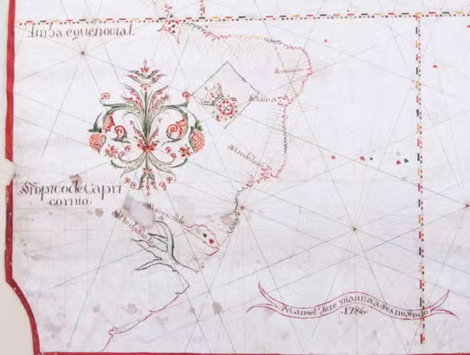
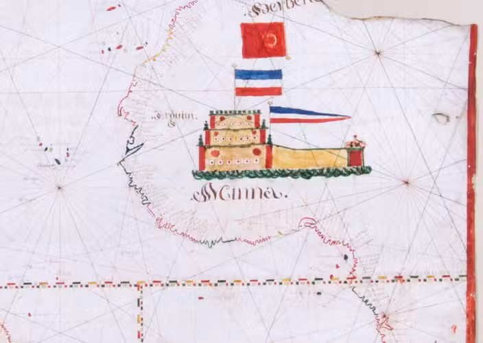
Porto, 1786. Chart ca. 86 x 68 cm; frame ca. 101 x 83.5 cm. Detailed manuscript portolan chart in ink and paint and/or ink wash in green, yellow, red, and brown on vellum. The chart is drawn within a red washed border and shows the detailed coastlines of the east coast of South America, the west coast of Africa, and the west coast of northwest Europe up to the Netherlands and including Great Britain and Ireland. The coasts are drawn in sections alternatingly in yellow, green, and red ink. Principal regions are added in large decorative script, coastal towns, cities, and capes are added in a small cursive hand. Also depicted are a detailed split graticule indicating longitude and latitude, intricate rhumb lines, islands, dangerous rocky outcrops (marked vegia (= vigia, meaning lookouts)), and inshore shoals. Further decorative elements in the chart are the flags in Brazil (Portuguese coat-of-arms), Algeria (Ottoman Empire?), and West Africa (Dutch flag, upside down); the side view of Elmina Castle in west Africa, two half wind roses, elaborate rococo floral (fleur-de-lis) ornaments at the head of the chart and in South America. The banderole at the bottom of the chart contains the following text: "Manoel Joze Vianna a Fes no Porto" and below the year of production "1786". Framed in a gold-coloured frame and mounted on a cream cloth covered backboard.
€ 135,000
A very unusual and highly decorative late 18th century Portuguese manuscript chart, showing the Portuguese Empire on both sides of the Atlantic. On the left is colonial Brazil, the map listing more than 100 places along the Brazilian coast up to the Caribbean, including the following prominently marked places: Pernambuco, Bahia, Rio de Janeiro, Rio Grande (do Sul) and "Rio da Prata" (Rio de la Plata). On the right side of the map Western Europe can be found, with the Iberian Peninsula, marked "Portugal", and the western coast of Africa. Here, more than 270 places are listed, including the following prominently marked places: "Arguim" (Arguin in Mauritania) and "Minna" (Elmina Castle in Ghana), the latter drawn on a large scale in Western Africa and adorned with two Dutch flags (both shown upside down). This fortress, known as Castelo de São Jorge da Mina (St. George of the Mine Castle), was built in 1482 by the Portuguese as a trading post for the Guinea trade. It was captured by the Dutch in 1637 and they reconstructed the castle in 1770-1775. It became one of the most important stops along the main routes of the Atlantic slave trade, continued under the Dutch until ca. 1814. Above the Dutch flags, a red flag with a white crescent moon (most likely of the Ottoman Empire) is shown upside down for compositional reasons, placing its flagpole in "Berberia" (Barbary). This coastal region of central and western North Africa played a main role in the Barbary slave trade, which lasted until the end of the 19th century.
The name of the draughtsman, "Manoel Joze Vianna" (or Manuel José Vianna, dates unknown), is written in a banderole at the bottom of this chart together with the year of its production "1786". Although already archaic in its concept at the time of its creation, this chart is a statement of Portuguese interests in the world, particularly in Brazil. The draughtsmanship is skilled and accomplished, and the chart was probably commissioned by a prominent trader or noble family.
By 1786, when Vianna drew this map, Portugal was no longer a world power; its income from the American colonies had considerably diminished, and Portugal had begun a slow but inexorable decline that would last until the 20th century. Indeed, just a few decades after this map was made, in 1822, Brazil would declare its independence from Portugal, which contributed to a period of political chaos and civil war in the mother country.
Two small areas, the western Mediterranean and Nova Scotia, with water damage and loss; small section at upper neck similarly affected. A few light stains, one small hole and several abrasions to the margins. Otherwise in good condition.
Related Subjects:


")


