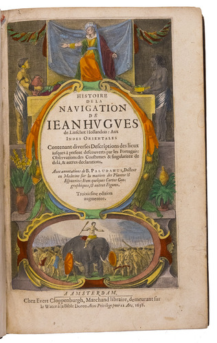
LINSCHOTEN, Jan Huyghen van.
Histoire de la navigation ... aux Indes Orientales ... Avec annotations de B. Paludanus, ... Troixiesme edition augmentee.
Including:
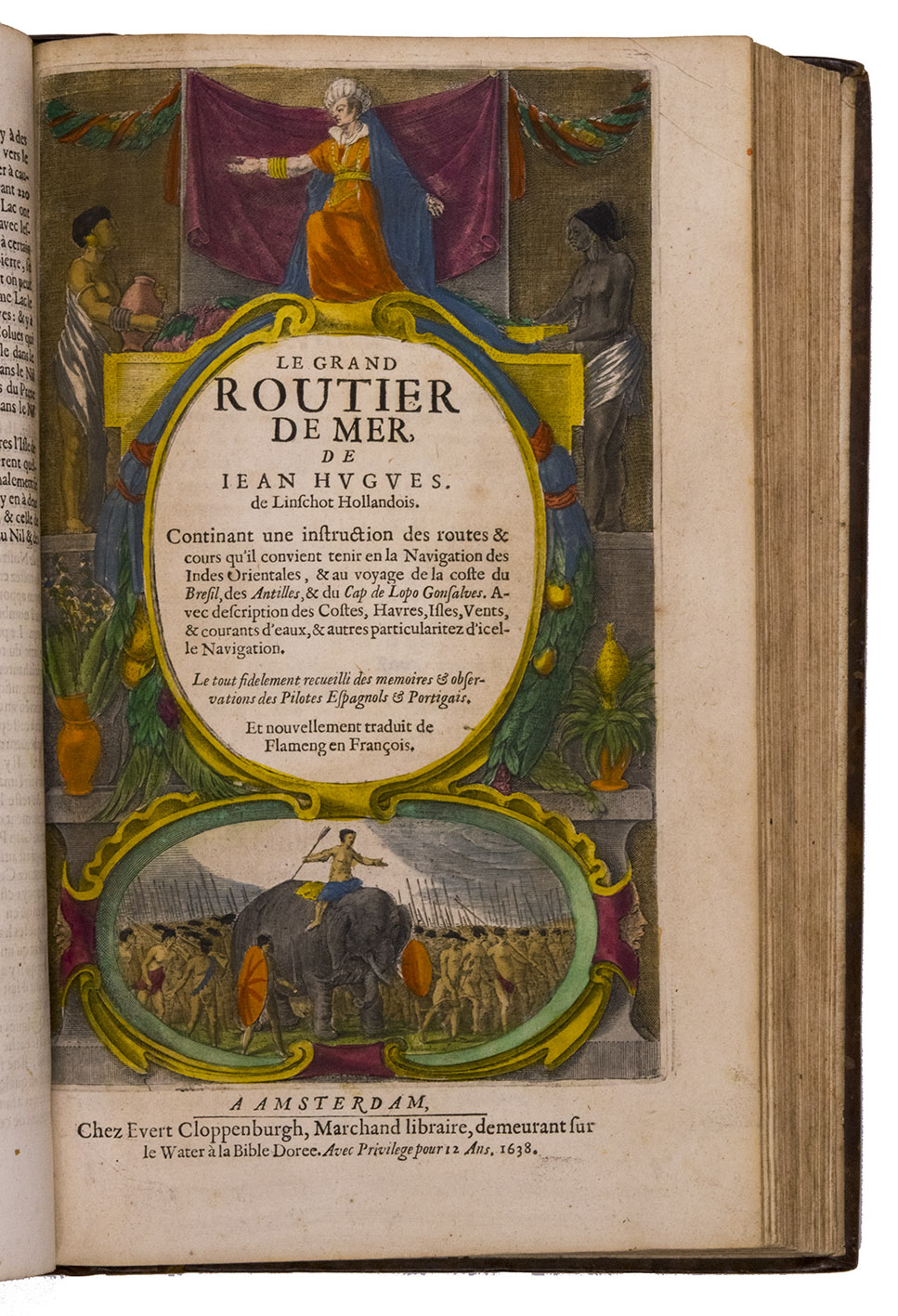
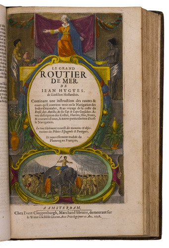
LINSCHOTEN, Jan Huyghen van. Le grand routier de mer, ...
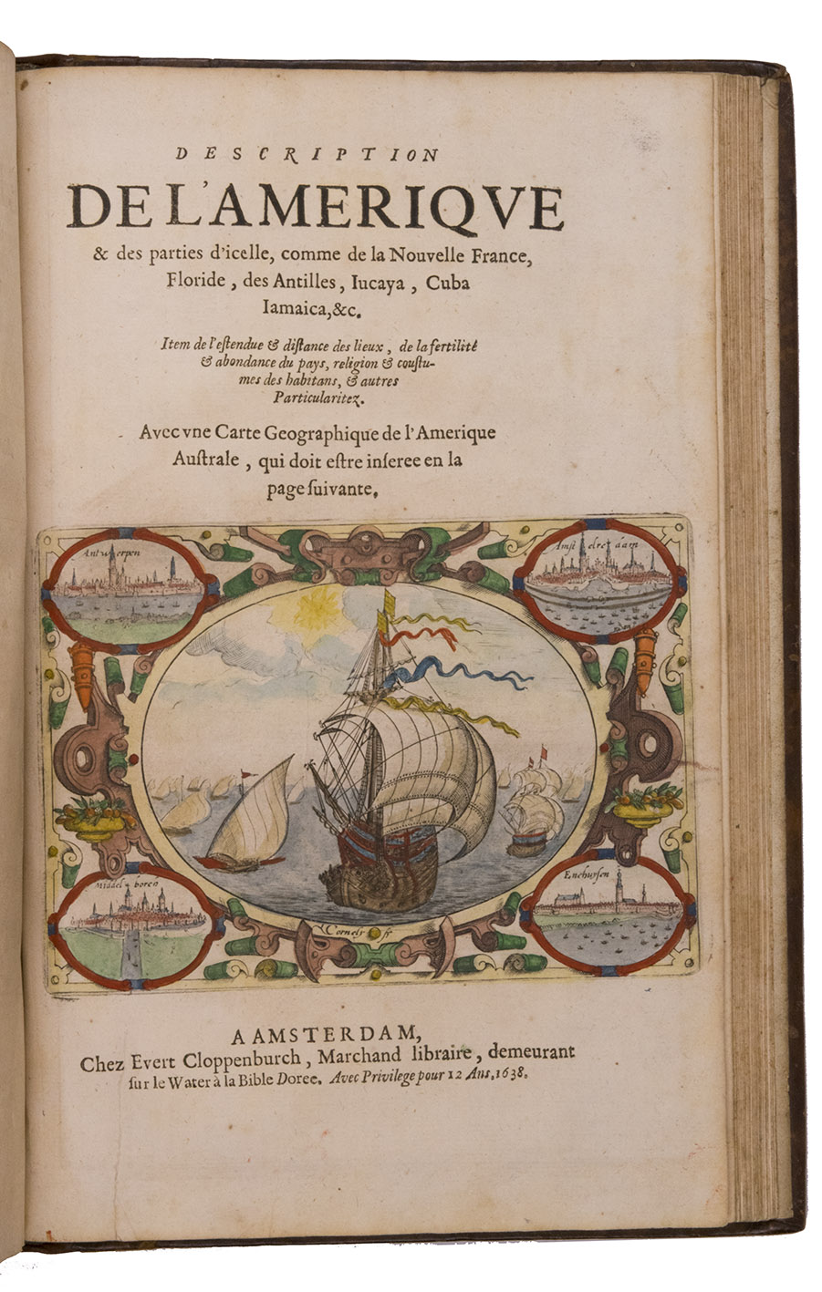
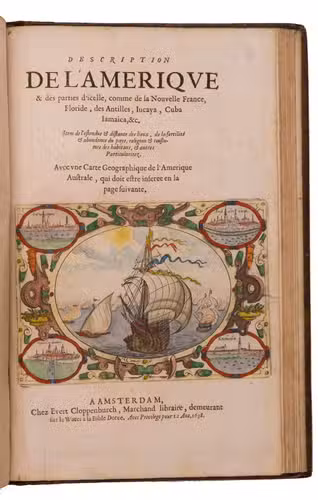
[LINSCHOTEN, Jan Huygen van]. Description de l'Amerique & des parties d'icelle, ...
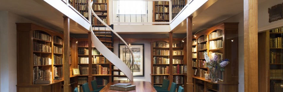
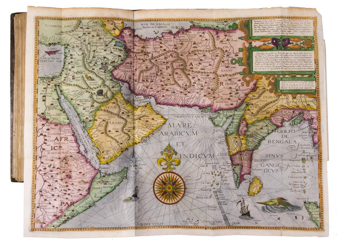
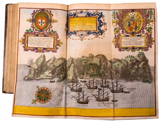
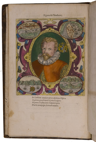
Amsterdam, Evert Cloppenburg, 1638. Folio (32.5 x 21 cm). With 3 title-pages (2 from the same full-page engraving and 1 letterpress with an engraving of a ship in a cartouche with 4 inset city views), a nearly full-page engraved portrait of the author in a cartouche with 4 inset views, 42 engraved plates including 6 maps (31 double-page & 11 larger folding). All plates coloured by a contemporary hand. Near contemporary mottled calf, gold-tooled spine. [8], 206 pp.; [4], 181, [1 blank]; [1], [1 blank], “86” [= 80], [2 blank] pp.
€ 275,000
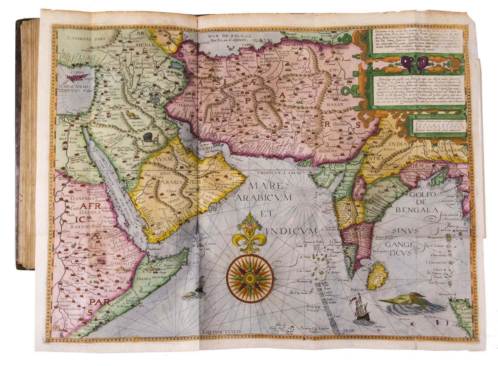
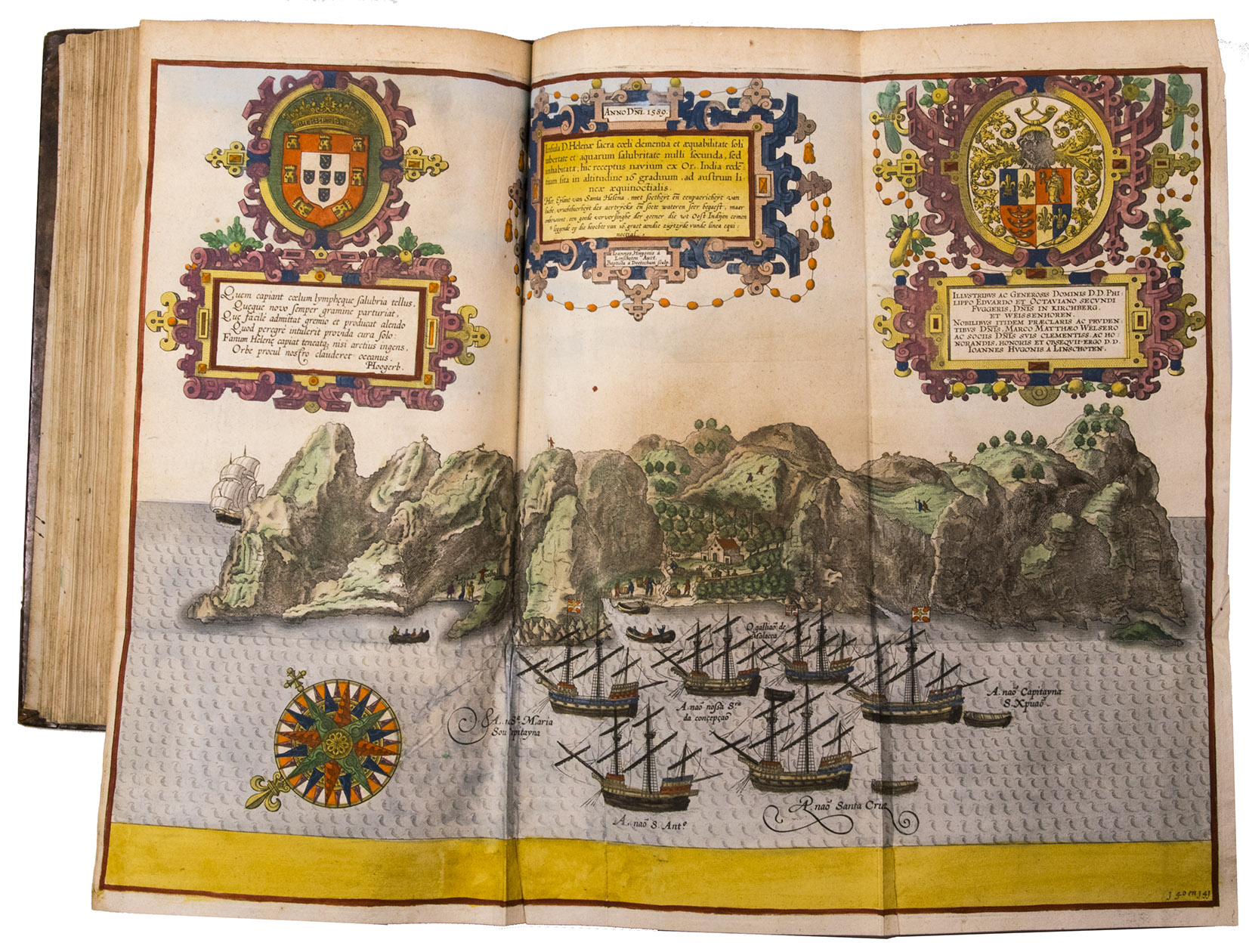
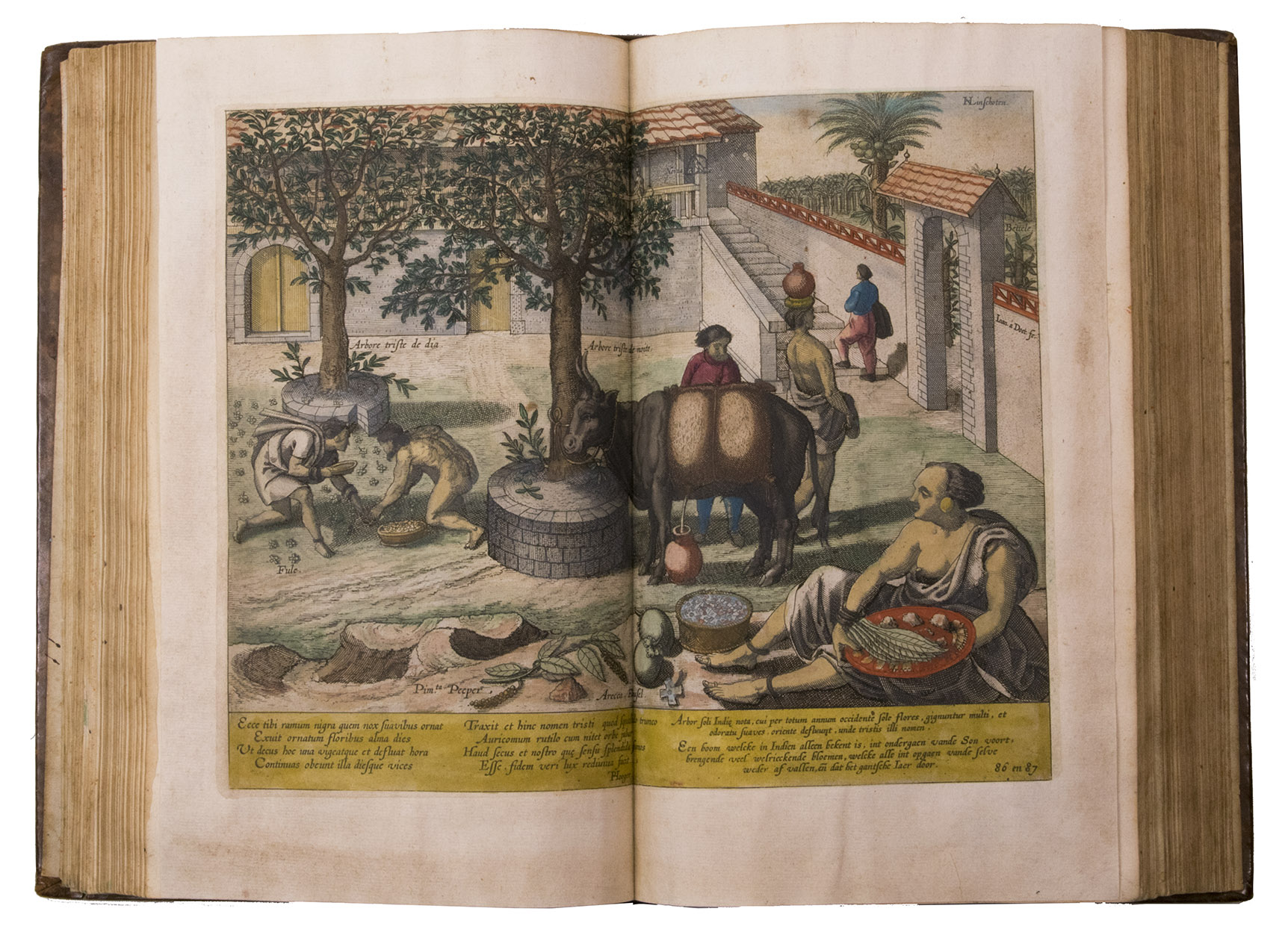
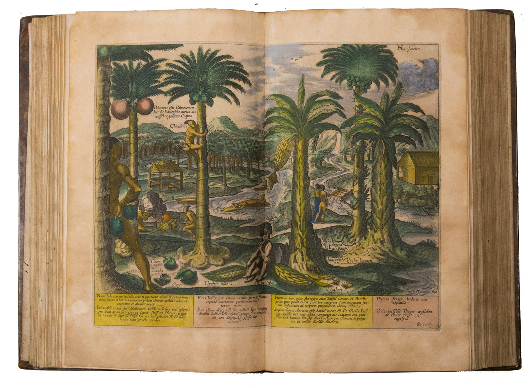
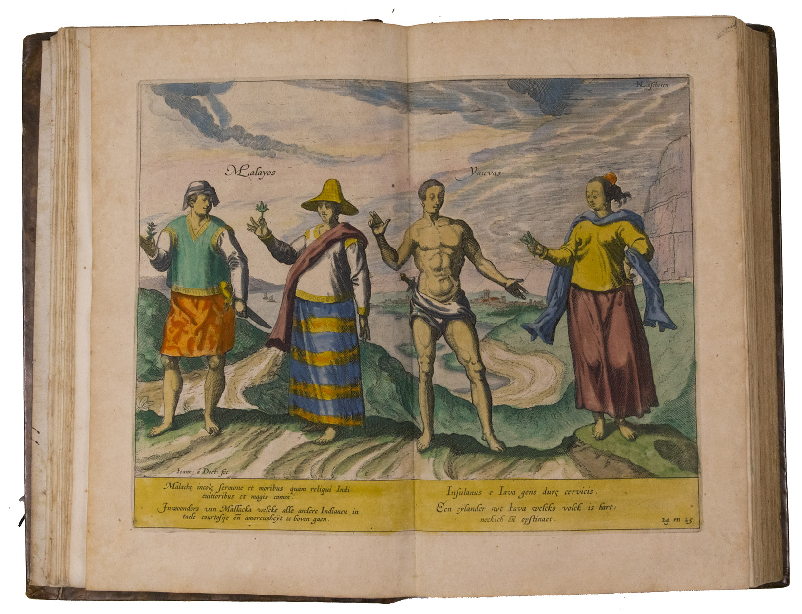
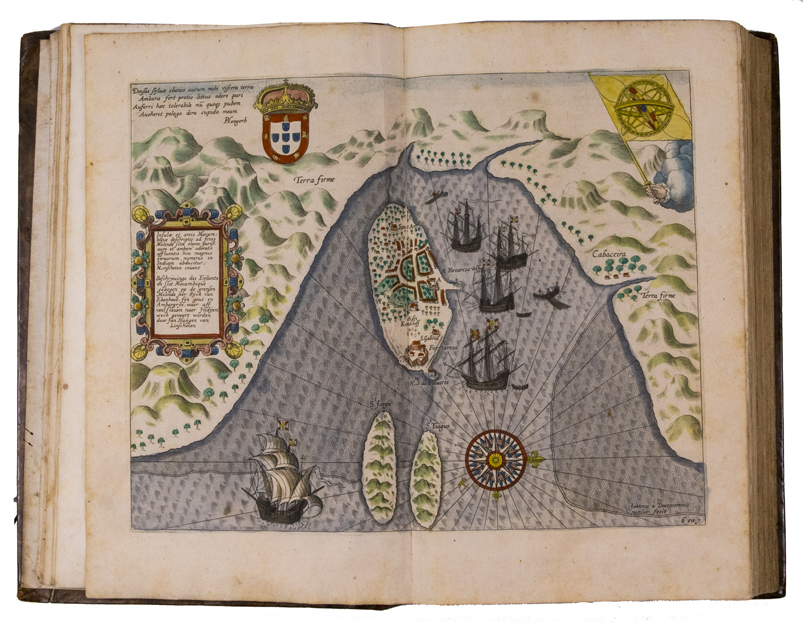
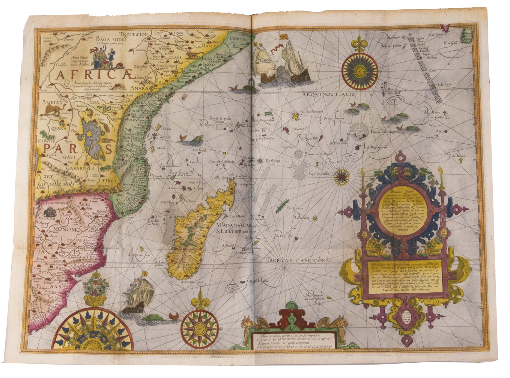
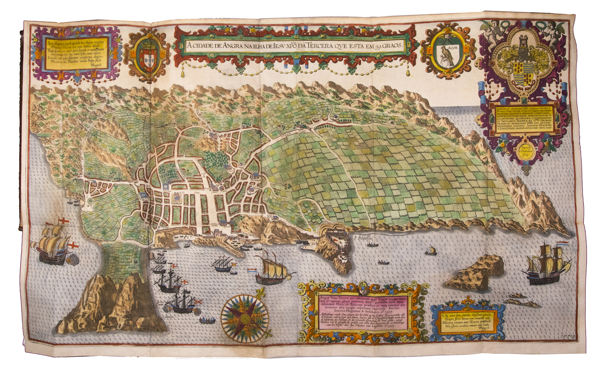
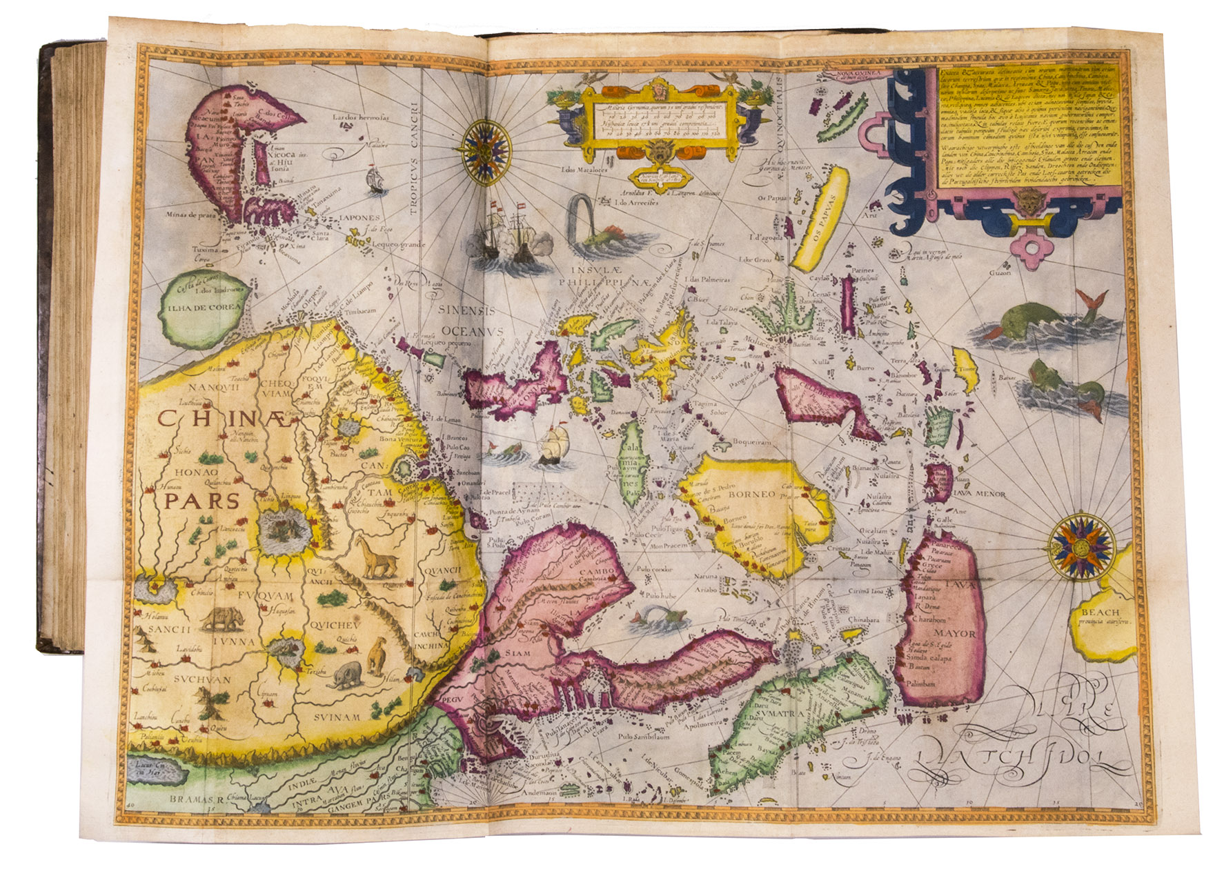
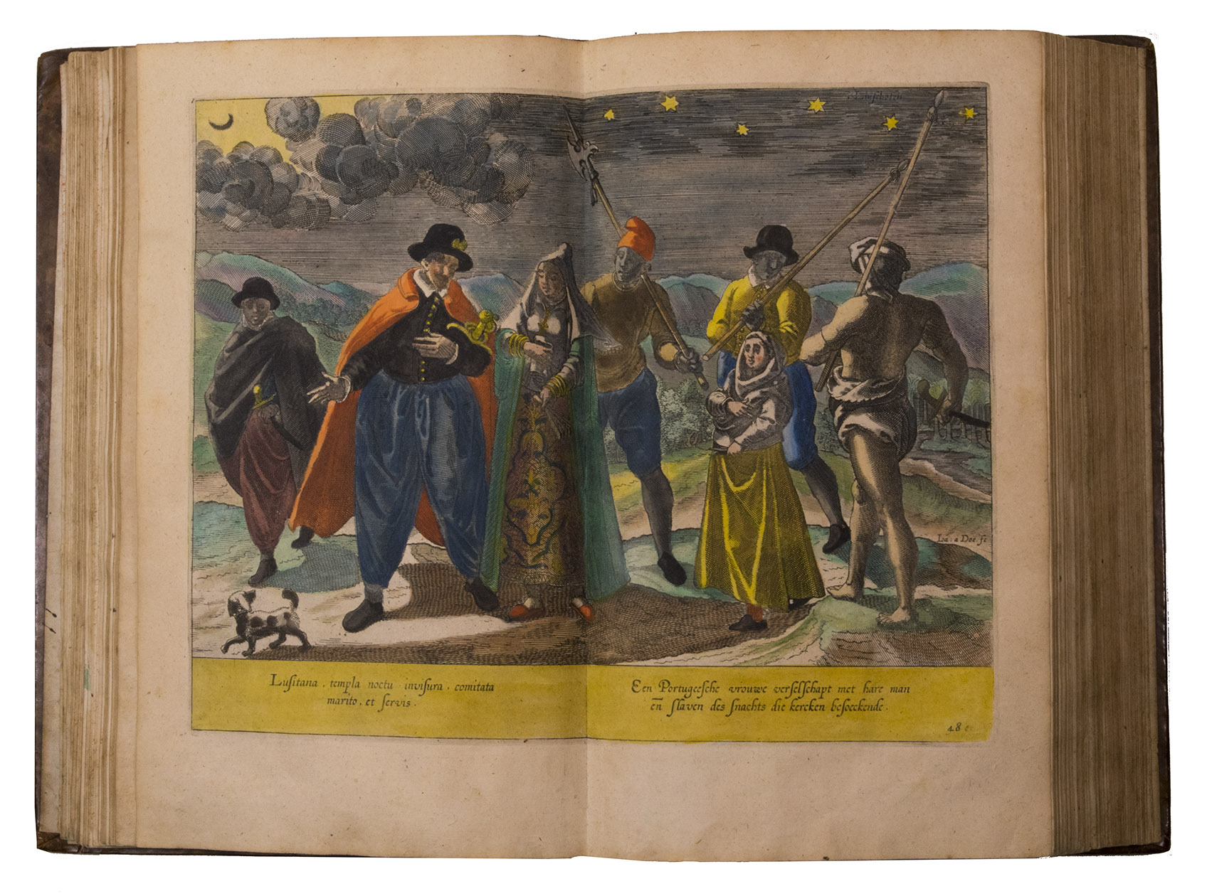
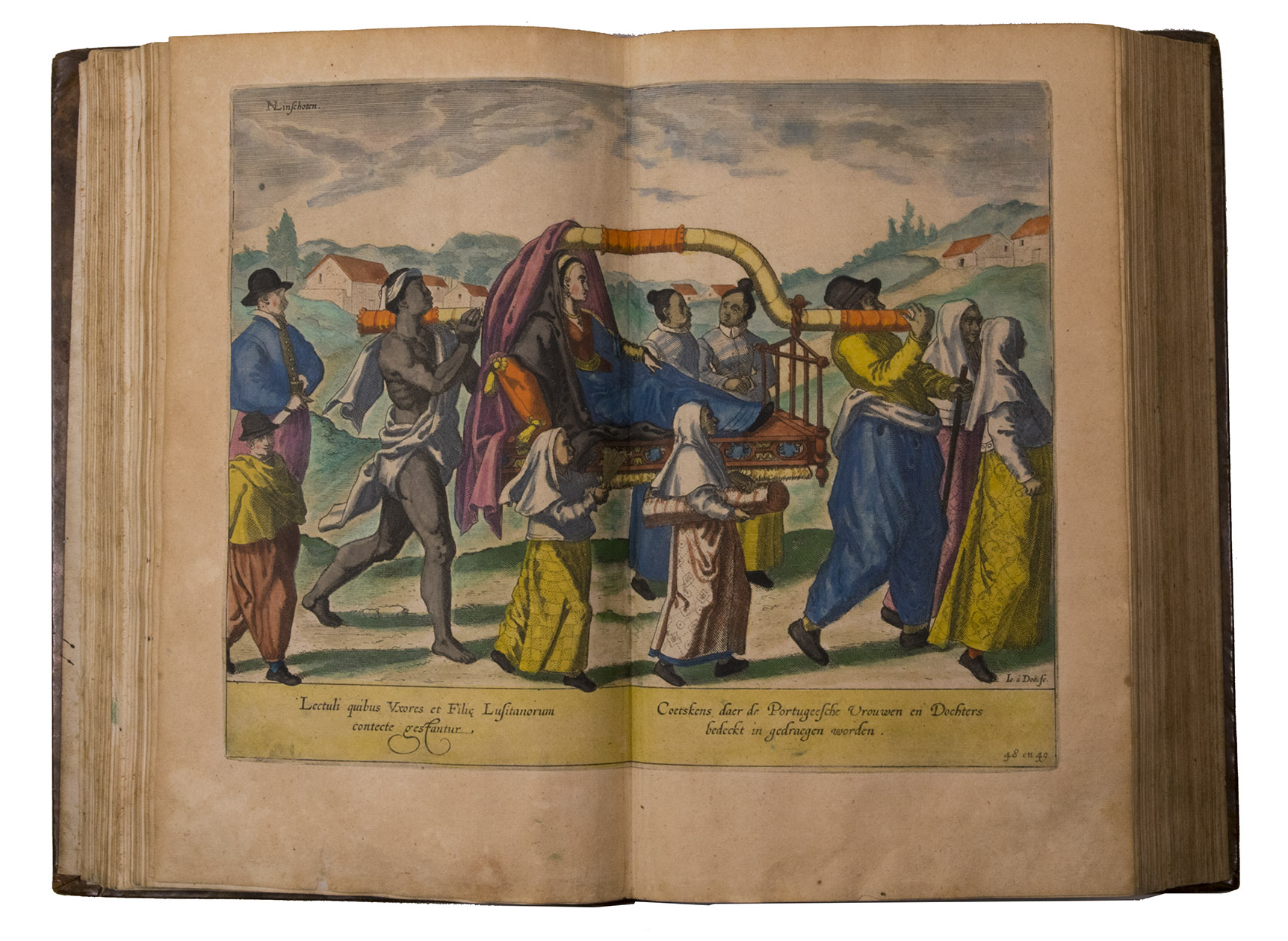
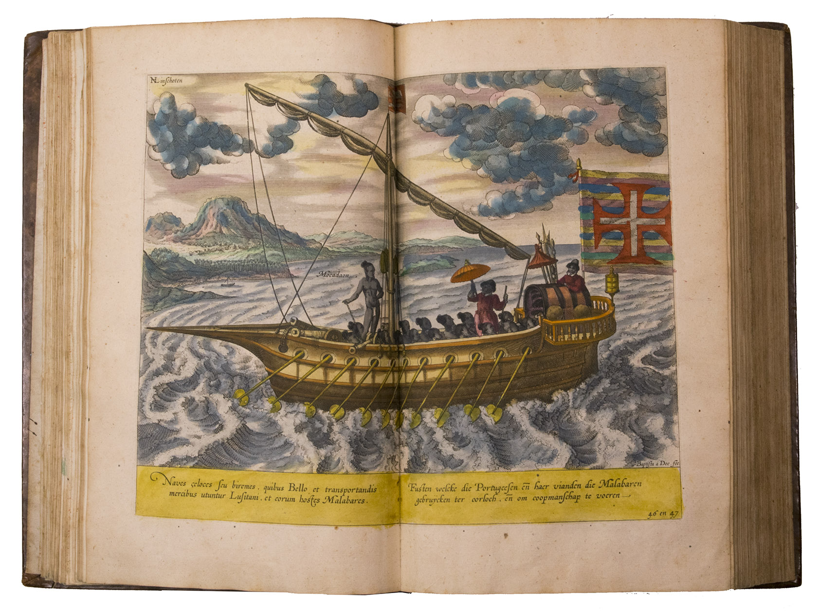
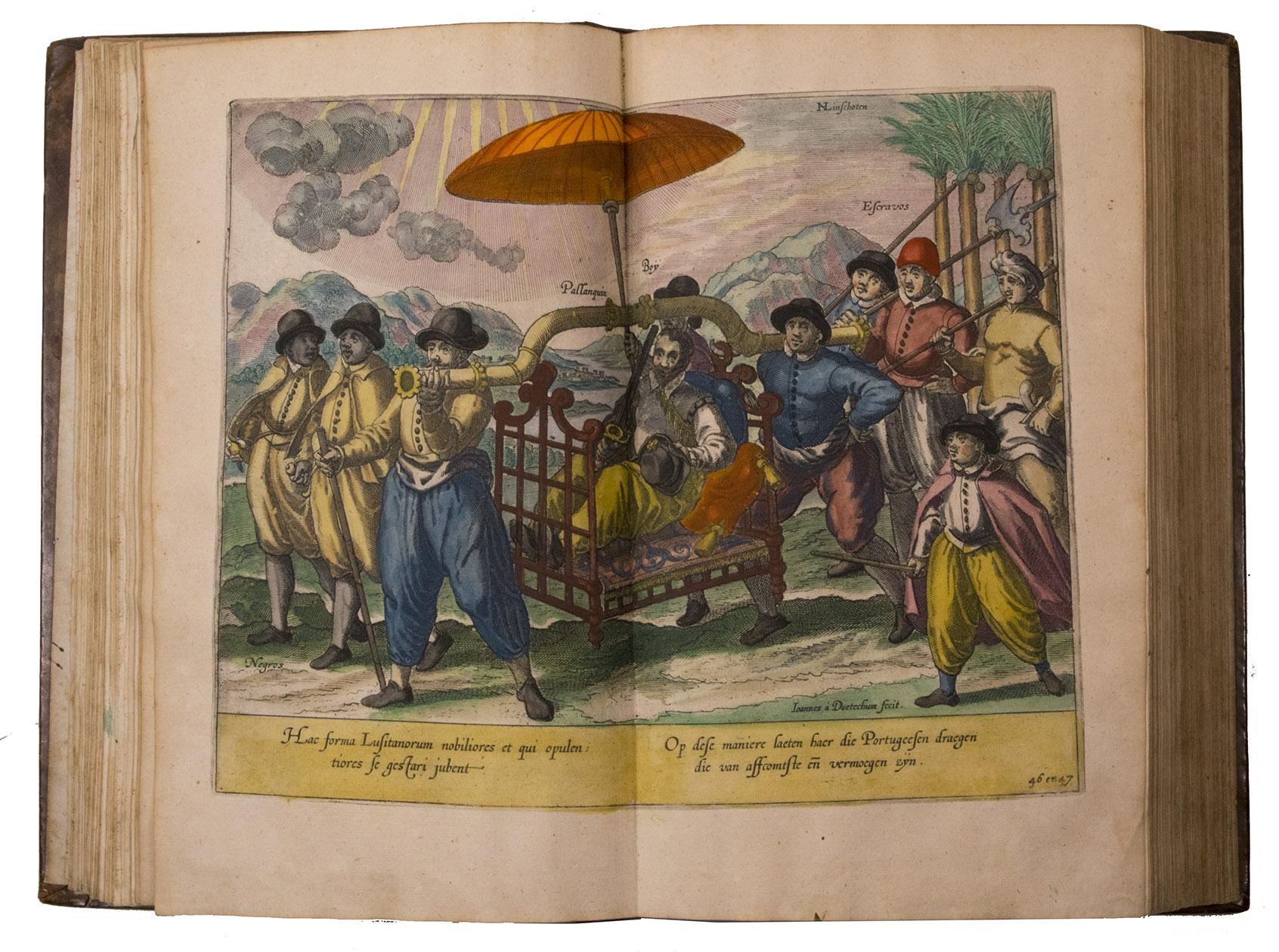
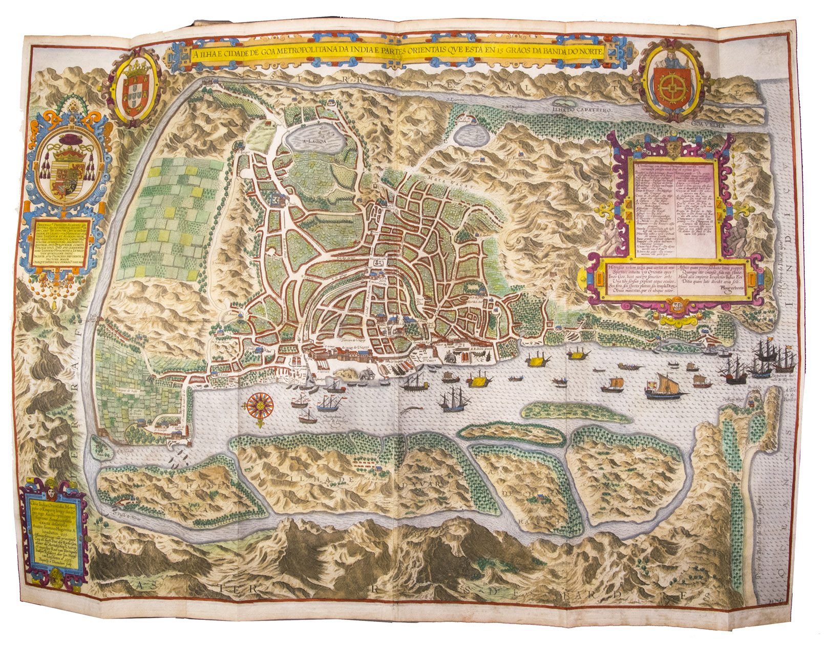
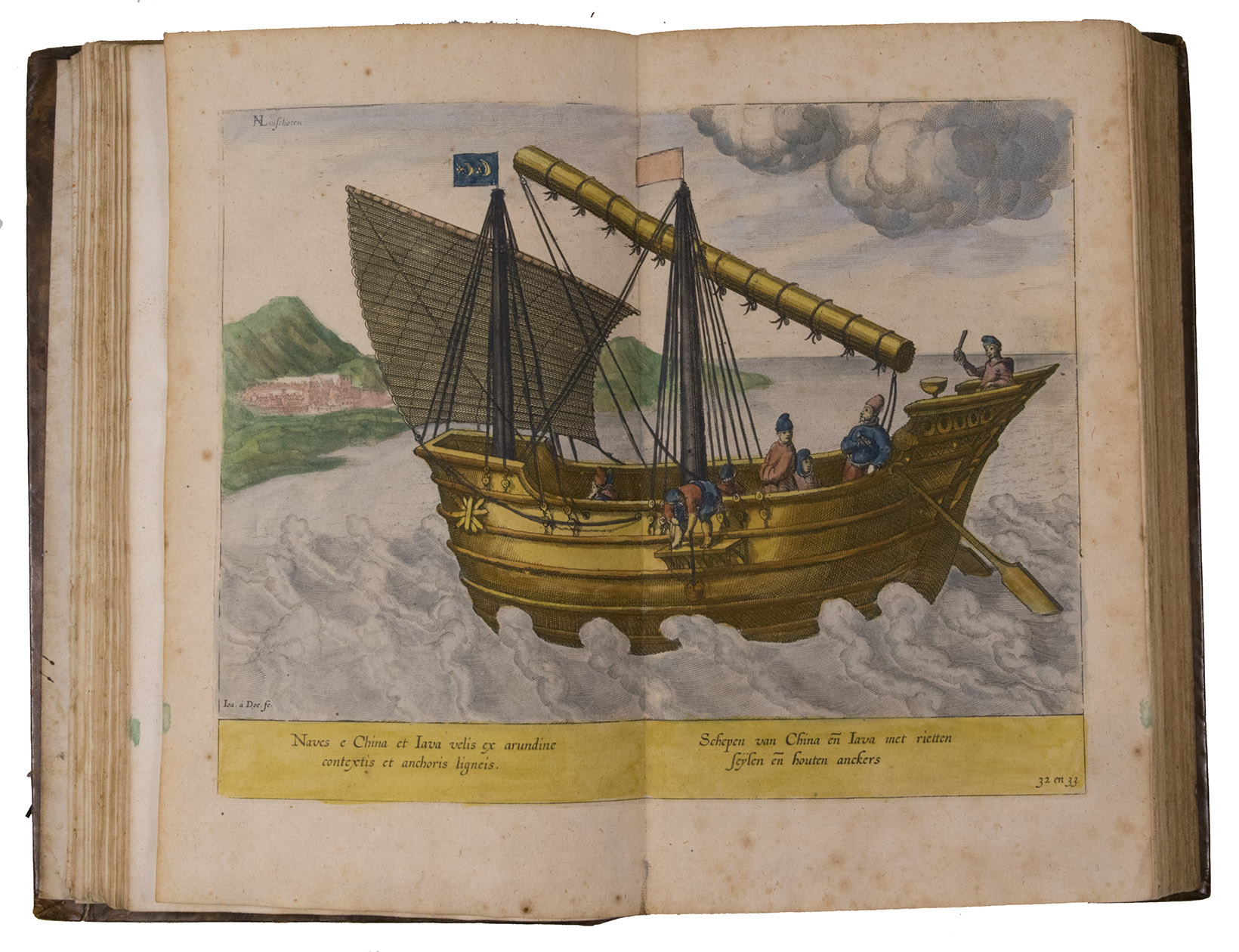
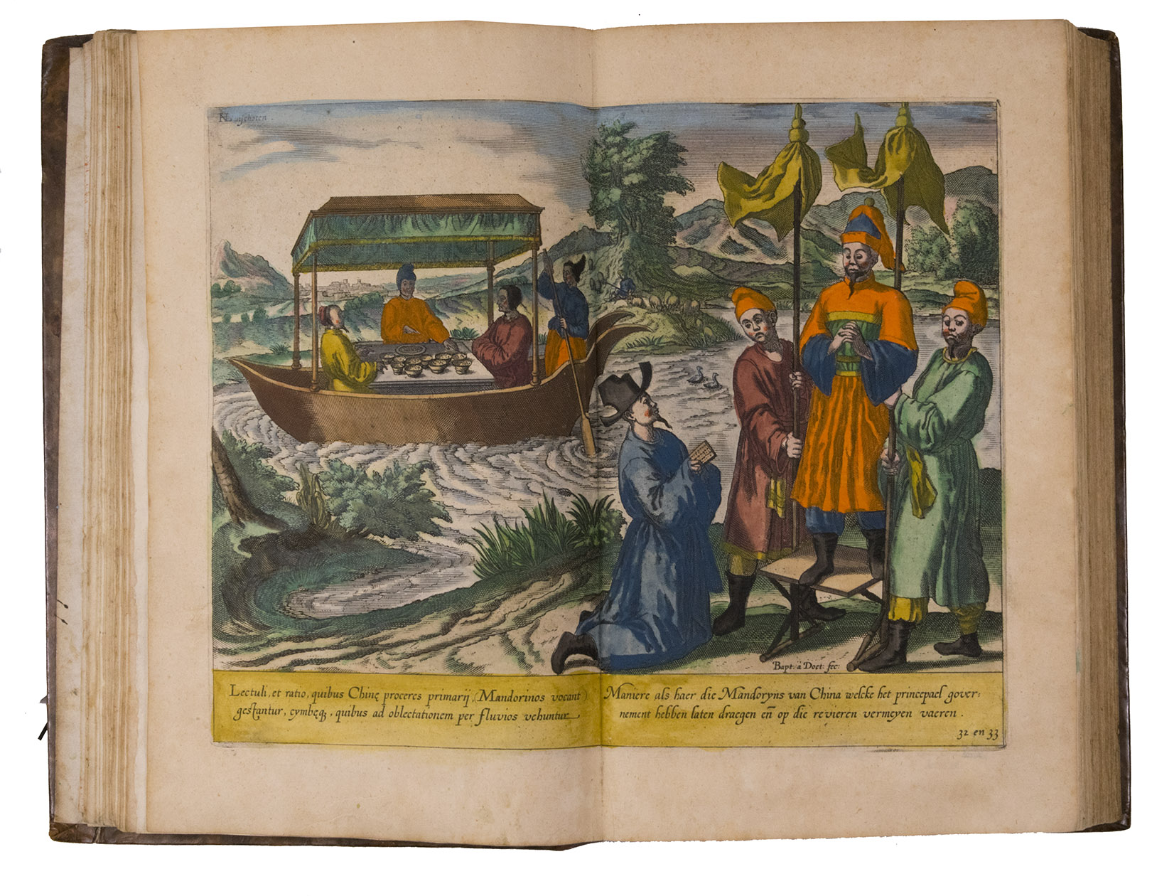
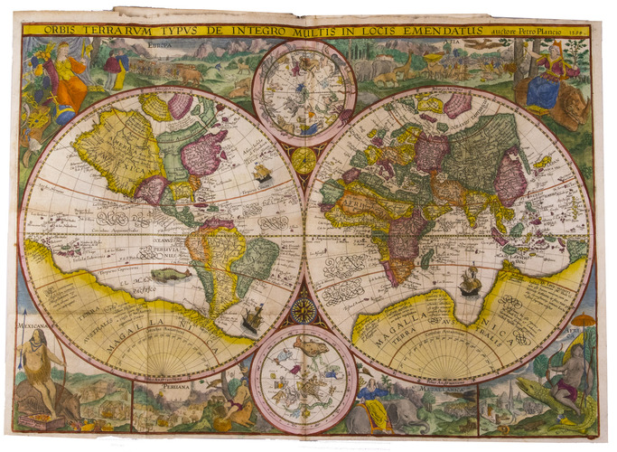
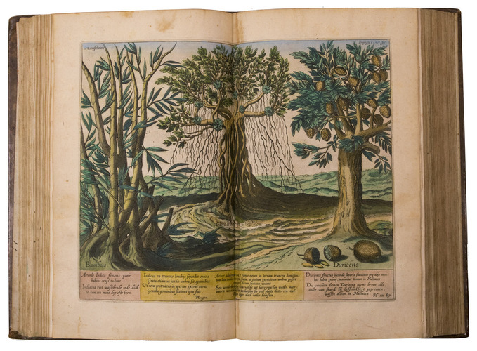
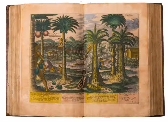
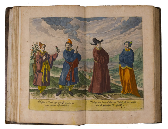
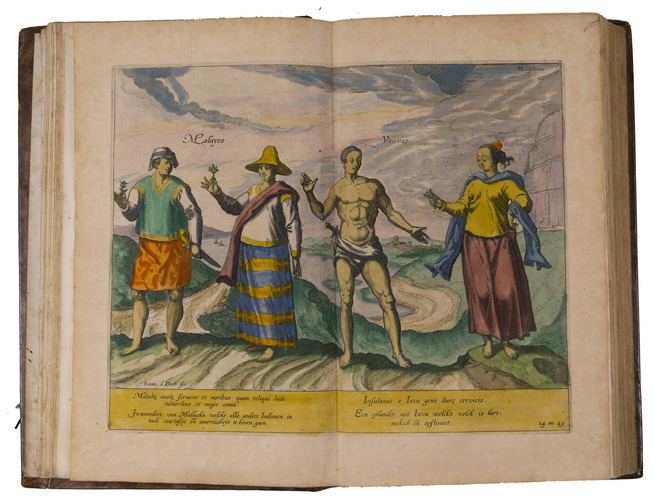
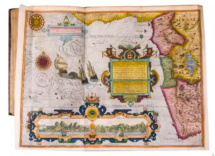
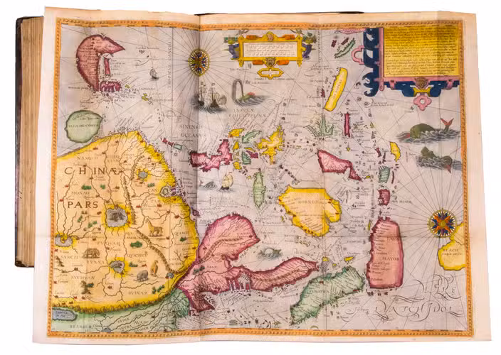
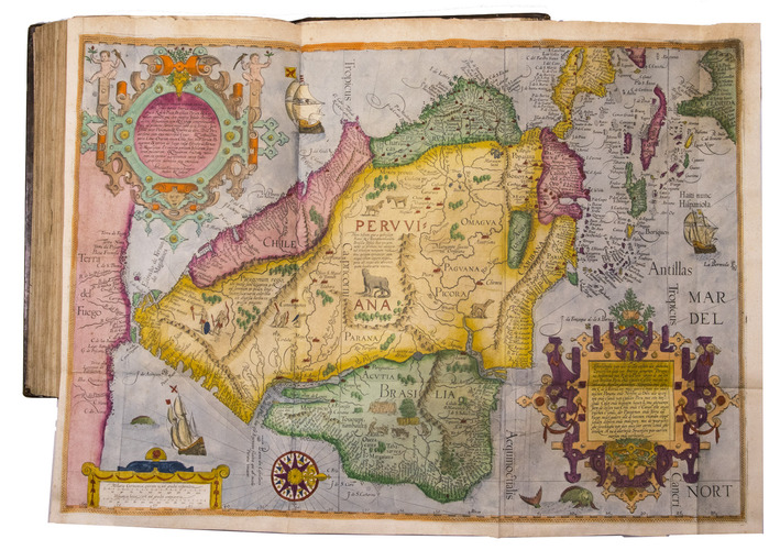
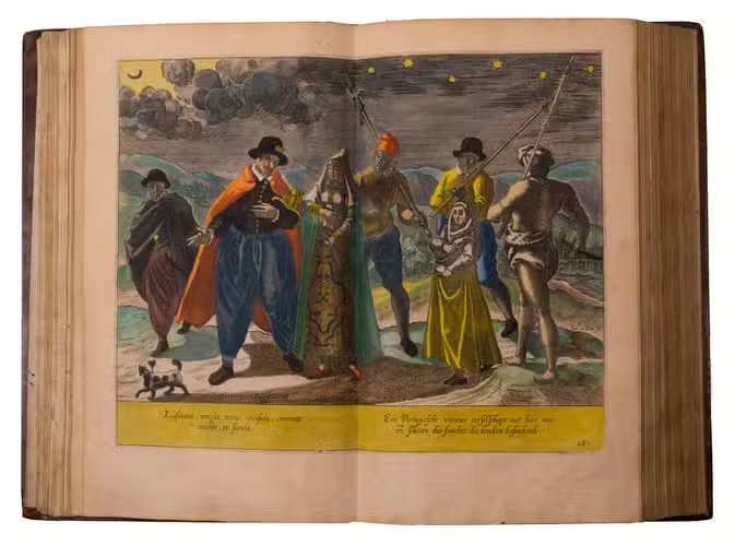
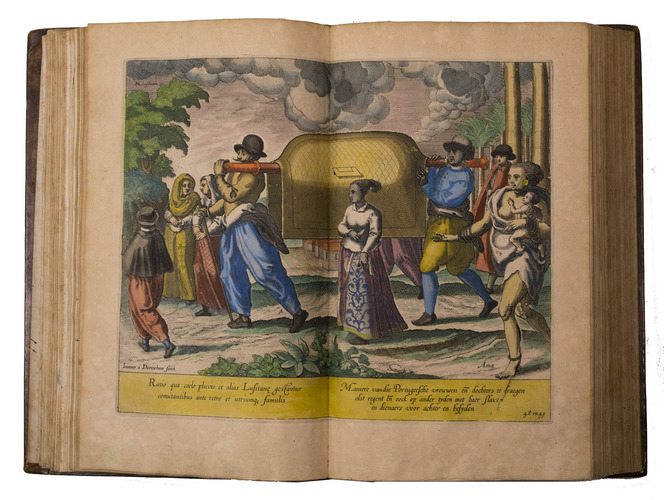
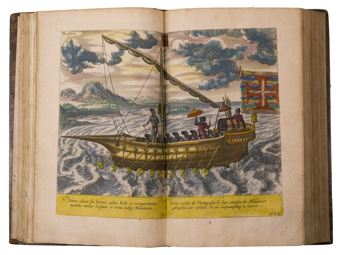
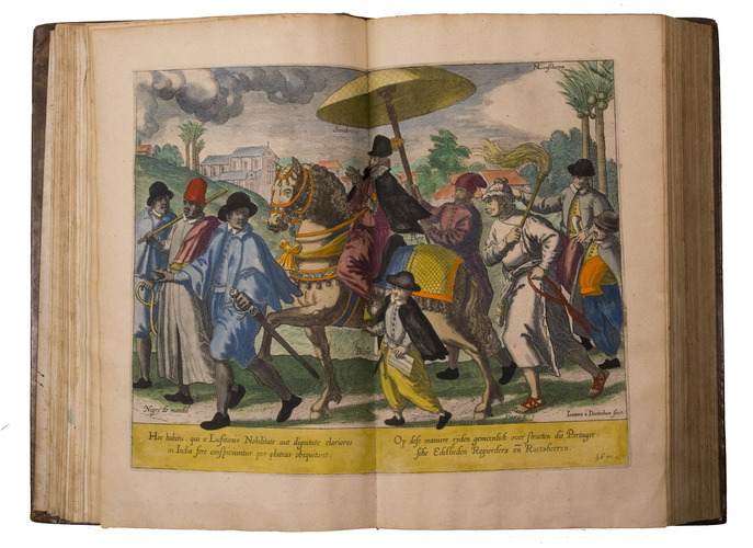
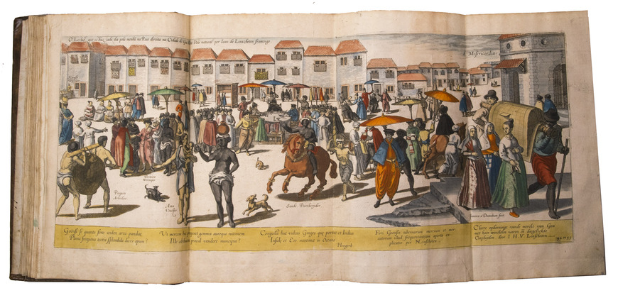
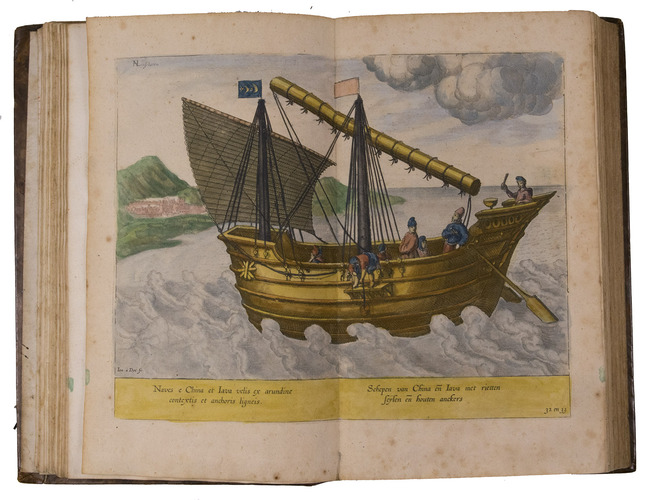
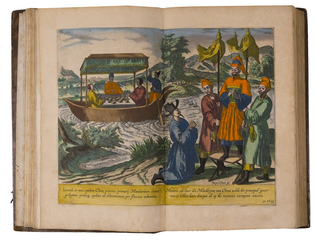
A hand-coloured copy of the third French edition of Linschoten's classic illustrated guide for travellers to the East and West Indies, termed by Lach ''the most important of the first-hand accounts published independently of the great travel collections'' (I.198). No other book contained so much useful intelligence on the East and West Indies. Unhindered by the censorship that constrained writers from the Iberian peninsula (details of seas and coasts in Asia and the Americas were military secrets), he included such information as sailing directions, physical descriptions of countries, and statistics on commerce and trade. The work was held in such high regard that for nearly a century, every Dutch ship sailing to Africa and Asia carried a copy of a Dutch edition of Linschoten. The 42 plates (11 large folding) are especially noteworthy, including 6 maps and several bird's-eye views, many with coats of arms of the regions shown and of the colonial powers that controlled parts of them.
Although the work contains valuable reconnaissance for the New World, the material on India and the East Indies is the most valuable, being the fruit of the author's own observation. In the service of the Portuguese, Linschoten spent five years in Goa (1583-1588/89), making numerous visits to other parts of India. He was thoroughly immersed in Indian culture and the complex relations between the Portuguese colonial apparatus and indigenous peoples. Highlights include a first-hand descriptions of the caste system, political structures, business practices of the Banyas, and exotic natural phenomena.
The text is divided into three parts. The first part covers the East Indies and East Africa, including regions as far east as Japan. The second describes the navigation along the coasts of West Africa around the Cape of Good Hope to Arabia, together with some coasts in the New World. The third book is devoted to North America, the Caribbean and Brazil.
About 4 sheets slightly browned and a few others with spots or minor foxing, a tear repaired in the title-page to part 3 (not affecting the text or engraving), one plate was cut and reattached at an early date and a few others show very minor browning or small tears where the folds cross, the corner of one leaf torn off (without loss of text) and a few other minor marginal defects, but still generally in very good condition, with the colouring rich and in good condition. The boards are slightly rubbed and the head and foot of the spine expertly restored, but the binding is still in good condition. A seminal work on navigation to the East and West Indies that opened up exploration to explorers outside Spain and Portugal. Alden & Landis 638/37 (8 copies); Lach, Asia in the making of Europe I, pp. 196-204 & 482-490; Palau 138584; Sabin 41373 & 28266; STCN (3 copies); Tiele, Bibl. 686-688.
Related Subjects: