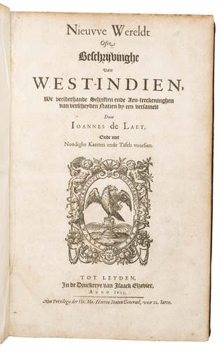
LAET, Johannes de.
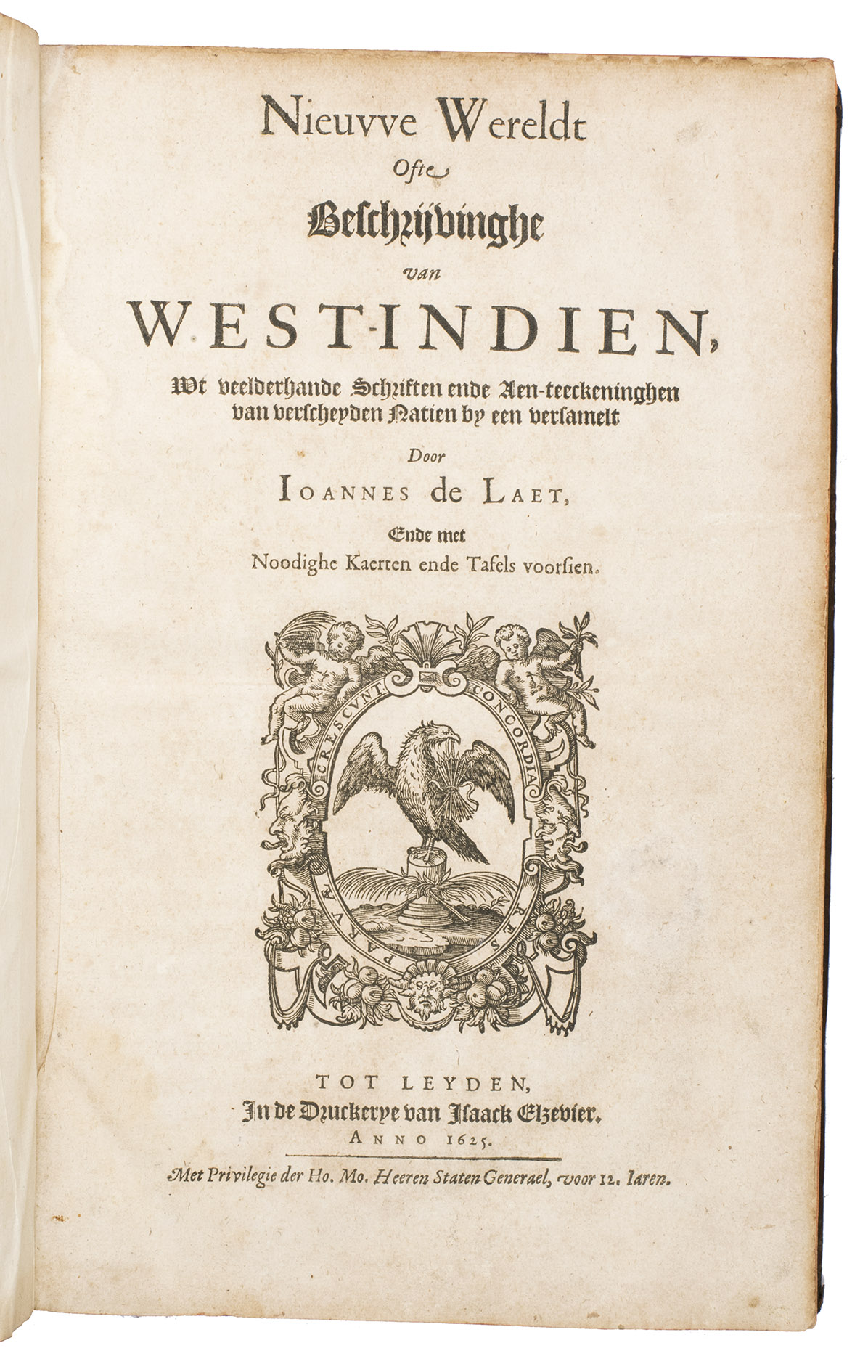
Nieuwe wereldt ofte beschrijvinghe van West-Indien, wt veelderhande schriften ende aen-teeckeninghen van verscheyden natien by een versamelt.
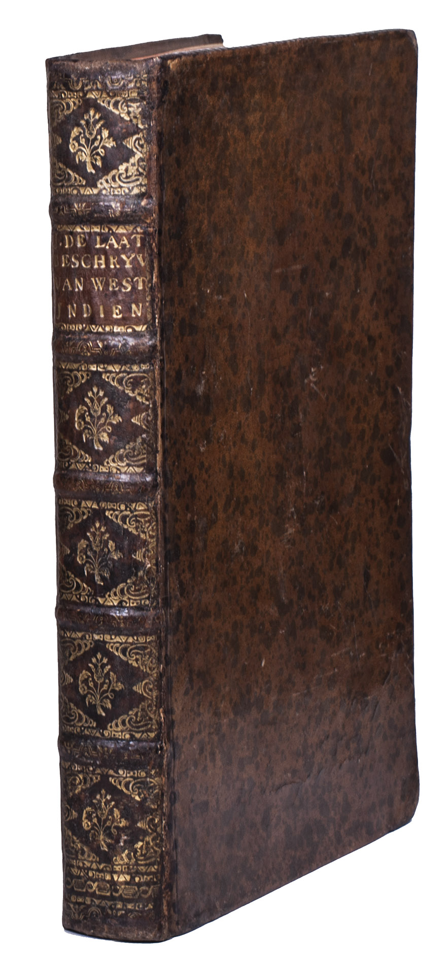
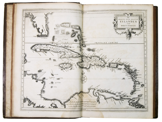
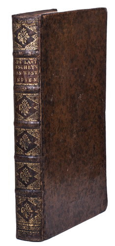
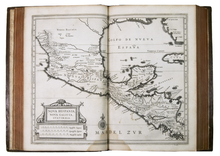
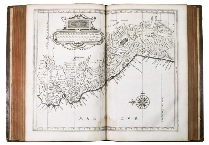
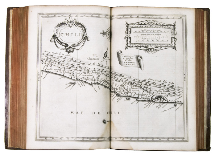
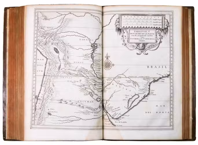
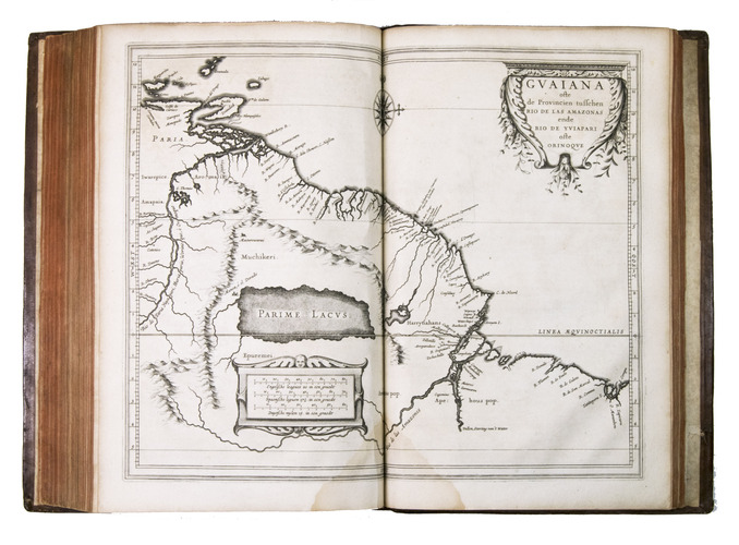
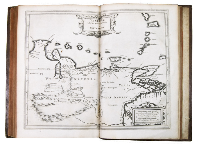
Leiden, Isaac Elzevier, 1625. Folio. With large woodcut printers mark on title-page, 10 double-page engraved maps (plate size 28.5 x 36 cm), woodcut decorative initial letters from two series, and a wide variety of printing types. Early 18th-century calf, gold-tooled spine. [24], 510, [16] pp.
€ 48,000
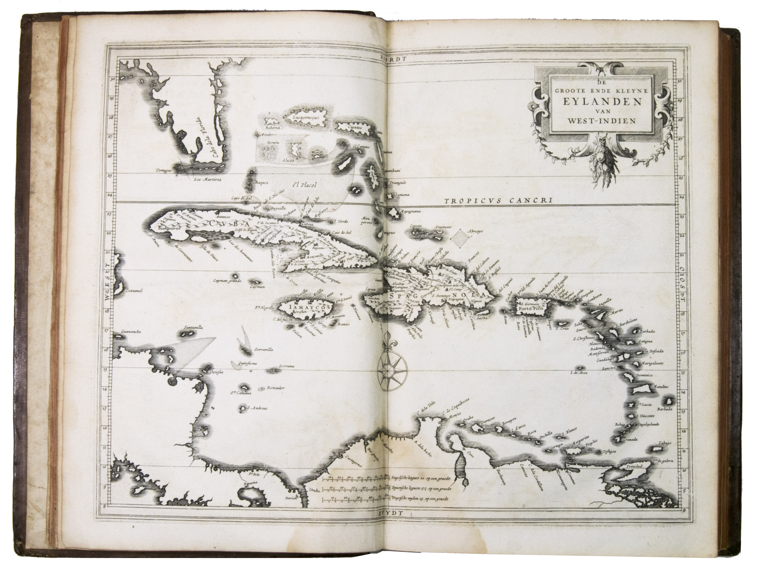
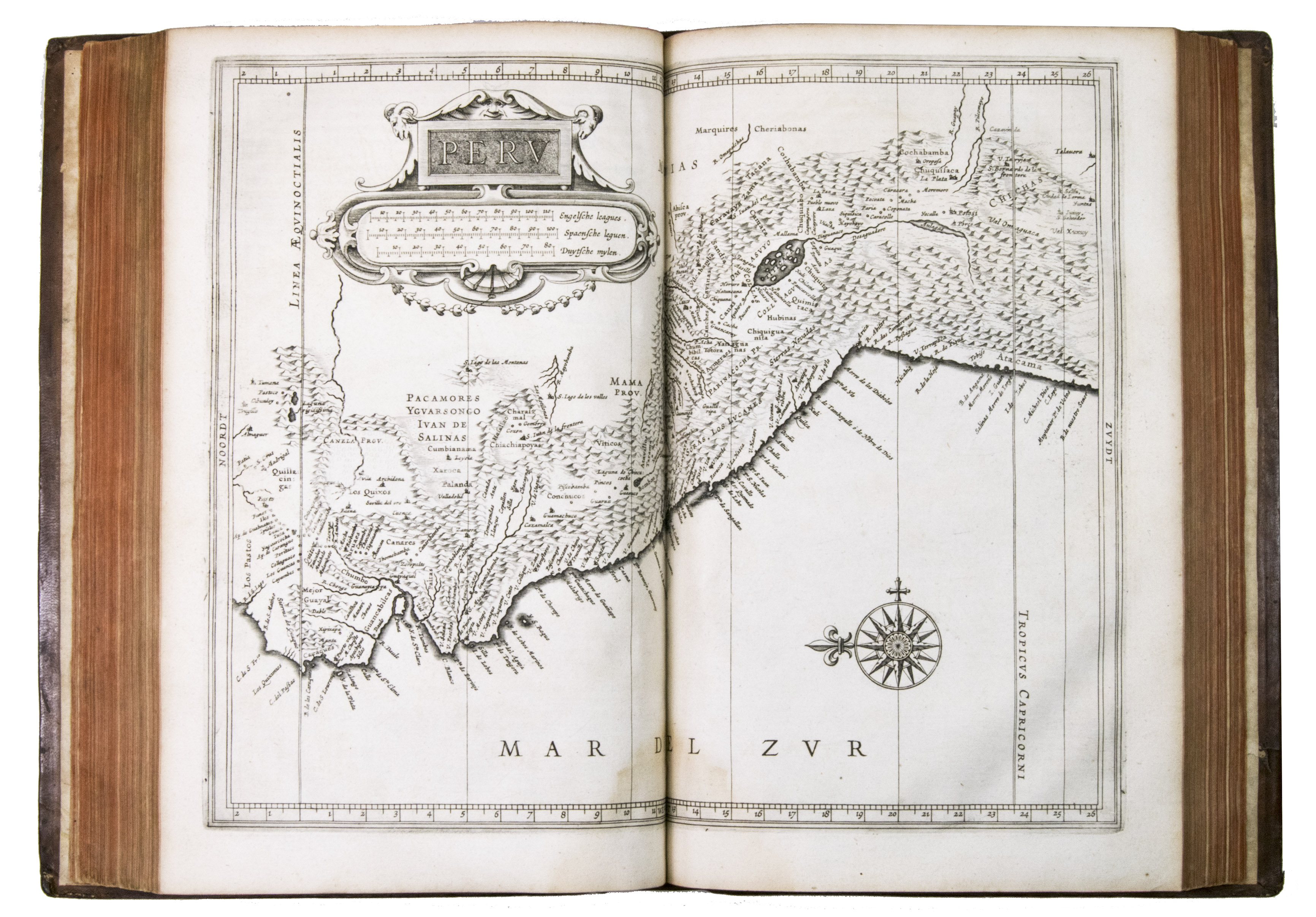
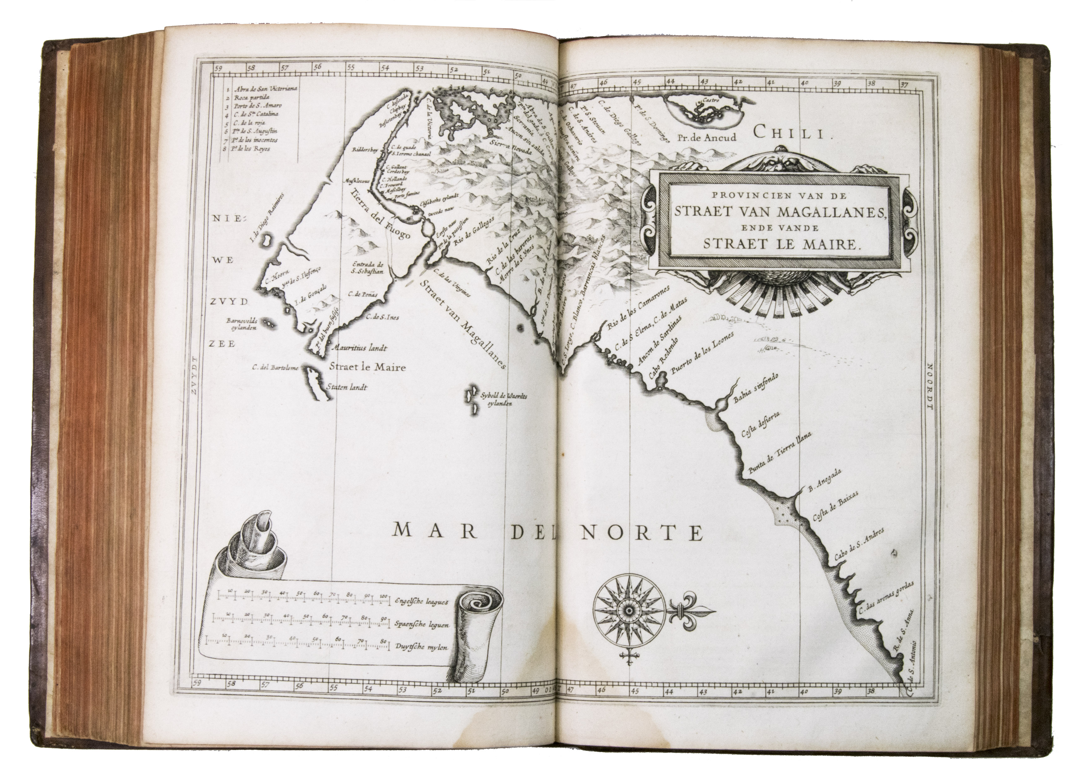
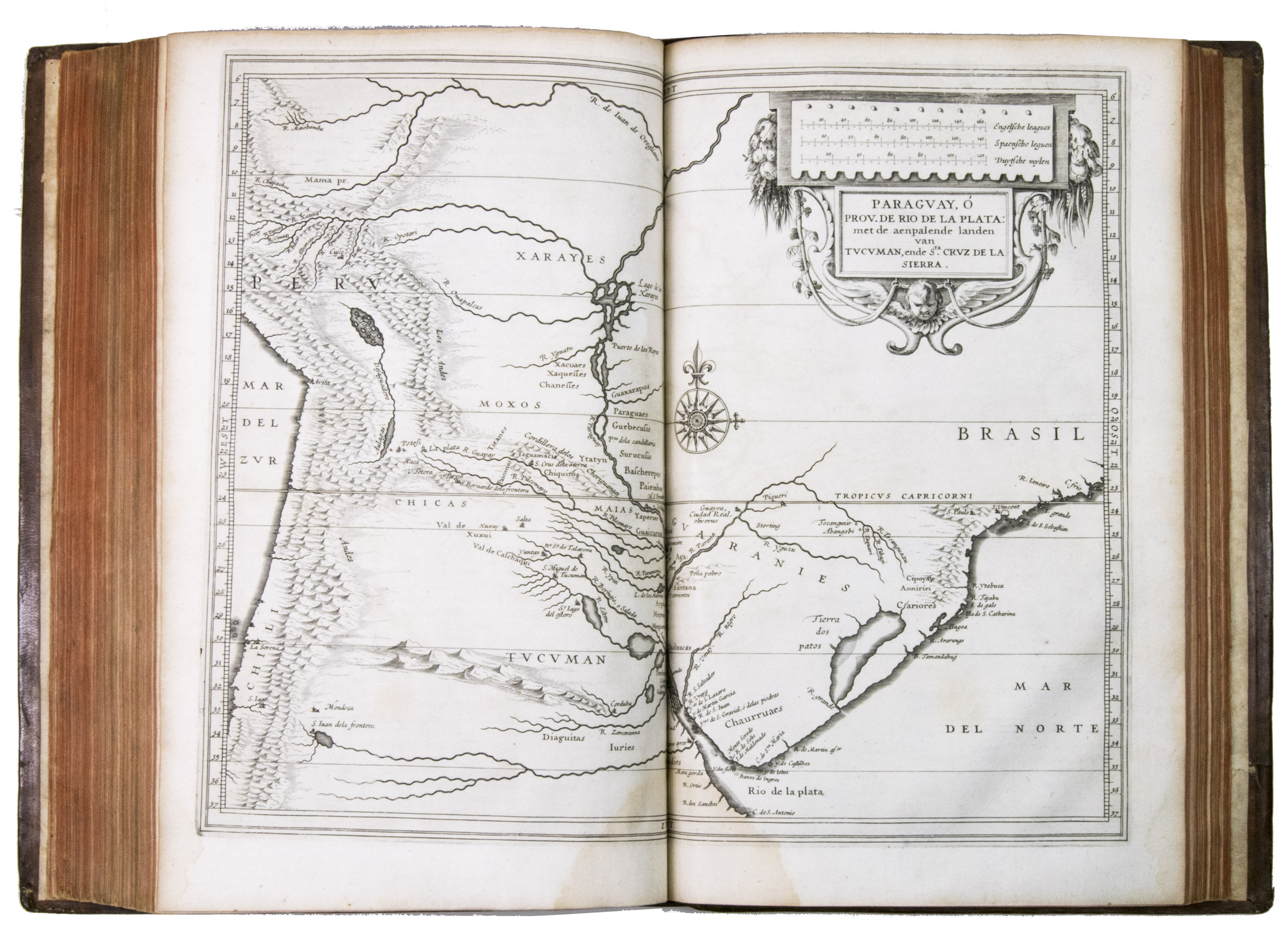
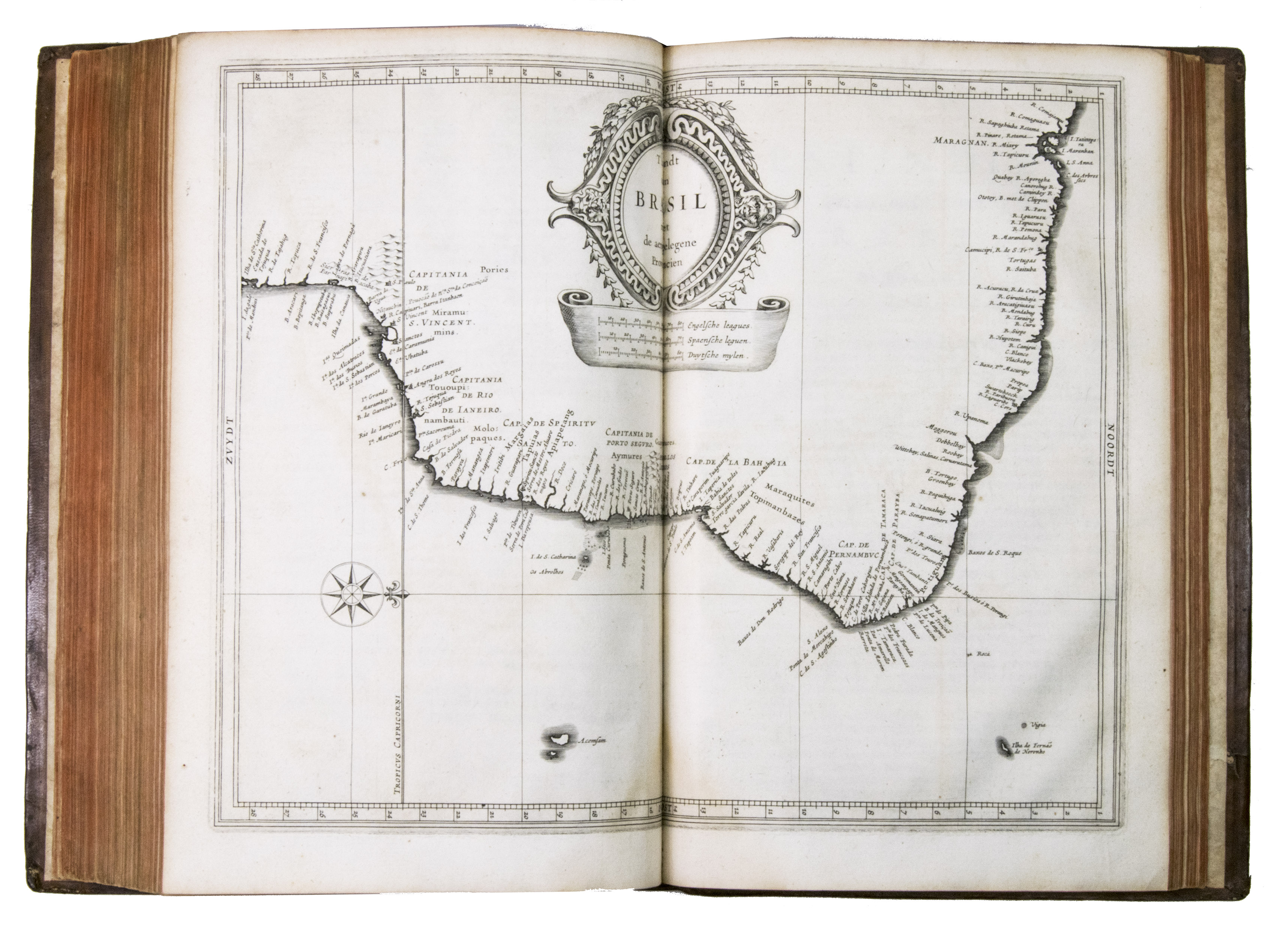
First edition of a 17th-century standard work on North and South America, including the West Indies, with 10 maps covering the whole of Mexico, the West Indies, and Central & South America. De Laets book remains an important source for the New World in the 16th and early 17th centuries, and covers its discovery, geography, topography, natural history, ethnology, and linguistics in 15 books. One book covers the West Indies, 3 the modern United States & Canada, 3 Mexico and Central America, and 8 South America. Included are 2 chapters devoted primarily to Brazil, 1 to Venezuela, and 1 to Guatamala.
Johannes de Laet (1582-1649) was a Dutch geographer, director of the Dutch West India Company (WIC, since 1621), and polyglot. As WIC director, he was able to bring together information from older publications and contemporary eye-witness accounts to produce the present masterpiece: the most comprehensive account of the New World to that time. It went through many editions, and was translated into Latin in 1633, French in 1640, and even abridged in Spanish around the same time. De Laet went on to produce a whole library of pocket descriptions of various regions of the world, and he, quite successfully, debated in print with Hugo de Groot.
The copperplate maps are unsigned, but the foreword proudly notes that they were drawn and produced for this edition largely by the leading Amsterdam cartographer Hessel Gerritsz. (1581-1632), who had studied with Willem Jansz. Blaeu. They appear at their best in the fresh impressions of this first edition.
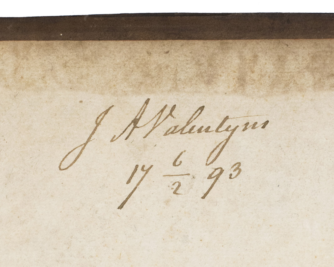
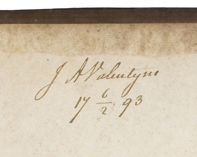
With a 1793 owners signature of J.A. Valentyn. The binding has cracked at the hinges, but otherwise still good. Internally somewhat browned and occasionally spotted, with water stains in the gutter of many leaves, sometimes encroaching on the corner of the text or the bottom centre of the maps, missing the final blank leaf. Otherwise in good condition. The first edition of a classic, printed by Isaac Elzevier, showing European knowledge of the New World in 1625. Alden & Landis 625/125; Asher 1; Borba de Moraes I, p. 450; JCB II, p. 193; NNBW VIII, cols. 991-992; Nissen, ZBI 2359 (erroneously dated 1626); Phillips & LeGear 1147; Rahir, Les Elzevier 195; Sabin 38554; Tiele, Volkenkunde 626; Willems 230; cf. Bosch, Brasilien-Bibliothek 85 (French ed. 1640); Lande, Canadiana 492 (French ed. of 1640); Rodrigues, Bib. Brasiliense 1351 (2nd ed.).
Related Subjects: