GUICCIARDINI, Lodovico.
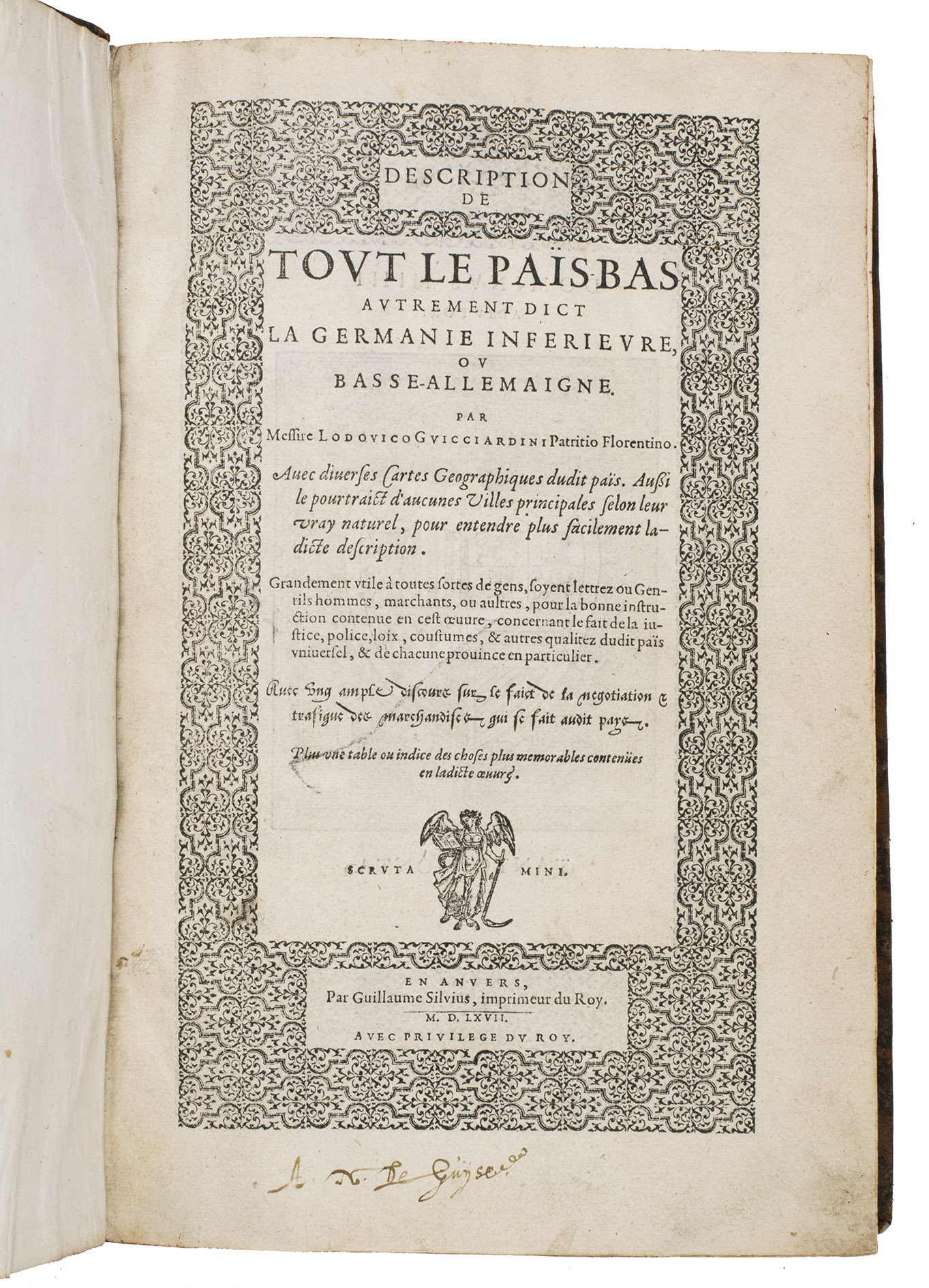
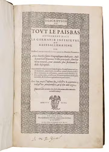
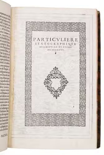
Description de tout le Païs-Bas autrement dict la Germanie inferieure, ou Basse-Allemaigne ... Avec diverses cartes geographiques dudit païs. Aussi le pourtraict daucunes villes principales ... Avec un ample discours sur le faict de la negotiation et trafique des marchandises qui se fait audit pays. Plus une table ...
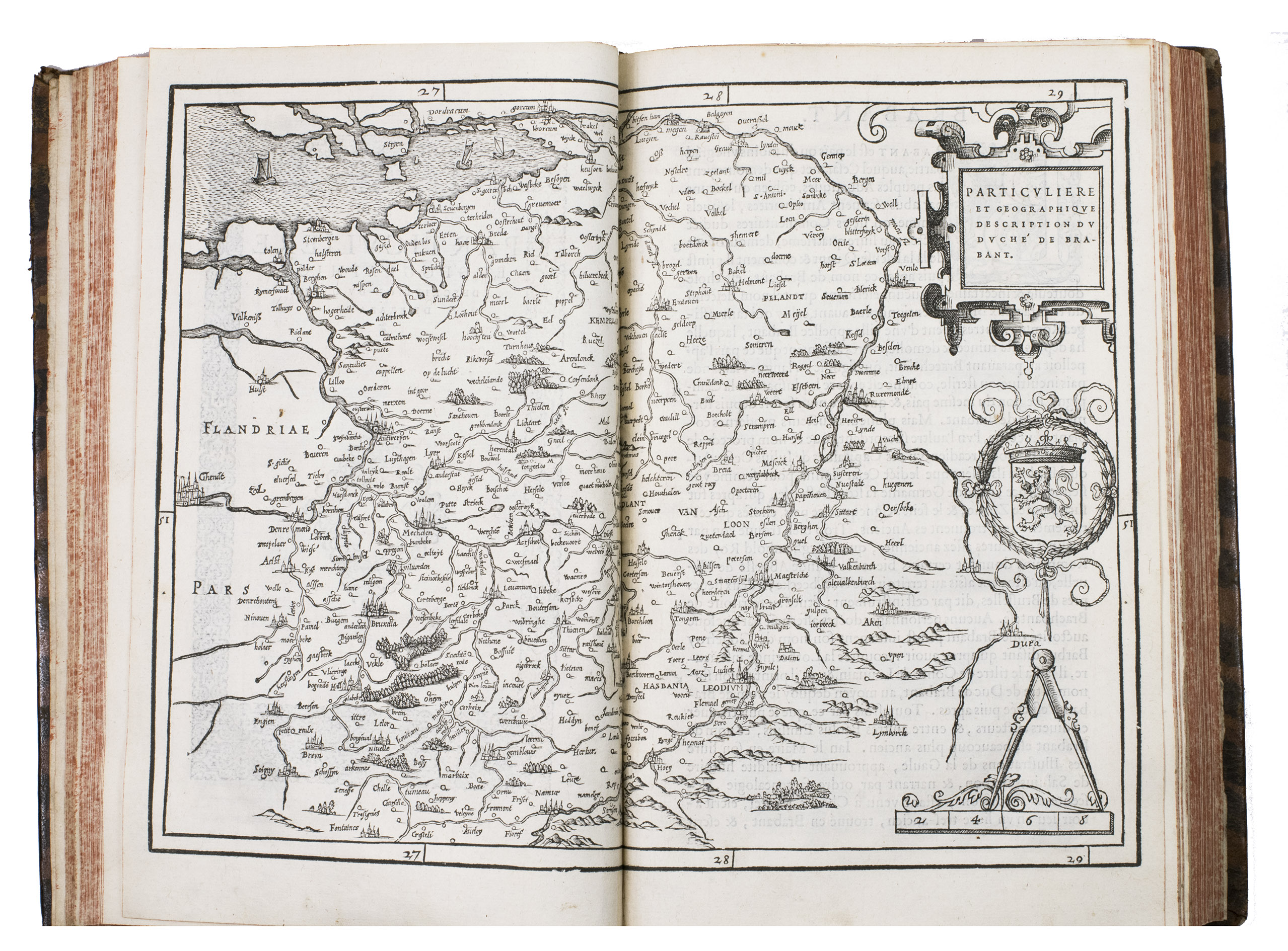
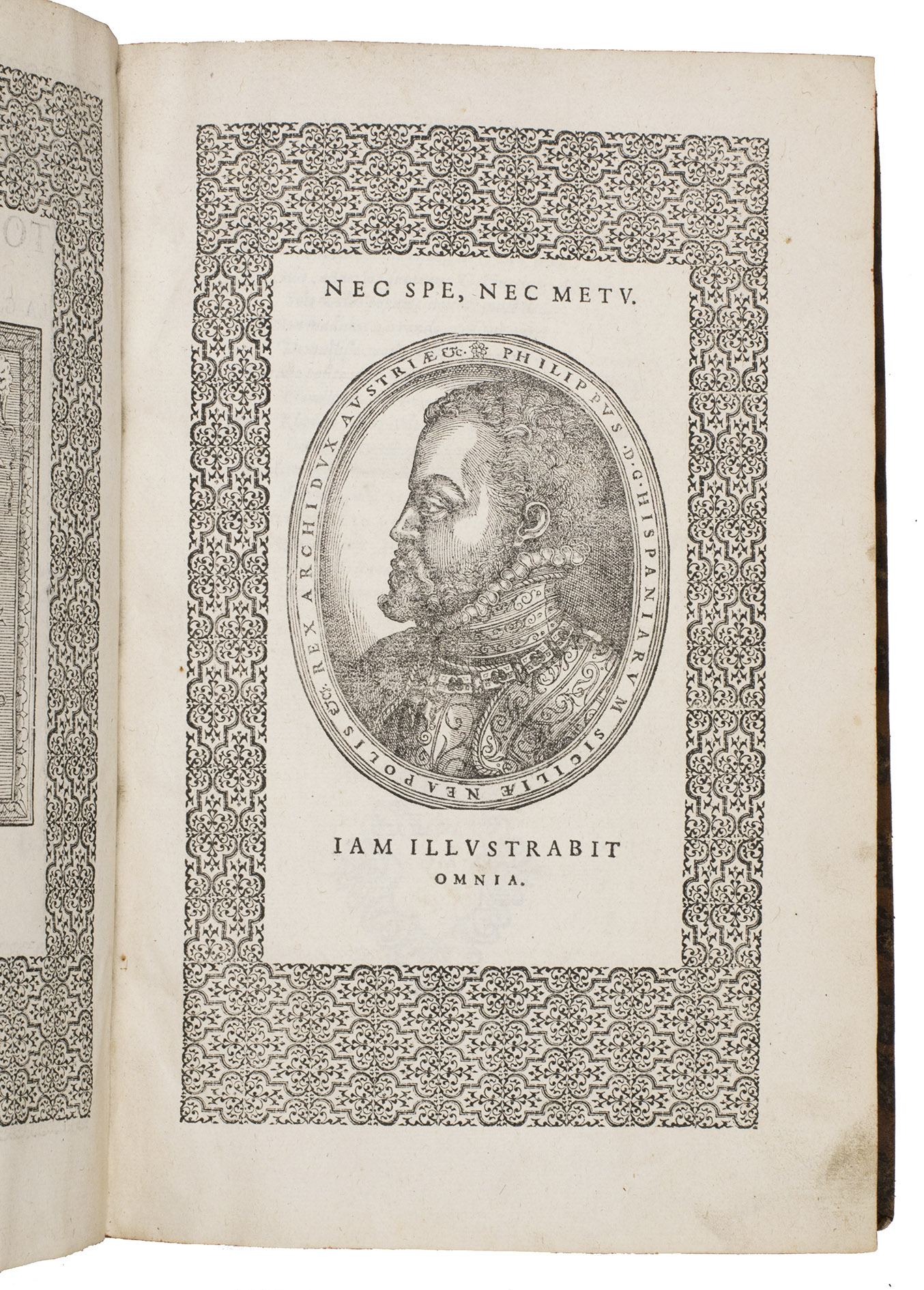
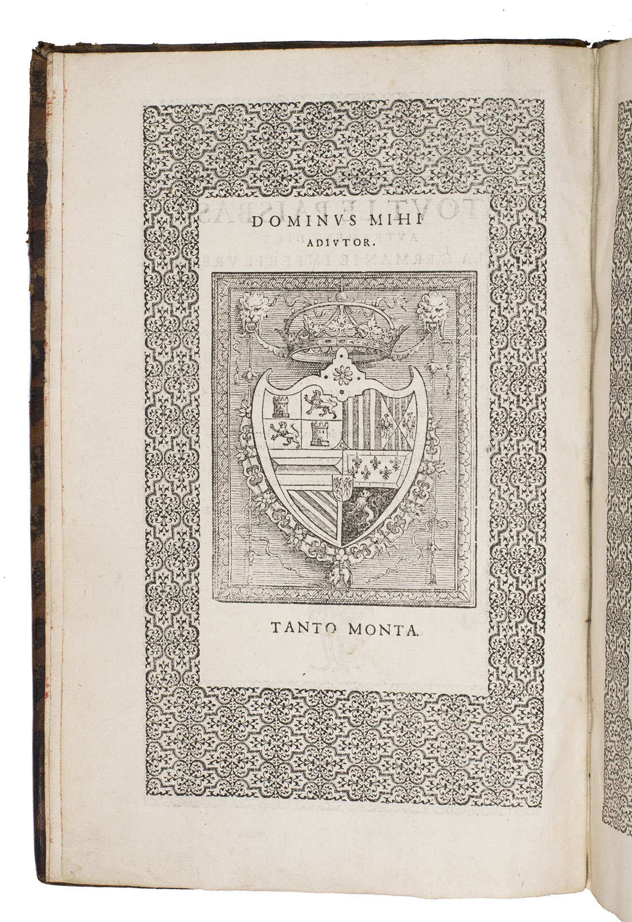
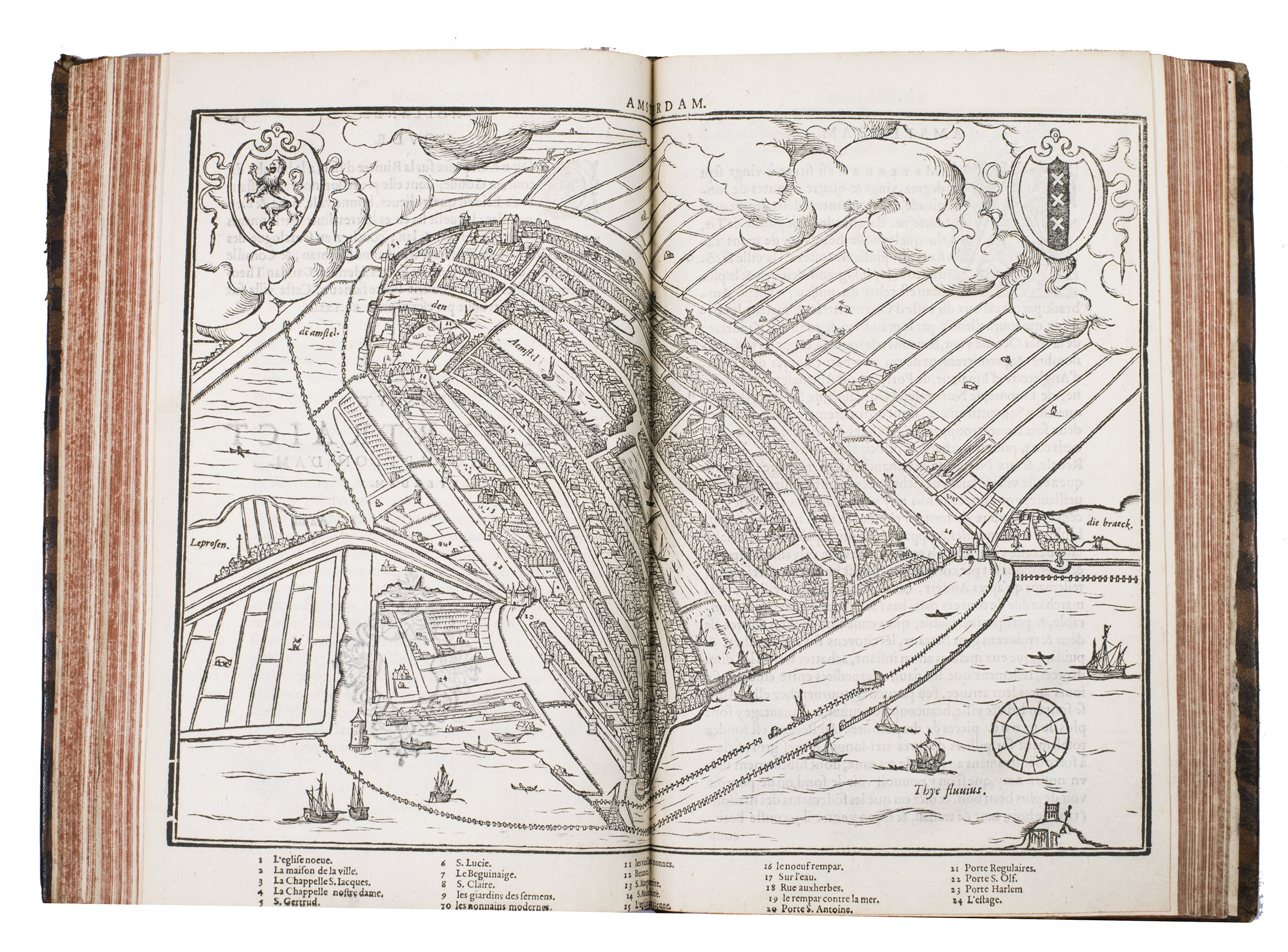
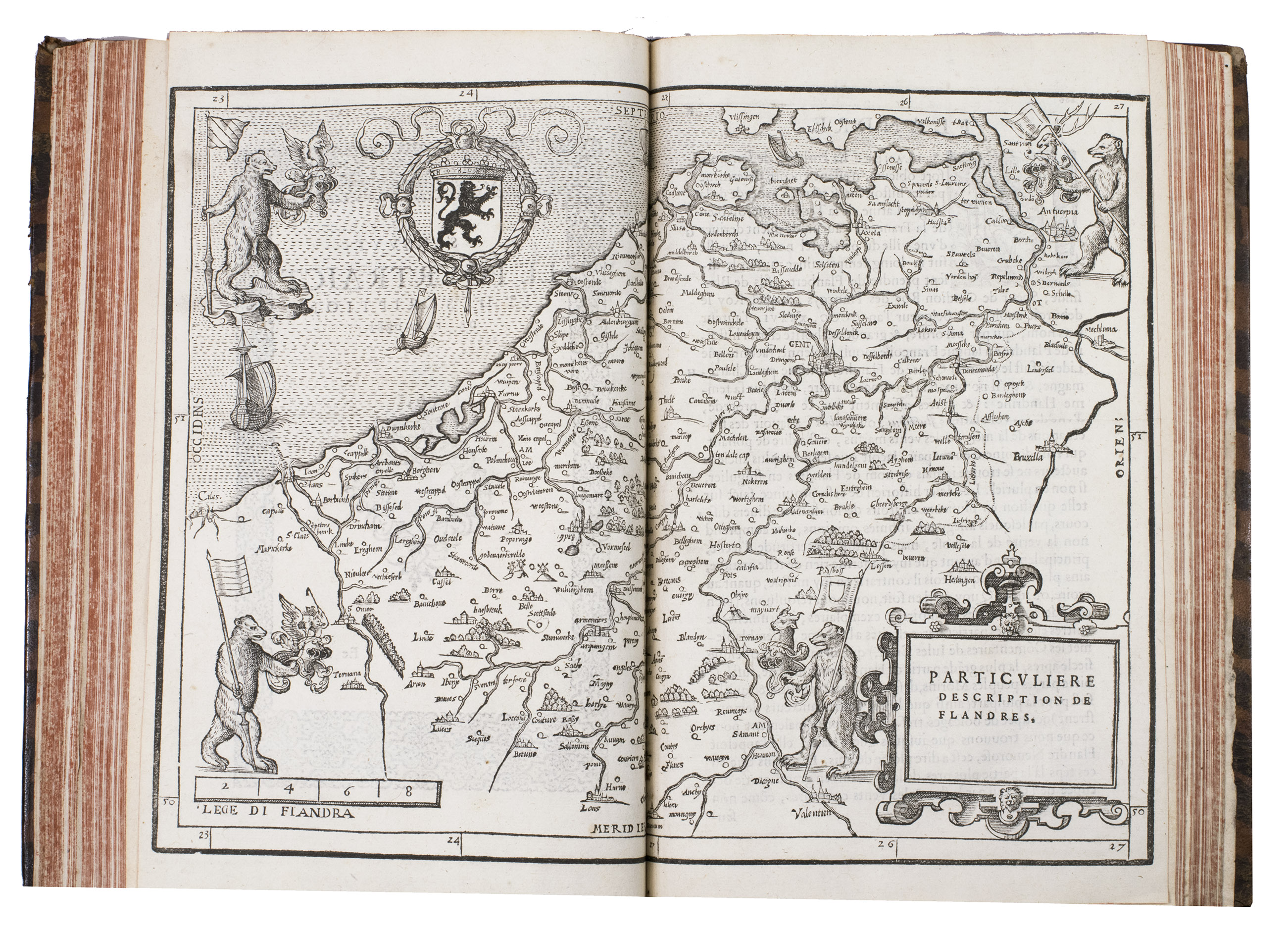
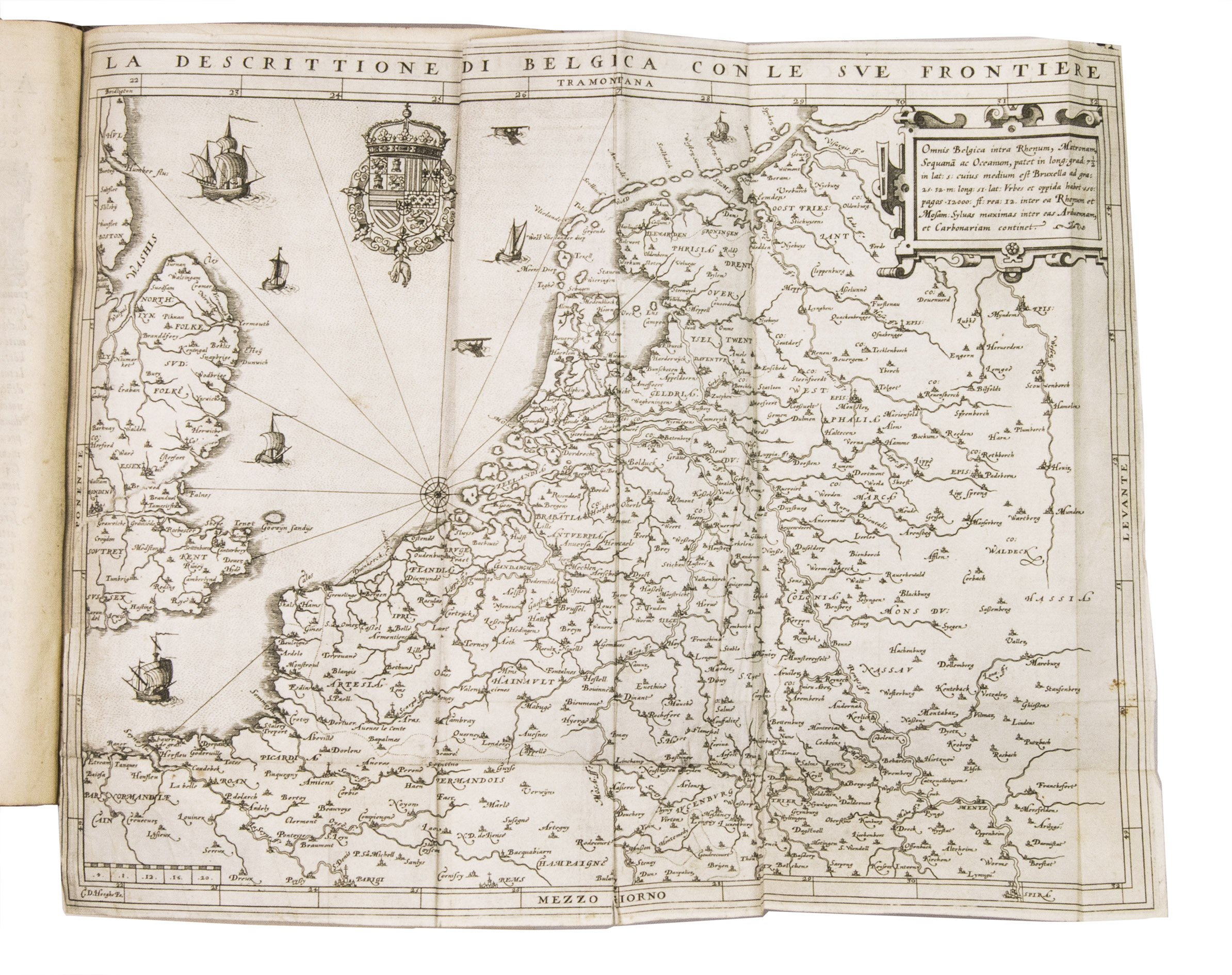
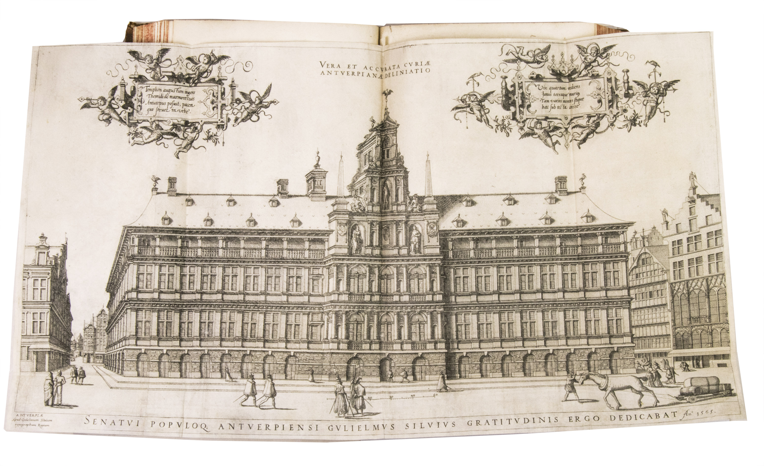
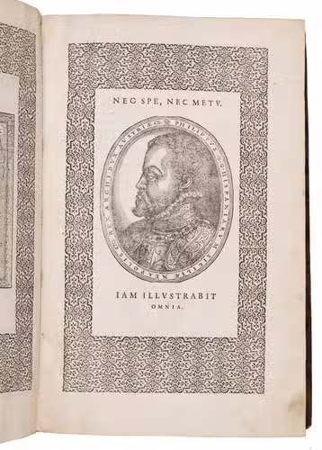
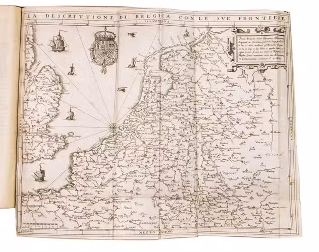
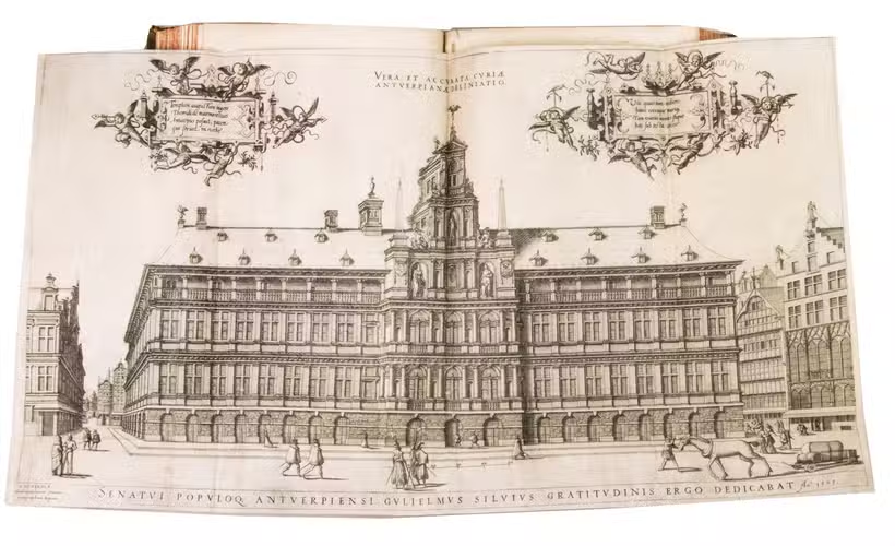
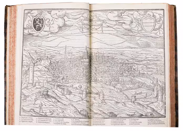
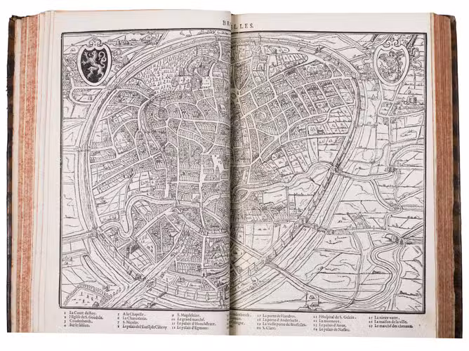
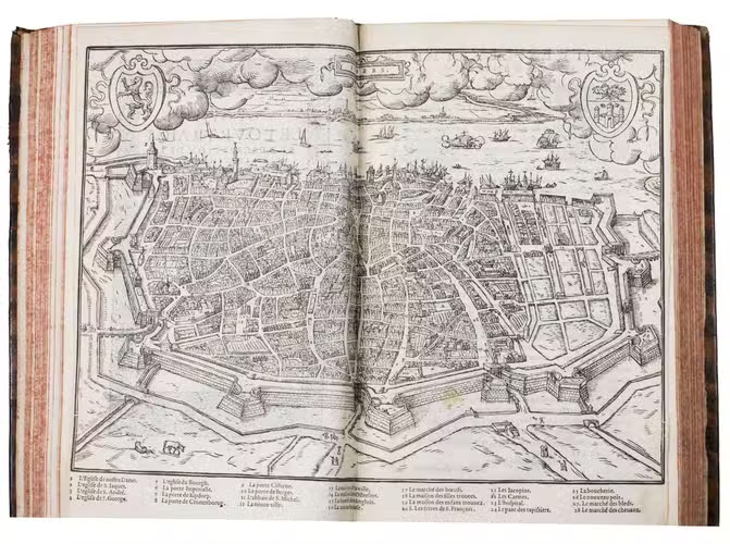
Antwerp, Guillaume Silvius, 1567. Folio. With a woodcut vignette on the title page, 1 folding engraved map of the Low Countries by Cornelis de Hooghe, 1 folding engraved view of the town hall of Antwerp, the woodcut coat of arms and portrait of King Philip II, and 15 double-page woodcut maps, plans and (bird's-eye) views after Jacob van Deventer in the text, the title is set within a frame of ornamental typographical elements (also used for the half-titles and head-pieces) and woodcut initials. 18th-century mottled calf. [24], "389" [=405], [26] pp.
€ 8,500
Much enlarged first edition in French of the first illustrated description of the Low Countries. This popular guide to the Netherlands was written by the nobleman Ludovico Giucciardini (1521-1589), an Antwerp-based merchant from Florence, Italy. The original Italian edition was published in 1567, with 17 maps and plans, mainly in woodcut. In 1581 Plantin published the Italian edition with nearly three times as many illustrations, all copper-engravings, and the present French edition was again enlarged. Not only was Guicciardini's work a great success, going through dozens of editions in a wide variety of languages, but its maps, plans and views were also copied for decades, both for use in other works and for separate publication.
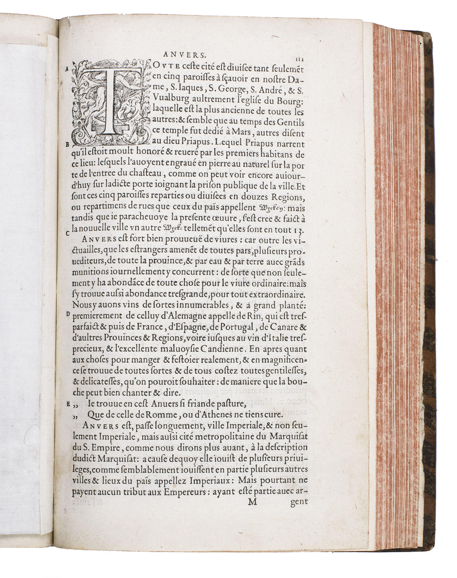
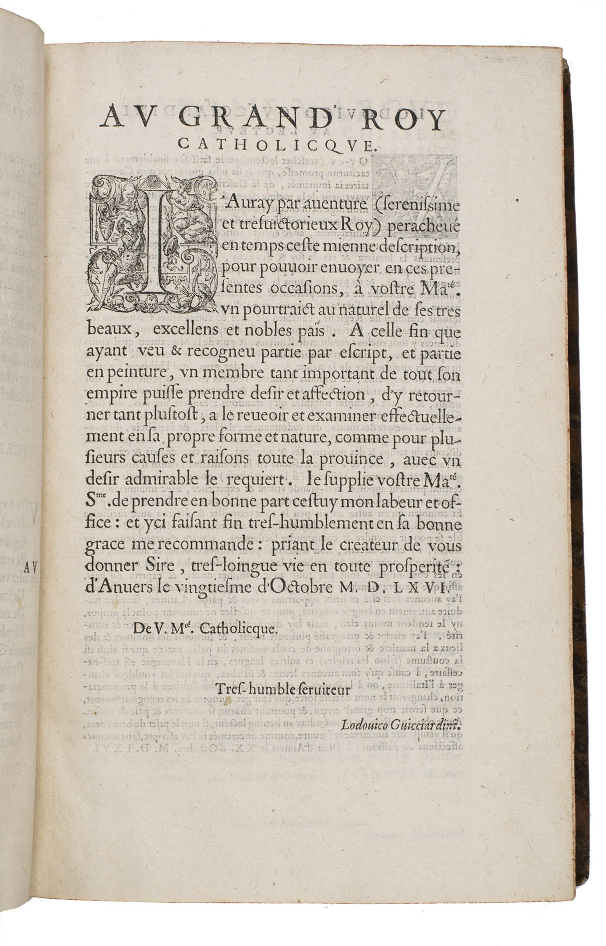
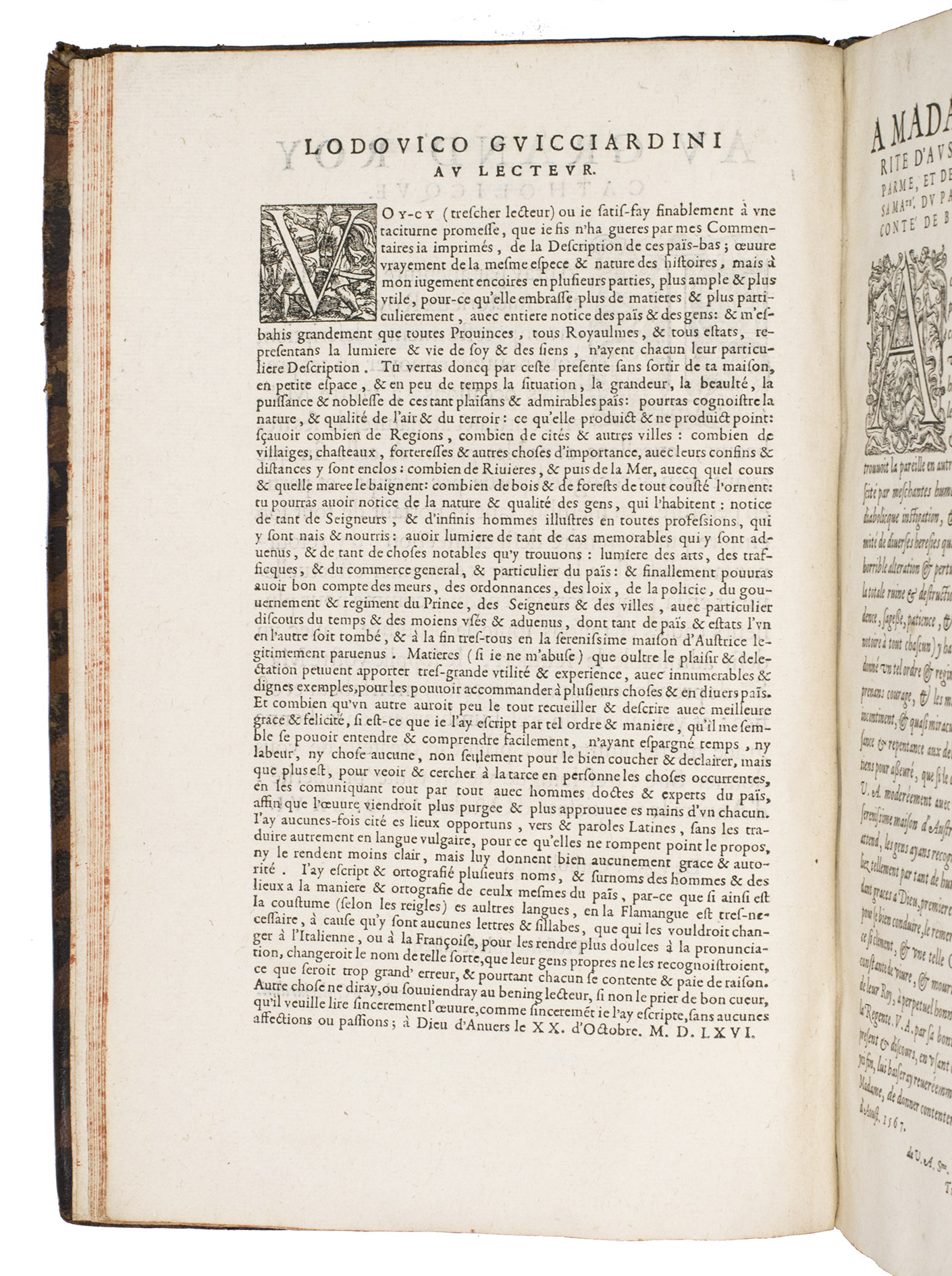
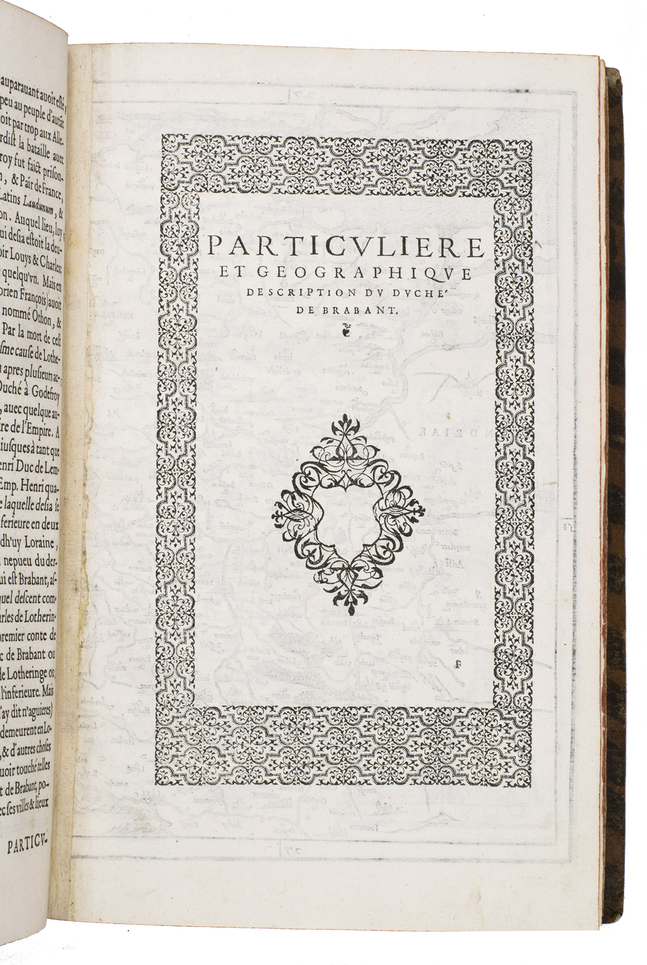
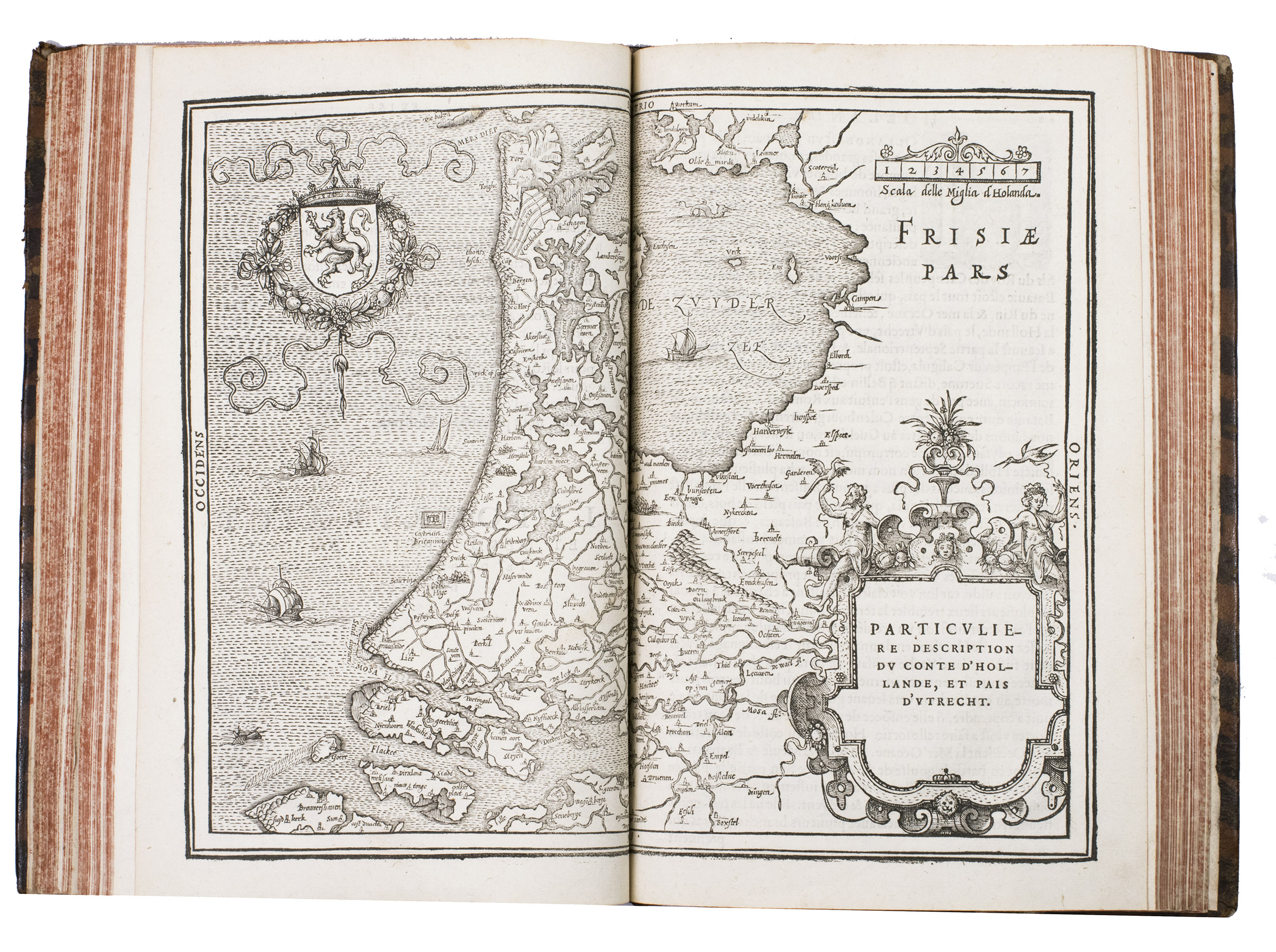
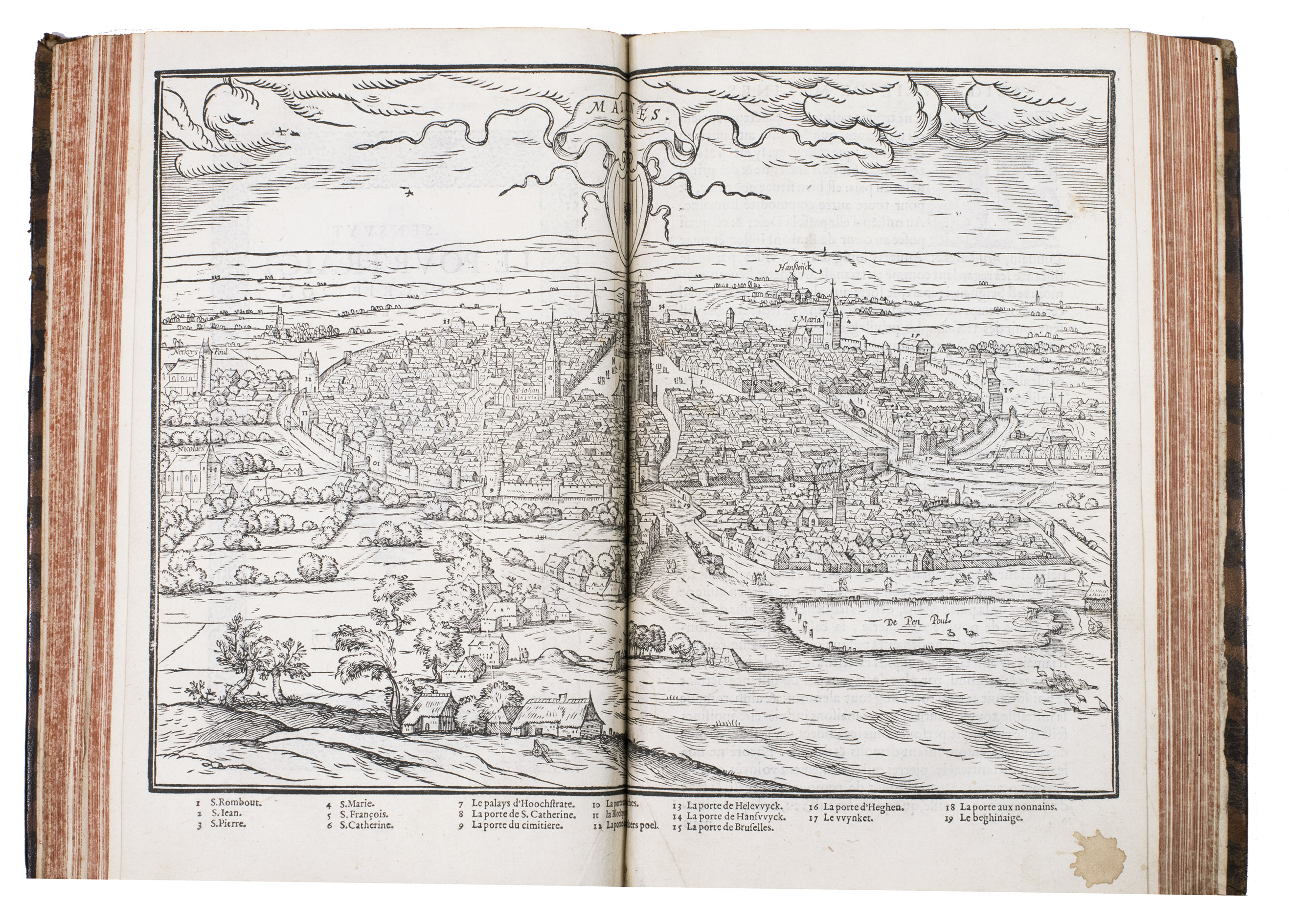
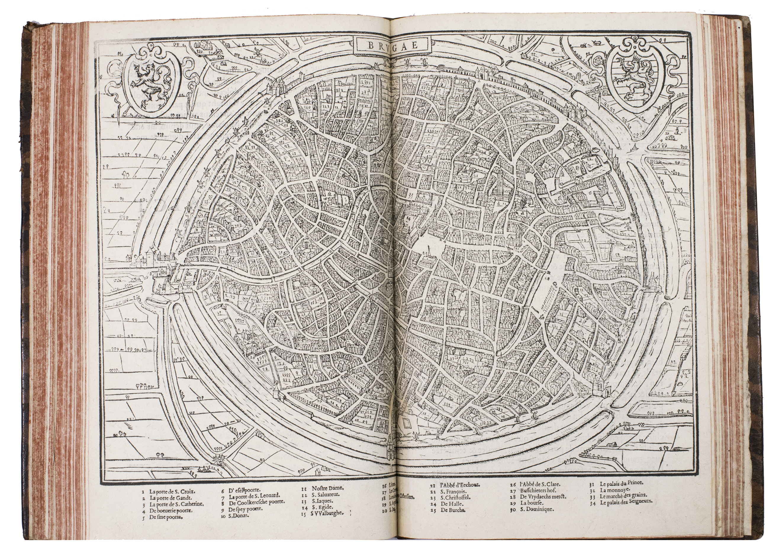
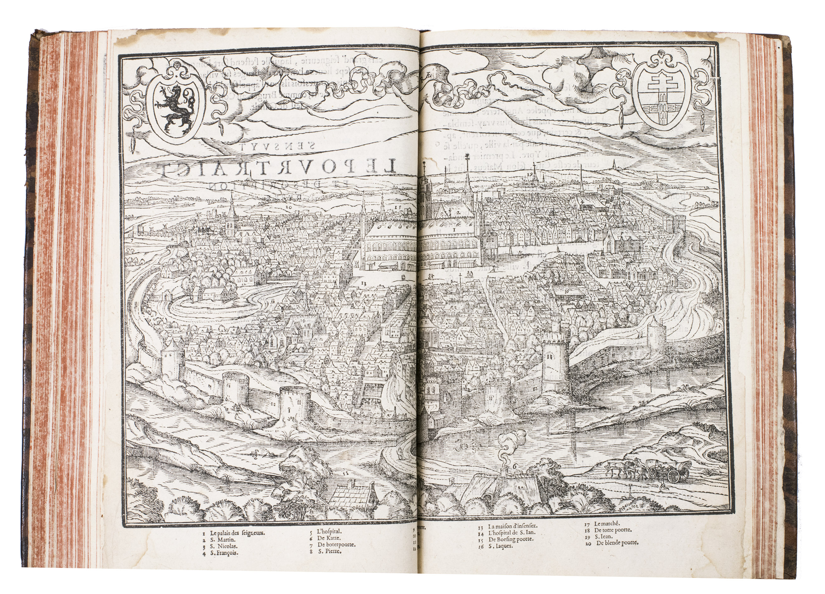
The work starts with some laudatory poems in Latin, Italian, Dutch, French and Greek, and a preface by Giucciardini. Then a general description of the Low Countries is given, followed by the different provinces and its cities, with maps of some of the major cities of the province, including Antwerp, Utrecht, Bruges, Amsterdam, Cambrai, and more. The topography of the various regions and major cities is emphasised, but it also covers all aspects of contemporary life in each area as well, including an extensive treatment of the fine arts, trade and the commercial concerns of each region. Written just at the beginning of the Dutch revolt against Spain by an eye-witness, the work is a very important source of information for the history of the Low Countries at the time describing all of the 17 provinces with their main cities and towns, albeit Antwerp takes the most prominent place. According to Prof. Robert Fruin it is the most original and important work on this turbulent and revolutionary period.
Guicciardini lived in Antwerp since 1542 where he developed a strong historical interest. After s
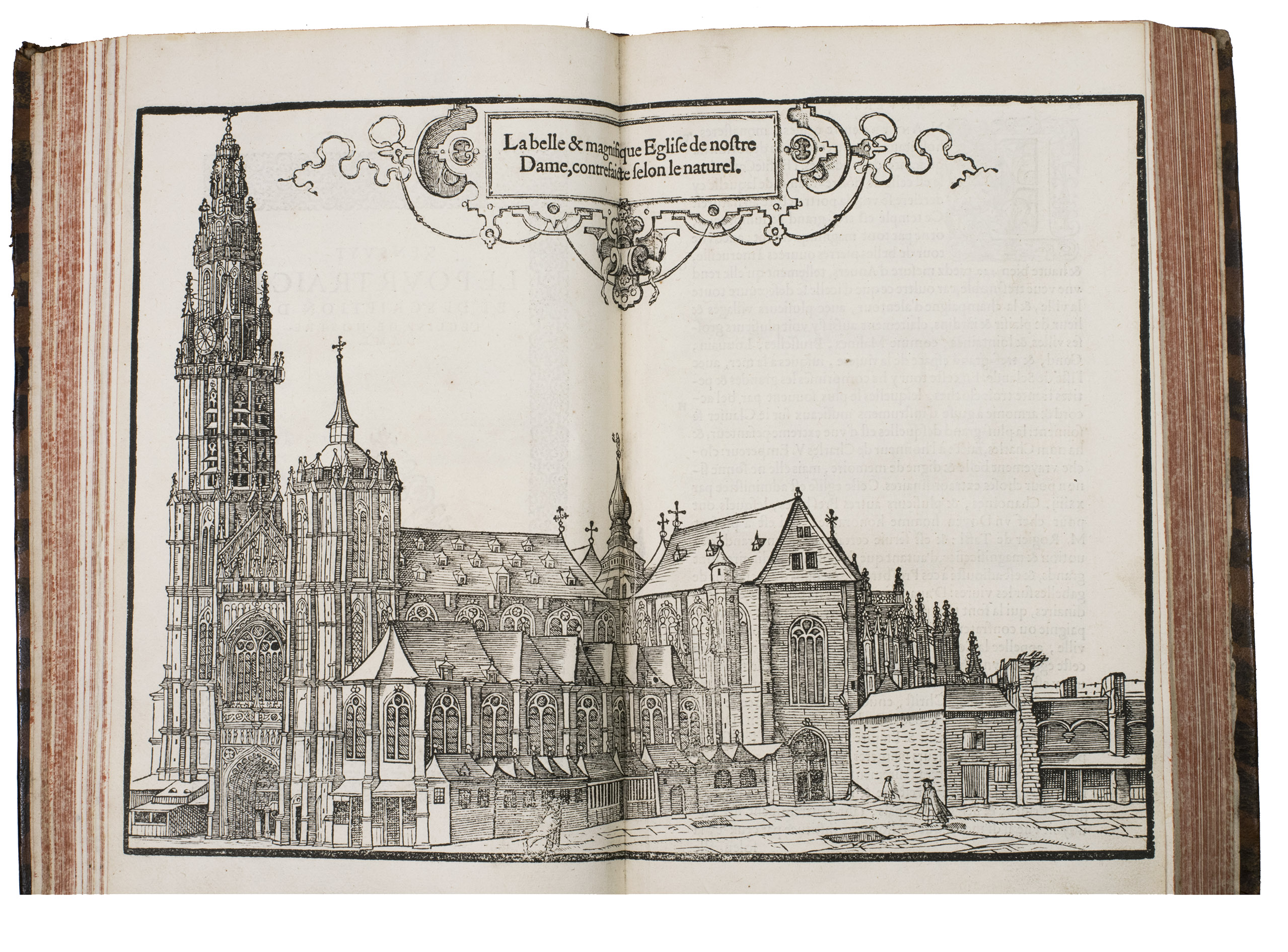
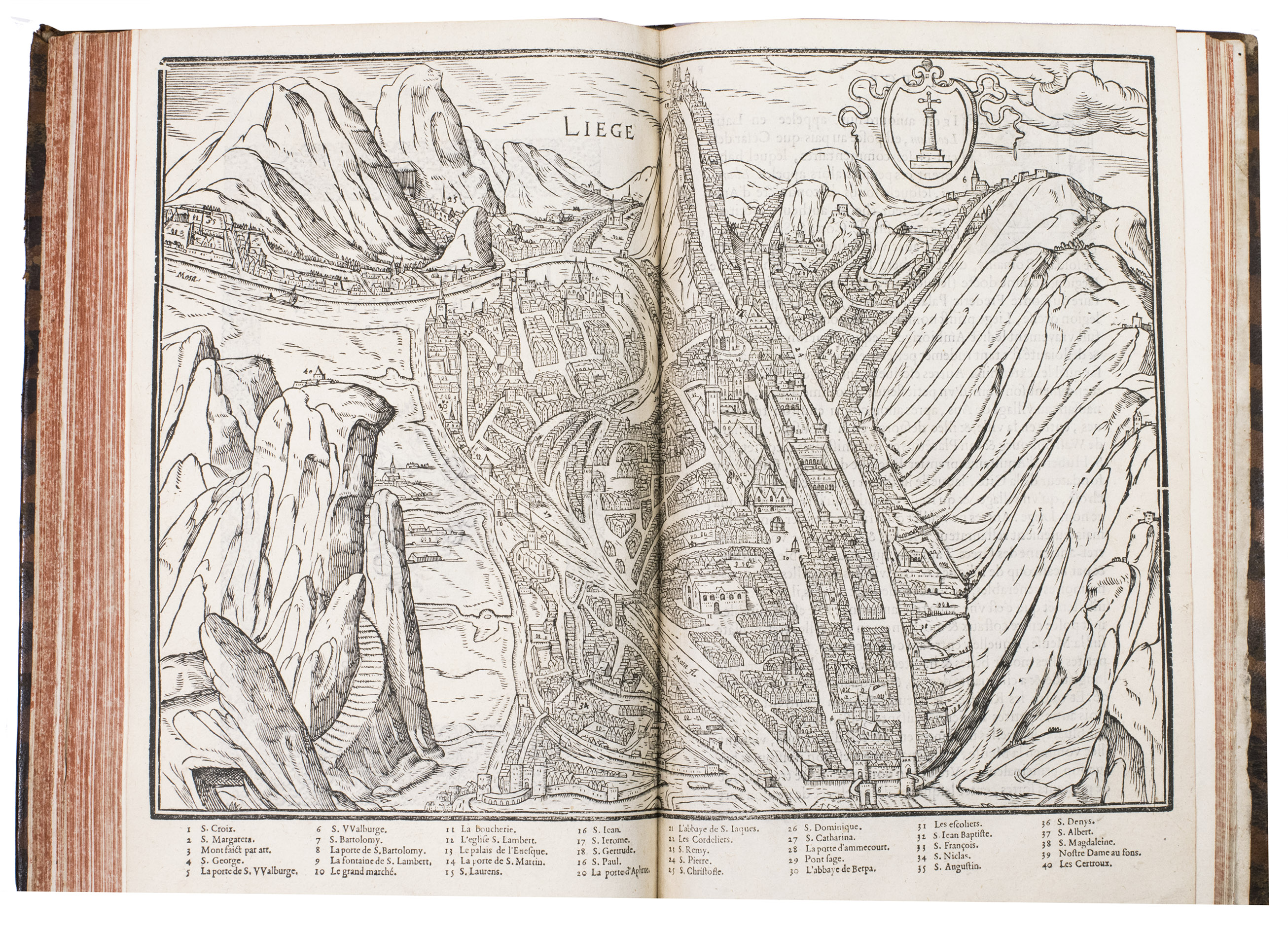
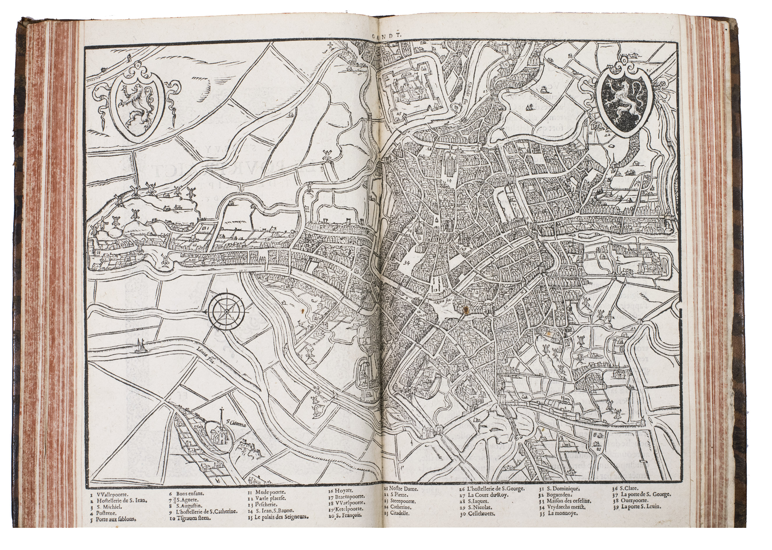
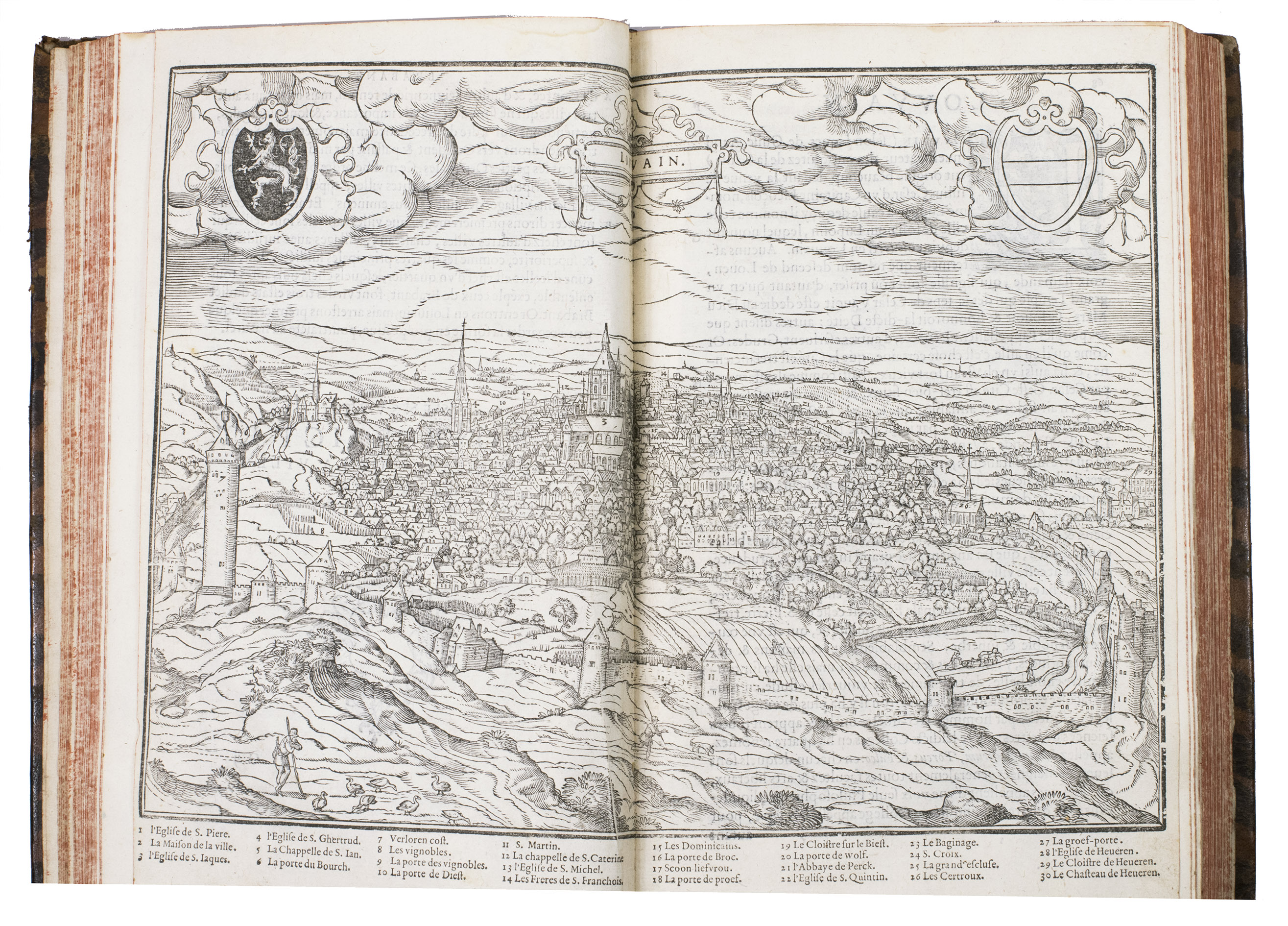
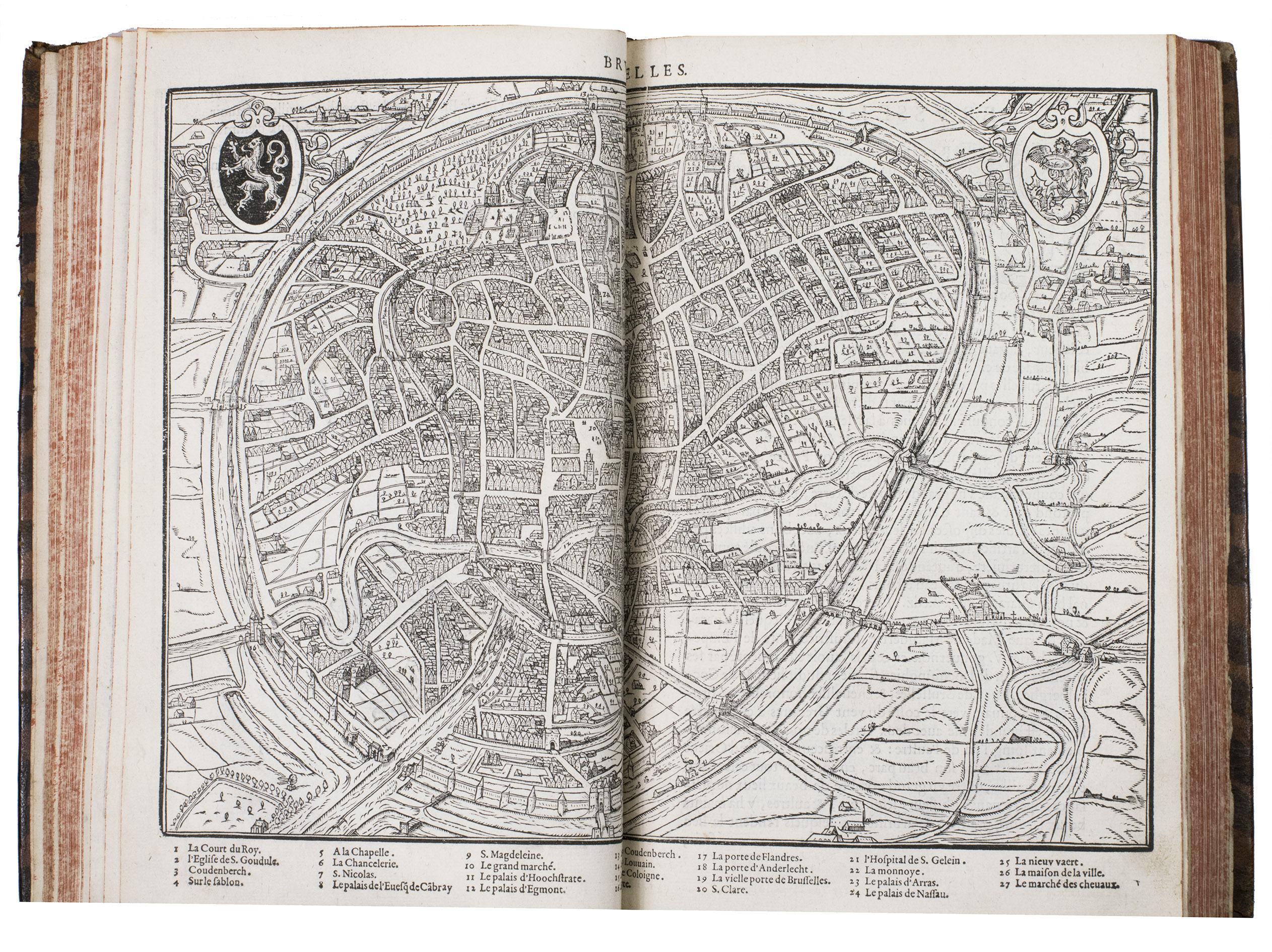
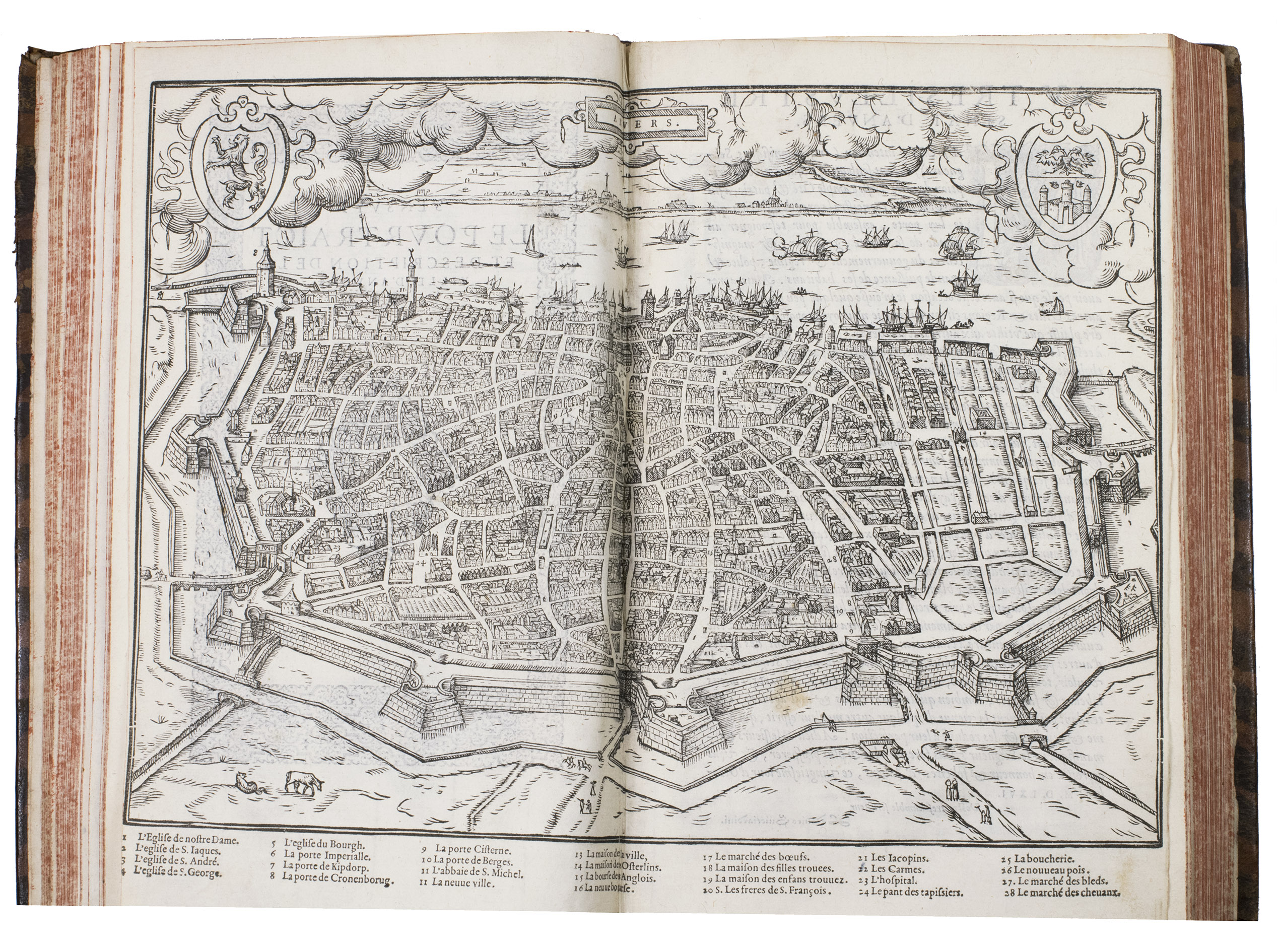
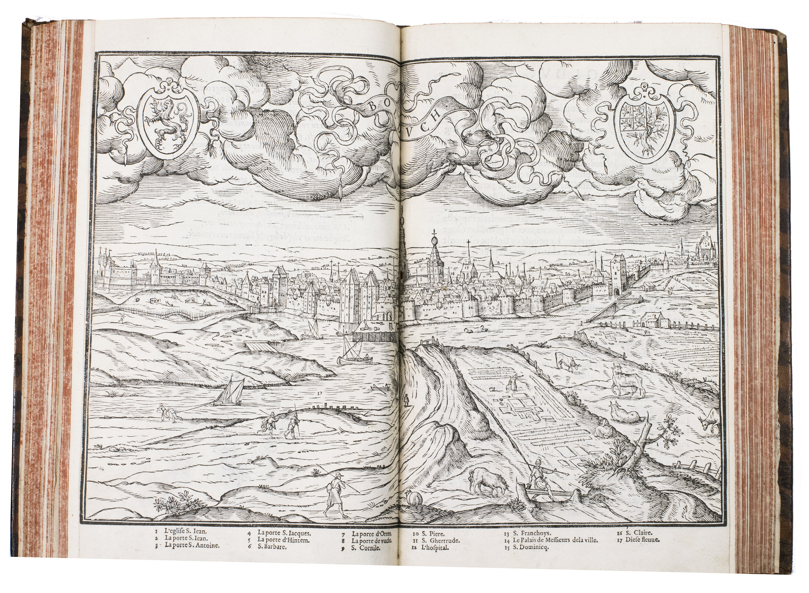
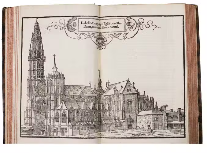
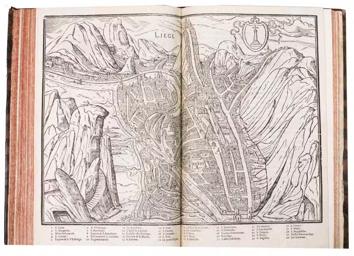
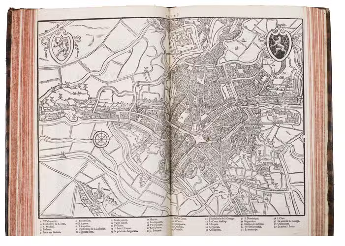
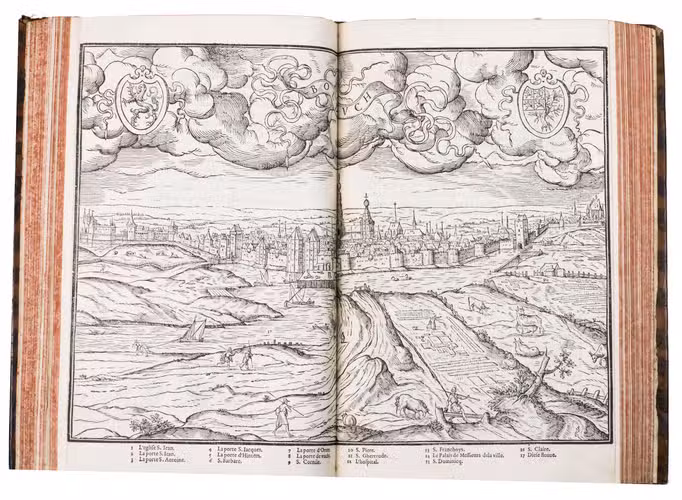
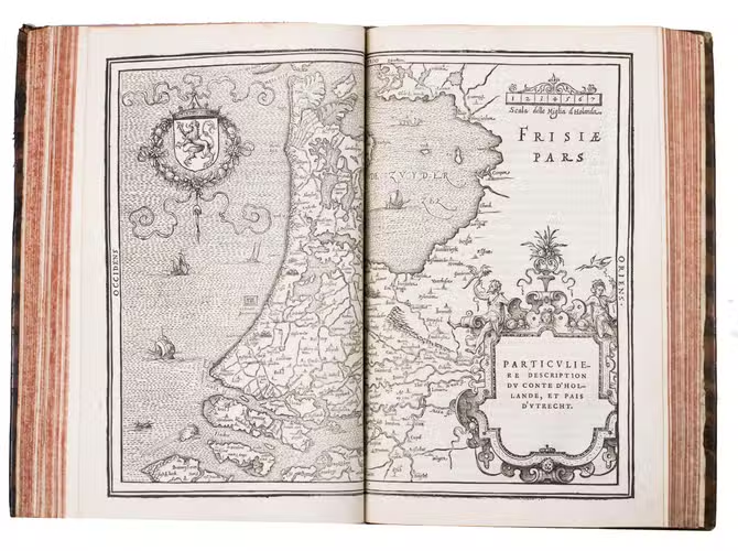
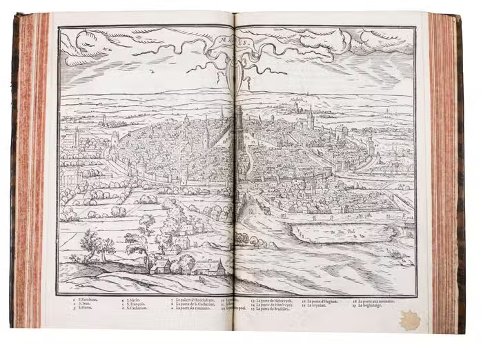
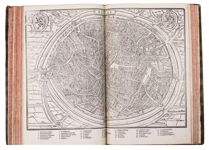
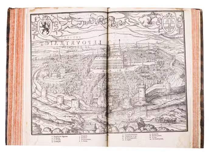
This first translation in French, probably by François Flory (not by Guicciardini himself as was suggested in 1973 by Prof. De la Fontaine Verwey, the translation of 1582 and later editions is by François de Belleforest) is illustrated with the same large woodcuts as in the original Italian edition of 1567. The 15 double-page woodcuts comprise 6 maps (resp. of Brabant, Holland and Utrecht, Flanders, Ghent, Bruges and Hainault), 1 plan of Brussels, 4 views (resp. of Louvain, the Cathedral of Antwerp, 'Bolduch' [='s-Hertogenbosch] and Malines) and 4 bird's-eye views (resp. of Antwerp, Amsterdam, Ypres and Liège).
With an unidentified armorial ownership stamp on the front pastedown, a 20th-century bookplate of Gerard Gorissen (with the motto 'Vrijheid adelt') mounted on the back pastedown, a contemporary ownership annotation ("A.N. De Guijsse") in black ink in the lower blank margin of the title page, and on the verso of the final leaf of the index a 16th-century ownership annotation in black ink ("Camerari [?] 10.o Martij, 1567. ante Pascha, constitit C. stus", possibly meaning that this book was bought on 10 March 1567 before Easter for 100 "stuvers"). The edges and corners of the boards are somewhat scuffed, the top and foot of the spine are slightly damaged. Some soiling and staining, the folding plate of the town hall of Antwerp has been restored. Otherwise in good condition. Belg. Typogr. 1363; Boele van Hoensbroek II; Pettegree & Walsby, French vernacular books 24; Tiele 421; Touwaide 2; USTC 27799; cf. De la Fontaine Verwey, De geschiedenis van Guicciardinis Beschrijving der Nederlanden, in: Uit de wereld van het boek, II, pp. 9-31; Guicciardini illustratus. De kaarten en prenten in Lodovico Guicciardinis Beschrijving van de Nederlanden (2001), p. 31.
Related Subjects: