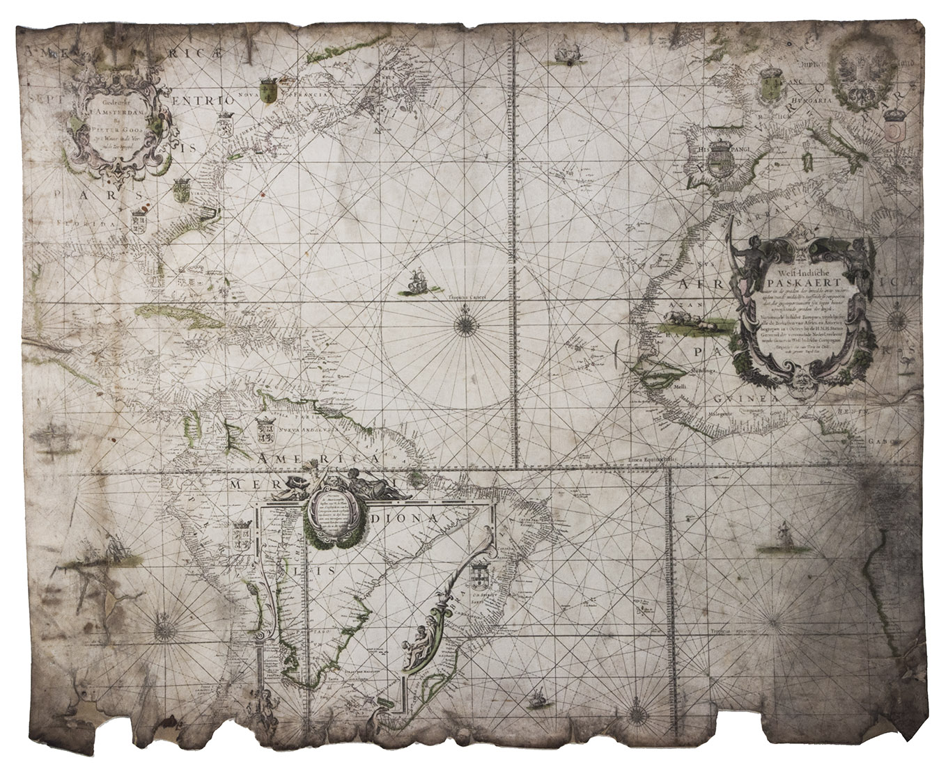
GOOS, Pieter.
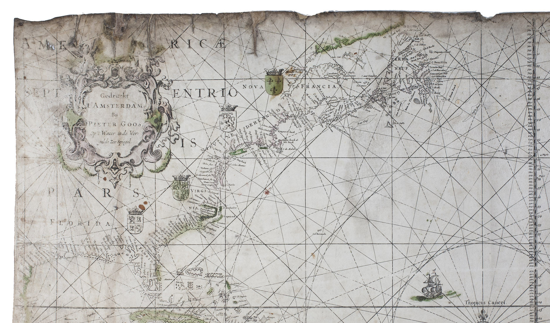
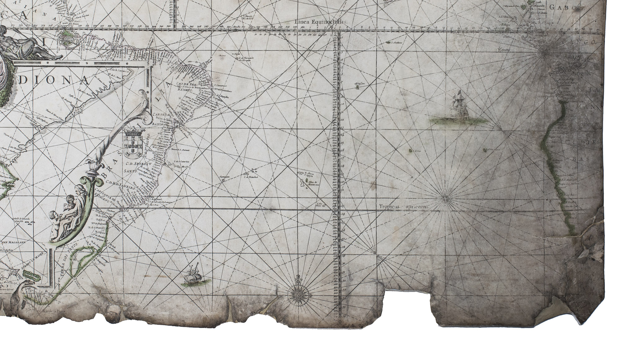
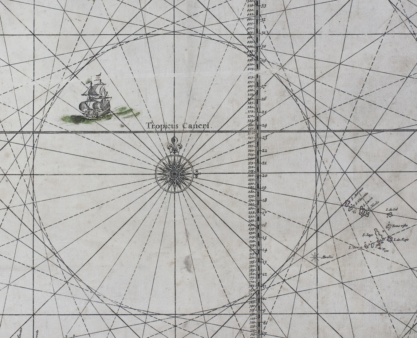
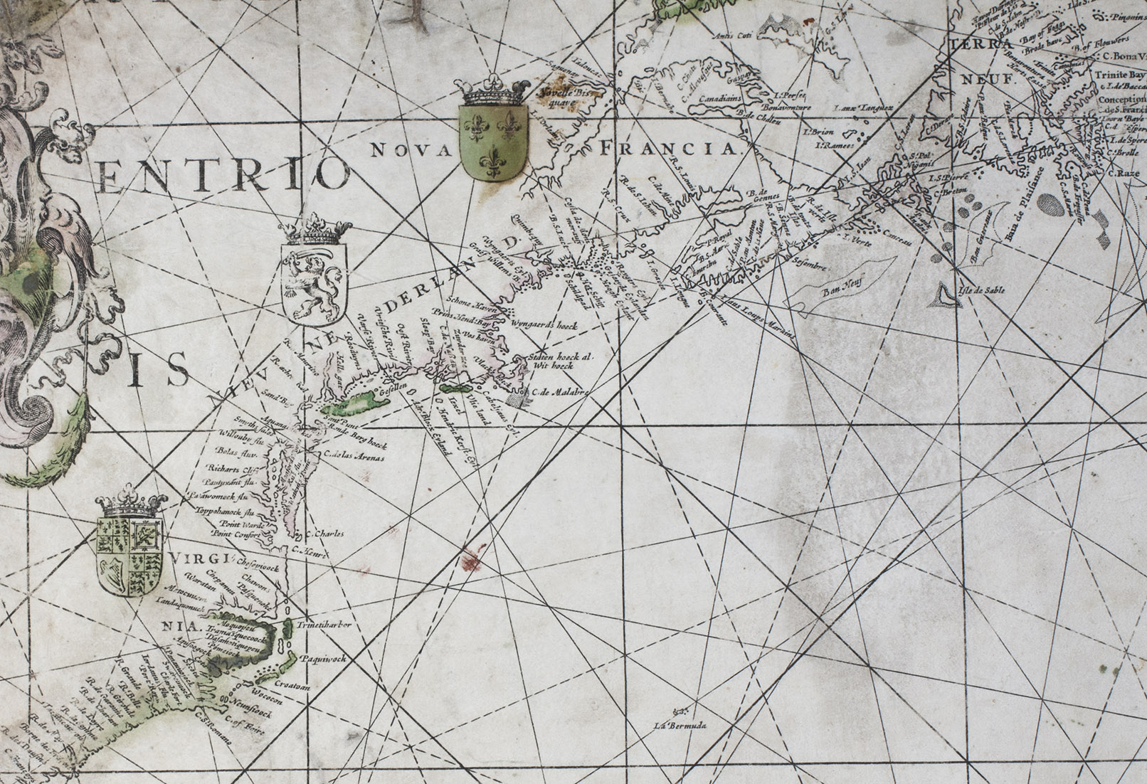
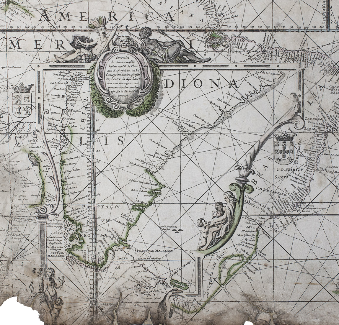
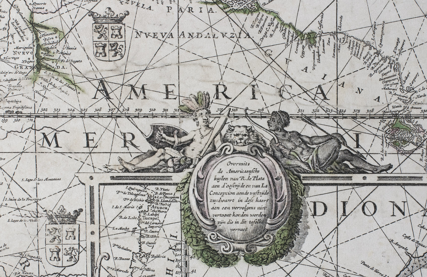
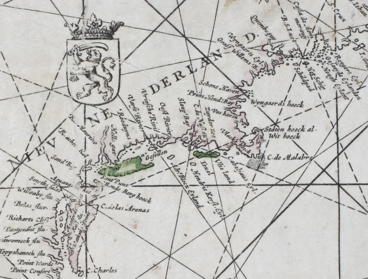
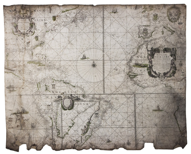
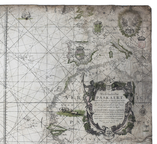
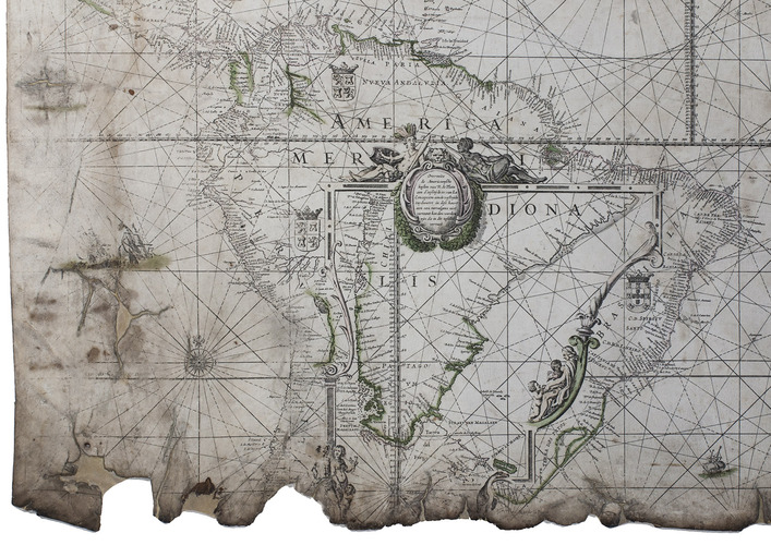
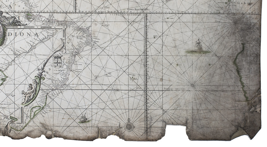
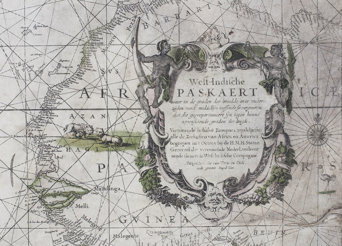
West-Indische Paskaert waer in de graden der breedde over wederzijden van de middellijn wassende so vergrooten dat die geproportioneert sijn tegen hunne nevenstaende graden de lengde. Vertonende behalve[n] Europaes zuydelijcste alle de zeekusten van Africa en America begrepen in 't Octroy bij de H.M.H. Staten Generael der vereenichde Nederl. verleent aende Generale West Indische Compagnie. Mitsgaders die van Peru en Chili inde groote Zuyd-Zee.
Amsterdam, Pieter Goos, [ca. 1660]. Printed on vellum (ca. 80 x 98 cm) from one large copperplate engraving, partly coloured by a contemporary hand.
€ 185,000
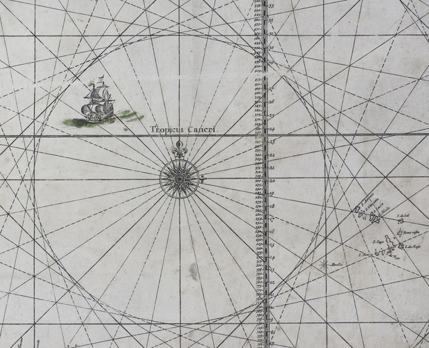
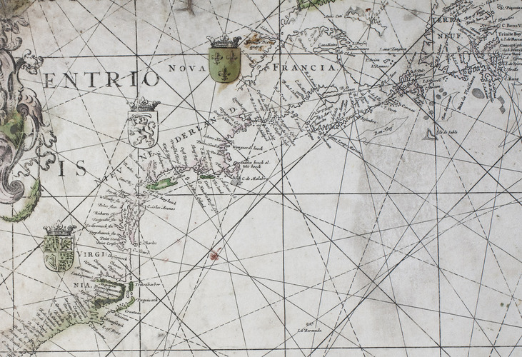
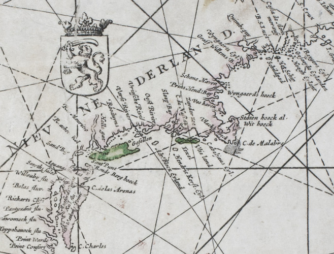
The West-Indische Paskaert engraved by Pieter Goos, in its rare first state, a nautical chart prepared for the Dutch West India Company (WIC) as an aid to crossing the Atlantic Ocean to the trading regions of the Americas and visiting trading posts in Africa. It shows parts of the east coast of North America, both coasts of South America, Mediterranean Europe and the west coast of Africa. Many West-Indische Paskaerten, as these navigational charts were called, were reprinted over and over from new states of the copperplates. For more than a century Dutch and foreign sea farers profited from their use on transatlantic journeys. The great cartographer Willem Jansz. Blaeu (1571-1638) published the first West-Indische Paskaert around 1630 using manuscript charts and other documents of the Atlantic and its coasts, including information provided by the Dutch WIC navigators who sailed these routes. Being one of the first practical uses of the Mercator projection, Blaeu's small-scale nautical chart was the first useful chart for crossing the Atlantic Ocean, making it easier to plot a straight line course for long distances on one map. Around 1660 Pieter Goos engraved four large navigation charts on new copperplates, including the plate for his present West-Indische Paskaert. The present copy shows the plate in its first state, the only copperplate that Goos actually engraved himself.
Pieter Goos (ca. 1616-1675) was a Dutch cartographer, engraver and printer and publisher of maps and atlases, whose father Abraham Goos (ca. 1590-1643) published many globes and maps together with Jodocus Hondius and Johannes Janssonius. He was especially known for his sea charts and his Zee-atlas ofte water-wereld (first edition 1666), one of the best maritime atlases of its time. Goos' West-Indische Paskaert in its present first state is of the utmost rarity: 8 other copies are known and only 4 on vellum.
The West-Indische Paskaert remained one of the maps for the Dutch West India Companys most important nautical charts for decades, with several important map printers and publishers producing editions from various plates that went through numerous states. The present nautical chart therefore not only bears beautiful witness to the golden age of Dutch maritime history, exploration and cartography; it is also a very rare vellum copy showing the first state of the copperplate engraved by Goos himself.
The map has been professionally restored, with the tears along the edges repaired and the brittle parts reinforced with Japanese paper, and the map mounted on museum-quality preservation corrugated board which in turn is mounted on museum-quality honeycomb board. Somewhat faded, with a water stain in the left part, some smaller stains, the foot a little frayed (hardly affecting the map) and a little dust-soiled, but overall in good condition. a very rare state, the first state of the Gooss copperplate nautical chart of the Atlantic in its rare first state and printed on vellum. Burden II, 442 (misdated ca. 1674); Schilder & Kok, Goos 4.1 (8 copies, incl. 2 on paper, 1 missing, 1 incomplete); cf Schilder, Monumenta, 63 (other states), 63.4 (the 1675 Blaeu-Goos state); for the use of nautical charts: Koeman, "17e eeuwse Hollandse bijdragen in de kartering van de Amerikaanse kusten", in: Caert thresoor 1 (1982), pp. 50-51; Schilder & Van Egmond, "Maritime cartography in the Low Countries during the Renaissance", in: The history of cartography, volume 3: cartography in the European Renaissance (2007), pp. 1425-1426.
Related Subjects: