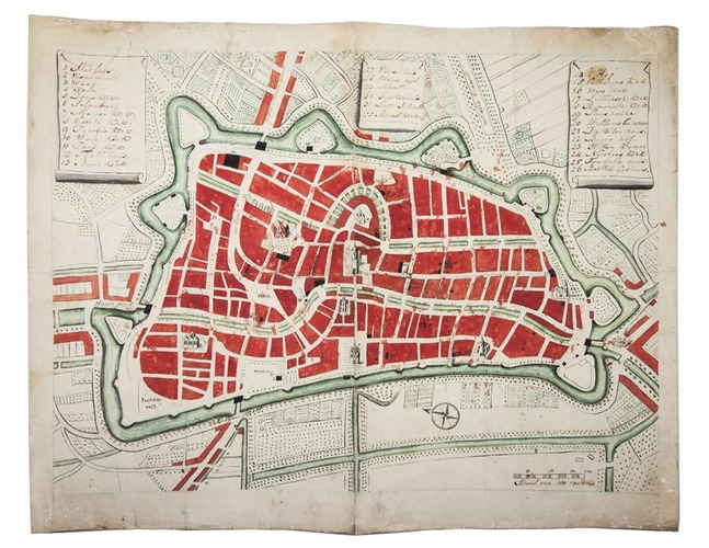
[MAP - NETHERLANDS - UTRECHT].
[Manuscript map of Utrecht].
[Netherlands, late 18th century]. Manuscript map (38 x 52.5 cm) on paper, in brown ink with bright green and red watercolour. With 3 panels at top left, middle and right, with keys to 31 important locations, a compass rose, a scale, and detail drawings of several buildings.
€ 1,000
Late 18th-century enlarged manuscript copy of Platte grond der stad Utrecht published ca. 1740 by Hendrik de Leth, with a revised list of keys (the original keys weren't all displayed in the map), and even including the same scale and compass rose. It shows the fortification and the most important locations, rivers and roads. Paper with watermark Blauw & Briel and with the original merchants mark of D&C Blauw (cf. Voorn 165), so probably after 1768.
The colouring is a bit crude, with some stains. Reasonable condition. Cf. Donkersloot-De Vrij, Kaarten van Utrecht 25.
Related Subjects: