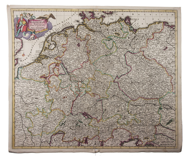
[MAP - CENTRAL EUROPE]. DANCKERTS, Justus.
Accuratissima Germaniae tabula.
Amsterdam, Justus Dankerts, [before 1701]. Engraved map (48.5 x 57.5 cm) on a sheet of laid paper (51.5 x 61 cm), coloured in outline in a contemporary hand, with the title in an illustrated cartouche at the upper left, and a scale at the lower right (ca. 1:2,400,000).
€ 450
Engraved map of central Europe by the cartographer Justus Danckerts (1635-1701). It shows present-day Germany, Belgium and the Netherlands in its totality, with large parts of Austria, Czech Republic, France, Hungary, Poland, Switzerland and even small parts of Croatia, Denmark, England, and Italy.
Corners folded, and a small damage at the bottom of the fold, only slightly affecting the image, otherwise in good condition. Koeman II, Dan 1 (no. 11).
Related Subjects: