[LAFRERI - DUCHETTI - FLORINI - MAPS AND ENGRAVINGS - ITALY].
[Large album with 16th-century maps and engravings of Italy].
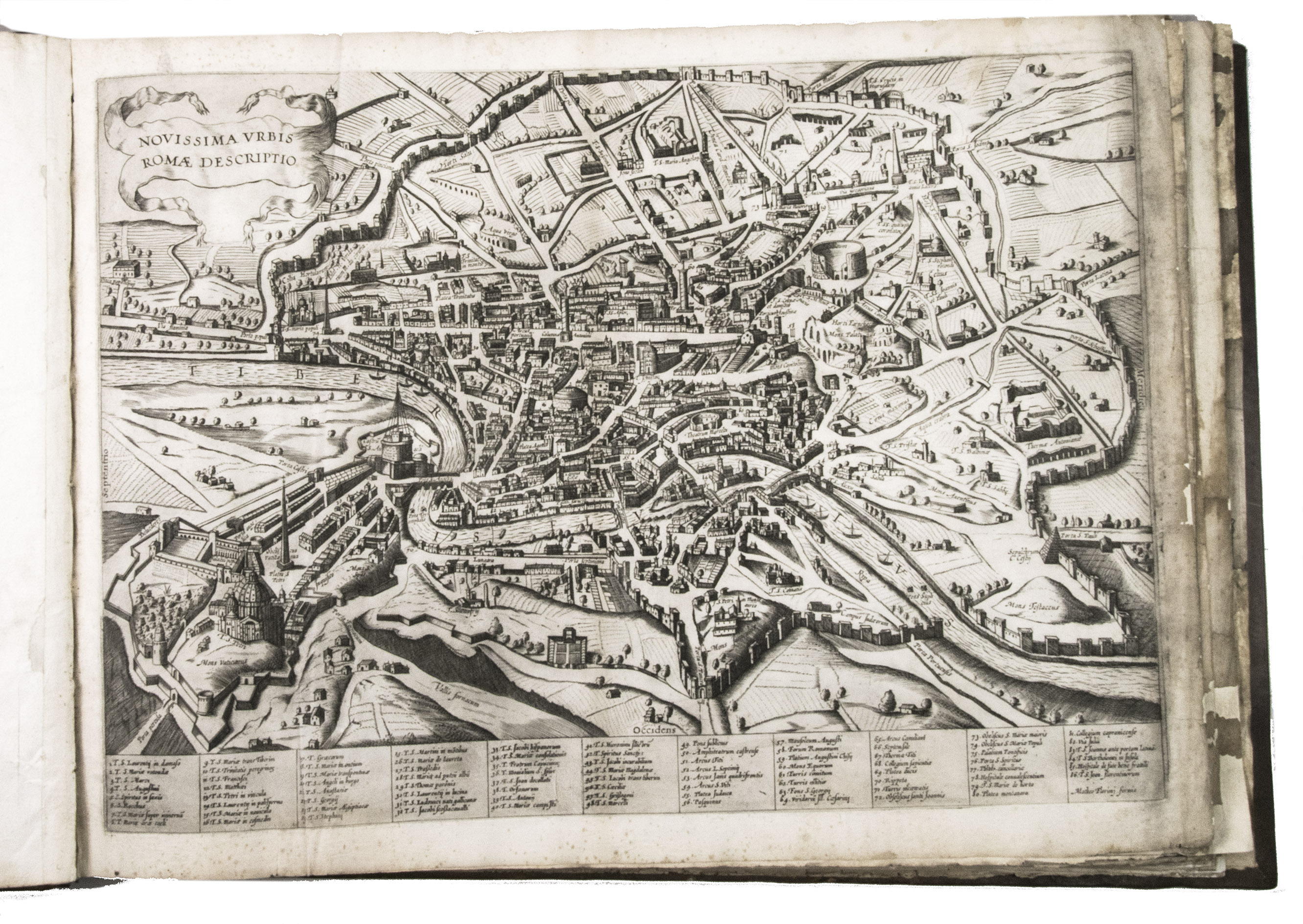
[Italy, late 16th and early 17th century]. Large oblong folio (ca. 59 x 42.3 cm). With 76 full-page engravings, and 12 full-page etchings. 17th-century gold-tooled brown calf, sewn on 6 supports with the corresponding raised bands on the spine, a red morocco title label on the spine with the title "Novissim[a] urbis Romae descript[io]" lettered in gold, gold-tooled board edges.
€ 150,000
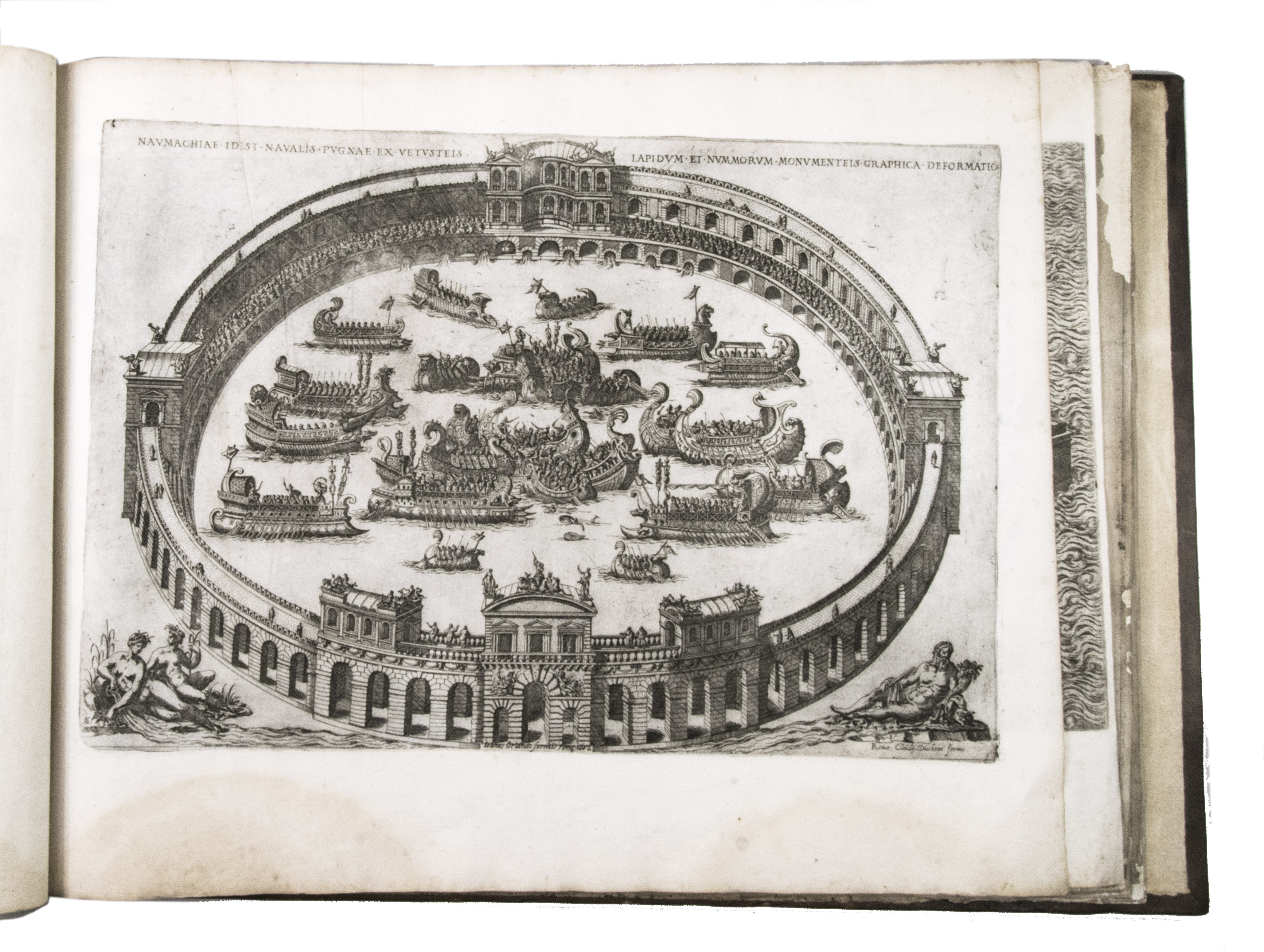
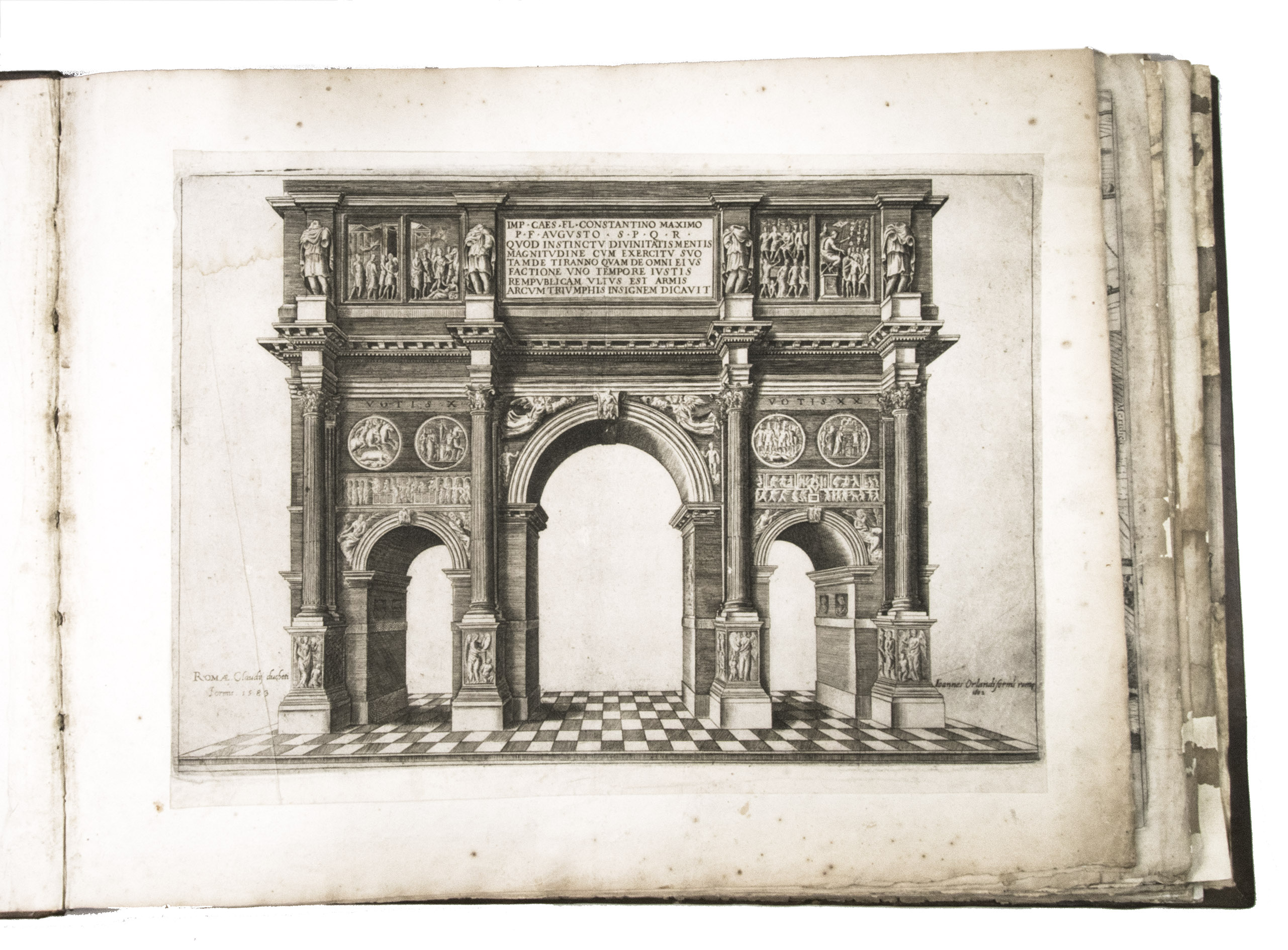
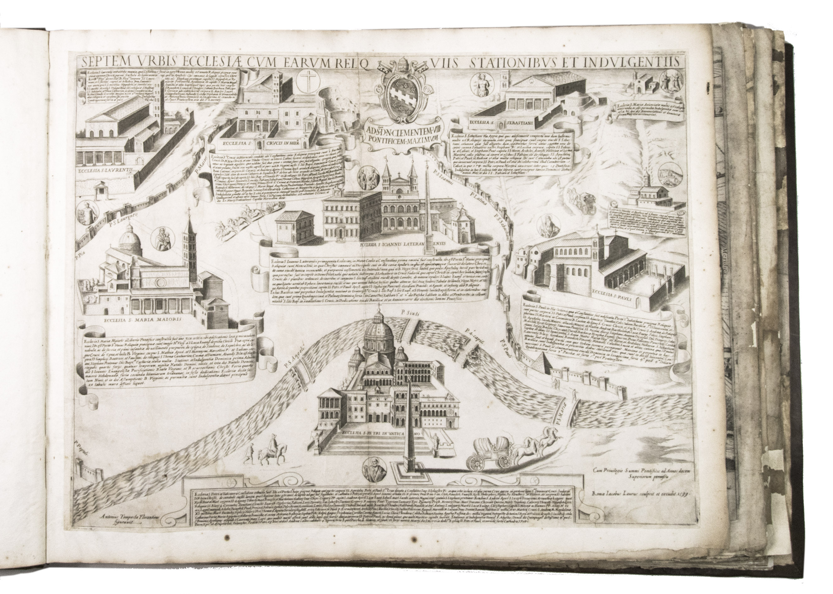
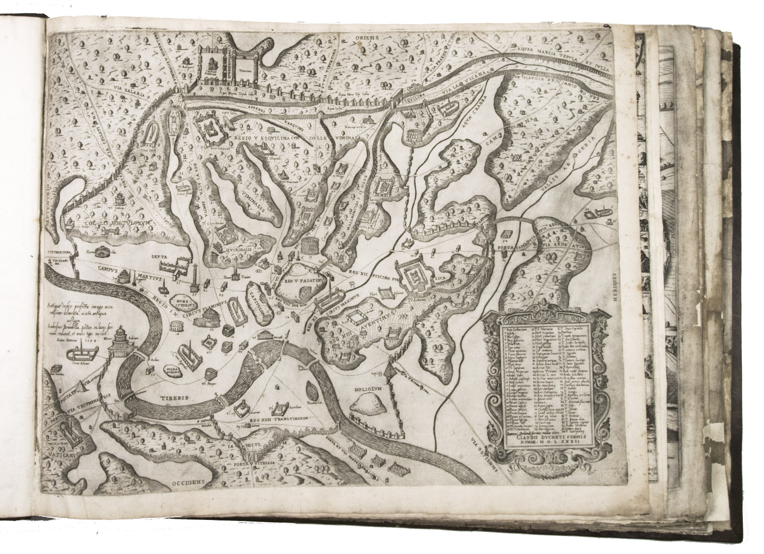
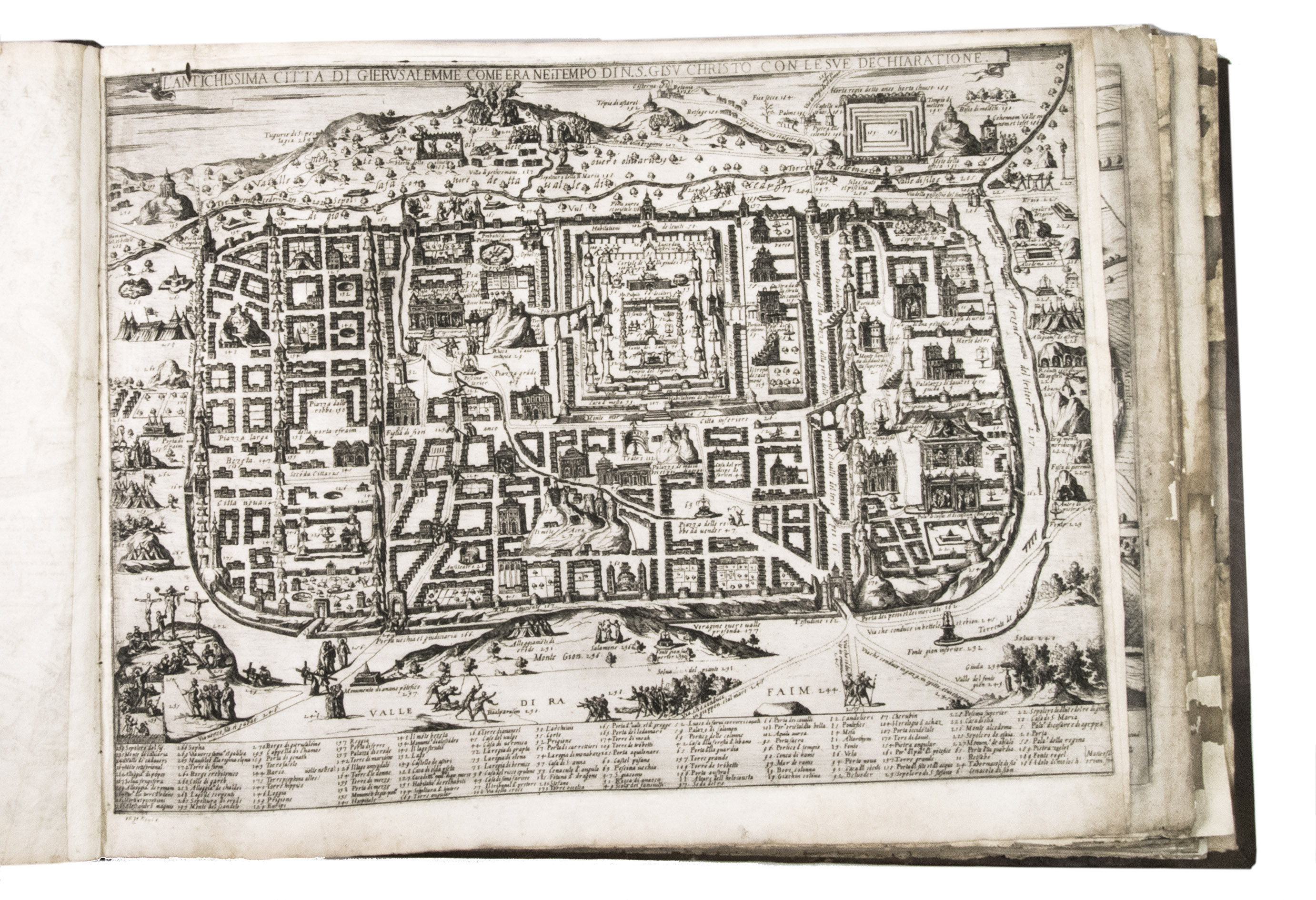
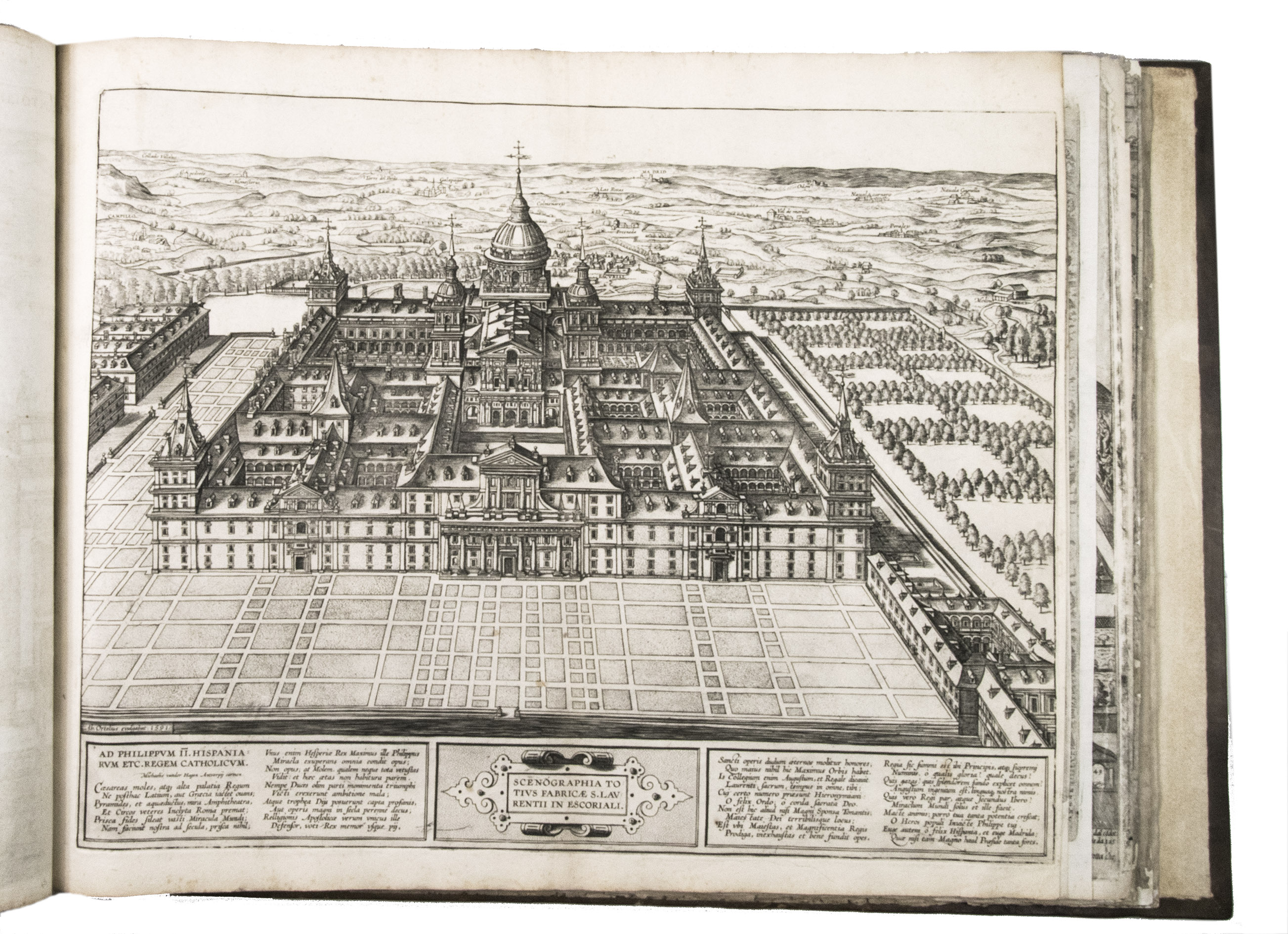
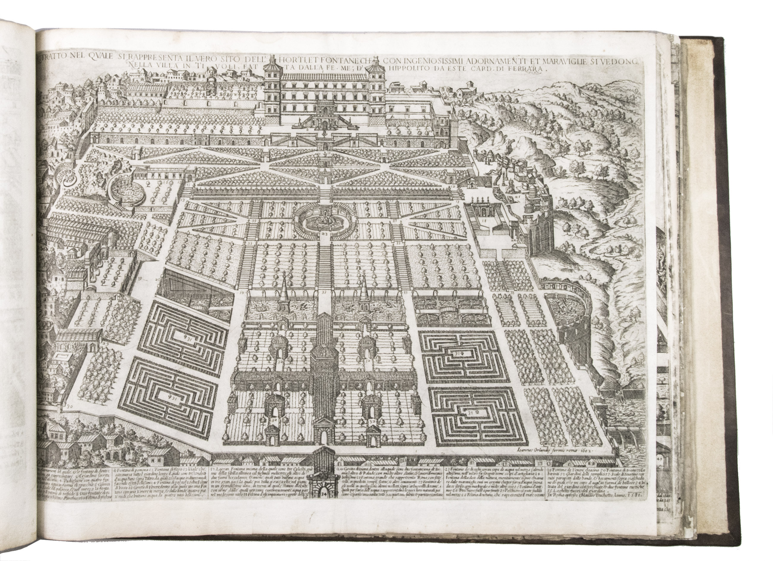
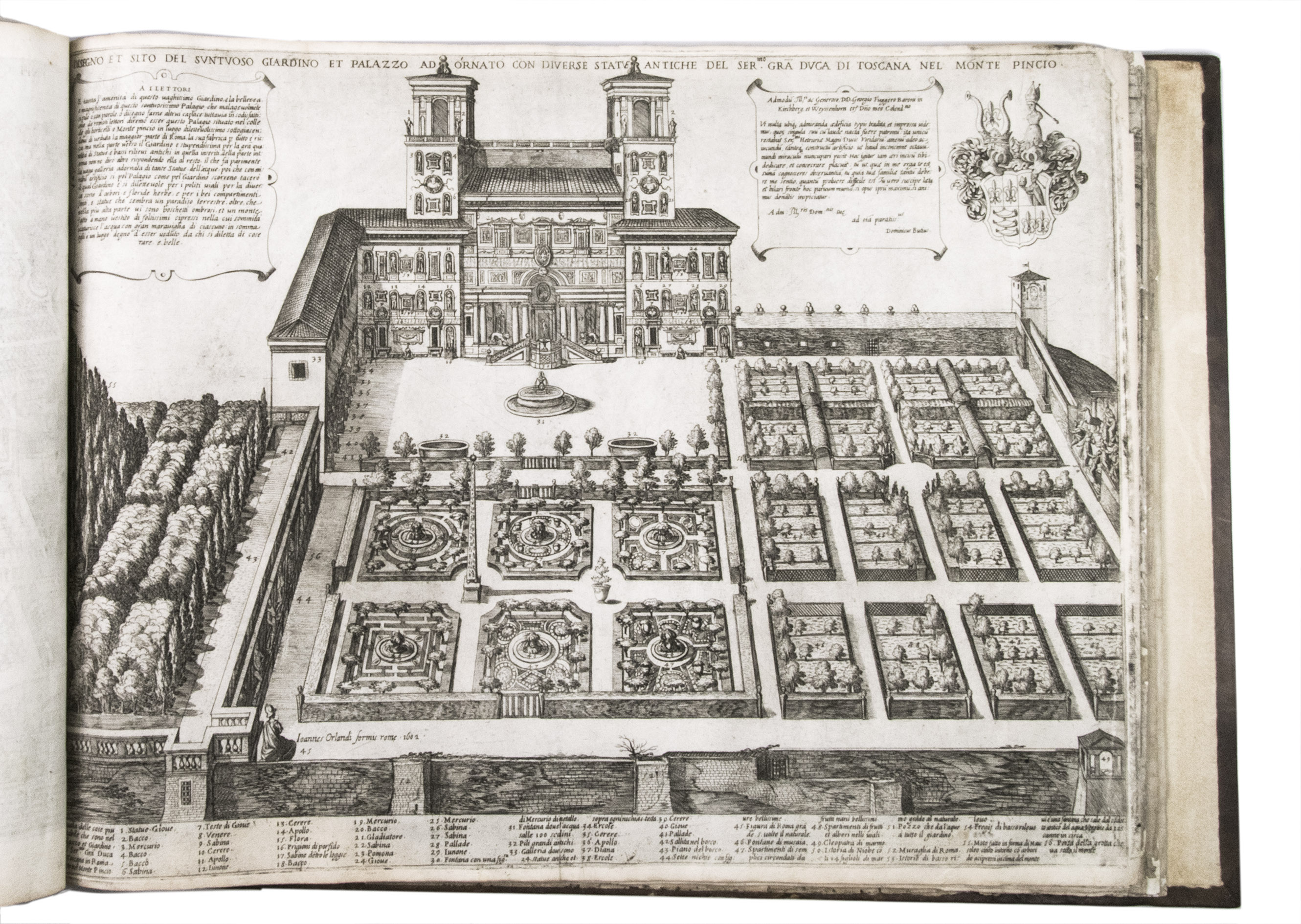
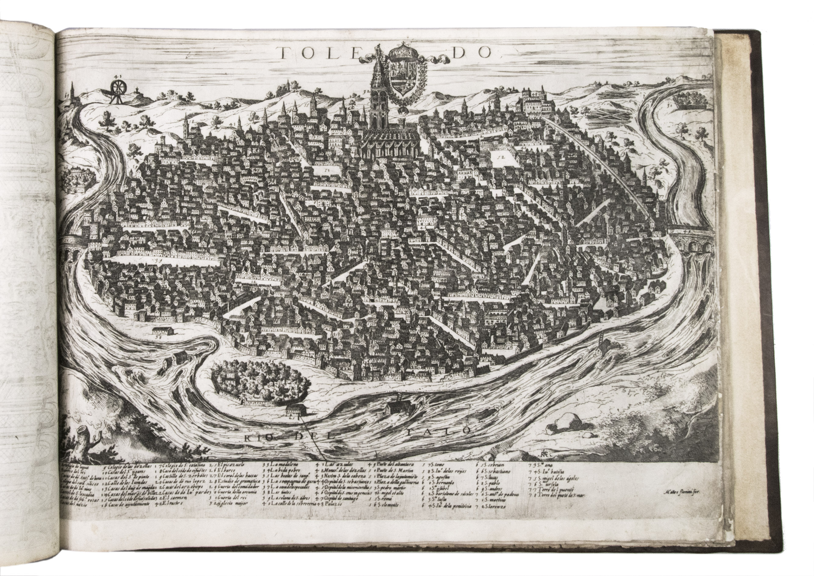
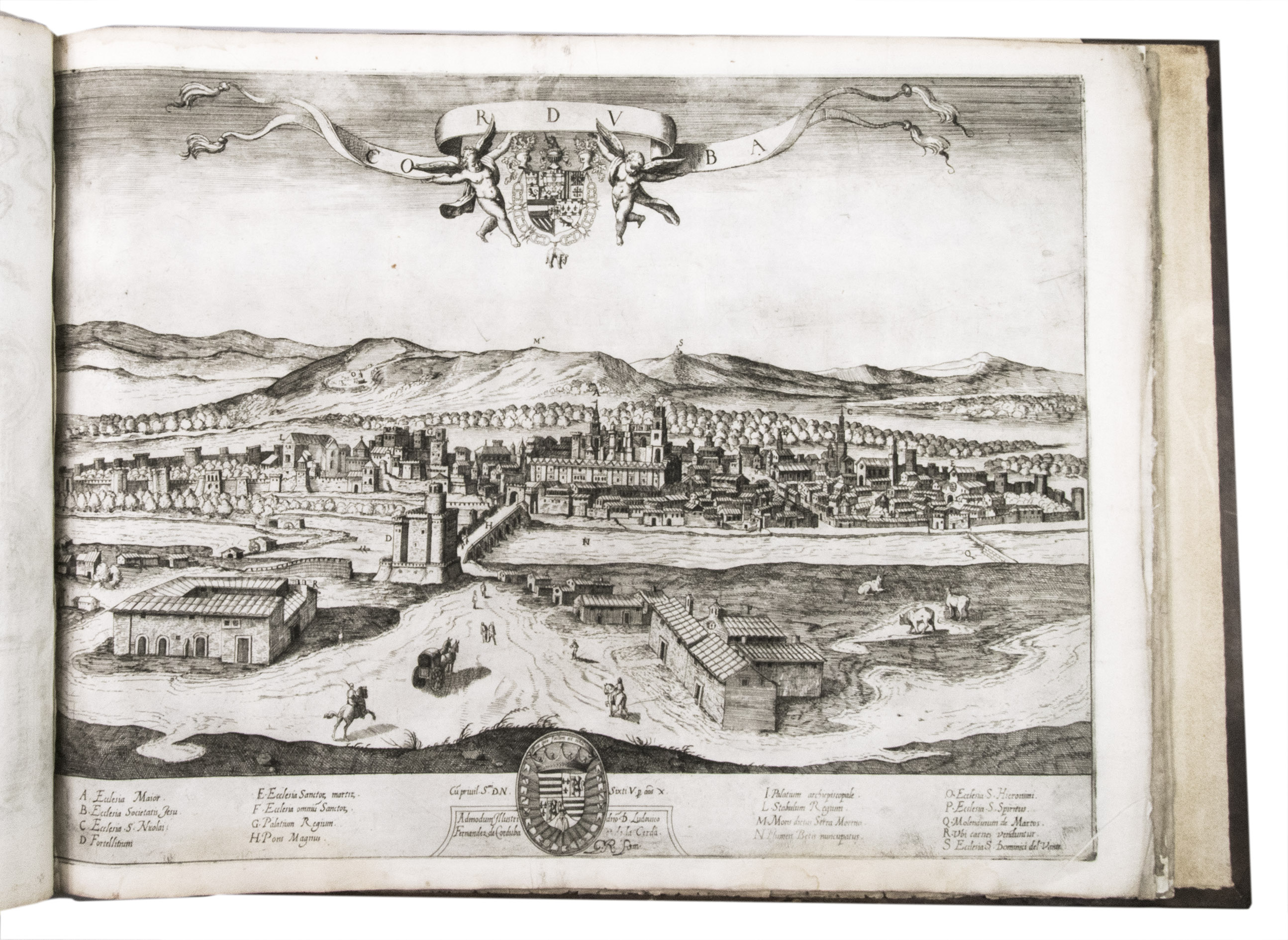
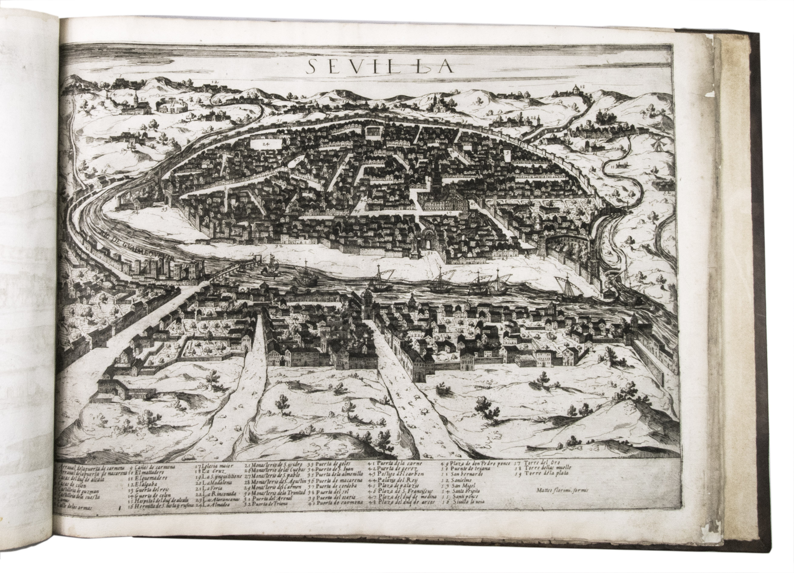
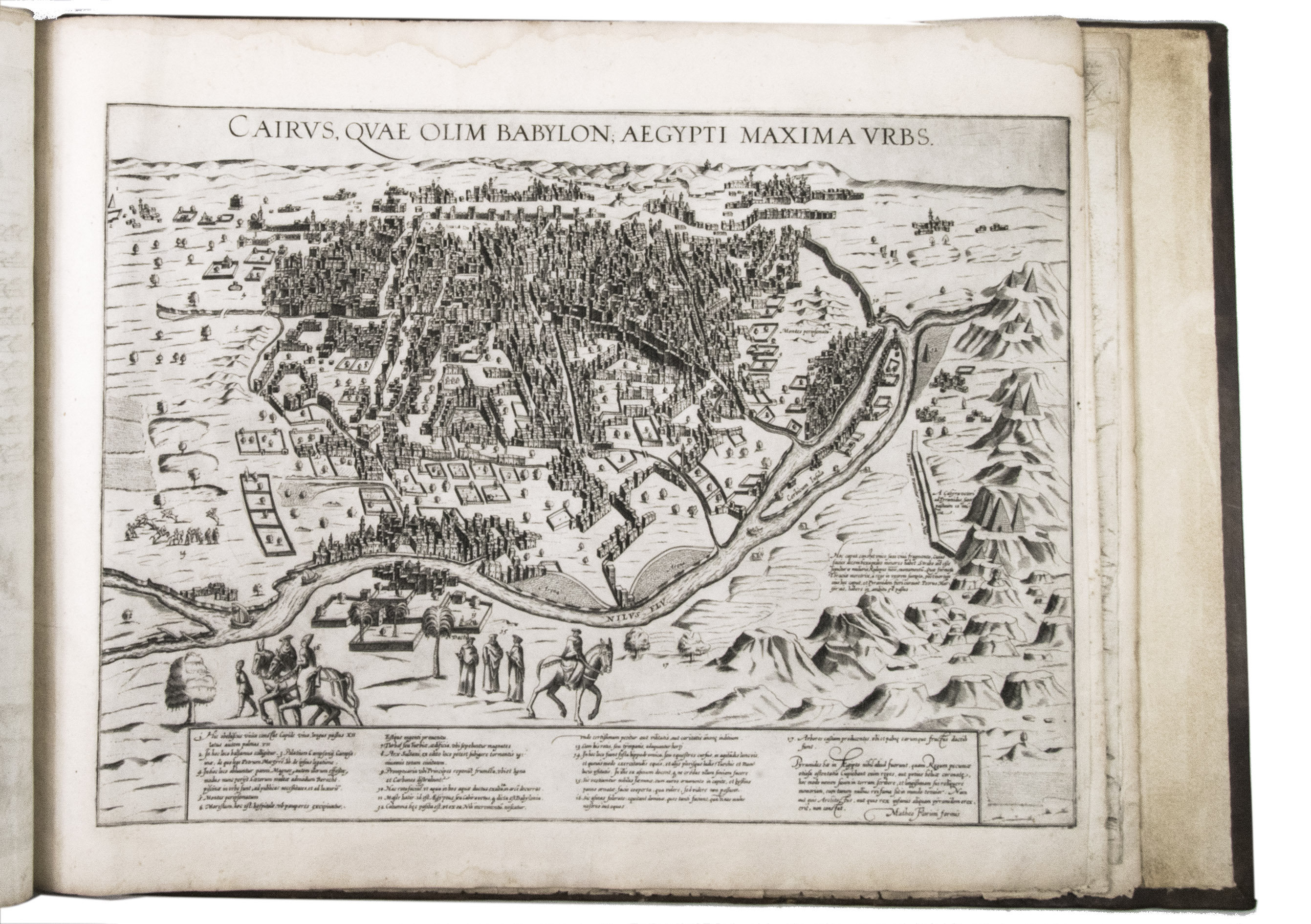
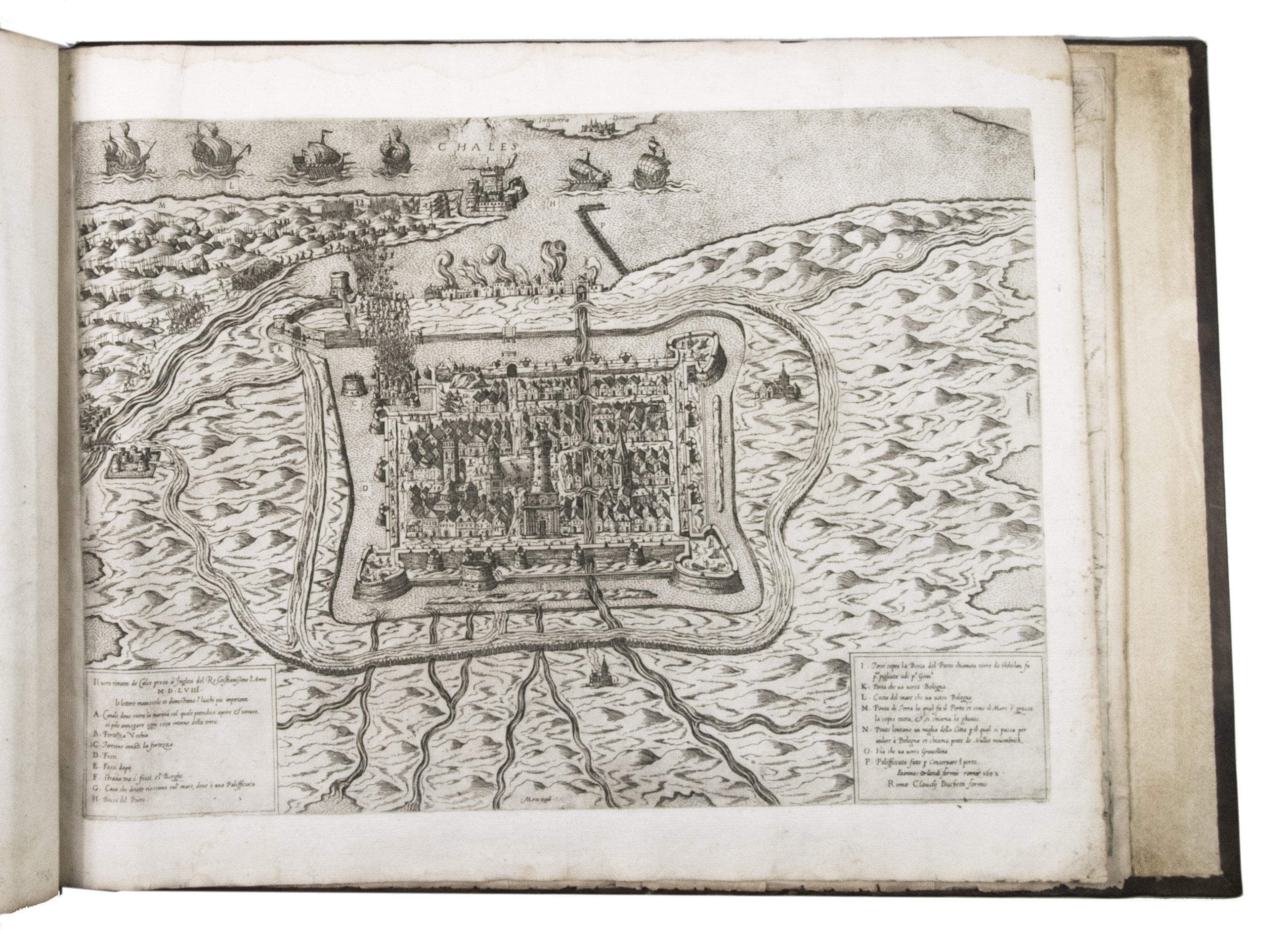
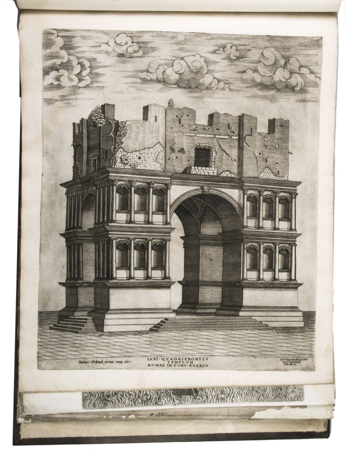
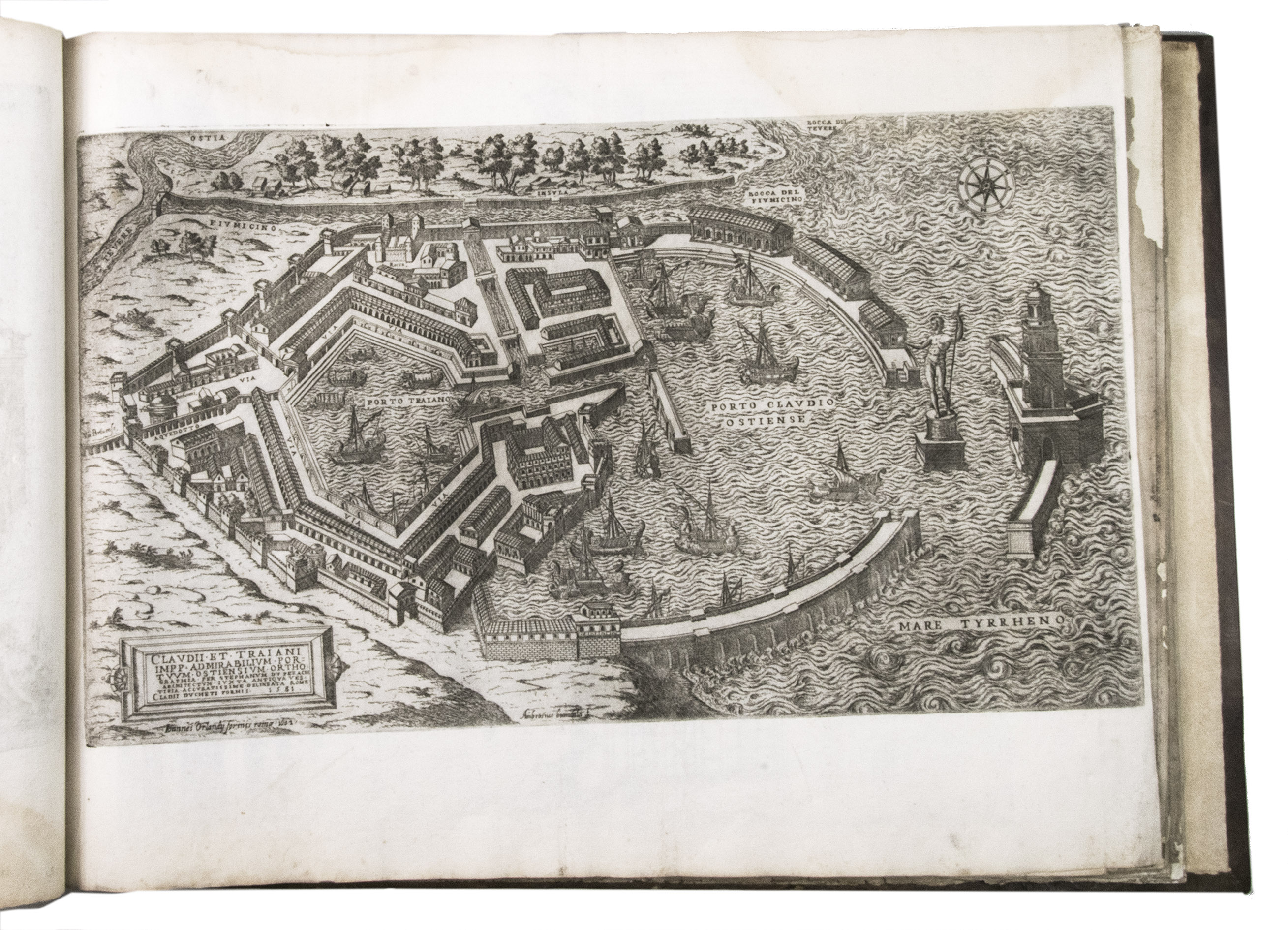
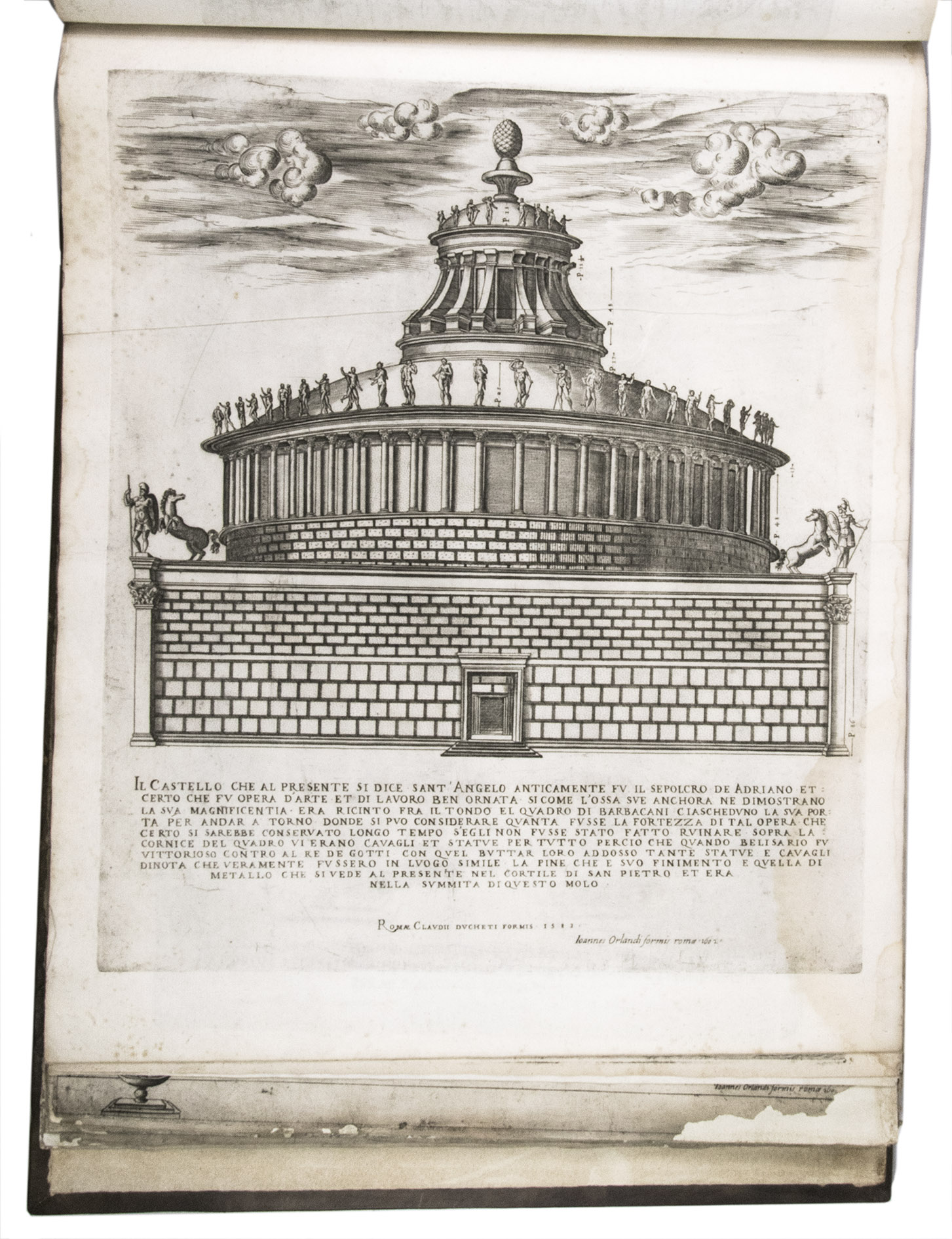
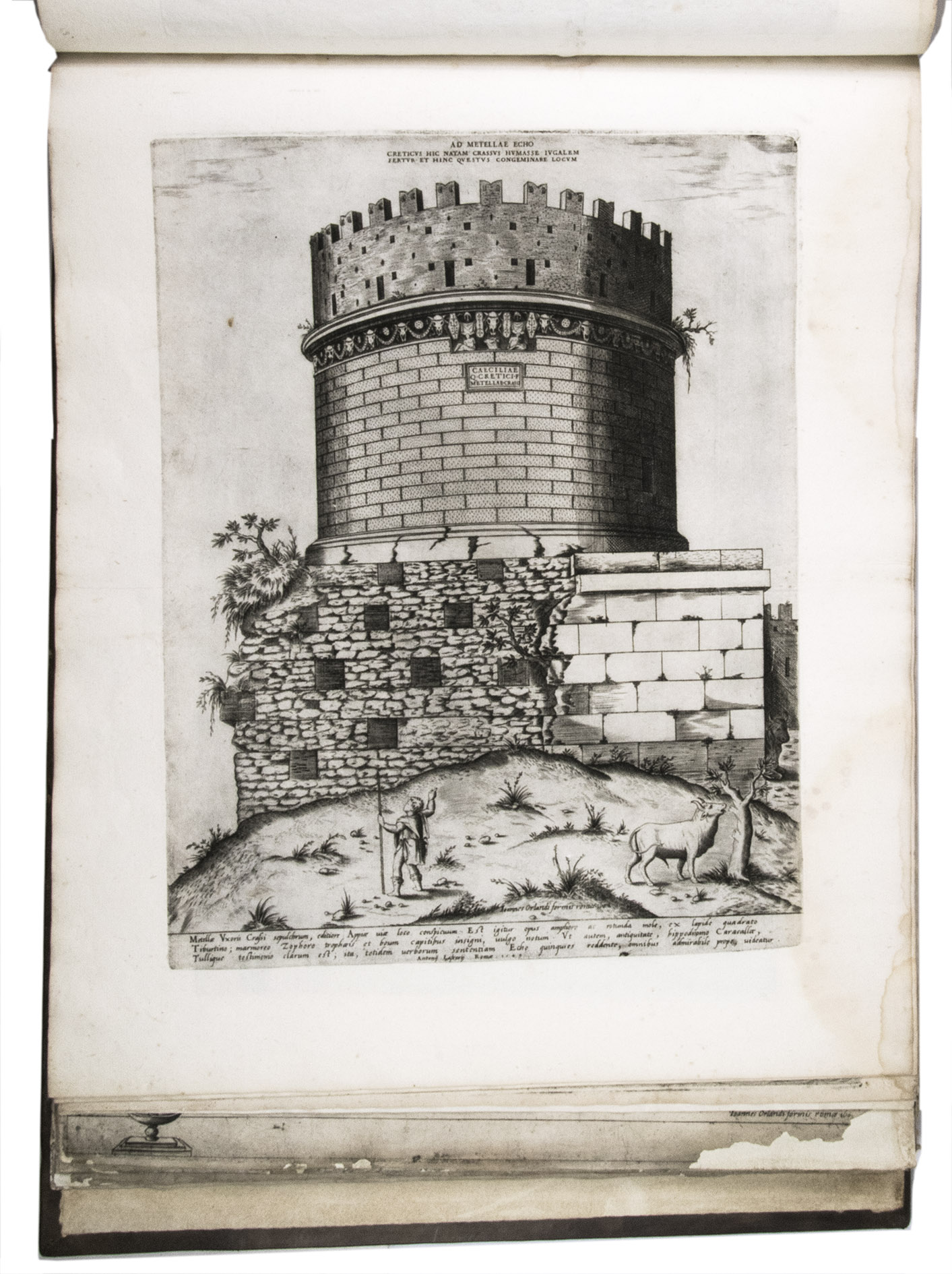
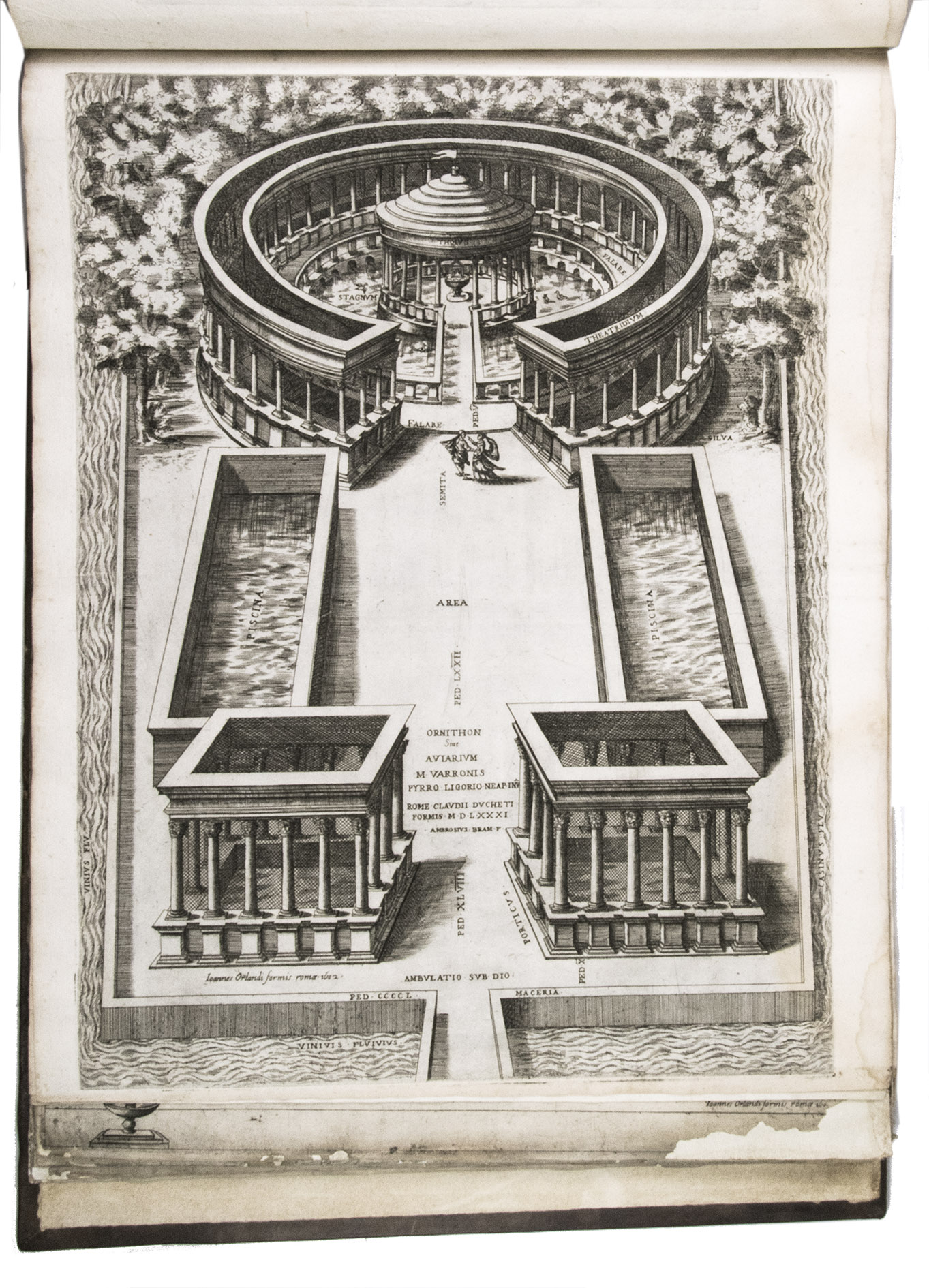
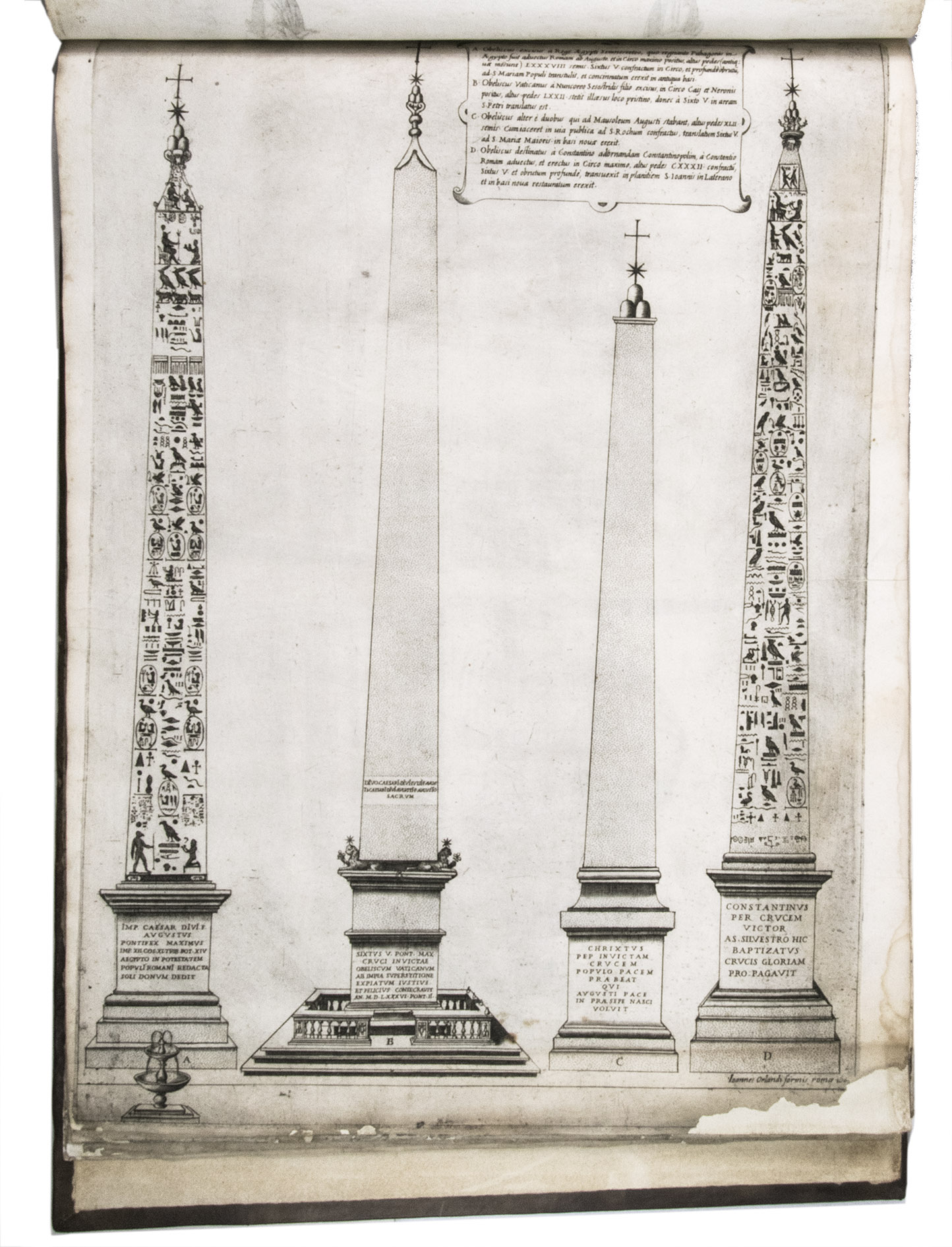
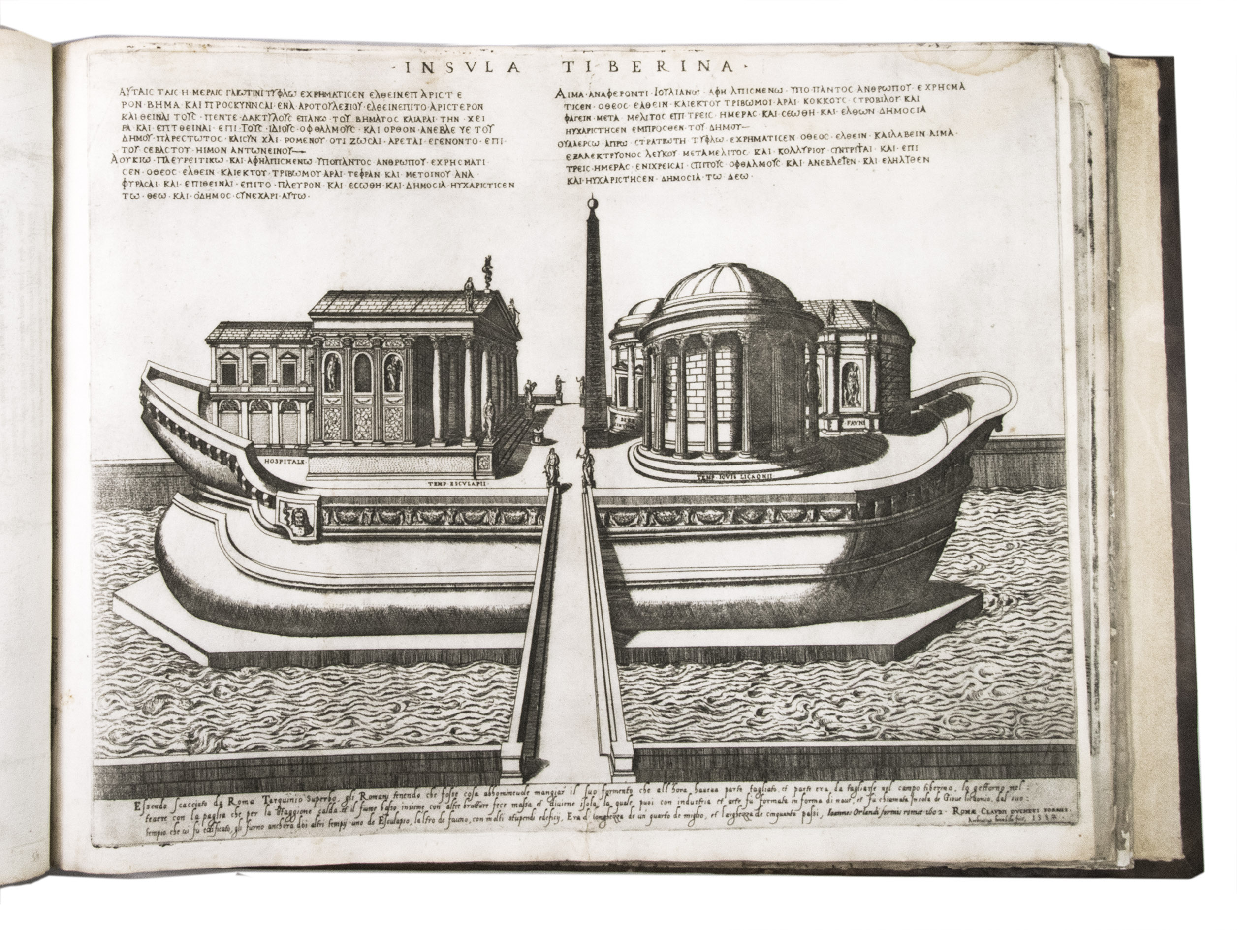
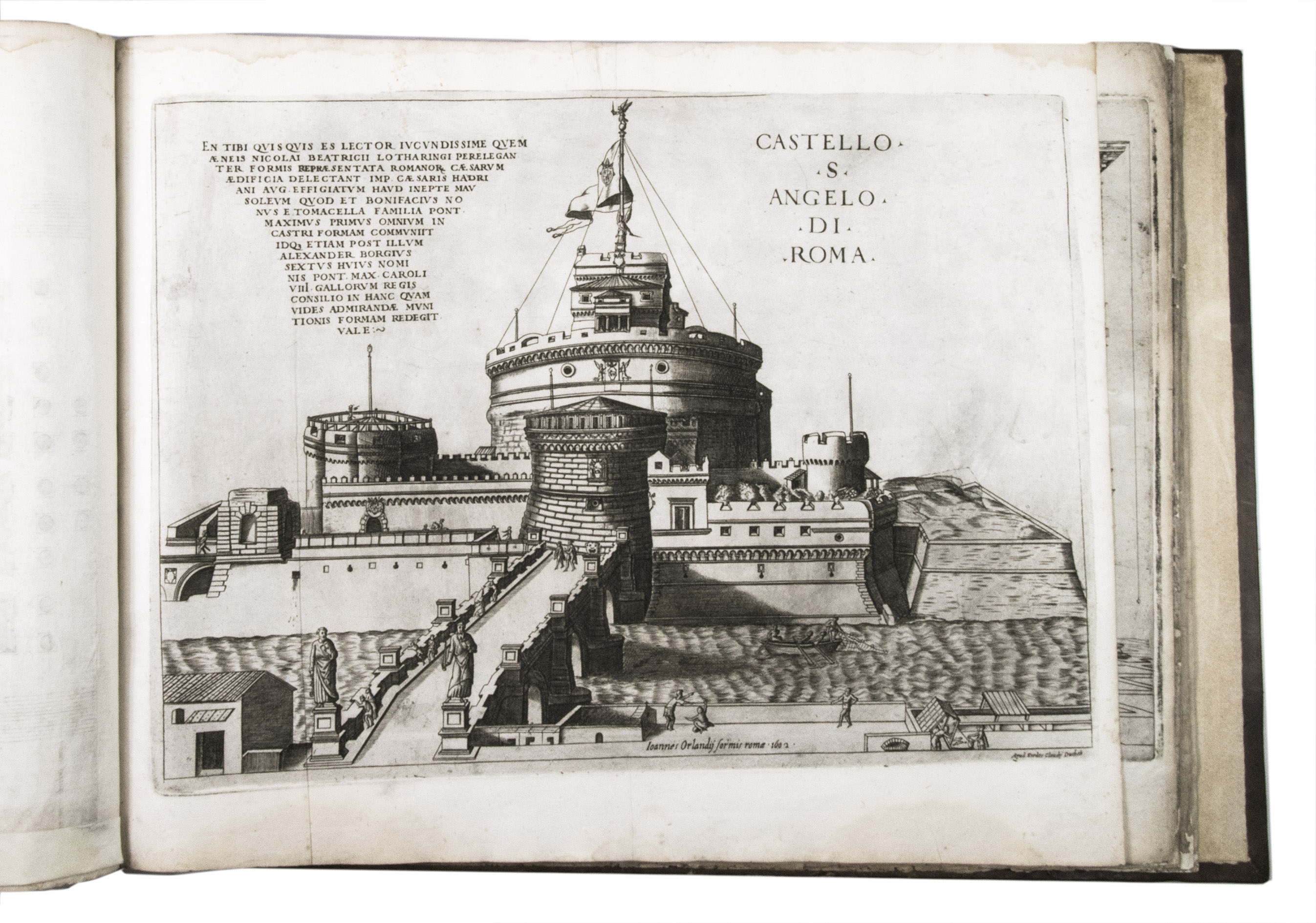
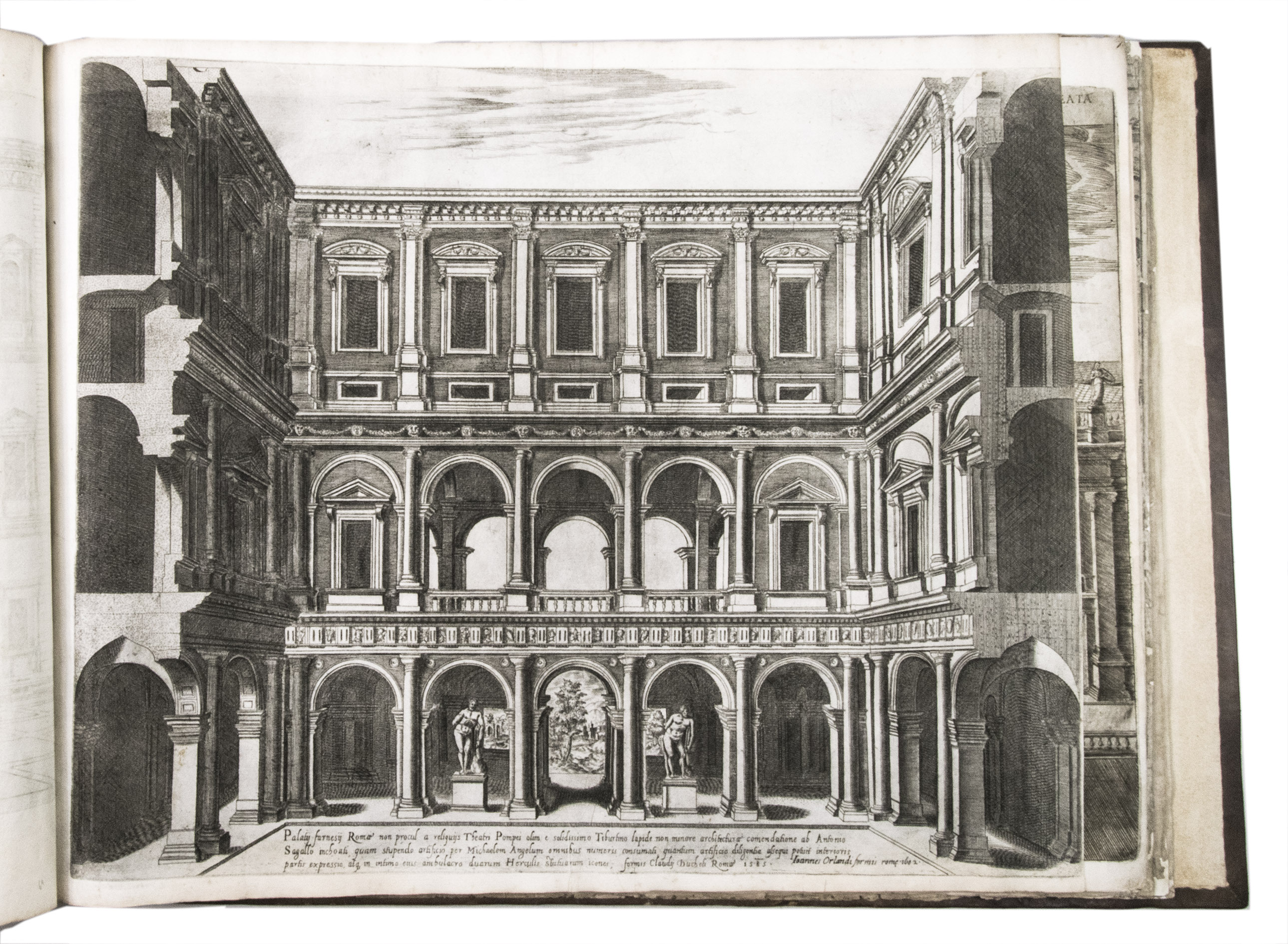
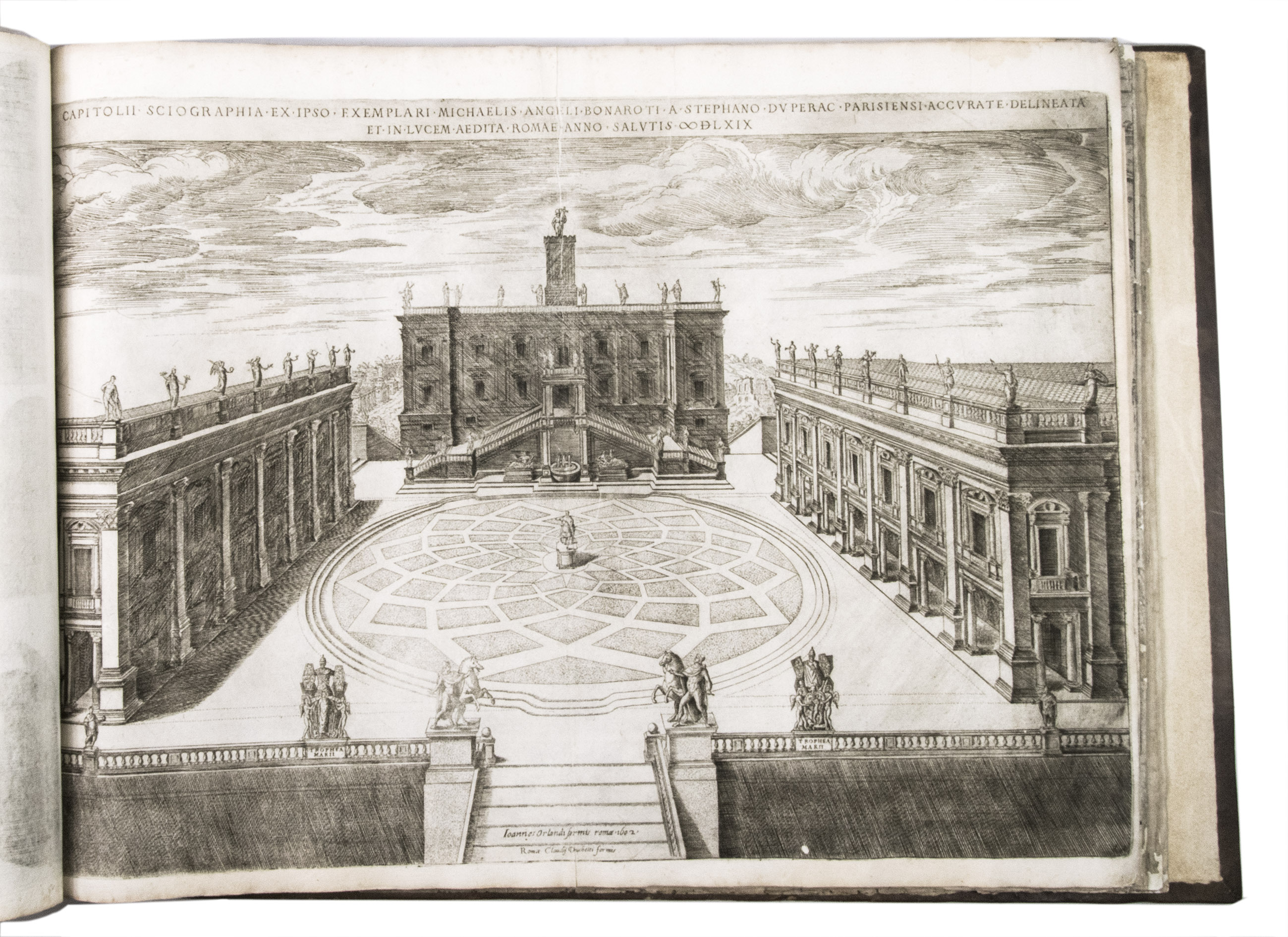
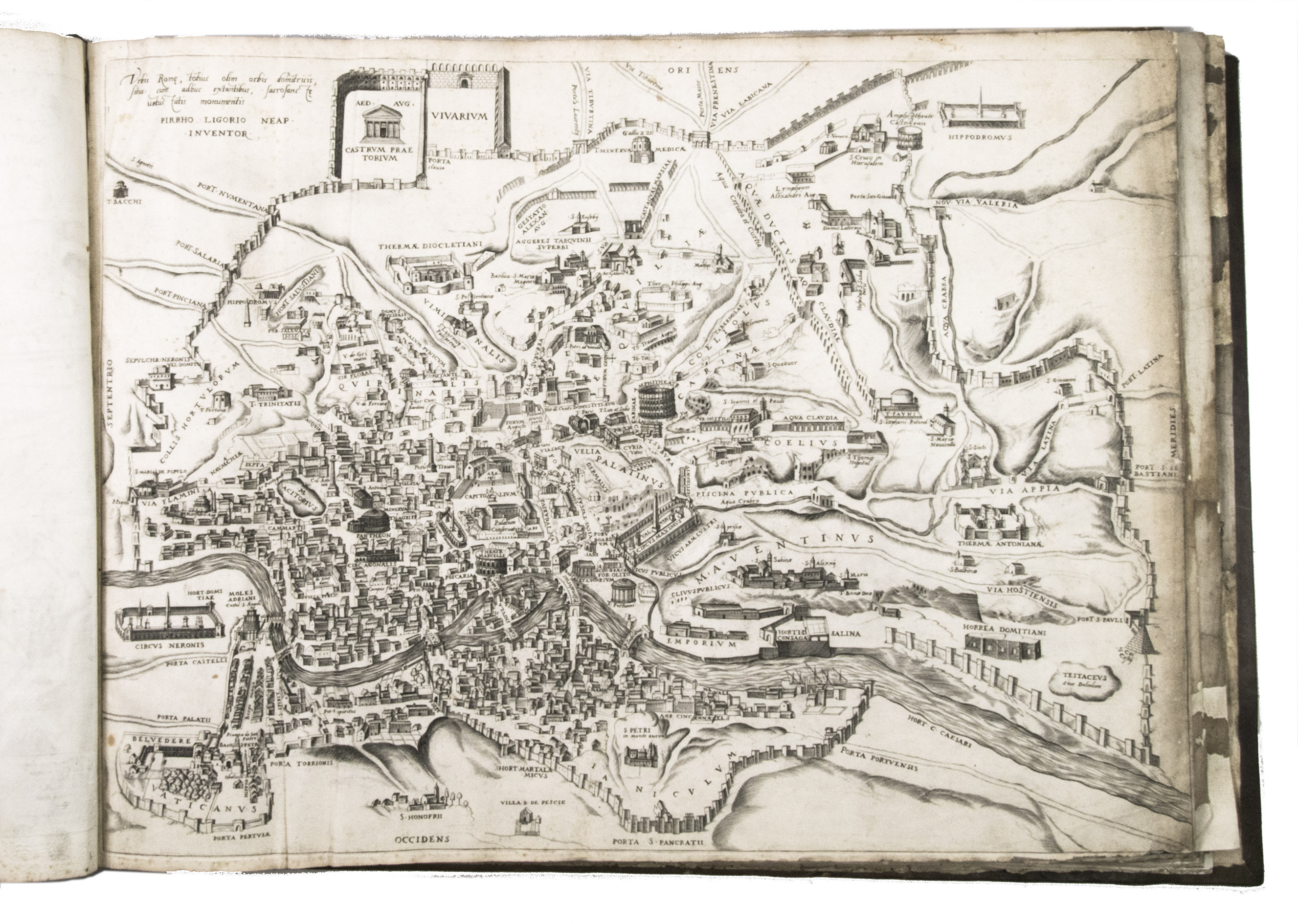
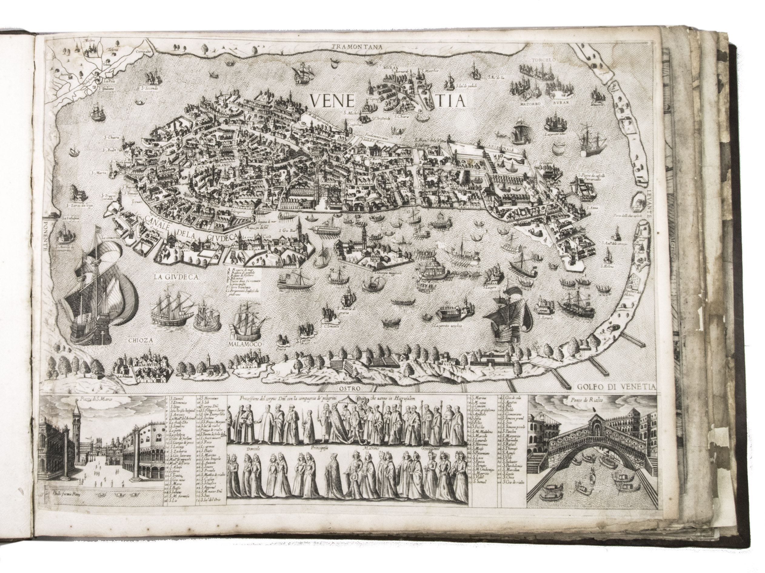
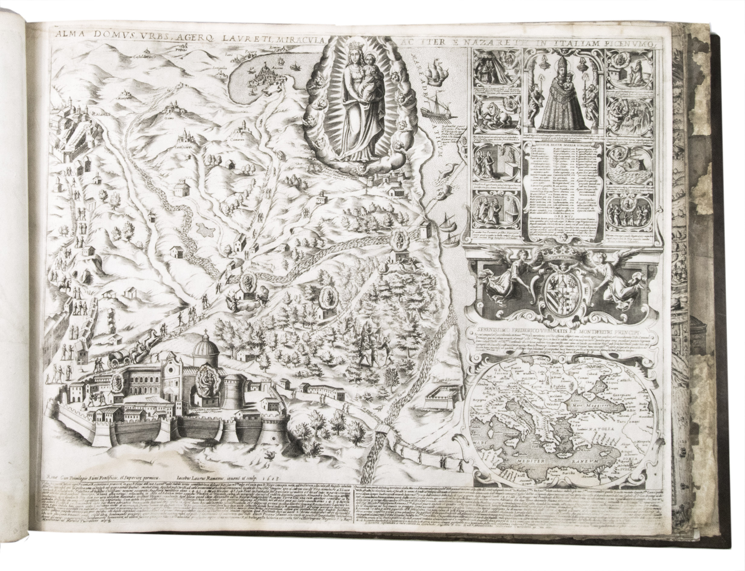
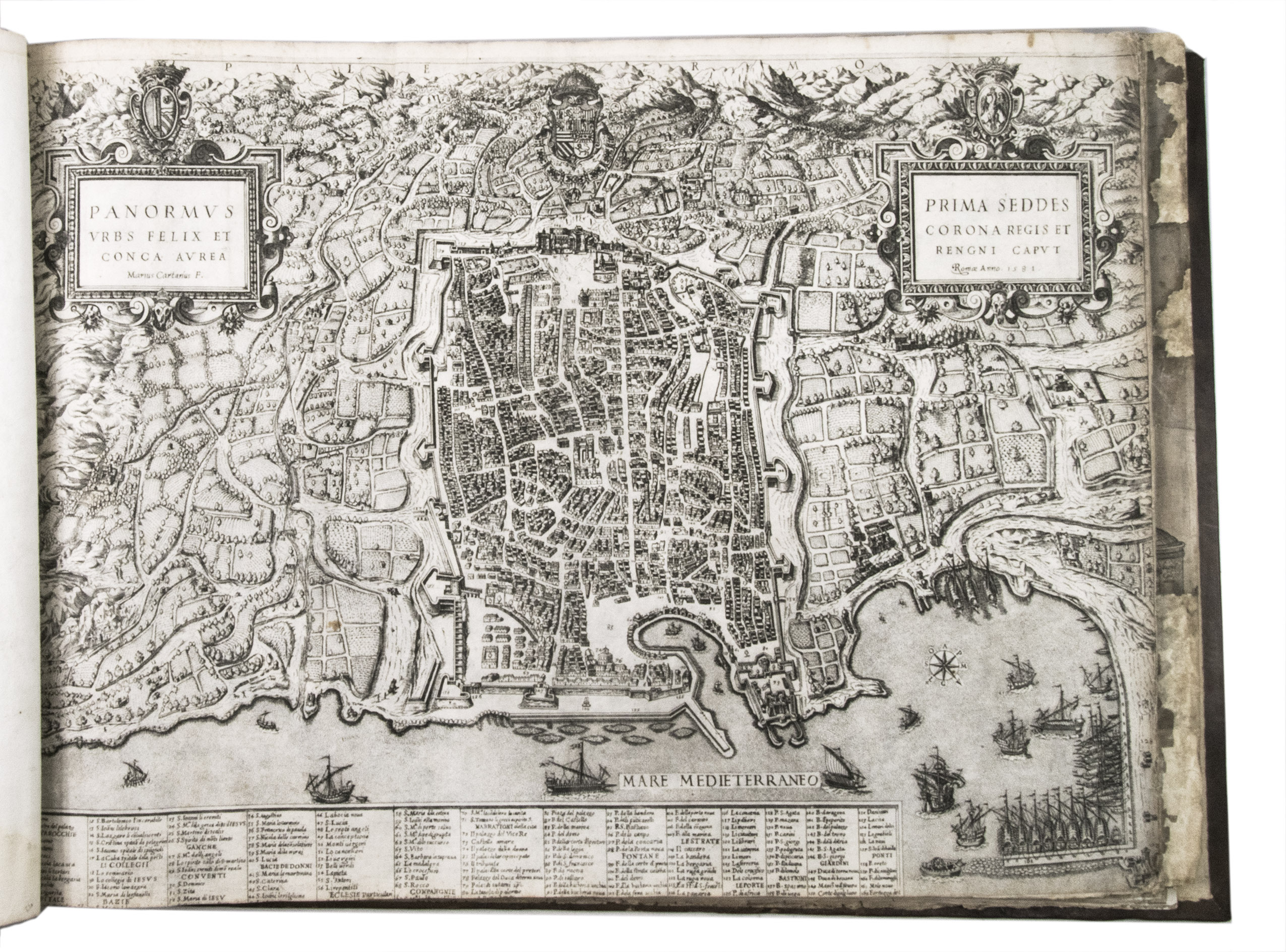
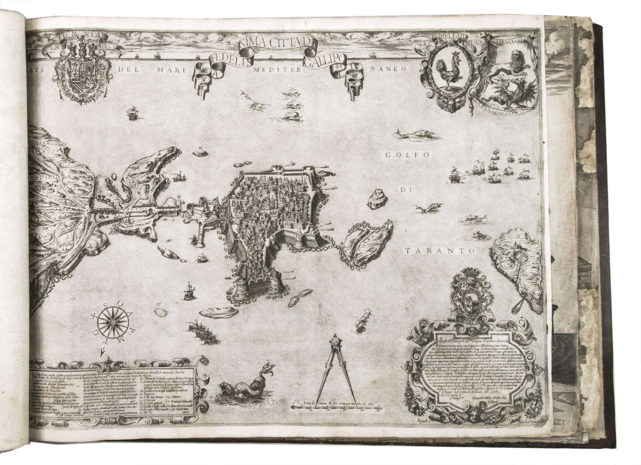
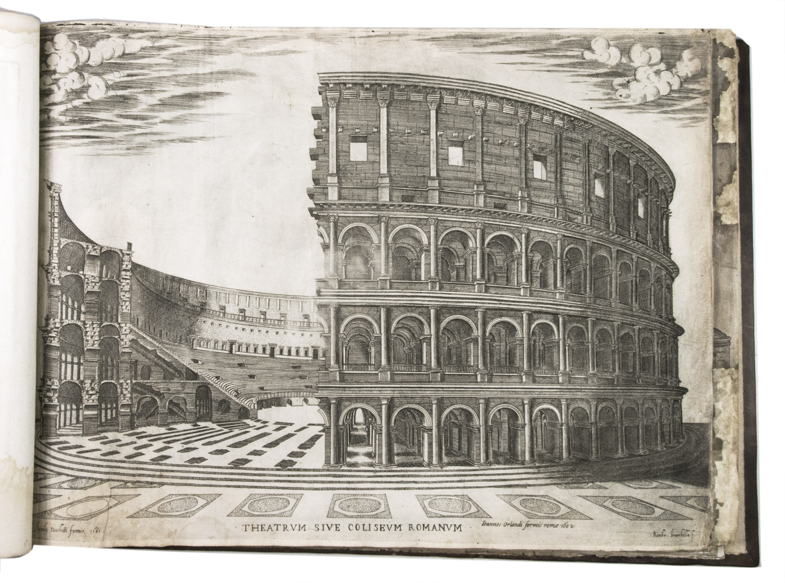
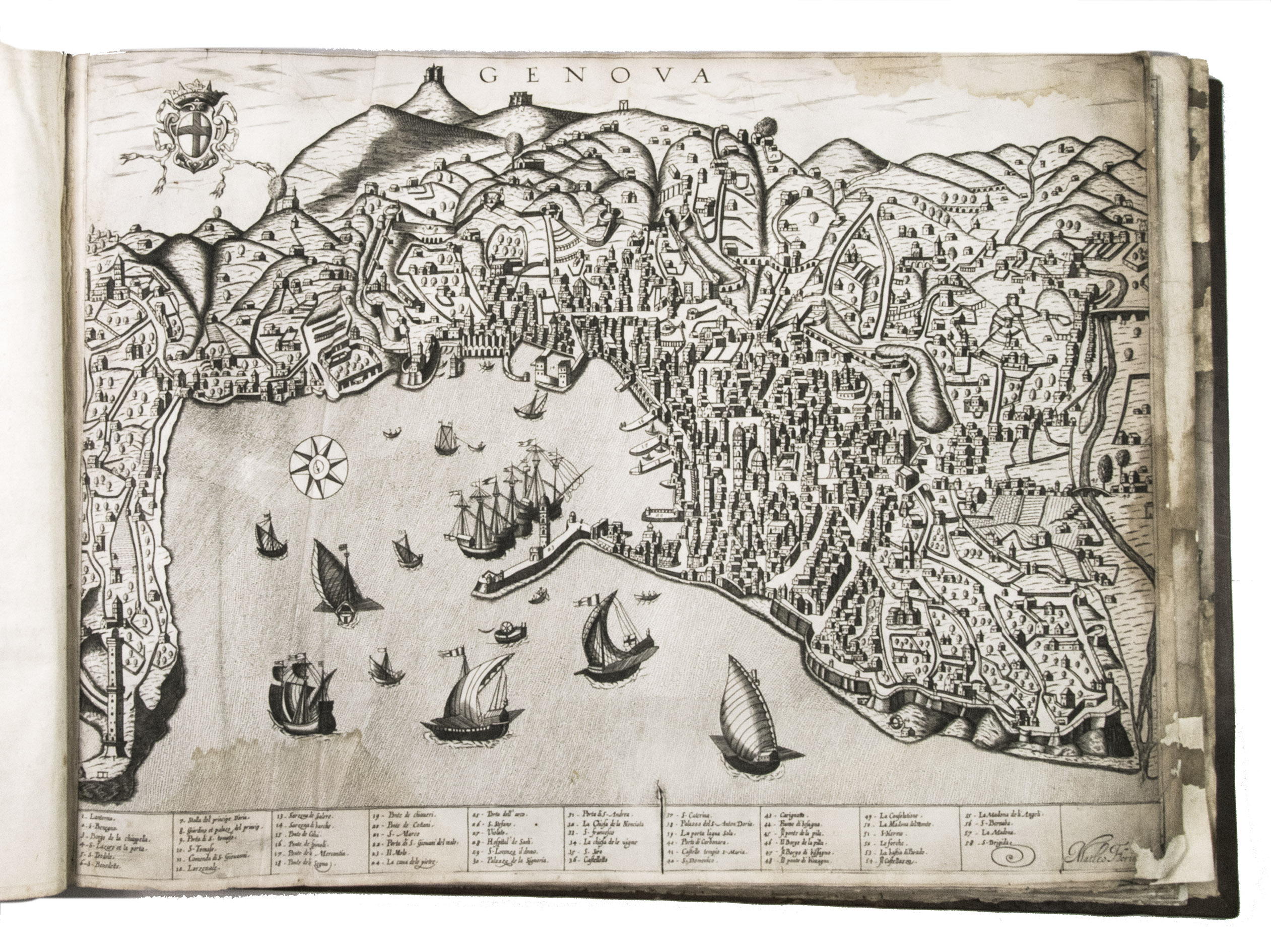
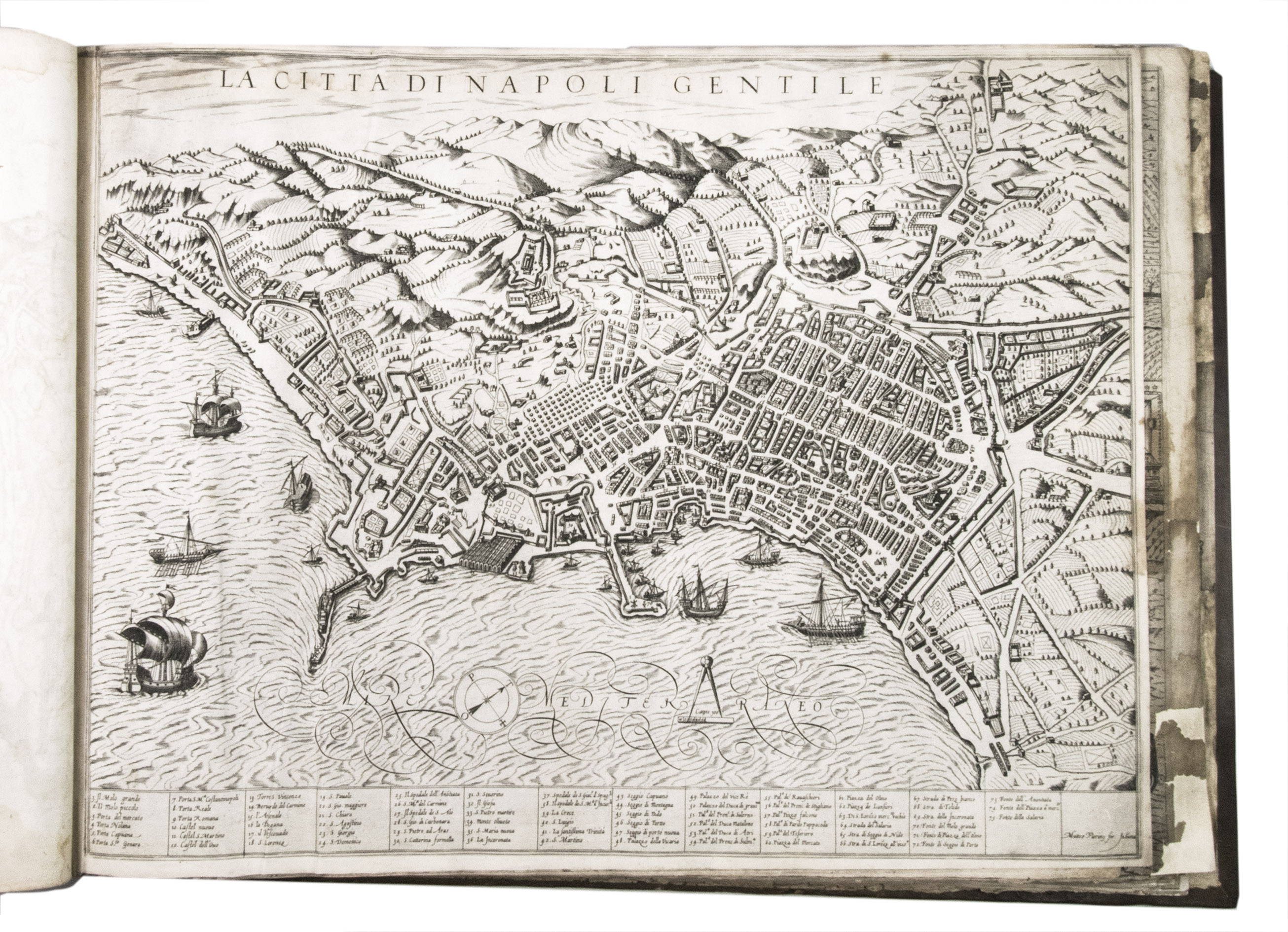
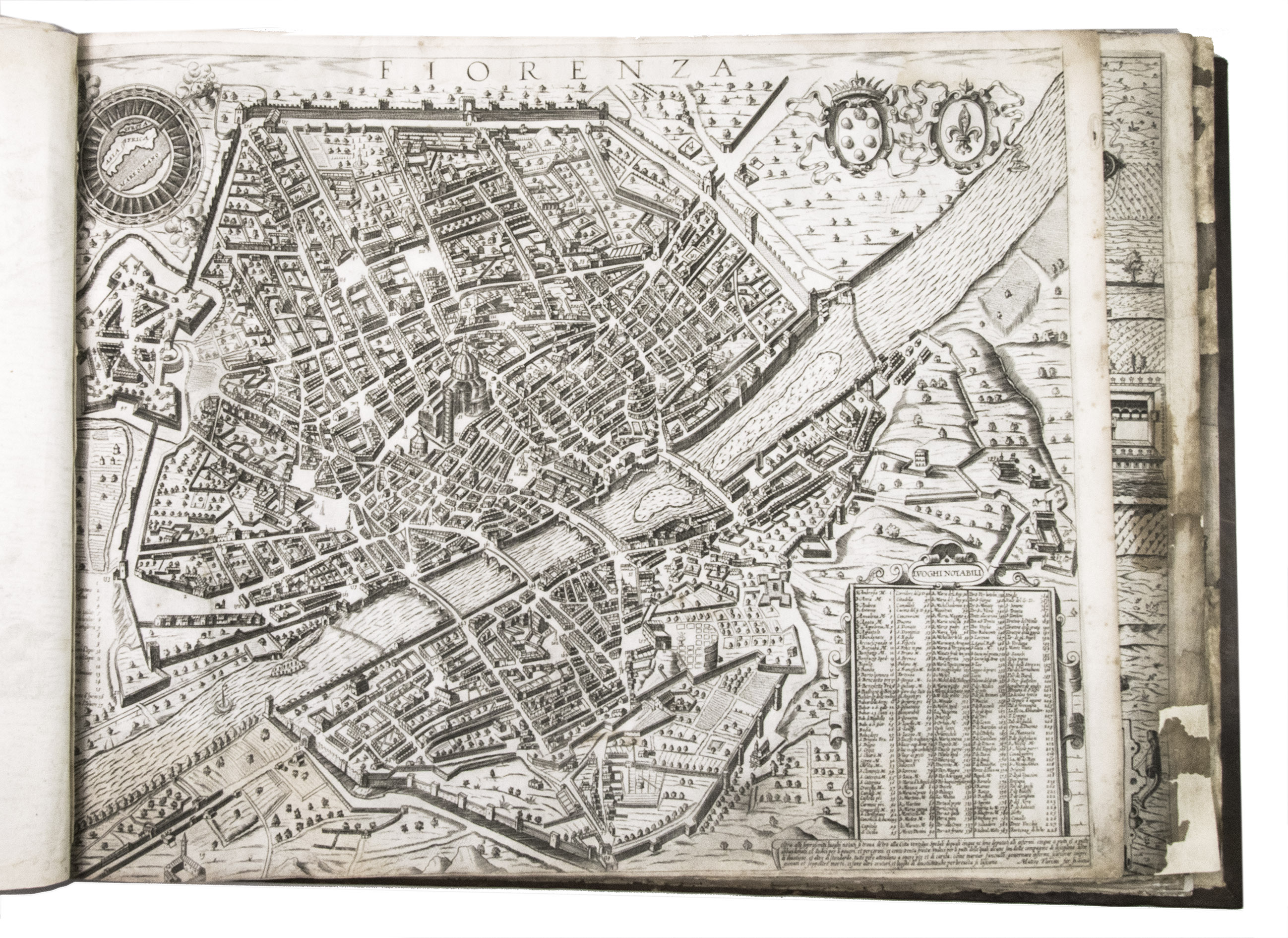
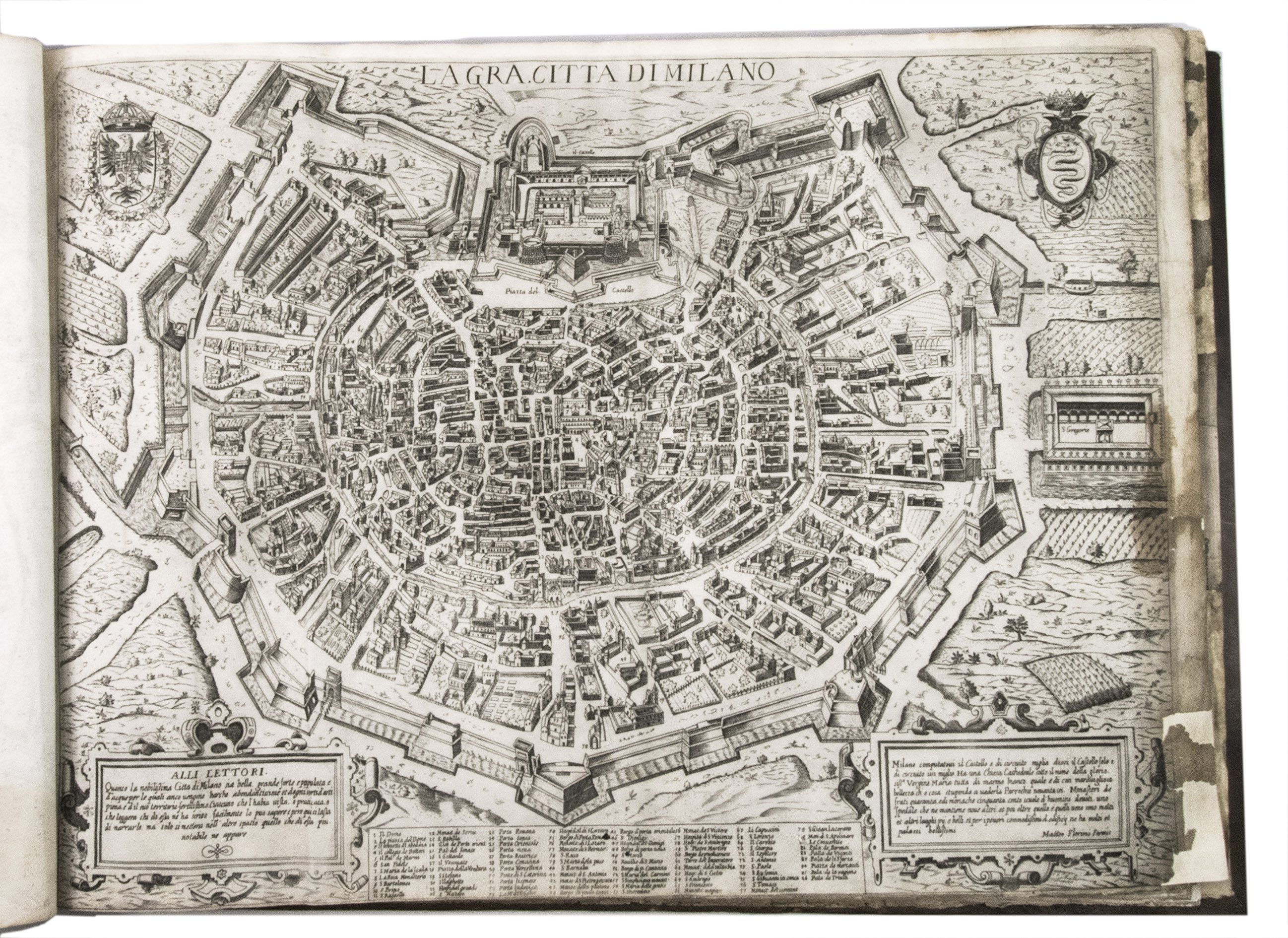
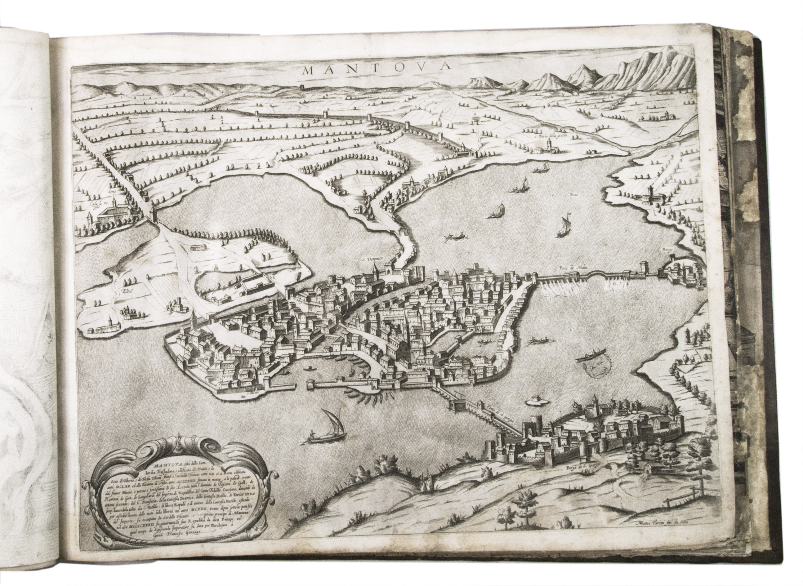
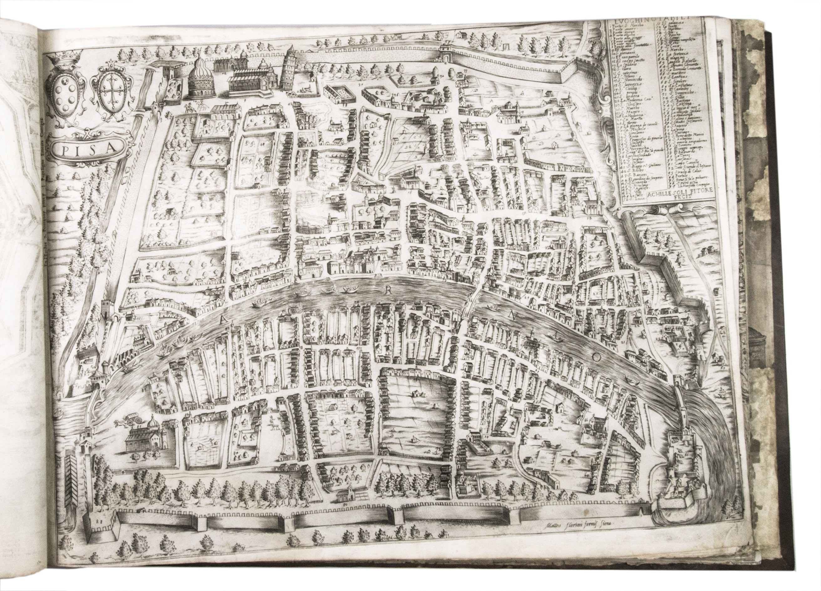
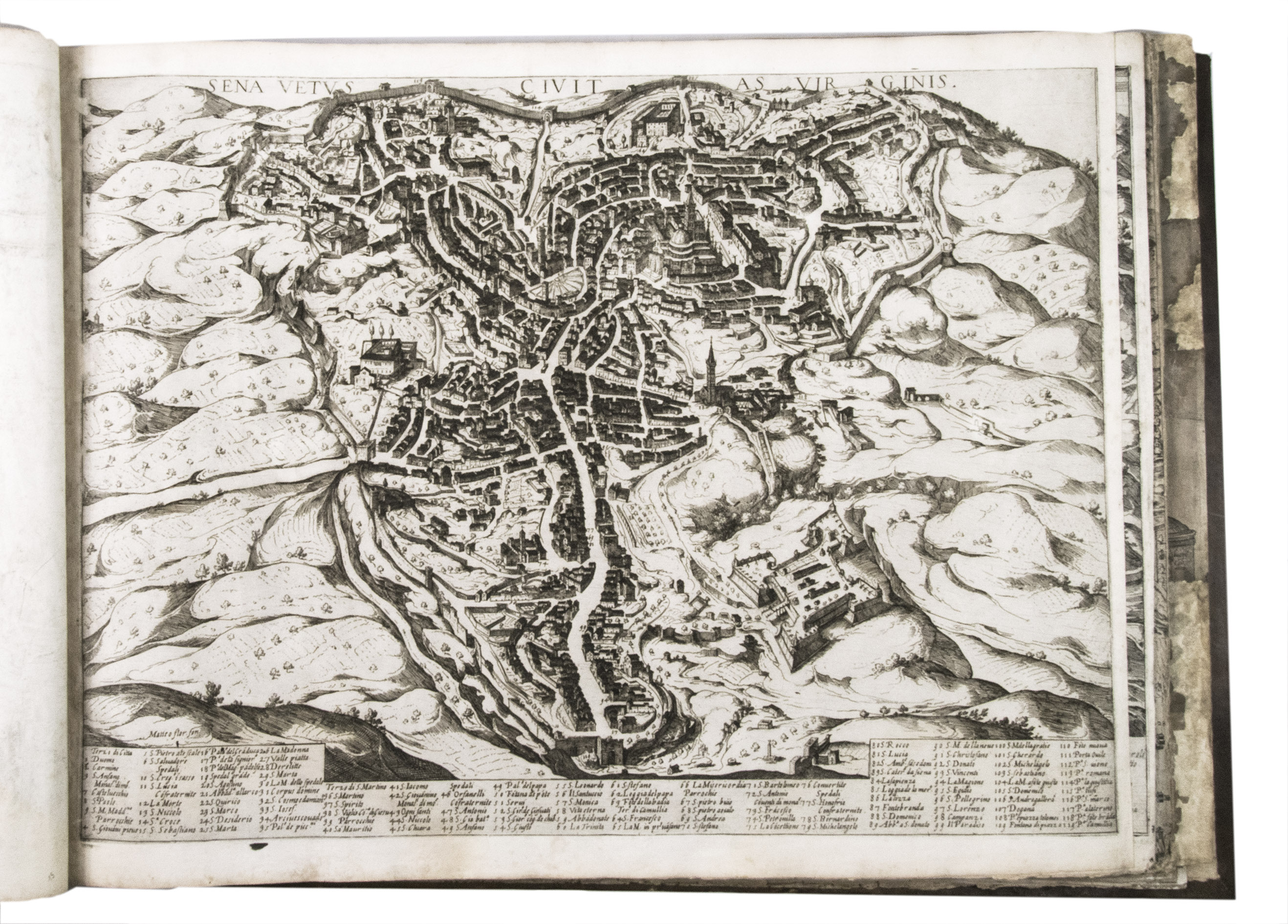
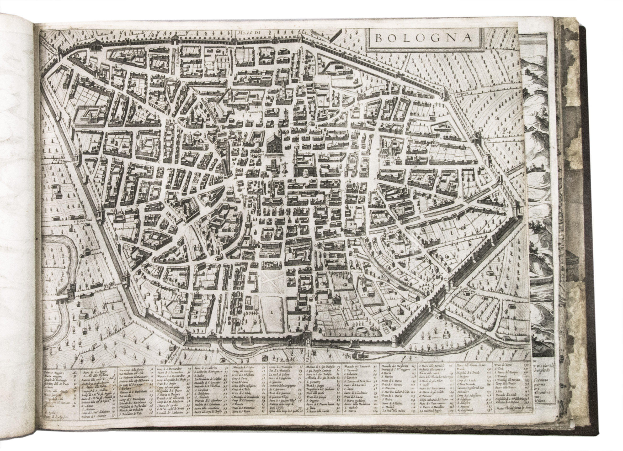
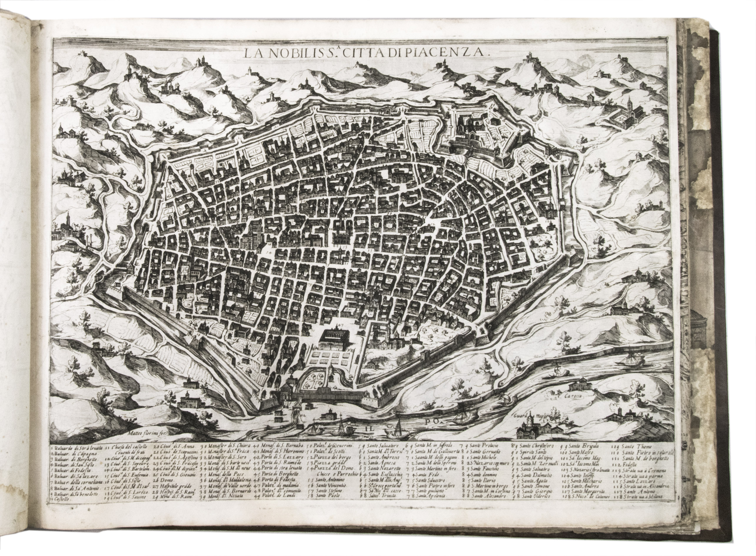
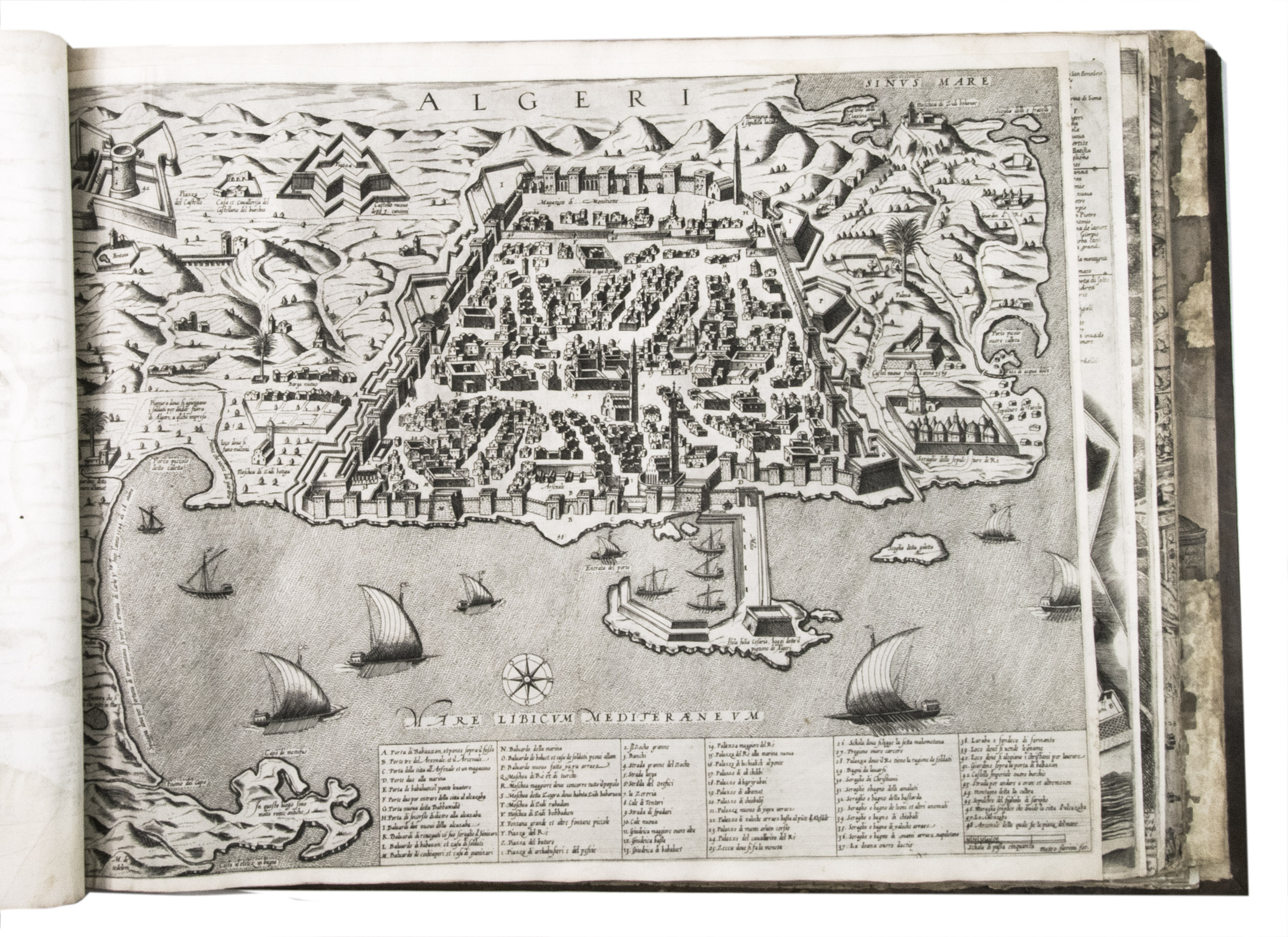
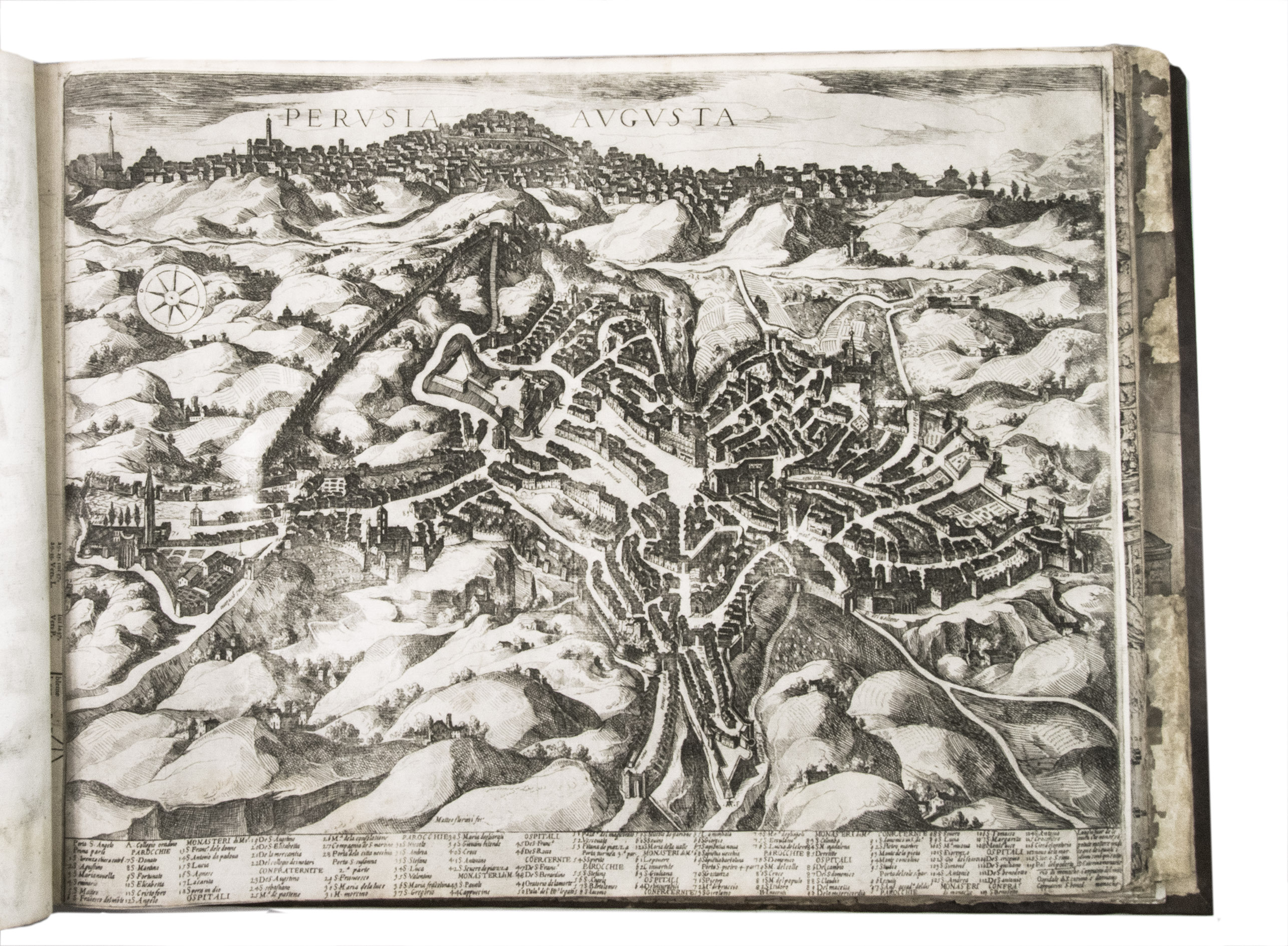
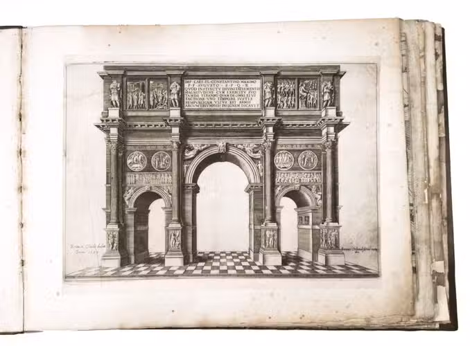
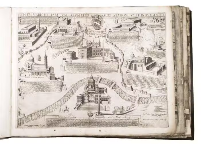
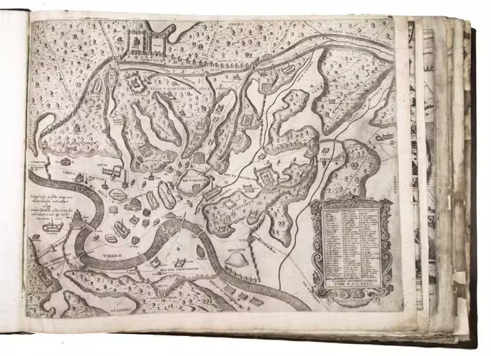
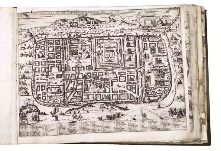
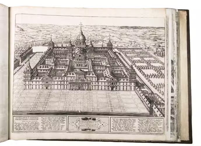
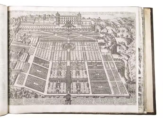
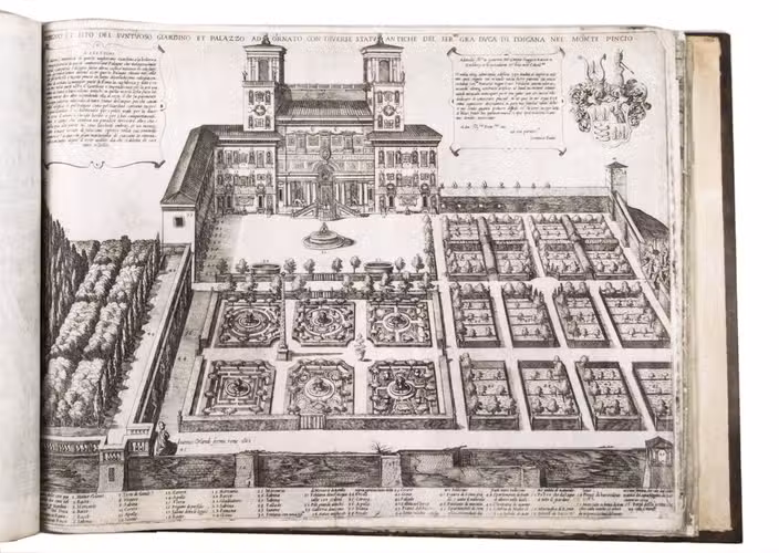
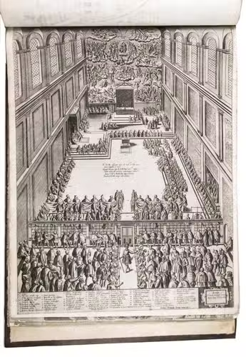
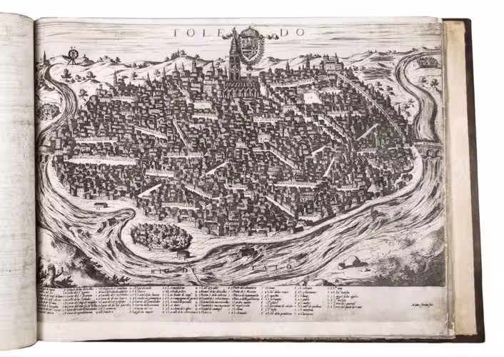
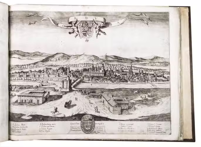
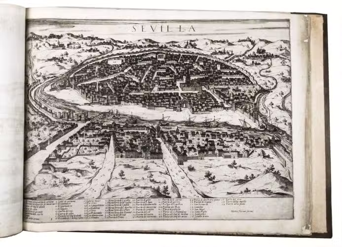
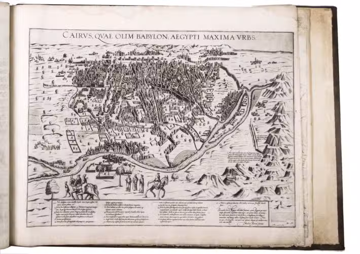
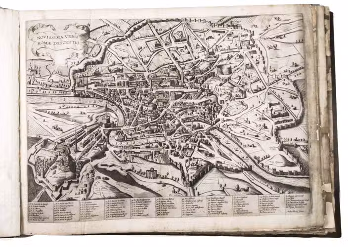
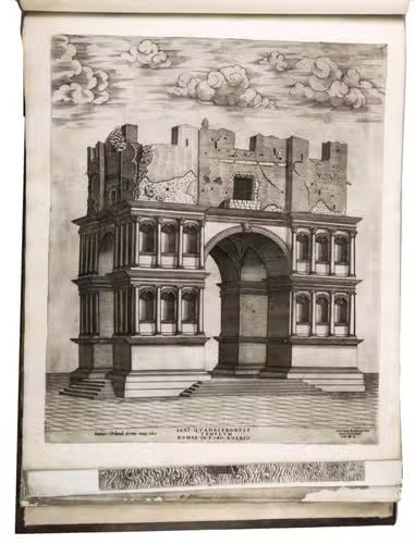
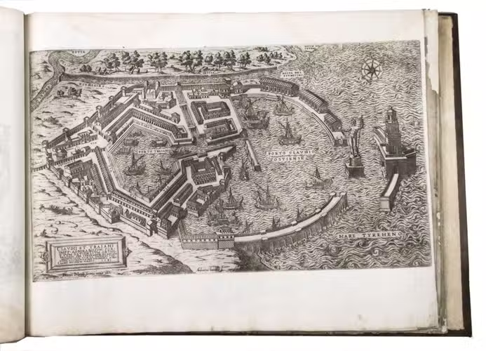
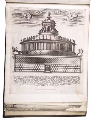
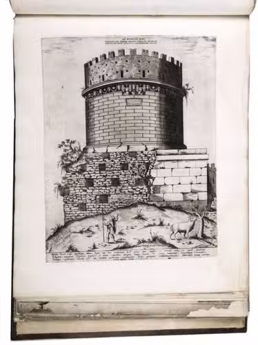
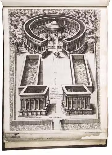
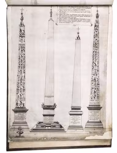
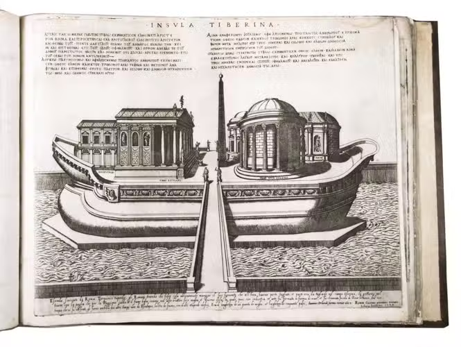
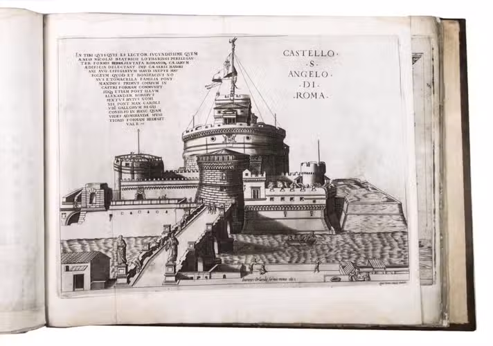
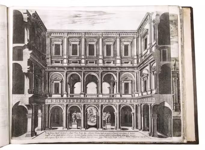
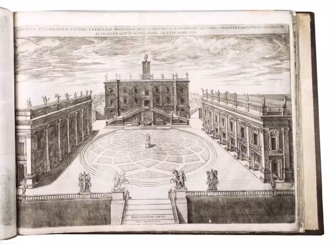
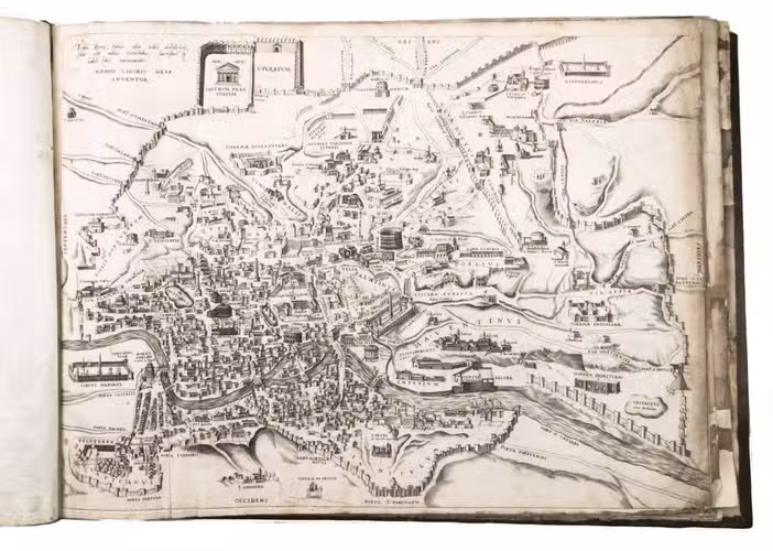
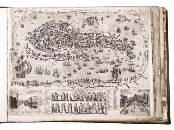
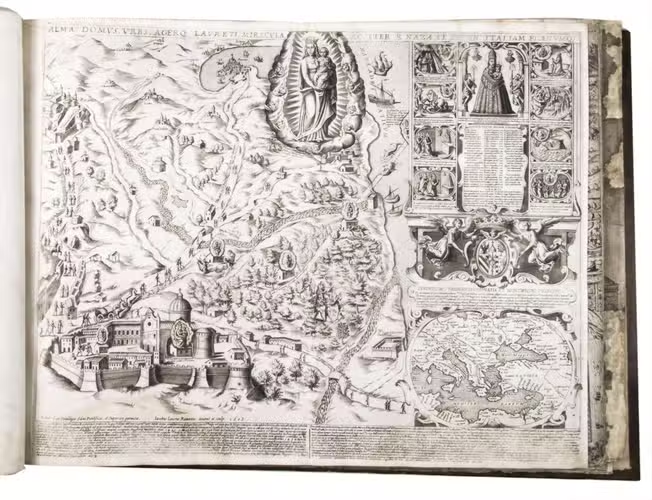
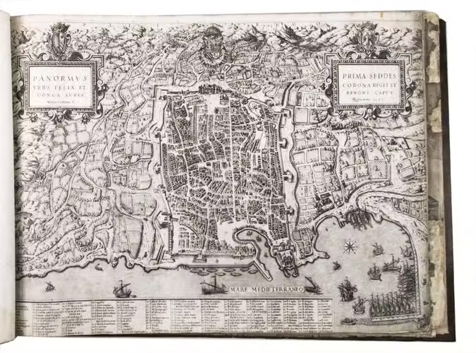
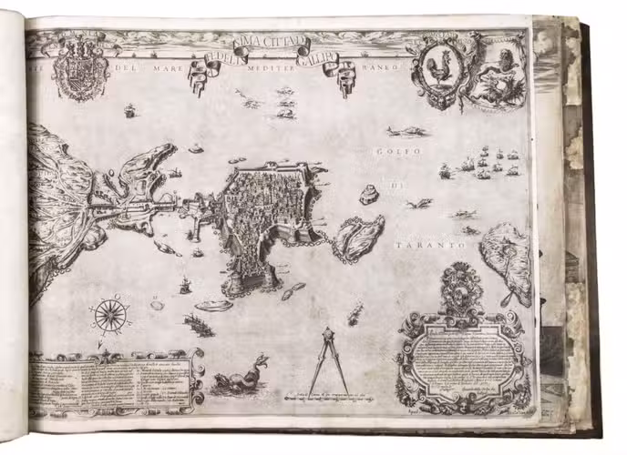
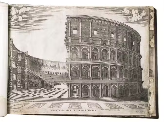
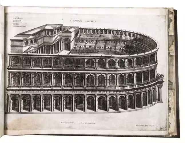
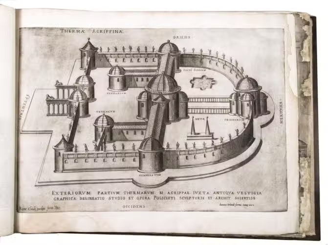
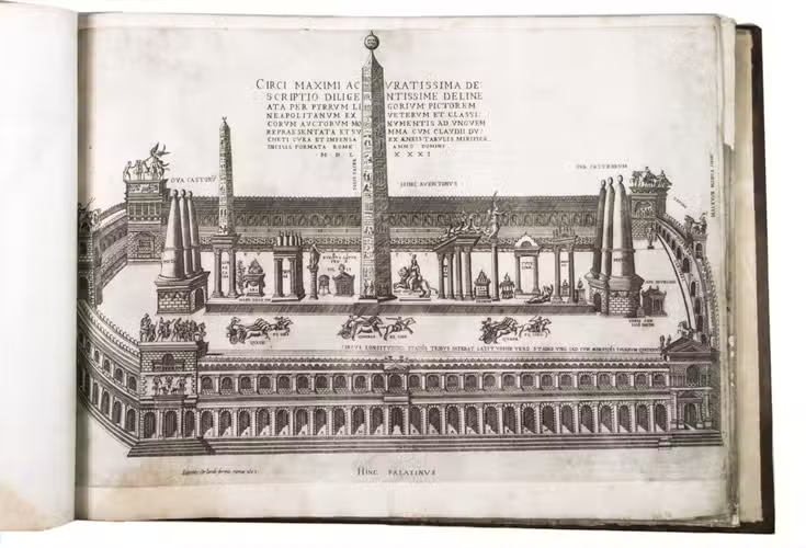
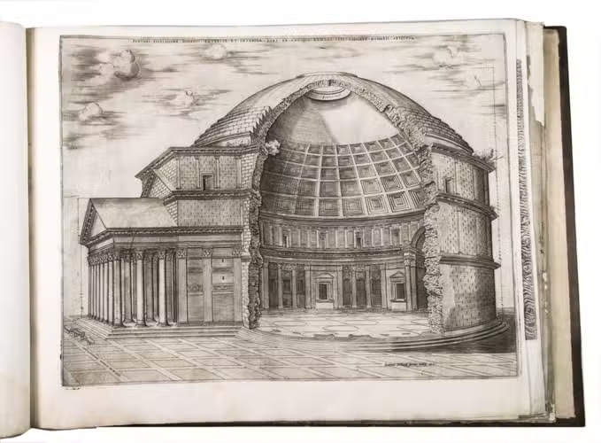
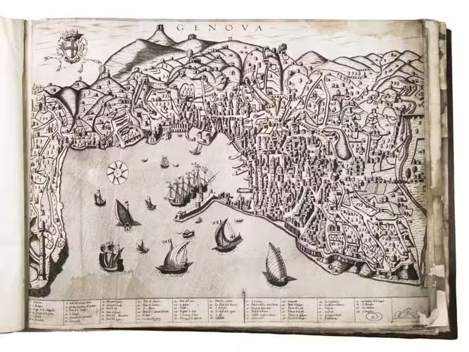
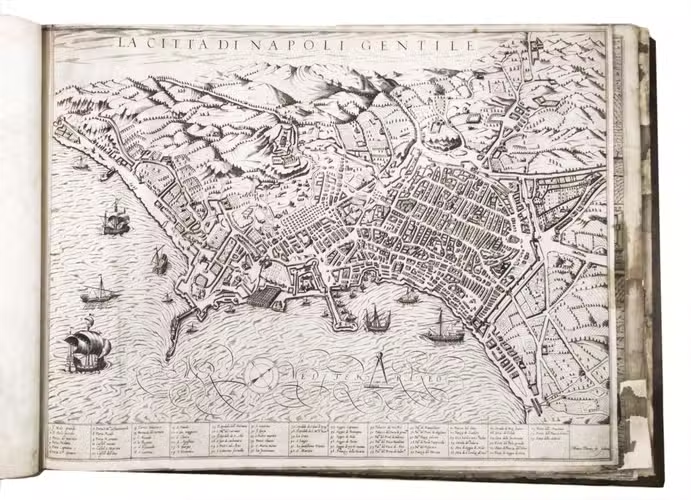
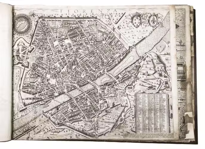
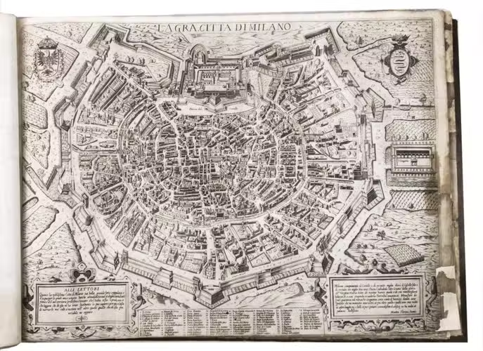
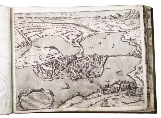
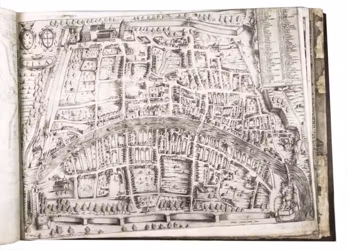
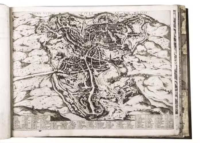
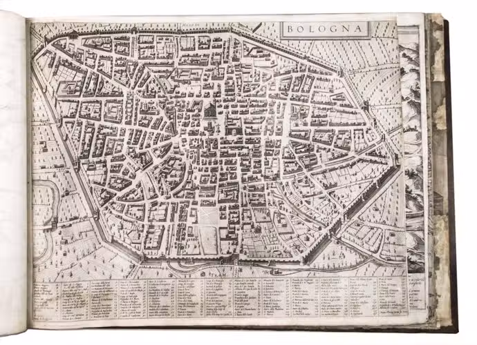
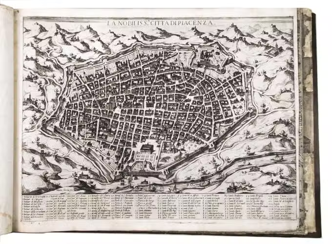
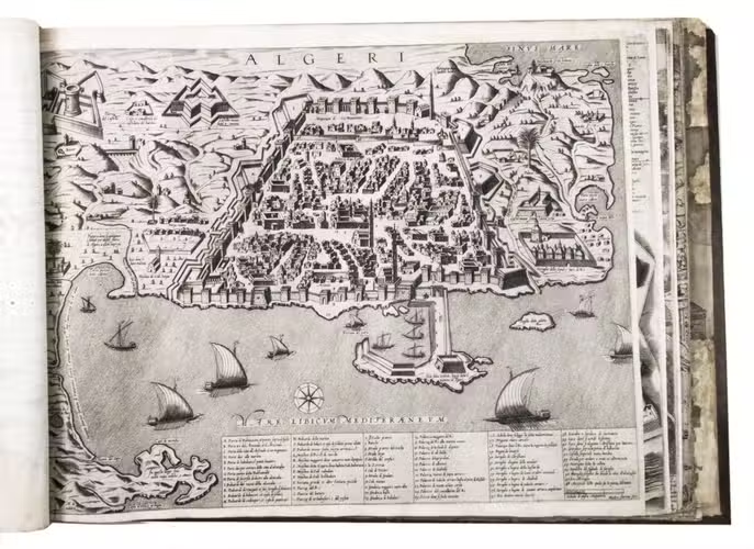
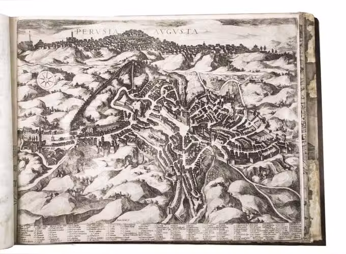
Remarkable album with 77 beautiful examples of 16th-century Italian cartography, all in very fine dark impressions. The collection includes plans of important Italian towns, such as Rome, Venice, Genoa, Naples, Milan, Florence, Palermo, Siena, Bologna, and Pisa, as well as detailed views of individual buildings and monuments in Rome. They are engraved by several cartographers from the school of Antonio Lafreri (1512-1577), primarily Claudio Duchetti (d. 1585), Matteo Florimi (d. 1613), and Lafreri himself. Florimi's works are among the rarest of the Lafreri school map makers, especially his Siena imprints, of which several have here been included.
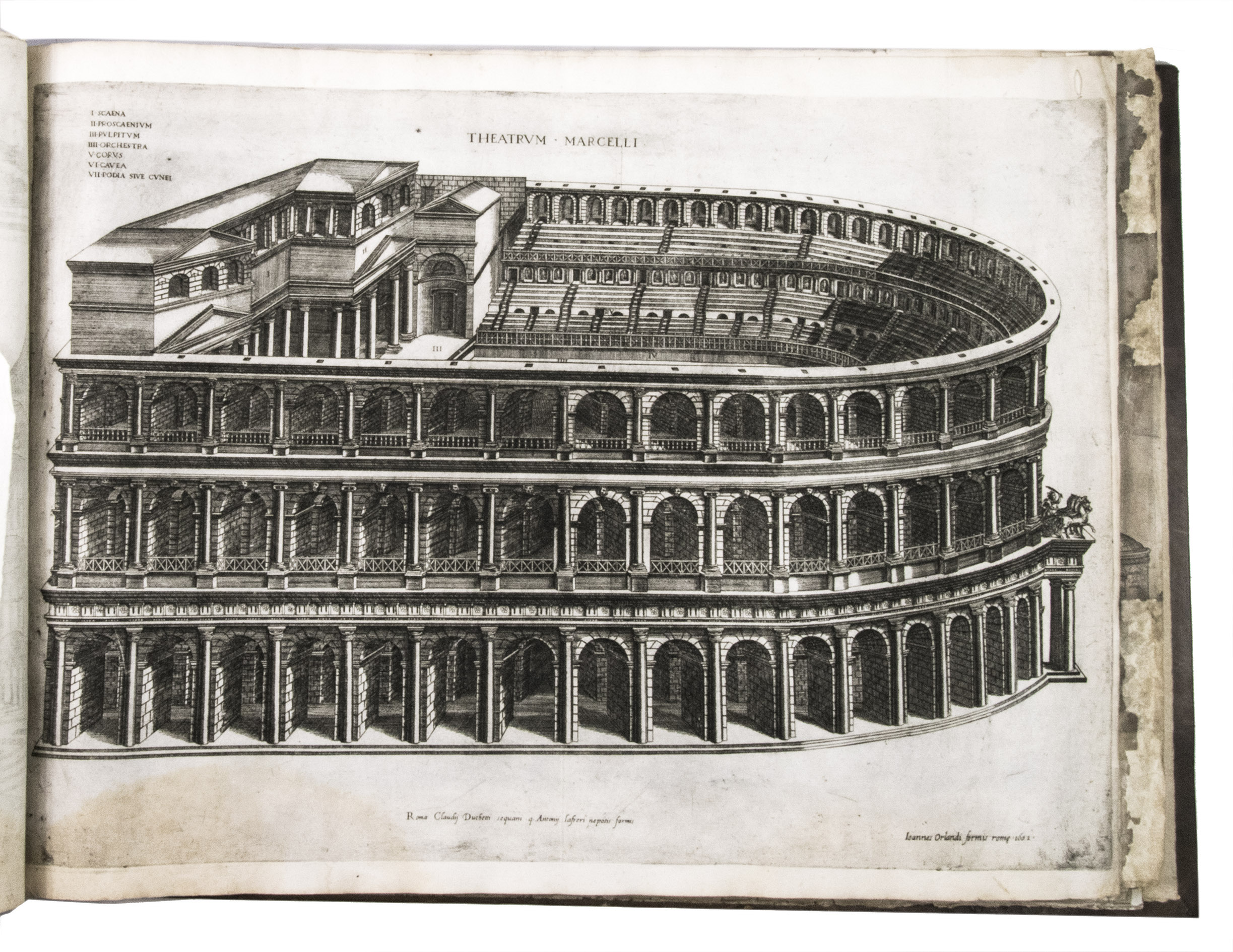
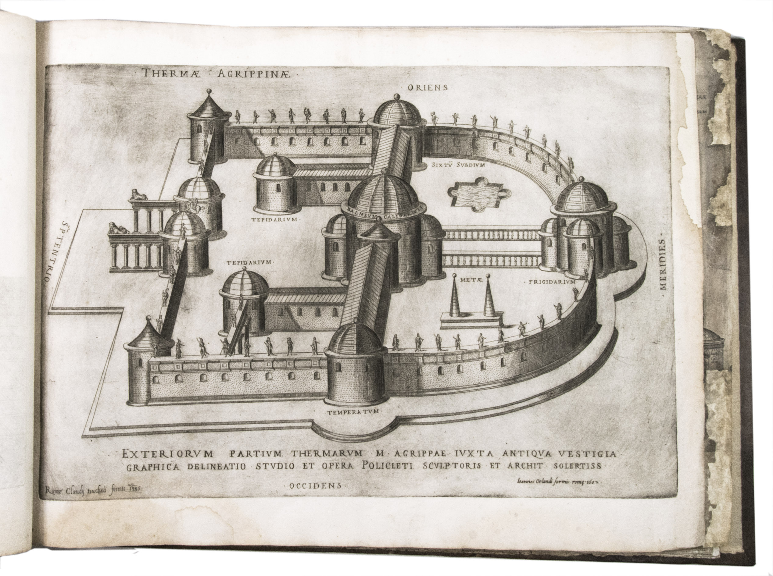
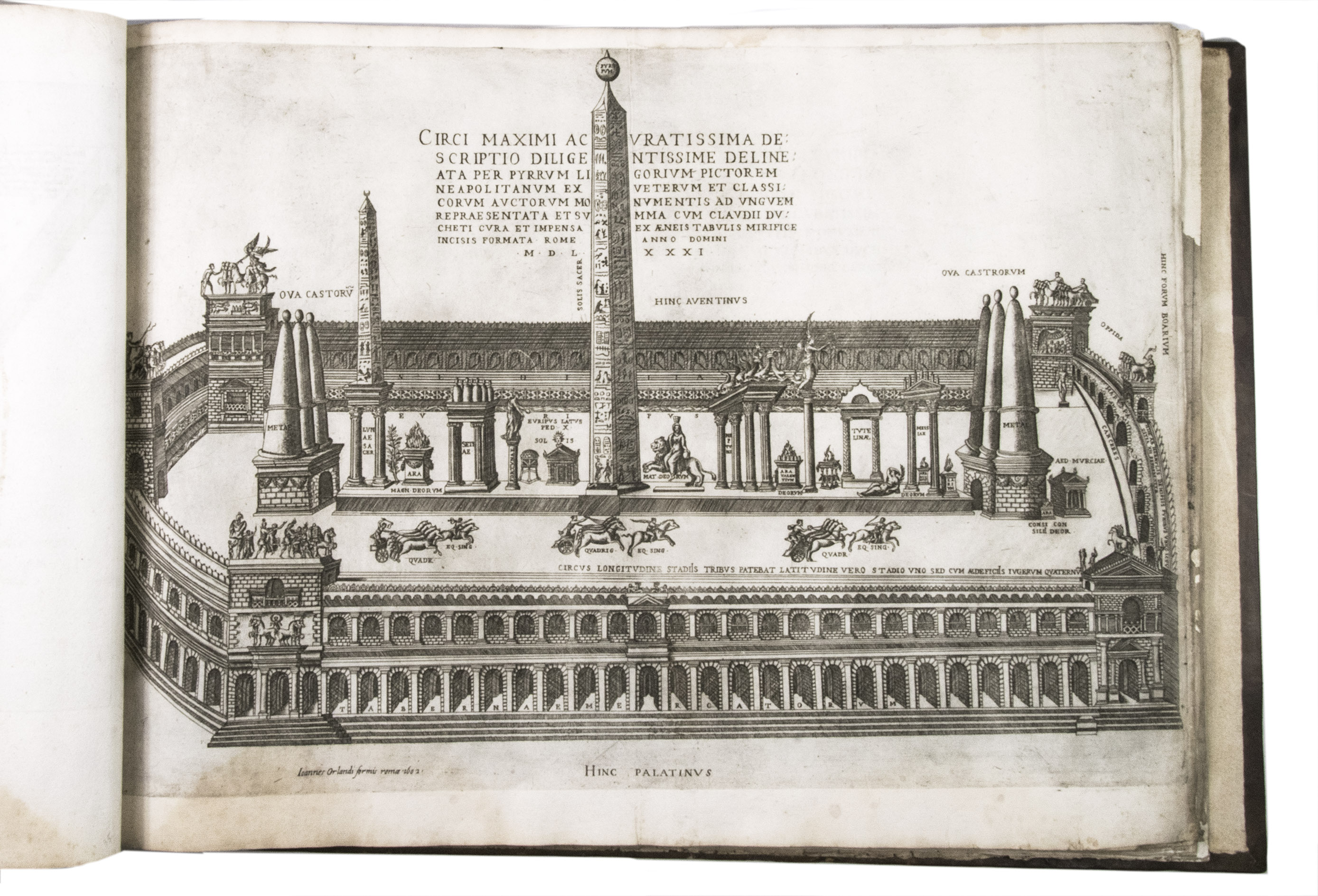
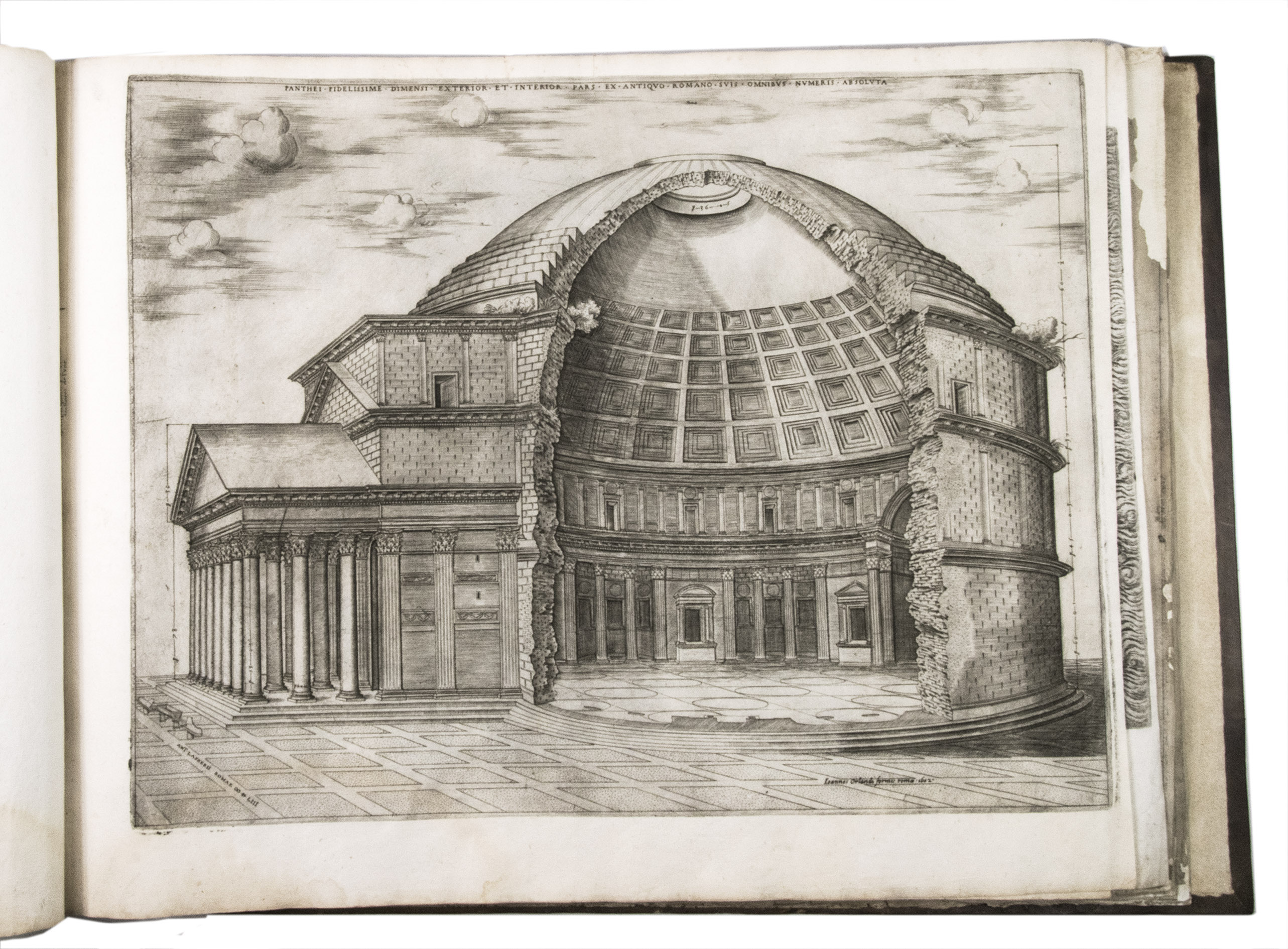
In the middle of the 16th century, Italy was the centre of map production and distribution in Europe. This industry primarily took place in Venice and Rome. The most notable of the publishers in Rome was Lafreri. His most important and most popular work is the Speculum Romanae magnificentiae, a collection of plans an views of Rome's monuments; no two copies of the Speculum are the same. The present collection contains more than thirty plates from the Speculum. When Lafreri died, his nephew Claudio Duchetti inherited the company. He continued to produce the Speculum plates, but often made small adjustments, and signed his own name at the bottom. Most of the Speculum plates in the present album are by Duchetti. After his death, the copperplates were sold to other publishers, such as Giovanni Orlandi (before 1590-after 1640), who reissued them. The majority of the plates in the present album were printed by Orlandi in 1602.
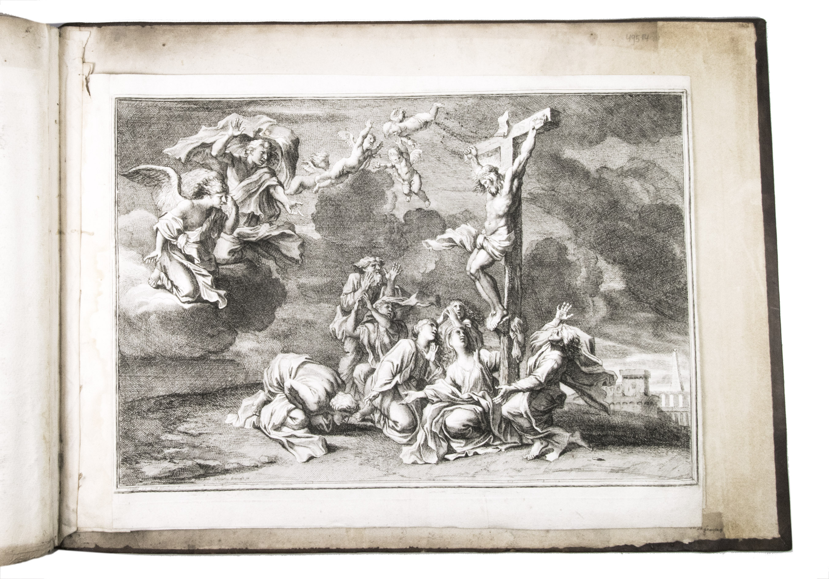
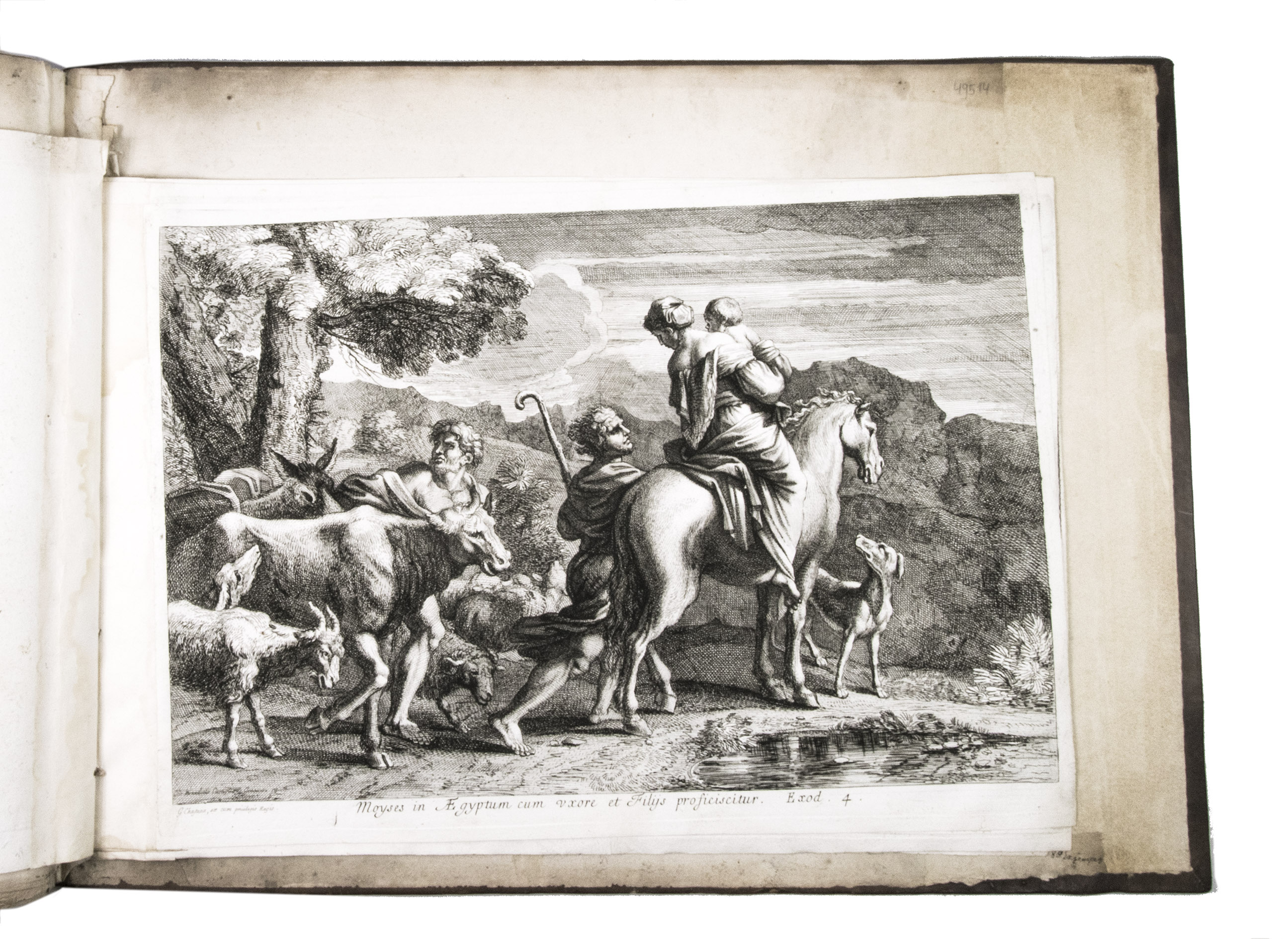
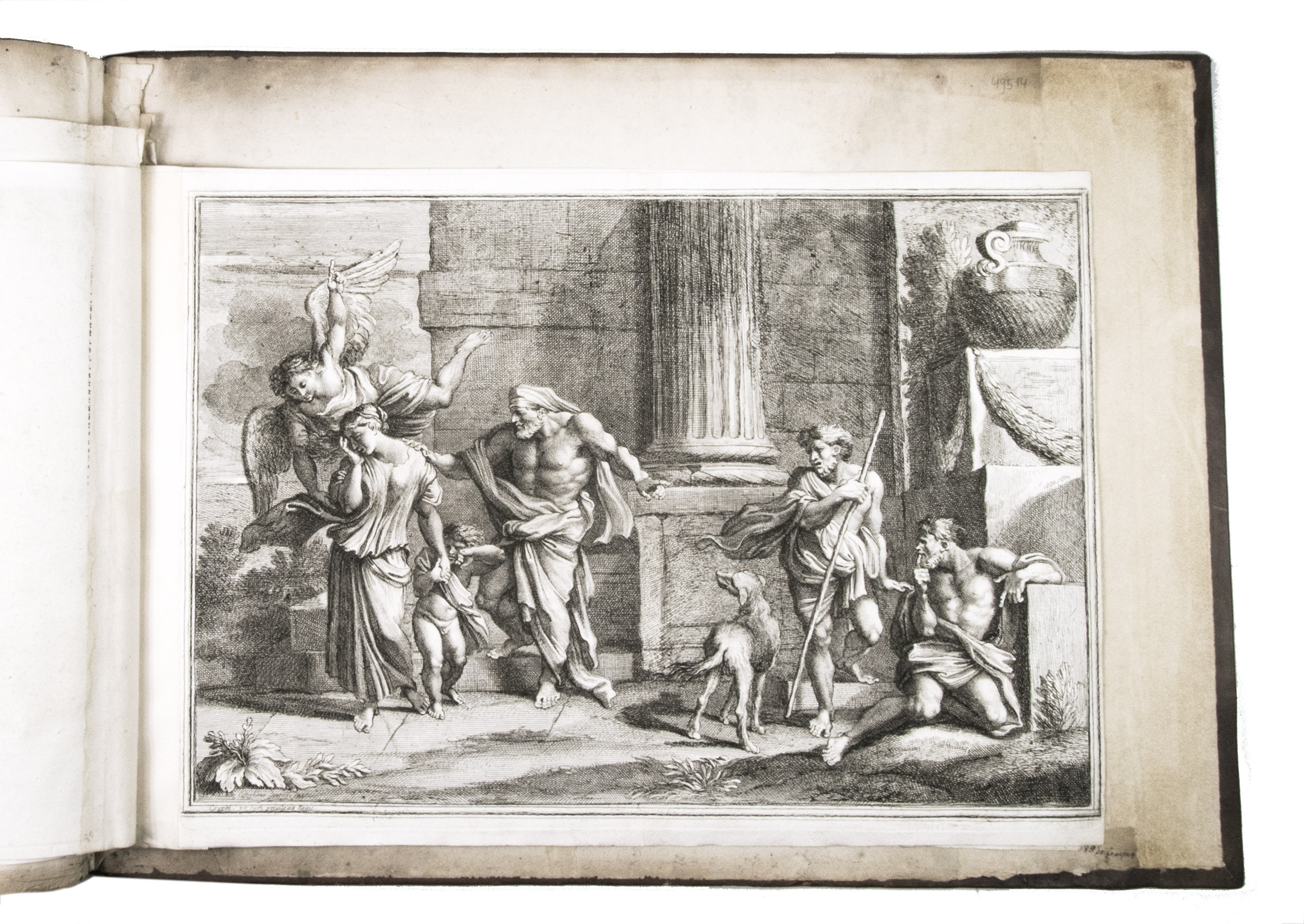
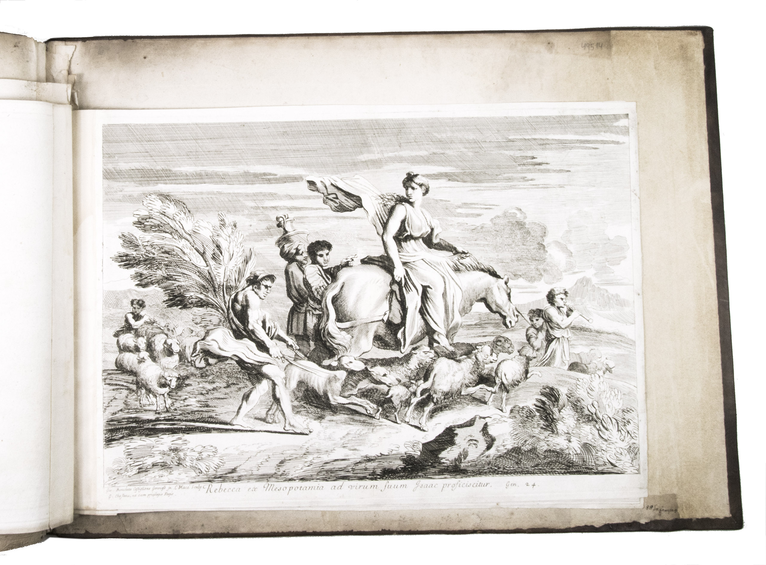
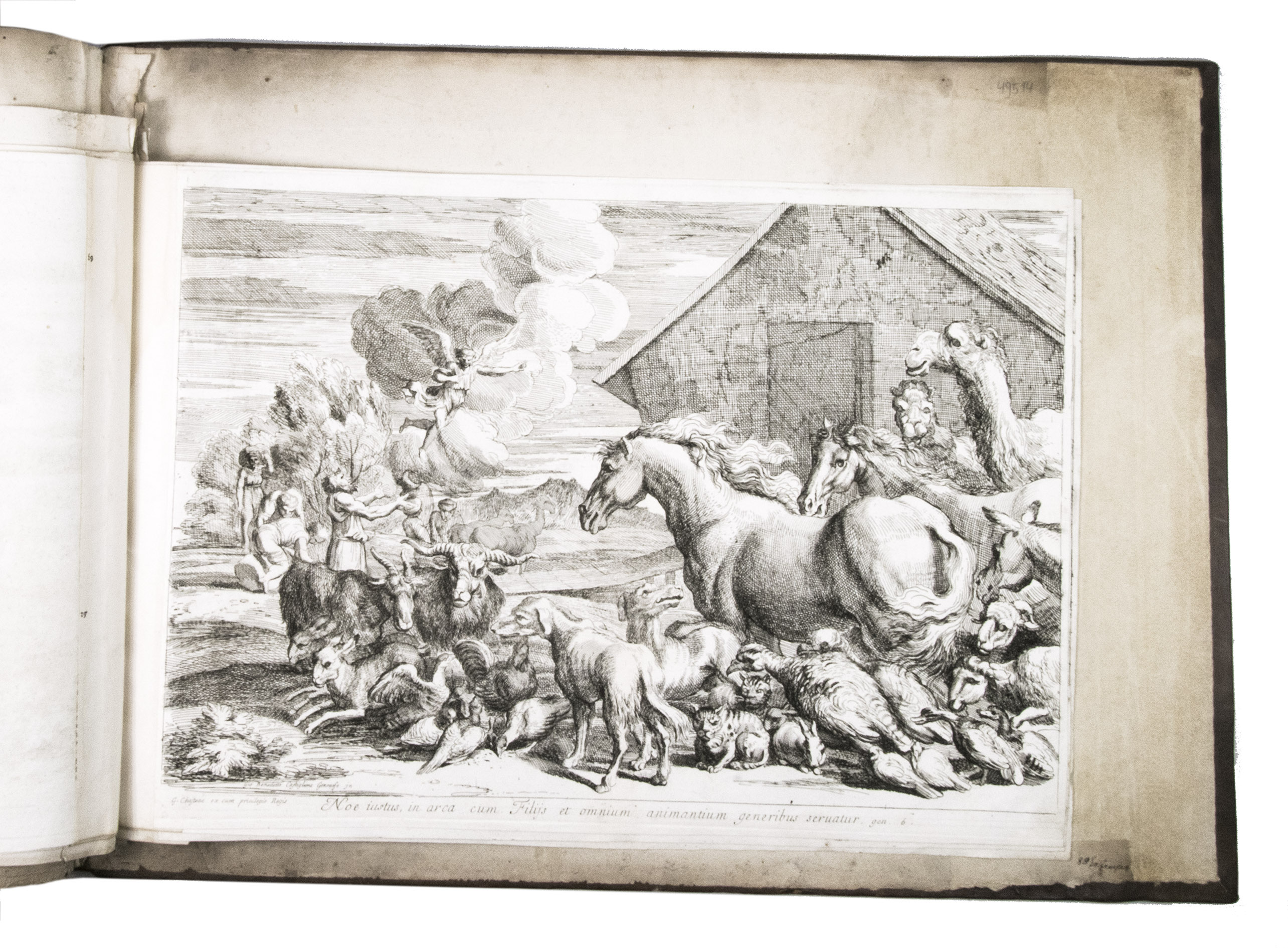
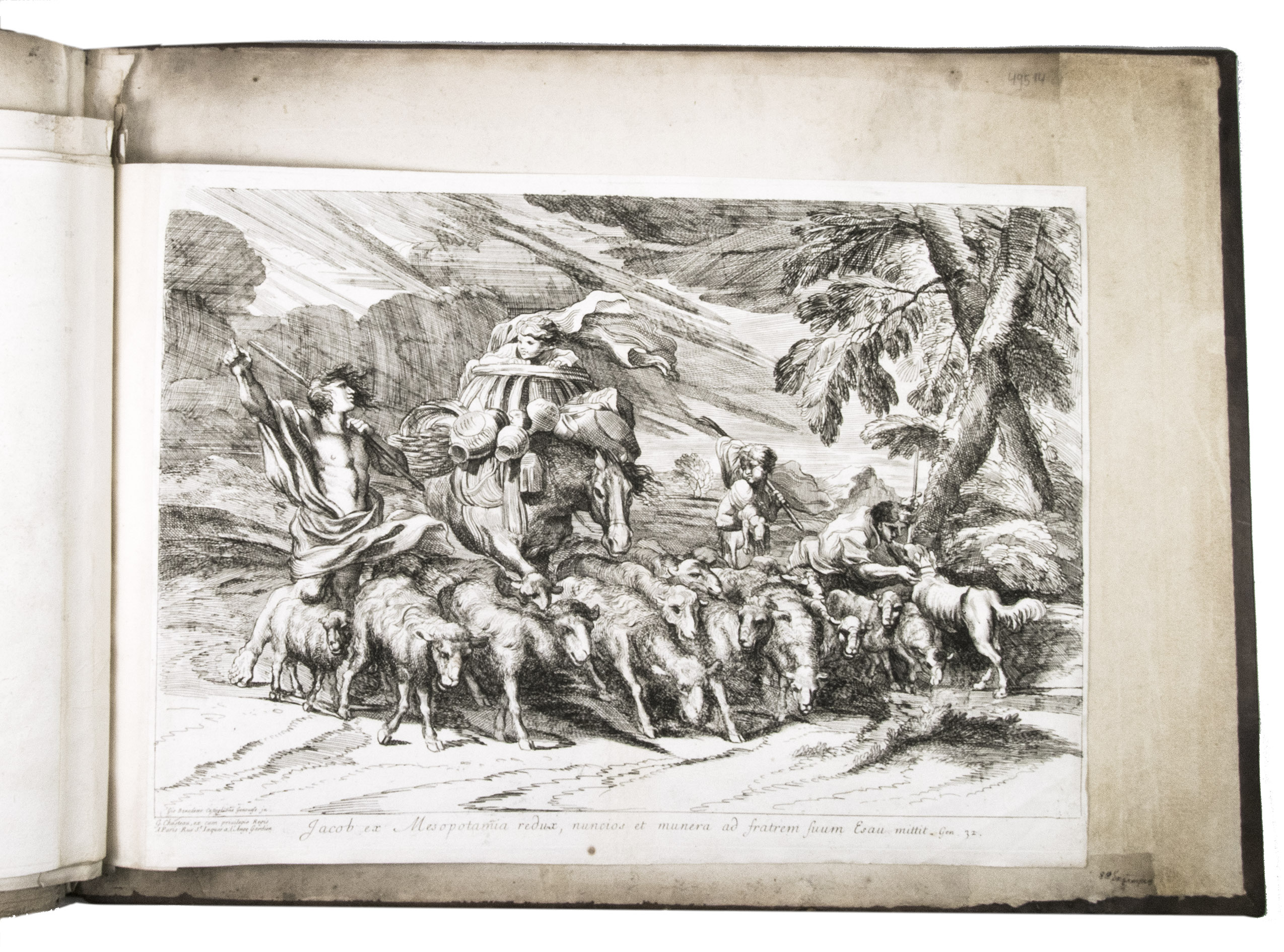
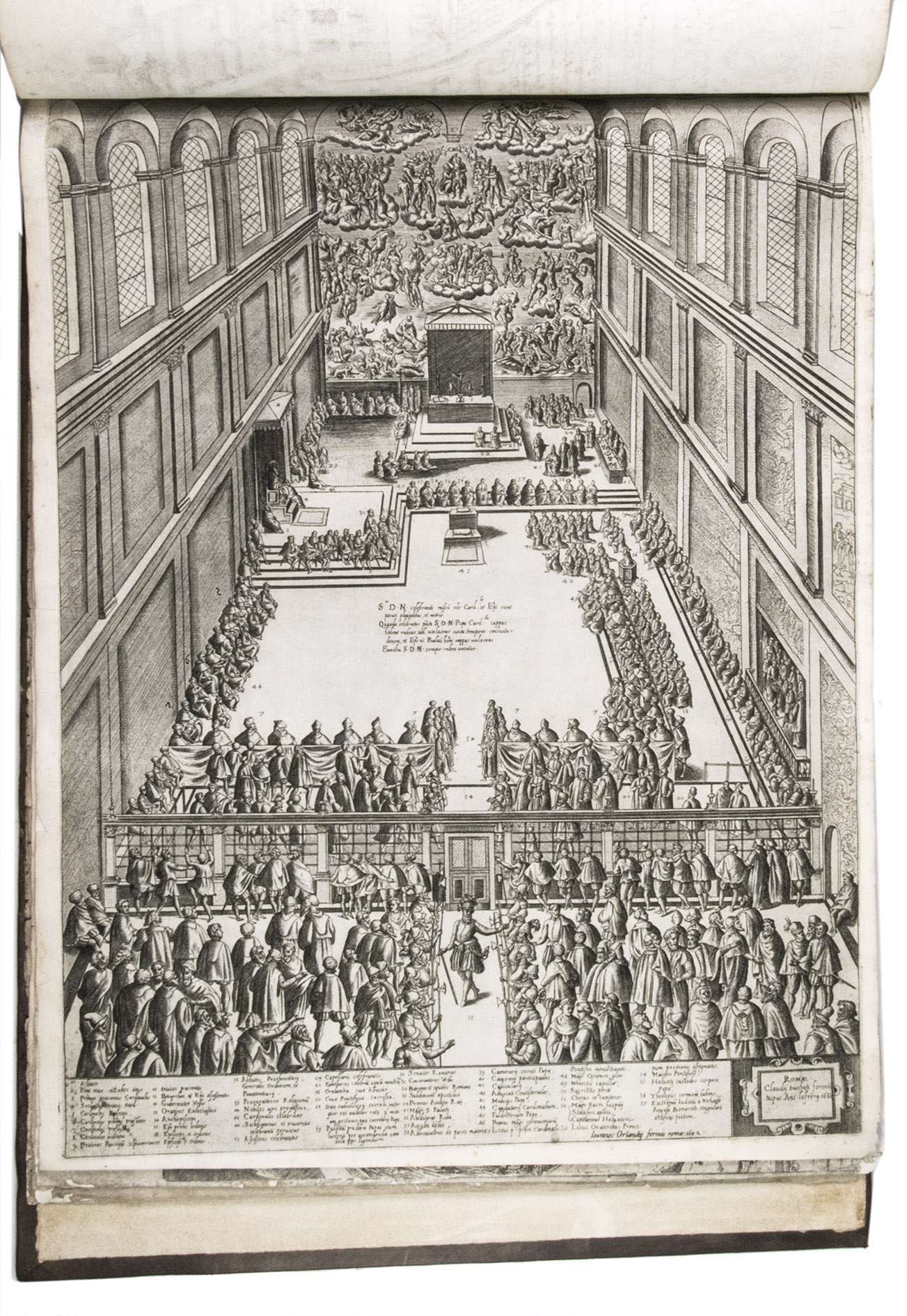
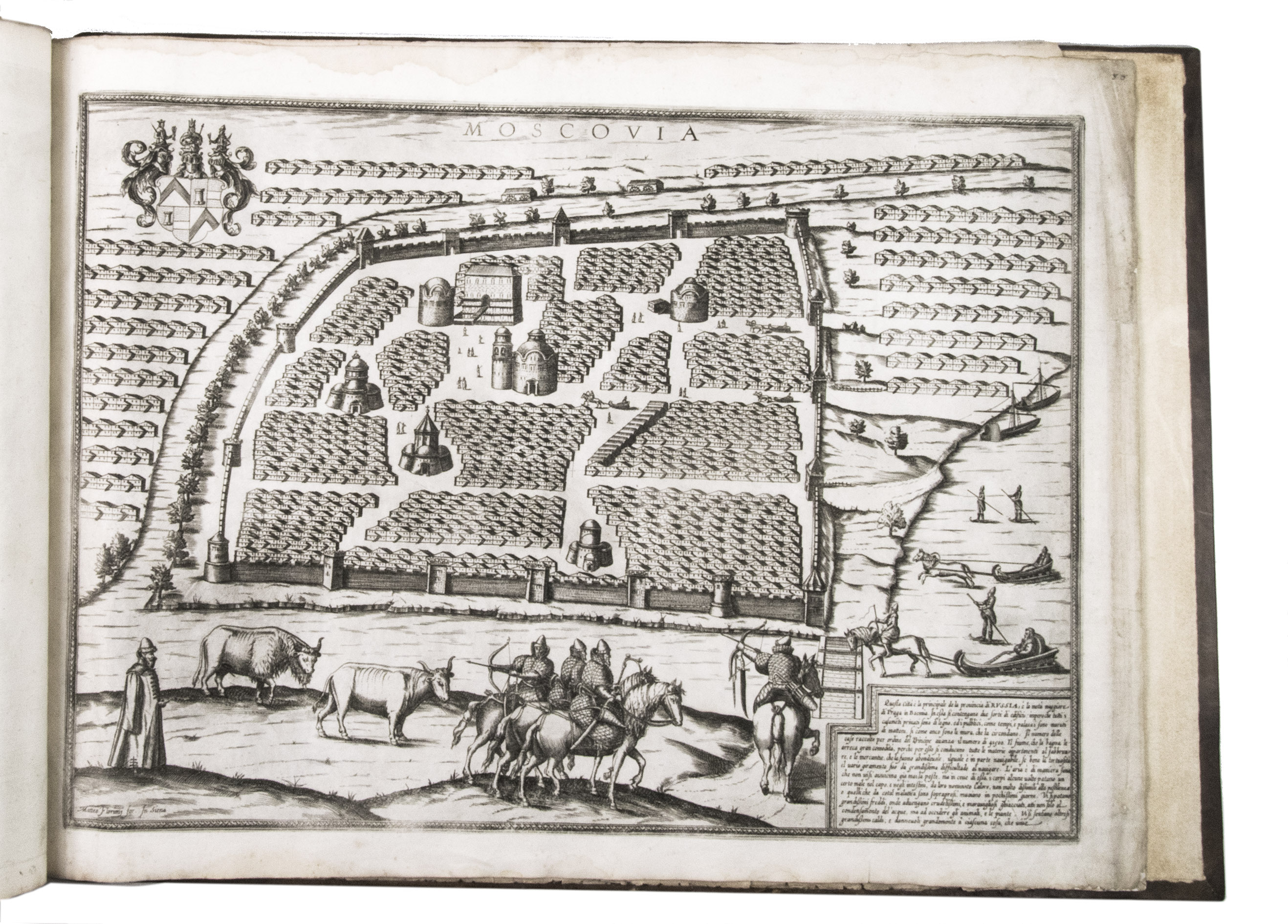
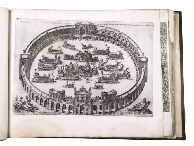
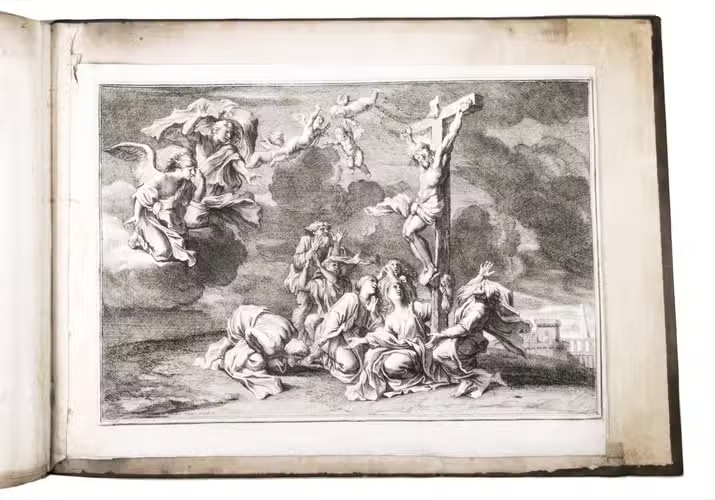
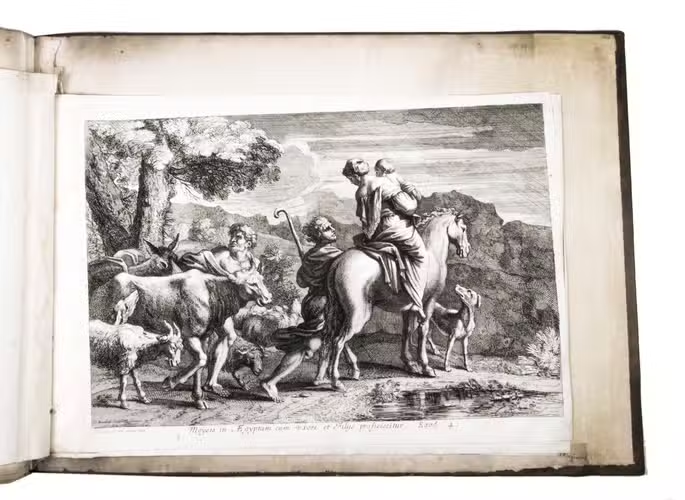
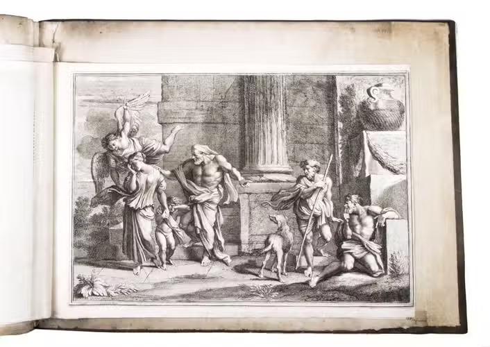
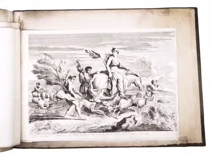
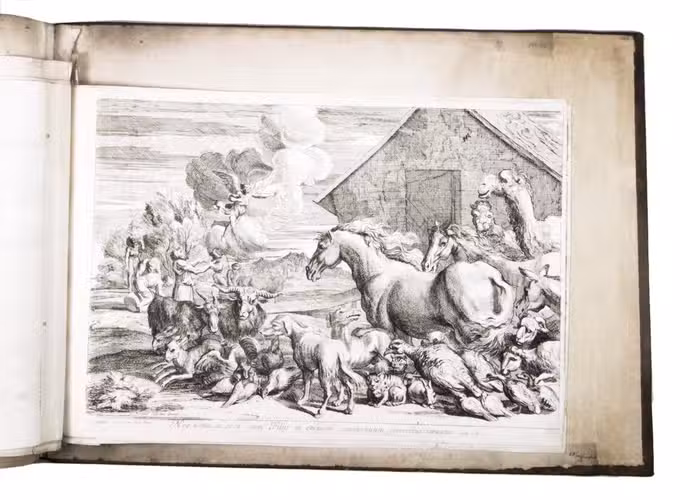
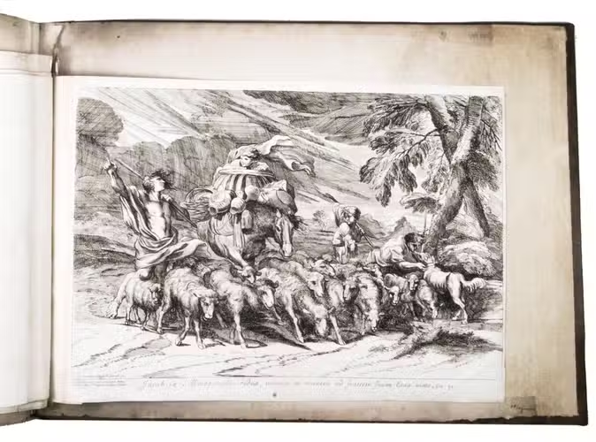
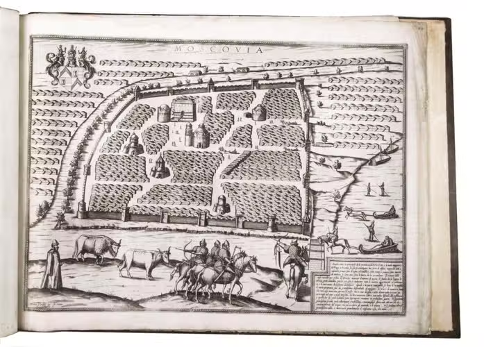
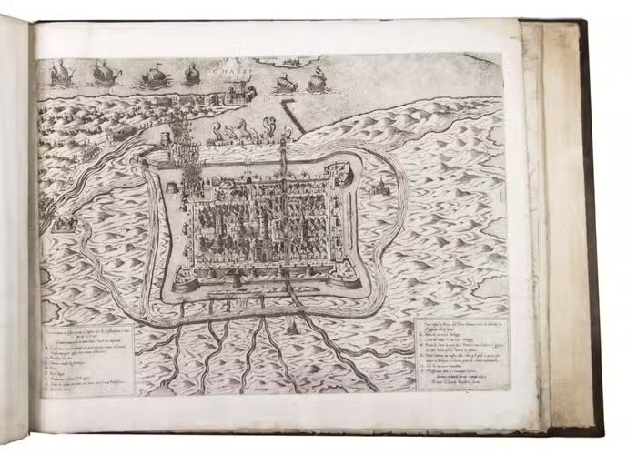
The album further contains 32 engraved city plans, mostly of Italian towns, although a few foreign cities are also included; one of the rarest is the view of Moscow, which is also included here. The collection ends with a (incomplete) series of 11 etchings of landscapes and biblical scenes.
A list of contents is available upon request.
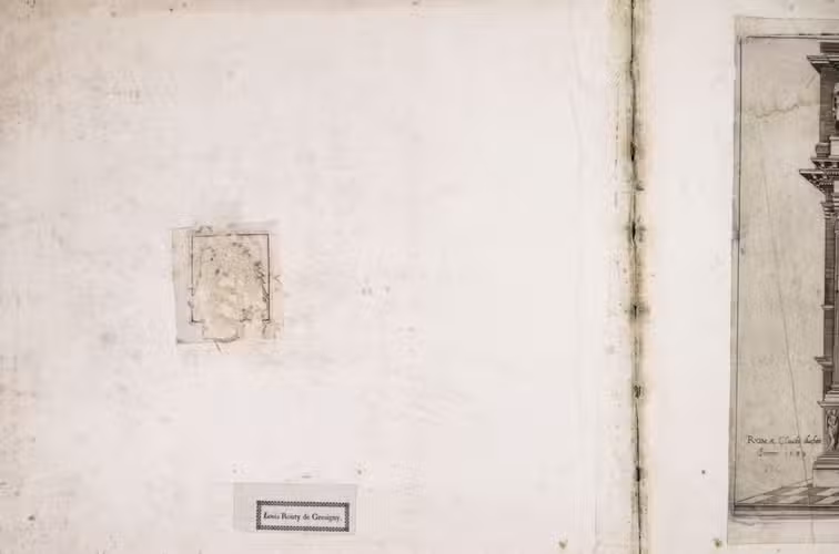
With the bookplate of Louis Routy de Charodon, seigneur de Grésigny and Charodon (1710-1794) on the front pastedown, and remnants of another bookplate above. The boards are somewhat scratched and stained, the spine shows traces of use, the edges of the boards have been professionally restored and the boards have been lengthened to fit the maps. The maps are slightly browned, some are slightly foxed, the first few maps have been mounted onto 17th-century leaves, the longer maps are somewhat soiled on the fore edge, three maps are restored at the fore edge and one at the bottom edge, some maps have been cut slightly short. Otherwise in good condition. Cf. Parshall, P., "Antonio Lafreri's "Speculum Romanae magnificentiae"", in: Print Quarterly, vol. 23 (1), 2006, pp. 3-28.
Related Subjects: