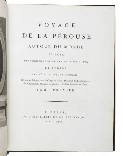
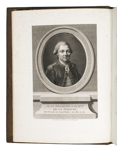
PÉROUSE, Jean Francois de Galaup de la.
Voyage autour du monde.
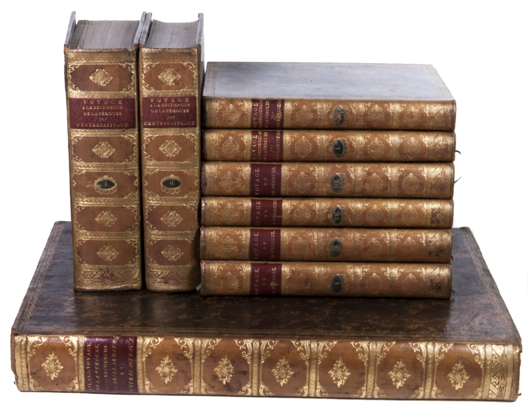
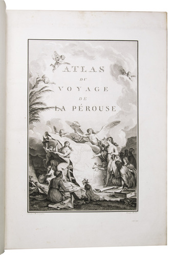
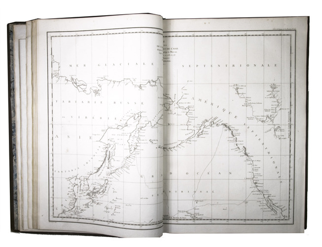
Paris, Imprimerie de la République, An V (= 1797). 9 volumes: ad 1 in 4 volumes; ad 2 in 2 volumes; ad 3 in 2 volumes, with the atlases of the 3 works bound together in 1 volume. 4to (30 x ca. 23 cm.) and large folio (ca. 57 x 40 cm.). Ad 1: with an engraved portrait of De la Pérouse by Tardieu and tables in the text. The atlas contains an engraved title-page, 1 large double-page folding map of De la Pérouse's journey, 20 double-page maps, and 48 full-page maps, views, and illustrations. Ad 2: with tables in the text. The atlas contains an engraved title-page, 1 double-page map, and 43 full-page plates. Ad 3: with 33 folding engraved plates and with tables in the text. The atlas contains an engraved title-page, an engraved table of contents, 37 large double-page folding maps, 2 large double-page folding views, and 10 full-page maps and illustrations. The three atlases for ads 1-3 are bound together in a large folio matching contemporary gold-tooled marbled calf binding.
With:
(2) LABILLARDIÉRE, Jacques Julien Houton de. Voyage à la recherche de Lapérouse.
Paris, H.J. Jansen, An VIII (= 1799-1800).
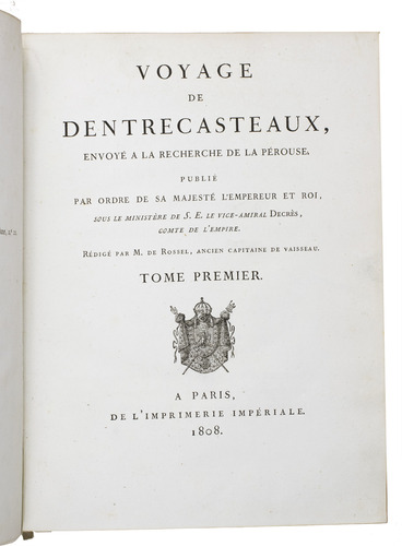
(3) ENTRECASTEAUX, Antoine Raymond Joseph de Bruni, chevalier d'. Voyage envoyé à la recherche de Lapérouse.
Paris, Imprimerie Impériale, 1808.
Contemporary uniform gold-tooled marbled calf, richly gold-tooled spines with a red title-label and a small green volume number label, both lettered in gold, gold-tooled board edges, marbled endpapers.
€ 175,000
Three first editions of descriptions of the rarest and most interesting 18th-century expeditions bound as a set in beautiful contemporary uniform bindings. A milestone set in the history of exploration of the Pacific.
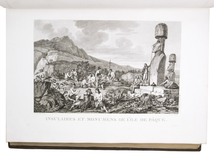
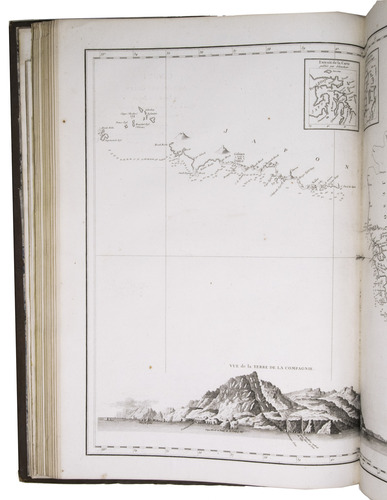
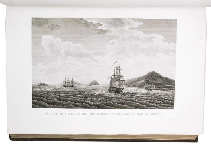
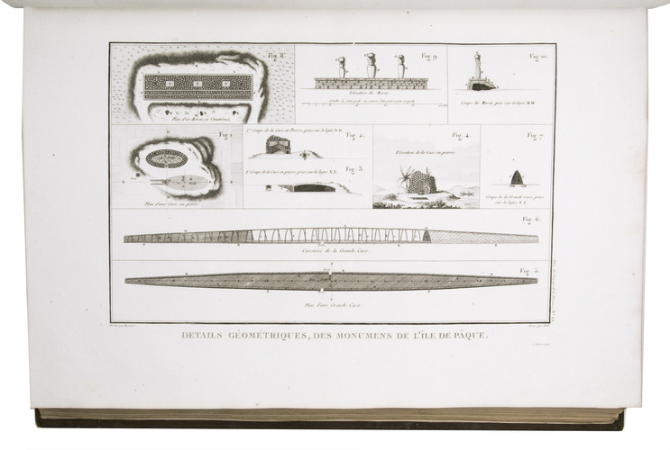
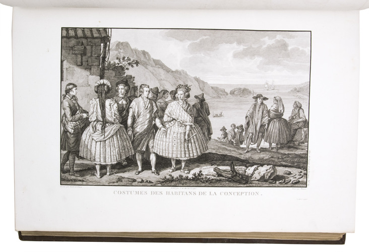
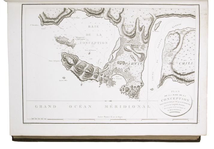
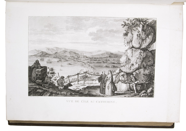
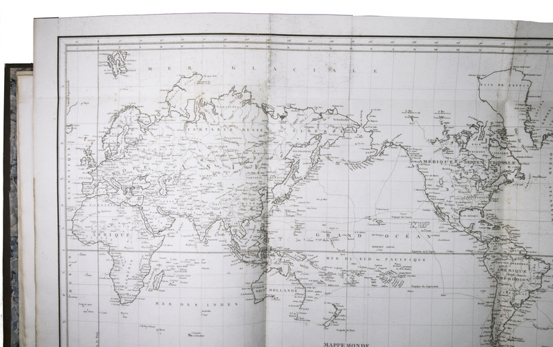
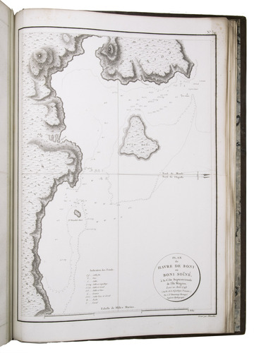
Ad 1: Record of an important French scientific expedition, in which participated a number of scientists and artists. De la Pérouse left France in 1785, with two frigates, the Astrolabe and Boussole, to explore the Pacific and the west coast of North America. He was sent there to explore the regions not explored by Captain Cook. Furthermore, he was to seek for an interoceanic passage, to scientifically observe the various countries, peoples, and products, and to obtain reliable information about the fur trade and the extent of the Spanish settlements in California. This way, De la Pérouse made a valuable contribution to the history of geographical discovery, particularly concerning the American coast and its natives. The account describes expeditions to Easter Island, Hawaii, Macao, Formosa, the Aleutian Islands, Samoa, Tonga, and Australia. The best results were obtained in exploring and mapping the unknown territories on the Asiatic side of the Pacific. This includes the discovery of the strait - still bearing De la Pérouse's name - between the island of Sakhalin and the northernmost island of Japan. De la Pérouse sent his accounts to France from Kamchatka and Botany Bay. But after the expedition left Botany Bay, it was never heard from again. Two expeditions were sent out to look for him: the first was led by Dillon in 1827, the second by Dumont d'Urville in 1828. Only 39 years later, the remnants of De la Pérouse's two frigates were discovered on the reef of Vanikoro, one of the Santa Cruz Islands, by Peter Dillon. The maps included in the present travel account is a large general map of the journey, detailed maps of different isles, several views, and beautiful illustrations of plants, birds, ships, people, etc.
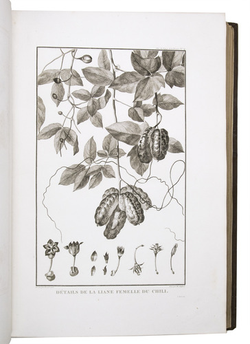
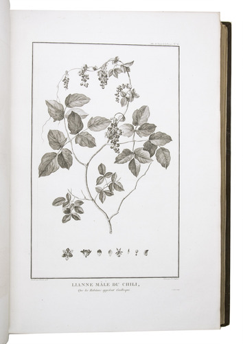
Ad 2: Account of the naturalist De Labillardiére, who accompanied one of the futile searches for De la Pérouse. The present expedition was sent out under d'Entrecasteaux and Huon de Kermadec in 1791-1794. Although the expedition was not successful, it is of considerable importance because of the scientific observations and surveys of the coasts of Tasmania, New Caledonia, the north coast of New Guinea, and the southwest coast of Australia it produced. De Labillardière's account of the Tongans is among the best contributions to their ethnology. The illustrations include views, a portrait of a native, illustrations of jewellery, and 14 engraved botanical plates after Redouté.
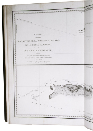
Ad 3: Scientific account of a search for De la Pérouse, the same expedition as described in the work mentioned above (ad 2). The expedition did not succeed, but d'Entrecasteux made important geographical discoveries, and his account is extraordinarily rich in cartographical and astronomical material. The Recherche and the Espérance were under his command, second captain was Huon de Kermadec, after whom the islands north of New Zealand were named. The d'Entrecasteaux Islands near New Guinea were discovered and named for the admiral, who later died of colic near the north coast of New Guinea. The beautiful large maps in the atlas depict wonderfully detailed illustrations of isles and coasts along the South Sea. The French Revolution divided the expedition: the royalists joined the Dutch on Java, and the Republicans fell into the hands of the British Royal Navy. Also captured were the expedition's journal, charts, and natural history specimens. Sir Joseph Banks ordered that they be delivered to the coast of France under a flag of truce.
With two small book plates on the front endpapers, of Clemens Platen-Hallermund and IvR, in every volume. Occasionally very slightly foxed in the margins and with a few minor tears in the bottom margin of some leaves, otherwise in very good condition. Beautiful copies of an extremely rare and complete set of De la Pérouse's expedition and two descriptions of one of the two expeditions in search of De la Pérouse. Ad 1: Chadenat 106; Cox I, 67; Hill, p. 173; Lada-Mocarski 52; Nissen, ZBI, 281; Sabin 38960; ad 2: Chadenat 99; Cox I, 68; Nissen, ZBI, 2331; Sabin 38420; cf. Hill, p. 168 (English ed.); ad 3: Chadenat 5056; Hill, p. 97 (only 32 plates in text vols.); Poggendorf I, 671; Sabin 22671.
Related Subjects: