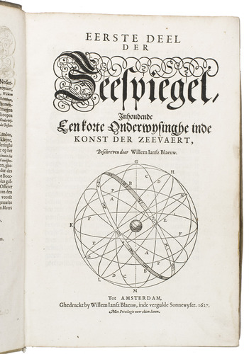
BLAEU, Willem Jansz.
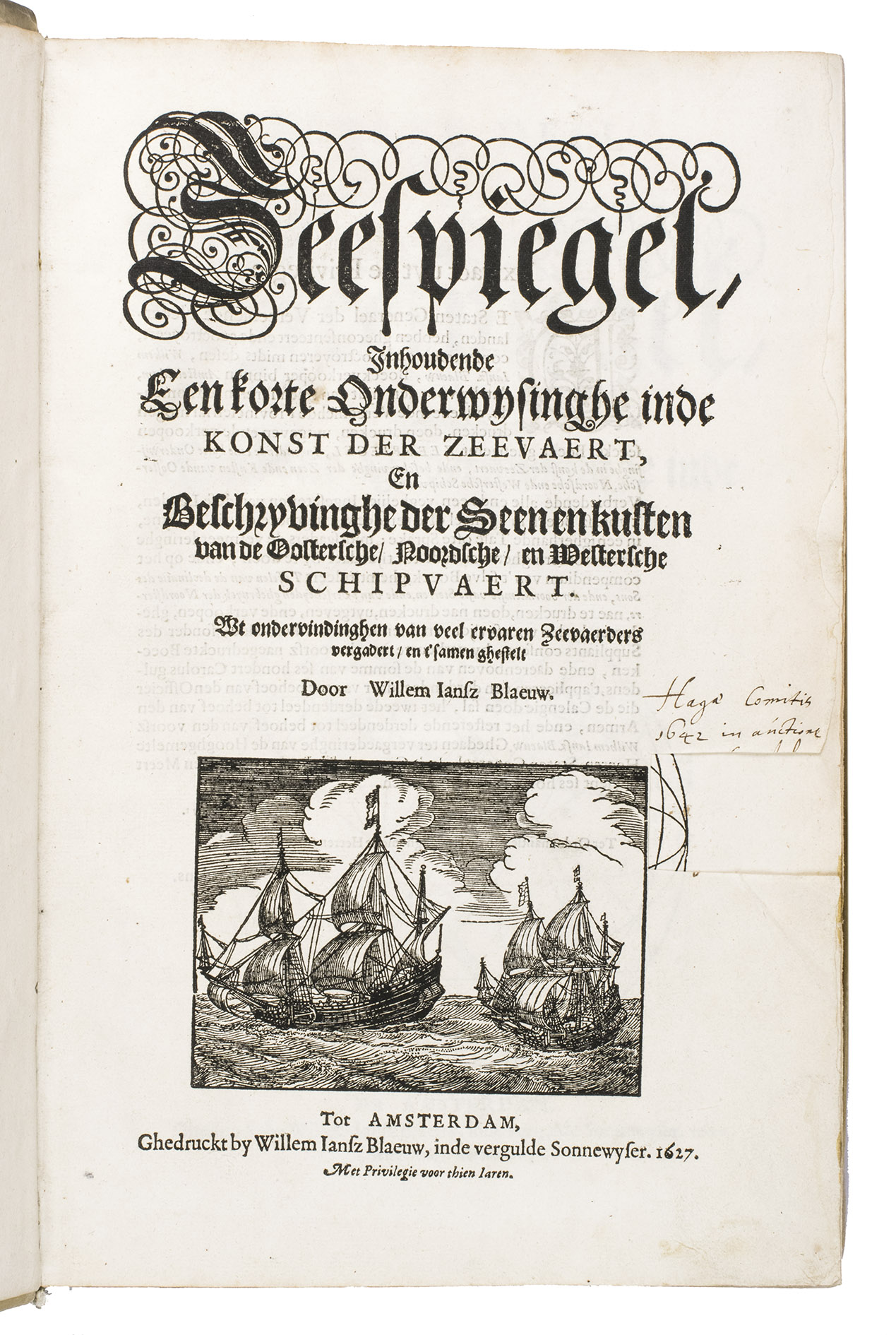
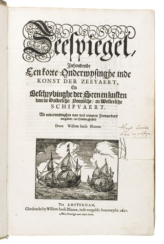
Zeespiegel, inhoudende een korte onderwijsinghe inde konst der zeevaert, en beschryvinghe der seen en kusten van de Oostersche, Noordsche, en Westersche schipvaert. ...
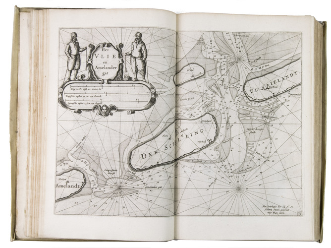
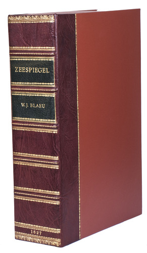
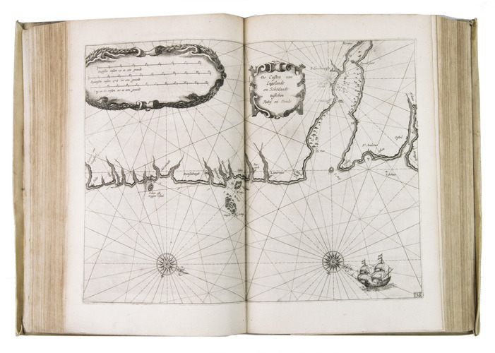
Amsterdam, Willem Jansz. Blaeu, 1627. 3 parts in 1 volume, parts 2 and 3 consist of 6 books each. Folio. With 108 numbered engraved charts, 2 half-page engraved charts, 2 volvelles, a woodcut vignette on the divisional title page of each part, and numerous woodcut illustrations in the text. Contemporary overlapping vellum. The work is preserved in a gold-tooled half red morocco clamshell box, with two green morocco title labels, lettered in gold, red buckram sides, and a green felt lining. [16], 64; 39, [1], 43, [1], 48, 32, 28, 24; 32, 52, 46, 43, [1], 40, 23, [1 blank] pp.
€ 120,000
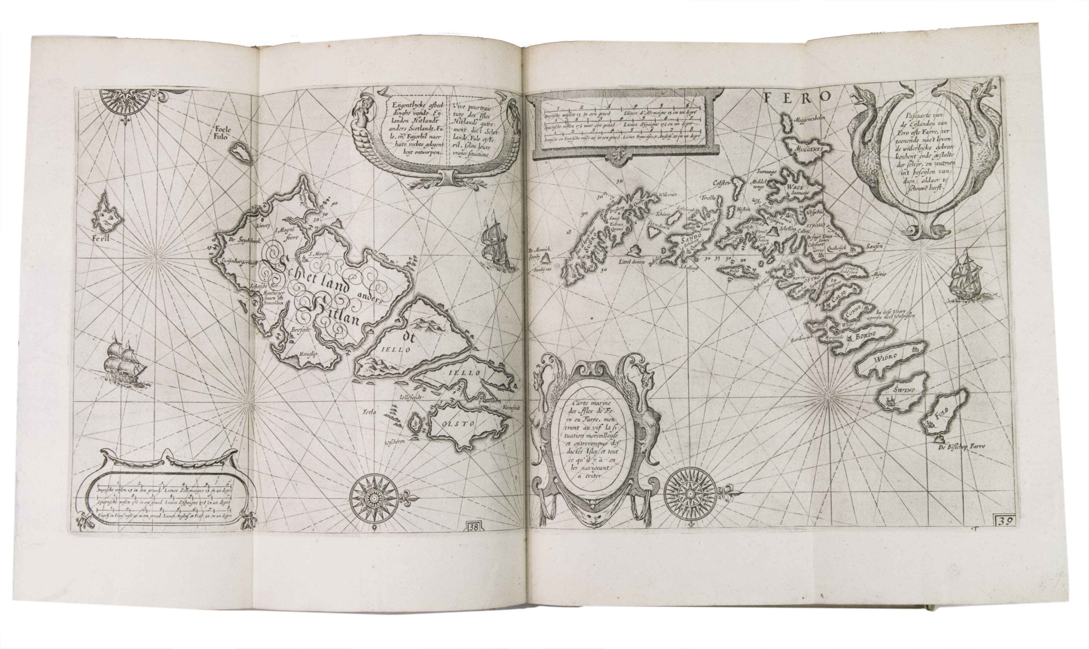
Second edition of Willem Blaeu's famous but extremely rare pilot guide, of which only a handful of copies are still known to exist. It was one of the largest pilot guides of the time, containing almost thrice as many charts as another famous example of the time, Blaeu's own Het Licht der Zee-vaert (1608). Although the work proved hugely successful because of this large update and was republished many times, it was also actively used at sea for navigation, which accounts for its extreme rarity today. Only a few copies of each edition are currently known. For the present edition, we have only been able to trace five other copies, of which four in institutions, and just one in sales records.
Blaeu's first pilot guide, Het Licht der Zee-vaert, was also the first work he ever published, and the one that established his career. Although pilot guides were popular in the 16th and 17th centuries, Blaeu was the only one at the time to author them. The other guides on the market were republications of older works, so the information in them was outdated. Blaeu therefore filled an important gap in the market with his publication. The work appeared in various editions and languages between 1608 and 1630, but Blaeu's copyright for it ended around 1618, causing his competitor, Johannes Janssonius, to publish his own version of it in 1620, which he could offer for a lower price. This stimulated Blaeu to write and publish a new and significantly enlarged pilot guide in 1623, which was the present work.
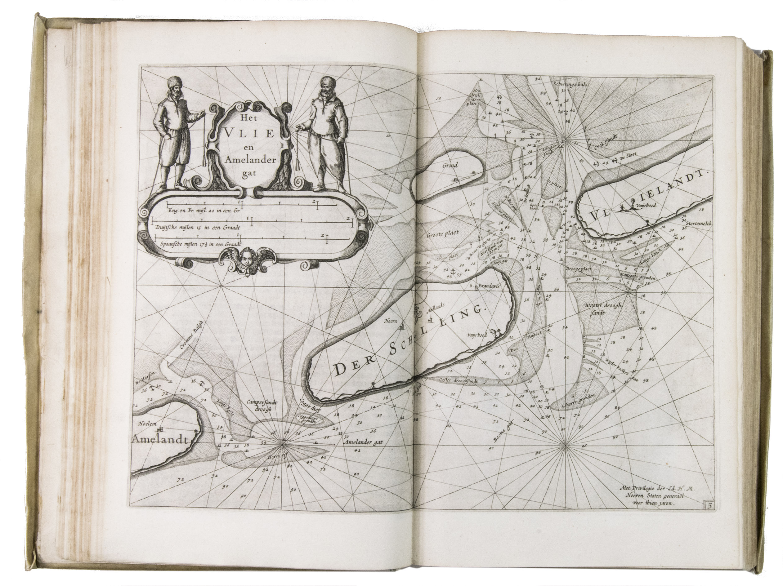
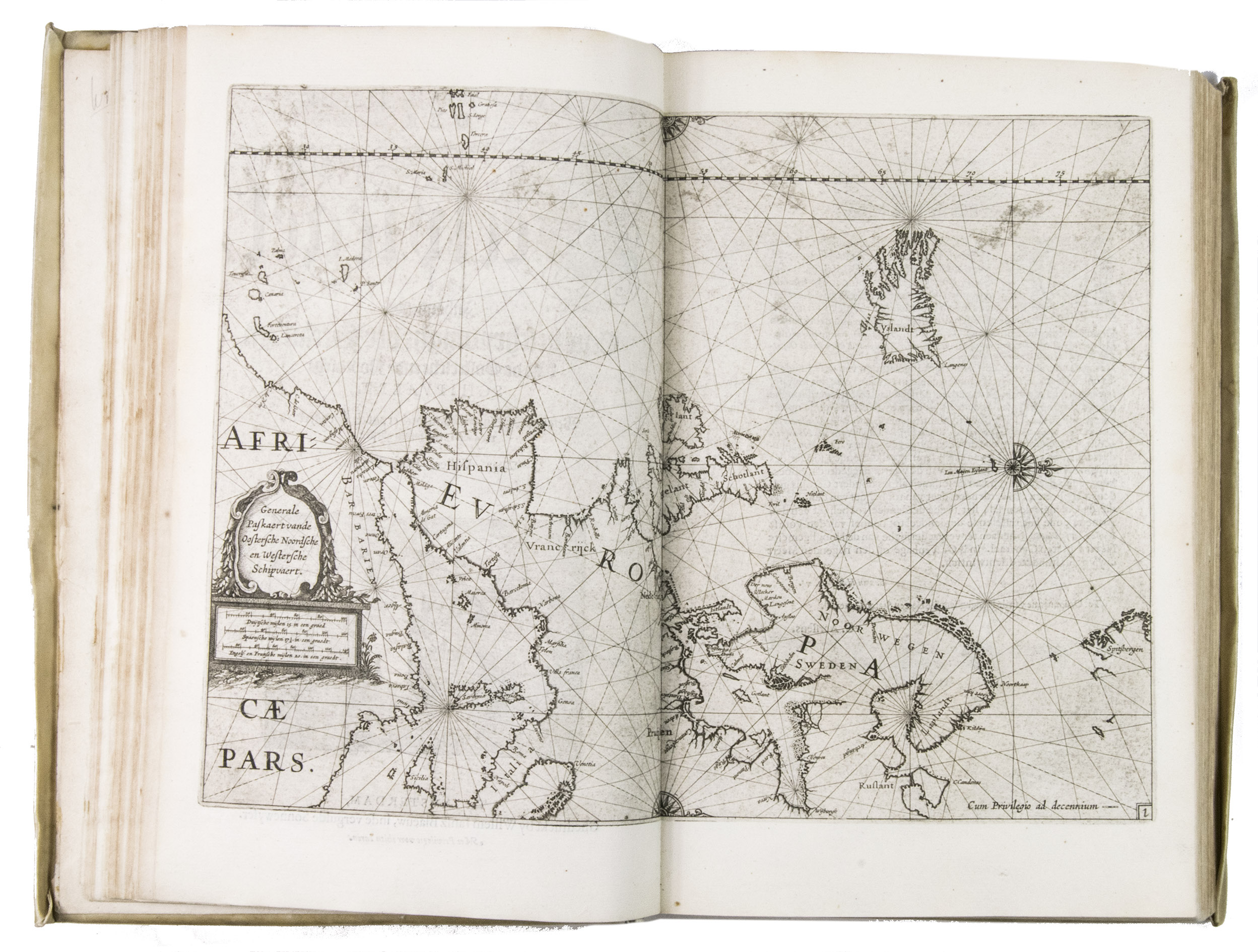
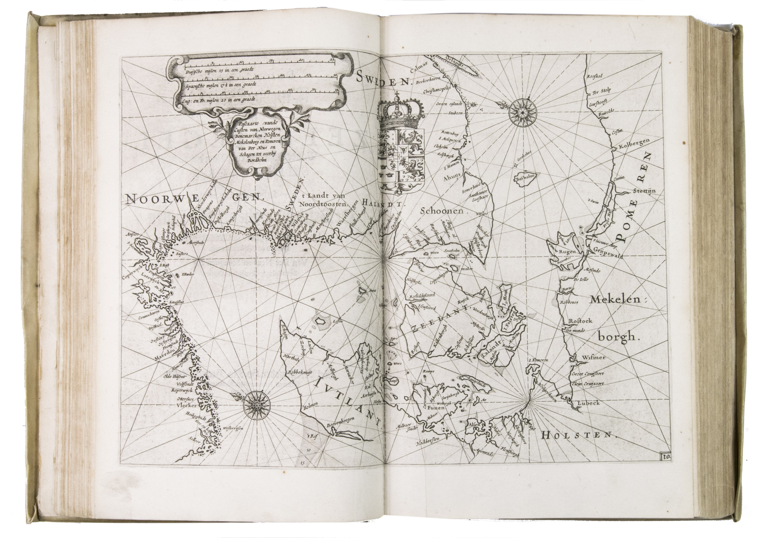
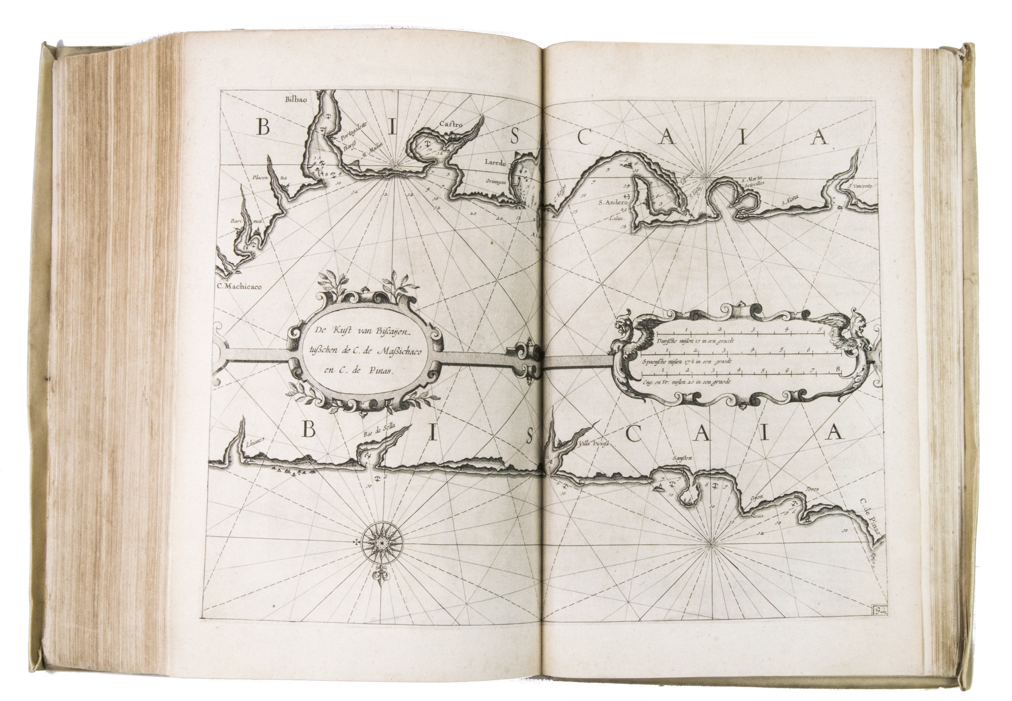
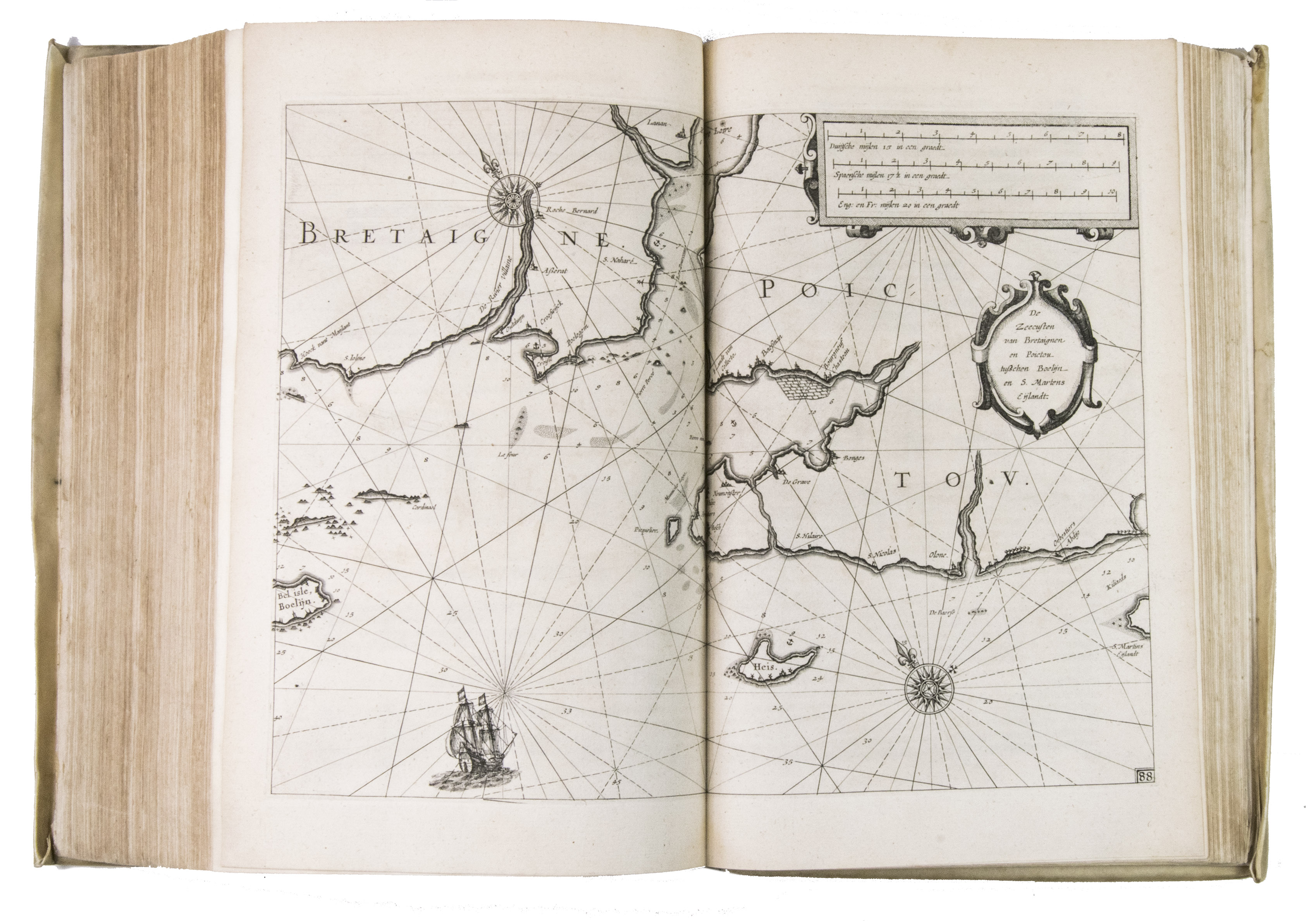
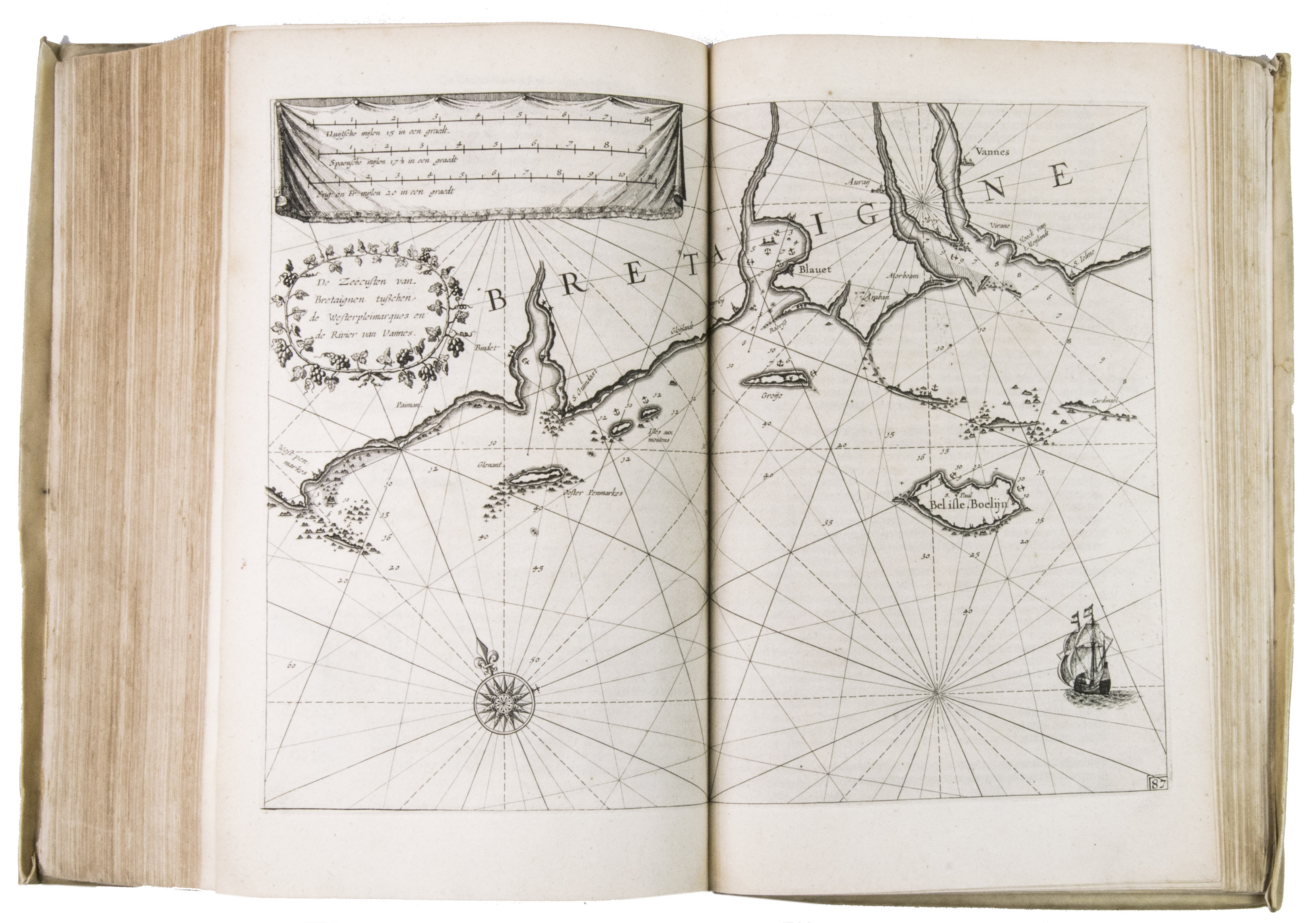
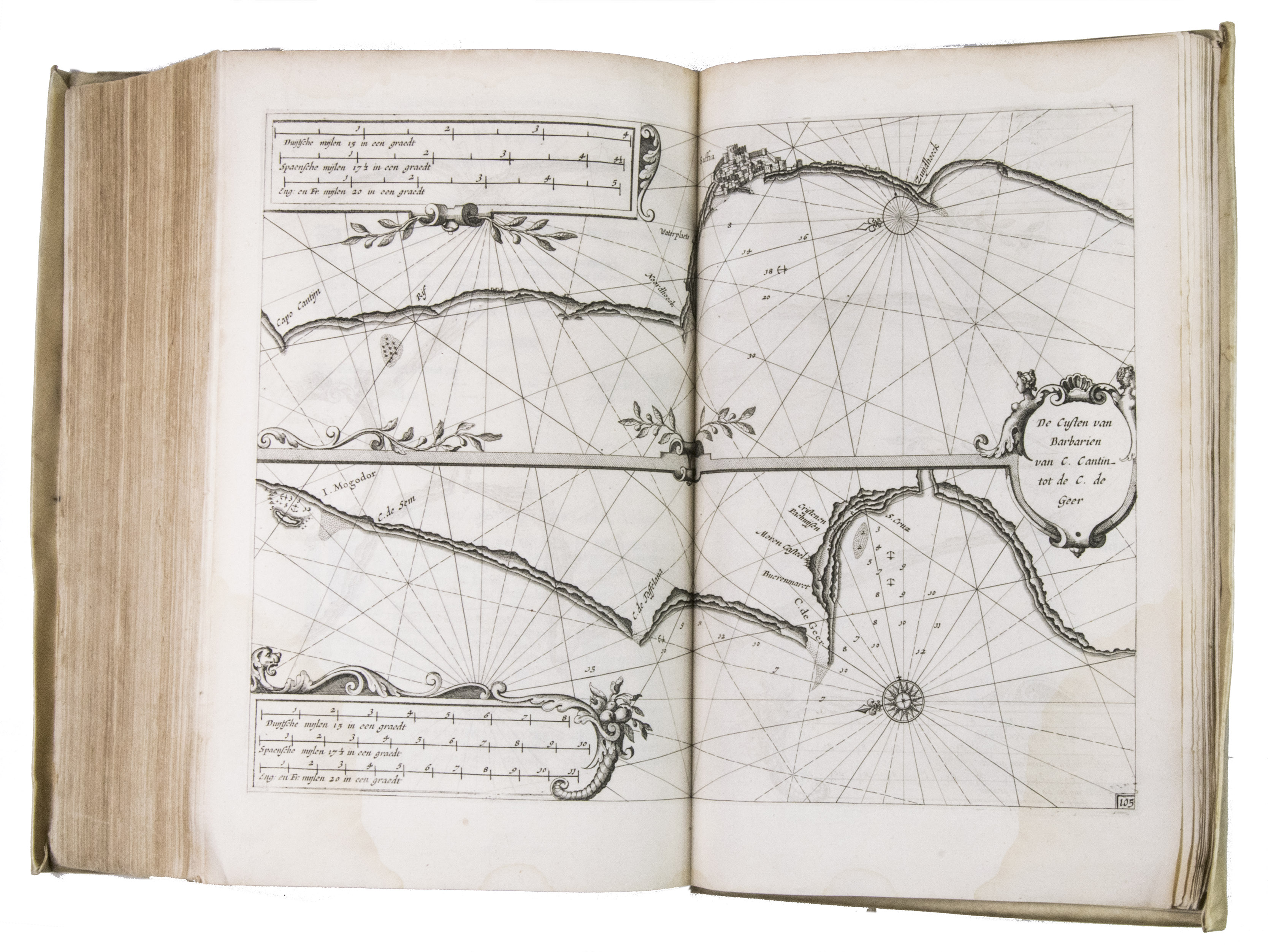
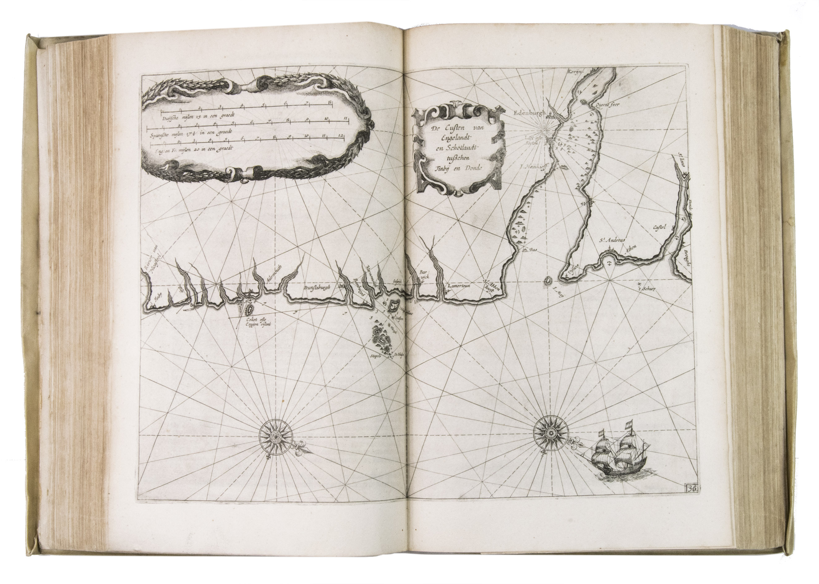
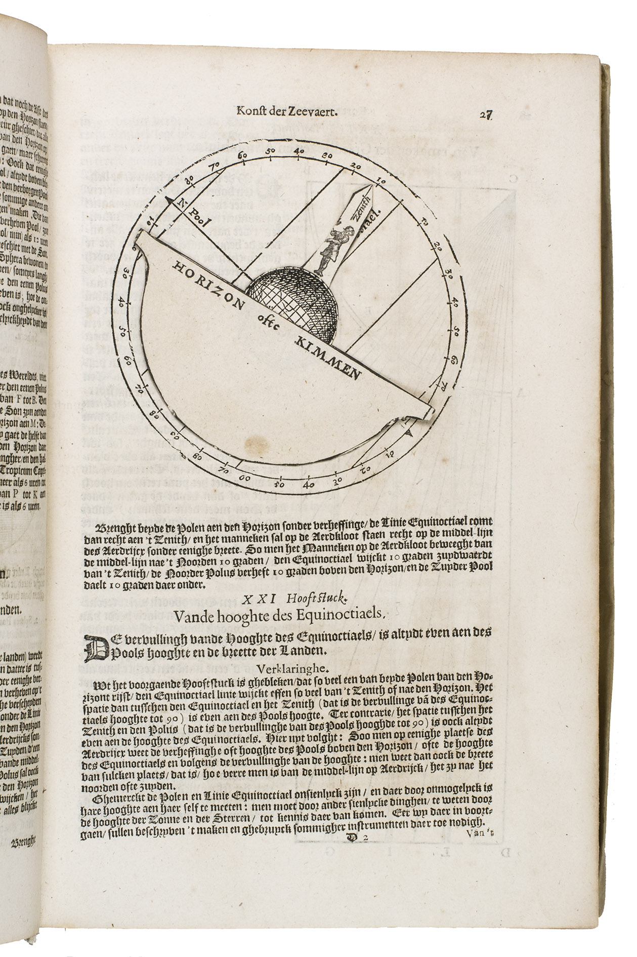
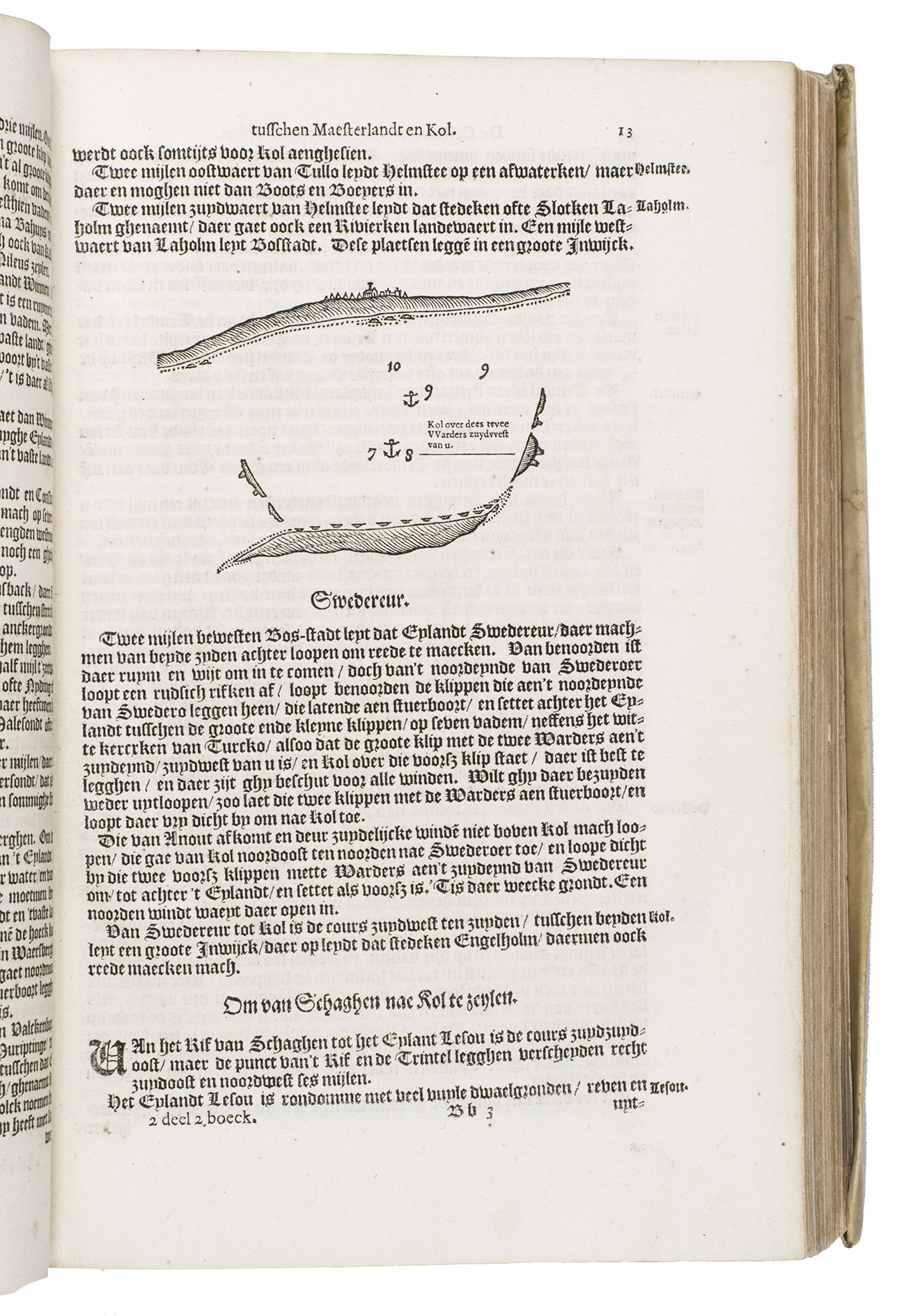
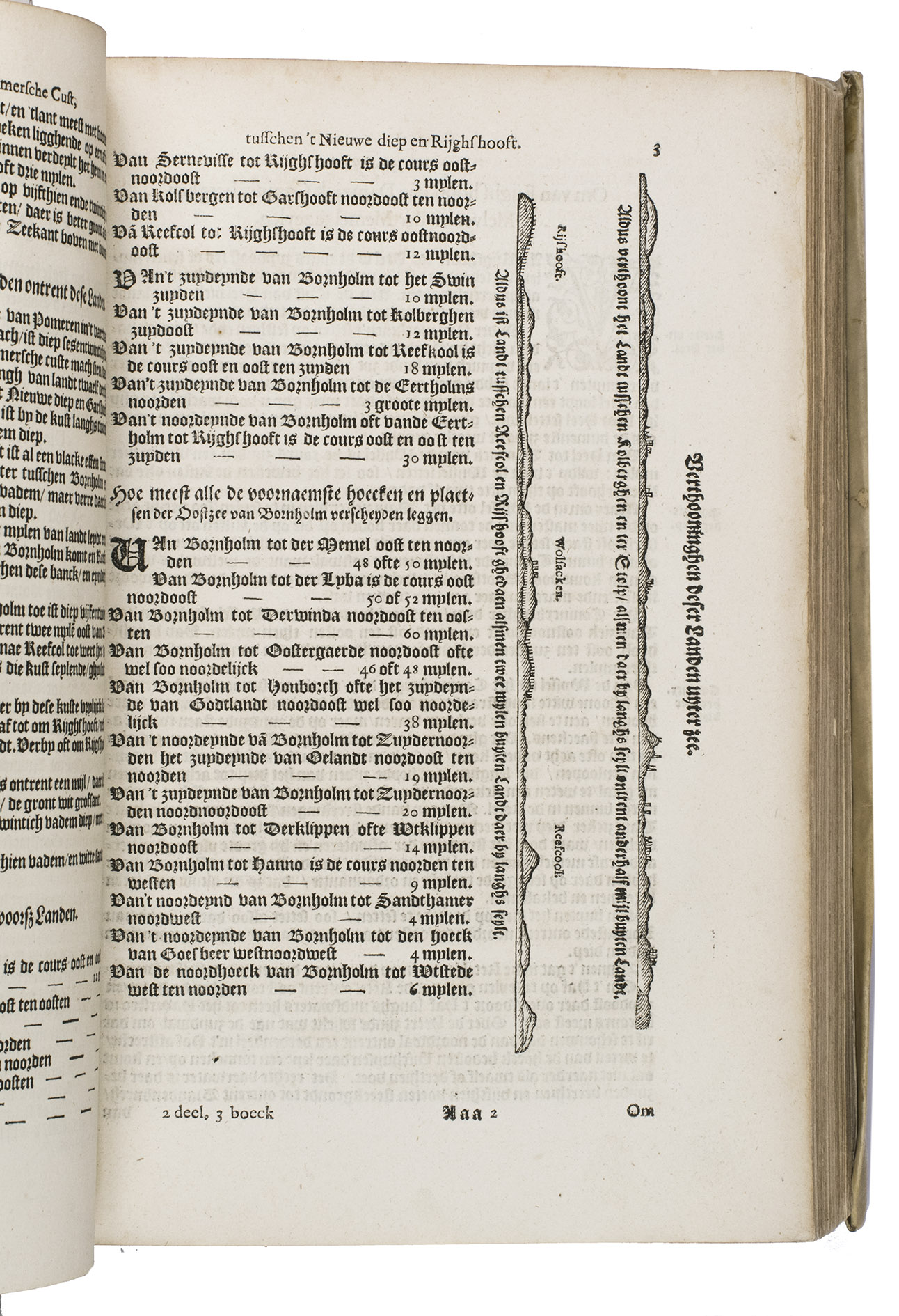
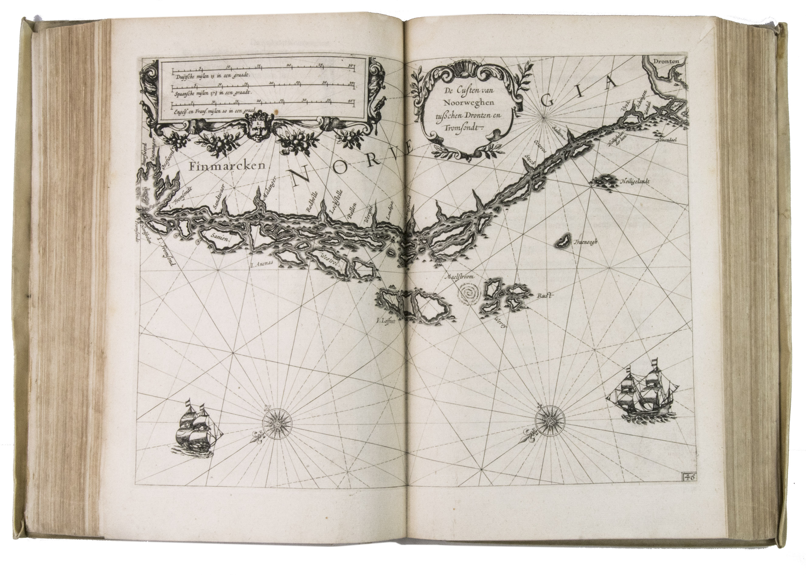
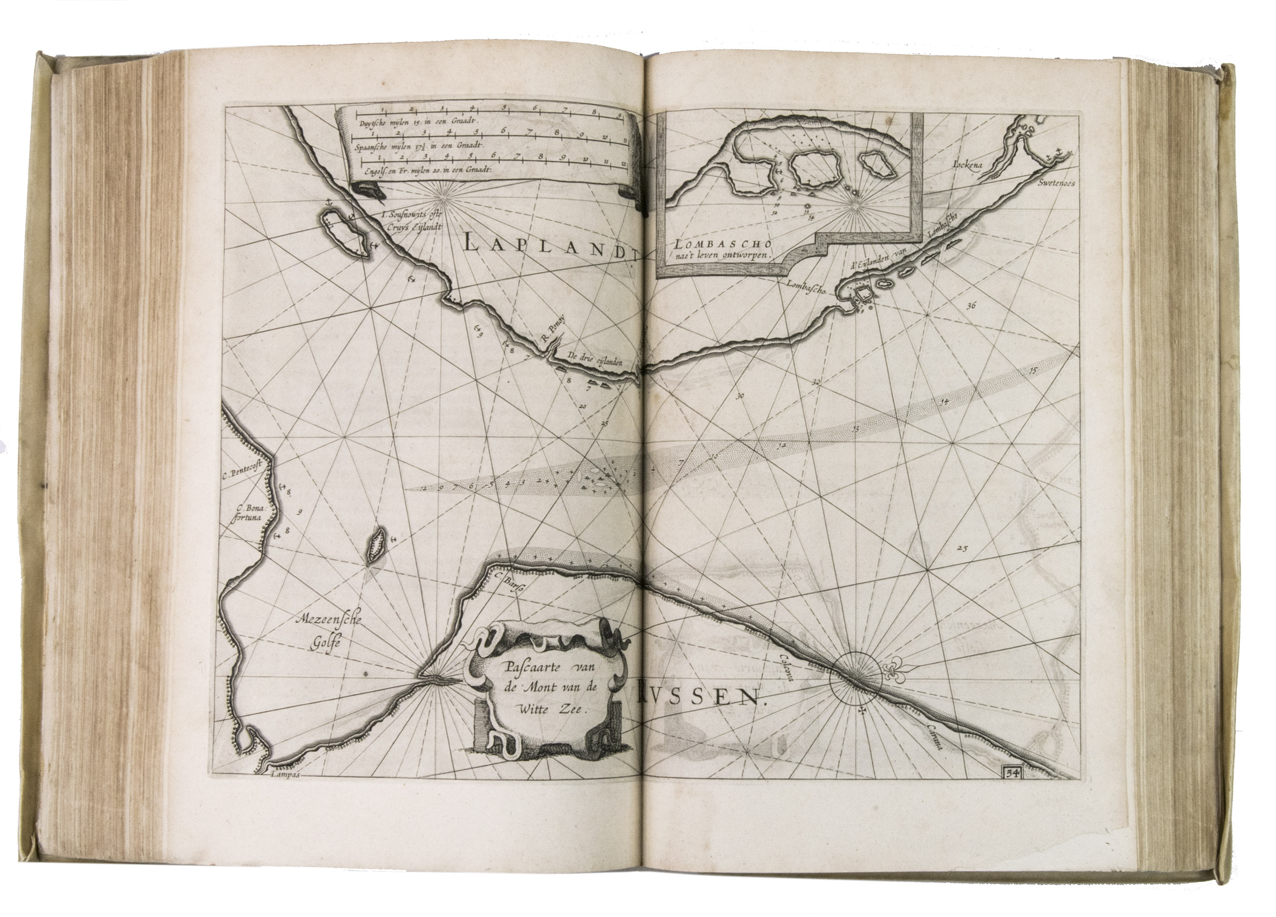
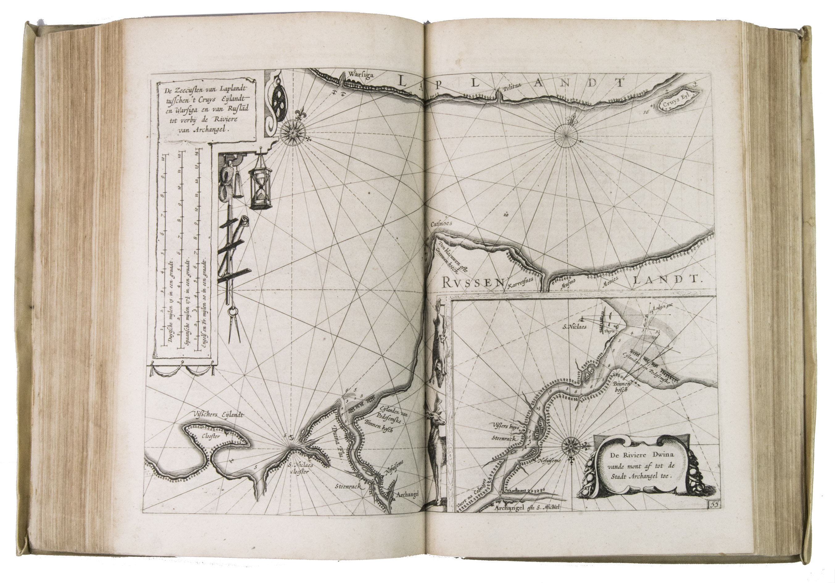
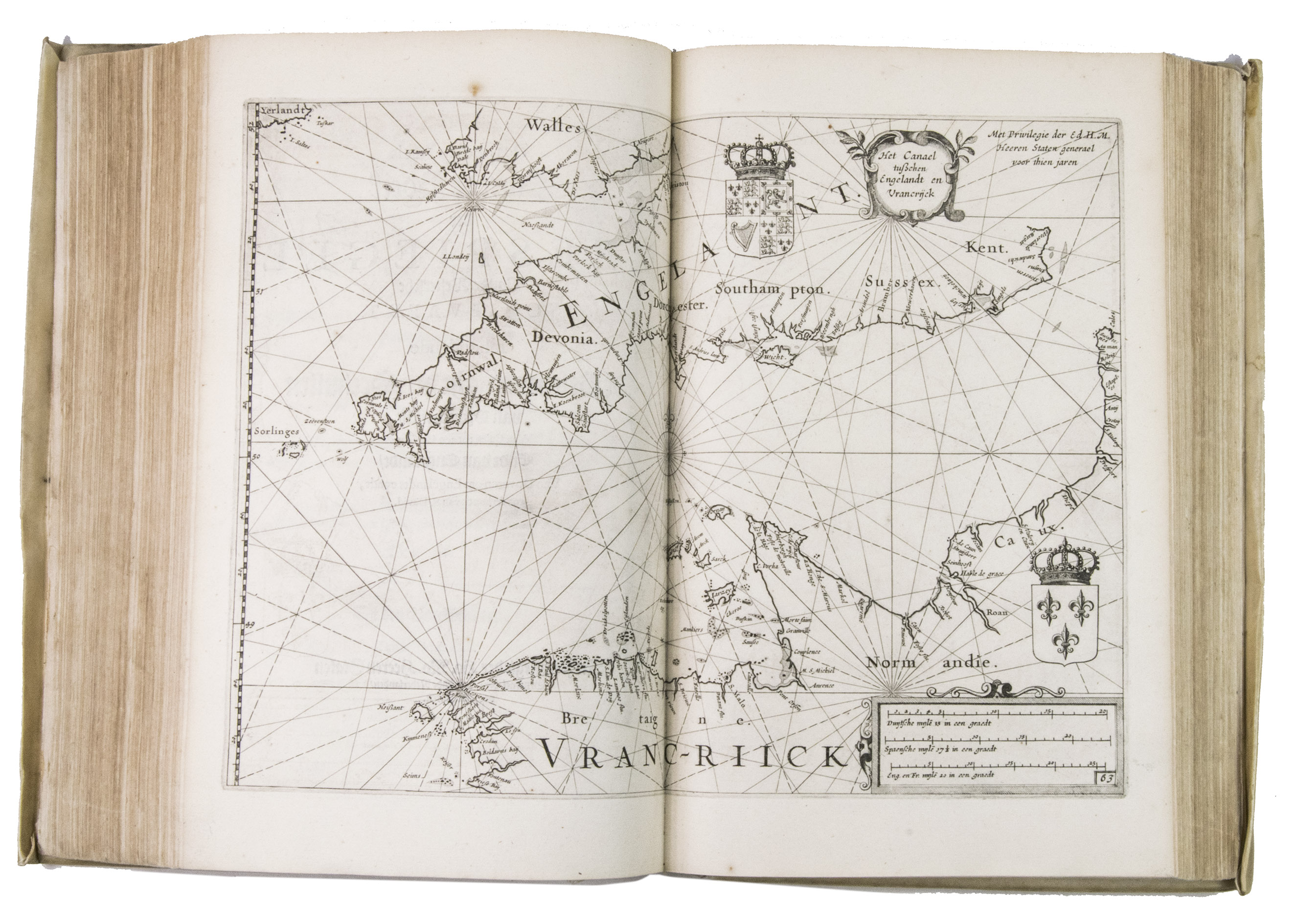
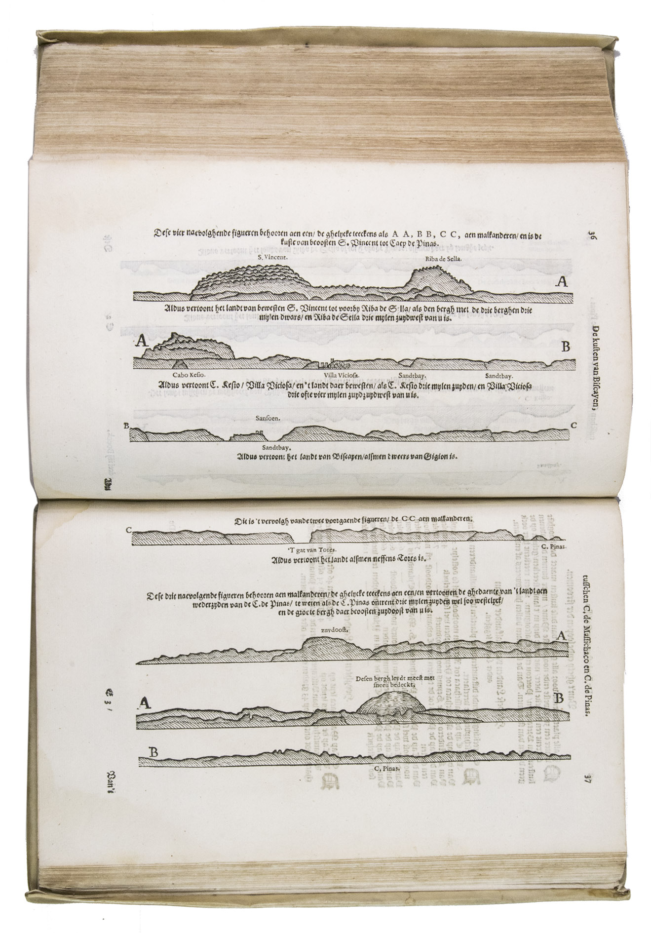
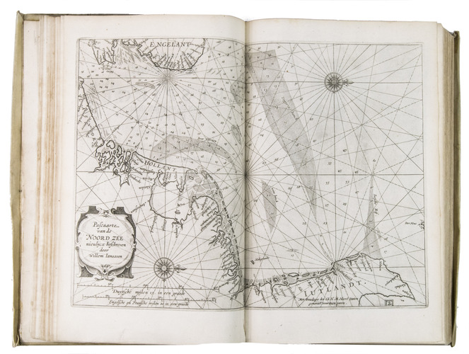
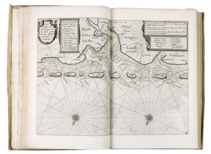
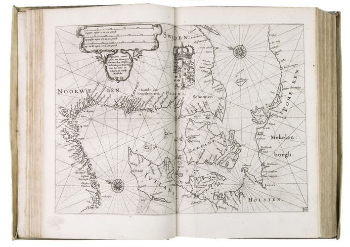
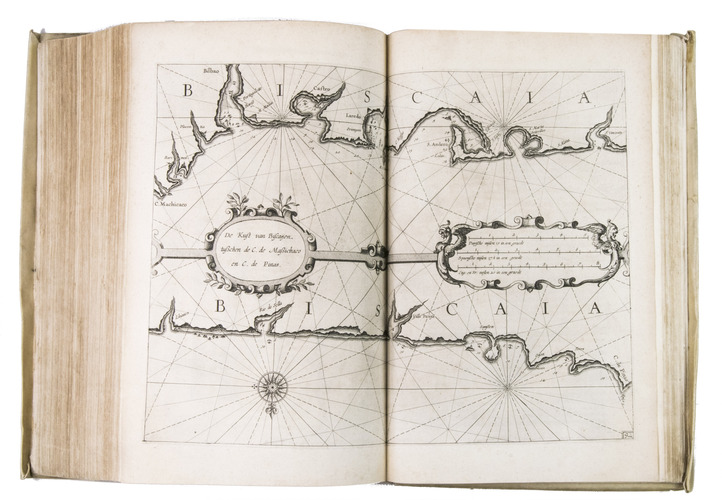
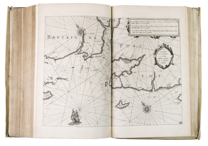
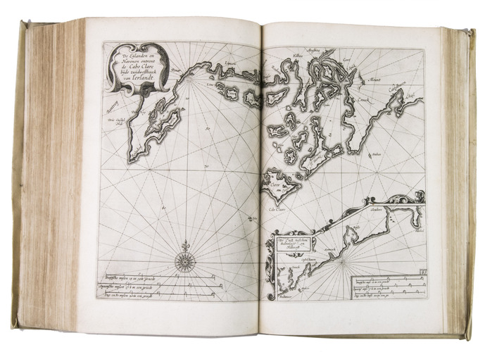
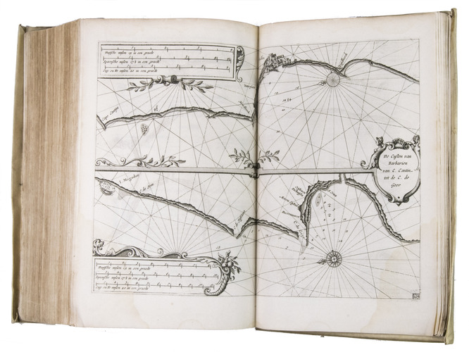
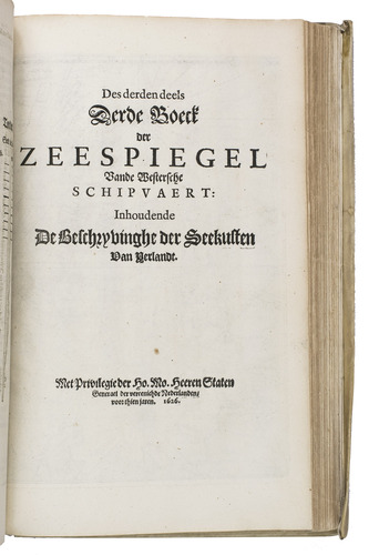
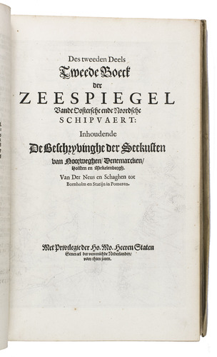
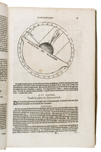
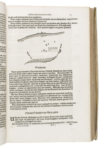
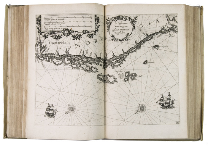
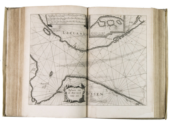
The Zeespiegel consists of three parts. It covers much the same coastal regions as in Het Licht der Zee-vaert, but does so in much greater detail and with larger scale charts, showing the European coast, all the way from Nova Zembla in the north to Malaga in the south, as well as the coasts of Africa from the Barbary (West) coast to the Canary Islands. The coasts of the Mediterranean were included in a fourth part, which appeared in 1638.
The present copy, which is in remarkable condition, would appear never to have made it further than a gentleman's library. It unfortunately lacks the chart of the White Sea, but this was likely never bound with it, since it does not appear to have been removed later. It comes from the library of Théodore Edme Mionnet (1770-1842), the famous French numismatist, who introduced a way of describing the size of coins, medallions, and similar flat round objects, which became known as the "Mionnet scale".
With the bookplate of the French numismatist T. E. Mionnet mounted on the front pastedown, an armorial bookplate mounted below, and a contemporary, partly clipped, ownership annotation on the title page of the first part. The vellum is slightly soiled, most of the sewing supports have broken, but the structural integrity of the work is still intact. The work is slightly browned throughout, with small marginal tears or holes in some of the charts and leaves, the volvelle on page 62 of part 1 without the moveable part, lacking chart 56, a water stain in the lower outer corner of the last 60 leaves. Otherwise in good condition. Koeman IV, M Bl. 32; Koeman, Blaeu and his grand Atlas, p. 29; STCN 083423273 (4 copies, of which 1 incomplete); Tiele, Ned. bibliogr., 124; USTC 1013047 (3 copies, of which 1 incomplete); WorldCat 68853876, 979986167, 248543751, 311897589 (4 copies).
Related Subjects: