[PORTOLAN CHART - Luis TEXEIRA].
[Portolan chart of the Mediterranean basin].
[Iberian peninsula, second half of the 16th century, before 1574?]. 96 x 61 cm. Manuscript nautical chart on a single sheet of vellum, centred on the Mediterranean basin.
€ 325,000
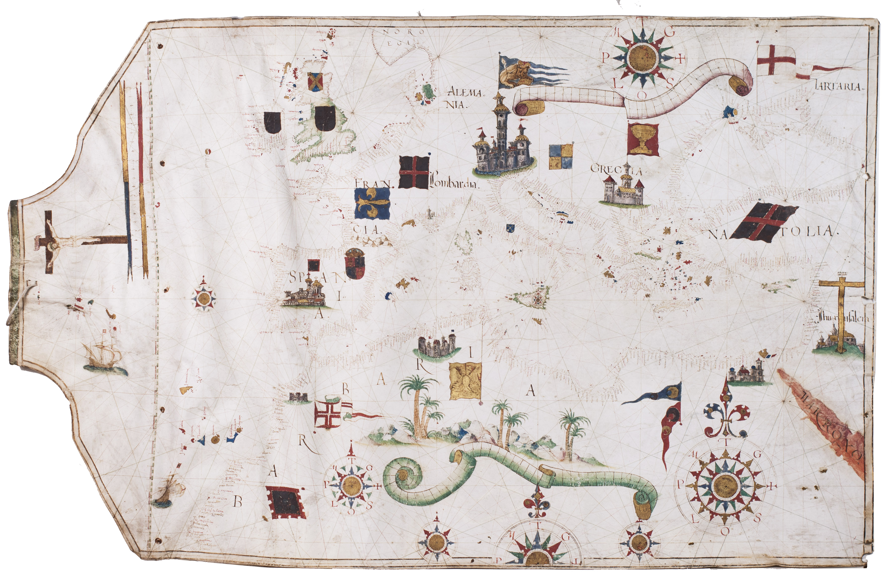
A visually striking portolan chart of the Mediterranean, North Africa, and parts of the Middle East, lavishly decorated and preserved in exceptional condition. Stylistically unmistakably Portuguese, it was likely produced by the prominent cartographer Luis Teixeira, father of João Teixeira Albernaz I, who also became a celebrated mapmaker. The map of Japan in Ortelius Theatrum Orbis Terrarum is also attributed to Luis Teixeira, a fitting contribution given the strong Portuguese presence in the region, and he is likewise credited with the Magna Orbis, a large wall map of the world.
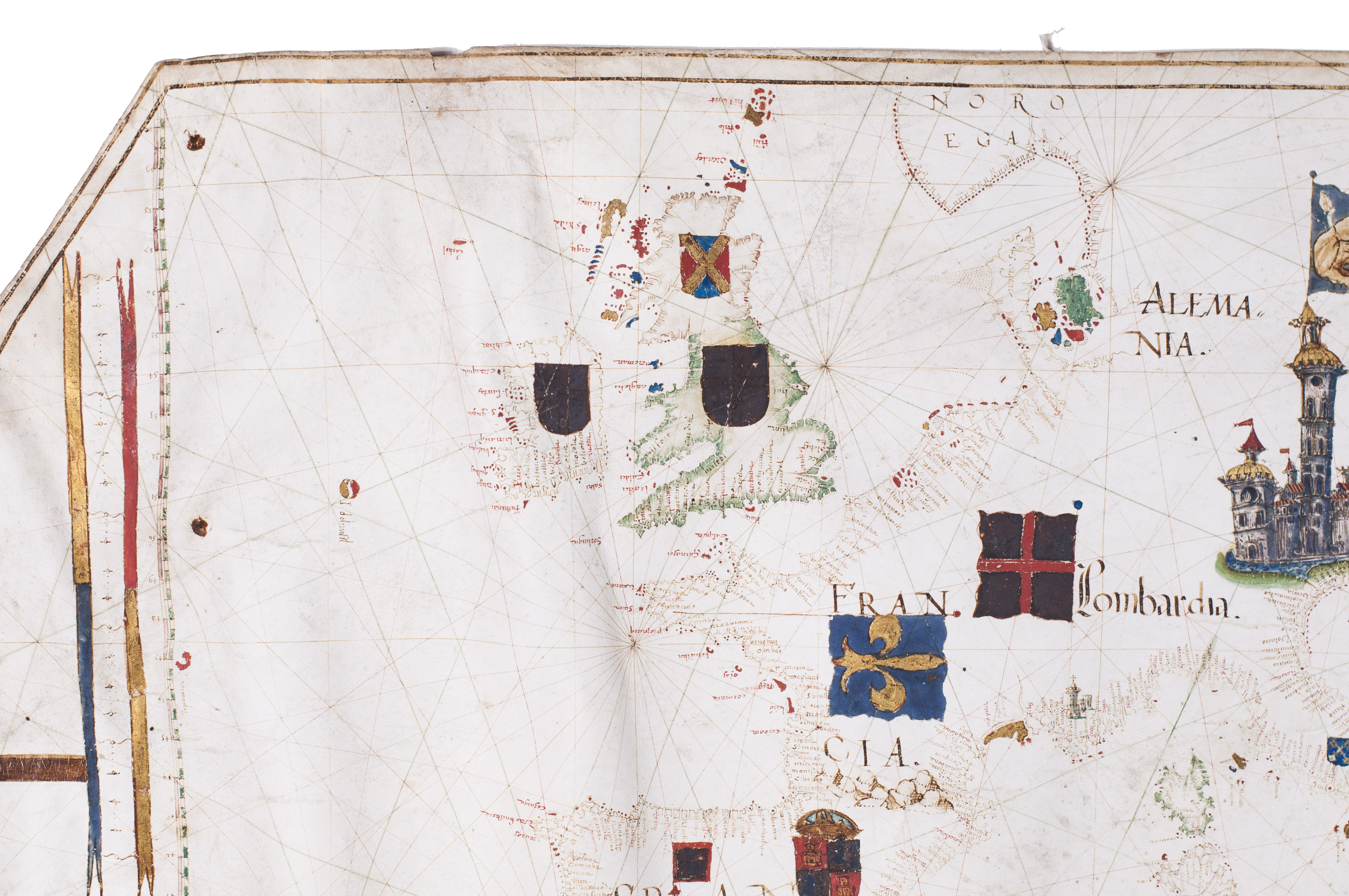
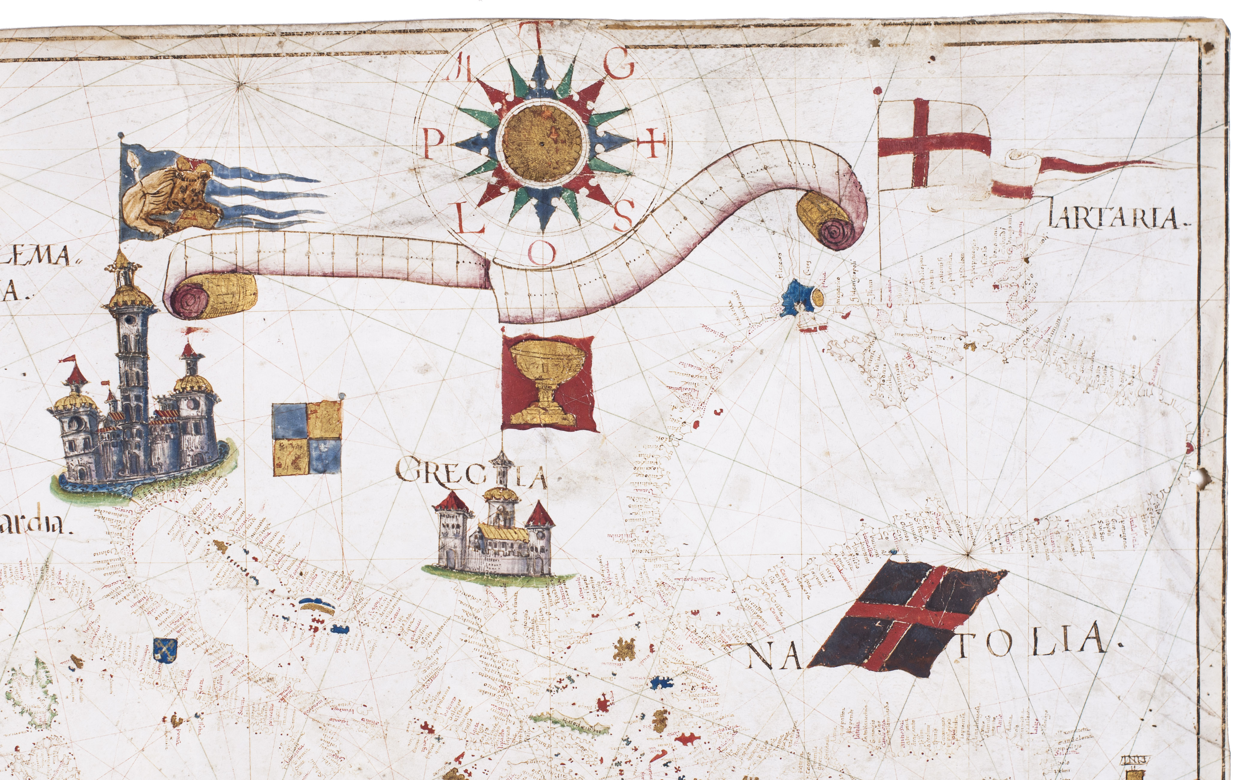
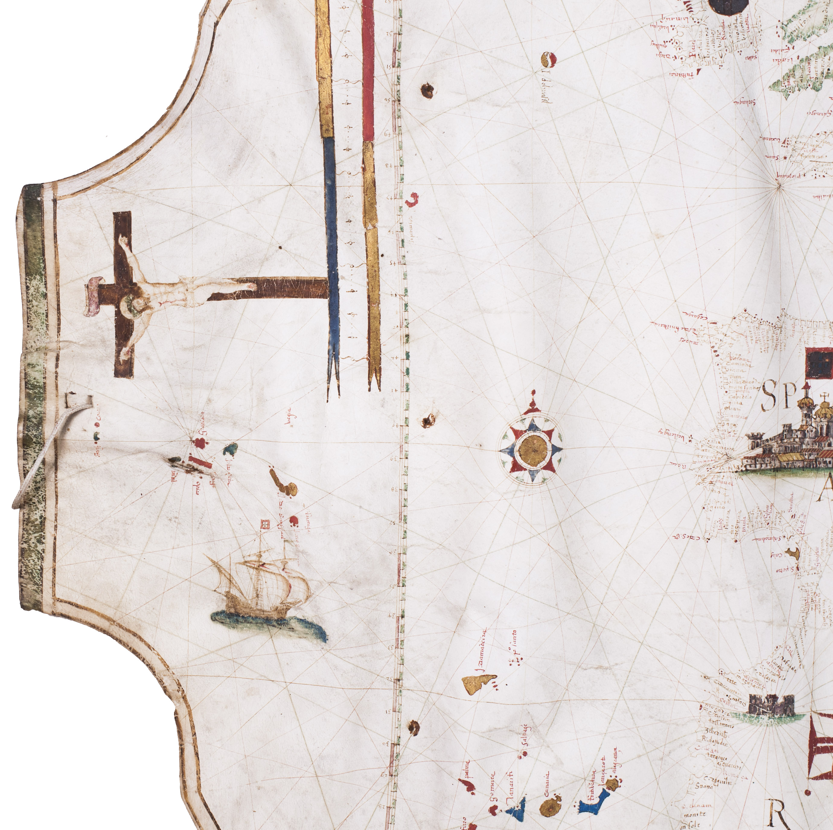
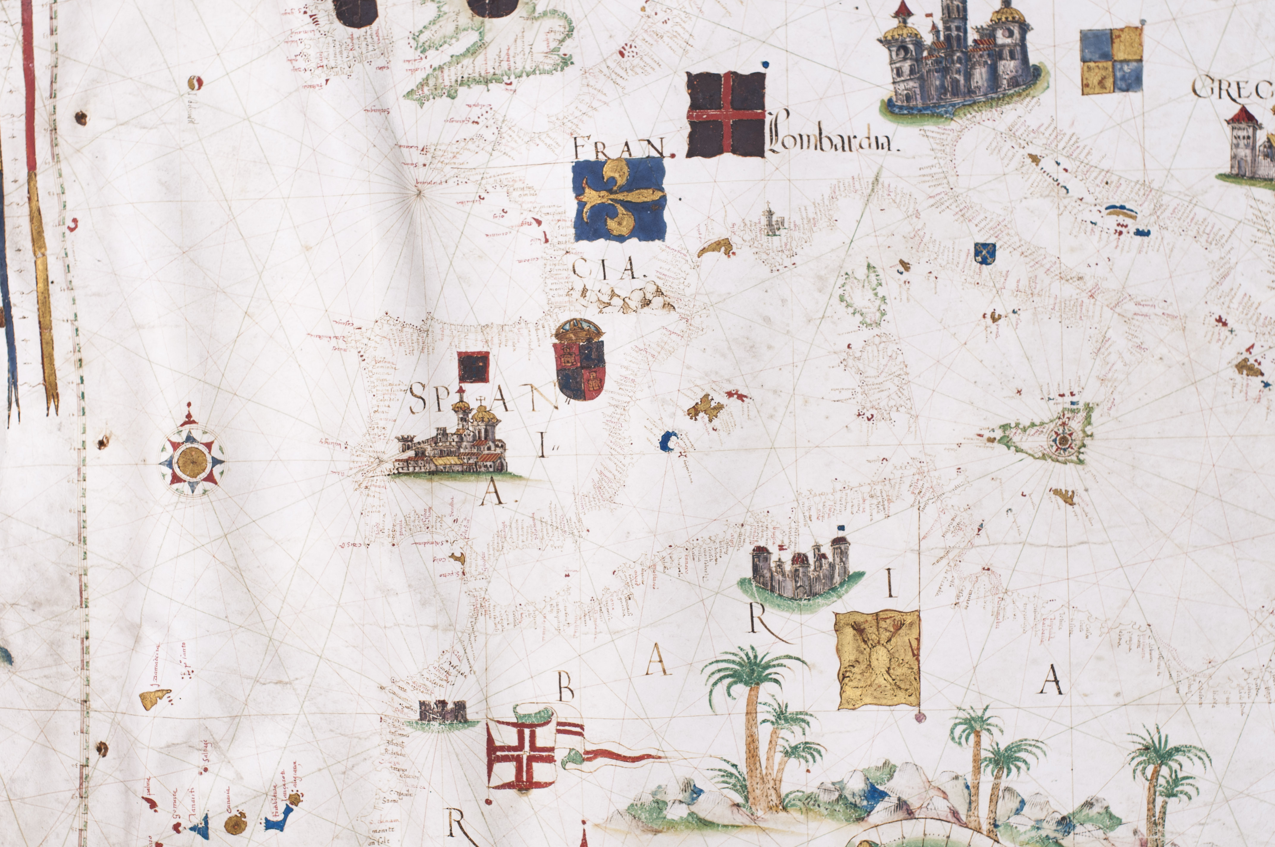
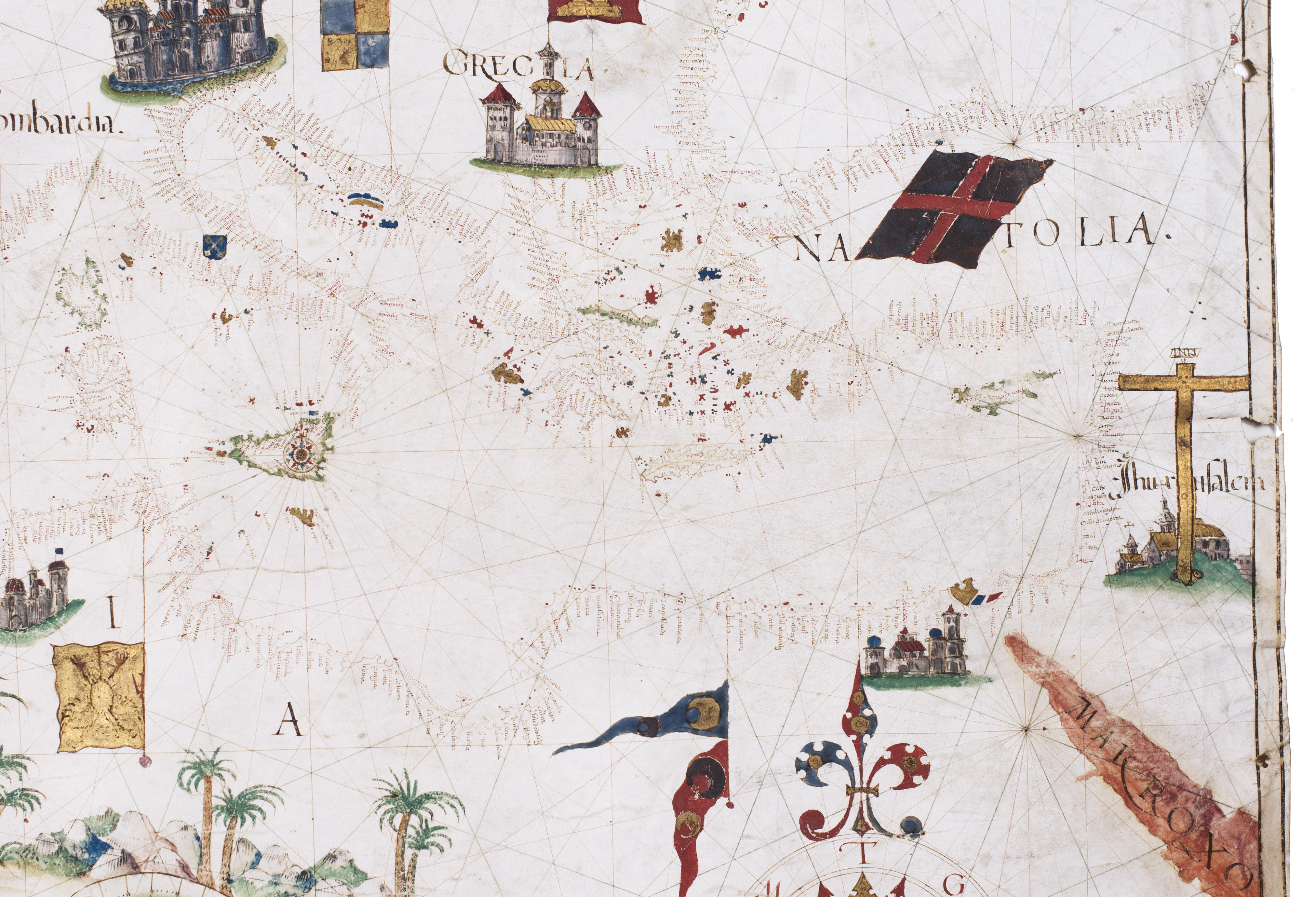
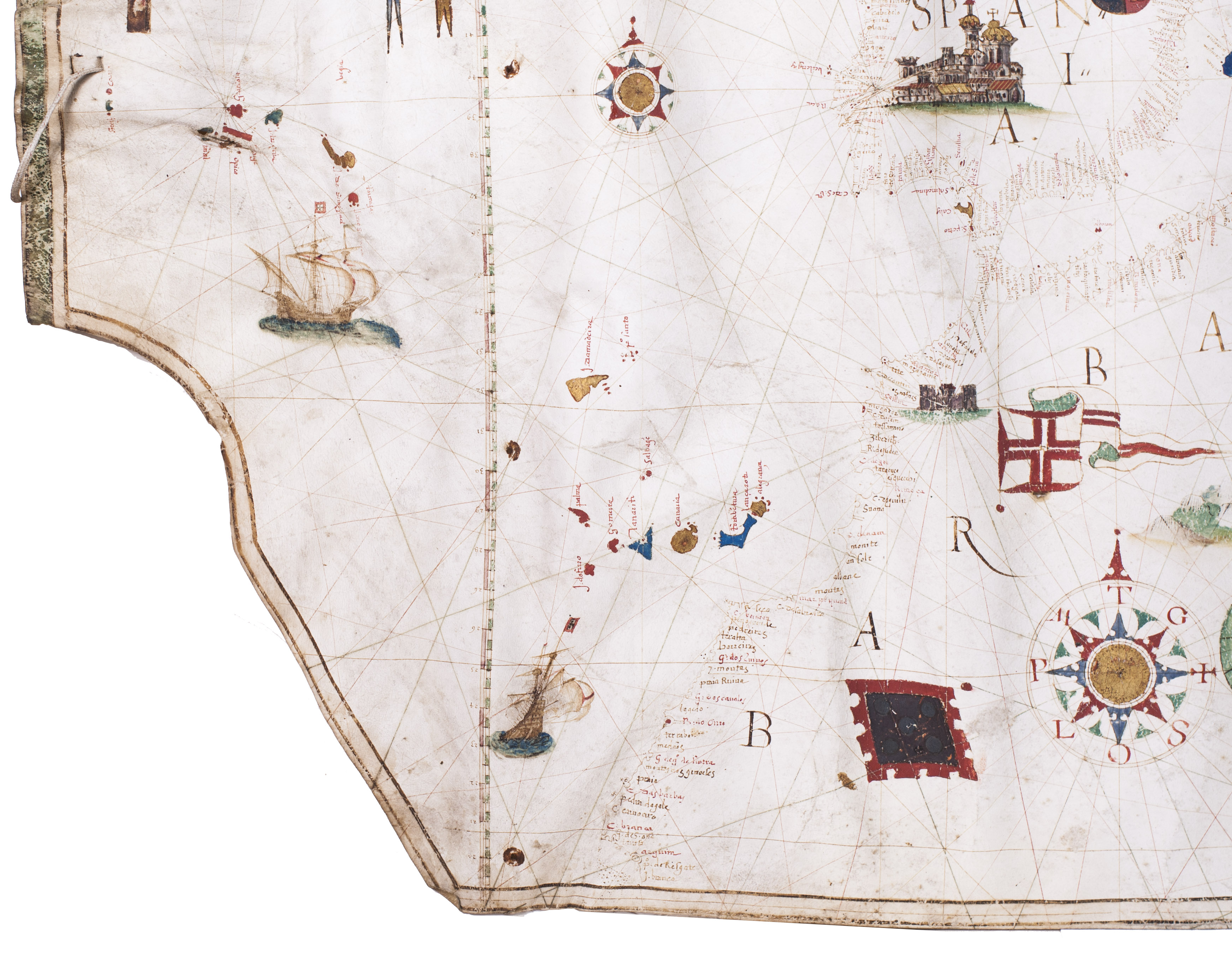
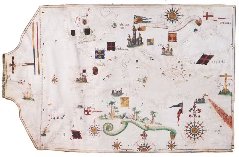
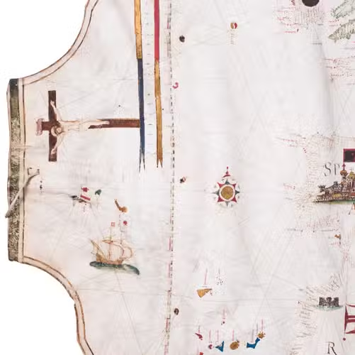
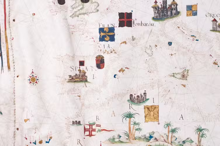
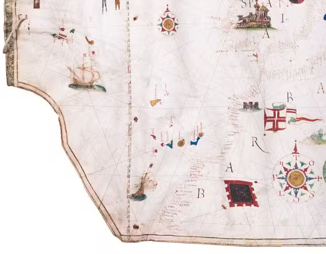
As typical of portolans produced in the Iberian Peninsula during the period of the Iberian Union, the chart is richly embellished. It depicts the desert-like yet greenish landscapes of North Africa, the castles of Spain and Germany, and the Cross over Jerusalem, among other features. Coastlines are drawn in reddish ink; smaller islands are fully painted in gold, blue, red, or green, while major islands are outlined in green. No rivers are indicated. Toponyms, names of cities and towns, are rendered in red and black ink, numbering over 800 coastal place names.
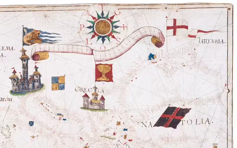
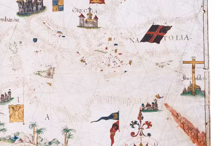
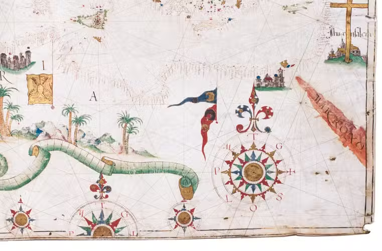
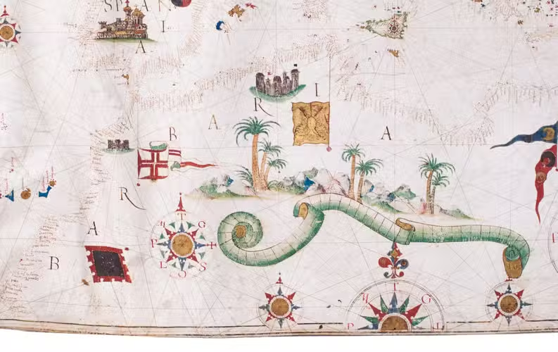
Seven town vignettes are included, notably Lisbon, topped with the Portuguese flag; Jerusalem, marked with the Cross of Golgotha; and Venice, displaying the Lion of Saint Mark. The decorative programme is further enriched with thirteen heraldic arms and flags, including those of Ireland, Scotland, and England, the fleur-de-lis of France, the coat of arms of Spain, the probable flag of Genoese Gazaria over Crimea (denoting the Sanjak of Caffa), and the banner of the Portuguese Order of Christ over Ceuta. Particularly noteworthy is the imperial double-headed eagle over Tunis; if this refers to actual Habsburg occupation rather than a retrospective tribute, it would suggest a date prior to 1574, when the city was retaken by Ottoman forces (it had been under Christian control since 1534).
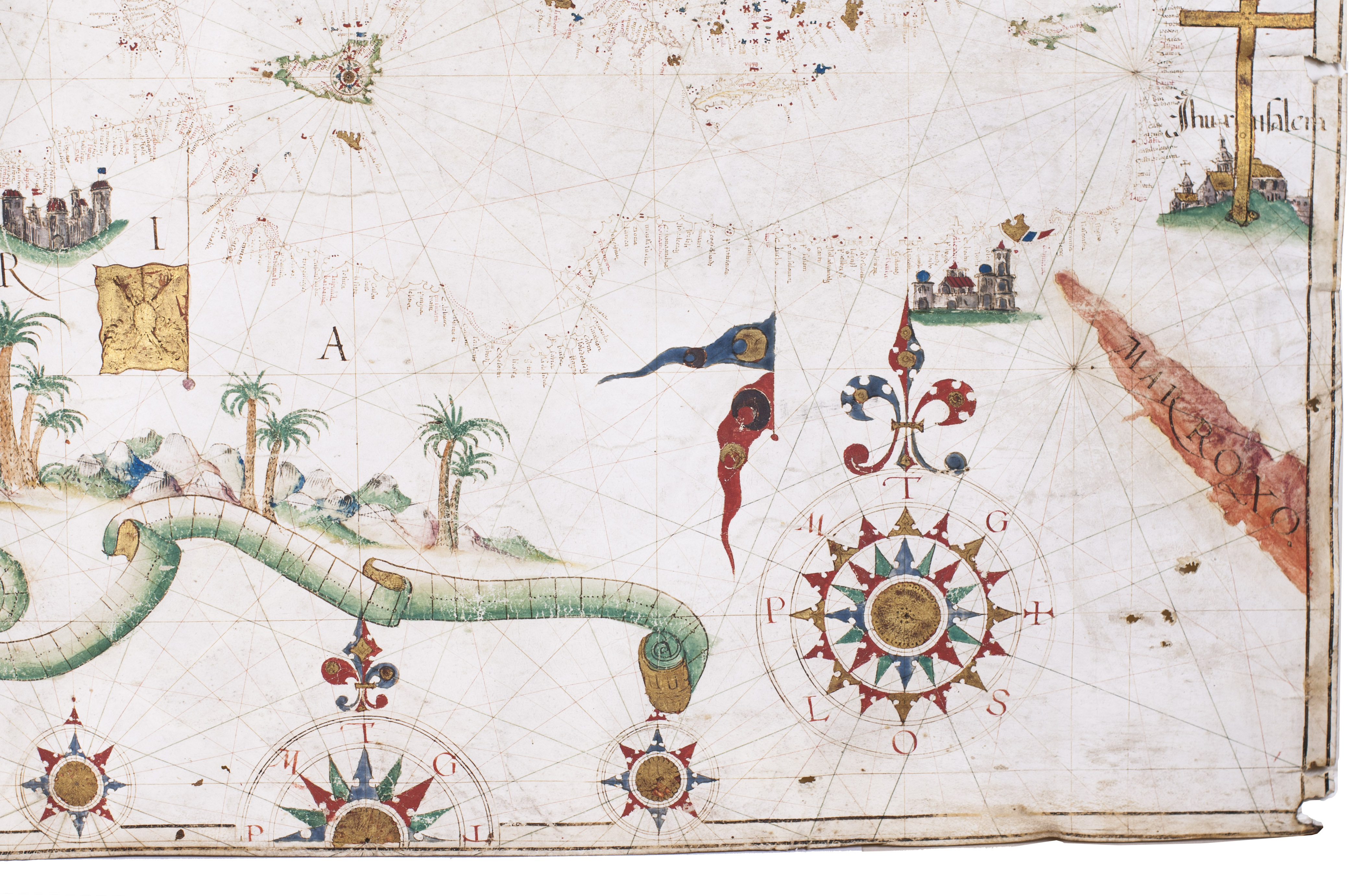
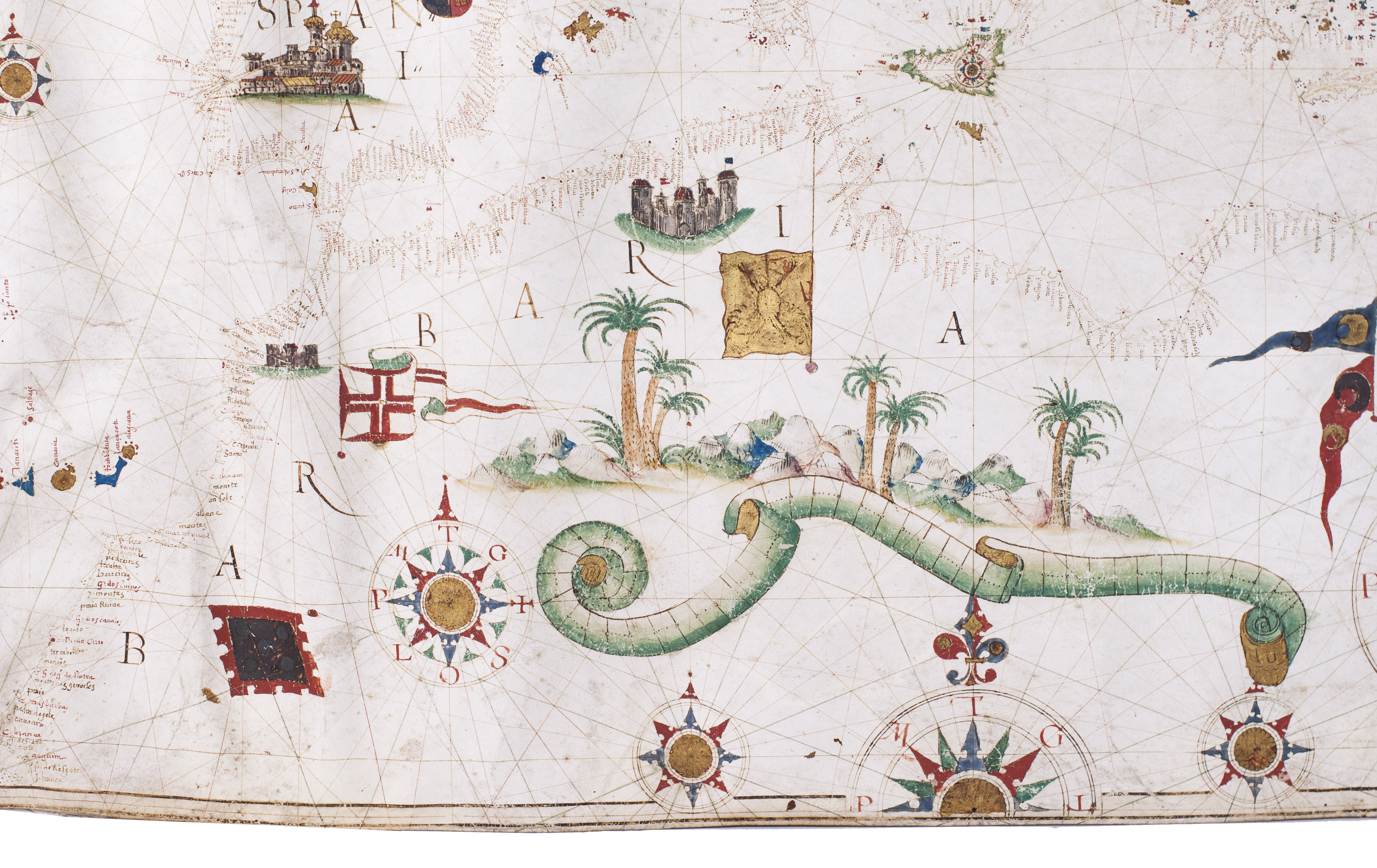
Additional decorations include a Christus Patiens, two Portuguese carracks sailing the Atlantic, and a cluster of palm trees with rocks in the Sahara. Eight wind roses are depicted, two of which prominently display a fleur-de-lis at the north point. A latitude scale runs along the extreme left border, marked from the 20th to the 60th parallel, while three scale bars, two framed in decorative cartouches, provide further reference.
Overall, this is a highly accomplished portolan chart, executed in the Iberian style, which is characterised by greater visual richness than the typically more restrained Italian school. Its elaborate embellishment and careful execution suggest that it was intended for presentation or collection rather than active navigational use.
Portolan charts have existed since the 13th century, with the earliest known examples dating to the second half of the 14th century. Originally, they served as tools for coastal navigation in the Mediterranean and Atlantic, providing a European-centred understanding of the known world. Charts intended for practical navigation typically left inland areas blank, whereas luxury examples such as this one feature elaborate decoration and symbolic embellishments.
Geographic scope: The chart extends north to the Shetland Islands and the Norwegian coast (excluding the Baltic Sea), east to the eastern shores of the Black Sea, south to the Red Sea, and westward to the Azores, including Faja Grande and Corvo. The Atlantic coastline reaches as far south as the Mauritanian coast, between present-day Guerguerat and Ras Nouadhibou.
Comparison: This example shares notable stylistic and compositional features with the HM1549 portolan chart at the Huntington Library, signed by Luis Teixeira. The distribution of town vignettes, flags, the crucifix, and the palm motif are highly comparable, with subtle stylistic differences. The toponymic script also shows significant similarities. Geographically, the present chart spans from the 19th to the 61st parallel and is centred on Sicily, whereas HM1549 extends from the 19th to the 64th parallel and is centred on Sardinia.
It is also worth noting that while HM1549 shows the Ottoman flag flying over Tunis, the present chart features the imperial eagle. Assuming, as previously noted, that this denotes actual territorial control rather than a symbolic anachronism, the map may be dated prior to 1574. This would place it within the formative period of Luis Teixeira and the Portuguese cartographic school, particularly as Teixeira passed his cosmography examination in 1564 under Pedro Nunes and Jorge Reinel and received a royal commission in 1569 to produce nautical charts for the Portuguese navy.
We are grateful to Richard Pflederer and Chet van Duzer for their input in the preparation of this description.
Fine condition, the chart presents some cockling to the vellum and traces of a previous mounting at the edges and near the latitude scale, some minor fading to colours which for the most part are strong and vibrant; overall excellent.
Related Subjects: