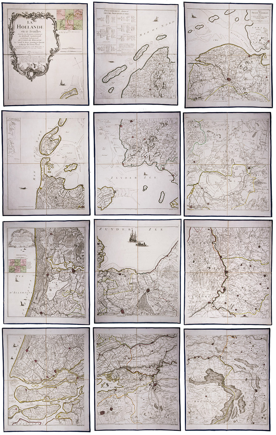
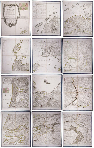
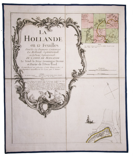
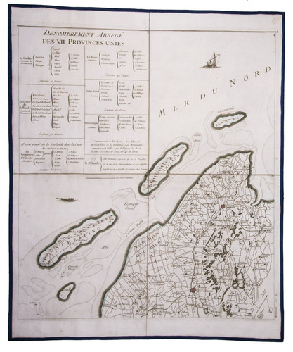
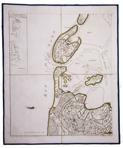
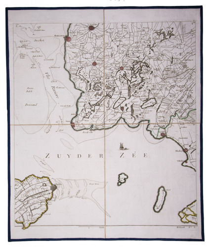
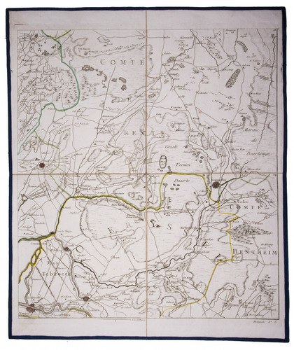
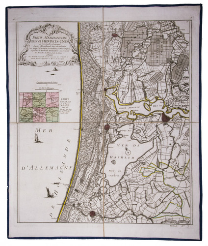
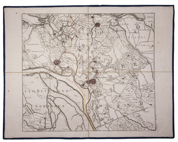
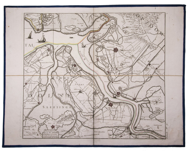
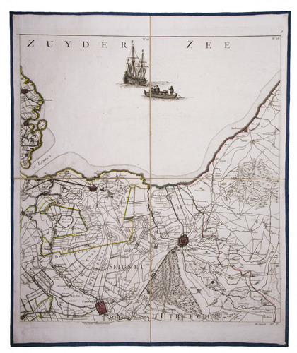
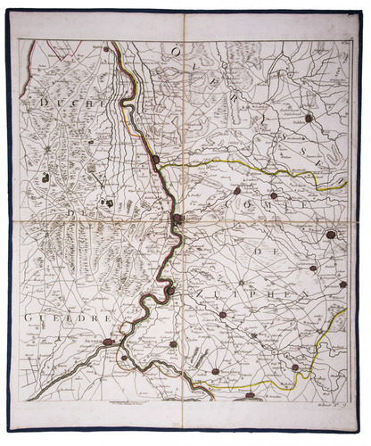
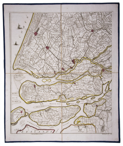
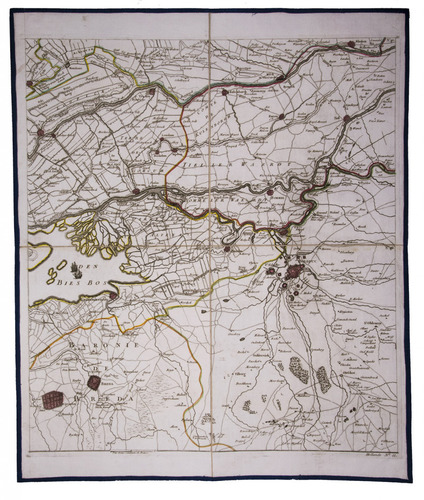
[MAP - NETHERLANDS]. [LE ROUGE, George-Louis].
La Hollande en 12 feuilles dont les six premieres contiennent la Hollande ...
Paris, Jean A. Dezauche, successor of Delisle & Buache, 1790. Together ca. 230 x 155 cm. Engraved map, hand-coloured in outline. Printed on 12 sheets, each divided into 4 segments, numbered 1-48. The 12 sheets are mounted on contemporary linen and folded, the edges reinforced with blue ribbon.
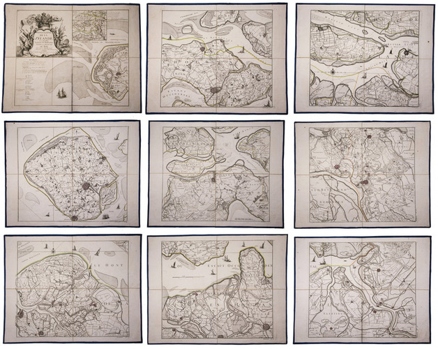
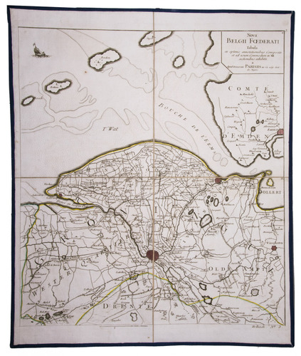
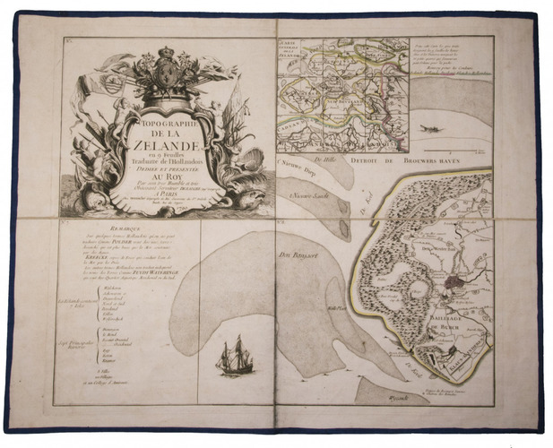
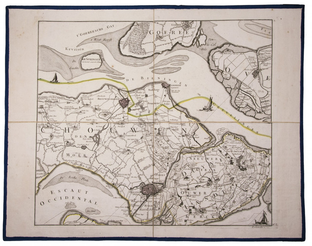
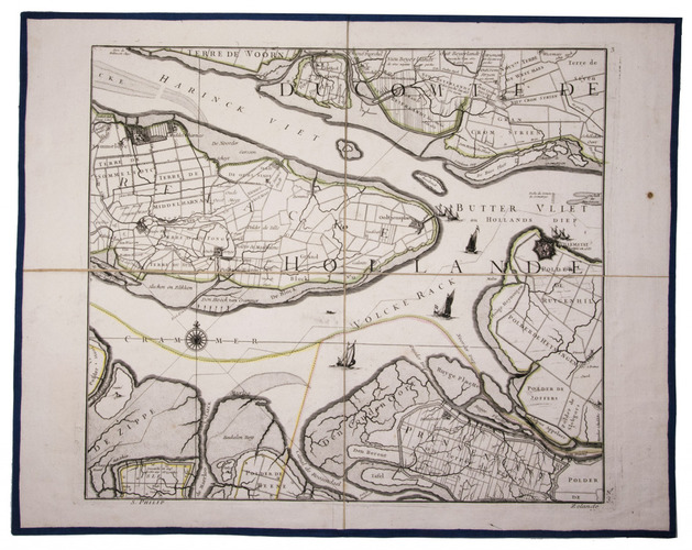
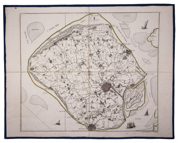
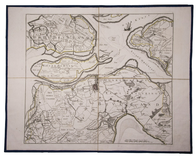
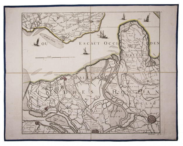
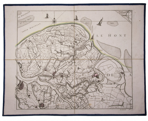
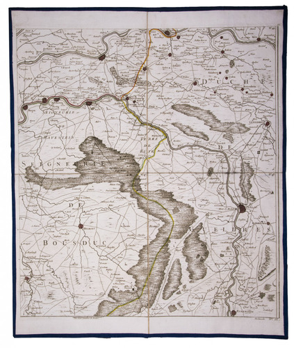
With: (2) LE ROUGE, George Louis. Topographie de la Zelande en 9 feuilles traduitte de l'Hollandois. [Second title:] Partie orientale de la Flandre Hollandoise, ...
Paris, Jean A. Dezauche, 1790. Large engraved wall map, hand-coloured in outline, printed on 9 numbered sheets, each divided into 4 segments, numbered 1-36 (each sheet 48 x 56.5 cm); the 36 segments are mounted on contemporary linen, the edges reinforced with blue ribbon. Each map in contemporary box.
€ 8,950
Two large complementary wall maps of the seven Dutch provinces, covering (1) the provinces Holland, Utrecht, Friesland, Groningen, Overijssel and Gelderland and a part of Brabant, bound to the line Steenbergen - Roermond, and (2) Zeeland. Both are rare, especially the map of Zeeland. They were the first maps of the Netherlands on such a large scale, mostly about 1:105,000, but with some eastern regions squeezed in at about 1:140,000. Fully assembled, the map of "Hollande" would measure about 230 x 155 cm, and the map of Zeeland about 143 x 175 cm.
Originally published in 1748, Le Rouge's 21 plates for the two maps were revised for publication in a second state by Jean Crepy ca. 1770. The map in its present third state was revised and published by Jean A. Dezauche in 1790. On the back of each sheet is an engraved label with the sheet number and the name of the region covered added in manuscript.
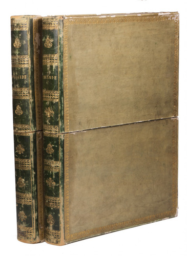
From the library of Marco-Antonio III (1730-1800), Prince Borghese: on each box is the engraved armorial bookplate of the library of this Borghese Prince. Marc-Antonio's son, Camillo Filippo Ludovico (1775-1832), married Napoleon's sister in 1803.
Boxes are slightly scuffed. A remarkable copy with a princely provenance. De Vries, 'Een Franse wandkaart van Nederland uit 1748', in: Caert-Thresoor, 1 (1982), pp. 24-29; cf. BMC Printed maps VIII, cols. 967 & 969 (1748 edition); not in Donkersloot-de Vrij; Oehme, "A French world atlas", in: Imago mundi, 25 (1971), pp. 55-64 (on Le Rouge).
Related Subjects: