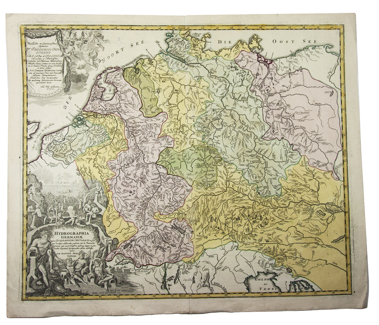
[MAP - GERMANY - LOW COUNTRIES]. HOMANN, Johann Baptist.
Hydrographia Germaniae qua geographiae naturalis ea pars quae de aquis celebrioribus praesertim vero de fluminibus Germaniae agit...
Nuremberg, Johann Baptist Homann, [ca. 1710?]. Engraved map (48.5 x 58 cm) on a whole sheet of paper (53 x 63.5 cm), coloured in an early hand, with the title in an illustrated cartouche with Neptune and other mythological figures at lower left, an illustrated cartouche at upper left with a coat of arms, and a scale (ca. 1:2,400,000) in the margins.
€ 200
Hand-coloured engraved map showing the rivers of western Europe by the German cartographer Johann Baptist Homann (1665-1724). It doesn't depict any cities, only the main rivers, their bifurcations and lakes of the Low Countries, Germany and a part of Austria. Homann was appointed Imperial Geographer by the emperor of the Holy Roman Empire.
Very slightly browned and margins somehwat thumbed, otherwise in very good condition. D. Woodward, Art and cartography (1987), p. 138.
Related Subjects: