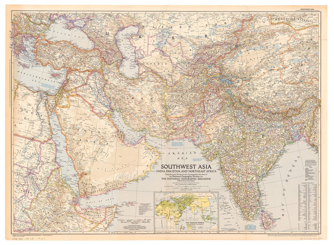
[MAP – ASIA – MIDDLE EAST]. NATIONAL GEOGRAPHIC SOCIETY.
Southwest Asia, India, Pakistan, and Northeast Africa.
Washington, DC, National Geographic Society, 1952. Colour printed map, 68.5 x 95 cm. Scale 1:7,5000,000. With an inset map of "the Moslem World; percentage of Moslems in total population".
€ 850
Large map of Asia and the Middle-East in 1952, published for the National Geographic Magazine. The map clearly shows the unresolved nature of several borders due to the waning colonial power of France and Great Britain. Notations mention that the "boundaries between India and Pakistan are not finally fixed", the borders between Saudi Arabia and Jordan are "undefined". almost the complete Arabian Peninsula is without any border markings with only the single mention near Saudi Arabia and Trucial Oman (the future UAE) of "coastal sovereignty undefined". Showing the world before the oil boom in the Middle East, it is noteworthy that the only significant airport in Trucial Oman is that of Sharjah.
With two stamps of the University of Chicago library (including one withdrawal stamp) on the back. A few small repaired tears and some discolouring at the edges; in very good condition.
Related Subjects: