[MADRAS GOVERNMENT]. C.C. JOHNSTON & H.C. MONTGOMERY.
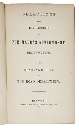
Selections from the records of the Madras government. Published by authority. No. VI. General report of the road department.
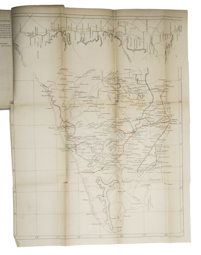
Madras [Chennai], Printed at the Fort St. George Press, 1854. 2 parts in 1 volume. 4to. With a large folding lithographed and hand-coloured map of South India (58 x 44 cm) and 7 folding tables. Later cloth with the original front cover preserved. [2], 48 pp.
€ 1,750
The 6th publication in a series published by the British colonial governmental in Madras in 1854. It discusses the current state of the roads of South India, in 2 parts. The first part by C.C. Johnston, superintendent of the roads office at Camp Madras, describes the progress of the construction of 14 "trunk roads" throughout South India, as depicted in the map at the end of the work. The second part reports on the number and types of vehicles on these roads, by chief secretary H.C. Montgomery.
By the mid-19th century Madras had become the central administrative centre for the British in South India. With the advent of railways in India in the 19th century, the thriving urban centre was connected to other important cities such as Bombay and Calcutta, promoting increased communication and trade with the hinterland. Good roads were crucial for this development. The map included, by E. Clinton, provides a detailed overview of the roads of South India at that moment and is highlighted in red or orange to indicate where the constructions discussed were taking place. Railways were not yet being constructed in that part of India yet. The map depicts South India from Nellore on the east coast and Kumta on the west coast to the southernmost tip of India.
With contemporary annotations in ink at the foot of p.18 providing technical details of road construction in English, which could only have been written by someone officially involved in the matter. Bind stamp at the foot of the first 4 pp. of the Topgraphical and Statistical Depot of the UK War Department. Small tear in the foot of the front free endleaf. Minor tears at the folds of the folding map. Hinges cracked and repaired. Shelf label on the front cover. Annotations in ink on the title-label on the front cover. Label partly removed from the back wrapper. Wrappers slightly soiled. Otherwise in good condition. WorldCat 884795130 (3 copies).
Related Subjects: