Home
Shopping cart (0 items € 0)
Advanced search

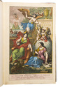
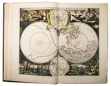
Magnificent eighteenth-century atlas of the world, with 30 beautiful maps.

ANVILLE, Jean Baptiste Bourguignon d'. [Atlas Général].
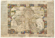
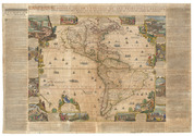
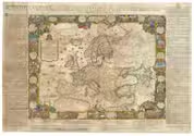
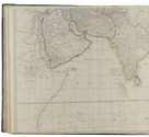
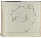
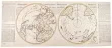
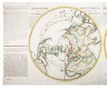
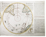
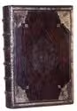
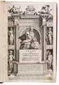
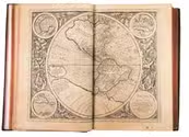
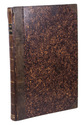
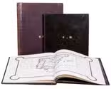
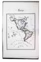
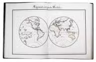
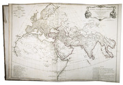
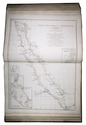
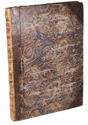
[Paris, "chez l'auteur aux Galleries du Louvre", 1743-1771]. Large folio (54.5 x 40.5 cm). Atlas comprising 30 maps of the world, most of them engraved by Guillaume de la Haye, (in 2 full-page, 23 double-page, and 21 folding; about 10 maps measuring ca. 100 x 100 cm when put together). Numbers 1-8 and 9-33 have a coloured in outline. Contemporary three-quarter calf, boards covered with marbled paper. Without printed title (not always present), but with manuscript index on the recto of the first flyleaf. Full description
€ 27,500
Order Inquire Terms of sale

A previously unobtainable set of magnificent wall maps by Nicolas de Fer

FER, Nicolas de. Set of four wall maps: America (1698), Africa (1698), Asia (1696), Europe (1695).
Paris, chez lauteur / van Loon, 1695-1698. Approximately 114.3 x 165.1 cm each. Copperplate engravings in original outline colour, tissue-backed for stability, laid down to modern cartographic linen. All with title banner dated 1698 with the Royal Privilege, and text panels dated 1703. Each map printed on four joined sheets with title surmounted and engraved text panels at sides and bottom. Full description
€ 850,000
Order Inquire Terms of sale

World atlas including one 6-sheet and eleven 4-sheet wall maps

KITCHIN, Thomas and others. Kitchin's general atlas, describing the whole universe.
London, Robert Laurie, James Whittle, 1808. Imperial folio (53 x 39.5 cm). With 28 engraved maps (numbered in 41 parts) assembled from 67 sheets. Most include elaborate cartouches with pictorial decoration. With the maps coloured in outline. Contemporary half calf. 1 leaf plus maps. Full description
€ 18,000
Order Inquire Terms of sale

Extremely rare atlas with 76 very large hand-coloured maps

WIT, Frederick de. Atlas maior.
Amsterdam, Johannes Covens & Cornelis Mortier, [ca. 1725]. Imperial folio (53 x 35.5 cm). With engraved title-page and 76 double page (or in 8 cases larger folding) engraved maps, the title-page and all maps and their decorations coloured by a contemporary hand. Half tanned sheepskin (ca. 1900), gold-tooled spine. Full description
€ 85,000
Order Inquire Terms of sale

Graphically stunning 3-volume historical manuscript atlas

[ATLAS - HISTORICAL]. Atlas historique. - Souvenirs historiques. - Tableaux et cartes.
[Montpellier?], [date on spine of vol. 1:] 1851. 3 volumes. Folio (vol. 1) and large 4to (vols. 2-3). Neatly written manuscripts on paper with 23 graphically vibrant maps, coloured in outline with subtly shaded washes in grey (for the coasts) and numerous bright colours (for political boundaries), and with calligraphic headings. Contemporary bindings: vol. 1 red half goatskin; vol. 2 black half goatskin; vol. 3 black sheepskin. [1], [26 double]; [1], [22 double]; [1], 30 double, [1] ll. Full description
€ 1,750
Order Inquire Terms of sale
5 books found