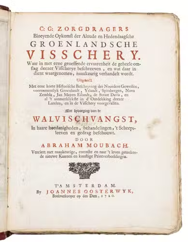
ZORGDRAGER, Cornelis Gijsbertz. and Abraham MOUBACH.
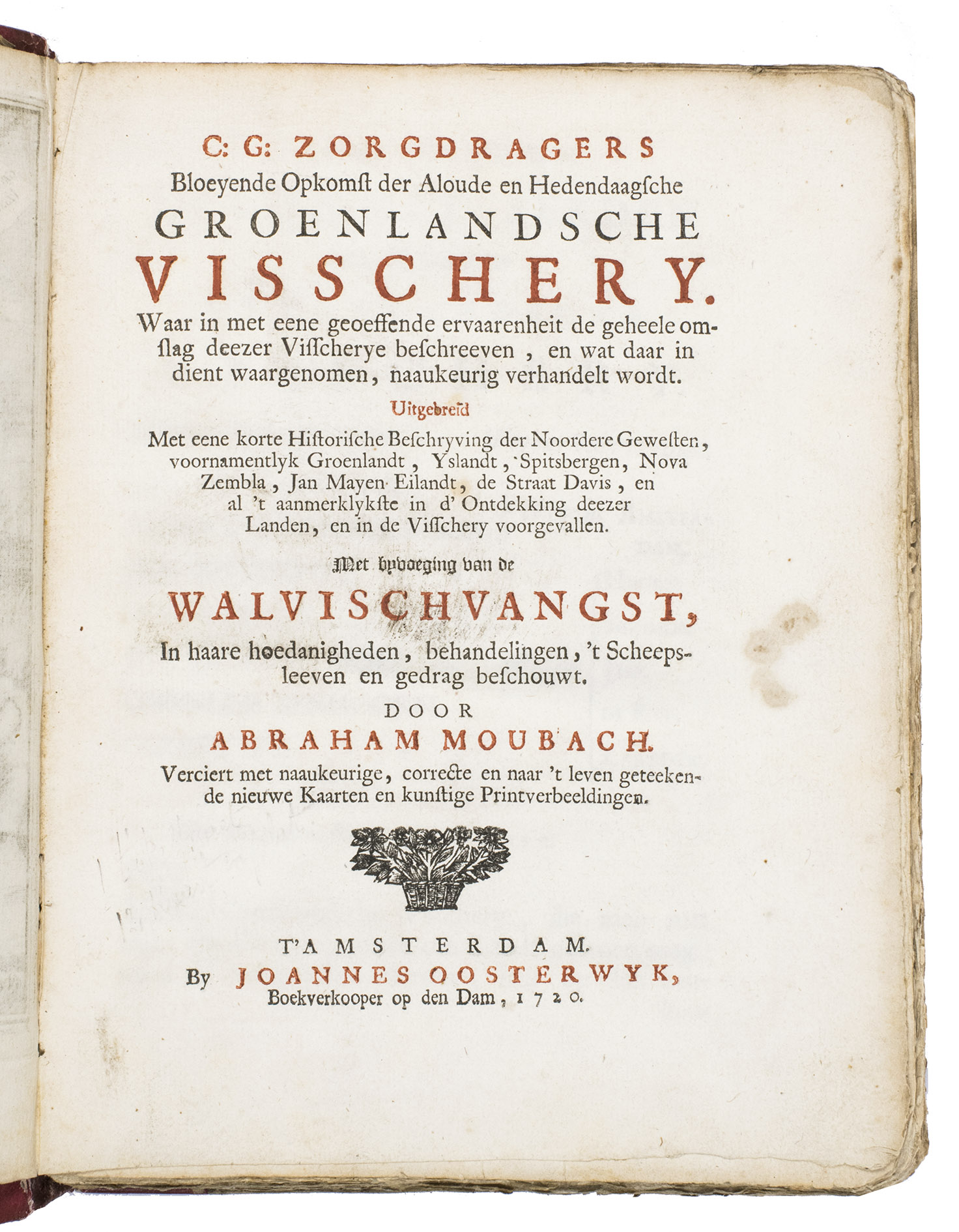
Bloeyende opkomst der aloude en hedendaagsche Groenlandsche visschery. Waar in met eene geoeffende ervaarenheit de geheele omslag deezer visscherye beschreeven, en wat daar in dient waargenomen, naaukeurig verhandelt wordt. Uitgebreid met eene korte historische beschryving der noordere gewesten, voornamentlyk Groenlandt, Yslandt, Spitsbergen, Nova Zembla, Jan Mayen Eilandt, de Straat Davis, en al 't aanmerklykste in d'ontdekking deezer landen, en in de visschery voorgevallen. Met byvoeging van de walvischvangst, in haare hoedanigheden, behandelingen, 't scheepsleeven en gedrag beschouwt, door Abraham Moubach.
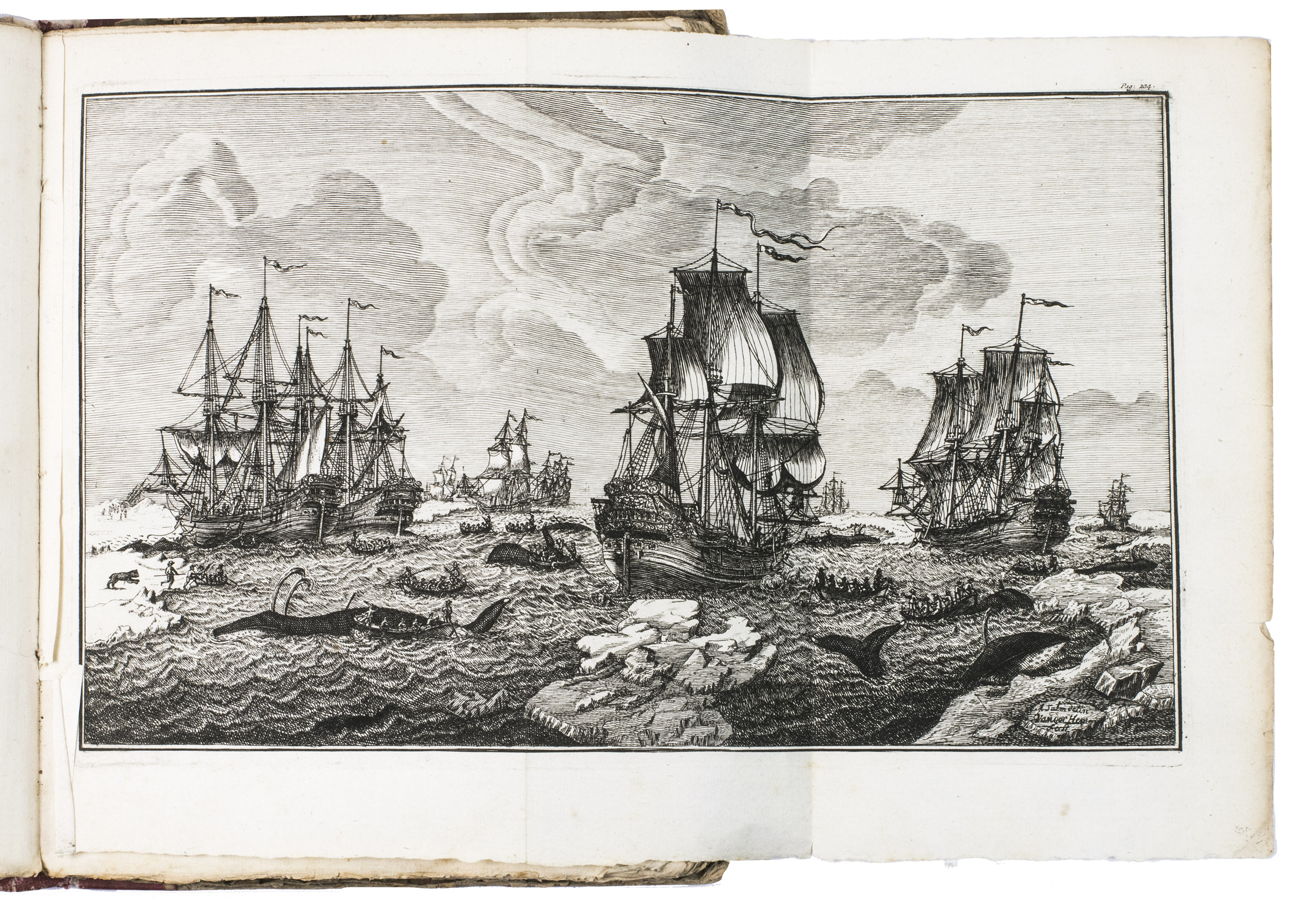
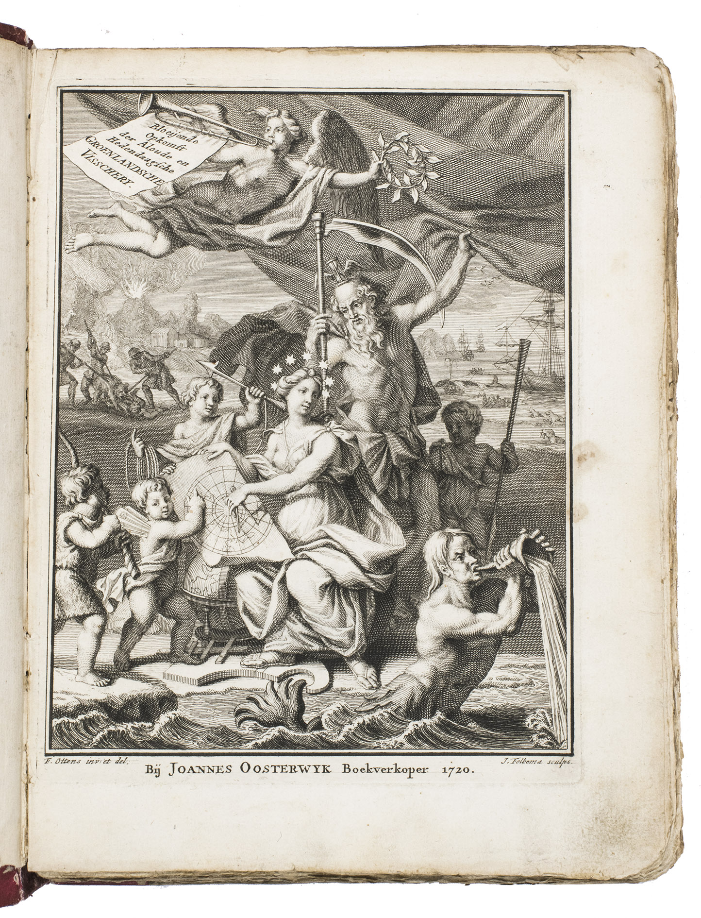
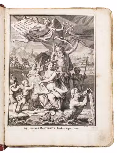
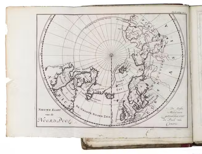
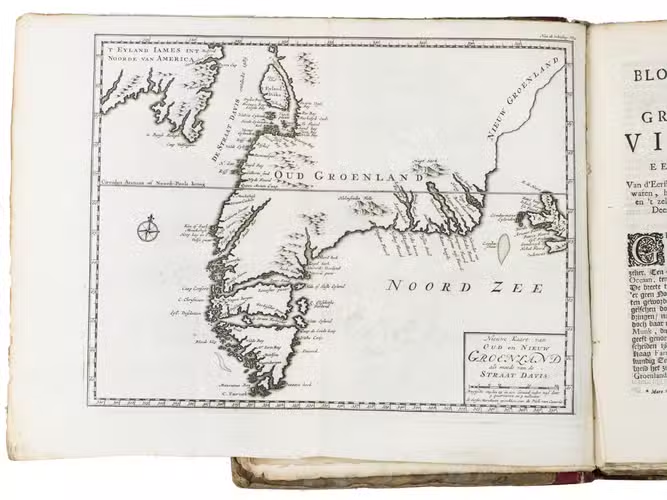
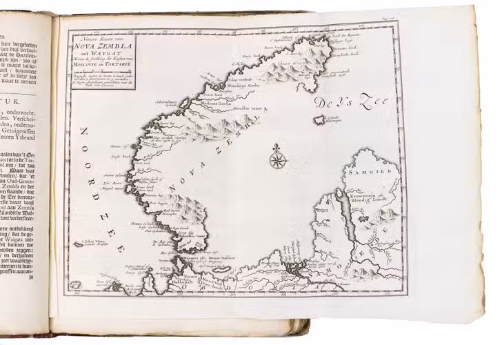
Amsterdam, Joannes Oosterwyk, 1720. 4to. With an engraved allegorical frontispiece by J. Folkema after F. Ottens, 6 folding engraved maps, and 7 engraved plates (including 1 folding showing ships at sea by A. Salm after Van der Hem). Further with the title page printed in red and black, a small woodcut vignette on the title page, some woodcut decorated initials, and some large woodcut floral tailpieces. Contemporary half sheepskin, marbled paper sides. [38], 330, [14] pp.
€ 6,950
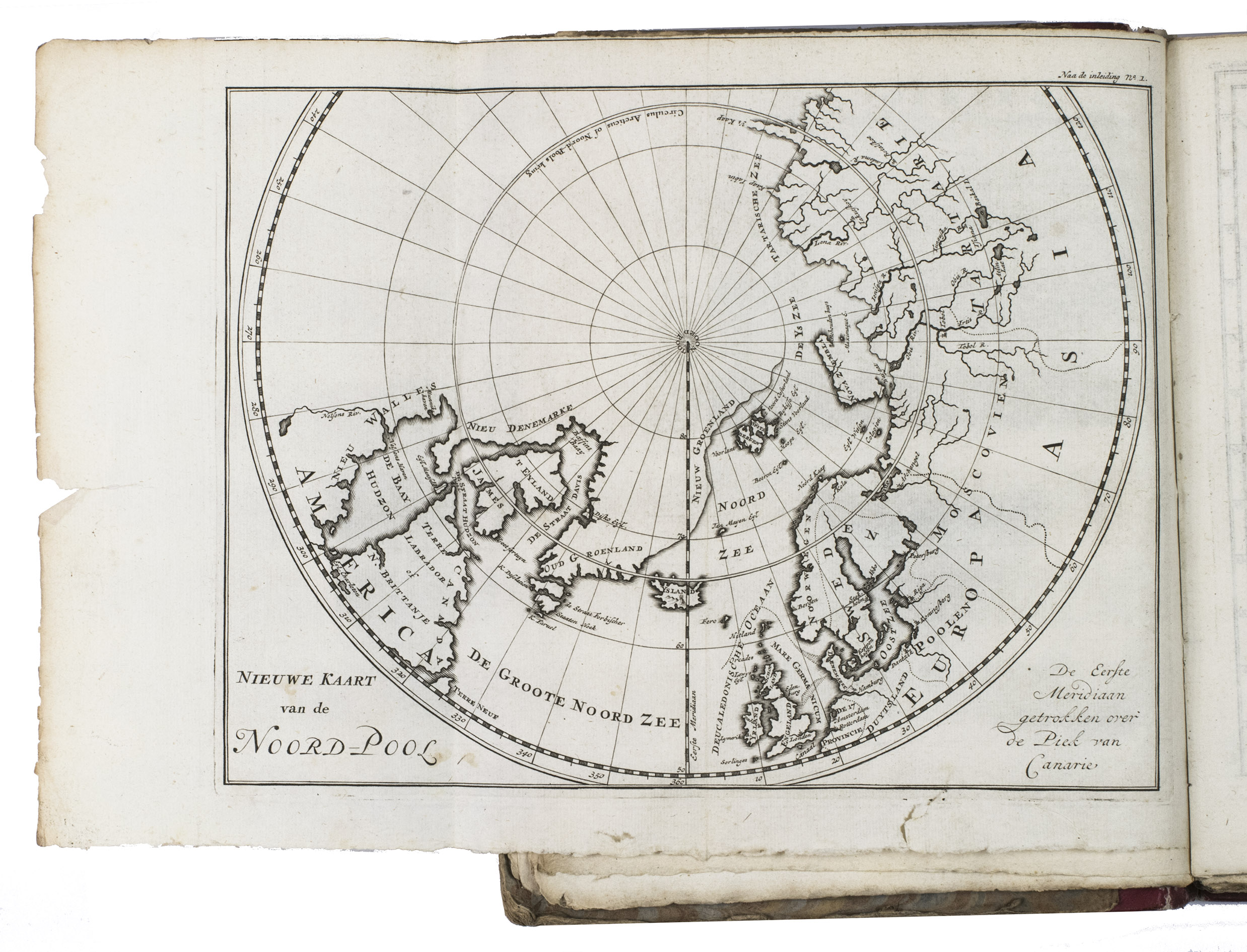
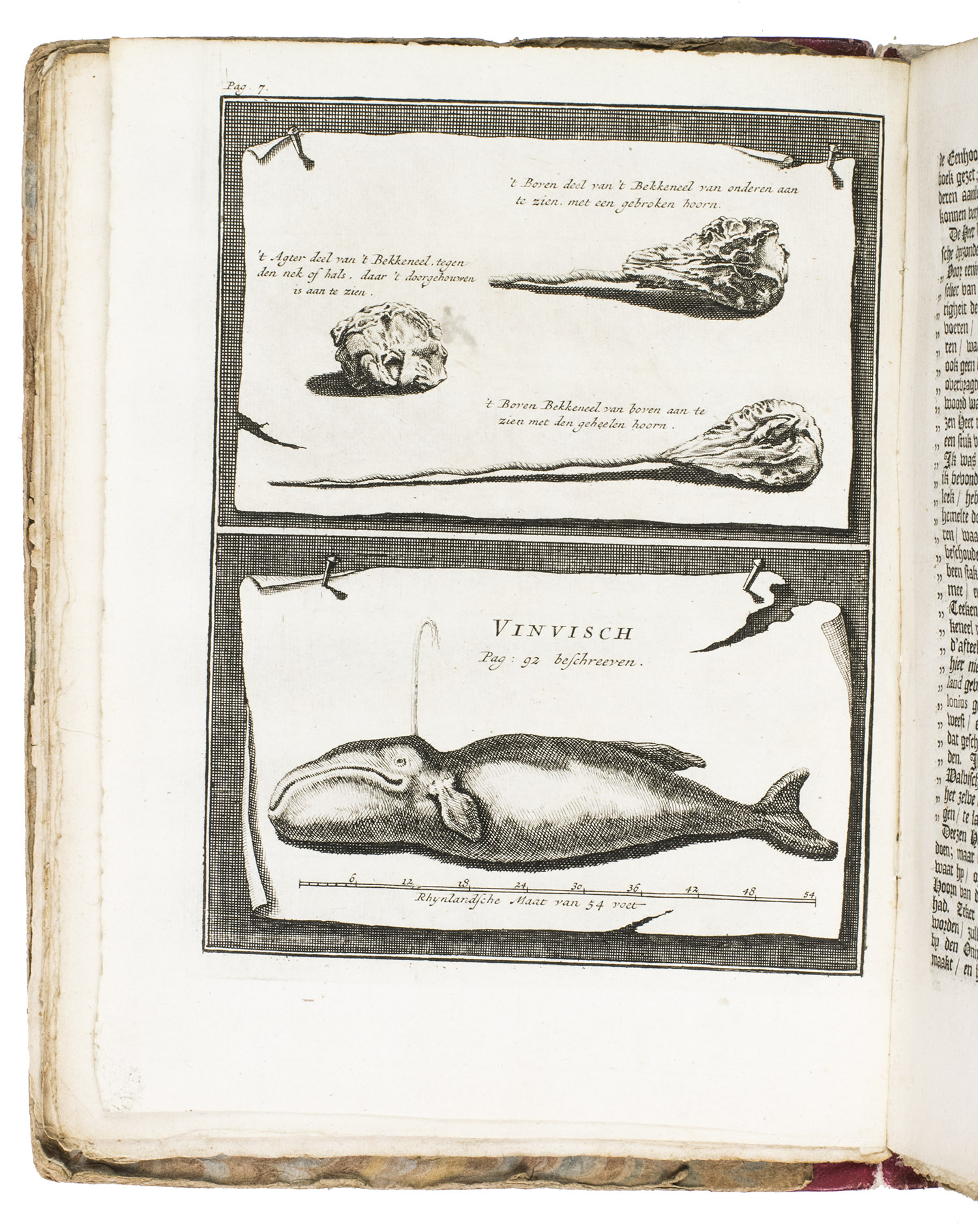
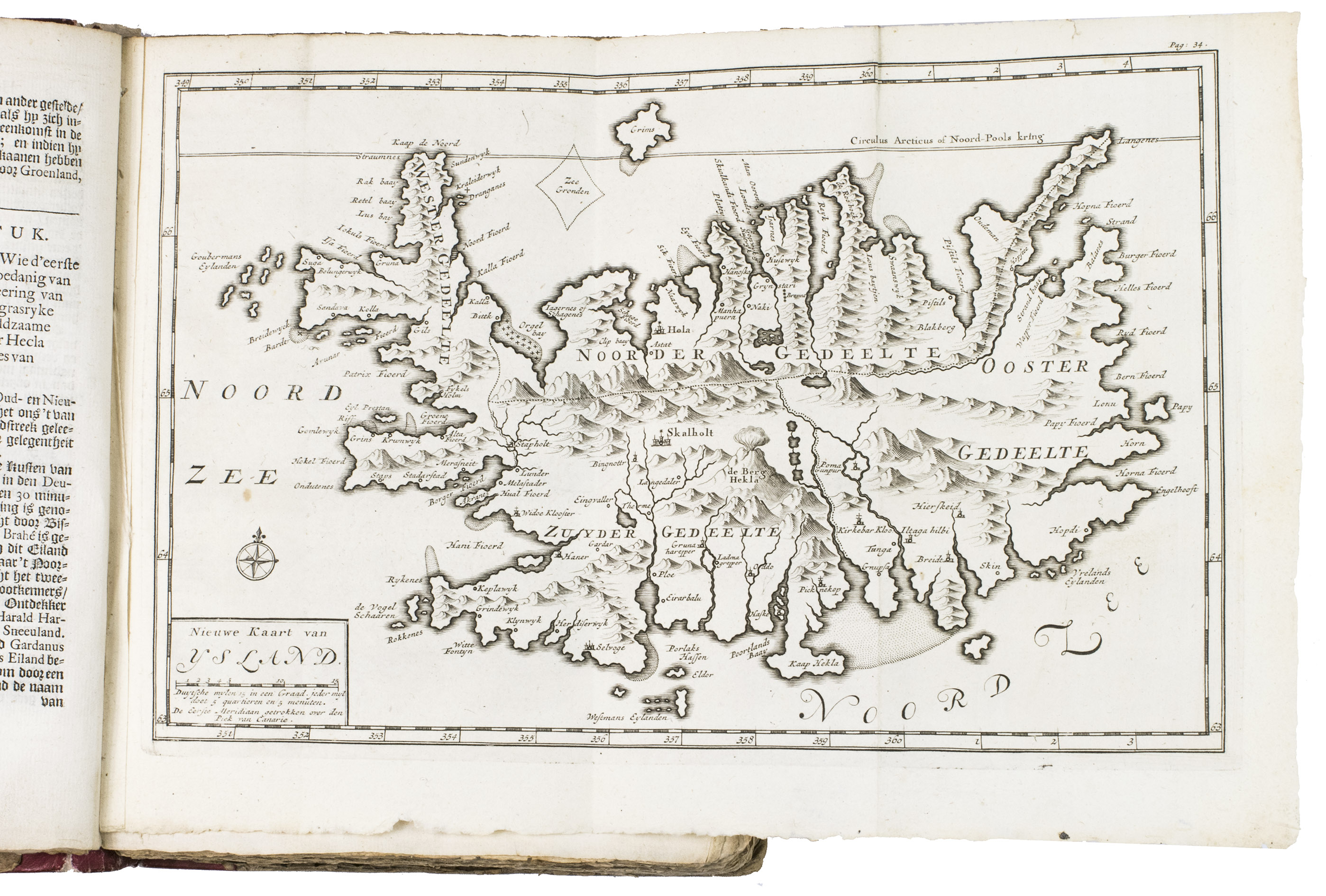
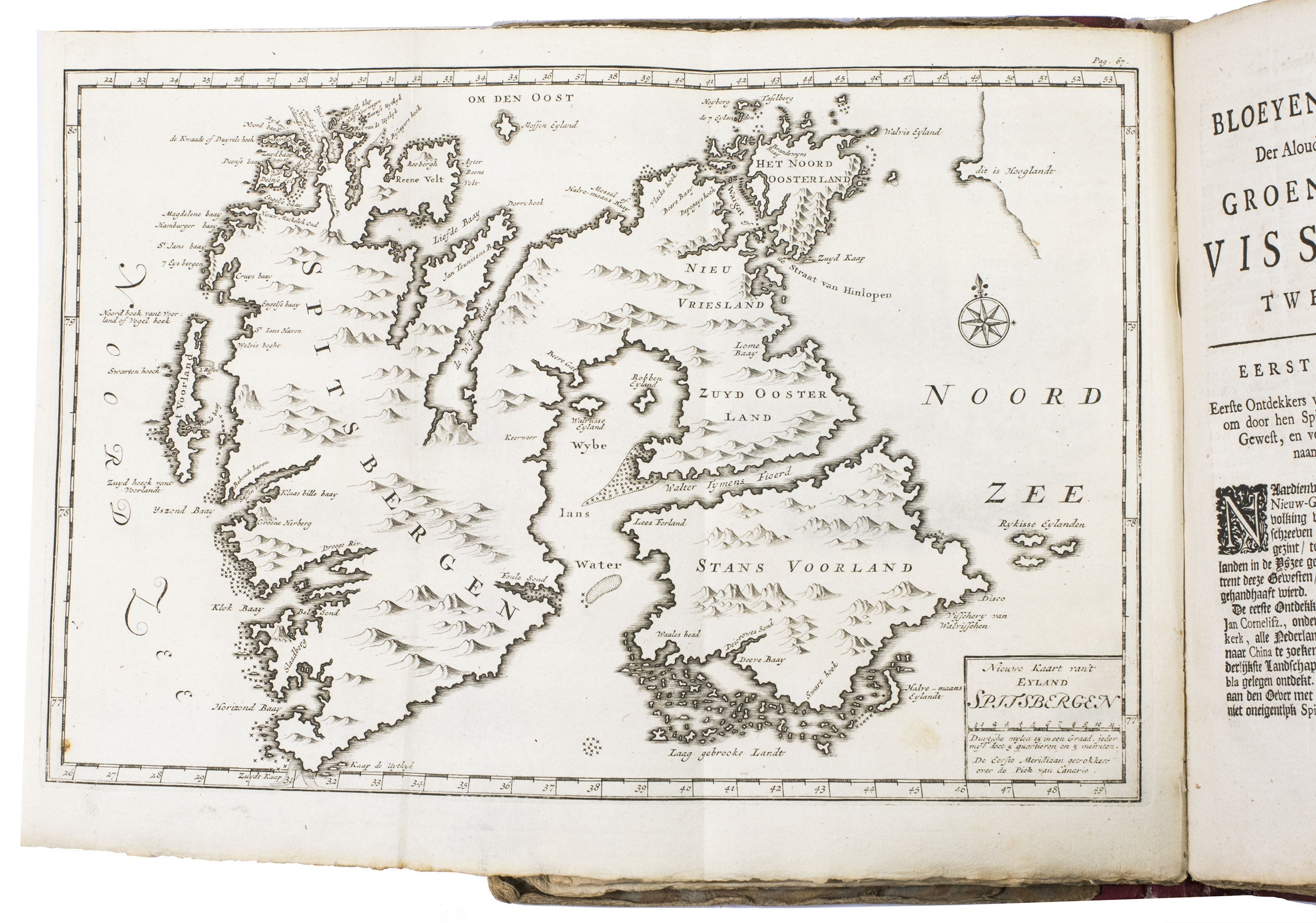
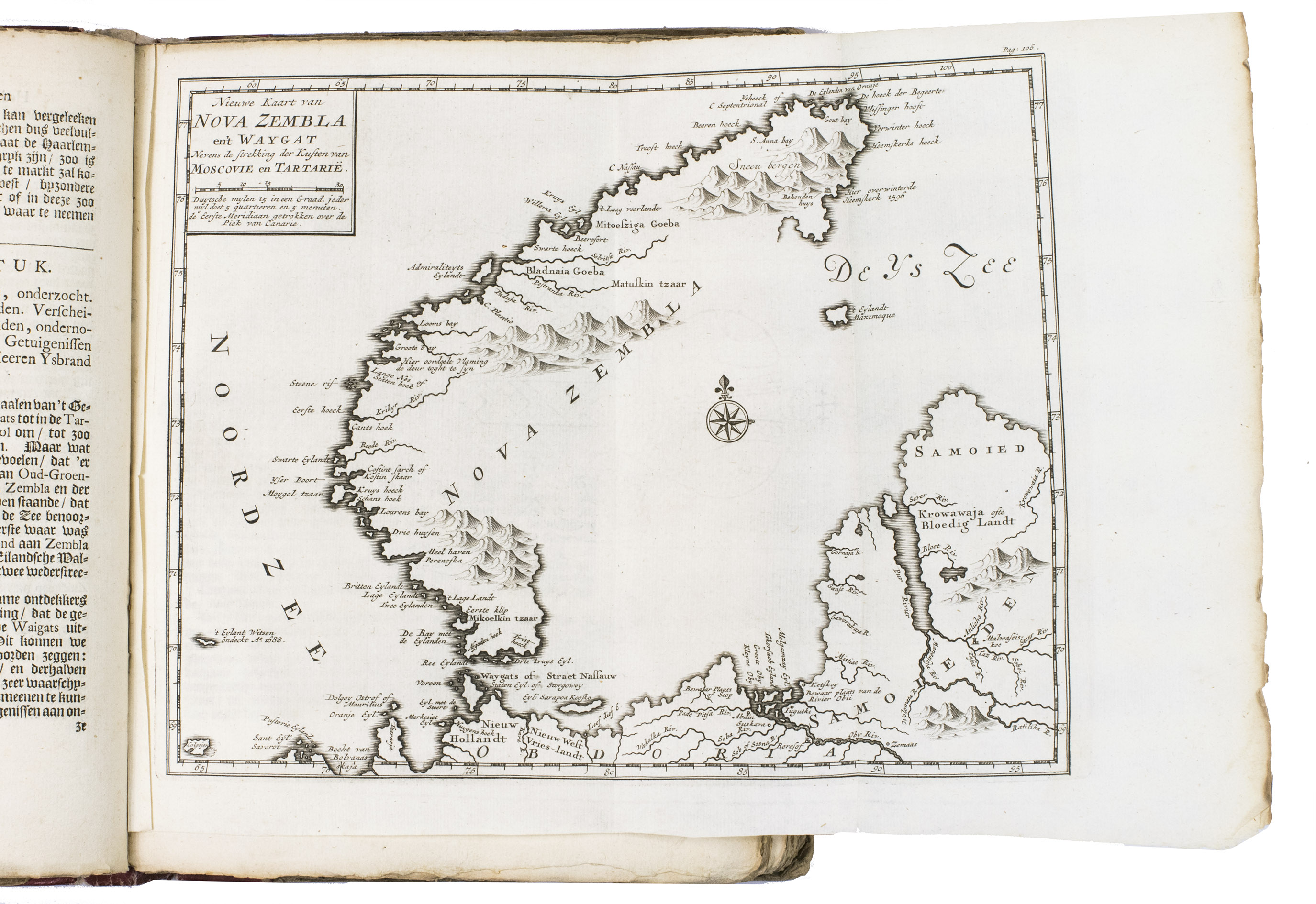
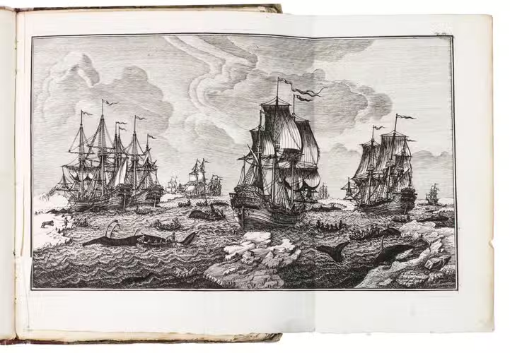
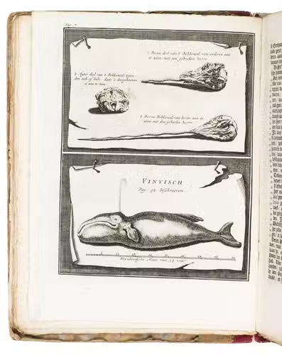
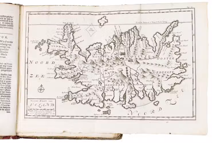
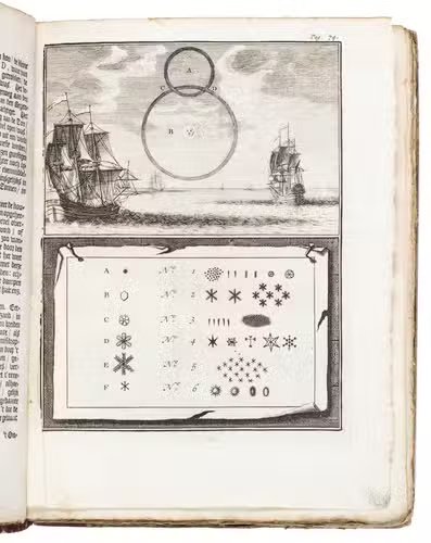
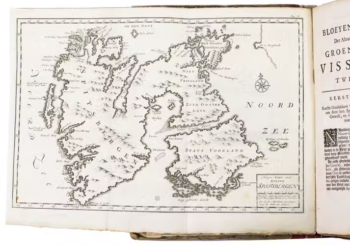
First edition of the most important early account of whaling in the northern seas. The author, a ship's commander in the Dutch Greenland fleet, describes the history of the Dutch whaling in the northern seas. Dutch whaling, dominating in Europe for most of the 17th and 18th century, was not confined to the Greenland waters only, but ranged widely across the northern fisheries, from the Davis Straits to the Siberian Sea. The work also includes short histories of the northern explorations in Greenland, Iceland, Spitsbergen, Nova Zembla, Jan Mayen Island, and Strait Davis, all accompanied by the newest maps and preceded by a map of the North Pole. The plates show the different whales and ships of the whalers. To Zorgdrager's work detailed lists are added of captains, ships, equipment and provisions for the ships, caught whales, the cost of equipment and crew, etc. Also the practical and technical aspects of whaling are fully described. The book was used as one of the sources for Melville's Moby Dick.
With a printed ex libris bookplate of N. Du Jardin-Van der Avoort mounted on the front pastedown. The spine and boards are somewhat scuffed, the corners of the boards are slightly bumped, a tear in one leaf, some occasional foxing and (water) staining, the edges are slightly frayed. Otherwise a good copy of a rare and interesting work. Cat. NHSM p. 899; Chavanne 2110; Leclerc 678; Sabin 106374; STCN 201968800 (14 copies, incl. 1 incomplete); Tiele, Bibl. 1241 note; V. Gestel - Van het Schip, Maps in books on Russia and Poland 299.
Related Subjects: