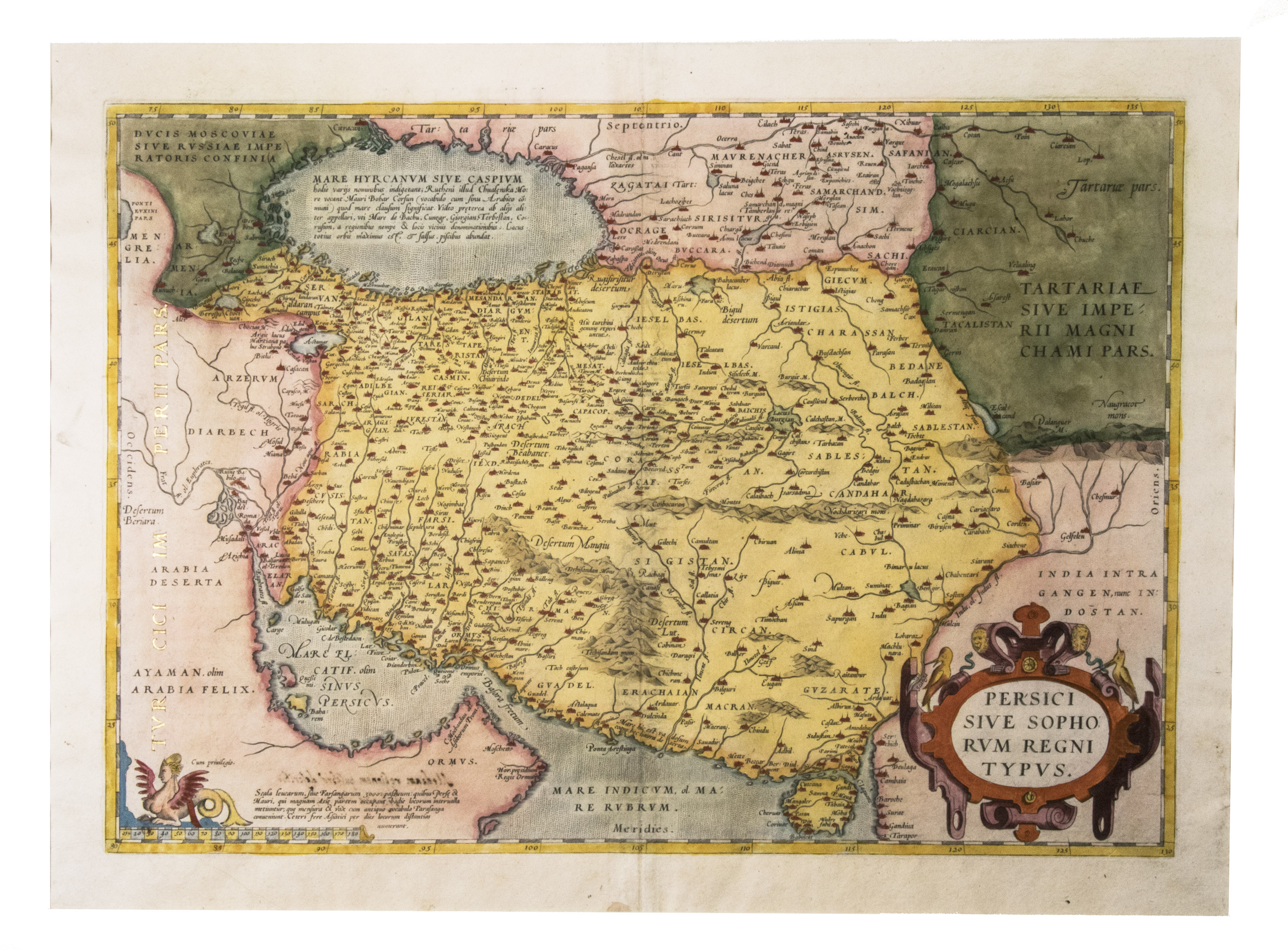
ORTELIUS, Abraham.
Persici sive Sophorum Regni Typus.
Antwerp, Christophe Plantin, 1574. Engraved map (35 x 50 cm), in contemporary hand-colouring and highlighted in gold. Scale 1:9,000,000.
€ 2,500
16th-century Dutch map of Persia based on the Gastaldi map, with additional new cartographic information. Alai, General maps E.70; Al-Qasimi 30; Van den Broecke 167 (first state).
Related Subjects:


 <BR>and Masawaih al-Mardini (Mesue)")


