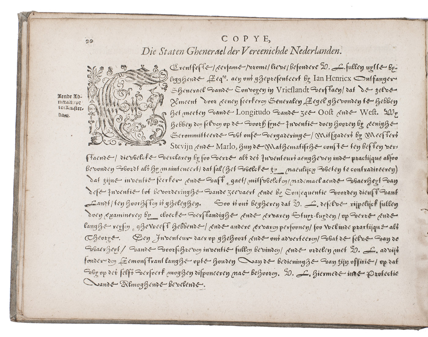
LEY, Jan Hendrick Jarichs van der.
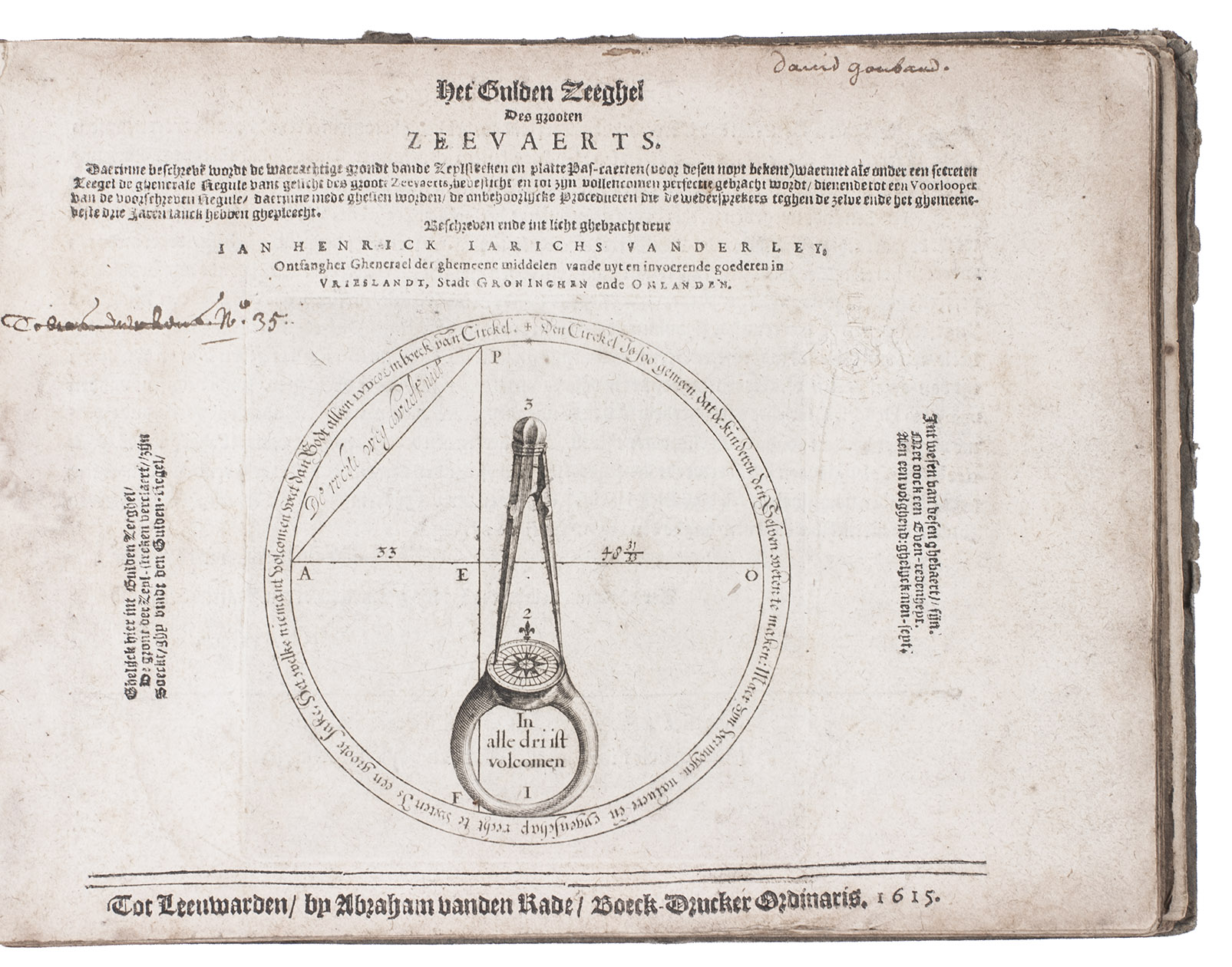
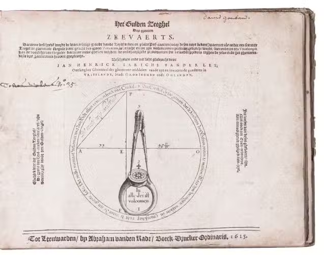
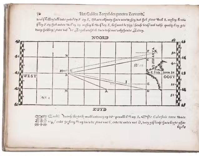
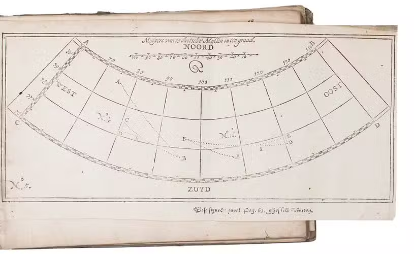
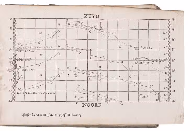
Het gulden zeeghel des grooten zeevaerts, daerinne beschreven wordt de waerachtige grondt vande zeylstreken en platte pas-caerten ...
Leeuwarden, Abraham vanden Rade, 1615. Oblong 4to (16.5 x 22 cm). With an emblematic engraved device/navigational diagram on the title-page and 27 (of 28) woodcut figures: 18 printed on integral leaves and the others on 3 folding plates. 18th-century(?) half vellum, blue-green paper sides, with manuscript author and title on spine. 114, [2] pp.
€ 55,000
Rare first edition of a seminal work on practical navigation, describing for the first time the method developed by Jan Hendrick Jarichs van der Ley (1565-1639) to estimate longitude at sea.
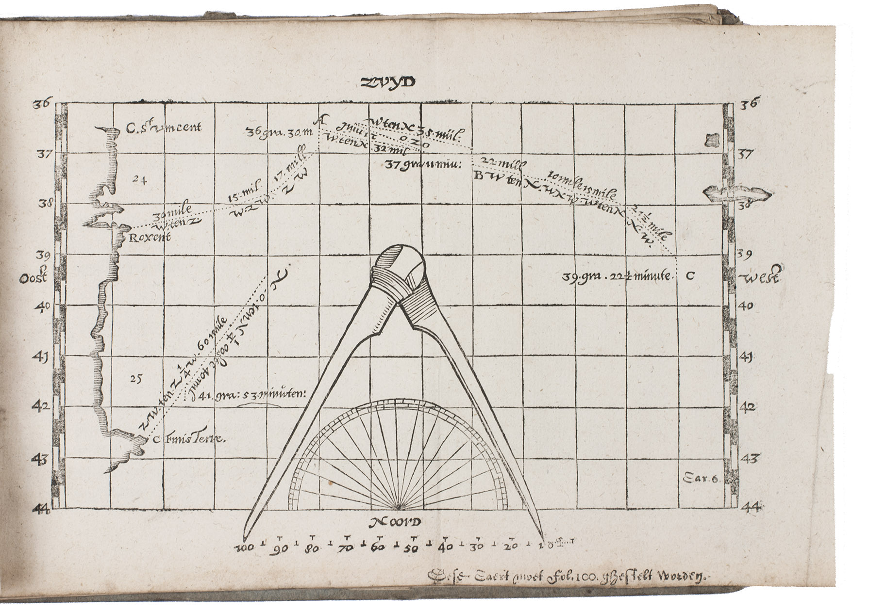
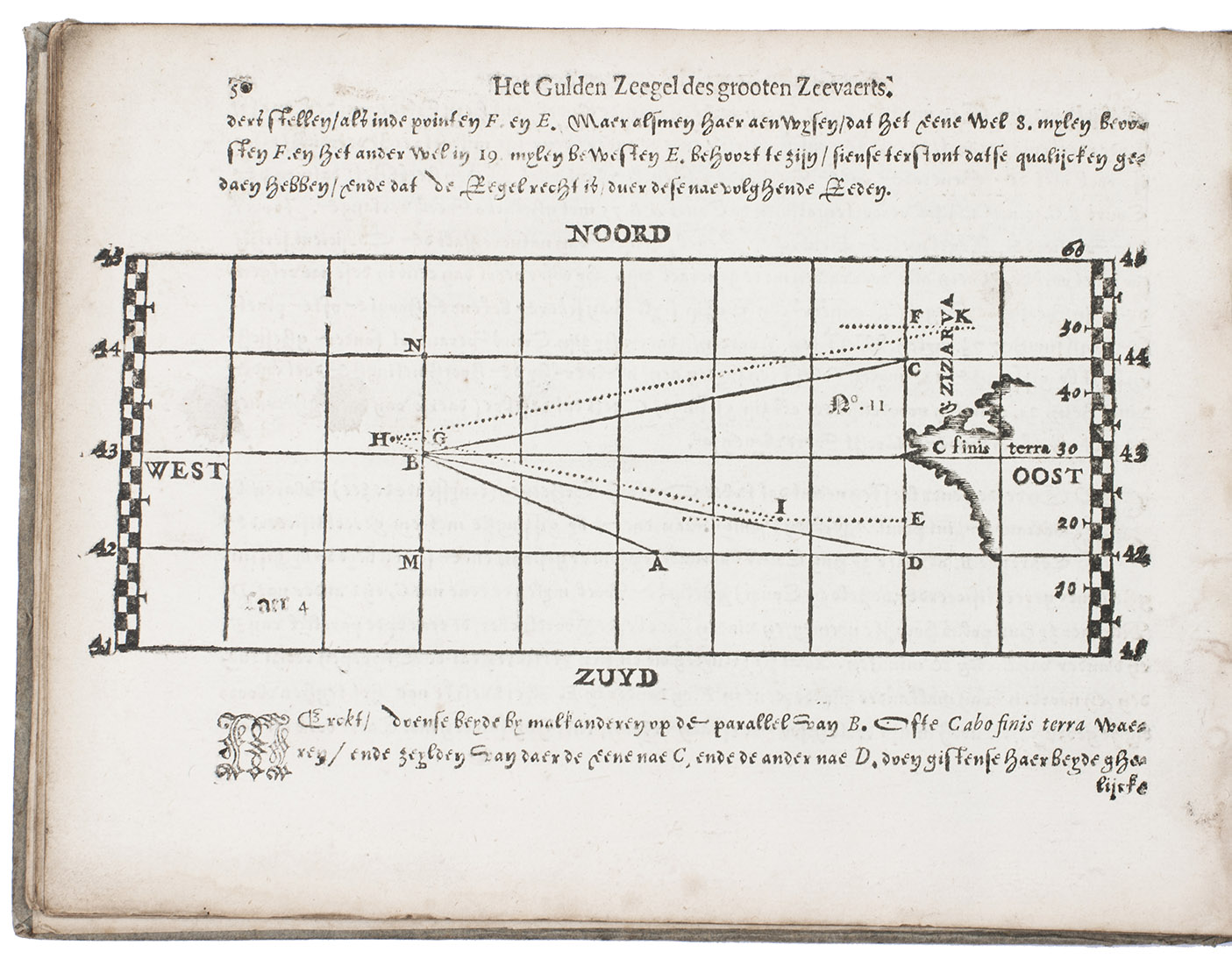
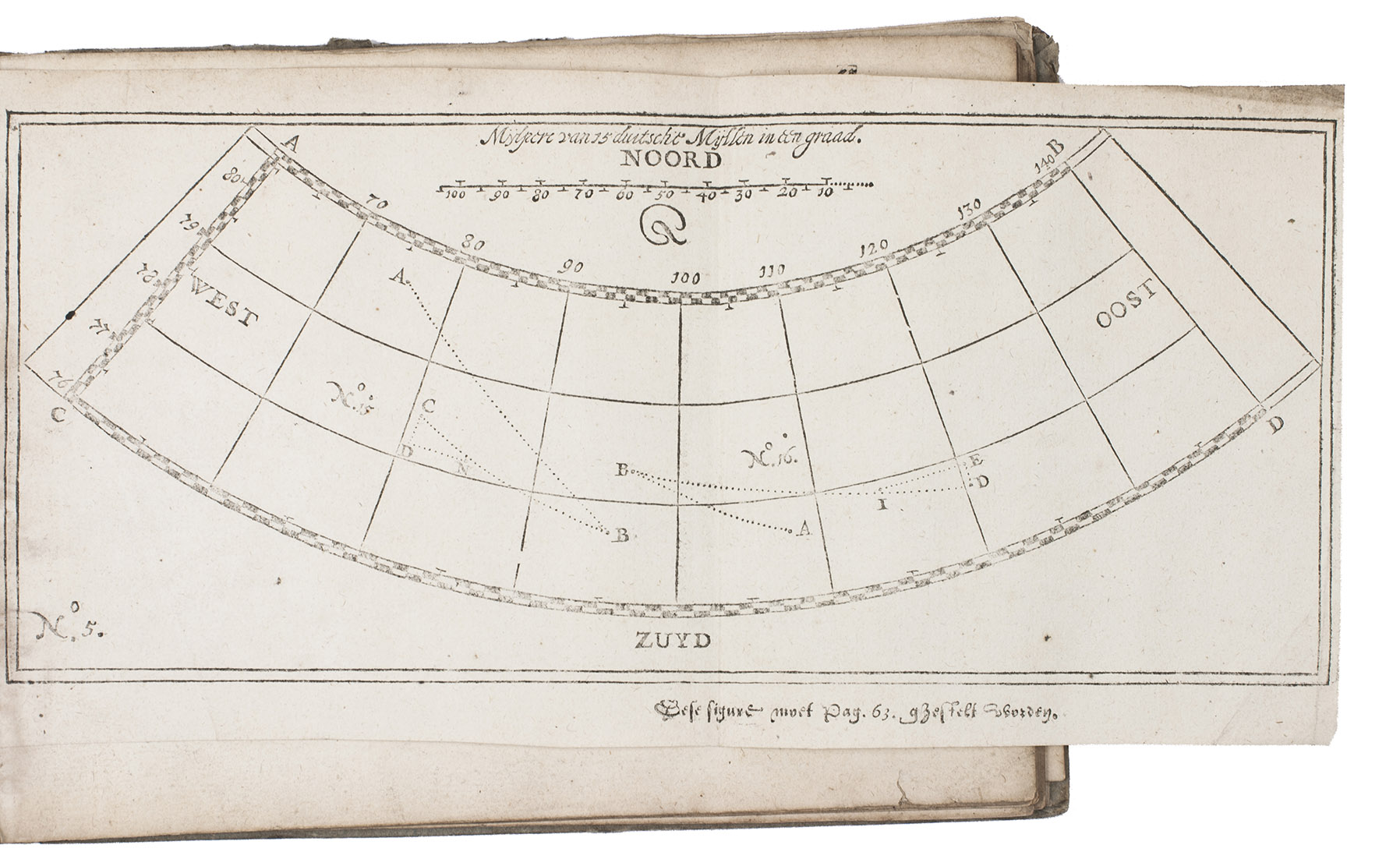
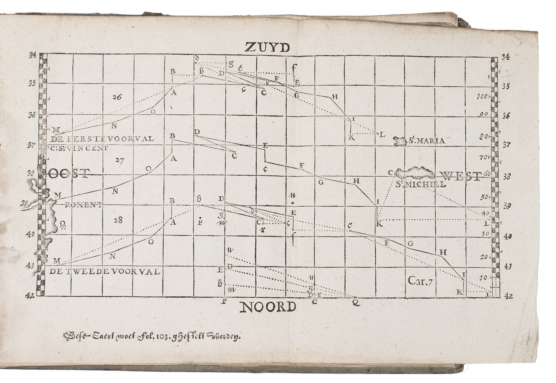
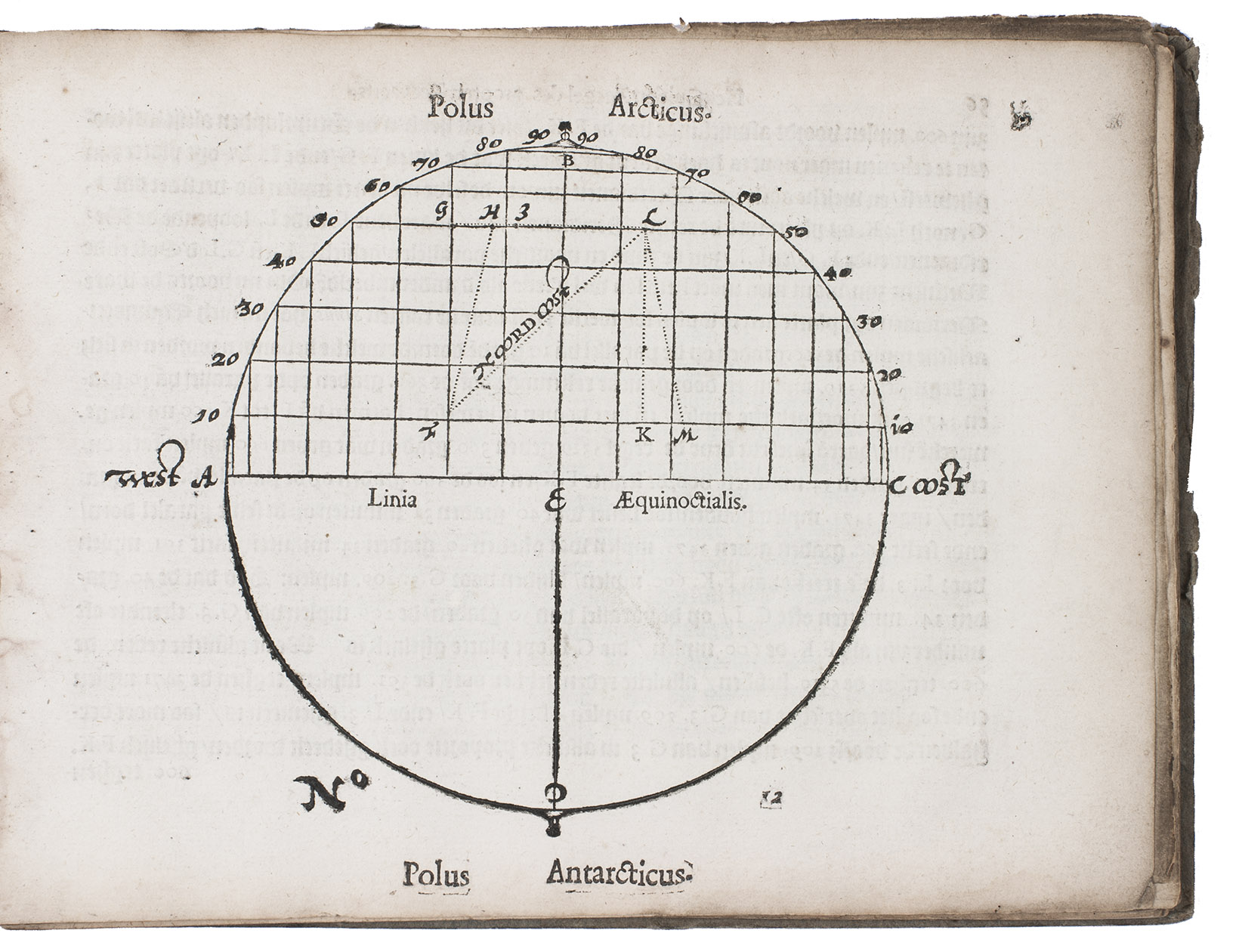
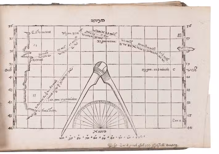
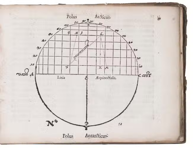
In 1612 the Dutch States General had offered a large reward to anyone who could solve the navigational problem of accurately determining longitude at sea. Van der Ley developed a detailed system for estimating latitude and longitude based in part on estimates of the distance sailed. The estimated latitude could easily be checked by simple astronomical observations, which also helped to correct errors in the estimated longitude, which could not be checked directly. He drew his charted routes on what he called "platte pascaerten" in Mercator projection. The method's greatest disadvantage was that any errors in longitude made for the various parts of a voyage would be compounded in the estimate of the final location.
It remained almost the only method in regular practical use among mariners of the seventeenth century, especially on ships of the Dutch East India Company (VOC).
The Earl of Macclesfield's copy, with his 1860 armorial bookplate on the paste-down and embossed armorial stamp on the first 2 leaves, with two early owners' names on the title-page: David Goubaud (probably the first owner) and Tobias Dierckens ("No. 35"). Lacking folding plate no. 17. Some water stains in the gutter margin, and a few leaves nearly detached. A good copy of a rare work on the determination of the longitude at sea. Bierens de Haan 2307; Davids, Zeewezen en wetenschap, pp. 80- 85; V.d. Krogt , Globi Neerlandici, p. 235; NCC (4 copies); STCN (2 copies); WorldCat (9 copies); not in Carter & Vervliet; Cat. NHSM; Crone Library; for Jarichs van der Ley: NNBW III, cols. 766-767.
Related Subjects: