GULLAIN, Charles.
Documents sur l'histoire, la geographie et le commerce de l'Afrique orientale.
Paris, Arthus Bertrand, [1856-1857]. 3 text volumes and 1 atlas volume. Text volumes: 8vo; atlas volume: folio. With 55 tinted plates. Contemporary leather-backed marbled boards. XXXI, [1], 628; XXIII, [1], 556; [4], 527, [1 blank] pp. Atlas volume: [4] pp. and 55 plates.
€ 35,000
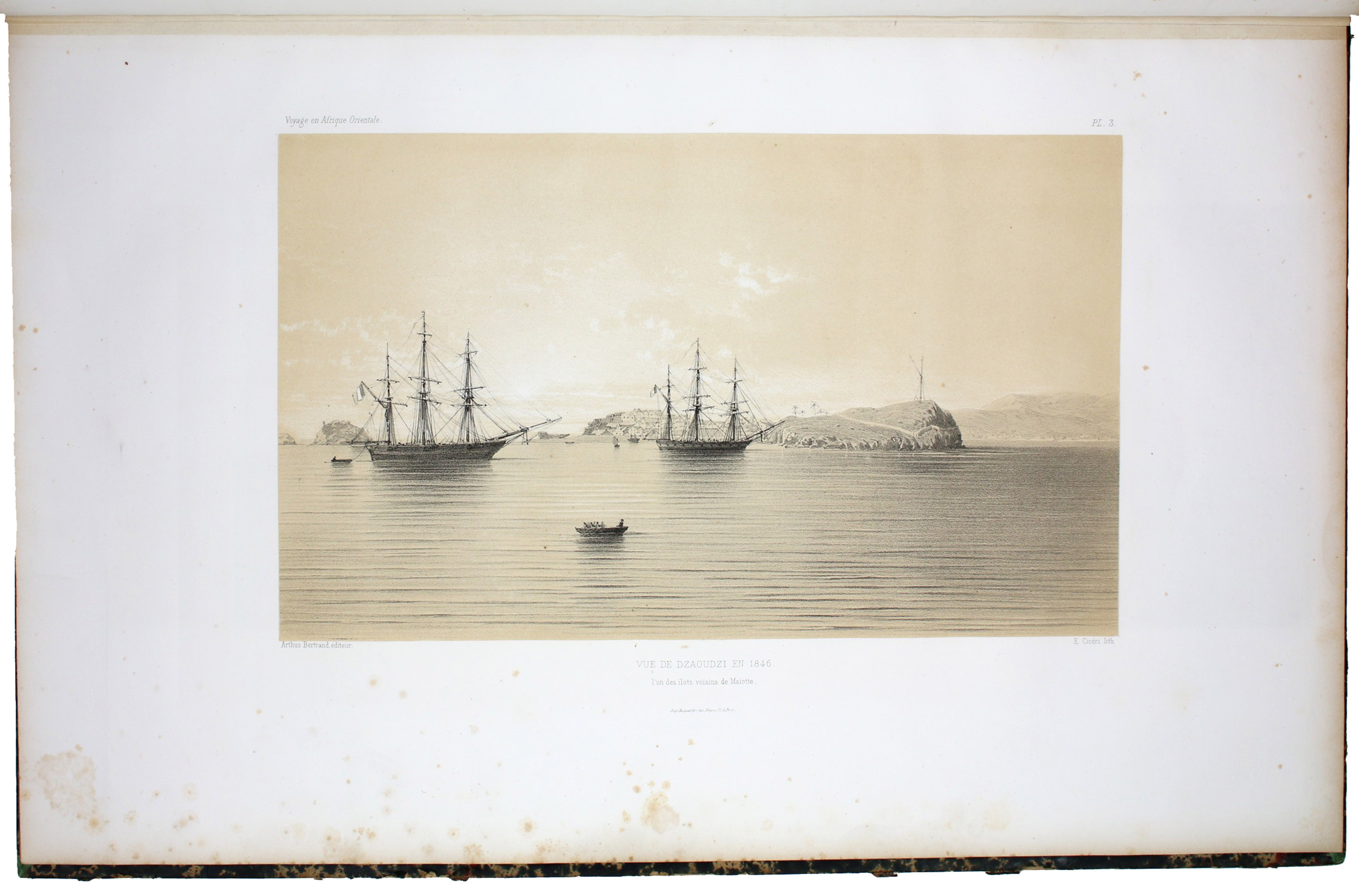
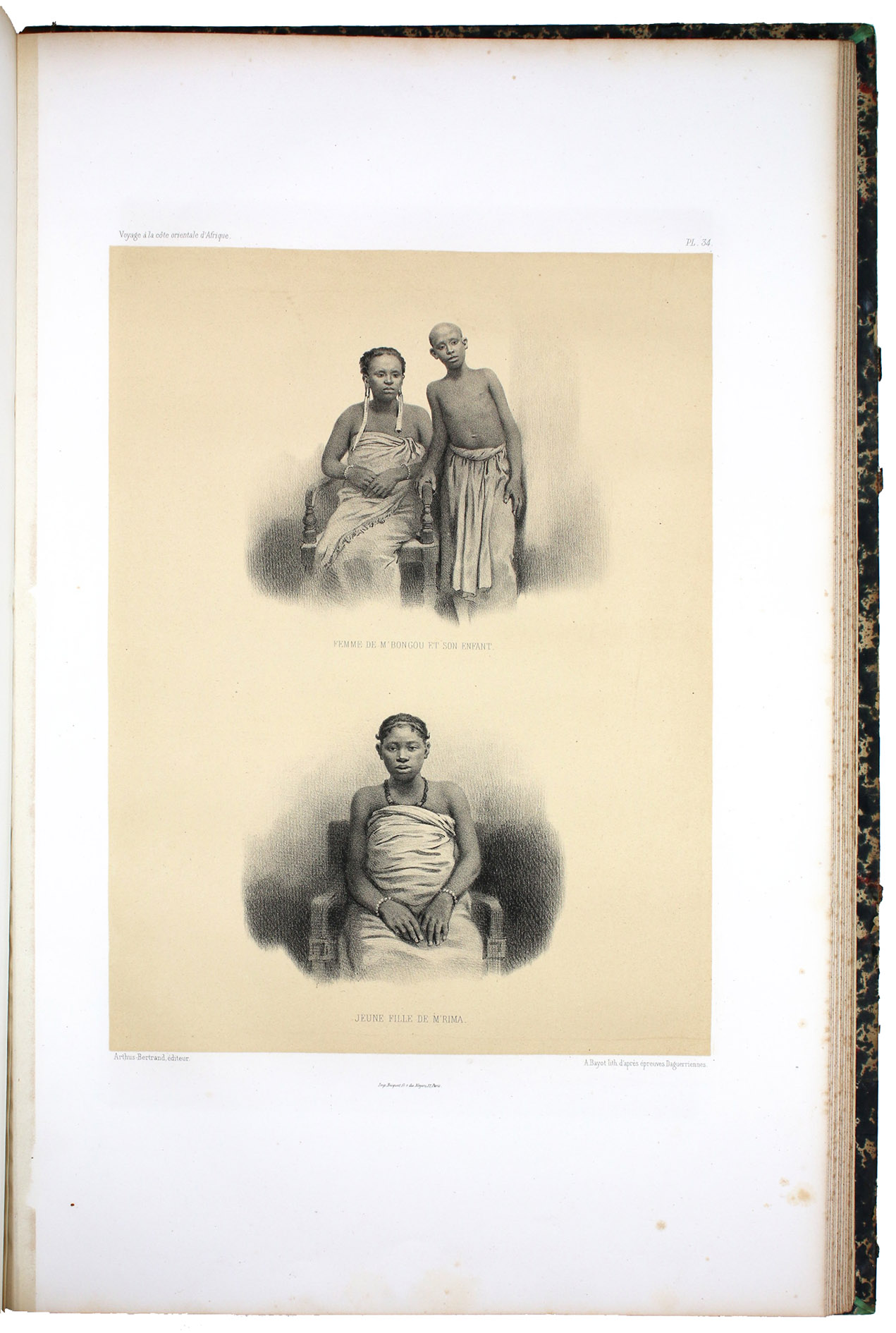
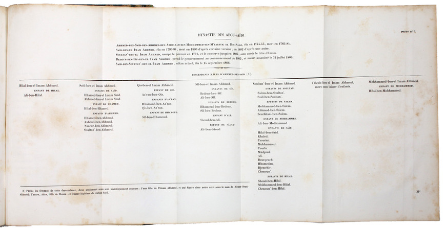
Complete in three volumes and a folio atlas, this work traces the expedition of Charles Gullain (1808-75) along the eastern coast of Arabia and Africa, from Oman to Madagascar, and features several innovations in its maps and plates, including lithographed portraits based on daguerreotypes.
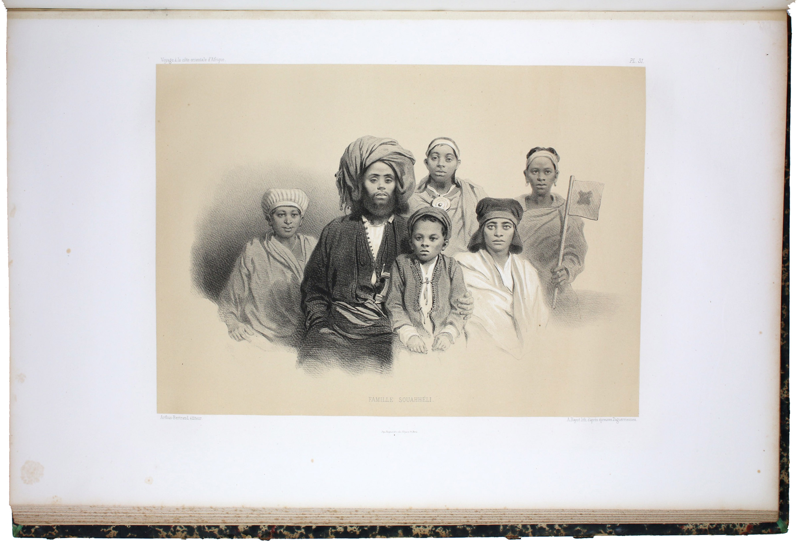
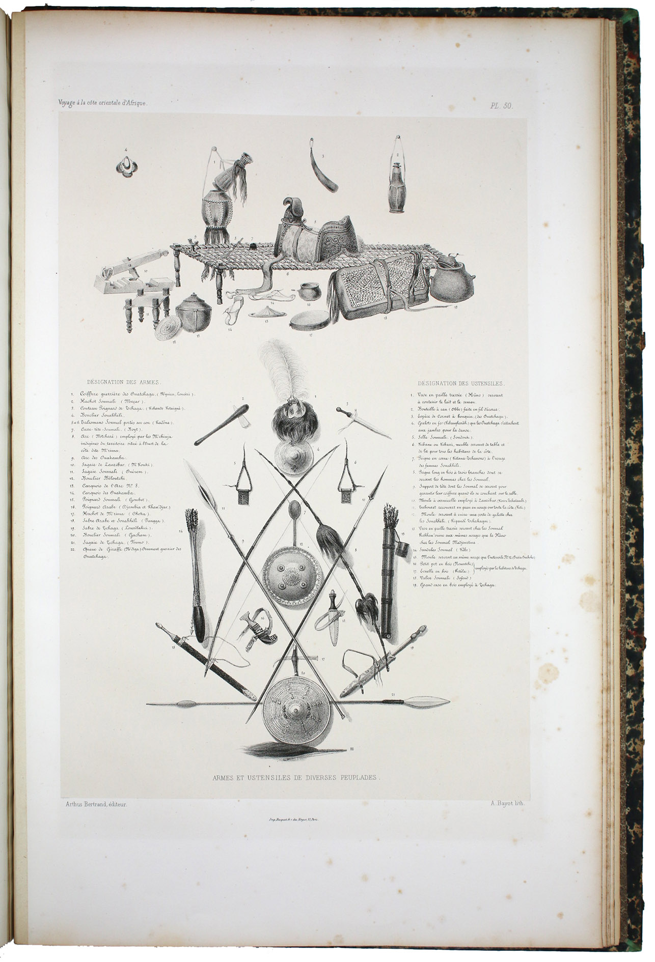
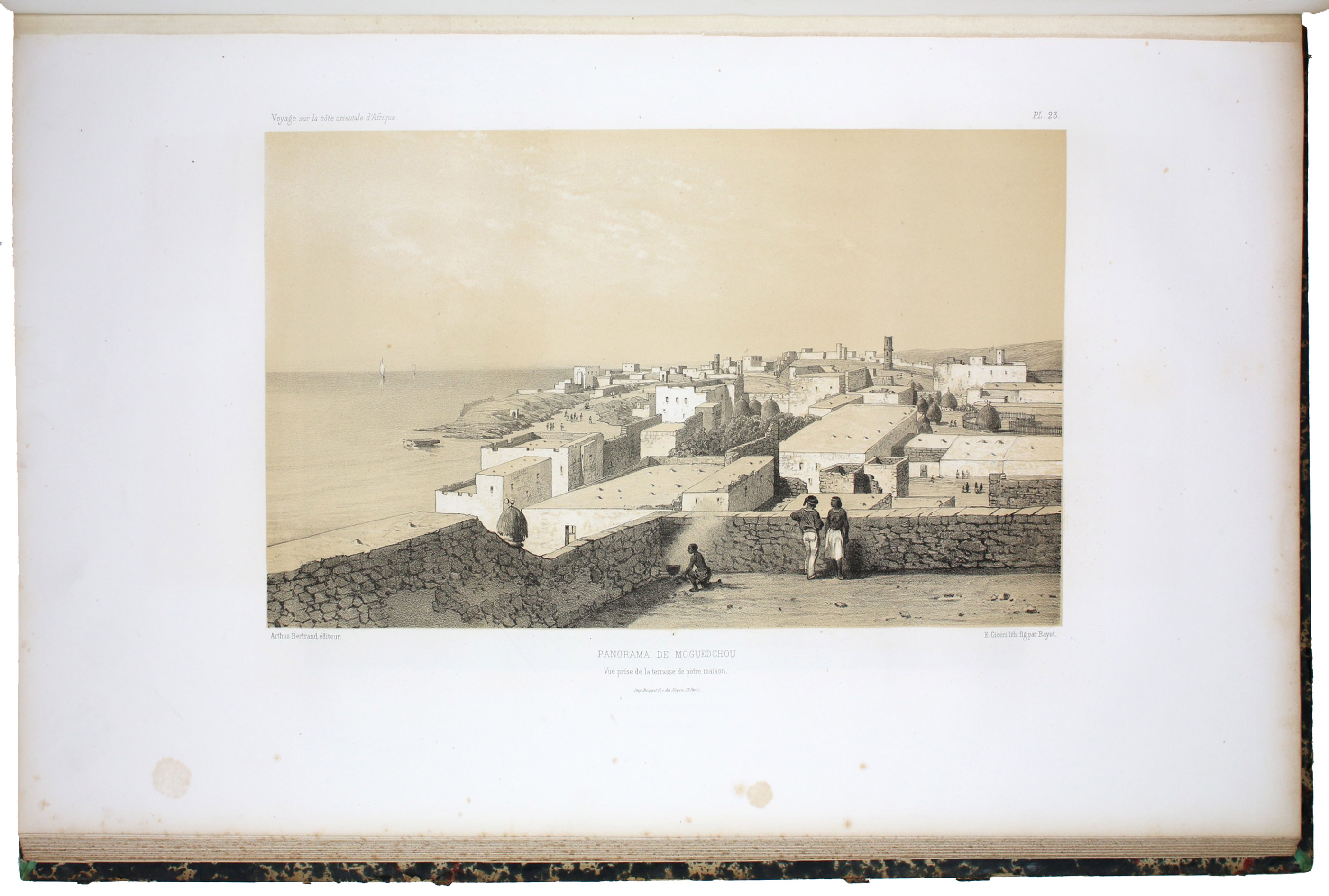
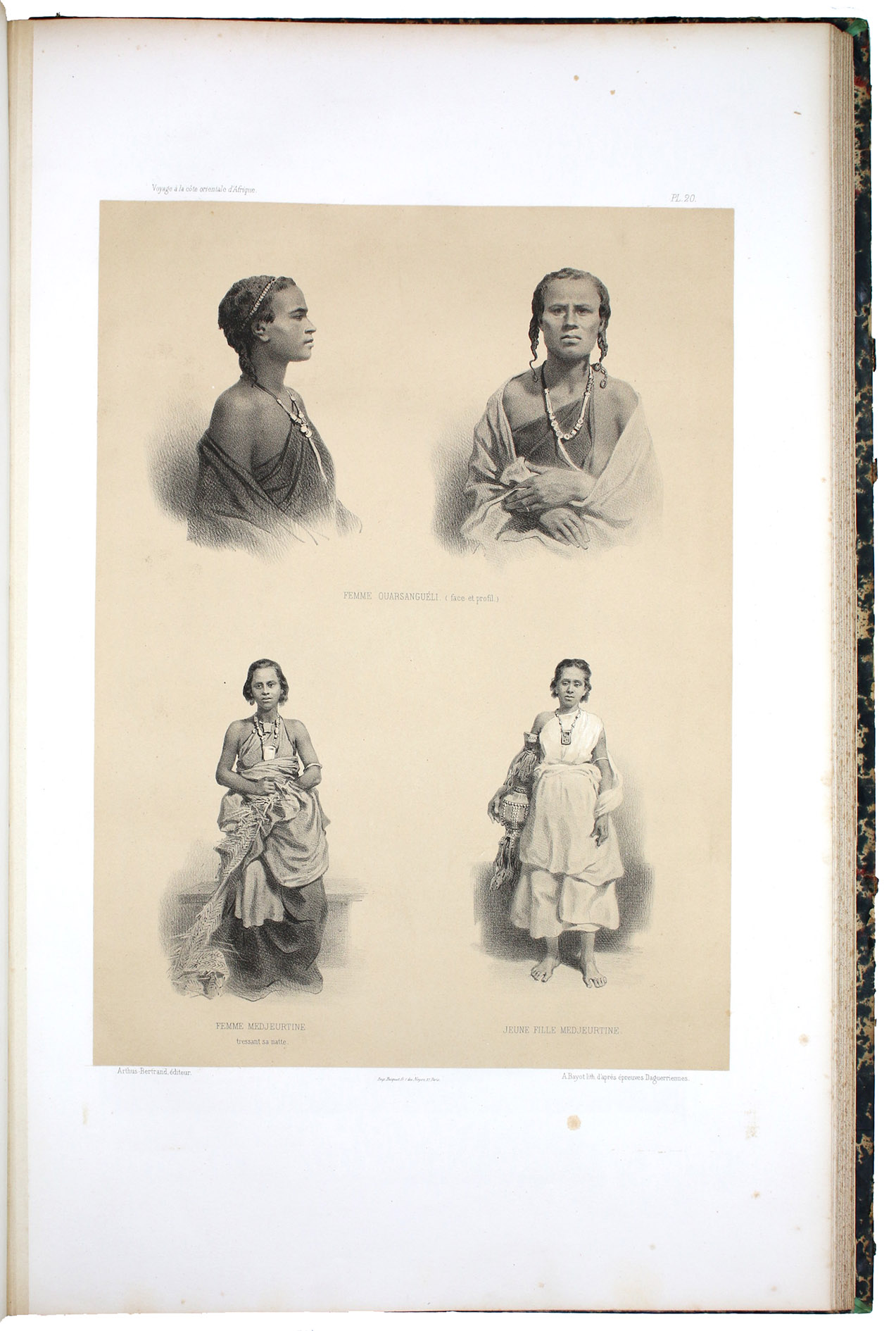
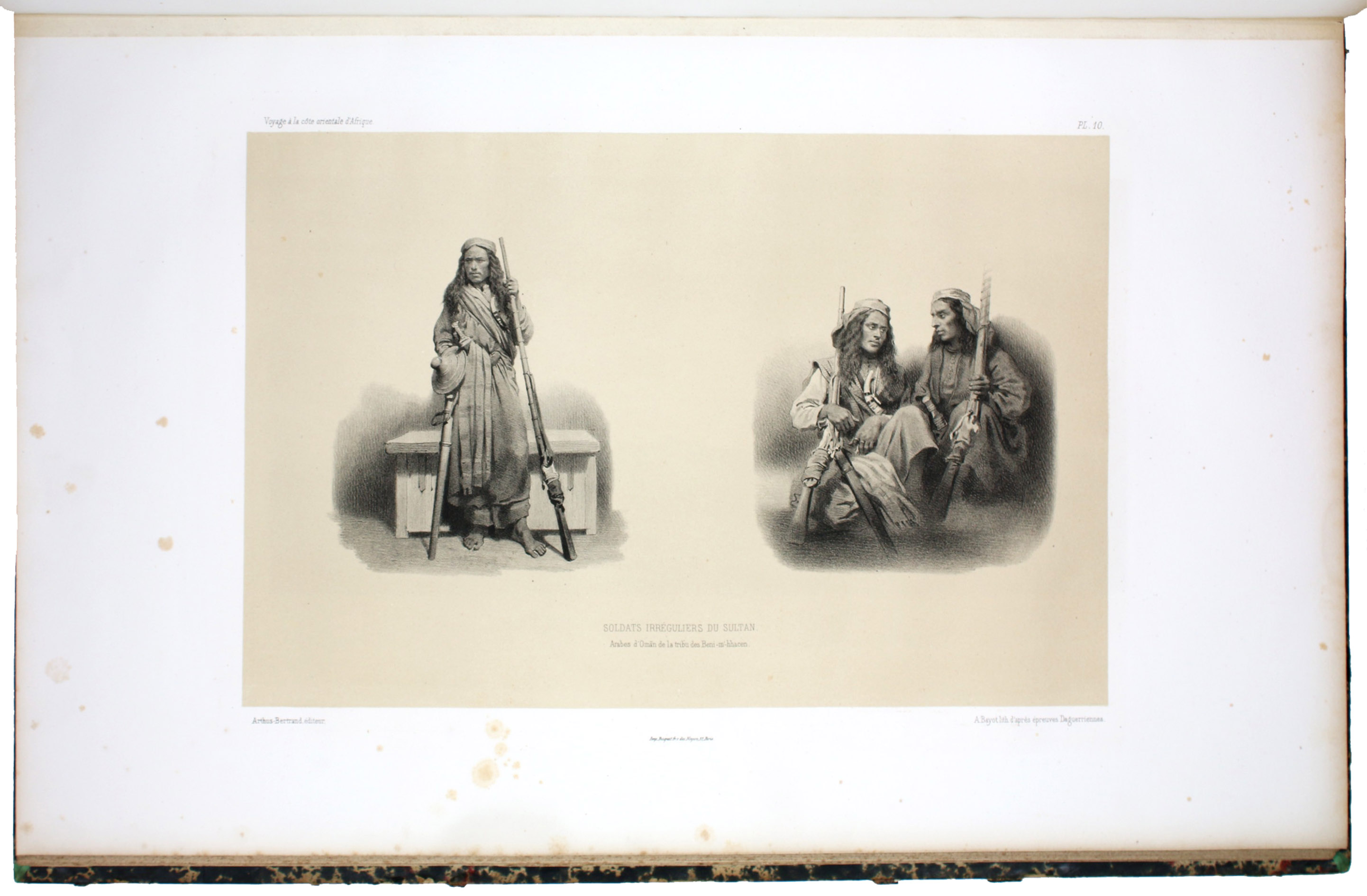
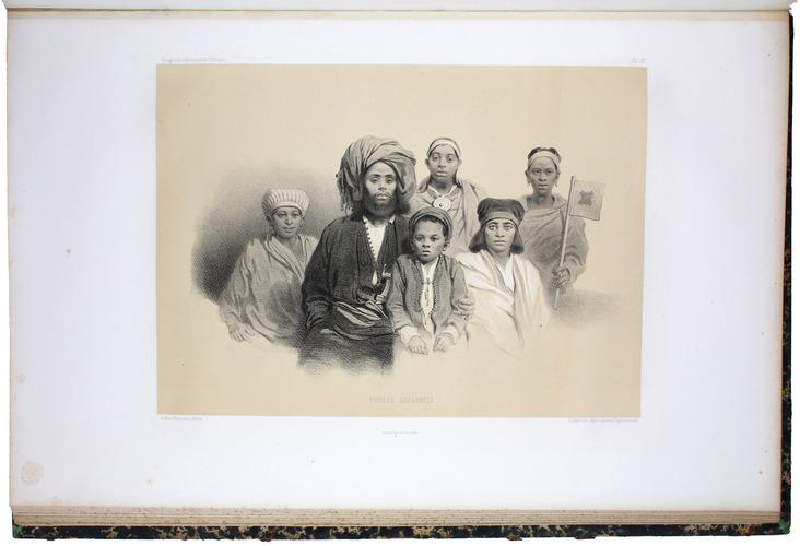
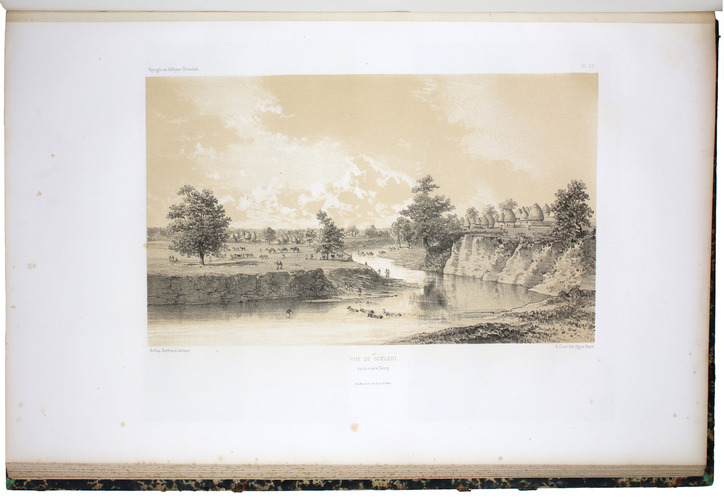
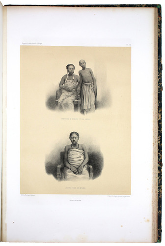
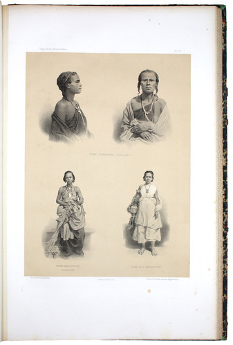
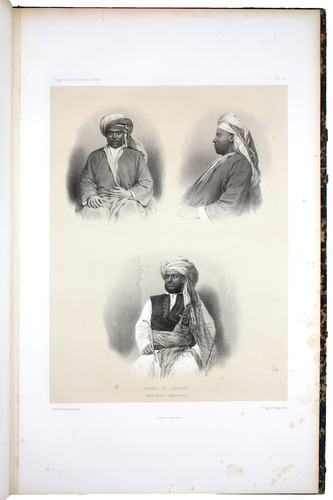
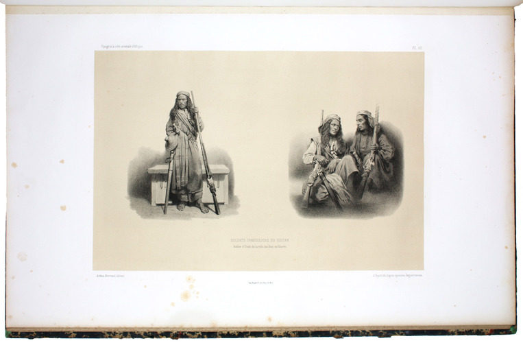
In the 1850s, the French Ministère de la Marine was anxious to publicize their outstanding advances in the field of coastal mapping, especially as France appeared to be losing ground in the colonial scramble for overseas conquests. Gullains expedition was a perfect combination of cartography and ethnology with which to do just that, and no expense was spared in publishing the attractive atlas volume, containing extensive maps and quite beautiful plates. The portraits of Arabs and Africans are drawn from early photographs, including a portrait-sitting which took place in the courtyard of the governors mansion in Zanzibar, where Gullain was often hosted on his travels. The first to sit was the governors great-niece, an eight-year-old named Aziza dressed in her finest clothes. This persuaded the governor himself, Syed Seliman Ben Ahmed, to have his own portrait taken; subsequent daguerreotype sessions were made in the houses of Khamis Ben Osman, a prominent Zanzibar citizen, and Abdallah Ben Ali, a trader. Other plates include as "Soldats Irréguliers du Sultan", showing Omani Arab soldiers of the "Beni-m-hhacen" tribe, the sheikh "Abdallah Ben Naceur ben Mohhamed, Membre de la tribu des Mzara" in Mombasa, and "Arabes de Zanzibar".
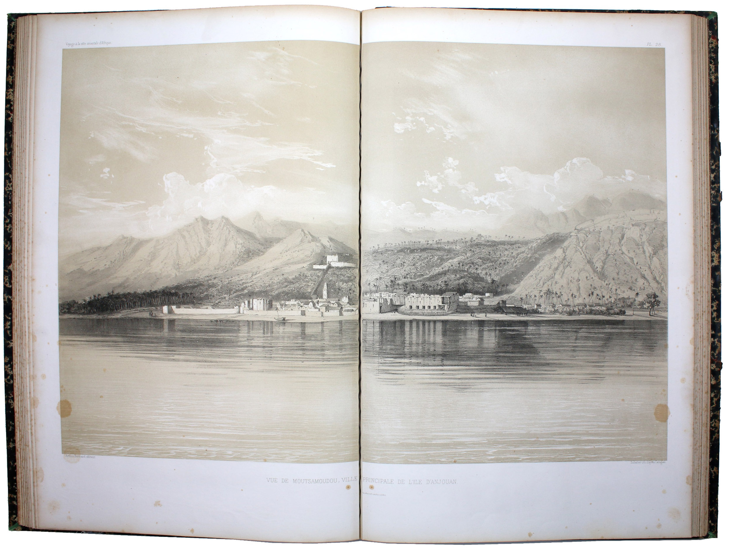
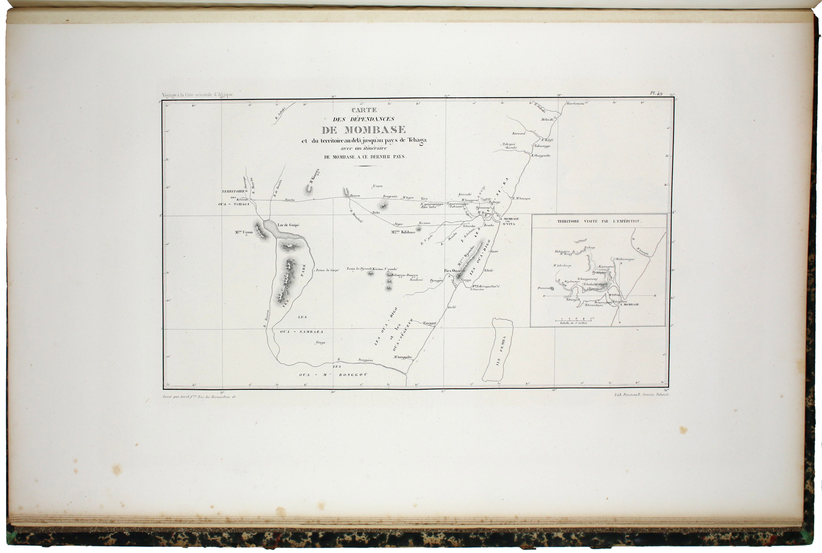
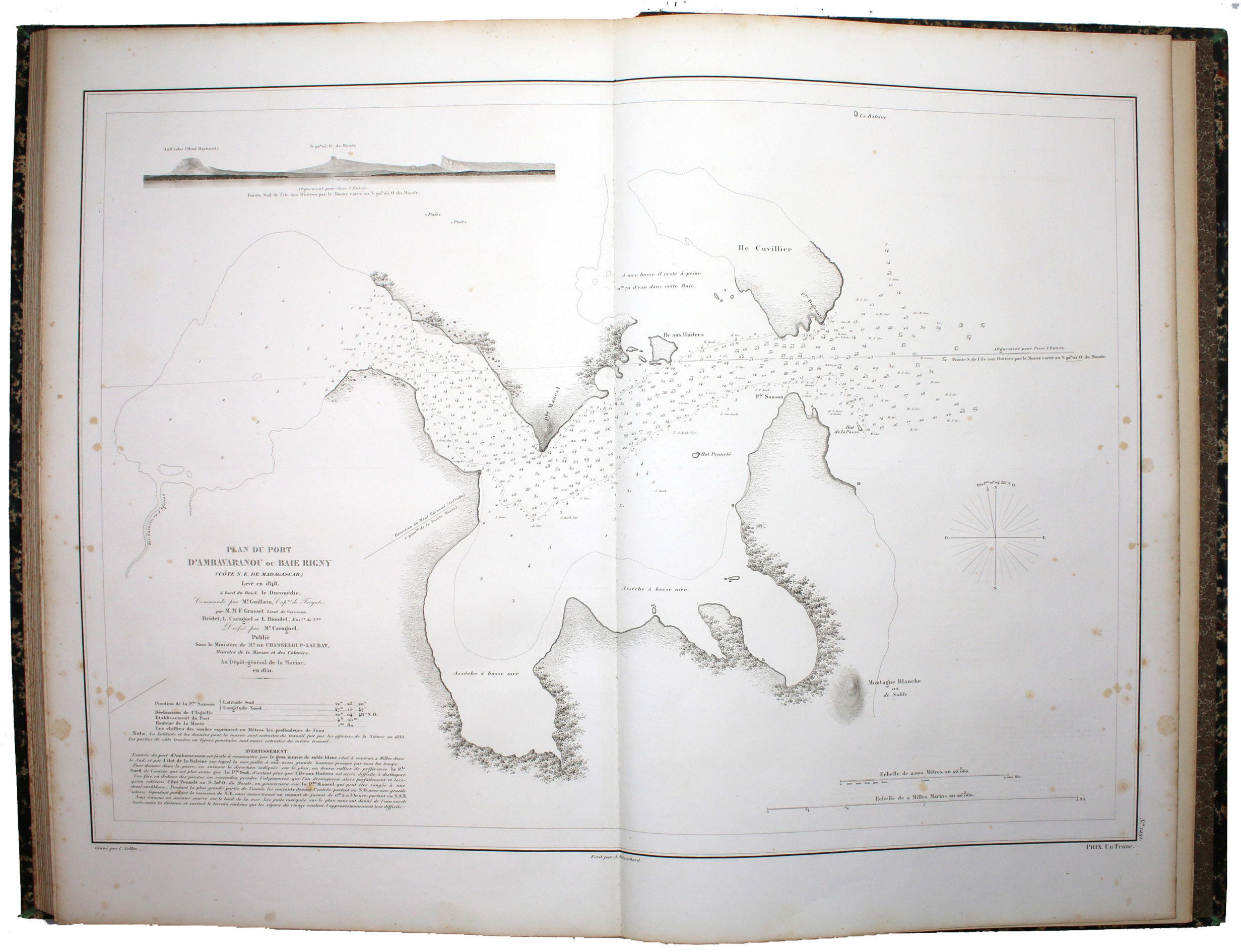
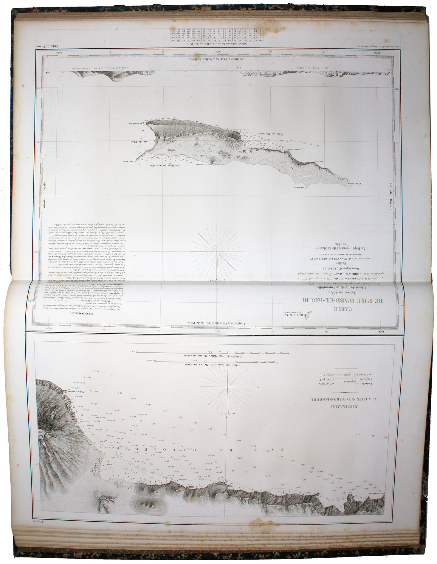
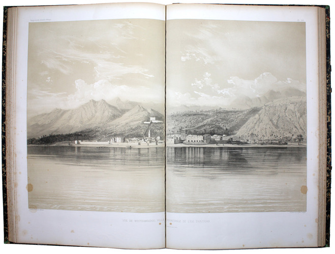
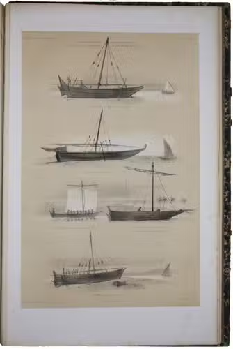
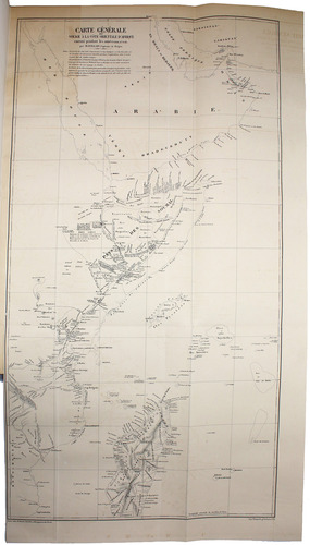
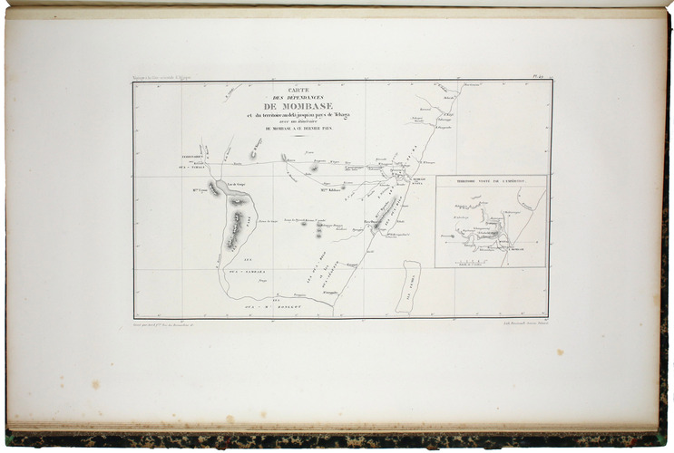
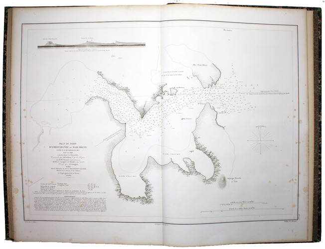
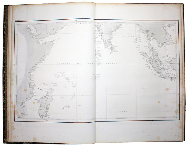
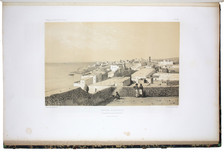
The maps provided from the expedition are, alongside the lithographs, its crowning achievement, and the largest traces coastlines from Bahrain to Madagascar, including the coasts of what are now the modern states of Saudi Arabia, the UAE, Oman, Yemen, Somalia, Kenya, Tanzania, and Mozambique. Smaller maps and plans show the city of Zanzibar and its palaces and fortifications, the layout of Mombasa, and the island of Abd al Kuri, now part of Yemen.
Exterior wear with chipped spines. Light foxing, otherwise quite well preserved. Brunet III 1816; Gay 236, 2715.
Related Subjects: