COLOM, Jacob Aertsz.
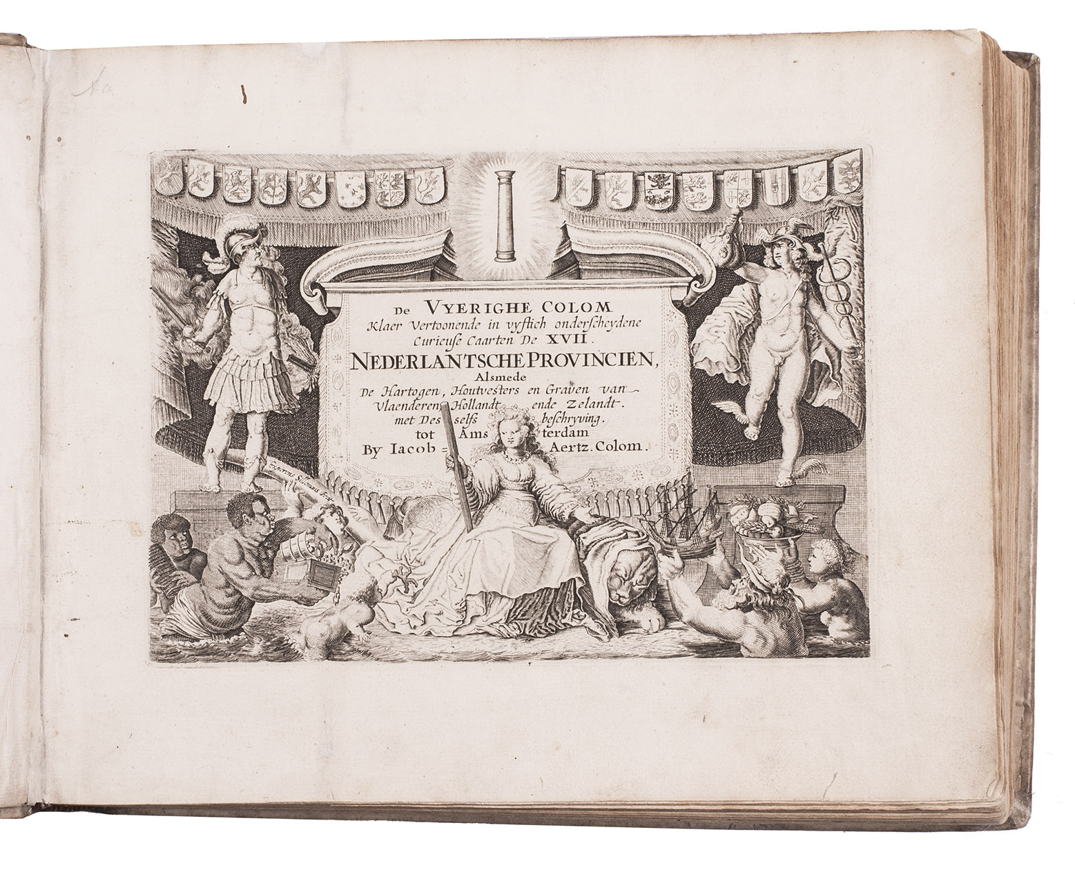
De vyerighe colom klaer vertoonende in vyftich onderscheydene curieuse caarten de XVII Nederlantsche provincien, alsmede de hartogen, houtvesters en graven van Vlaenderen, Hollandt ende Zelandt. Met desselfs beschryving.
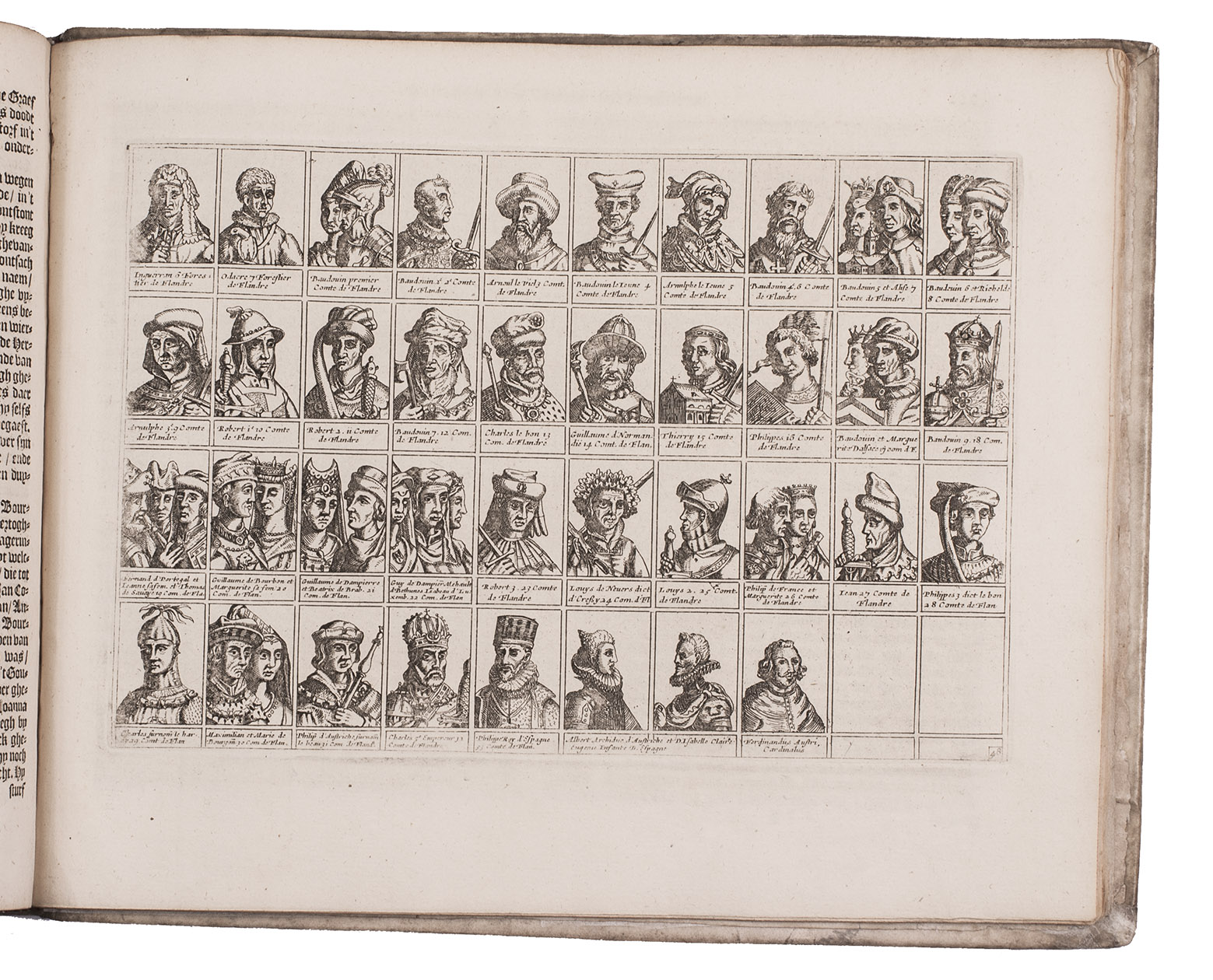
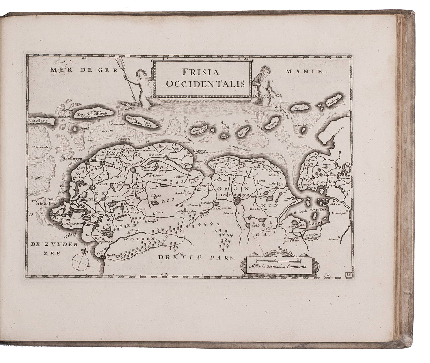
Amsterdam, Jacob Aertsz. Colom, [ca. 1660]. Oblong 4to (ca. 23 x 28 cm). With an engraved allegorical title page by Experiens Sillemans, and 50 full-page numbered engraved plates (47 maps, and 3 plates containing 117 portraits of the Counts of Brabant, Flanders, and Holland). Contemporary vellum. [2], 4, [14], 223, [2], [1 blank] pp.
€ 6,500
Enlarged Dutch edition of an attractive atlas of the Seventeen Provinces (roughly corresponding to present-day the Netherlands and Belgium), containing all 50 maps and plates. The work was compiled and published by the ambitious Amsterdam map- and globe maker, printer and publisher Jacob Aertsz. Colom (1600-1673). Like Willem Jansz. Blaeu, Colom began his career by publishing pilot guides and maritime atlases (a field in which few dared to compete with Blaeu), before branching out into terrestrial atlases. The maps and portraits in this second Dutch edition were printed from the plates of the first Dutch edition (1635), but the accompanying text has been revised and expanded.
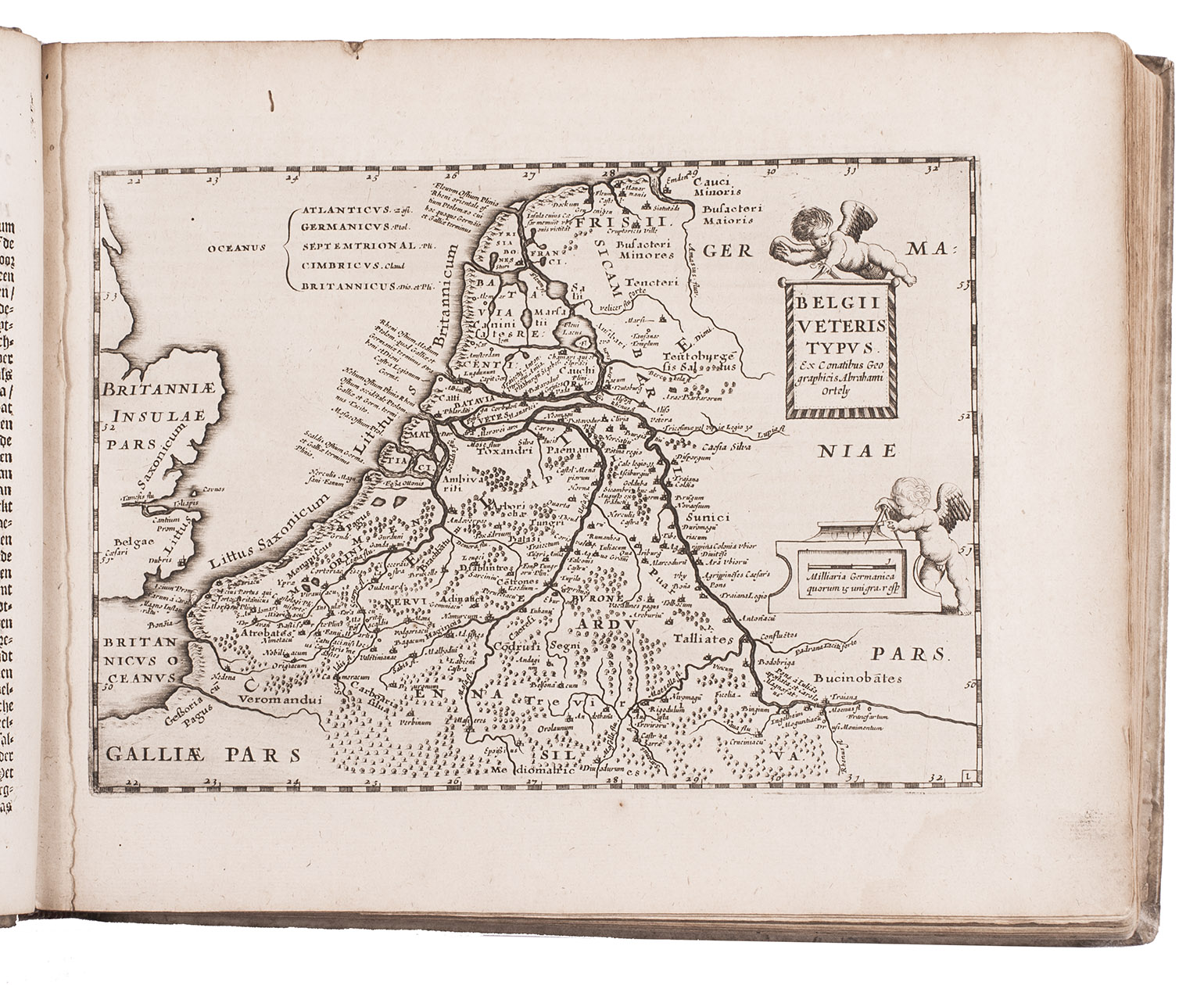
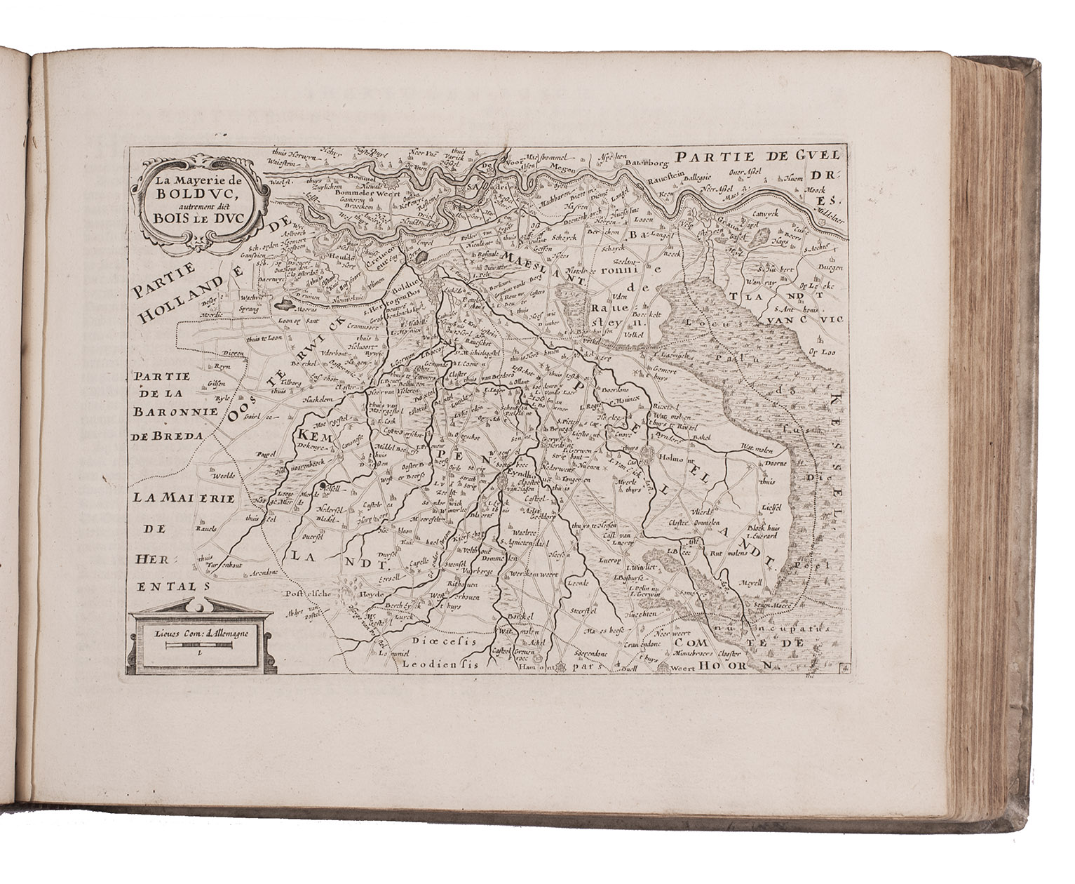
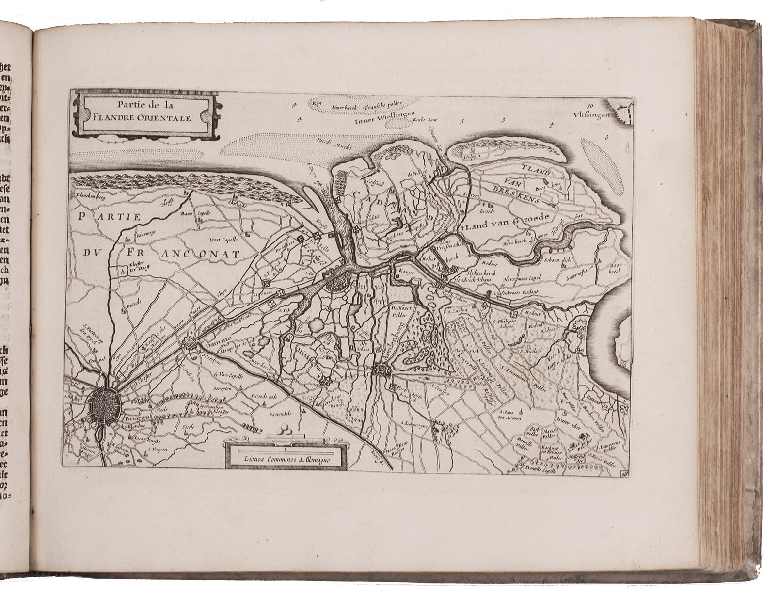
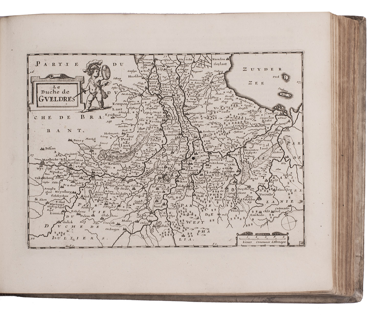
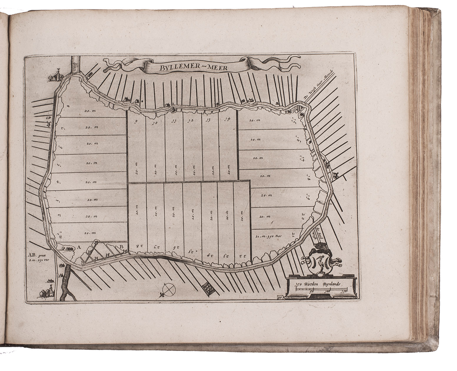
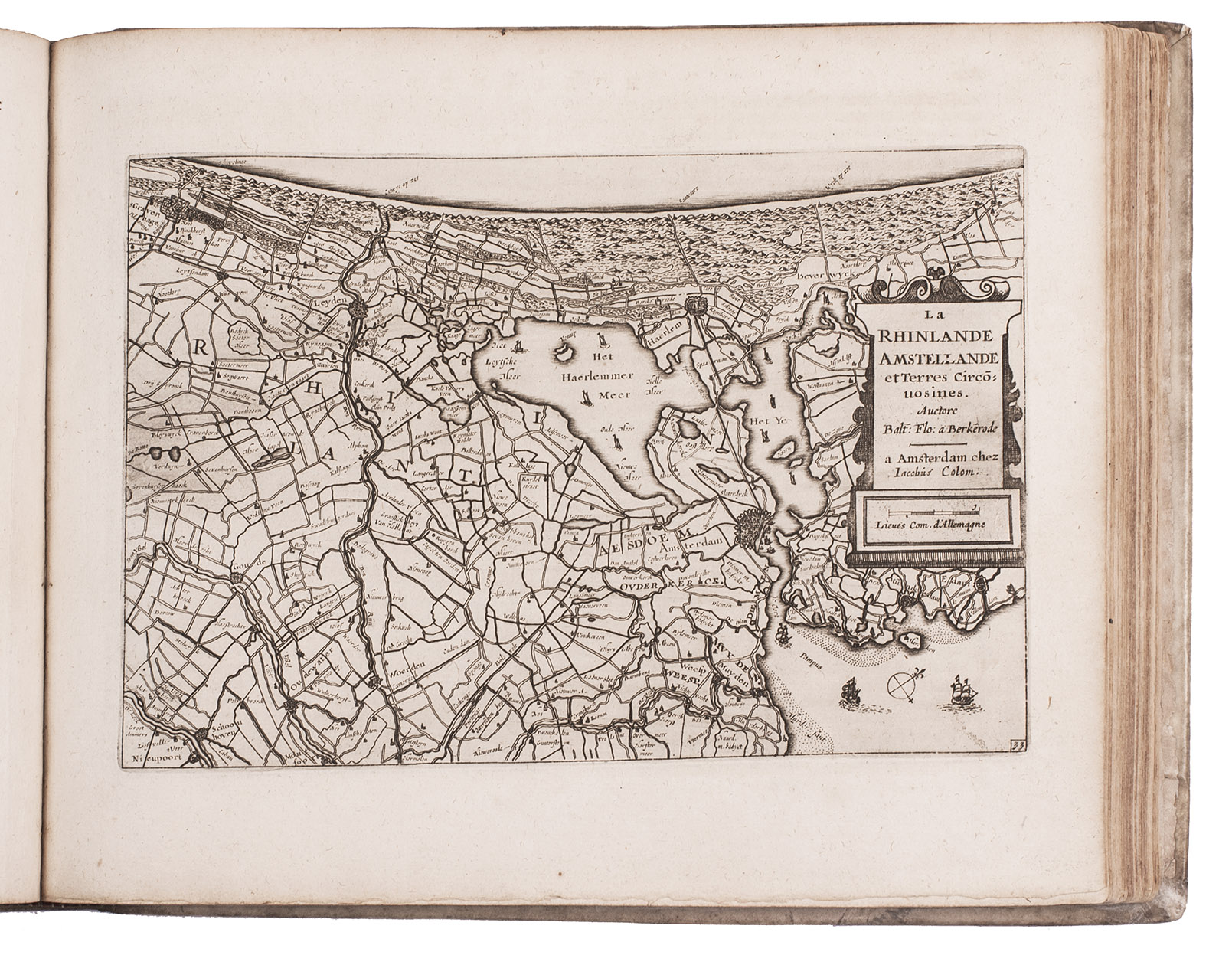
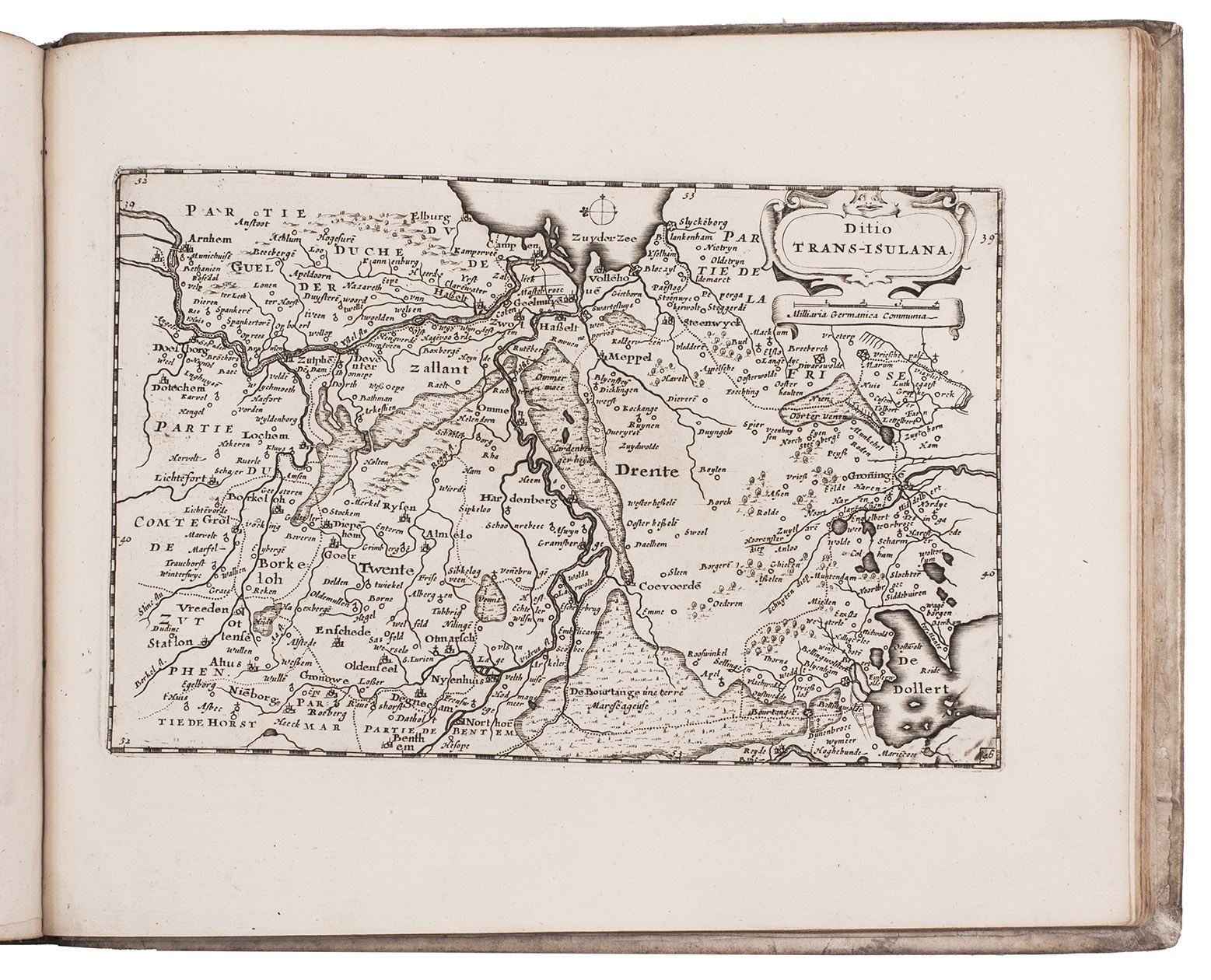
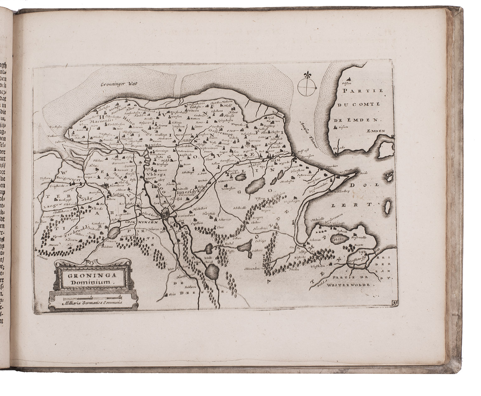
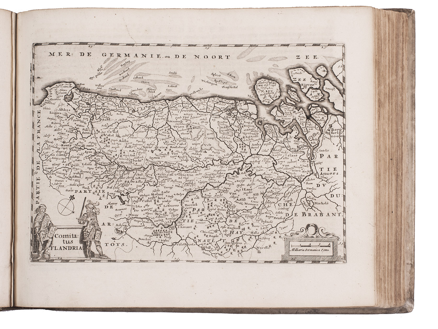
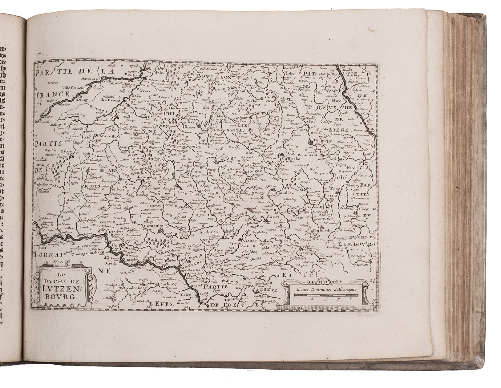
The descriptions were derived from the text written by Reinier Telle for Abraham Gooss Nieuw Nederlandtsch Caertboeck (1616), which itself was largely based on Lodovico Guicciardinis classic Beschryvinghe van alle de Nederlanden (1612). In addition to general maps of the Netherlands (depicting both the Roman period and the 17th century) and of the Seventeen Provinces, the work contains numerous detailed maps of individual regions and cities together with their surrounding areas. These include, among others, the Meierij of s-Hertogenbosch, Bergen op Zoom, Breda, Valkenburg and Dalhem, Mechelen, the diocese of Liège, Namur, the Veluwe, Zutphen, the island of Dordrecht, Delfland, six maps of newly reclaimed polders (Bijlmermeer, Purmer, Wormer, Heerhugowaard, Diemermeer, and Zijpe), the three historic regions of Frisia (Eastergoa, Westergoa, and Zevenwouden), and Walcheren.
The engraved portrait plates comprise two sheets containing, respectively, 40 and 38 portraits of the Dukes of Brabant and the Forestiers of Flanders, and a third with 39 portraits of the Counts of Holland.
With the library stamp of the Oudheidkamer Twente on the front flyleaf. The work has been recased, with the endpapers restored, the vellum is slightly soiled and stained. Restored tears in the head and foot margins of the title page, the maps have not been bound in order, the margins of map 31 have been trimmed, without affecting the image, map 45 with a water stain in the lower outer corner. Otherwise in good condition. Koeman, Col 5; V.d. Krogt, Koeman's Atlantes Neerlandici IIIB, 365:02 (pp. 635-637); Shirley, British Library T.COLM-1a; STCN 853365954; Tiele, Bibl. 262; USTC 1845771.
Related Subjects: