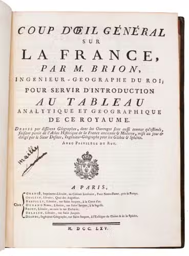
BRION DE LA TOUR, Louis & Louis Charles DESNOS.
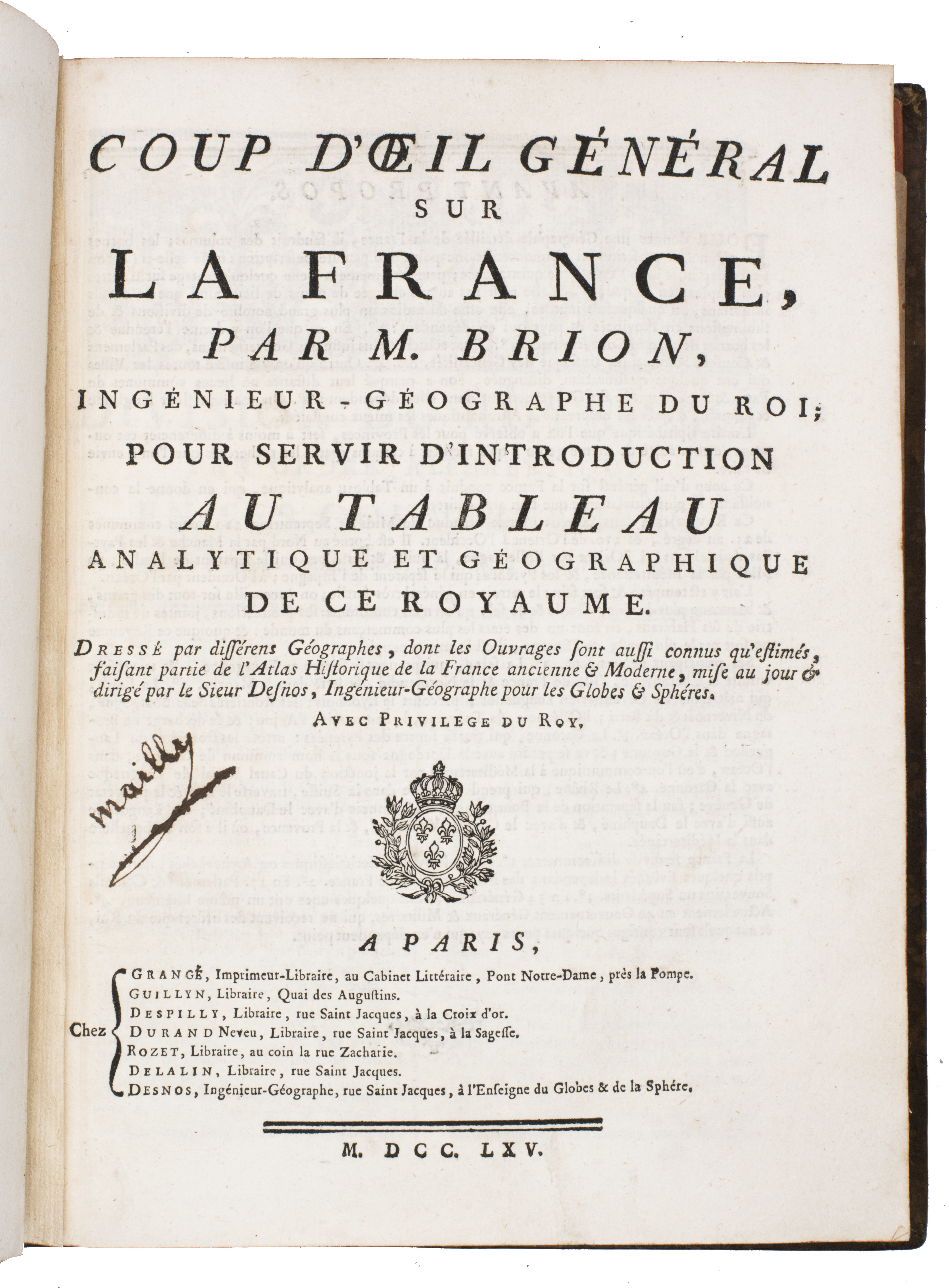
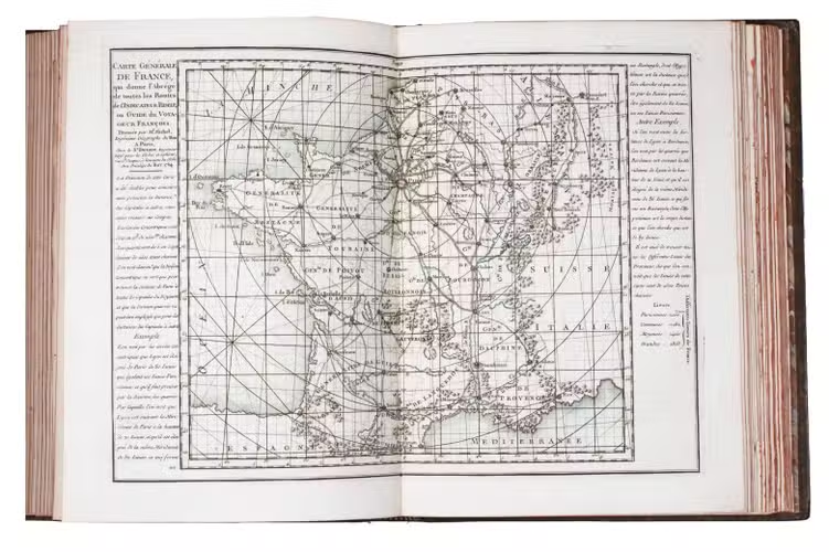
Coup d'oeil général sur la France, pour servir d'introduction au tableau analytique et géographique de ce Royaume. Dressé par différens géographes, dont les ouvrages sont aussi connus qu'estimés, faisant partie de l'atlas historique de la France ancienne & moderne ...
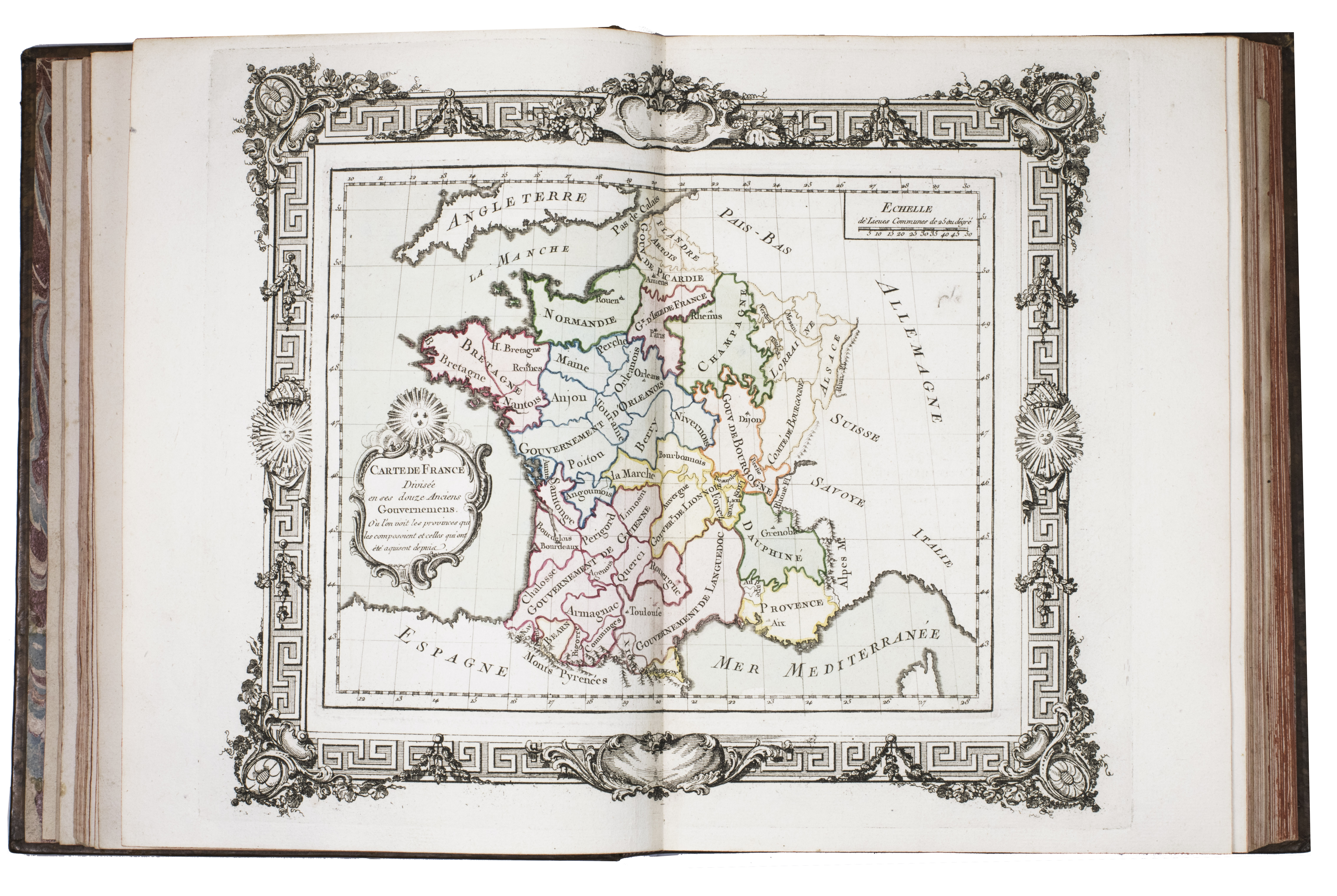
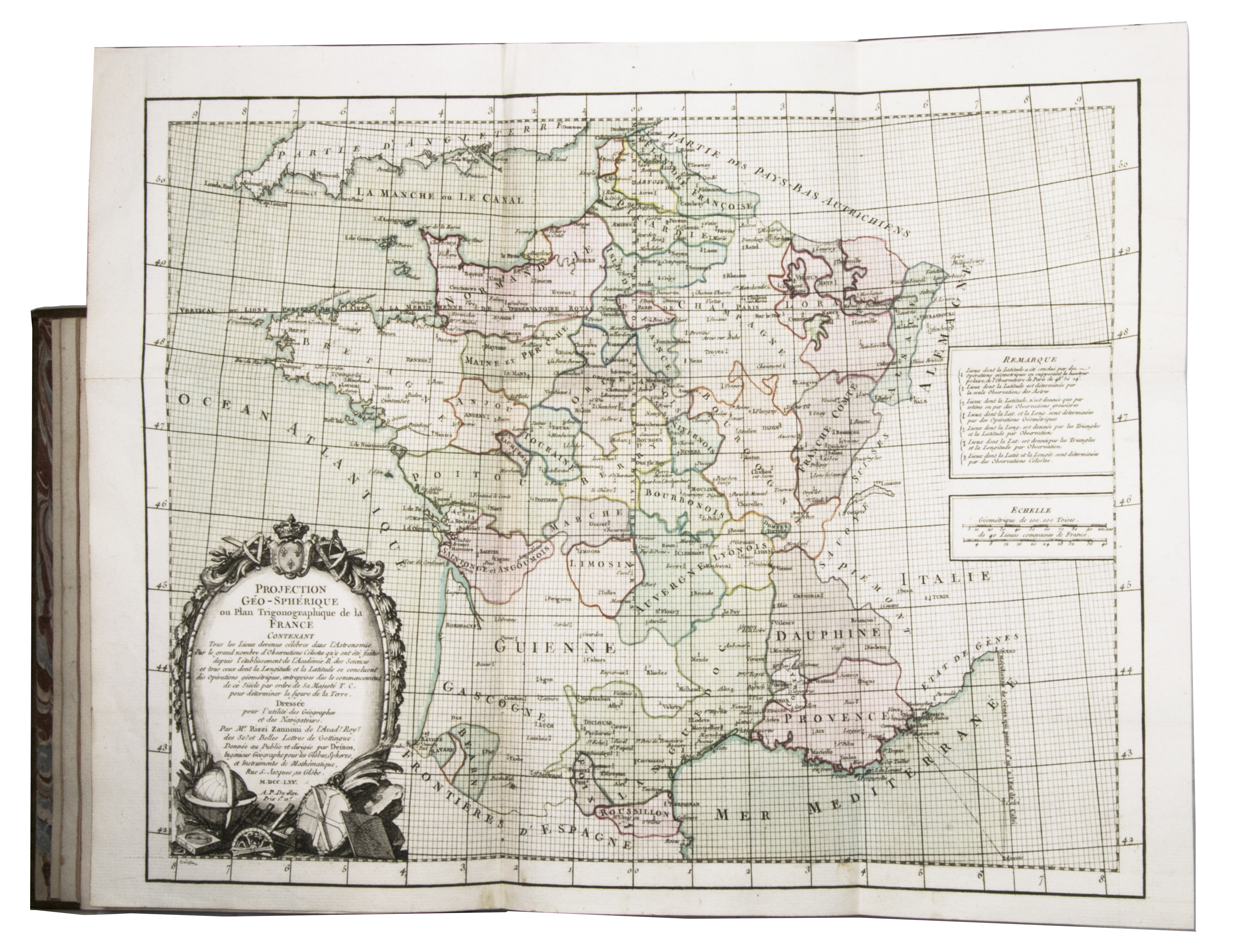
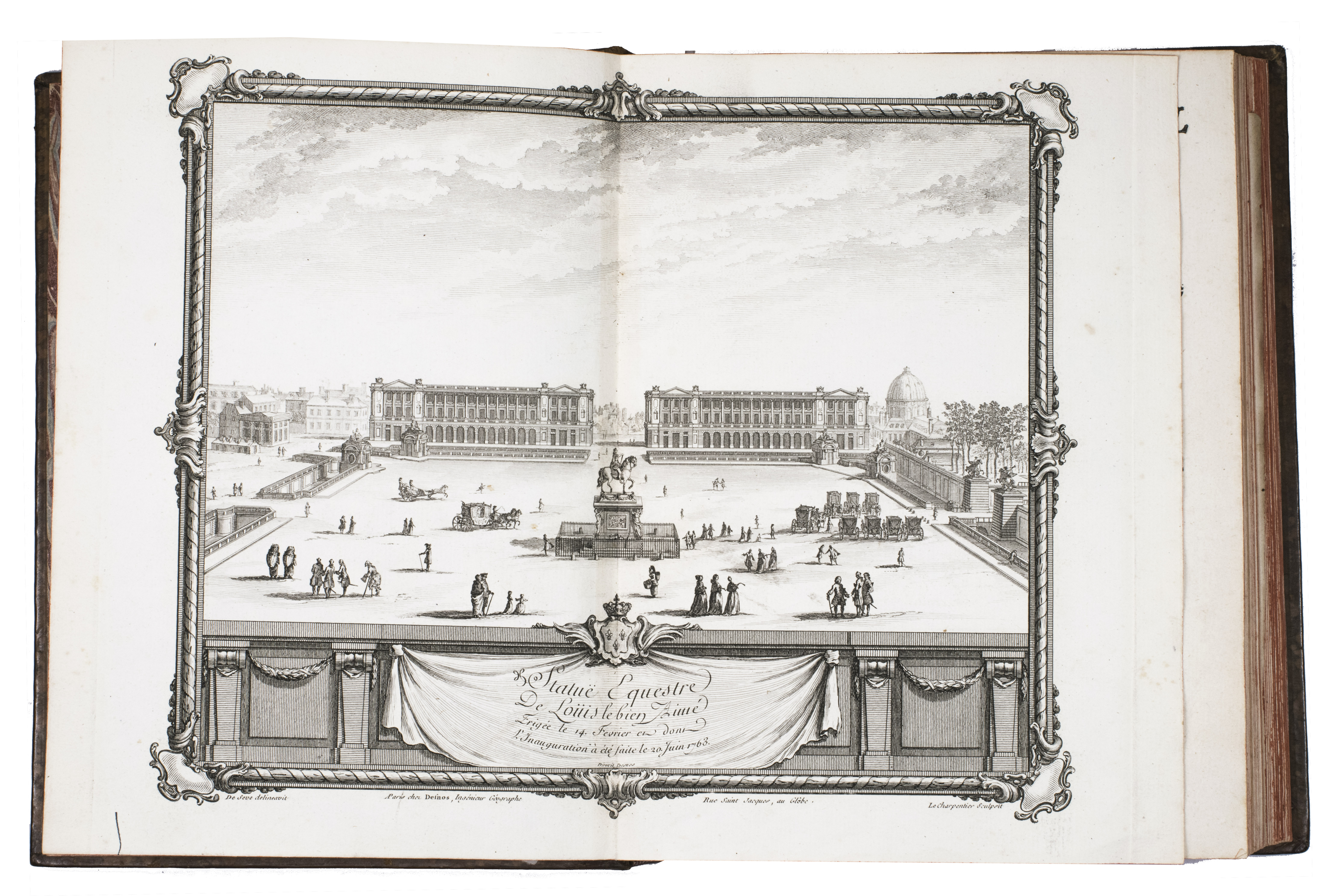
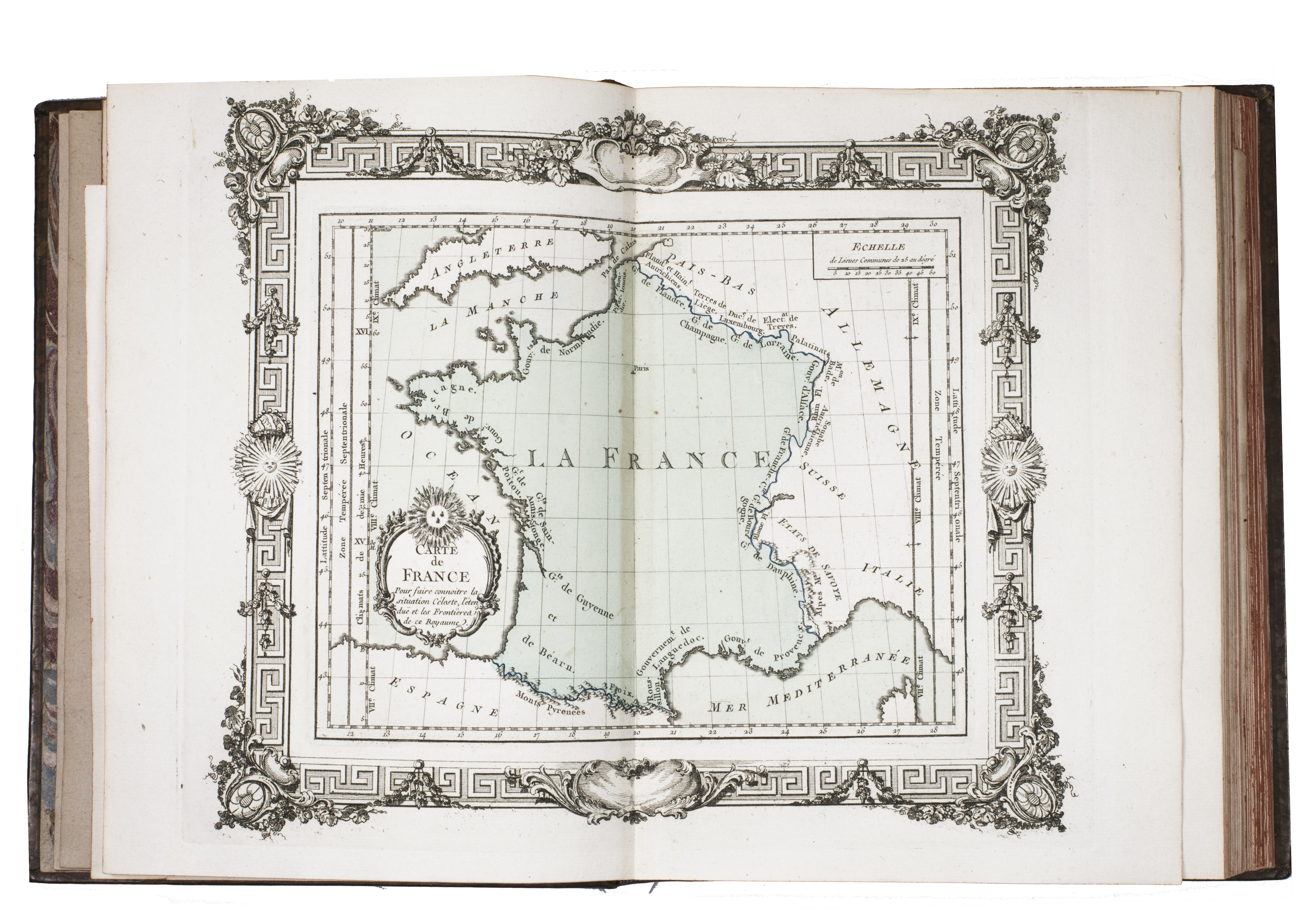
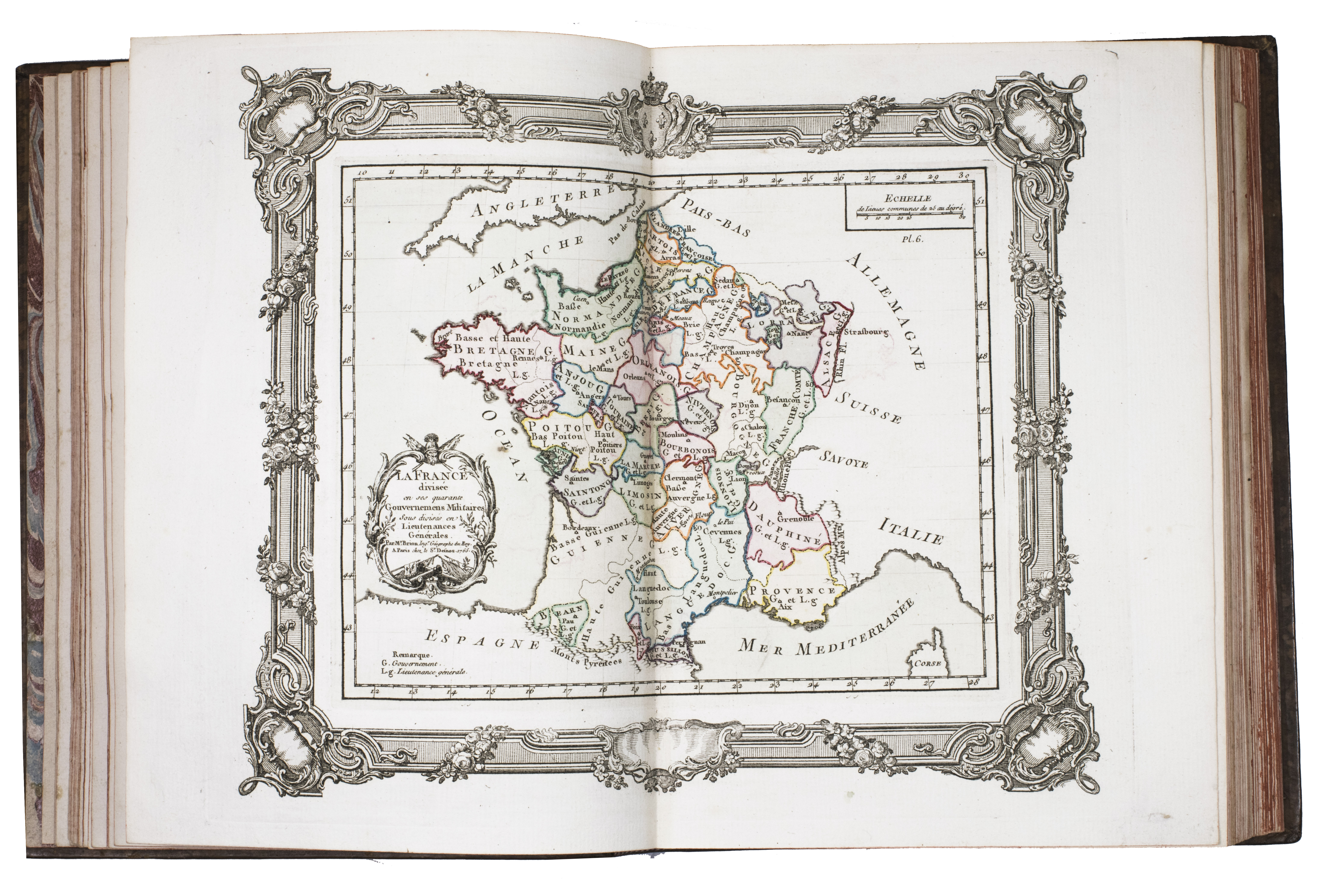
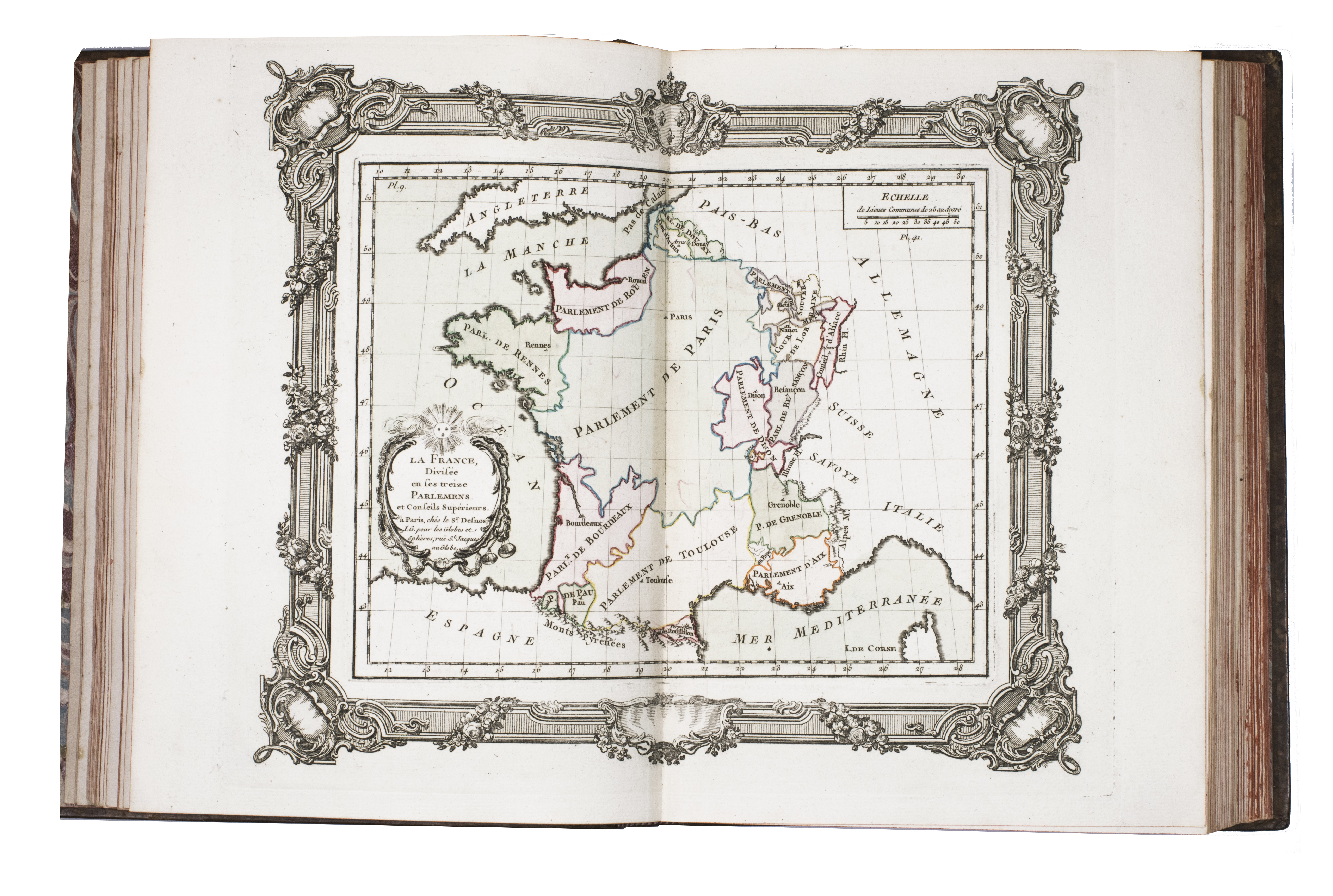
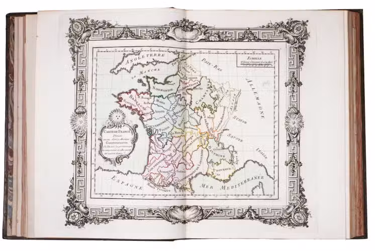
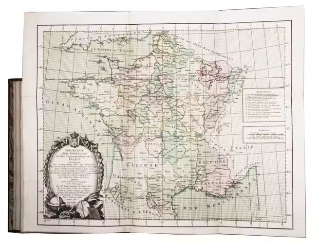
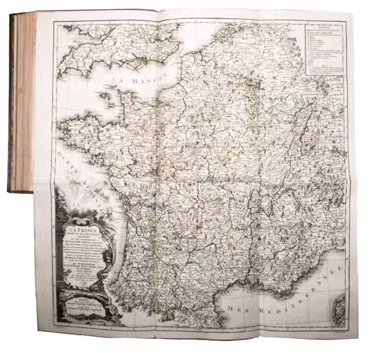
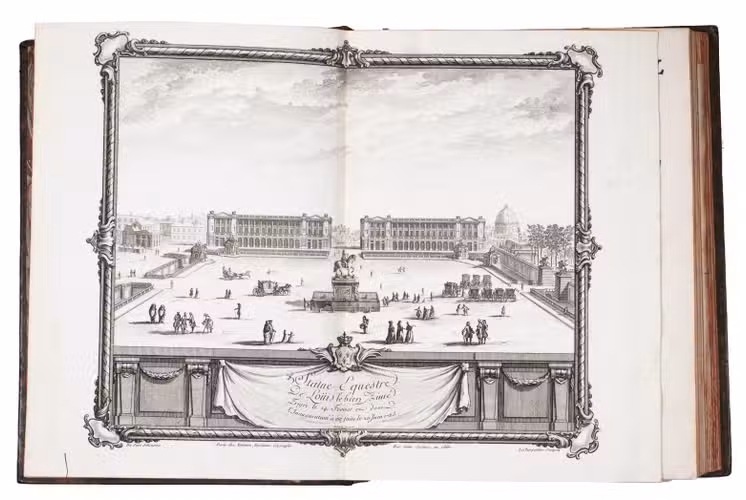
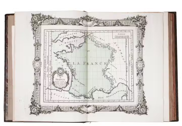
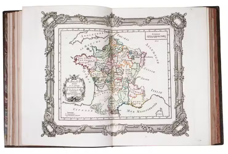
Paris, Grangé, Guillyn, Desnos, et al., 1765. 2 works in 1 volume, the first in 3 parts. 4to. With a double-page frontispiece by Le Charpentier after De Sève, with a view of the Place de la Concorde in Paris, 2 large folding engraved maps of France by Rizzi Zannoni, 40 double-page engraved maps and charts of France, 10 folding road maps, 2 "Cartes odographiques" with the distances between French cities, and 3 double-page engraved part-titles, all but the frontispiece and titles in a contemporary hand colouring.
Comprising: (2) DESNOS, Louis Charles. Tableau analytique de la France.
Paris, chez l'auteur, 1765.
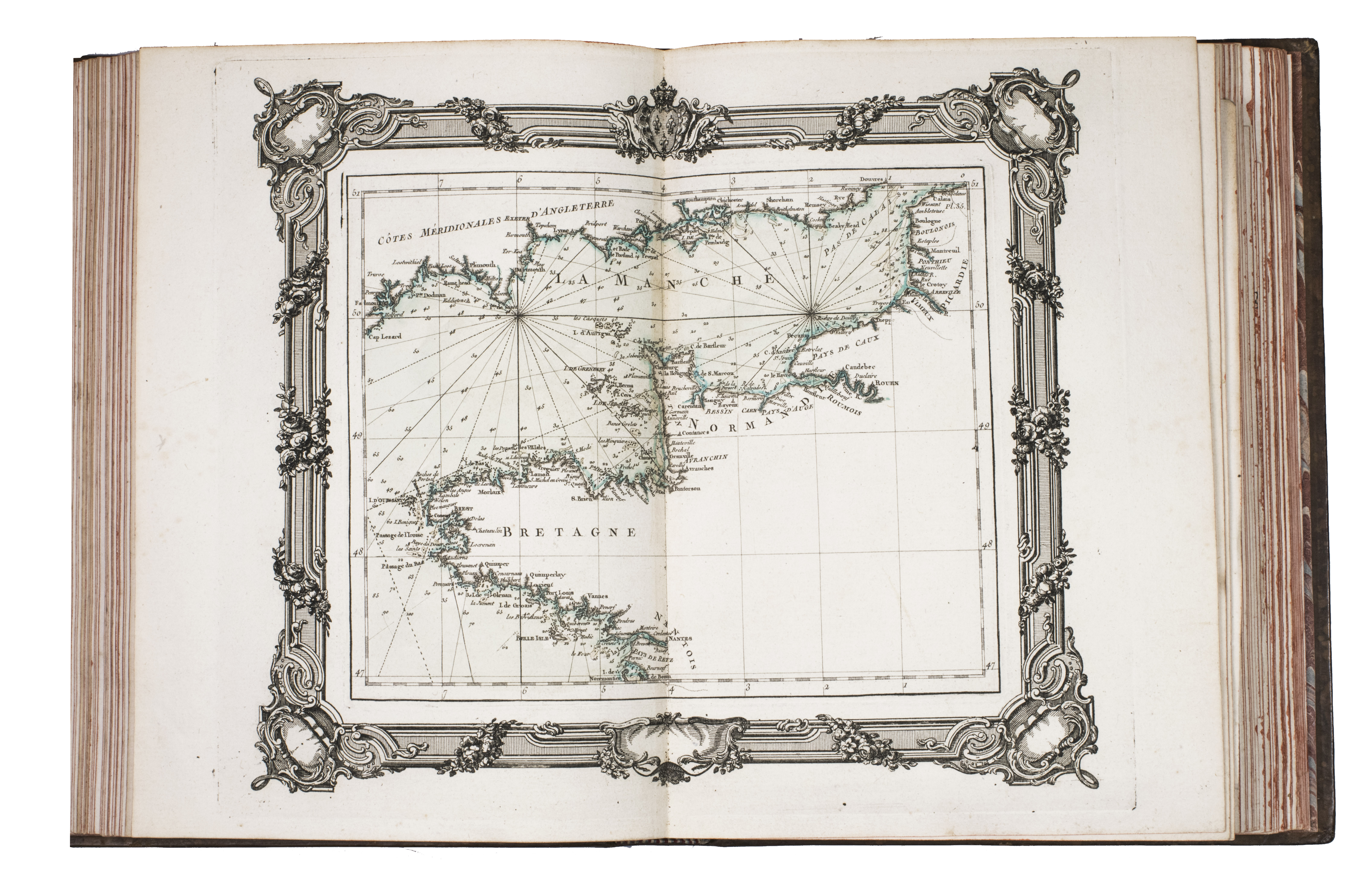
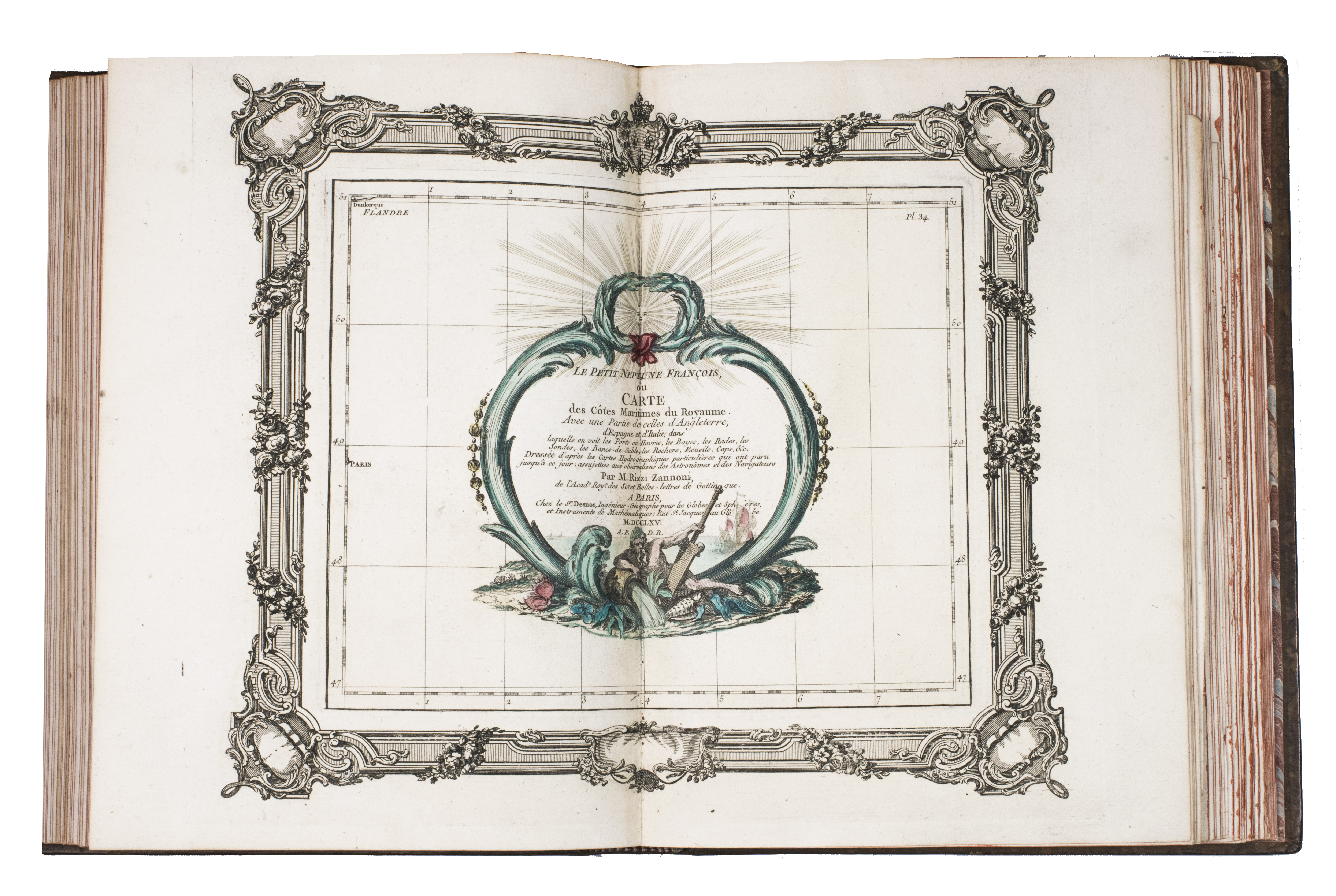
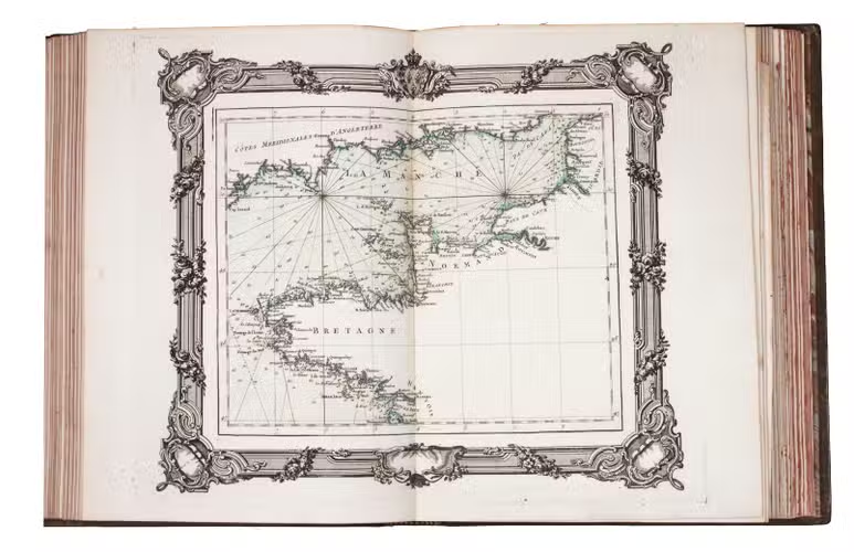
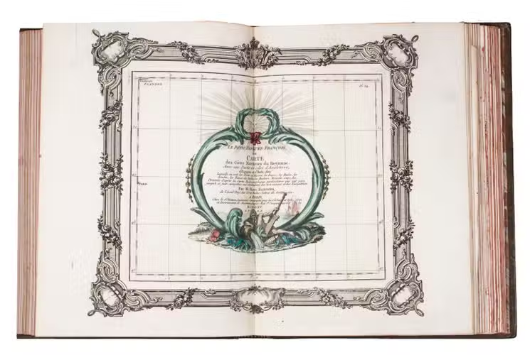
(3) ZANNONINI, Rizzi. Le petite Neptune François ou carte des côtes maritimes du Royaume.
Paris, chez le Sr. Desnos, 1765.
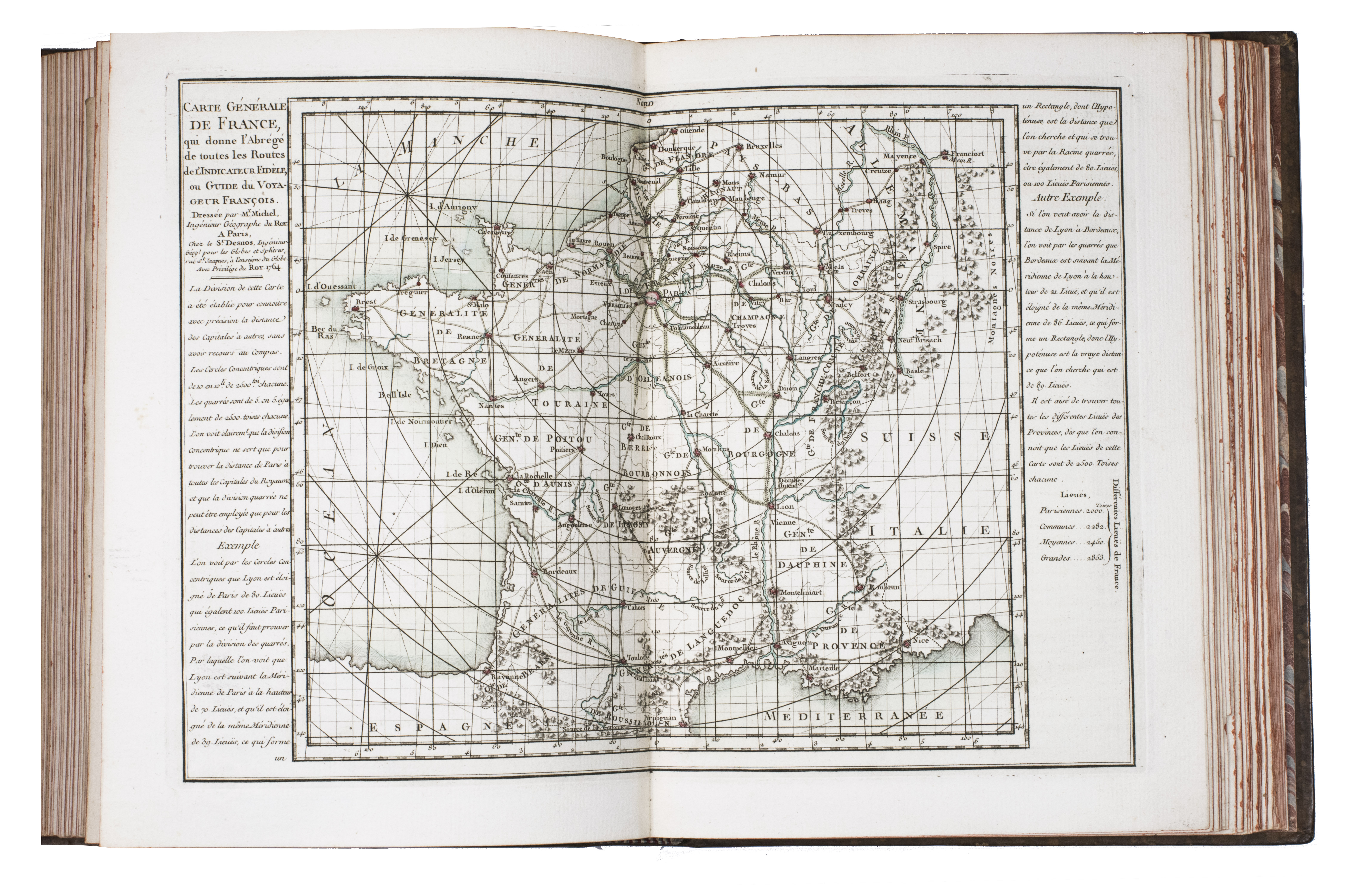
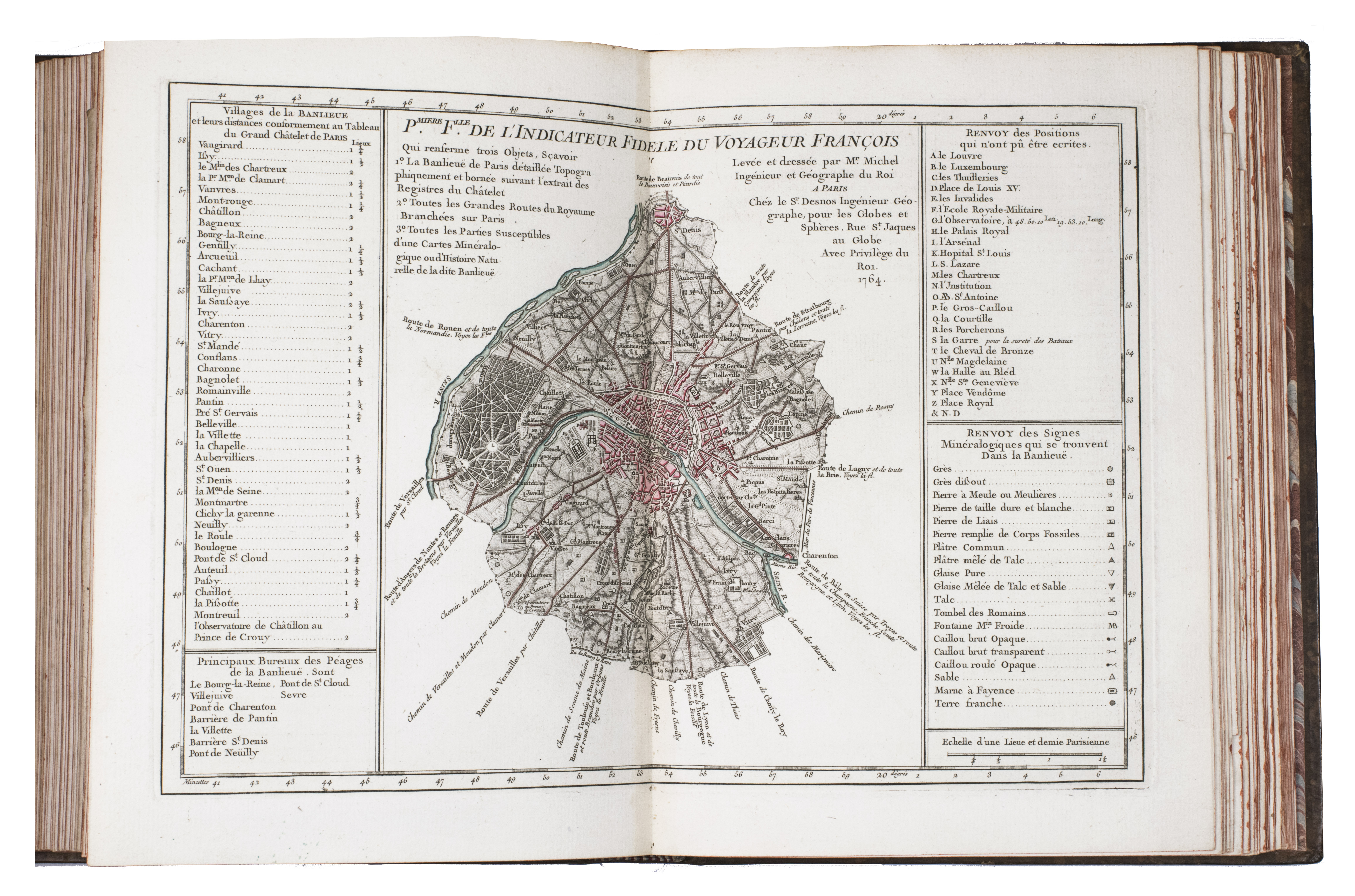
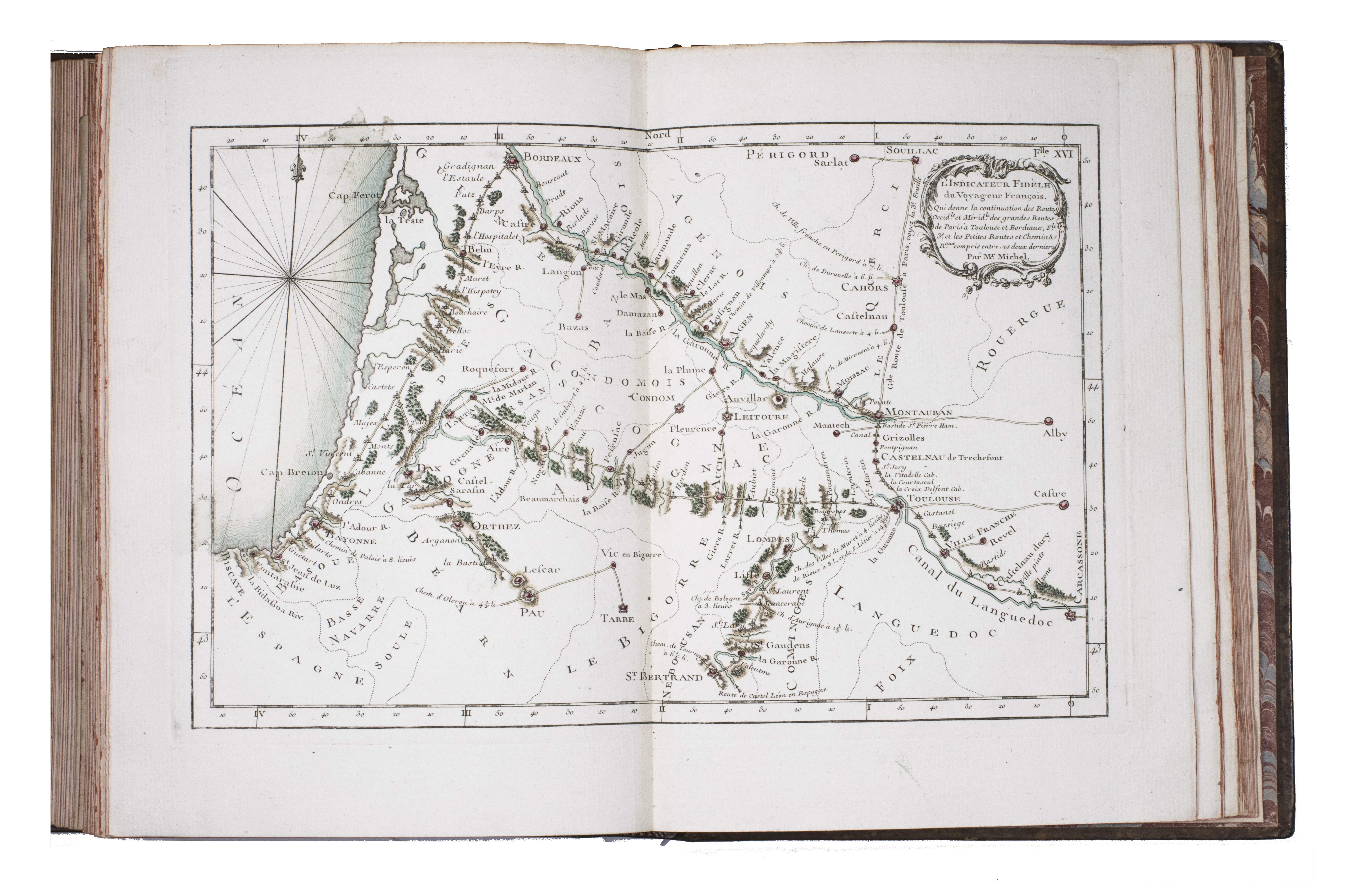
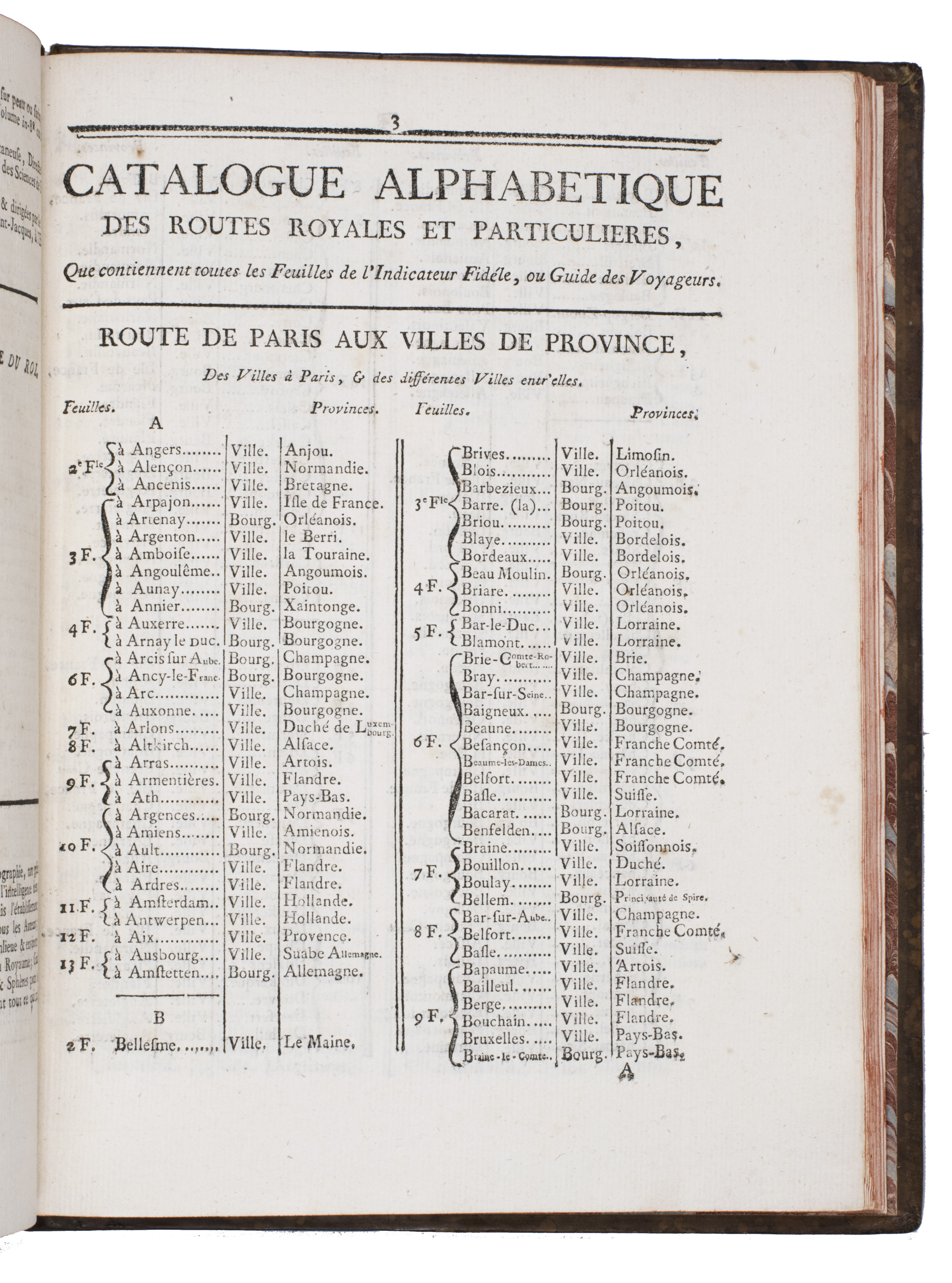
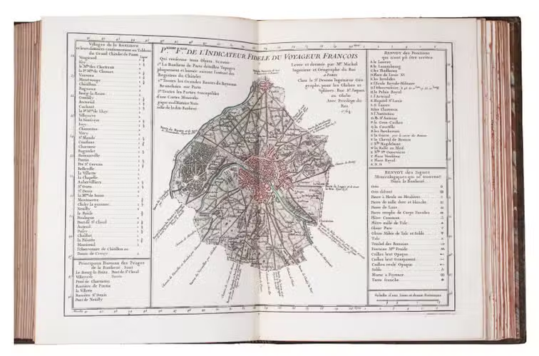
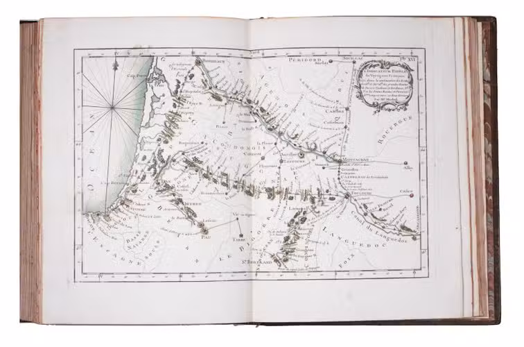
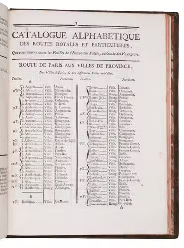
(4) MICHEL. L'indicateur fidèle ou guide des voyageurs.
Paris, à l'enseigne du globe, 1765.
With: (5) [CATALOGUE]. Catalogue des Ouvrages, tant anciens que modernes, du Fonds du Sr. Desnos.
Paris, à l'enseigne du globe et de la sphere, 1765. Contemporary gold- and blind-tooled marbled calf. 15, [1 blank], [3], [1 blank], 8, 10; 16 pp. + 56 plates
€ 3,250
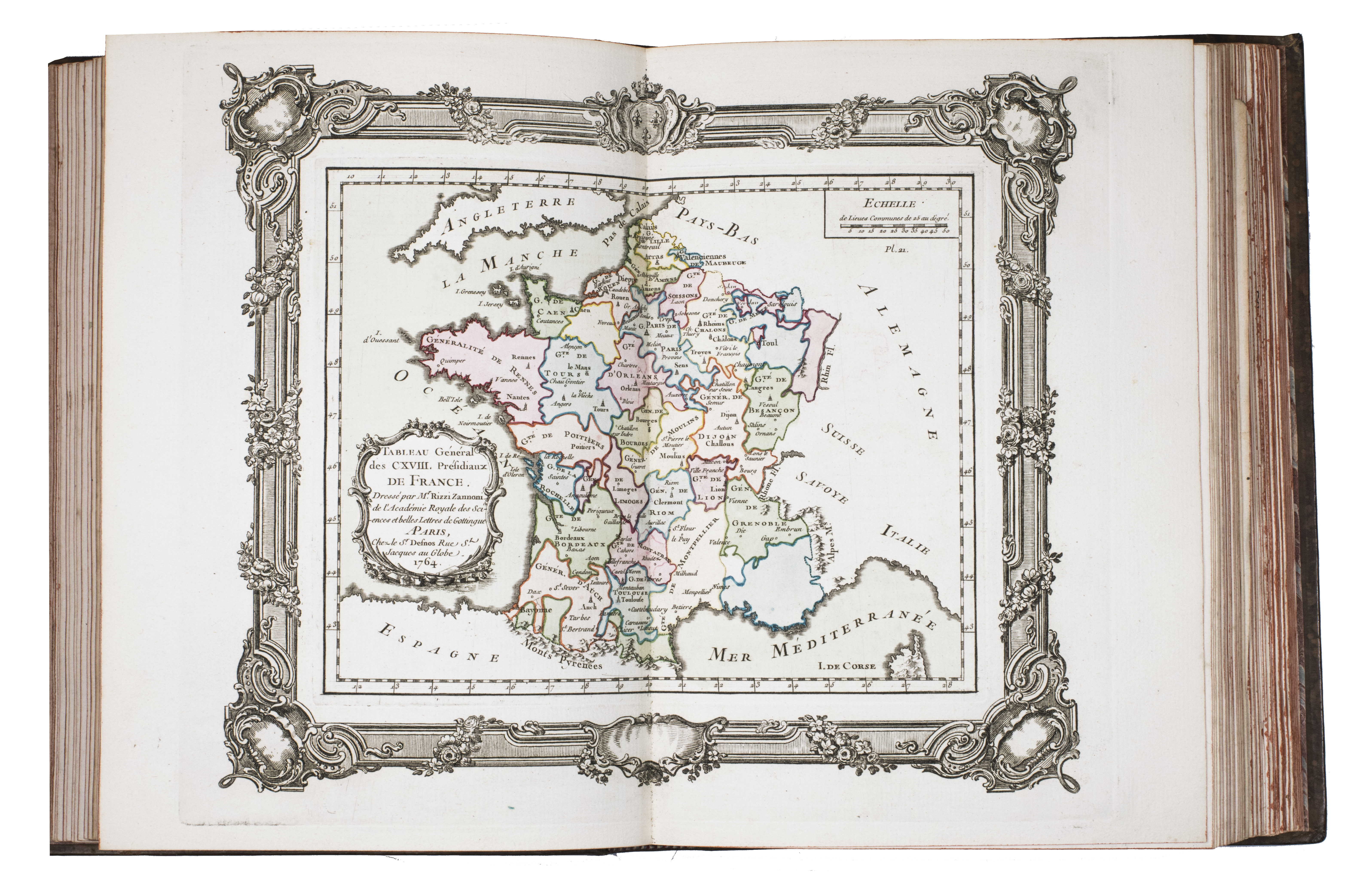
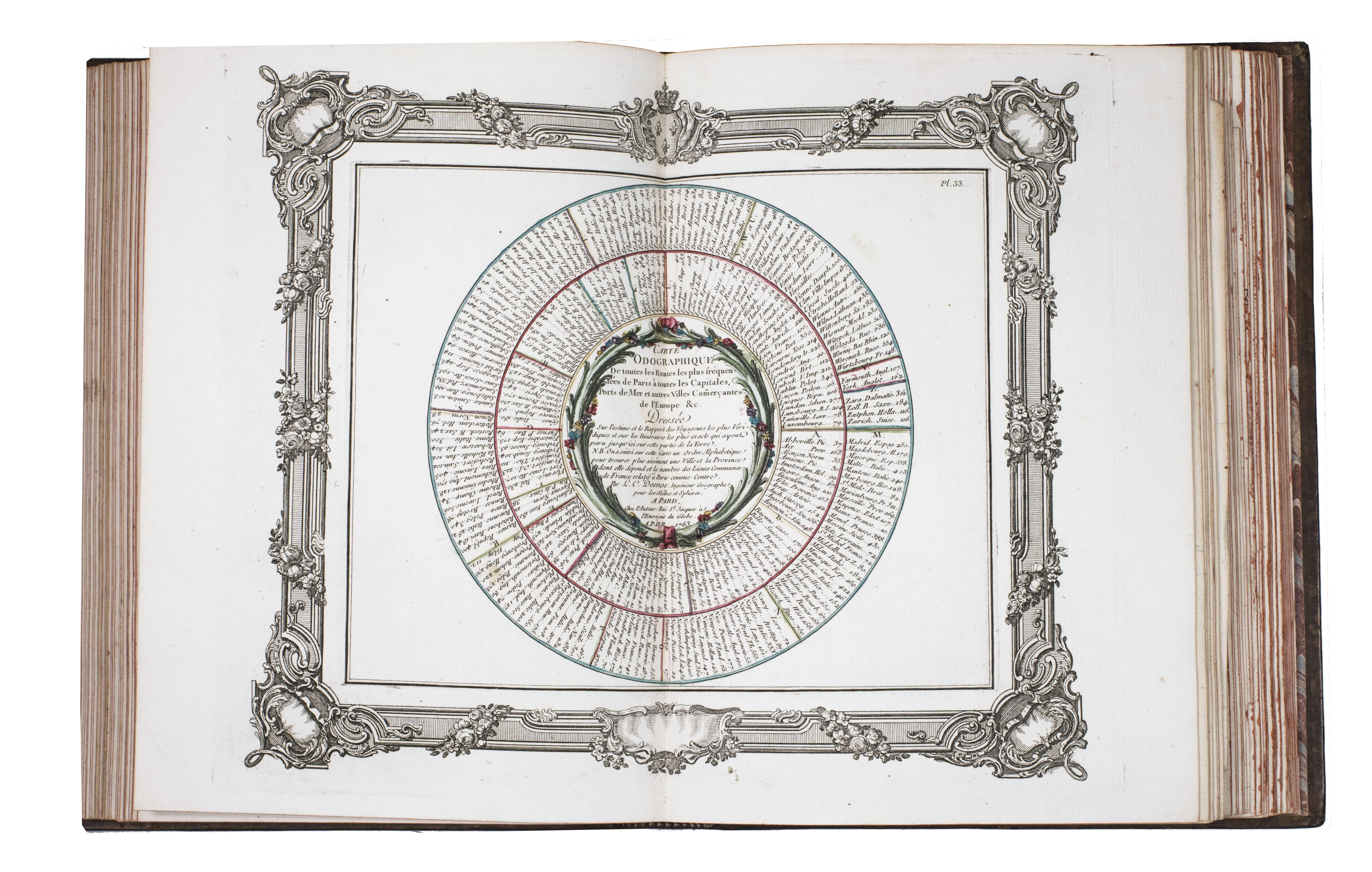
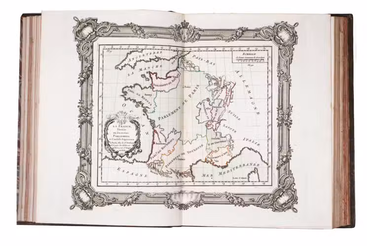
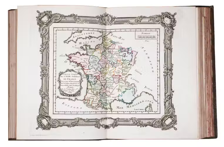
First edition of a rare atlas of France, mapping out the country from all possible useful points of view. The work includes "analytical" maps, which divide France in many ways, showing not only the various geographical and political divisions of the country, but also the military, ecclesiastical, juridical, genealogical, commercial, and financial divisions, and even hunting territories. The atlas also includes a small sea-atlas with 3 charts showing the French coasts, as well as a French road atlas, mapping out all the travelling routes of France. The maps were all made under the direction of Louis Charles Desnos (1725-1805), but they were drawn by various mapmakers. Several of the analytical maps and all sea charts were drawn by Rizzi Zannoni, and all the road maps by Michel, Royal geographer and engineer of the Paris Observatoire.
This important geographical compendium, drawn primarily from the cartographic collections of Desnos, is structured around three series of maps: the Tableau analytique de la France, Le petit Neptune, and L'indicateur fidèle. All maps, 52 in total, were newly made, and dated 1763-5. In the present composition, published by Louis Brion de la Tour (ca. 1745-1823), the atlas is in first edition, and exactly as issued, with all maps, including the part-titles dated 1765. Most maps are set within broad ornamental borders and are attractively hand-coloured. After the maps, three additional texts follow: the Prospectus du guide des voyageurs pour des routes royales & particulières de la France & autres, a Catalogue alphabetique des routes royales et particulières, and a Catalogue alphabetique du supplement des 1380 villes de France. Of particular interest is the added catalogue of the stock of Mr. Desnos, who was a Paris publisher, bookseller and engineer geographer of globes and spheres at Paris. All parts of the present atlas are offered for sale in the catalogue separately as well.
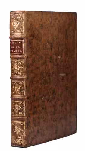
With remnants of 2 bookplates mounted on the front pastedown, an ownership annotation ("Mailly") on the title page. The boards are somewhat scratched with some loss of material. Two maps are browned. Otherwise in very good condition. Cf. Phillips 2990-2993 (all three parts separate, with the "Neptune" and "L'Indicateur" dated 1766); Quérard I, 515.
Related Subjects: