[TRAVEL GUIDE - THE NETHERLANDS].
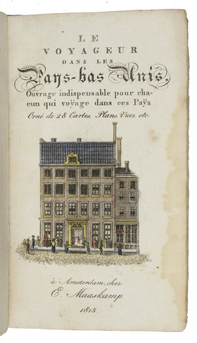
Le voyageur dans les Pays-Bas Unis. Ouvrage indispensable pour chacun qui voyage dans ces Pays. Orné de 28 cartes, plans, vues, etc.
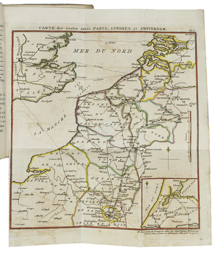
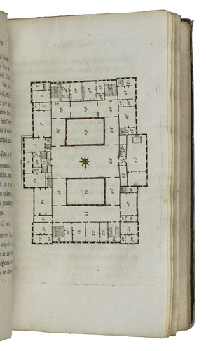
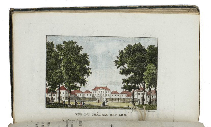
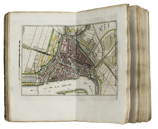
Amsterdam, Evert Maaskamp, 1815. 12mo. With a title vignette showing the Amsterdam publishing house of Evert Maaskamp, 3 folding maps, 13 double-page maps by I.B.D.B., 3 double-page city plans of Amsterdam, the Hague and Rotterdam, 6 full-page plates of the coins in use in The Netherlands on 1 folding leaf and 2 full-page plates of the ground floor of the Amsterdam city hall and Paleis Het Loo; all coloured by a contemporary hand. Original publisher's blue paper wrappers over boards. [2], 380, XXII, [10] pp.
€ 1,850
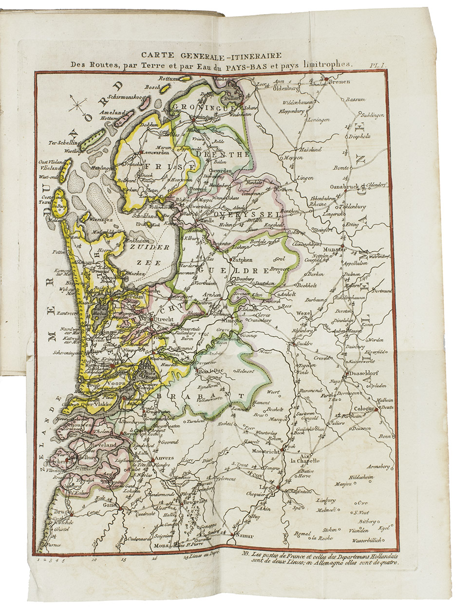
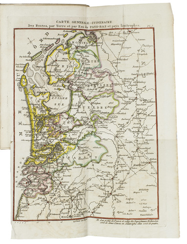
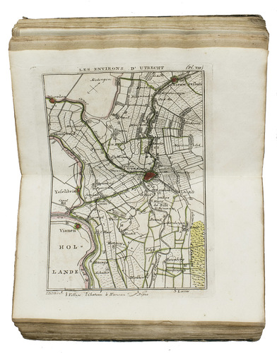
Very rare first edition of a rare, early, interesting and charming travel guide for The Netherlands, containing three folding maps: a "Carte generale itineraire. des routes du Pays Bas", a "Carte des routes entre Paris, Londres et Amsterdam" and a "Carte generale de la Hollande", 16 double-page maps and plans including a "Carte itineraire des environs d'Amsterdam", "Carte itineraire d'Amsterdam à Haarlem et Leiden", "Les environs de Haarlem" and a "Plan itineraire d'Amsterdam", "Carte itinéraire dAnvers a Breda", etc. all including the roads, waterways and distances.
The text starts with a "Table des distances" and the descriptions of 29 different routes, mostly to and from places within the Netherlands but no. 29 is a description of a route from Amsterdam to Paris , all including the number of "postes" indicated (pp. 1-31). "Manière de voyager" follows on pp. 32-41 with interesting details on distances, prices, ways of travelling by diligence (post coach), horse-drawn canal barge, etc. Pp. 42-380 contain accounts of the money, industries, agriculture, products, schools and universities, dress, customs, societies, cafés, "colleges" and everything else you might wish to know. Further descriptions of the cities and villages, followed by a "Table de matières" and "Table des cartes, etc." on pp. i-xxii.
With the bookplate of John Murison on the front paste-down. Binding worn and shaved, especially around the spine. Otherwise in good condition and untrimmed. Cf. Koeman, Atlantes Neerl., II, p. 271 (Maa, 1-2).
Related Subjects: