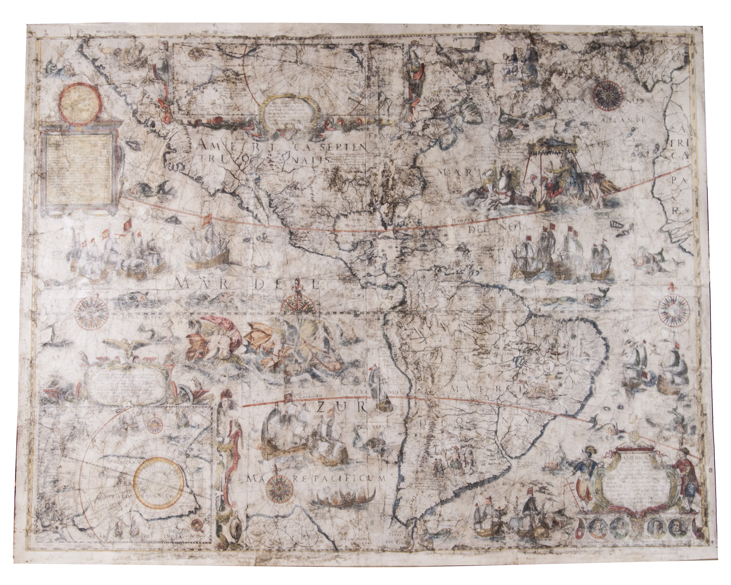
[TODESCHI, Pietro].
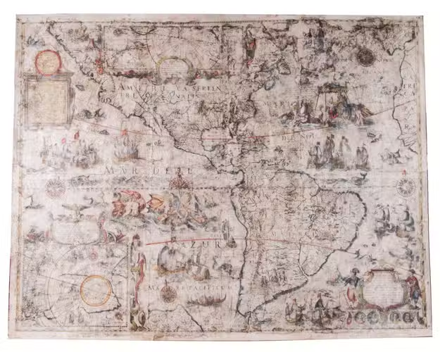
[Nova et accurata totius Americae tabula auct. G. I. Blaeu] America quarta pars orbis quam plerunq, nuvum orbem apellitant primo detecta est anno 1492 a Christophoro Columbo...
[Bologna, Giuseppe Longhi?, 1673]. Ca. 86 x 110 cm. A hand-coloured engraved wall map, printed on 4 joined sheets.
€ 65,000
Large, very rare, hand-coloured copy of Willem Blaeu's famous wall map of the Americas, which is considered "one of the most influential maps of America ever made" (Burden). The map is based on the latest explorations and shows everything known at the time about the American continent, as well as the north and south pole, which are included on two inset maps. As the wall map was in great demand, but expensive and difficult to transport, it was also printed by various French and Italian publishers for the local market. Like Blaeu's edition, the French and Italian editions are very scarce, as it is highly unusual for wall maps from this period to survive. We have only been able to trace 4 other copies of the present edition in sales records of the past hundred years, of which only 1 is also hand-coloured.
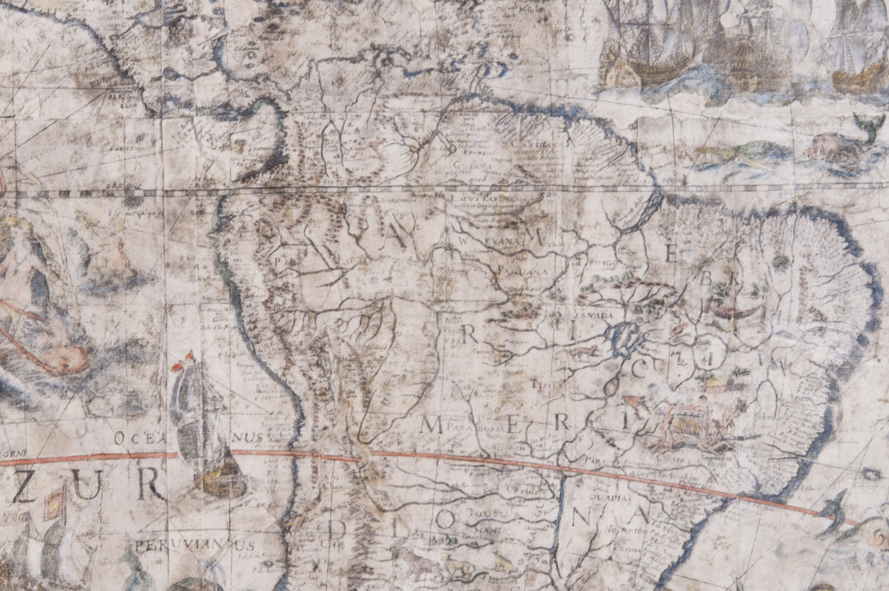
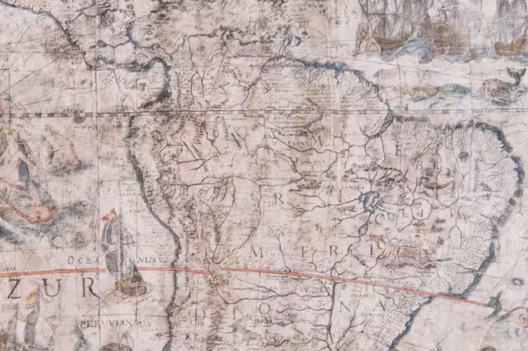
Willem Janszoon Blaeu (1571-1638) first published the wall map in 1608, together with similar maps of Asia, Africa, and Europe. He spared no expenses for this project and hired Hessel Gerritsz (1580-1632), a great cartographer in his own right, to both design the maps and research the latest sources exhaustively, in order to create the most accurate depiction of the continents possible. Although the Americas were drawn too wide due to the inadequate methods of determining longitude at the time, the shapes and most of the coastline are already very well defined. Central and South America were drawn according to Portuguese and Spanish sources, and "Nova Scotia" on the Atlantic coast was based on the voyages of Samuel de Champlain and Pierre Gua de Monts from 1604. After the first edition in 1608, the wall maps were subsequently published in 1612, reissued in 1624 by Hendrik Hondius, and in 1655 by Nicholas Visscher. The Hondius reissue, or the third state, included changes to the Strait of Magellan based on Le Maire's findings from his expedition in 1615-1617.
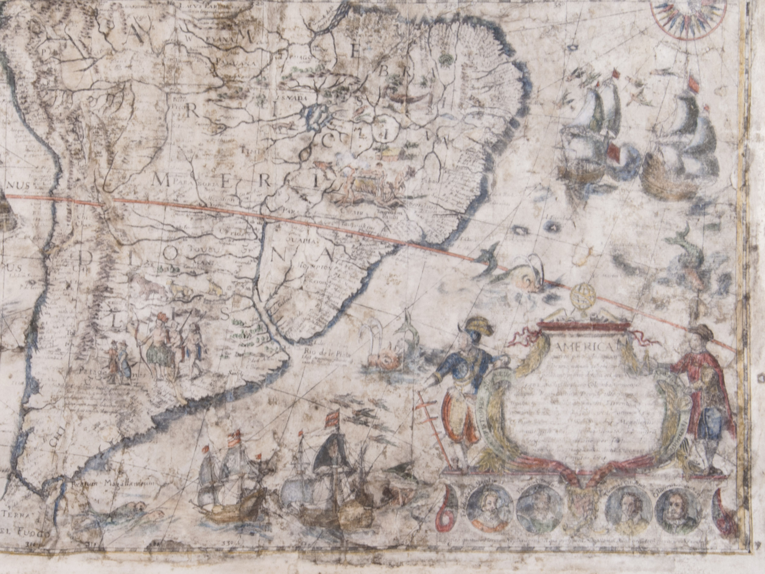
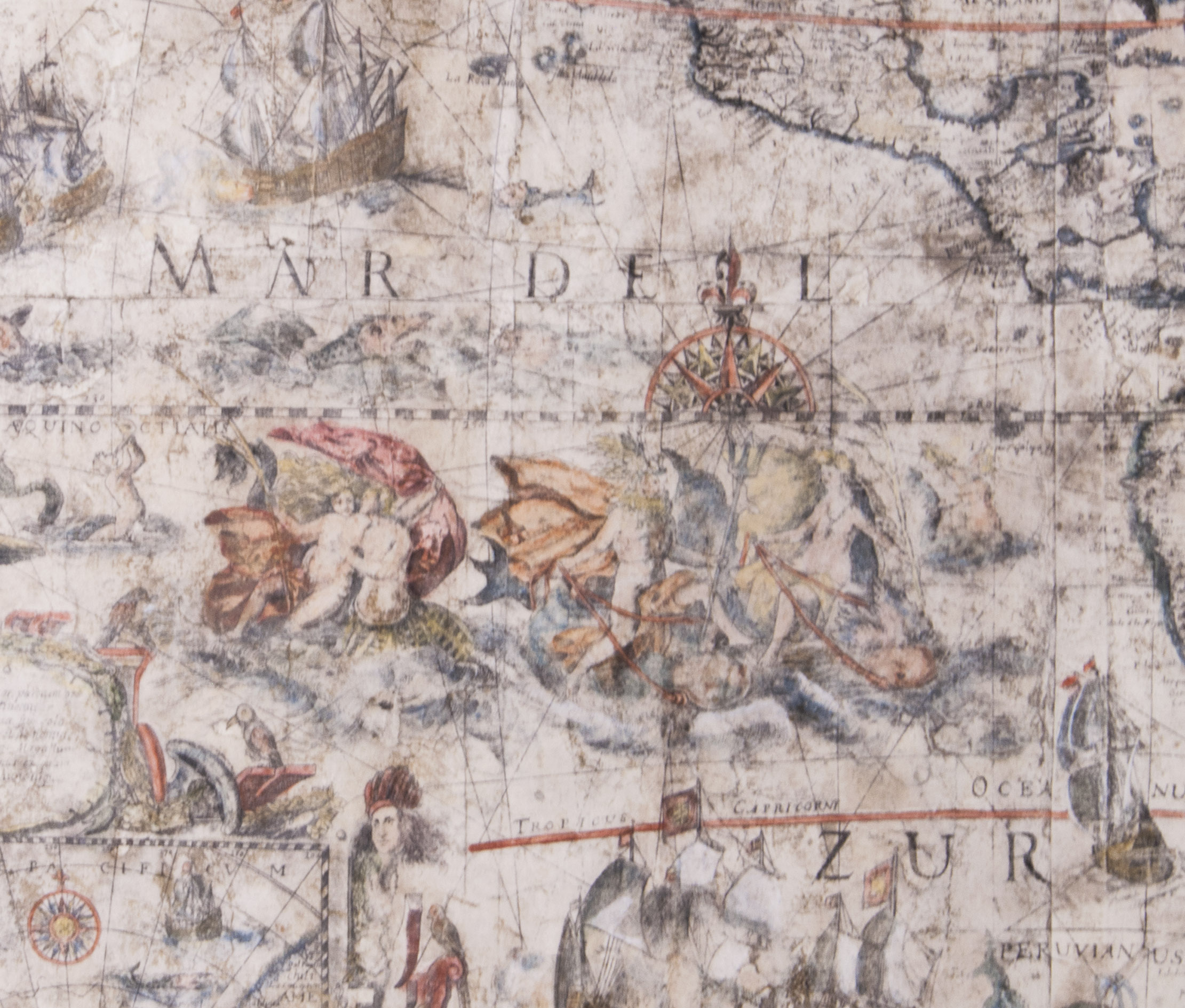
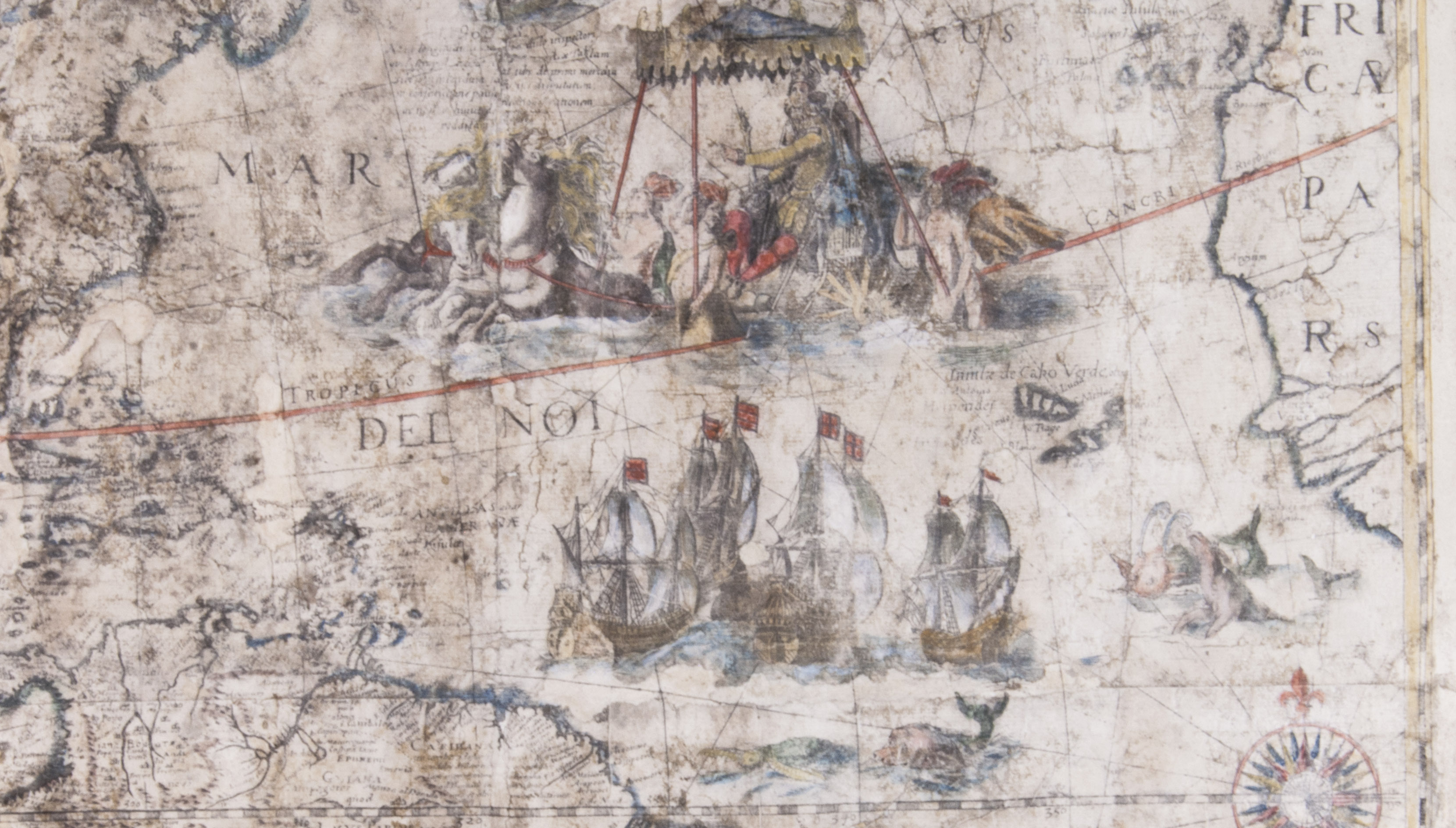
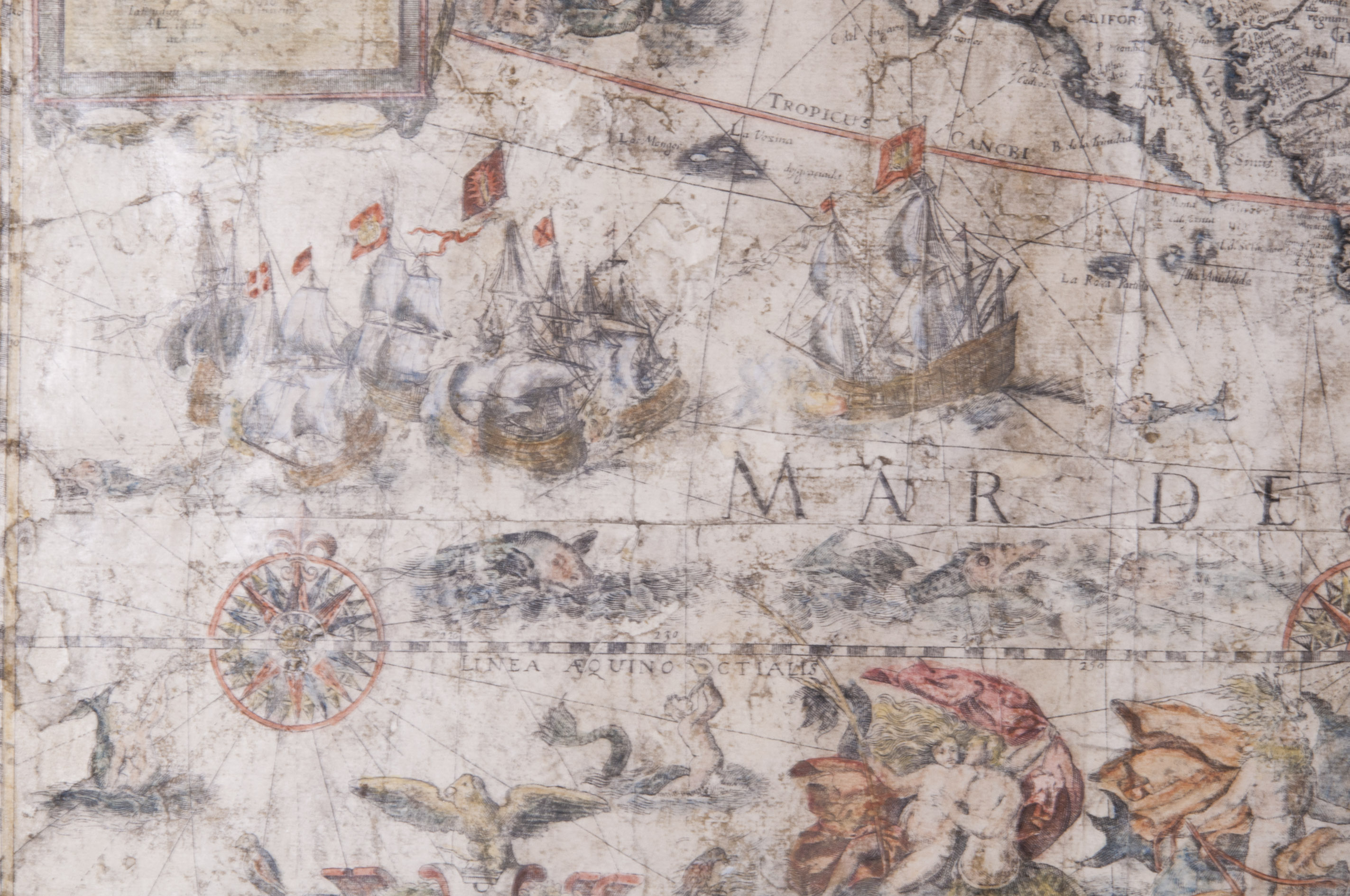
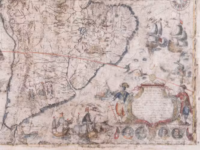
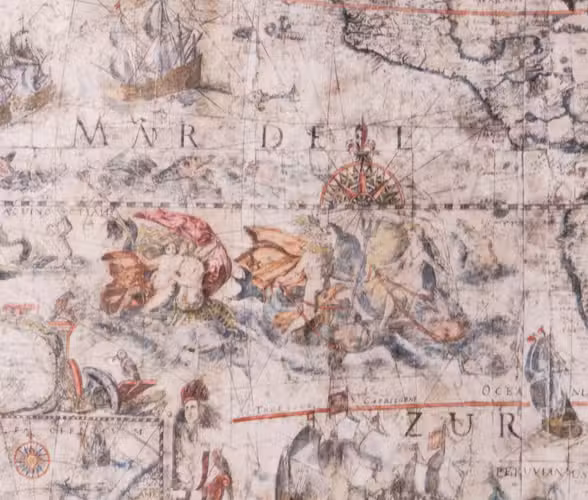
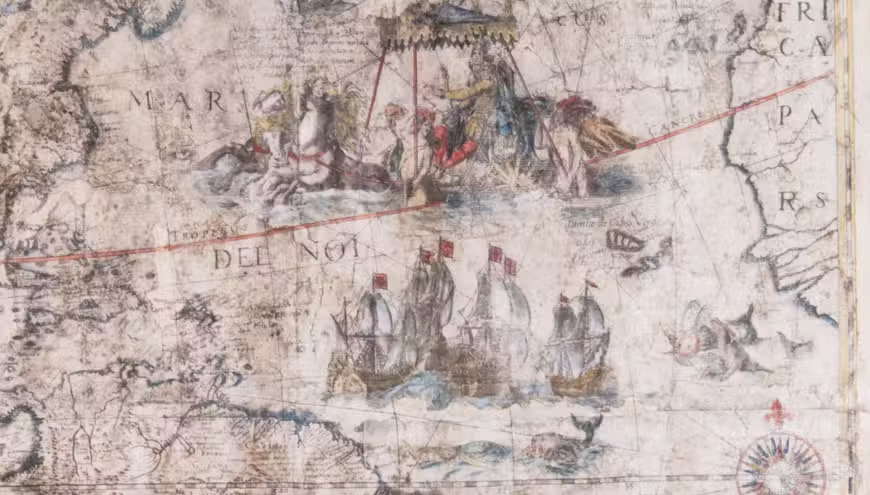
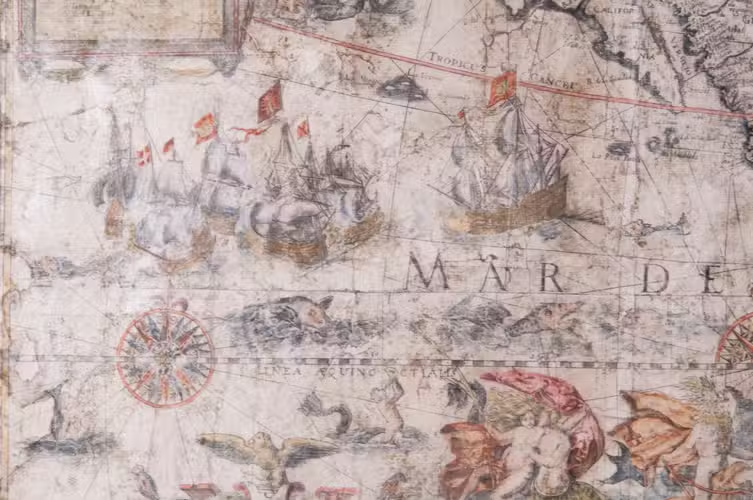
The map has been beautifully decorated with cartouches and illustrations. The cartouche in the lower right tells how the New World was discovered, and is flanked by the figures of Christopher Columbus and Amerigo Vespucci. Below are four roundels containing the portraits of the four circumnavigators: Ferdinand Magellan, Sir Francis Drake, Sir Thomas Cavendish, and Olivier Van Noort. The Atlantic features a beautiful depiction of the King Philip III of Spain riding a sea chariot, supposedly on a figurative visit to his New World possessions, and in the Pacific Poseidon with his wife Amphitrite and son Triton can be found, amidst battle ships and sea monsters. Elephants, rhinoceroses, camels, and ostriches roam the continent. Some copies of the map include a decorative border with illustrations of native people, and sometimes also a textual border with descriptions, which are not present here. These borders were engraved on separate copperplates and were not always included.
Blaeu's wall maps were first printed in Italy in 1646, probably by Stefano Mozzi Scolari (1598-1650) in Venice, which were based on the third state from 1624. The present copy was engraved by Pietro Todeschi (dates unknown) around 1670, and published in Bologna in 1673, probably by Giuseppe Longhi (active 1620-1691), who had worked on similar projects with Todeschi before. It closely resembles the Venetian edition, which was most likely used as the model. Todeschi's edition is, however, clearly recognisable because of the misspelling of Mar del Nort as Mar del Noi, and the fact that California has been drawn as an island. It is the only edition known to do so.
The map is somewhat browned and stained, the surface has faded, the work has been professionally restored: it has been reinforced on the back, the colouring has been retouched, some of the losses have been filled in, the work has been toned and varnished. Otherwise in good condition. Burden II, 433; Schilder, Monumenta cartographica Neerlandica V, pp. 195 and 197; cf. Burden I, 156 (Blaeu edition).
Related Subjects: