[THORNTON, John].
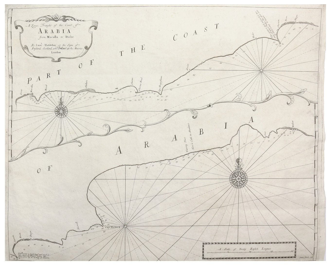
A large draught of the coast of Arabia from Maculla to Dofar. By Sam.l Thornton at the signe of England, Scotland, and Ireland, in the Minories London.
London, Samuel Thornton, [1711]. Engraved map (43 x 53 cm), hand-coloured in outline.
€ 3,500
Rare nautical chart of the southern coasts of Yemen and Oman, published in The English pilot ... the third book, and signed at lower right by the engraver: "Sutton Nicholls sculp". The coast is shown in two slightly overlapping parts, the western part above and the eastern part below, with a charming decorative vine dividing them (running diagonally across the chart). Each half has a reticulated scale of degrees latitude, the upper (western) part in the left border and the lower (eastern) part in the right border. Together they show the coast from "Sooa" (?) and "Maculla" (al Mukalla in Yemen) in the west to "Dofar" (Dhofar or Dhufar in Oman) in the east (about 750 km of the coast from about 49 to a bit more than 54°E, at a scale of about 1:750,000). John Seller first published the third book of The English pilot in 1675, but brought John Thornton (1641-1708) into partnership in 1677 and later turned the publication over to him. He served as hydrographer to the English East India Company and published a new edition of the third book in 1703. When he died in 1708, his son Samuel (d. 1715) took charge and published a new edition, including the present map bearing his imprint, in 1711. The three lines with Samuels imprint were removed in a later state of the chart. Tibbetts 177. Not in Al Ankary; Al-Qasimi. For the English Pilot: Tooley, Maps and mapmakers, pp. 59-61.
Related Subjects: