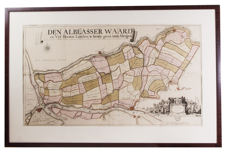
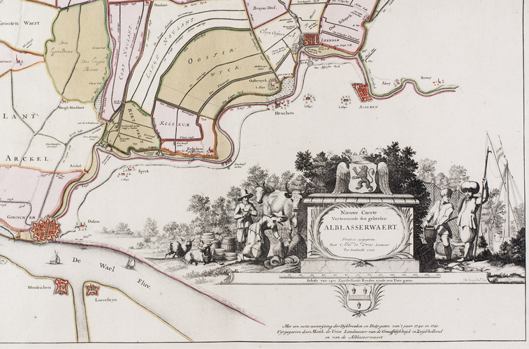
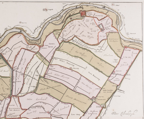
[MAP - NETHERLANDS - ALBLASSERWAARD].
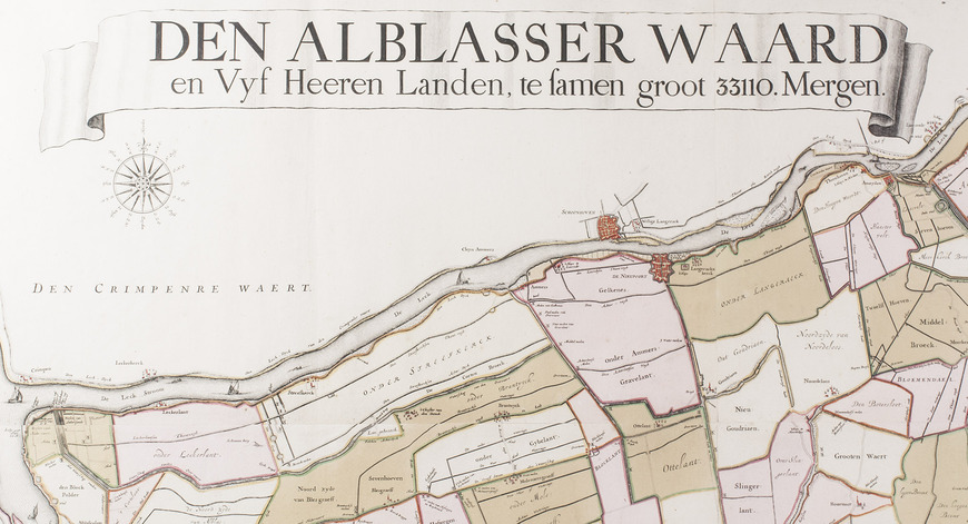
]. Den Alblasserwaard en Vyf Heeren Landen, te samen groot 33110. mergen. Nieuwe caerte vertoonende den geheelen Alblasserwaert. Nieuwlycx uytgegeven door Abel de Vries landmeter tot Dordrecht 1716. Met een nette aanwijzing der dijkbreuken en hulpgaten van 't jaar 1740 en 1741. uytgegeeven door Matth. de Vries.
[Dordrecht], Matthias de Vries, [ca. 1741]. 66 x 117 cm. Wall-map on 4 sheets, originally engraved by Bastiaan Stopendaal (1637-1693), in contemporary hand colouring. Framed (93 x 143 cm).
€ 9,500
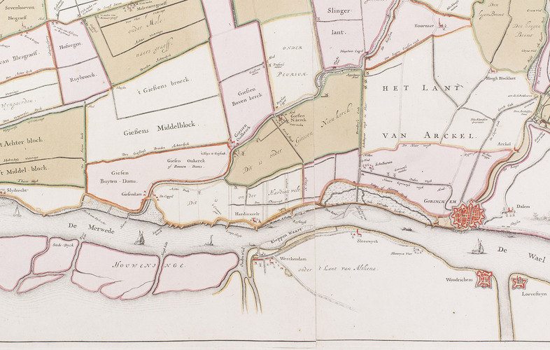
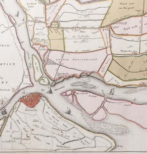
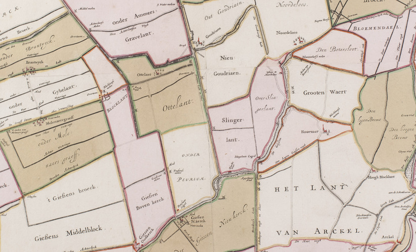
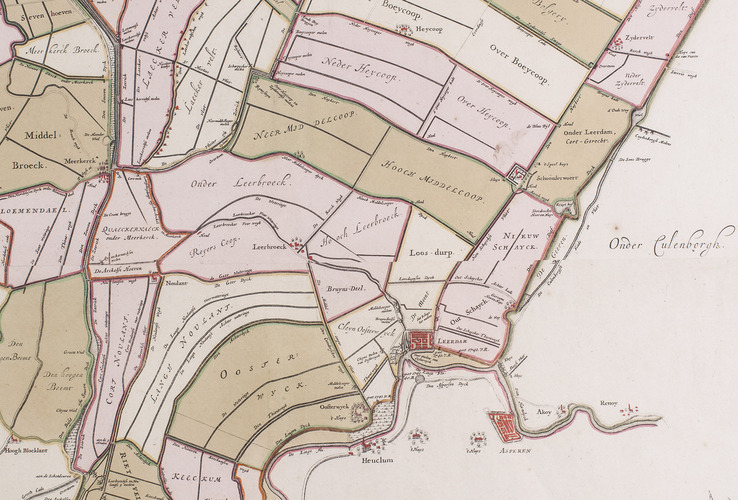
Third edition of a fine wall map of the Alblasserwaard and the "Vijfheerenlanden", the area south of Utrecht and south of the river Lek (a branch of the Rhine) between Vianen, Leerdam, Gorinchem, Dordrecht and Schoonhoven, including Asperen, Woudrichem and the castle Loevesteyn.
Commissioned by the "Hoogheemraadschap" of the Alblasserwaard, the map was first published by the surveyor and bookseller Matthaeus van Nispen in 1681. Abel de Vries in Dordrcht published a second edition in 1716. The present third edition, updated by indicating the dike bursts of 1740 and 1741, was published by Abel's son Matthias de Vries (1681-1751), the official surveyor of the County of South-Holland and the Alblasserwaard, also in Dordrecht. A. Blussé in Dordrecht published the last edition in 1767.
In fine condition. Donkersloot-de Vrij 767.
Related Subjects: