[MAP - KYOTO]. IKEDA Tori.
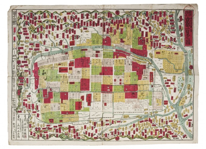
[Map of Kyoto].
Koto (Tokyo), Tori Ikeda, Meiji 11 [1878]. Woodcut map on paper (37 x 50 cm), printed in six colours.
€ 875
Colour-printed woodcut map of Kyoto, traditionally with the east at the head. Different colours show the different types of area in the city, with the temples printed in red and often named with text.
Red stamp in the upper right corner, some marginal spots along the extremities, otherwise a good copy.
Related Subjects: